
Hike Schedule
Join us for a hike! Registration required:
All hikes available to BTC members. Some hikes are open to non-members.
TIP: The calendar view displays up to 7 hikes on a day, but often there are more. Click “More events” to see them all.
Categories
- 13December 13, 2023
Bighead Valley
https://hikesstaging.brucetrail.org/event/bighead-valley-2/Sorry, the registration cut-off time for this hike has been reached.Not a member? Click here to join today!Hosting Club: Blue Mountains
Category: Register in person the morning of hike.
Location (Google Maps): Hike meets in the parking lot behind Tim Hortons on First St. in Collingwood.Hike Leader(s): David Little Click here to contact Hike Leader(s)
Pace: Medium – 3 to 4 km/hr
Terrain: Moderate – Some hills and/or some poor footing
Distance: 10 kmDescription
We will park the cars on 4th Concession S in the Sydenham section and hike west to Massie Forest and return. Trail passes through fields, bush and forest areas. The trail climbs to a high point near Bighead Campsite with views to the south. Bring a snack or lunch and water.
9:00 am Side Trail Challenge #4 - Bert Lowe
https://hikesstaging.brucetrail.org/event/900-am-side-trail-challenge-4-bert-lowe/Sorry, the registration cut-off time for this hike has been reached.Not a member? Click here to join today!Hosting Club: Niagara
Category: Car Pool
Location (Google Maps): Park at Sobey’s, Glendale Ave and carpool to Decew House Heritage Park km 31.2 Main TrailHike Leader(s): Sam Rutherford Click here to contact Hike Leader(s)
Pace: Brisk
Terrain: Easy
Distance: 15 kmsDescription
Park at Sobey’s, Glendale Ave and carpool to Decew House Heritage Park km 31.2 Main Trail (N 43.107568º, W 79.249598º)
Cross the road and follow Bert Lowe ST until it reaches Main Trail at km 20.8
Take the Main Trail back to Sobey’s at km 21.9Photos: Murals painted on the back walls of buildings going uphill by flight locks, City of Thorold Water Tower,
Hiking Tunnel under 406Participate in all 9 scheduled hikes in the NBTC Side Trail Challenge or hike the side trails on your own. Submit your photos to collect the NBTC Side Trail badge.
http://niagarabrucetrail.club/wp/niagara-side-trails/
Grey Road 40 to Griersville
https://hikesstaging.brucetrail.org/event/grey-road-40-to-griersville/Sorry, the registration cut-off time for this hike has been reached.Not a member? Click here to join today!Hosting Club: Beaver Valley
Location (Google Maps): Meet in the BTC parking lot on Grey Road 40, Km 105.7 Map 28 Edition 31
Hike Leader(s): Margaret Yaraskavitch Click here to contact the hike leader.
Pace: Medium
Terrain: Moderate
Length of Hike: 7.2Description
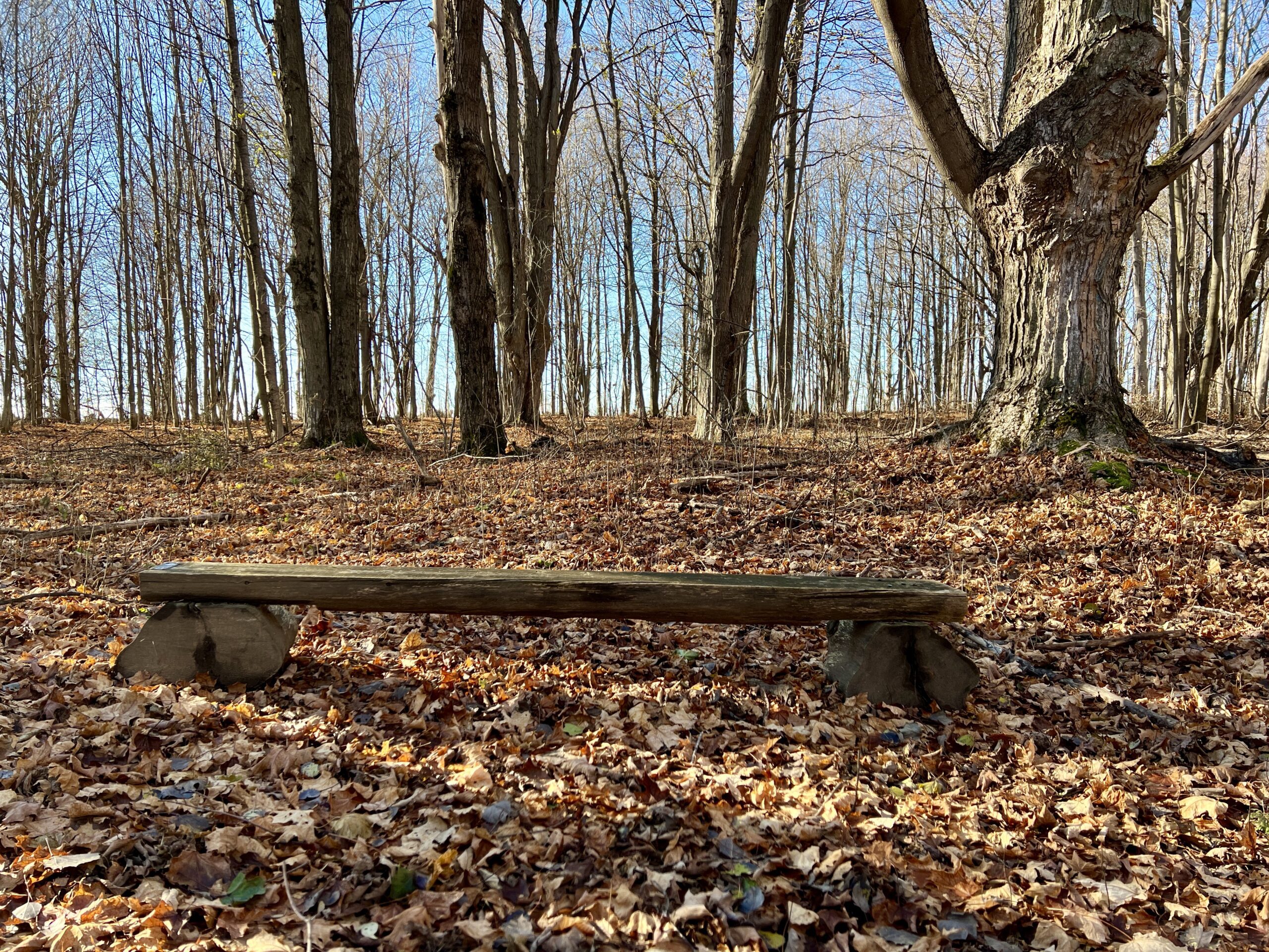
It’s time for a pleasant walk in the woods, a fairly easy walk. We begin at the parking lot on Grey Road 40, crossing the highway and walking into a BTC Nature Reserve. After reaching Grey Road 7, we return on the same route.Good Companions - Two Loops from City View Park Burlington
https://hikesstaging.brucetrail.org/event/good-companions-two-loops-from-city-view-park-burlington-2/Sorry, the registration cut-off time for this hike has been reached.Not a member? Click here to join today!Hike open to BTC Members only.
Hosting Club: Iroquoia
Category: Good Companions
Location (Google Maps):North Parking Lot off Kerns Road (Near Dundas Street)
City View Park
BurlingtonHike Leader(s): Ted Bossence Click here to contact Hike Leader(s)
Pace: Medium – 3 to 4 km/hr
Terrain: Strenuous – Hilly with steep climbs and some poor footing
Distance: 7.5 kmDescription
We will do a loop on the East side of Kerns Road including the Ian Reid Side Trail and then do a loop using the main Bruce Trail and King Road Side Trail on the West side of Kerns. A couple of the hills will be steep and may be slippery. We will stop for a snack between the two loops. If it is snowy/icy then icers will be needed. Poles are essential as well. If you need to cancel after 4:00 pm on the Tuesday, please email me at tedbossence@sympatico.ca on Tuesday or text me at 905 334-8752 on Wednesday morning. Please arrive a 10 minutes before the start time. I will be leaving promptly at 10:00 am.Please check your email the evening before the hike as I will cancel the hike if weather conditions are not suitable.
- 14December 14, 2023

9:00 am HOLIDAY PARTY Hike Jordan to Moyer / Louth
https://hikesstaging.brucetrail.org/event/900-am-holiday-party-hike-jordan-to-moyer-louth/Sorry, the registration cut-off time for this hike has been reached.Not a member? Click here to join today!Hosting Club: Niagara
Category: In and Out
Location (Google Maps):Jordan Hollow Park 3039 King St Jordan
Hike Leader(s): Alan Laver Click here to contact Hike Leader(s)
Pace: Fast
Terrain: Moderate
Distance: 6kDescription
Join us for our annual Christmas celebration after the hike or just show up at 10:30. Bring a snack for the table and Dress for the weather
9:15 HOLIDAY PARTY Short Hike - Jordan Hollow
https://hikesstaging.brucetrail.org/event/915-short-hike-jordan-hollow-87/Sorry, the registration cut-off time for this hike has been reached.Not a member? Click here to join today!Hosting Club: Niagara
Location (Google Maps): Jordan Hollow Park, Jordan Station
Hike Leader(s): Bill Russell Click here to contact Hike Leader(s)
Pace: Medium
Terrain: Moderate
Distance: 6 kmsDescription
Join us for a holiday hike followed by our annual Christmas Celebration. Join us for the Celebration at 10:30 or after the 9:15 hike. Bring something to shareHike the main and side trails around Jordan and Ball’s Falls. Bring water and hiking boots.

Nature Seekers - Exploring Riverside Woods
https://hikesstaging.brucetrail.org/event/nature-seekers-exploring-riverside-woods/Sorry, the registration cut-off time for this hike has been reached.Not a member? Click here to join today!Hosting Club: Caledon Hills
Category: Nature Walks
Location (Google Maps): Meet at the Bruce Trail Parking Lot, 713377 1st Line EHS, Mono, 43.959720, -80.070870Directions: From ON-9, head north onto 3rd Line EHS for 3 km. Turn left/west onto Side Road 5 for 2.7 km. Turn right onto 1st Line EHS for approximately 1 km. Continue straight into the parking lot.
From ON-10, head east on Hockley Road/Dufferin County Road 7 for 1 km. Continue straight onto Side Road 5 for 1.5 km. Turn left onto 1st Line EHS for approximately 1 km. Continue straight into the parking lot.
Hike Leader(s): Sandy Green Click here to contact Hike Leader(s)
Pace: Leisurely – 3 km/hour or less
Terrain: Moderate – some hills and/or some poor footing
Distance: 5 kmDescription
Explore the new Riverside Woods Nature Reserve in the Caledon Hills. Bring your choice of hydration and snacks. Sturdy footwear is highly recommended. After the hike, you can head over to the Club’s Winter Market located at 933445 Airport Road, for an exclusive weekday shopping experience. It’s less than a 10 minute drive. - 15December 15, 2023
Winter on the Bay and in the Forest
https://hikesstaging.brucetrail.org/event/winter-on-the-bay-and-in-the-forest/Sorry, the registration cut-off time for this hike has been reached.Not a member? Click here to join today!Hosting Club: Peninsula
Location (Google Maps): Forty Hills Road parking lot
Hike Leader(s): Barbara Reuber Click here to contact Hike Leader(s)
Pace: Medium
Terrain: Moderate
Distance: 11 kmDescription
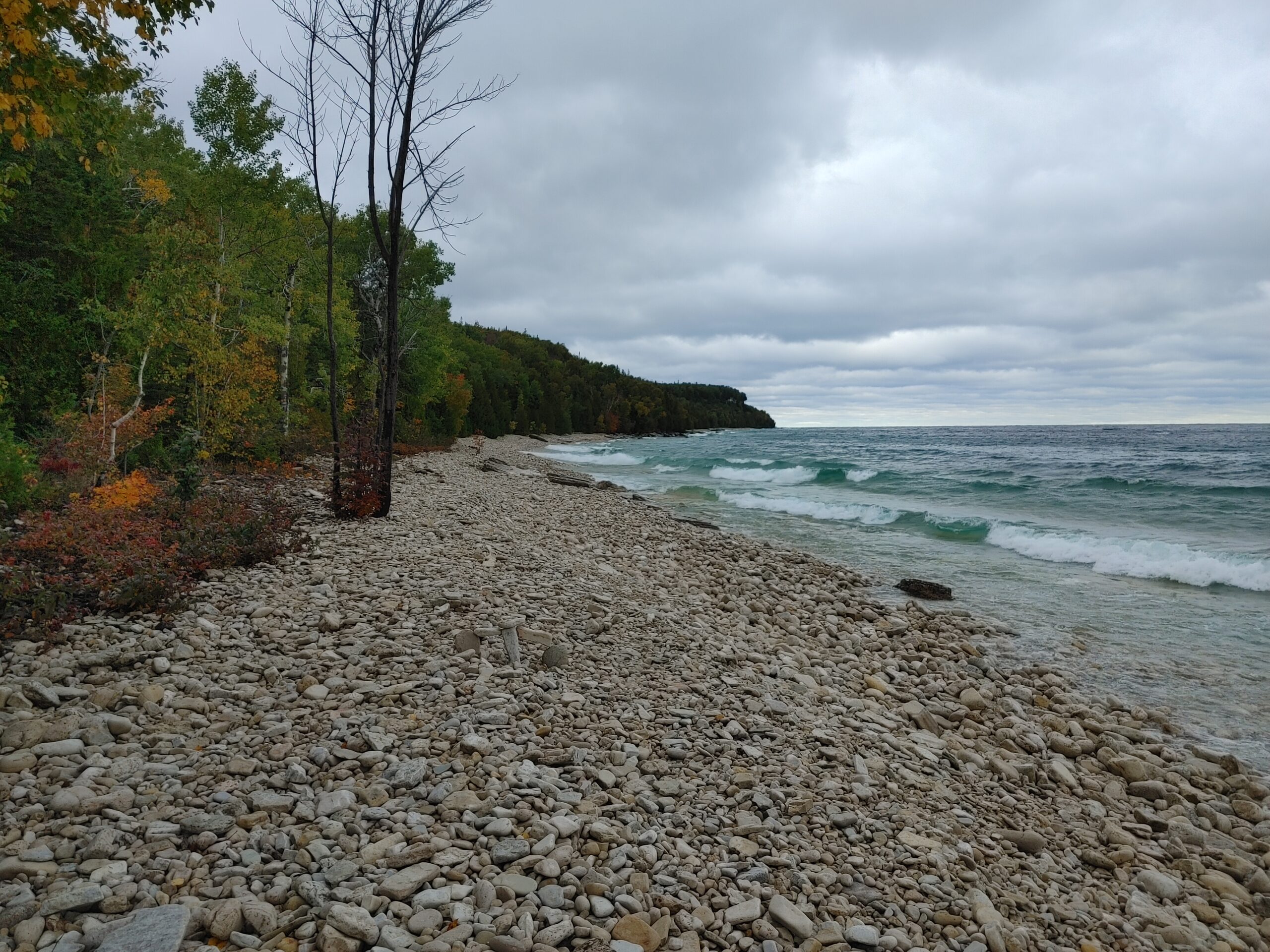
Enjoy the winter forest and Georgian Bay in all their beauty. From the Forty Hills Rd parking lot we will hike the Main Trail to Reeds Dump, enjoying the look outs over Georgian Bay. We’ll stop at Reeds Dump for a short lunch break (unless it’s cold and windy and then we may stop in the protection of the forest). We will return along the David Blasing, Walter Brewer and Whippoorwill Side Trails.Be prepared for variable weather and dress for the conditions on the day of the hike. Depending on the weather, icers may be required. As with all winter hikes, we will adjust or postpone the hike if required due to inclement conditions.
Bring water, snack and lunch.

Niagara-on-the-lake Tour
https://hikesstaging.brucetrail.org/event/niagara-on-the-lake-tour-46/Sorry, the registration cut-off time for this hike has been reached.Not a member? Click here to join today!Hosting Club: Niagara
Category: Urban
Location (Google Maps): Meet on King St near Centre at the entrance to Veteran’s Memorial Park, Niagara-on-the-LakeHike Leader(s): Margaret Northfield Click here to contact Hike Leader(s)
Pace: Medium
Terrain: Easy
Distance: 6-7kmDescription
Each Friday we will explore different neighbourhoods, trails and parkland throughout Historic Niagara-on-the-Lake.
Moderate pace with some weeks entirely on sidewalks and roads while others may include a mix of trails and paved pathways. Great way to build up endurance for longer more strenuous hikes.
Prepare for cooler windy conditions on open parkland and along Lake Ontario and Niagara River trails.
Plan to stay for holiday celebration and treats at Sharon & Graham Summerhayes, #11-450 Nassau St, NOTL
Inglis Falls loop
https://hikesstaging.brucetrail.org/event/inglis-falls-loop-2/Sorry, the registration cut-off time for this hike has been reached.Not a member? Click here to join today!Hosting Club: Sydenham
Category: General Hike
Location (Google Maps): Meet in the parking lot behind the Grey-Sauble Conservation Authority head office.
237897 Inglis Falls Road, Owen SoundHike Leader(s): Carol Graham Mullin Click here to contact Hike Leader(s)
Pace: Leisurely: 3 km/h or less
Terrain: Moderate: Some hills and/or poor footing, There might be icy and slippery sections., There might be muddy sections.
Distance: approx 5 km.Description
We will hike a loop starting from the Conservation office parking lot, combining Bruce trail sections (main trail and Keeling side trail) and Conservation trails, with a stop at the magnificent Inglis Falls lookout. Please dress appropriately and be prepared to use snowshoes, icers, poles, depending on the weather that day. Water and snacks suggested. If you have difficulty registering, please contact the hike leader at 226-787-8804. - 16December 16, 2023

Great Niagara Circle Route #2 Port Colborne to Ridgeway
https://hikesstaging.brucetrail.org/event/great-niagara-circle-route-2-port-colborne-to-ridgeway/Sorry, the registration cut-off time for this hike has been reached.Not a member? Click here to join today!Hosting Club: Niagara
Category: Car Pool
Location (Google Maps): Meet at 273 Ridge Road North Ridgway Car Pool to Port ColborneHike Leader(s): Alan Laver Click here to contact Hike Leader(s)
Pace: Medium
Terrain: Easy
Distance: 18Description
Beginning at the Port Colborne Border, this trail takes us through farmlands, villages, watersheds on our way to old Fort Erie
The Greater Niagara Circle Route badge is awarded to walkers who independently complete the Circle Route Trail i.e. Lock 1 Port Weller, along the Welland Canal to Port Colborne , following the Friendship Trail to Fort Erie, following the Niagara Recreational Parkway Trail to Niagara-on-the-Lake and following the Waterfront Trail to Port Weller.Car Hike: Hockley Valley to Glen Haffy - 17.5KM
https://hikesstaging.brucetrail.org/event/car-hike-hockley-valley-to-glen-haffy-17-5km/Sorry, the registration cut-off time for this hike has been reached.Not a member? Click here to join today!Hosting Club: Toronto
Category: Car Hike
Location (Google Maps):We meet at the roadside parking on Coolihans Sideroad, east of where the trail crosses the road.
Hike Leader(s): Fayyaz Mahmood Click here to contact Hike Leader(s)
Pace: Brisk
Terrain: Challenging, Hilly
Distance: 17.3 KMDescription
Enjoy the cold weather and great hiking conditions.
We will car shuttle to the BTC Hemlock Ridges Nature Reserve parking lot. We will hike the Hemlock Ridge Side Trail (0.6 KM) to join the Main Trail at Map 18, 51.7 KM (Ed 31). We will continue south hiking the hilly sections of Hockley Valley and Glen Haffy back to the parking on Coolihans Sideroad.This hike is for experienced hikers. Hiking boots are required. No dogs please.
Bring 1.5 – 2 liters of water and your lunch. Please dress for the weather.Car Hike: Wilder Forest Uxbridge 113
https://hikesstaging.brucetrail.org/event/car-hike-wilder-forest-uxbridge-2/Sorry, the registration cut-off time for this hike has been reached.Not a member? Click here to join today!Hosting Club: Toronto
Category: Car Hike
Location (Google Maps): 2499 Brock Road, Uxbridge, ON there is a free parking when you enter the road off brock road beside Horse training facilityHike Leader(s): Mohammad Aghamiri Click here to contact Hike Leader(s)
Pace: Moderate
Terrain: Variable
Distance: 14-17KMDescription
We will explore Wilder forest and the beautiful scenery of Uxbridge forests.Car Hike: Hockley Valley to Dufferin Hi-Land and Caledon Hills Boundary at Mono Center
https://hikesstaging.brucetrail.org/event/car-hike-hockley-valley-to-dhbtc-chbtc-boundary-at-mono-center/Sorry, the registration cut-off time for this hike has been reached.Not a member? Click here to join today!Hosting Club: Toronto
Category: Car Hike
Location (Google Maps): Meeting Location Map 18 GPS N43.972857, W80.056330 North Side of Hockley Rd at Hockley Rd Side Trail. Please arrive fifteen minutes early for car shuttle. We’ll car shuttle to the boundary between DHBTC and CHBTC at Mono Center area.Hike Leader(s): Ross Estrella Click here to contact Hike Leader(s)
Pace: Brisk, Moderate
Terrain: Challenging, Hilly, Rocky
Distance: +/- 13 kmsDescription
Now that the colder temperature is upon us, don’t freeze your self. Hockley Valley Provincial Nature Reserve hills and valleys will surely warm up your body and soul. Layered clothing is recommended on this fast approaching winter season so please dress accordingly. Bring food for snack, lunch and ample cold/hot drinks for hydration. Hiking poles is highly recommended, bring icers and gaters in case we need it. Depending on trail condition we’ll be at moderate to brisk pace for approximately 13 kms. We’ll occasionaly stop for photo shoots while maintaining the pace. Please monitor weather forecast and if you live in the city, country side is always several degress colder.
Urban Walk: Niagara Falls International Hike to Goat Island
https://hikesstaging.brucetrail.org/event/urban-walk-niagara-falls-international-hike-to-goat-island/Sorry, the registration cut-off time for this hike has been reached.Not a member? Click here to join today!Hike open to BTC Members only.
Hosting Club: Toronto
Category: Urban Walk
Location (Google Maps): We will take the Niagara Falls GO Train departing Toronto’s Union Station departing at 9:03 AM Meet in the Great Hall Of Union Station by the information desk (with the clock over it) by 8:40 or find us on the upper level of the Accessibility Coach. This train only stops at Exhibition GO, Port Credit, Oakville, and Burlington. If you have a smart phone purchase the GO Day Pass for just $10.00. The regular return Presto Fare is $35.58 ($17.79 for seniors). If you don’t have a smart phone you may purchase the pass from Tom (must travel both ways together).Hike Leader(s): Tom Swales, Andrew Proczek Click here to contact Hike Leader(s)
Pace: Moderate
Terrain: Flat
Distance: 15 kmDescription
We will wak from the Niagara Falls GO/Via station to the Rainbow Bridge, cross over the the USA side, and around Goat Island (Niagara Falls State Park) to view the American, Bridal Veil, and Horseshoe falls. We will around the perimeter of Goat Island passing by the rapids of the Niagara River and the Three Sisters Islands. We will have our lunch before crossing over to the US (consume any fruit or meat products you have at that time). As the daylight hours are getting shorter there will be the opportunity to view some of the Festival Of Lights displays in Queen Victoria Park on the Canadian side. You will need a valid Canadian Passport and $1.00 Cdn for the bridge toll. The return trip to Toronto will be via GO Bus to Burlington connecting to the GO Train (the bus departs the bus station opposite the train station hourly at approximately 10 minutes to the hour). The time of return will depend on how long the border crossings take, Dress warmly. We will stop at a coffee shop along the way to warm up. This hike will be open to members only due to the limited number of participants.Loree Forest Loop
https://hikesstaging.brucetrail.org/event/loree-forest-loop-4/Sorry, the registration cut-off time for this hike has been reached.Not a member? Click here to join today!Hosting Club: Blue Mountains
Category: Register in person the morning of hike.
Location (Google Maps): Hike meets in the parking lot behind Tim Hortons on First St. in Collingwood.Hike Leader(s): Annette Sandberg Click here to contact Hike Leader(s)
Pace: Leisurely – 3 km/hr. or less
Terrain: Easy – Mostly flat and usually good footing
Distance: 5 kmDescription
We will drive to the parking area on the 21st Sideroad at the Loree Forest. This is a circular hike that proceeds north along the access road to the Loree Forest. We then hike east along a forest trail and then west to arrive at the top of the Georgian Peaks ski club. We proceed west to arrive at the start point. There are several views of the Bay along the way. Bring a snack or lunch and water.Pine River Area
https://hikesstaging.brucetrail.org/event/pine-river-area/Sorry, the registration cut-off time for this hike has been reached.Not a member? Click here to join today!Hosting Club: Dufferin Hi-Land
Category: General Hike
Location (Google Maps): Meeting at the corner of Centre Rd (Kilgore) and River Road. Parking is road side and limited to 7 cars.Hike Leader(s): Patricia Foley, Tristan Goguen Click here to contact Hike Leader(s)
Pace: Medium
Terrain: Slippery and Steep Sections
Distance: approximately 12 kmDescription
Hike will be a loop covering the main trail and including on return the Meladonna Side Trail, the Pine River Valley Side Trail and the Carl Alexander Side Trails with a possible snack/lunch stop at the Bell Look Out Side Trail weather permitting. Dress for the weather, proper foot wear and possibly icers maybe necessary. Please be sure you have enough water and snacks/lunch.Please note hike leaders have dogs who will accompany this hike, no other dogs will be permitted.
Urban Walk: Sawmill Valley-Credit River
https://hikesstaging.brucetrail.org/event/urban-walk-sawmill-valley-credit-river/Sorry, the registration cut-off time for this hike has been reached.Not a member? Click here to join today!Hosting Club: Toronto
Category: Urban Walk
Location (Google Maps):Erindale Park, 1695 Dundas St West. — From QEW take Erin Mills Parkway north to Dundas St. Turn right and after about one km (just after passing lights at Mississauga Rd) turn left into Erindale Park. From Hwy 401 or 403 come south on Erin Mills Pkwy to Dundas and turn left. Note: The exit from 401 is called “Mississauga Rd”. Two km south of 401 Mississauga Rd goes to the left but keep right to stay on “Erin Mills Pkwy”.
Hike Leader(s): Peter Leeney, cell phone 905-301-4091 Click here to contact Hike Leader(s)
Pace: Moderate
Terrain: Flat
Distance: 11 km loopDescription
An urban walk from Erindale Park up the Sawmill Valley Trail then across on Burnhamthorpe Rd. to the Credit River (Culham Trail) and return to Erindale Park.
Urban Walk: #4/4 Toronto Urban Badge Hike - 21km
https://hikesstaging.brucetrail.org/event/urban-walk-4-4-toronto-urban-badge-hike-21km/Sorry, the registration cut-off time for this hike has been reached.Not a member? Click here to join today!Hosting Club: Toronto
Category: Urban Walk
Location (Google Maps): Old Mill Subway Station EntranceHike Leader(s): Alina Lin Click here to contact Hike Leader(s)
Pace: Brisk
Terrain: Flat
Distance: 24 KMDescription
Let’s explore the city in winter and build up our appetites for the holiday season while earning the unique Toronto Urban Hike Badge.To qualify for the badge, we are embarking on a 75 KM loop (map:https://onthegomap.com/s/rmtm1nhv ) through a series of four Saturday hikes scheduled for Nov 25 (18 KM), Dec 2 (17 KM), Dec 9 (24 KM ), and Dec 16 (21KM, from Old Mills Subway Station to Evergreen Brick Works Lookout).
Please bring hot beverage and snacks/light lunch for our journey. We will take short breaks for restroom stops and lunch at suitable locations along the trails. The majority of the route consists of paved paths, so running shoes are recommended over hiking boots on dry day.
Badges by request will be presented at the last hike. The cost of the badge is $5 for members and $15 for non-members.

Looping through Dundas
https://hikesstaging.brucetrail.org/event/looping-through-dundas-2/Sorry, the registration cut-off time for this hike has been reached.Not a member? Click here to join today!Hosting Club: Iroquoia
Category: General Hike
Location (Google Maps): Dundas Valley Conservation Area, 650 Governor’s Rd., DundasHike Leader(s): Anne Armstrong Click here to contact Hike Leader(s)
Pace: Leisurely – 3km/hr or less
Terrain: Dependent on Conditions, Moderate – Some hills and/or some poor footing, Slippery and Steep Sections
Distance: Approx 9 km.Description
Join me for a hike in the lovely Dundas Valley Conservation Area with its ravines, valleys and hills. We will do a number of loops using main Bruce Trail, blue side trails and Conservation Area trails. The trails will be hilly with some rocky sections. Meet at 9:45 am. for a 10:00 am. start. Park in the last parking lot and then walk up to the Trail Centre where we will begin the hike. Bathrooms at the centre. Bring water, a snack and poles if using. Icers might be necessary. (Parking fee or Conservation Area pass.)
Leader: Anne Armstrong 905 617 3937 hikingrandma@gmail.comUrban Walk: Etobicoke Creek Nature and Biodiversity Walk
https://hikesstaging.brucetrail.org/event/urban-walk-etobicoke-creek-nature-and-biodiversity-walk/Sorry, the registration cut-off time for this hike has been reached.Not a member? Click here to join today!Hosting Club: Toronto
Category: Urban Walk
Location (Google Maps): Meet at Brampton Gateway at 10-30 am or if coming from Kipling Station, Meet at Kipling Terminal Platform 14 at 9 am , to catch bus 109 to square one From square on we will catch the bus to Brampton Gateway terminal to the start of the walkHike Leader(s): Makhan Dhesi (MIKE) Click here to contact Hike Leader(s)
Pace: Leisurely
Terrain: Flat
Distance: 8 KMDescription
This is a good hike to practice winter hiking and learn about the wildlife we may encounter on the trail. We will be heading to wards Dixie Road and Derry Area, Which is located South East of our starting pointSydenham Nature Reserve Side Trail
https://hikesstaging.brucetrail.org/event/sydenham-nature-reserve-side-trail-2/Sorry, the registration cut-off time for this hike has been reached.Not a member? Click here to join today!Hosting Club: Sydenham
Category: General Hike
Location (Google Maps): Roadside Parking on County Rd 18, just East of Rockford, where it meets the Keeling Side Trail ( rail trail ). East of km 94.5.Hike Leader(s): Franziska Edney Click here to contact Hike Leader(s)
Pace: Medium: 3 to 4 km/h
Terrain: Easy: Mostly flat and good footing., There might be muddy sections.
Distance: 3.6 kmsDescription
This beautiful Property was donated to the BTC several years ago. We will start our hike, or snowshoe, on County Rd 18, follow the Keeling Side Trail first, (rail trail), then access the loop on the Nature Reserve. It is a pretty hike, offering a nice variety of trees, a big field, a little creek. The trail is fairly flat and easy, but it will still take us 1.5 hrs to complete, especially with snow shoes. For more info, please call or text the leader at 519 379 2572.