
Hike Schedule
Join us for a hike! Registration required.
All hikes available to BTC members. Some hikes are open to non-members.
See Refund Policy for Paid Hikes >
TIP: The calendar view displays up to 7 hikes on a day, but often there are more. Click “View more events” to see them all.
Categories
- 25October 25, 2023

Dufferin Hi-Land End to End in Six Hikes - Fundraiser Hike for the new stained glass badge
https://hikesstaging.brucetrail.org/event/dufferin-hi-land-end-to-end-in-six-hikes-fundraiser-hike-for-the-new-stained-glass-badge/Sorry, the registration cut-off time for this hike has been reached.Not a member? Click here to join today!This is a Multi-Day Hike
You are signing up for the following dates:
2023-10-25, 2023-10-26, 2023-10-27, 2023-10-28, 2023-10-29, 2023-10-30Hosting Club: Iroquoia, Dufferin Hi-Land
Category: General Hike
Location (Google Maps): Mono Community CentreHike Leader(s): Ruth Moffatt Click here to contact Hike Leader(s)
Pace: Leisurely – 3km/hr or less, Medium – 3 to 4 km/hr
Terrain: Easy – Mostly flat and usually good footing, Moderate – Some hills and/or some poor footing, Strenuous – Hilly with steep climbs and some poor footing
Distance: Approx 10km per day over 6 concurrent daysDescription
Please join hike leaders Les Babbage from Dufferin Hi-Land Club and Ruth Moffatt from Iroquoia Club for this special event, six day, end to end, group hike of the Dufferin Hi-Land Club for the newest and latest stained-glass-designed badge.
This is a leisurely to medium paced hike for up to 15 people. 3-4km an hour; about 10km per day. We should finish by about noon each day and will take time to enjoy the flora and fauna of this section, perhaps even enjoy the fall colours.
Please meet at Mono Community Centre by at least 8:45am on October 25/23, our first day. A hiking schedule will be emailed to all who are registered prior to our start date.
Please bring enough water and snacks for each hike as well as any other necessities you may need. First aid kit, camera, rain gear if it’s forecast, etc. Since this is a group hike, please prepare to attend each day for this special badge and participate in the car shuttles. Your fee will include the new yellow lady slipper orchid stained glass badge designed by Joe Borges. If your schedule does not permit attending each day and you have to miss one day, you can make this day up another time and still qualify for this badge. If you have to miss more than one day, you can still make the days up and qualify for the regular Dufferin ETE trillium badge.Badges will be presented on our last day.
Please, no dogs.
Duncan Crevice - Pinnacle Rock
https://hikesstaging.brucetrail.org/event/duncan-crevice-pinnacle-rock/Sorry, the registration cut-off time for this hike has been reached.Not a member? Click here to join today!Hosting Club: Blue Mountains
Category: Register in person the morning of hike.
Location (Google Maps): Hike meets in the parking lot behind Tim Hortons on First St. in Collingwood.Hike Leader(s): Frank Huggins Click here to contact Hike Leader(s)
Pace: Brisk – 4 to 5 km/hr, Fast – 5+ km/hr
Terrain: Moderate – Some hills and/or some poor footing
Distance: 11kmDescription
We will carpool to Duncan parking lot on 9th Sideroad at km 33.3 in the Beaver Valley section. This is a loop hike and we will get fine views from Pinnacle Rock and Metcalfe Rock. We will hike first along the white blazed trail and then along the Chuck Grant Sidetrail, eventually returning to the parking lot via the white blazed trail. Bring water and lunch. Please note: the PACE is Brisk-Fast, ensure you are able to maintain this pace. This hike is not for Leisurely hikers.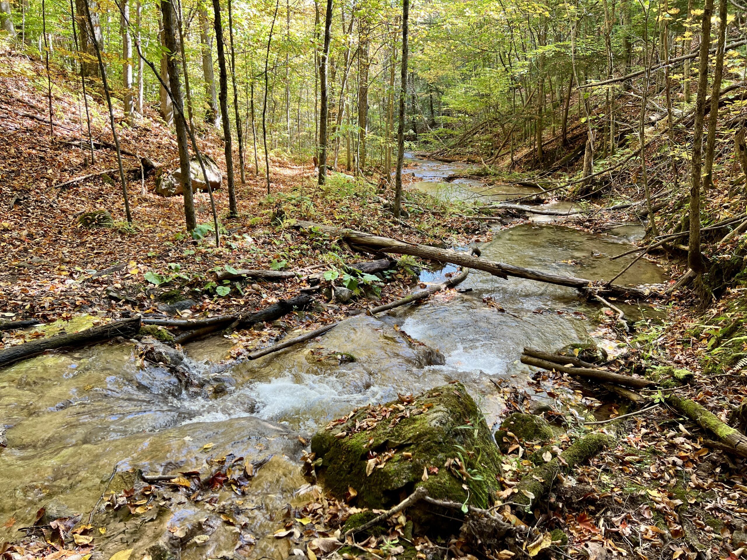
WEDNESDAY WALKERS - Kimberley Forest
https://hikesstaging.brucetrail.org/event/wednesday-walkers-kimberley-forest/Sorry, the registration cut-off time for this hike has been reached.Not a member? Click here to join today!Hosting Club: Beaver Valley
Location (Google Maps): Park in the lower parking lot of the Beaver Valley Ski Club, near the Valley Crossover Side Trail. From there, a few vehicles will be needed to shuttle to our starting point on Sideroad 7A.
Hike Leader(s): Margaret Yaraskavitch Click here to contact the hike leader.
Pace: Medium
Terrain: Moderate
Length of Hike: 5 kmDescription
After shuttling to Sideroad 7A, our hike begins as we walk through the BTC’s Kimberley Springs Nature Reserve, which includes beautiful Bill’s Creek. We also see the Stone Foundation Side Trail. After returning to the Main Trail, we then take the Kimberley Forest Side Trail. The Kimberley Forest is a beautiful multi-use and multi-trail area. Much of the walk is downhill as it finishes at the base of Beaver Valley Ski Club. - 26October 26, 2023
8:00 am Long Hike Jordan to Moyer / Louth
https://hikesstaging.brucetrail.org/event/800-am-long-hike-jordan-to-moyer-louth-64/Sorry, the registration cut-off time for this hike has been reached.Not a member? Click here to join today!Hosting Club: Niagara
Location (Google Maps):
Jordan Hollow Park 3039 King St Jordan
Pace: Medium
Terrain: Moderate
: 10kDescription
From Jordan Hollow Hike the main trail to Upper and Lower Balls Falls, Moyer Road or Louth and Return. You must register for each hike. Bring Poles, sunscreen, bug spray , snack and a drink and dress for the weather
9:15 Short Hike - Jordan Hollow
https://hikesstaging.brucetrail.org/event/915-short-hike-jordan-hollow-80/Sorry, the registration cut-off time for this hike has been reached.Not a member? Click here to join today!Hosting Club: Niagara
Location (Google Maps): Jordan Hollow Park, Jordan Station
Hike Leader(s): Bill Russell Click here to contact Hike Leader(s)
Pace: Medium
Terrain: Strenuous
Distance: 6 kmsDescription
Hike the main and side trails around Jordan Hollow and Ball’s Falls. Bring water and hiking boots.
New Badge! Beaver Valley Geology Hike #6
https://hikesstaging.brucetrail.org/event/new-badge-beaver-valley-geology-hike-6/Sorry, the registration cut-off time for this hike has been reached.Not a member? Click here to join today!Hosting Club: Beaver Valley
Location (Google Maps): Meet in the Beaver Valley Ski Club lower parking lot, on the Valley Crossover side Trail to shuttle to sideroad 13A, km 85.0
Hike Leader(s): Glenda Collings Click here to contact the hike leader.
Pace: Medium
Terrain: Moderate, Some rocky footing, Some steep sections, Strenuous
Length of Hike: Approx. 13.5 kmDescription
This is a series of 7 hikes to earn the Beaver Valley Geology badge. We will use the criteria listed in Beth Gilhespy’s book, Walking Through Time, Exploring Niagara Escarpment Geology in the Beaver Valley Bruce Trail Section. We’ll boost our knowledge of the local geology along the way as we take the required photos. Hikers are welcome to join any or all of the hikes, however, they must complete all 7 hikes to earn the badge. Bring sufficient water and snacks.Hike Five: Wodehouse Karst – Southern & Northern Route
COVID-19 Precautions Before, During and After your Hike
- Each hiker joining a Bruce Trail Club organized hike must perform a self-screening check before hiking.
Find Ontario’s self-assessment tool here: https://covid-19.ontario.ca/self-assessment/ - If you are experiencing COVID-19 symptoms, stay home.
- Personal Protective Equipment:
- Hikers may choose to wear masks
Transportation
It is the Bruce Trail Conservancy’s current policy that car shuttles are allowed. It is at the discrepancy of individual hike leaders to make that decision.
Other Guidelines
- Arrive 15 minutes before the start of the hike.
- Wear sturdy footwear and appropriate attire for the weather and the terrain.
Hiking poles are a good idea in any season, especially if the terrain is rocky or slippery. In winter, snowshoes or icers/crampons are needed when conditions dictate.
Wearing appropriate clothing and footwear prevents injuries and shows consideration for a safe and positive group hiking experience. - Always carry I.D. and your health card.
- Bring sufficient water and snacks (or lunch if indicated). A minimum of 1L of water is recommended on all hikes, and 3L is recommended for long, challenging hikes in the heat of the summer.
- Bring sunscreen and insect repellent (for spring and summer hikes).
- Bring your own first aid kit.
- Please leave dogs at home.
Iroquoia End-to-End Hike 8 of 10
https://hikesstaging.brucetrail.org/event/iroquoia-end-to-end-hike-8-of-10/Sorry, the registration cut-off time for this hike has been reached.Not a member? Click here to join today!Hosting Club: Caledon Hills
Category: End-to-End
Location (Google Maps): Meet at Greenhill Ave. at Cortina Cres., km 28.7. Shuttle to start at Scenic Dr.Hike Leader(s): Nancy Mooney Click here to contact Hike Leader(s)
Pace: Medium – 3 to 4 km/hour
Terrain: Moderate – some hills and/or some poor footing, Strenuous – hilly with steep climbs and some poor footing
Distance: From 40.5 to 28.7, 11.8 km Map 7.Description
This is the eighth hike of ten and the trail begins along the Chedoke Radial Trail through Chedoke Park. It then goes through the woods to the Dundurn steps, the James St. steps, along “the Mountain”, down the Wentworth Steps, across a railway bridge before returning to vehicles.
Easy Does It on the Sixteen
https://hikesstaging.brucetrail.org/event/easy-does-it-on-the-sixteen/Sorry, the registration cut-off time for this hike has been reached.Not a member? Click here to join today!Hosting Club: Iroquoia
Category: Easy Does It Hikes
Location (Google Maps): Oakville – Southeast Corner of River Glen Blvd. and Neyagawa Blvd.Hike Leader(s): Anne Armstrong Click here to contact Hike Leader(s)
Pace: Leisurely – 3km/hr or less
Terrain: Easy – Mostly flat and usually good footing
Distance: Approx. 9 km.Description
Please join us for a hike in this jewel of a valley, rich in history and natural features. Mostly flat with easy footing there are two hills to descend and ascend. Meet in the southeast parking lot at the intersection of River Glen and Neyagawa Blvd. at 9:45 am. for a 10:00 am. start. Bring a snack and water. Leader: Anne Armstrong 905 617 3937 hikingrandma@gmail.com - Each hiker joining a Bruce Trail Club organized hike must perform a self-screening check before hiking.
- 27October 27, 2023
Dufferin Hi-Land 2 of 3
https://hikesstaging.brucetrail.org/event/dufferin-hi-land-2-of-3/Sorry, the registration cut-off time for this hike has been reached.Not a member? Click here to join today!Hike open to BTC Members only.
Hosting Club: Niagara
Category: Car Pool
Location (Google Maps): Meet on 20 Sideroad and Prince of Wales Rd, Km 41.7 and carpool to km 20.5, on 1st Lien E. south of 5SideroadHike Leader(s): Vince Zvonar Click here to contact Hike Leader(s)
Pace: Brisk
Terrain: Moderate
Distance: 21.2Description

9:00 Niagara-on-the-Lake Tour
https://hikesstaging.brucetrail.org/event/900-niagara-on-the-lake-tour-13/Sorry, the registration cut-off time for this hike has been reached.Not a member? Click here to join today!Hosting Club: Niagara
Category: Urban
Location (Google Maps): Meet on King St near Centre St – just outside of Veteran’s Memorial ParkHike Leader(s): Margaret Northfield Click here to contact Hike Leader(s)
Pace: Medium
Terrain: Easy
Distance: 5-6kmDescription
Each Friday we will explore different neighbourhoods, trails and parkland throughout Historic Niagara-on-the-Lake.
Moderate pace with some weeks entirely on sidewalks and roads while others may include a mix of trails and paved pathways. Great way to build up endurance for longer more strenuous hikes.
Prepare for cooler windy conditions on open parkland and along Lake Ontario and Niagara River trails.
Plan to stay for conversation and a warm cup of coffee or tea at Sweets & Swirls, Community Centre, Niagara Stone Road, NOTL25
Owling Evening with Miptoon and Jarmo Jalava
https://hikesstaging.brucetrail.org/event/owling-evening-with-miptoon-and-jarmo-jalava/Sorry, the registration cut-off time for this hike has been reached.Not a member? Click here to join today!Hosting Club: Peninsula
Location (Google Maps): Mar Area. Exact meeting location will be provided after registration.
Hike Leader(s): Saabir Sohrab Click here to contact Hike Leader(s)
Pace: Leisurely
Terrain: EasyDescription
We are honoured to host a small group, special Owling evening facilitated by Saugeen Ojibway Nation (SON) Knowledge Holders Miptoon and Jarmo Jalava.People are fascinated with owls – whether because of their unique head movement, big eyes or mysterious night time behaviour. Join us for an evening of owling, to learn more about these wonderful nocturnal hunters.
This is a carpool hike. We will meet together near Mar and then carpool to nearby locations to watch and listen for different species of owls. Exact meet up location will be emailed to you before the hike.
This is a “donate what you can” hike. If you can make a donation, please donate what you can when registering for the hike. The proceeds will be directed toward the Peninsula Bruce Trail Club for birding events and protection of bird habitat on the Saugeen (Bruce) Peninsula.
- 28October 28, 2023
Hart's TRIPLE INFERNO
https://hikesstaging.brucetrail.org/event/harts-triple-inferno/Sorry, the registration cut-off time for this hike has been reached.Not a member? Click here to join today!Hosting Club: Blue Mountains
Category: Register in person the morning of hike.
Location (Google Maps): Hike meets in the parking lot behind Tim Hortons on First St. in Collingwood.Hike Leader(s): Hart Fischer Click here to contact Hike Leader(s)
Pace: Brisk – 4 to 5 km/hr, Fast – 5+ km/hr
Terrain: Strenuous – Hilly with steep climbs and some poor footing
Distance: looongDescription
This will be a challenging and grueling hike! Guaranteed to be super strenuous! Come prepared for a workout. ONLY for hikers that are experienced in longer distance hikes as well as managing various terrains. This will be extreme. Bring lots of water, snacks and lunch and maybe
even dinner!!
Blue Mountains End to End Part III of VI
https://hikesstaging.brucetrail.org/event/blue-mountains-end-to-end-part-iii/Sorry, the registration cut-off time for this hike has been reached.Not a member? Click here to join today!Trip Information
Departure Time: 08:00
Return to City Time: 19:00
Departure Point: York Mills Bus PickupOptional Items
Hosting Club: Toronto
Category: Bus Hike
Location (Google Maps): Maps 23 and 22 of the Bruce Trail Reference and Guide. Km 44.5 to km 34.2Hike Leader(s): George Lennon and Michael Humpage Click here to contact Hike Leader(s)
Pace: Moderate
Terrain: Variable
Distance: 12.3kmDescription
Bus departs 10 York Mills Rd at 8:00 AM and Major Mackenzie Dr and HWY 400 Park and Ride at 8:20 AM. If you wish to be picked up at the Major Mackenzie Dr and HWY 400 Park and Ride, type ‘yes’ in the additional information field. Please arrive 15 minutes before departure. The bus waits for no one.From km 44.5 we will head south into the Nottawasaga Lookout Nature Reserve. We begin with an ascent up a hill to the edge of the Escarpment. From there we will have stunning panoramic views of the surrounding landscape, with quick glimpses of Georgian Bay before we are submerged again in the lush forest. The reserve protects over 20 different species of fern. Moss-covered rock lines narrow and deep crevice caves. Eventually we come out into a farm field and then the newly-acquired BTC property of the Balsam Wetlands that adjoins the Highlands Nordic Ski Area. We will stop in Creemore on our way back to Toronto.
** Hikers are required to bring a mask and wear it on the bus. Masks must fit properly and cover the nose, mouth and chin. For the highest level of protection against Covid-19, respiratory viruses or the flu, KN95 or N95 masks are recommended. **
Car Hike; Happy Valley King City
https://hikesstaging.brucetrail.org/event/car-hike-happy-valley-king-city-5/Sorry, the registration cut-off time for this hike has been reached.Not a member? Click here to join today!Hosting Club: Toronto
Category: Car Hike
Location (Google Maps): Happy Valley, Oak Ridges TrailHike Leader(s): Mohammad Aghamiri Click here to contact Hike Leader(s)
Pace: Moderate
Terrain: Variable
Distance: 14-15KMDescription
Come and join the group to view nice sceneries and look out of Happy valleySome safety procedures during the hike:
1-Hikers must stay between the leader and the sweep.
2-Hikers must advise the leader or the sweep if they wish to leave the group.
3- Hikers must follow the whistle instructions: 1 blast- stay where you are; 2 blasts come to the leader; 3 blasts – come to the leader quickly.
4-Hike leader may request volunteers to stop at trail intersections, they need to help hikers to the direction the group walk and wait till they see the sweep .
5-Hikers have to make sure they can see the persons behind and in front of them.

9:00 Cave Spring Witch Hunt
https://hikesstaging.brucetrail.org/event/900-cave-spring-witch-hunt-12/Sorry, the registration cut-off time for this hike has been reached.Not a member? Click here to join today!Hosting Club: Niagara
Category: In and Out
Location (Google Maps):Parking lot Quarry Road Beamsville
Hike Leader(s): Bill Russell Click here to contact Hike Leader(s)
Pace: Leisurely
Terrain: Moderate
Distance: 6kDescription
Discover the history of the 19th Century Quarry Pioneers and the Cave Spring Witch. Complete this hike and count it towards the Screaming Tunnel Badge
Car Hike: Ball's Falls Conservation Area
https://hikesstaging.brucetrail.org/event/car-hike-balls-falls-conservation-area/Sorry, the registration cut-off time for this hike has been reached.Not a member? Click here to join today!Hosting Club: Toronto
Category: Car Hike
Location (Google Maps): GPS N43.133587, W79.385233 Ball’s Falls Conservation Area. Enter from Sixth Ave, 1km north of Seventh Ave and 500 meters East of Victoria Ave. (regional rd 24), parking fee is charged. Please don’t enter the parking lot upon arrival until we decide how many cars will park to avoid parking charges. Wait along the gate entrance or the roadside.Hike Leader(s): Ross Estrella Click here to contact Hike Leader(s)
Pace: Brisk
Terrain: Rocky, Variable
Distance: 14.5 kmsDescription
We will hike approximately 14.5 kms of the Niagara section of the Bruce Trail starting from the Southeast perimeter of Short Hills PP, passing thru Rockway Conservation Area and Louth Conservation Area to Ball’s Falls. We may not see the golden colours of the Autumn leaves up the trees but we’ll enjoy them in the ground. Please check the forecast weather for day of hike and dress appropriately including footwear and armed yourself with proper hiking gear. Please bring enough water for hydration, snacks and lunch. Please arrive at least twenty minutes early. Hike we’ll proceed on time and there are no dropouts.Old Baldy
https://hikesstaging.brucetrail.org/event/old-baldy-7/Sorry, the registration cut-off time for this hike has been reached.Not a member? Click here to join today!Hosting Club: Blue Mountains
Category: Register in person the morning of hike.
Location (Google Maps): Hike meets in the parking lot behind Tim Hortons on First St. in Collingwood.Hike Leader(s): Bob Moenck Click here to contact Hike Leader(s)
Pace: Leisurely – 3 km/hr. or less
Terrain: Moderate – Some hills and/or some poor footing
Distance: 5kmDescription
We will drive to and park at km 46.8 on Cty. Rd.13 in the Beaver Valley section. We begin a long climb with magnificent views of the Beaver Valley before reaching the top of the Escarpment. We will explore the MacKirk Side Trail and follow the white blazed trail back to the cars. The trail passes lookouts where you can watch for turkey vultures and buteo hawks. Bring a snack and water.Lions Head Loop Hike
https://hikesstaging.brucetrail.org/event/lions-head-loop-hike/Sorry, the registration cut-off time for this hike has been reached.Not a member? Click here to join today!Hosting Club: Iroquoia, Peninsula
Category: General Hike
Location (Google Maps): McCurdy Drive Municipal Parking Lot – Online booking requiredHike Leader(s): Pati Greenwood, Jeff Dowsett Click here to contact Hike Leader(s)
Pace: Medium – 3 to 4 km/hr
Terrain: Moderate – Some hills and/or some poor footing
Distance: 17 kmDescription
First of a two-day weekend hiking experience in the Peninsula section of the Bruce Trail. Join us for one or both.Today’s hike will be a loop around Lion’s Head Provincial Nature Reserve following the main trail and side trails. The route will include a visit to MacKay’s Harbour. Bring a lunch, snacks and plenty of water. Wear sturdy footwear and clothing appropriate to conditions.
Rosedale subway/Cedarvale Ravine/Mt.Pleasant Cemetery
https://hikesstaging.brucetrail.org/event/rosedale-subway-cedarvale-ravine-mt-pleasant-cemetery/Sorry, the registration cut-off time for this hike has been reached.Not a member? Click here to join today!Hosting Club: Toronto
Category: Urban Walk
Location (Google Maps): Rosedale TTC subway station ticket collectorHike Leader(s): Ray Berzins
Pace: Moderate
Terrain: Flat
Distance: 11 kmDescription
Hike shall go through Ramsden Park, Roycroft Park, Sir Winston Churchill Park, Nordheimer Ravine, Cedarvale Ravine, Kay Gardner Beltline Park to Mount Pleasant Cemetery South Entrance on Yonge Street.Bring water, juice or a thermos of hot beverage and light snacks to nibble on, but there will not be a sit-down mealtime as we shall eat immediately after the hike.
Swiss Chalet restaurant at Yonge & St. Clair has been suggested for 1 PM lunch (approx.$20).
You will receive a hike status email from hike leader by 8AM on day of hike to indicate whether hike will proceed or whether hike is cancelled due to rain.
Hole in the Wall
https://hikesstaging.brucetrail.org/event/hole-in-the-wall/Sorry, the registration cut-off time for this hike has been reached.Not a member? Click here to join today!Hosting Club: Iroquoia
Category: General Hike
Location (Google Maps): Limehouse Conservation Area, 12169 Fifth Line, LimehouseHike Leader(s): Anne Armstrong Click here to contact Hike Leader(s)
Pace: Leisurely – 3km/hr or less
Terrain: Moderate – Some hills and/or some poor footing
Distance: Approx. 9 km.Description
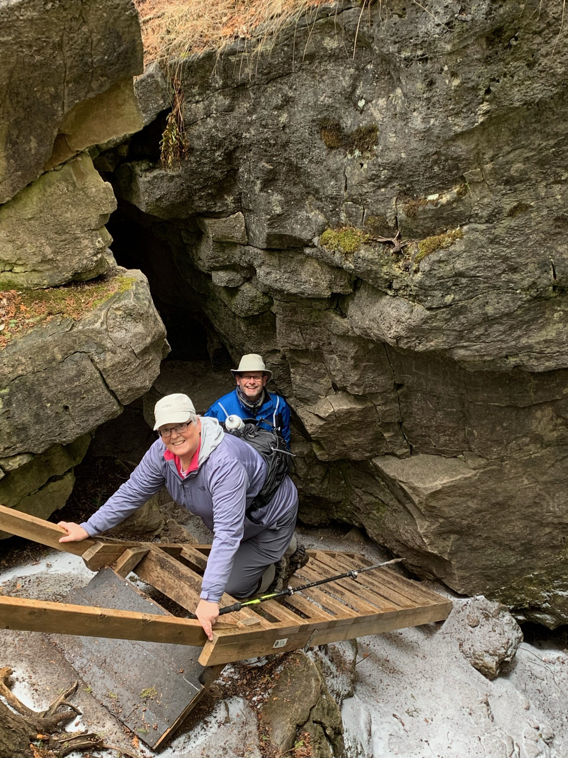
This “there and back” hike will take us through the Limehouse Conservation Area and beyond and will include negotiating the “hole in the wall”. The area is rich in history of quarrying limestone and has the remains of lime kilns and an explosives magazine. We will also visit the Todd Bardes SideTrail and the Ridge Side Trail. Meet at 9:45 am. in the parking lot of the Conservation area on Fifth Line for a 10:00 am. start. Bring water, a snack/lunch, sunscreen. Hiking poles will be useful.
Leader: Anne Armstrong 905 617 3937 hikingrandma@gmail.com10:00am Invasive Buckthorn Work Party - 2023 - St.Paul's Nature Reserve
https://hikesstaging.brucetrail.org/event/1000-invasive-buckthorn-work-party-2023-st-pauls-nature-reserve/Sorry, the registration cut-off time for this hike has been reached.Not a member? Click here to join today!Hosting Club: Niagara
Location (Google Maps): St. Pauls Nature Reserve – parking on road side on St.Pauls Ave, Niagara Falls just down from the rail road tracks.
Hike Leader(s): Alicia Aitchison Click here to contact Hike Leader(s)
Pace: Leisurely
Terrain: Moderate
Distance: ~3kmDescription
This work party is to continue with our invasive buckthorn removal at St.Pauls Nature Reserve.We are hoping to get lots of volunteers out and tackle this area in one work party per year.
Volunteers make a difference – come out & join us!
Invasive buckthorn removal methods vary based on how big the buckthorn is – small plants can be pulled by hand and hung upside down so the roots dry out and die. Medium sized are removed with the help of extractigators – special shovel like tools that make pulling much easier & large buckthorn “trees” must be cut with a chainsaw.
BTC Ecologists as well as certified chain sawyers will be there to help us.
Plan on arriving so we can all walk in together at 10am but it’s an easy walk out if anybody wants to leave after a shorter amount of time.
Remember to wear long pants, long sleeves, work gloves, bring lots of water & bring a lunch if you are staying for the duration!
Please register so you will be included in any relevant correspondence.