
Hike Schedule
Join us for a hike! Registration required.
All hikes available to BTC members. Some hikes are open to non-members.
See Refund Policy for Paid Hikes >
TIP: The calendar view displays up to 7 hikes on a day, but often there are more. Click “View more events” to see them all.
Categories
- 21October 21, 2023
Coach Trip: Algonquin Park - Centennial Ridges Trail
https://hikesstaging.brucetrail.org/event/coach-trip-algonquin-park-centennial-ridges-trail/Sorry, the registration cut-off time for this hike has been reached.Not a member? Click here to join today!Hosting Club: Toronto
Category: Day Coach Trips
Location (Google Maps): Centennial Ridges Trail, Algonquin Provincial ParkHike Leader(s): Martina Furrer, Celia Ho, Duro Vukman and Roland Mark Click here to contact Hike Leader(s)
Pace: Moderate
Terrain: Hilly
Distance: 11.5 KMDescription
Bus departure time: 7 AMBus departure location: 10 York Mills Rd.
Join us for an awesome fall hike with spectacular views of the Algonquin Park wilderness. We will split into two groups and hike the Centennial Ridges Trail in opposite directions. Both groups will hike the entire trail at similar paces so that we finish around the same time. The trail is hilly and challenging, with some rocks and routes underfoot. We hope to complete the loop in about 5 hours (including all breaks), no drop-outs. There will be many great view and water stops along the way, and a scenic lunch spot.
Bring lunch, snacks, water (at least 2 litres), sun and rain protection. We will be travelling in a washroom equipped highway coach.
The cost (to be determined) includes coach fare and park admission/bus parking fee.
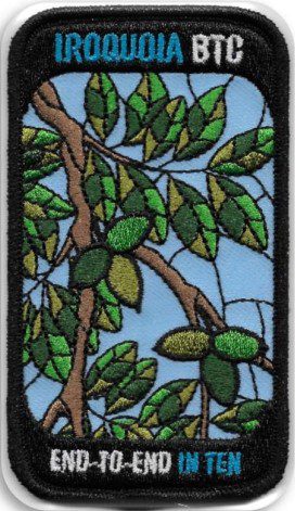
Iroquoia E2E in 10 – Butternut Tree Badge (Oct 21-22, Nov 4-5, Nov 18-19, Dec 2-3, Dec 16-17)
https://hikesstaging.brucetrail.org/event/iroquoia-e2e-in-10-butternut-tree-badge-oct-21-22-nov-4-5-nov-18-19-dec-2-3-dec-16-17/Sorry, the registration cut-off time for this hike has been reached.Not a member? Click here to join today!Hosting Club: Iroquoia
Category: Iroquoia E2E-in-Ten
Location (Google Maps): Iroquoia section – hike schedule will be sent out in advanceHike Leader(s): Freddy Wang Click here to contact Hike Leader(s)
Pace: Brisk – 4 to 5 km/hr
Terrain: Dependent on Conditions, Moderate – Some hills and/or some poor footing, Strenuous – Hilly with steep climbs and some poor footing
Distance: 11-15 kmDescription
This is a special series of 10 hikes to complete the entire Iroquoia section of the Bruce Trail over five weekends. There is an accomplishment badge, included in the registration fee – which was designed by Joe Borges and features the butternut tree.We will be following the main trail southbound starting in Milton and finishing in Grimsby. Please note that you are signing up for the entire series of ten hikes as a Group Hike. The Iroquoia in 10 series is geared to experienced hikers with the expectation of a 3.5 to 5.0 km/hr pace maintained over an 11 to 15 km hike.
Hikers will be expected to wear proper hiking footwear and have layered clothing. Sufficient snacks, water, hiking poles, and wet weather gear (if necessary) are recommended.
The fee goes towards supporting the Iroquoia Bruce Trail Club, which in turn supports the mission of the Bruce Trail Conservancy, which is: “Preserving a ribbon of wilderness, for everyone, forever.”
A maximum of 2 of the 10 hikes can be self-completed as a result of scheduling challenges, but it is intended that this badge be earned while hiking as part of a group led by a certified hike leader. Car shuttles are shared amongst the hikers.
Please note there are no refunds!
TRANSPORTATION
This series will be through hikes and will require car shuttling, you must be willing to drive or to be a passenger. Some parking locations require paid parking, and hikes that enter Conservation Areas (CA) will require reservations. The fee for the E2E-in-Ten does not cover any parking/entry fees for hikers who are not members of the Halton CA and/or Hamilton CA. If the group has enough hikers who are members of a CA, those will be the cars chosen to park in those areas so as to minimize costs but since conservation passes are not free, please consider nominal compensation to the pass holder. At least one hike starts at one CA and possibly ends at another, so parking fees are unavoidable for non-CA members.
Remember, you can only miss two hikes to qualify for this special Butternut Tree badge. You must still complete the distance you have missed. If you miss more than two but still complete the distances on your own, you may apply for the regular club End to End badge.
Car Hike: Wilder Forest, Uxbridge
https://hikesstaging.brucetrail.org/event/car-hike-wilder-forest-uxbridge/Sorry, the registration cut-off time for this hike has been reached.Not a member? Click here to join today!Hosting Club: Toronto
Location (Google Maps): 2499 Brock Road, Uxbridge, ON there is a free parking when you enter the road off brock road beside Horse training facility
Hike Leader(s): Mohammad Aghamiri Click here to contact Hike Leader(s)
Pace: Moderate
Terrain: Variable
Distance: 14-15KMDescription
We will explore Wilder forest and the beautiful sceneries of fall in wilder forest in Uxbridge .Some safety procedures during the hike:
1-Hikers must stay between the leader and the sweep.
2-Hikers must advise the leader or the sweep if they wish to leave the group.
3- Hikers must follow the whistle instructions: 1 blast- stay where you are; 2 blasts come to the leader; 3 blasts – come to the leader quickly.
4-Hike leader may request volunteers to stop at trail intersections, they need to help hikers to the direction the group walk and wait till they see the sweep .
5-Hikers have to make sure they can see the persons behind and in front of them.
https://hikesstaging.brucetrail.org/event/24626/Sorry, the registration cut-off time for this hike has been reached.Not a member? Click here to join today!Hosting Club: Blue Mountains
Category: Organized Hike
Location (Google Maps):Hike Leader(s): Linda Finley Click here to contact Hike Leader(s)
Pace: Medium – 3 to 4 km/hr
Terrain: Moderate – Some hills and/or some poor footingDescription
Len Holley Side Trail, Curly Harnden Side Trail and Bruce’s Caves 9 of 9 hikes Start time:8:30AM Hikers meet at trailhead at 8:30AM
Contact hike leader to confirm start up point.Barrow Bay to Whippoorwill Bay
https://hikesstaging.brucetrail.org/event/barrow-bay-to-whippoorwill-bay/Sorry, the registration cut-off time for this hike has been reached.Not a member? Click here to join today!Hike open to BTC Members only.
Hosting Club: Dufferin Hi-Land
Category: General Hike
Location (Google Maps): Bruce Trail parking lot at the end of the Richardson Access Trail with access from Forty Hills Road. Isthmus Bay Road north of Lion’s Head may be closed for construction so please access via Caudle Sideroad off Hwy 6. Near km 87.4 BTC Map 38.Hike Leader(s): Stuart Law Click here to contact Hike Leader(s)
Pace: Medium
Terrain: Dependent on Conditions, Slippery and Steep Sections, Slippery Sections Likely, Strenuous
Distance: 19.5 kmsDescription
Join us for this series of Peninsula shuttle hikes from Jackson’s Cove to Cape Chin South on the Bruce Peninsula. The terrain is as demanding as it gets but stunning. Hikes range from 12 to 19.5 km. See individual hike descriptions for details. Please be ready for slippery rocks, cliff tops, poison ivy, bugs and ticks. Hiking boots and poles mandatory. Lots of climbing, some mud and a lot of laughs. Please arrive 15 minutes ahead of time because our departure times are firm. Please bring your own first aid kit with moleskin, 2.5L water, lunch, snack and a change of footwear and a garbage bag (for the shuttle). Please be prepared to use your vehicle for the shuttle. No dogs and no dropouts. Km references are to 31st Edition Bruce Trail Reference.
9:00 Cave Spring Witch Hunt
https://hikesstaging.brucetrail.org/event/900-cave-spring-witch-hunt-10/Sorry, the registration cut-off time for this hike has been reached.Not a member? Click here to join today!Hosting Club: Niagara
Location (Google Maps):
Parking lot Quarry Road Beamsville
Hike Leader(s): Bill Russell Click here to contact Hike Leader(s)
Pace: Leisurely, Medium
Terrain: Moderate
Distance: 6kDescription
Discover the history of the 19th Century Quarry Pioneers and the Cave Spring Witch. Complete this hike and count it towards the Screaming Tunnel Badge.Bring poles and wear good hikers as the terrain is rocky and hilly in parts.
Louth Conservation area to Rockway return
https://hikesstaging.brucetrail.org/event/louth-conservation-area-to-rockway-return/Sorry, the registration cut-off time for this hike has been reached.Not a member? Click here to join today!Hosting Club: Niagara
Category: Loop
Location (Google Maps): Louth Conservation Area Parking Lot, Staff AvenueHike Leader(s): Lauren Doig Click here to contact Hike Leader(s)
Pace: Medium
Terrain: Moderate
Distance: 15 km maxDescription
Meet at Louth Conservation Area Parking Lot and head towards Rockway. We will enjoy a few side trails en route.
New Badge! Beaver Valley Geology Hike #5
https://hikesstaging.brucetrail.org/event/new-badge-beaver-valley-geology-hike-5/Sorry, the registration cut-off time for this hike has been reached.Not a member? Click here to join today!Hosting Club: Beaver Valley
Location (Google Maps): Meet in the Hogg’s Falls parking lot, km 67.5 to shuttle to Johnston’s Side Road, km 74.3
Hike Leader(s): Glenda Collings Click here to contact the hike leader.
Pace: Medium
Terrain: Moderate, Some rocky footing, Some steep sections, Strenuous
Length of Hike: 6.8 kmDescription
This is a series of 7 hikes to earn the Beaver Valley Geology badge. We will use the criteria listed in Beth Gilhespy’s book, Walking Through Time, Exploring Niagara Escarpment Geology in the Beaver Valley Bruce Trail Section. We’ll boost our knowledge of the local geology along the way as we take the required photos. Hikers are welcome to join any or all of the hikes, however, they must complete all 7 hikes to earn the badge. Bring sufficient water and snacks.Hike Five: Falling Waters Trail
COVID-19 Precautions Before, During and After your Hike
- Each hiker joining a Bruce Trail Club organized hike must perform a self-screening check before hiking.
Find Ontario’s self-assessment tool here: https://covid-19.ontario.ca/self-assessment/ - If you are experiencing COVID-19 symptoms, stay home.
- Personal Protective Equipment:
- Hikers may choose to wear masks
Transportation
It is the Bruce Trail Conservancy’s current policy that car shuttles are allowed. It is at the discrepancy of individual hike leaders to make that decision.
Other Guidelines
- Arrive 15 minutes before the start of the hike.
- Wear sturdy footwear and appropriate attire for the weather and the terrain.
Hiking poles are a good idea in any season, especially if the terrain is rocky or slippery. In winter, snowshoes or icers/crampons are needed when conditions dictate.
Wearing appropriate clothing and footwear prevents injuries and shows consideration for a safe and positive group hiking experience. - Always carry I.D. and your health card.
- Bring sufficient water and snacks (or lunch if indicated). A minimum of 1L of water is recommended on all hikes, and 3L is recommended for long, challenging hikes in the heat of the summer.
- Bring sunscreen and insect repellent (for spring and summer hikes).
- Bring your own first aid kit.
- Please leave dogs at home.

Urban Walk; Don Valley to The Distillery District
https://hikesstaging.brucetrail.org/event/urban-walk-don-valley-to-the-distillery-district/Sorry, the registration cut-off time for this hike has been reached.Not a member? Click here to join today!Hosting Club: Toronto
Category: Urban Walk
Location (Google Maps): TorontoHike Leader(s): Brian Rideout Click here to contact Hike Leader(s)
Pace: Moderate
Terrain: Flat
Distance: 27.5 kmDescription
This hike follows the Don River south through Toronto to the Distillery District, through a series of ravines and several parks. We will detour to street level when we cross the 401 (trail closed due to construction) and again south of Pottery Rd where we take the Bayview Ave Extension (trail closed due to construction).Please bring a lunch and at least two liters of water. Be prepared for cool / wet weather.
Here is an online map of our route: Don Valley to The Distillery
Car Hike: Hockley Valley, Map 18
https://hikesstaging.brucetrail.org/event/car-hike-hockley-valley-map-18-2/Sorry, the registration cut-off time for this hike has been reached.Not a member? Click here to join today!Hosting Club: Toronto
Category: Car Hike
Location (Google Maps): Hockley Provincial Nature ReserveHike Leader(s): Al Brown Click here to contact Hike Leader(s)
Pace: Moderate
Terrain: Challenging, Hilly
Distance: 14 kmDescription
We will complete a loop hike through the Nature reserve on the main and side trails. This is one of the hilliest sections of the Bruce Trail and one of my favorites.After the hike we will stop at the Hockley Resort for refreshments.
To get to the meeting point drive north on Hwy 10 past Orangeville to Hockley Road. Turn right (east) and go about 5 km to the parking area on your left, across from the Black Birch Restaurant.
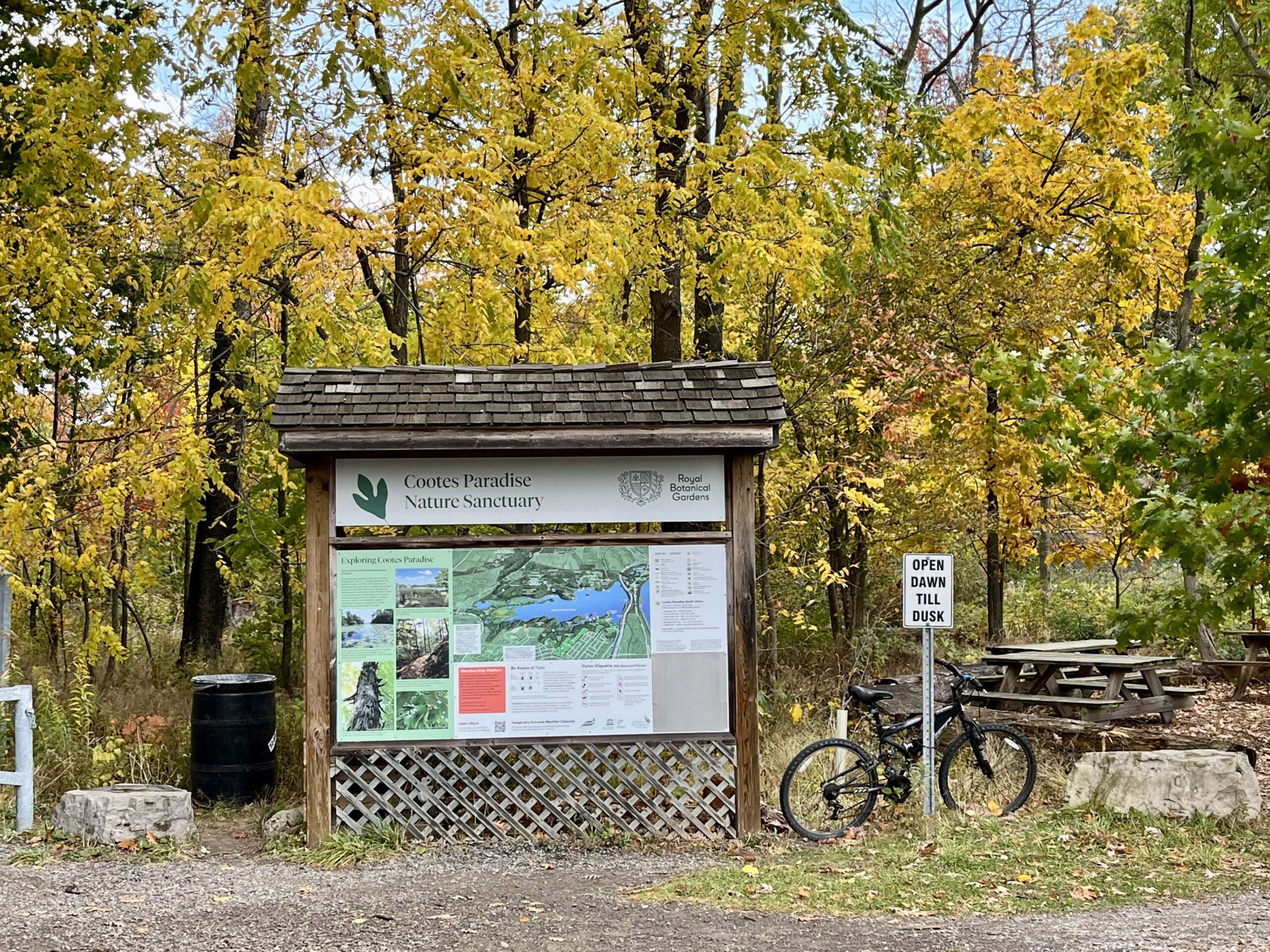
Urban Walk: Coote's Paradise/Hamilton Waterfront Trail
https://hikesstaging.brucetrail.org/event/urban-walk-cootes-paradise-hamilton-waterfront-trail-3/Sorry, the registration cut-off time for this hike has been reached.Not a member? Click here to join today!Hike open to BTC Members only.
Hosting Club: Toronto
Category: Urban Walk
Location (Google Maps):Hike will start from McMaster University GO Bus Terminal. We will meet at Toronto’s Union Station 8:30 AM to take the 8:44 AM Train to Aldershot where we will transfer to the GO Bus for a short ride to McMaster University. On the return we take the GO Train to Toronto from West Harbour GO Train Station. If you have a smart phone then the return fare is just $10 with GO’s Weekend Pass. Seniors fare return from Union is $11.44. Hikers without a smartphone may purchase pass from Hike Leader at Union Station. If meeting us at McMaster you will have to make your way back to start by local transit or Uber and parking fee would apply.
Hike Leader(s): Tom Swales, Tiffany & Steve Harding Click here to contact Hike Leader(s)
Pace: Moderate
Terrain: Variable
Distance: 12-13 kmDescription
This will be a one way hike through the trails of the RBG’s (Royal Botanical Gardens) South Shore Cootes Paradise Trails to Princess Point and then continuing on Hamilton’s Waterfront Trail along Burlington Bay to Bayfront Park which is a 7 minute walk to the West Harbour GO Station. Cootes Paradise is the largest and most diverse of RBG’s sanctuaries. Nestled between the Niagara Escarpment and Lake Ontario the picturesque area is significant as a migratory bird flyover zone and home to a wide variety of flora and fauna. There will be a few hills including one steeper one. Come and enjoy the last part of the fall colour season in the Hamilton area with me and hike leader apprentices Tiffany and Steve Harding. - Each hiker joining a Bruce Trail Club organized hike must perform a self-screening check before hiking.
- 22October 22, 2023
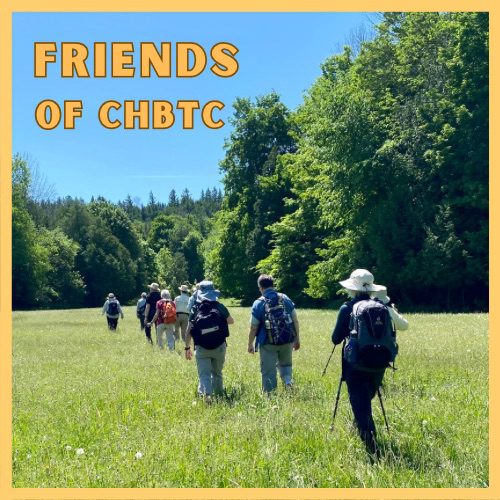
Just For Fun - Friends of CHBTC
https://hikesstaging.brucetrail.org/event/just-for-fun-friends-of-chbtc/Sorry, the registration cut-off time for this hike has been reached.Not a member? Click here to join today!Hosting Club: Caledon Hills
Category: General
Location (Google Maps): Meet at the Hockley Road Parking Lot: Located on the north side of Hockley Road at the Hockley Road Side Trail. Google Map Coordinates: 43.972857, -80.056330
Directions: From ON-10, turn east onto Hockley Road/Dufferin County Road 7. Drive for 5 kilometres. The parking lot is on the lefthand side.Hike Leader(s): Sandy Green and Roopa Dindigal Click here to contact Hike Leader(s)
Pace: Medium – 3 to 4 km/hour
Terrain: Moderate – some hills and/or some poor footing
Distance: 11.5 kmDescription
Plan to enjoy the fall colours and explore a section of the Hockley Valley Provincial Nature Reserve. Our route will take us along the Hockley Road Side Trail, sections of the main Trail, and the Glen Cross, Isabel East, and Tom East Side Trails. Bring your choice of hydration and snacks. Sturdy footwear is highly recommended.Whippoorwill Bay to Cape Chin South
https://hikesstaging.brucetrail.org/event/whippoorwill-bay-to-cape-chin-south/Sorry, the registration cut-off time for this hike has been reached.Not a member? Click here to join today!Hike open to BTC Members only.
Hosting Club: Dufferin Hi-Land
Category: General Hike
Location (Google Maps): North side of the curved shoulder of Cape Chin South Road. km 99.3 BTC Map 39. GPS coordinates and address only approximate.Hike Leader(s): Stuart Law Click here to contact Hike Leader(s)
Pace: Medium
Terrain: Dependent on Conditions, Slippery and Steep Sections, Slippery Sections Likely, Strenuous
Distance: 12 kms.Description
Join us for this series of Peninsula shuttle hikes from Jackson’s Cove to Cape Chin South on the Bruce Peninsula. The terrain is as demanding as it gets but stunning. Hikes range from 12 to 19.5 km. See individual hike descriptions for details. Please be ready for slippery rocks, cliff tops, poison ivy, bugs and ticks. Hiking boots and poles mandatory. Lots of climbing, some mud and a lot of laughs. Please arrive 15 minutes ahead of time because our departure times are firm. Please bring your own first aid kit with moleskin, 2.5L water, lunch, snack and a change of footwear and a garbage bag (for the shuttle). Please be prepared to use your vehicle for the shuttle. No dogs and no dropouts. Km references are to 31st Edition Bruce Trail Reference.
Car Hike: Promenading plus Pumpkin-picking
https://hikesstaging.brucetrail.org/event/car-hike-promenading-and-pumpkin-picking/Sorry, the registration cut-off time for this hike has been reached.Not a member? Click here to join today!Hosting Club: Toronto
Category: Car Hike
Location (Google Maps): We will meet at the Artaban Road parking lot of the Dundas Valley Conservation Area – coordinates are 43.240974, -79.975582. (Map 8 of the Bruce Trail Reference Guide, Edition 30).Hike Leader(s): Monica Pasquali Click here to contact Hike Leader(s)
Pace: Leisurely
Terrain: Variable
Distance: 5 kmDescription
Enjoy two terrific things in one day: promenading along the beautiful trails within the Dundas Valley Conservation Area followed by a visit to Dyment’s Glen Drummond Farm for lunch and to pick out the perfect pumpkin for Halloween! First we’ll do a loop hike that incorporates Artaban Road Side Trail, Canterbury Falls Side Trail, and the main Bruce Trail within the Dundas Valley Conservation Area, stopping to admire a couple of waterfalls along the way. After returning to our cars, those who would like to join me in extending their day of fun will make the 15-minute drive to reach Dyment’s Glen Drummond Farm for their annual “Pumpkin Patch Festival.” Before departing the farm, you might also want to purchase some delicious baked goods to enjoy at home.Children under 13 years of age are encouraged to join their parents/guardians on this hike so they can fulfill the requirements for the Iroquoia Bruce Trail Club’s Fall Junior Hiker Badge (https://www.iroquoia.on.ca/index.php/hiking/junior-hiker-program/) – all family members who are planning on joining us should register for the hike, including children. You should bring enough water and food for a 2-hour hike, comfortable hiking shoes, sun and bug protection, appropriate clothing for the weather, and money if you intend to join us at Dyment’s Glen Drummond Farm after the hike (please note that the farm only accepts cash as a form of payment).
Note that there is a pay-and-display cost associated with parking at the Artaban Road parking lot within the Dundas Valley Conservation Area. The cost is $11 per vehicle.
Also note that there is a fee to visit the “Pumpkin Patch Festival” at Dyment’s Glen Drummond Farm (http://www.dyments.com/pumpkin-patch/pumpkins.aspx). This year’s entrance fee has not yet been advertised, but last year’s entrance fee was $16 (HST included) per person aged 2 years and older. These fees can only be paid in cash upon entering the farm.
Fall Colours in Toronto Parks & Ravines: High Park
https://hikesstaging.brucetrail.org/event/fall-colours-in-toronto-parks-ravines-high-park/Sorry, the registration cut-off time for this hike has been reached.Not a member? Click here to join today!Hosting Club: Toronto
Category: Urban Walk
Location (Google Maps): High Park – Meet in front of the Nature CentreHike Leader(s): Sajedeh Zahraei Click here to contact Hike Leader(s)
Pace: Leisurely, Moderate
Terrain: Flat
Distance: 5.1 KMDescription
This is the last walk in a 4 part series of fall colour walks in Toronto Parks and Ravines. Come enjoy a walk in beautiful High Park! We will start at the Nature Centre and do a loop around the park exploring different habitats and gardens within the park and discussing different nature initiatives led by the Nature Centre. Wear comfortable shoes, bring water, snacks, and lunch.
Urban Walk: Mississauga: Meadowvale - Churchville Pumpkin Pie Hike/Tour
https://hikesstaging.brucetrail.org/event/urban-walk-mississauga-meadowvale-churchville-pumpkin-pie-hike-tour/Sorry, the registration cut-off time for this hike has been reached.Not a member? Click here to join today!Hosting Club: Toronto
Category: Urban Walk
Location (Google Maps): Meet me Kipling Terminal for a 9:02 am departure on MiWay bus #11. Or drive direct to Credit Valley Conservation Authority Parking.Hike Leader(s): Andrew Proczek Click here to contact Hike Leader(s)
Pace: Leisurely, Moderate
Terrain: Flat
Distance: 12.5 kmDescription
Come join me for our annual pumpkin pie hike/tour with gifted storyteller, Terry Wilson. Take in the fall colors and be charmed by Terry’s stories. This year we will once again visit Terry’s little pioneer village that he constructed with his mother, Rosemary, over two decades. This will be followed with a highlights tour of Meadowvale Village and a trek to the pioneer cemetery of Churchville to the north. Pumpkin pie and hot chocolate will be offered at the cemetery where we will stop for lunch. Copies of Terry’s latest book of short stories will be raffled for 1 dollar a ticket. Bring your loonies or better yet a fiver for a greater chance to win. Most importantly we will honor the memory of Rosemary Wilson. You will get to know this gentle soul, who had such a welcoming heart.
POSTONED FROM Sept 20 to Oct 22 Courtcliff Park Restoration over the Years
https://hikesstaging.brucetrail.org/event/courtcliff-park-restoration-over-the-years/Sorry, the registration cut-off time for this hike has been reached.Not a member? Click here to join today!Hosting Club: Iroquoia
Category: Education Hike
Location (Google Maps): Courtcliff Park CarlisleHike Leader(s): Bronwen Tregunno Click here to contact Hike Leader(s)
Pace: Leisurely – 3km/hr or less
Terrain: Easy – Mostly flat and usually good footing
Distance: 2-3 kmDescription
Postponed as per guest leader. Join Logan Mercier, Conservation Halton, Landowner Outreach & Restoration Team member for an informative tour of Courtcliffe Park – a City of Hamilton park that was once farmland then a trailer park, and now a public park. More information, including an interactive story map is available at https://www.conservationhalton.ca/restoration/courtcliffe-park-restoration/ Much as been done to restore Mountsberg Creek and Bronte Creek back to cold water creeks suitable for species like Brook Trout. As an education walk there will be several stops where Logan will explain the restoration processes that have taken place over the years to restore this park. There will be lots of opportunities for questions. *Note there are no facilities. Closest public restroom is the Tim Hortons at the Corner of Carlisle Road and Highway 6. Bring snacks, water, bug repellent and personal first aid kit. Hike boots recommended. Note ticks are still active. More information on ticks https://conservationhamilton.ca/ticks-and-lyme-disease/ Registration is not required but I would appreciate an email or text with your name saying you are coming. Please arrive before at 12:15 pm so we can get started on our walk promptly at 12:30 pm. You will need to sign a waiver on arrival and have contact information. Bring binoculars if you have them because this is a great birding area. Thank you!Bron brontreg@cogeco.ca text 905-334-4013
2:00 Merrit island loop
https://hikesstaging.brucetrail.org/event/200-merrit-island-loop/Sorry, the registration cut-off time for this hike has been reached.Not a member? Click here to join today!Hosting Club: Niagara
Category: Loop
Location (Google Maps): Merritt Island ParkHike Leader(s): Sylvia Wheeler Click here to contact Hike Leader(s)
Pace: Medium
Terrain: Easy
Distance: 10 kmDescription
Hike from Merritt Island along the East Side of the Welland Canal returning on the West side - 23October 23, 2023
Dufferin Hi-Land 3 of 3
https://hikesstaging.brucetrail.org/event/dufferin-hi-land-3-of-3/Sorry, the registration cut-off time for this hike has been reached.Not a member? Click here to join today!Hike open to BTC Members only.
Hosting Club: Niagara
Category: Car Pool
Location (Google Maps): Meet at Mono Centre, off 2nd Line EHS, south of Reg Rd. 8 and carpool to km 20.5 on 1st Line E. south of 5 Sideroad.Hike Leader(s): Lauren Doig Click here to contact Hike Leader(s)
Pace: Brisk
Terrain: Moderate
Distance: 20Description
- 24October 24, 2023
8:00 Long Hike Wiley Road Short Hills
https://hikesstaging.brucetrail.org/event/800-long-hike-wiley-road-short-hills-37/Sorry, the registration cut-off time for this hike has been reached.Not a member? Click here to join today!Hosting Club: Niagara
Location (Google Maps):
Short Hills Wiley Road Entrance
Pace: Medium
Terrain: Moderate
: 10kmDescription
Explore Short Hills and the majestic side trails of Scarlett Tanager, Hemlock. Swayze Falls and Terrace. Register for each hike
Bring Poles water, snack, sunscreen and bug spray and dress for the weather
Skinner’s Bluff and Bruce’s Caves
https://hikesstaging.brucetrail.org/event/skinners-bluff-and-bruces-caves-2/Sorry, the registration cut-off time for this hike has been reached.Not a member? Click here to join today!Hosting Club: Sydenham
Category: General Hike
Location (Google Maps): The Owen Sound Galaxy Theatre parking lot. Meet at the tall “Galaxy Centre” sign next to the traffic lights.Hike Leader(s): Maureen McFarland Click here to contact Hike Leader(s)
Pace: Medium: 3 to 4 km/h
Terrain: Moderate: Some hills and/or poor footing, Strenuous: Hilly with steep climbs and some poor footing.
Distance: 14 kmsDescription
We will carpool to the start of the Len Holley Side Trail. We hike the Len Holley Side Trail to the Skinners Woods Side Trail then follow the Skinners Woods Side Trail to the main trail. We then hike west along the escarpment edge to the Bruce’s Caves Access Trail. We follow the Bruce’s Caves Side Trail down to the caves, then continue east to the new Colpoy’s Cavern Side Trail. The Colpoy’s Cavern Side Trail involves climbing around big part way up the escarpment. If you like this sort of thing, it is a of fun, but it is optional. Those who wish to skip it, can wait at the picnic area at Bruce’s Caves where will stop for an early lunch or snack. We return via the Bruce’s Caves Access Trail to the main trail, then take the Curly Harnden Side Trail back to the cars. There are beautiful view from the top of the escarpment overlooking Colpoy’s Bay. Bring a lunch. Map 359:15 Short Hike - Pelham Road, Short Hills
https://hikesstaging.brucetrail.org/event/915-short-hike-pelham-road-short-hills-65/Sorry, the registration cut-off time for this hike has been reached.Not a member? Click here to join today!Hosting Club: Niagara
Location (Google Maps): Pelham Road entrance, Short Hills Provincial Park
Hike Leader(s): janet davey Click here to contact Hike Leader(s)
Pace: Medium
Terrain: Moderate
Distance: 6 kmsDescription
Hike the main and side trails of Short Hills Provincial Park. Bring water.
Hockley Valley Nature Reserve
https://hikesstaging.brucetrail.org/event/hockley-valley-nature-reserve-2/Sorry, the registration cut-off time for this hike has been reached.Not a member? Click here to join today!Hosting Club: Dufferin Hi-Land
Category: Tuesday Hike
Location (Google Maps): (Google Maps)Caledon Hills Section, Map 18. Meet at the parking area on 3rd Line EHS about 2 km north of Hockley Rd. for a 9:30 am start.Hike Leader(s): Tony Evangelista, Les Babbage, Inge Eckerich, Julie Daley Click here to contact Hike Leader(s)
Pace: Medium
Terrain: Moderate, Slippery and Steep Sections
Distance: Long Hike 7.5 km Short Hike 4 kmDescription
We will experience the wonderful fall colour burst at its peak as we travel the Isabel East Side Trail, the Main Trail, The Cam Snell Side Trail, and the Glen Cross Side Trail.The short hike will comprise the Isabel East Side Trail, and the Main Trail returning to the parking area by the Glen Cross Side Trail.
Bring water and snacks. Hiking poles are recommended.
Optional refreshment stop after the hike at The Hockley General Store in the village of Hockley.

Sydenham Chipper (km128.4-km115.5)
https://hikesstaging.brucetrail.org/event/sydenham-chipper-km128-4-km115-5/Sorry, the registration cut-off time for this hike has been reached.Not a member? Click here to join today!Hosting Club: Beaver Valley
Location (Google Maps): Bruce Trail parking area on Lindenwood Rd.
Map 33 ED 30
Km 128.4Hike Leader(s): Kristina Rettie Click here to contact the hike leader.
Pace: Brisk
Terrain: Some rocky footing, Some steep sections, Strenuous
Length of Hike: 12.9kmDescription
Please join us as we chip away through the Sydenham section. This will be a series of 11 hikes that range between 13-19kms with one longer hike of 24km. We will begin our journey at the northern end of Sydenham and work our way south to try and avoid the dangers the falling leaves and snow will bring.If you complete the 11 hikes in this series you will qualify for Sydenham’s new independent badge. Please keep track of your hikes as each hiker will be submitting their own badge request.
All hikes in this series will include a car shuttle and everyone will take a turn as a shuttle driver. Please have your vehicle passenger ready.
Oct 24 hike – meet@km128.4 carpool to 115.5
If you have any questions please text me @ 519-410-9077 (this is the most efficient way)
Please bring plenty of water and snacks/lunch
No dogs
Please text Kristina @ 519-410-9077 for morning of cancelations
COVID-19 Precautions Before, During and After your Hike
- Each hiker joining a Bruce Trail Club organized hike must perform a self-screening check before hiking.
Find Ontario’s self-assessment tool here: https://covid-19.ontario.ca/self-assessment/ - If you are experiencing COVID-19 symptoms, stay home.
Transportation
It is the Bruce Trail Conservancy’s current policy that car shuttles are allowed. It is at the discrepancy of individual hike leaders to make that decision.
Other Guidelines
- Arrive 15 minutes before the start of the hike.
- Wear sturdy footwear and appropriate attire for the weather and the terrain.
Hiking poles are a good idea in any season, especially if the terrain is rocky or slippery. In winter, snowshoes or icers/crampons are needed when conditions dictate.
Wearing appropriate clothing and footwear prevents injuries and shows consideration for a safe and positive group hiking experience. - Always carry I.D. and your health card.
- Bring sufficient water and snacks (or lunch if indicated). A minimum of 1L of water is recommended on all hikes, and 3L is recommended for long, challenging hikes in the heat of the summer.
- Bring sunscreen and insect repellent (for spring and summer hikes).
- Bring your own first aid kit.
- Please leave dogs at home.
Dufferin - Honeywood reroute, Black Bank
https://hikesstaging.brucetrail.org/event/dufferin-honeywood-reroute-black-bank/Sorry, the registration cut-off time for this hike has been reached.Not a member? Click here to join today!Hosting Club: Caledon Hills
Category: Car Hike
Location (Google Maps): Meet at the BTC parking lot at Map 21 km 53.1. Take Hwy 10 north and turn left at Primrose. In 4 km turn right on Road 124. Follow for 15 km to Road 21 (Honeywood) and turn right. In 5 km turn left onto Centre Road. Follow Centre Rd for 4 km to 30 Sideroad. Turn right at 30 Sideroad and go 1.5 km to parking lot at 1st Line EHS. Leader’s phone no. 905-301-4091.Hike Leader(s): Peter Leeney Click here to contact Hike Leader(s)
Pace: Moderate
Terrain: Hilly, Rocky
Distance: 11 kmDescription
We will do a car shuffle south to Sideroad 20 and hike back through scenic terrain with striking views to the north-east. - Each hiker joining a Bruce Trail Club organized hike must perform a self-screening check before hiking.