
Hike Schedule
Join us for a hike! Registration required.
All hikes available to BTC members. Some hikes are open to non-members.
See Refund Policy for Paid Hikes >
TIP: The calendar view displays up to 7 hikes on a day, but often there are more. Click “View more events” to see them all.
Categories
- 12October 12, 2023
8:00 am Long Hike Jordan to Moyer / Louth
https://hikesstaging.brucetrail.org/event/800-am-long-hike-jordan-to-moyer-louth-62/Sorry, the registration cut-off time for this hike has been reached.Not a member? Click here to join today!Hosting Club: Niagara
Location (Google Maps):
Jordan Hollow Park 3039 King St Jordan
Pace: Medium
Terrain: Moderate
: 10kDescription
From Jordan Hollow Hike the main trail to Upper and Lower Balls Falls, Moyer Road or Louth and Return. You must register for each hike. Bring Poles, sunscreen, bug spray , snack and a drink and dress for the weather
9:00 Exploring Woodend Conservation Area, sections of the Bruce Trail and Side Trails
https://hikesstaging.brucetrail.org/event/900-exploring-woodend-conservation-area-sections-of-the-bruce-trail-and-side-trails/Sorry, the registration cut-off time for this hike has been reached.Not a member? Click here to join today!Hosting Club: Niagara
Location (Google Maps): Woodend Conservation Area, Parking Lot near Taylor Rd
Hike Leader(s): Mary-Lyn Hopper Click here to contact Hike Leader(s)
Pace: Leisurely
Terrain: ModerateDescription
The series of hikes will provide opportunities to learn about the vegetation in the area, including invasive and native plants.9:15 Short Hike - Jordan Hollow
https://hikesstaging.brucetrail.org/event/915-short-hike-jordan-hollow-78/Sorry, the registration cut-off time for this hike has been reached.Not a member? Click here to join today!Hosting Club: Niagara
Location (Google Maps): Jordan Hollow Park, Jordan Station
Hike Leader(s): Bill Russell Click here to contact Hike Leader(s)
Pace: Medium
Terrain: Strenuous
Distance: 6 kmsDescription
Hike the main and side trails around Jordan Hollow and Ball’s Falls. Bring water and hiking boots.
New Badge! Beaver Valley Geology Hike #4
https://hikesstaging.brucetrail.org/event/new-badge-beaver-valley-geology-hike-4/Sorry, the registration cut-off time for this hike has been reached.Not a member? Click here to join today!Hosting Club: Beaver Valley
Location (Google Maps): Meet on the shoulder of sideroad 7B, km 43.5 to shuttle to the start of the hike on Blue Mountains-Euphrasia Townline, km35.0
Hike Leader(s): Glenda Collings Click here to contact the hike leader.
Pace: Medium
Terrain: Moderate, Some rocky footing, Some steep sections
Length of Hike: 8.5 kmDescription
This is a series of 7 hikes to earn the Beaver Valley Geology badge. We will use the criteria listed in Beth Gilhespy’s book, Walking Through Time, Exploring Niagara Escarpment Geology in the Beaver Valley Bruce Trail Section. We’ll boost our knowledge of the local geology along the way as we take the required photos. Hikers are welcome to join any or all of the hikes, however, they must complete all 7 hikes to earn the badge. Bring sufficient water and snacks.Hike Five: Fox Ridge & McCluskey’s Rock
COVID-19 Precautions Before, During and After your Hike
- Each hiker joining a Bruce Trail Club organized hike must perform a self-screening check before hiking.
Find Ontario’s self-assessment tool here: https://covid-19.ontario.ca/self-assessment/ - If you are experiencing COVID-19 symptoms, stay home.
- Personal Protective Equipment:
- Hikers may choose to wear masks
Transportation
It is the Bruce Trail Conservancy’s current policy that car shuttles are allowed. It is at the discrepancy of individual hike leaders to make that decision.
Other Guidelines
- Arrive 15 minutes before the start of the hike.
- Wear sturdy footwear and appropriate attire for the weather and the terrain.
Hiking poles are a good idea in any season, especially if the terrain is rocky or slippery. In winter, snowshoes or icers/crampons are needed when conditions dictate.
Wearing appropriate clothing and footwear prevents injuries and shows consideration for a safe and positive group hiking experience. - Always carry I.D. and your health card.
- Bring sufficient water and snacks (or lunch if indicated). A minimum of 1L of water is recommended on all hikes, and 3L is recommended for long, challenging hikes in the heat of the summer.
- Bring sunscreen and insect repellent (for spring and summer hikes).
- Bring your own first aid kit.
- Please leave dogs at home.
Iroquoia End-to-End Hike 6 of 10
https://hikesstaging.brucetrail.org/event/iroquoia-end-to-end-hike-6-of-10/Sorry, the registration cut-off time for this hike has been reached.Not a member? Click here to join today!Hosting Club: Caledon Hills
Category: End-to-End
Location (Google Maps): Meet at Davidson Blvd. at km 54.9. Shuttle to start at Old Guelph Rd.Hike Leader(s): Nancy Mooney Click here to contact Hike Leader(s)
Pace: Medium – 3 to 4 km/hour
Terrain: Moderate – some hills and/or some poor footing
Distance: From 65.8 to 54.9 plus Davidson Blvd. access trail, 11.0 km. Maps 9, 8.Description
This is the sixth hike of ten and takes us up the escarpment and along the top, through the Royal Botanical Gardens property, past Borer’s Falls and through the conservation area to the Sydenham lookout and views over Hamilton. The trail follows roads and nears the Bruce Trail Conservancy Office and the edge of the Dundas Golf and Country Club.Mount Nemo Loop
https://hikesstaging.brucetrail.org/event/mount-nemo-loop/Sorry, the registration cut-off time for this hike has been reached.Not a member? Click here to join today!Hosting Club: Iroquoia
Category: Thursday Group
Location (Google Maps): Mount Nemo Conservation AreaHike Leader(s): Anne Armstrong Click here to contact Hike Leader(s)
Pace: Leisurely – 3km/hr or less
Terrain: Moderate – Some hills and/or some poor footing
Distance: Approx. 6 – 7 Km.Description
From rocky sections to spectacular views and a hidden quarry, this hike has something for everyone. We will challenge ourselves with rocky sections to the lookout to see beautiful views which should be rich with Fall colours. We should get views of the old quarry both from above and below. Meet in the parking lot of Mount Nemo Conservation Area at 9:45 am. for a 10:00 am. start. Bring water, a snack and sunscreen. Poles would be very useful. Reservations are necessary and can be made through Conservation Halton Parks reservation system. Please note that there are some rocky sections. Leader: Anne Armstrong 905 617 3937 hikingrandma@gmail.com - Each hiker joining a Bruce Trail Club organized hike must perform a self-screening check before hiking.
- 13October 13, 2023
9:00 am Niagara-on-the-Lake Tour
https://hikesstaging.brucetrail.org/event/900-am-niagara-on-the-lake-tour-15/Sorry, the registration cut-off time for this hike has been reached.Not a member? Click here to join today!Hosting Club: Niagara
Location (Google Maps): Veterans Memorial Park, park just outside the park on King Street
Hike Leader(s): Robin Garrett Click here to contact Hike Leader(s)
Pace: Medium
Terrain: Easy
Distance: 6-7 kmDescription
Each Friday we will explore different neighbourhoods, trails and parkland throughout Historic Niagara-on-the-Lake.Moderate pace with some weeks entirely on sidewalks and roads while others may include a mix of trails and paved pathways. Great way to build up endurance for longer more strenuous hikes.
Prepare for cooler windy conditions on open parkland and along Lake Ontario and Niagara River trails.
Plan to stay for conversation and a warm cup of coffee or tea at Sweets & Swirls, Community Centre, Niagara Stone Road, NOTL

Peninsula Hiking Festival
https://hikesstaging.brucetrail.org/event/peninsula-hiking-festival/Sorry, the registration cut-off time for this hike has been reached.Not a member? Click here to join today!This is a Multi-Day Hike
You are signing up for the following dates and times:
2023-10-13 at 17:00
2023-10-14 at 10:00Hosting Club: Peninsula
Location (Google Maps): Bluewater Outdoor Education Centre 3092 Bruce Road 13 Wiarton, ON N0H 2T0
Description
The Peninsula Hiking Festival is a two-day event that highlights the beauty, biodiversity and resilience of the natural environment of the Saugeen (Bruce) Peninsula, while strengthening interest and support in local conservation efforts.Join us at the Bluewater Outdoor Education Centre on October 13 and 14 to connect with fellow outdoor enthusiasts and learn more about local culture and ecology. Focusing on the theme of Forest Ecology, festival attendees will be invited to participate in a variety of interpretive hikes and workshops, along with social opportunities to connect with one another.
For details and registration please visit https://www.pbtc.ca/peninsulahikingfestival2023
- 14October 14, 2023
Blue Mountains End to End Part II of VI
https://hikesstaging.brucetrail.org/event/blue-mountains-end-to-end-part-ii/Sorry, the registration cut-off time for this hike has been reached.Not a member? Click here to join today!Trip Information
Departure Time: 08:00
Return to City Time: 19:00
Departure Point: York Mills Bus PickupOptional Items
Hosting Club: Toronto
Category: Bus Hike
Location (Google Maps): Map 23 of the Bruce Trail Reference and Guide. Km 55.7 to km 44.5Hike Leader(s): George Lennon and Michael Humpage Click here to contact Hike Leader(s)
Pace: Moderate
Terrain: Variable
Distance: 11.3kmDescription
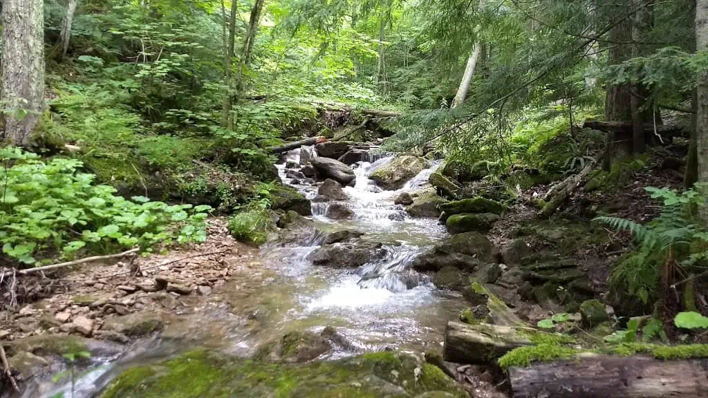
Bus departs 10 York Mills Rd at 8:00 AM and Major Mackenzie Dr and HWY 400 Park and Ride at 8:20 AM. If you wish to be picked up at the Major Mackenzie Dr and HWY 400 Park and Ride, type ‘yes’ in the additional information field. Please arrive 15 minutes before departure. The bus waits for no one.On this hike we will be going east from km 55.7 through the Petun Conservation Area. The Conservation Area was named for the indigenous peoples that inhabited the land during the early 1600’s. As the Bruce Trail winds its way through rock faces, cliffs and crevices, one of the highlights of the trail are lookouts from Osler Bluff. The view is especially beautiful in the fall when the leaves change colors. There are also unique fern and moss communities. We will continue through the Pretty River Valley Provincial Park. Here we will take a short climb of a few hundred metres on the John Haigh Side Trail to the highest point along the Bruce Trail at 540m above sea level. We will stop in Creemore on our way back to Toronto for a chance to walk its heritage trail or to visit bakeries, a craft brewery, art galleries, museums and parks.
** Hikers are required to bring a mask and wear it on the bus. Masks must fit properly and cover the nose, mouth and chin. For the highest level of protection against Covid-19, respiratory viruses or the flu, KN95 or N95 masks are recommended. **
Boyd Conservation park King
https://hikesstaging.brucetrail.org/event/car-hike-cherry-beach-down-town-toronto-3/Sorry, the registration cut-off time for this hike has been reached.Not a member? Click here to join today!Hosting Club: Toronto, Caledon Hills
Location (Google Maps): Free parking lot before the park main gate
Hike Leader(s): Mohammad Aghamiri, Amir Alemohammad Click here to contact Hike Leader(s)
Pace: Moderate
Terrain: Variable
Distance: 14-15 KMDescription
Some safety procedures during the hike:
1-Hikers must stay between the leader and the sweep.
2-Hikers must advise the leader or the sweep if they wish to leave the group.
3- Hikers must follow the whistle instructions: 1 blast- stay where you are; 2 blasts come to the leader; 3 blasts – come to the leader quickly.
4-Hike leader may request volunteers to stop at trail intersections, they need to help hikers to the direction the group walk and wait till they see the sweep .
5-Hikers have to make sure they can see the persons behind and in front of them.
8:30 Woodend to Screaming Tunnel and Fireman's Park Loop
https://hikesstaging.brucetrail.org/event/830-woodend-to-screaming-tunnel-and-firemans-park-loop/Sorry, the registration cut-off time for this hike has been reached.Not a member? Click here to join today!Hosting Club: Niagara
Category: In and Out
Location (Google Maps):Meet at Woodend Conservation Area off Taylor Road (Map 2)
Hike Leader(s): Alan Laver Click here to contact Hike Leader(s)
Pace: Brisk
Terrain: Moderate
Distance: 14kmDescription
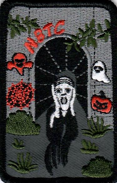
Hike through Woodend along the Main Trail and Side Trails visiting the Screaming Tunnel and on to Fireman’s Park before returning. This hike qualifies for the hike required regarding the screaming tunnel badge
Boyne Valley 25K Challenge
https://hikesstaging.brucetrail.org/event/boyne-valley-25k-challenge-3/Sorry, the registration cut-off time for this hike has been reached.Not a member? Click here to join today!Hosting Club: Dufferin Hi-Land
Category: Special Events
Location (Google Maps): Dufferin Hi-Land Section, Map 20, Km 28.3. The hike starts from the BTC Rock Hill parking lot on 1st Line EHS, Mulmur, 6.0 km north from Hwy 89, east of Hwy10. You will be directed to parking on the west side of the road, just opposite the meeting site. We ask that you do not park on the road.Hike Leader(s): Tom Thayer Click here to contact Hike Leader(s)
Pace: Brisk
Terrain: Dependent on Conditions, Slippery and Steep Sections
Distance: 25 kilometersDescription
This is a loop hike, hiking south beginning and ending at km 28.3. A detailed map will be handed out at the start. There will be one checkpoint along the route where snacks and water will be available. Please bring your own refillable water bottle.There will be hotdogs and snacks at the finish line along with photos taken with your new accomplishment!
Note: Adult Members are considered 12 years old and older. Children under the age of 12 may not register due to the strenuous nature of this challenge.
Check-in will begin at 8:00 am, continuing until 9:00.am. Registrants may leave as soon as 8:20am after they check in and receive any further instructions.
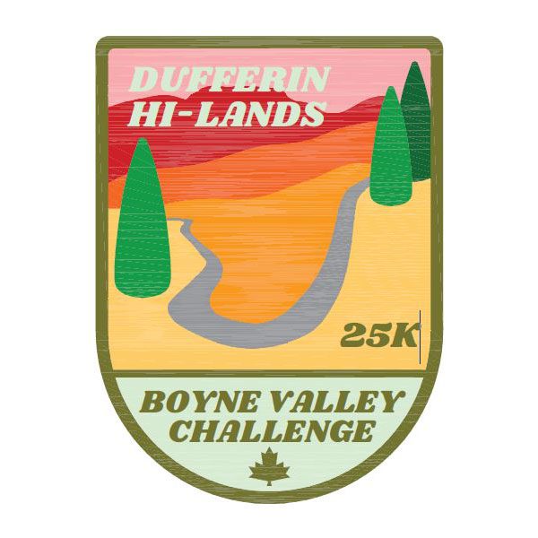
Participants will earn the Boyne Valley 25 K badge.
Please Note: Unfortunately, due to many reasons, dogs are not allowed.
Enjoy the hike!
Looping through Sydenham #8 of 9
https://hikesstaging.brucetrail.org/event/looping-through-sydenham-8-of-9/Sorry, the registration cut-off time for this hike has been reached.Not a member? Click here to join today!Hosting Club: Blue Mountains
Category: Organized Hike
Location (Google Maps):Hike Leader(s): Dick Edwards Click here to contact Hike Leader(s)
Pace: Medium – 3 to 4 km/hr
Terrain: Moderate – Some hills and/or some poor footing
Distance: 10.6kmDescription
Nels Maher Side Trail, Slough of Desmond Side Trail, Presidents Path Side Trail and Chris Walker Side Trail 8 of 9 hikes Start time: 8:30AM Hikers meet at trailhead at 8:30AM
Contact hike leader to confirm start up point.
9:00 Cave Spring Witch Hunt
https://hikesstaging.brucetrail.org/event/900-cave-spring-witch-hunt-9/Sorry, the registration cut-off time for this hike has been reached.Not a member? Click here to join today!Hosting Club: Niagara
Location (Google Maps):
Parking lot Quarry Road Beamsville
Hike Leader(s): Bill Russell Click here to contact Hike Leader(s)
Pace: Leisurely
Terrain: Moderate
Distance: 6kDescription
Discover the history of the 19th Century Quarry Pioneers and the Cave Spring Witch. Complete this hike and count it towards the Screaming Tunnel Badge
Clappison Woods to Smokey Hollow MAP 9
https://hikesstaging.brucetrail.org/event/clappison-woods-to-smokey-hollow-map-9-3/Sorry, the registration cut-off time for this hike has been reached.Not a member? Click here to join today!Hosting Club: Iroquoia
Category: General Hike
Location (Google Maps):Park at Clappison Corners Walmart Parking Lot -east side -also parking lot above near Dollar Tree-we will meet in the grassy area between parking lots
Hike Leader(s): Cathie Green Click here to contact Hike Leader(s)
Pace: Medium – 3 to 4 km/hr
Terrain: Moderate – Some hills and/or some poor footing
Distance: Approximately 12 kmsDescription
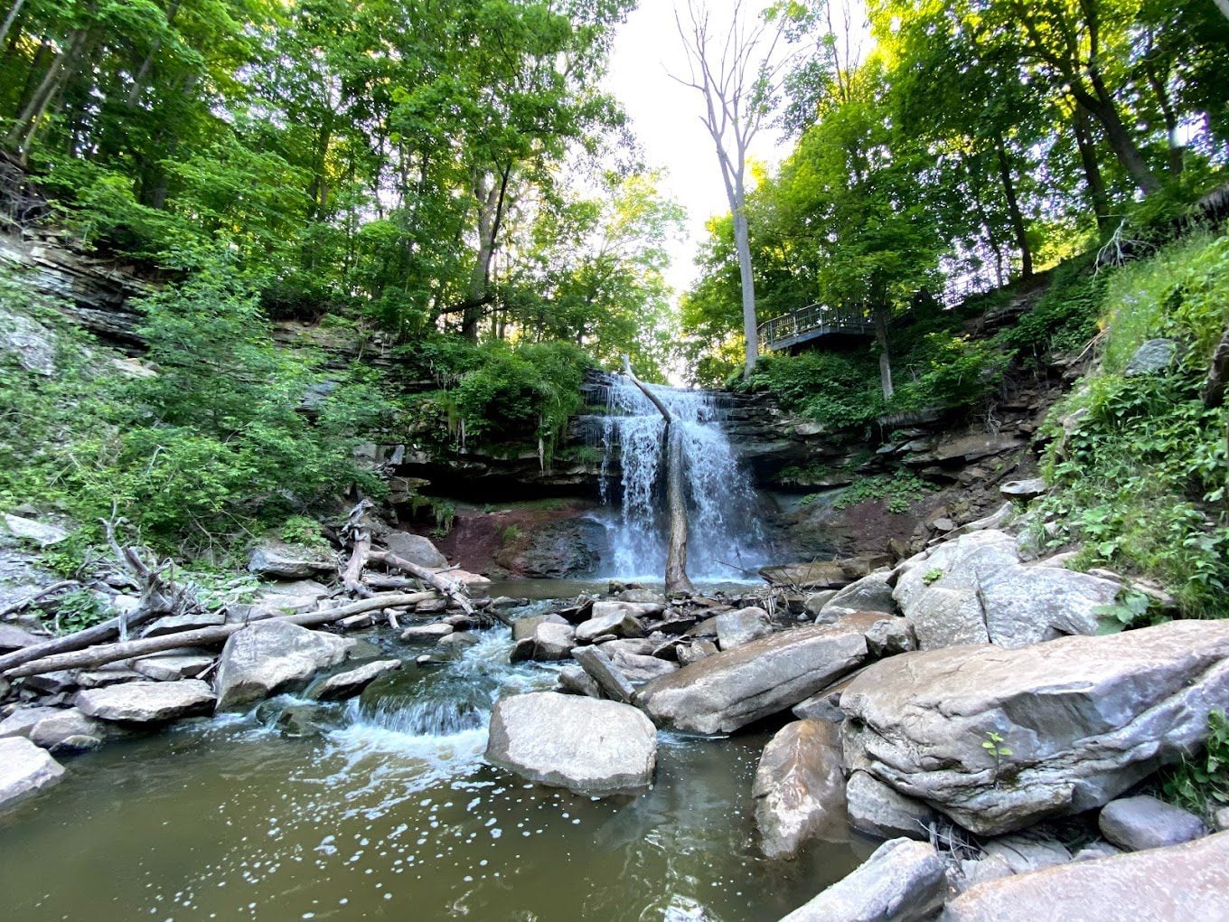
A There and Back-starting out on the old quarry trails behind the shopping centre we will pick up the BT main trail through Clappison Woods – and along Grindstone Creek – to Smokey Hollow FallsSome steep and rocky trail as well as staircase climb to view the Great Falls – Pack water, snack/lunch- wear weather appropriate clothing, hiking poles, boots recommended as well
Car Hike: Mono Cliffs Provincial Park
https://hikesstaging.brucetrail.org/event/car-hike-mono-cliffs-provincial-park/Sorry, the registration cut-off time for this hike has been reached.Not a member? Click here to join today!Hosting Club: Toronto
Category: Car Hike
Location (Google Maps): Mono Cliffs Provincial Park, Map 19Hike Leader(s): Al Brown Click here to contact Hike Leader(s)
Pace: Brisk
Terrain: Variable
Distance: 15 kmDescription
We will complete a loop hike through the Provincial Park including the north outlier (Splitrock and Ralph Tremills side trails). The route is mostly flat with some small hills in the first part and generally easy hiking. There should still be a bit of fall colours to see. Hiking boots are recommended. For those wishing it there is an option for a shorter 8 km hike.After the hike you are invited to join me at the Hockley Resort for refreshments.
To get to the meeting place drive north on Hwy 10 past Orangeville. Continue to Mono Centre Road (crossroad name is Camilla). Turn right and take this road into Mono Centre. Community Centre parking is on your right about 200 meters before you get to the crossroads.
10:00 NBTC FALL Nature Hike
https://hikesstaging.brucetrail.org/event/1000-nbtc-fall-nature-hike/Sorry, the registration cut-off time for this hike has been reached.Not a member? Click here to join today!Hosting Club: Niagara
Category: Loop
Location (Google Maps): Louth Conservation AreaHike Leader(s): Helen Hermansen Click here to contact Hike Leader(s)
Pace: Leisurely
Terrain: Moderate
Distance: ~5kmDescription
NBTC FALL NATURE HIKEJoin us for the last hike of this series of four 2023 NBTC Nature Hikes to learn more about the biodiversity along the Niagara Escarpment. We will explore the trails throughout Louth Conservation area which offer beauty in all four seasons. Hikes will be held January, May, August & October – it will be amazing to see all the changes throughout the seasons. Your hike leaders, members of the NBTC Biodiversity Committee, will share their knowledge of the amazing flora & fauna along the trail as well as any biodiversity projects in the works for this year.
Be sure to register in advance as space is limited & the hike will be rescheduled in the event of heavy rains or heavy snow.
Contact Alicia Aitchison, aliciaaitchison1@gmail.com, with any questions.
West Rocks
https://hikesstaging.brucetrail.org/event/west-rocks-2/Sorry, the registration cut-off time for this hike has been reached.Not a member? Click here to join today!Hosting Club: Sydenham
Category: General Hike
Location (Google Maps): 460 7th Street West, Owen SoundHike Leader(s): Franziska Edney Click here to contact Hike Leader(s)
Pace: Medium: 3 to 4 km/h
Terrain: Moderate: Some hills and/or poor footing
Distance: 4 – 6 kmsDescription
We will hike the blue trail up from 7th St. W. , then take the main trail south to Concession 3. From there we will either take the hydro line back to the main trail, or add some distance in Springmount Forest. There are crevasses and holes in the area. Map 32 If you are unable to register, please call or text leader at 519 379 2573. - 15October 15, 2023

Chasing the Salmon Run and Fall's Palette on Humber River
https://hikesstaging.brucetrail.org/event/chasing-the-salmon-run-and-falls-palette-on-humber-river/Sorry, the registration cut-off time for this hike has been reached.Not a member? Click here to join today!Hosting Club: Niagara
Category: Urban
Location (Google Maps): We will meet each other on James Garden Park at 99 Edenbridge Dr, Etobicoke, ON M9A 3G4Hike Leader(s): Mehrnoush Ahmadi Click here to contact Hike Leader(s)
Pace: Medium
Terrain: Easy
Distance: 17kmDescription
Embark on a scenic journey along the Humber River, where nature’s spectacle unfolds during the annual salmon run. Explore the riverside trails to witness the breathtaking sight of salmon leaping upstream amidst vibrant fall colors. Don’t forget your camera to capture this enchanting chapter of nature’s autumn show in action!
Iroquoia End to End - 6 Hikes
https://hikesstaging.brucetrail.org/event/iroquoia-end-to-end-6-hikes/Sorry, the registration cut-off time for this hike has been reached.Not a member? Click here to join today!This is a Multi-Day Hike
You are signing up for the following dates:
2023-10-15, 2023-10-21, 2023-10-22, 2023-11-18, 2023-11-19, 2023-11-26Hosting Club: Iroquoia
Category: Iroquoia E2E-in-Six
Location (Google Maps): Day 1 – October 15th, 2023-Kilbride School, Panton St, Burlington – Please park in the back 43.427756, -79.937991Hike Leader(s): Anita Bergsma Click here to contact Hike Leader(s)
Pace: Medium – 3 to 4 km/hr
Terrain: Moderate – Some hills and/or some poor footing
Distance: Varies but about 15km per outingDescription
Join us in the Iroquoia End to End this fall starting in October, 2023 for 6 hikes. Each hike will be approximately 15-26 kms at a moderate pace. This is suitable for intermediate to advanced hikers.We will be using hiker’s vehicles to shuttle between our start and end point for each hike. As well, there will be costs at Hilton Falls.
Proper hiking boots is a must! Bring hiking poles, food/snacks, water, hat, and rain gear.
Arrive at 9:30am for roll call/check in/drive to the starting point. Hike will start at 10 am sharp
It is important to complete each section within a time frame to consider the shorter days.
Hikers will receive their End to End badge upon completion.
If you must miss a day but can make it up before the last scheduled hike, you will still qualify for this special Jefferson Salamander badge which was designed by Joe Borges and represents an endangered species sometimes seen in the Iroquoia section. This is a fundraising hike for the Iroquoia Bruce Trail Club. Proceeds go to the mission of protecting this ribbon of wilderness, the Bruce Trail.Please, no dogs. All logistics/scheduling/start/stop and parking (shared cost if there is a fee)and a hike leader to guide you, is included.
__________
Day 1 – October 15th, 2023-Kilbride School, Panton St, Burlington – Please park in the back 43.427756, -79.937991
(20). Car shuttle to Hilton Falls Conservation Area.4985 Campbellville Rd, Milton 43.505705,
-79.961589 (100) 26.68kmDay 2 – October 20th, 2023- City View Park Waterdown (2nd entrance off Kerns Rd. South of Dundas St.)
N43.352308, W79.862585 (50) 22.64kmDay 3 – October 21st, 2023- Davidson Blvd. Dundas N43.265251, W79.990490 (5) 21.94km
Day 4 – November 18th, 2023 – Chedoke Golf Club parking lot, Hamilton N43.246205, W79.906935 (40)15.24km
Day 5 – November 19th,, 2023 – Glover Mountain Rd. Side Trail roadside parking, Stoney Creek N43.209155,
W79.773801 (10) 17.58kmDay 6 – November 26th, 2023 – Grimsby Lions Community Pool 1 Elm St, Grimsby. N43.193201, W79.565301 (30)
21.33kmFall Colours in Toronto Parks & Ravines: Glen Stewart Ravine - Kew Beach
https://hikesstaging.brucetrail.org/event/fall-colours-in-toronto-parks-ravines-glen-stewart-ravine-kew-beach/Sorry, the registration cut-off time for this hike has been reached.Not a member? Click here to join today!Hosting Club: Toronto
Category: Urban Walk
Location (Google Maps): Glen Stewart Park Entrance – Kingston Rd. West of Malvern AvenueHike Leader(s): Sajedeh Zahraei
Pace: Leisurely, Moderate
Terrain: Flat, Variable
Distance: 6-8 KMDescription
This is the third walk in a 4 part series of fall colour walks in Toronto Parks and Ravines. You may sign up for any or all walks in the series. enjoy the beautiful fall colours in Glen Stewart Ravine and walk down to the Beaches Board Walk. We will have a lunch break at Kew Beach then you have the option to walk back to Glen Stewart Ravine where we started or drop-off at Queen Street East. Bring water, snacks, lunch, and wear comfortable foot wear.
Car Hike: Maureen Smith Tribute Hike - Scotsdale Farm
https://hikesstaging.brucetrail.org/event/car-hike-maureen-smith-tribute-hike-scotsdale-farm/Sorry, the registration cut-off time for this hike has been reached.Not a member? Click here to join today!Hosting Club: Toronto
Category: Car Hike
Location (Google Maps):Scotsdale Farm Parking. Take Trafalgar Road north to where it merges with Highway 7. Continue north on Highway Trafalgar/Highway 7 to Halton Regional Road 3 (Signs for Regional Rd 3/Trafalgar Road N/Ballinafad/Brisbane) and turn right. Continue on Trafalgar/Regional Road 3 for 600 metres and driveway for Scotsdale Farm will be on the right. There is a blue and white sign.
Hike Leader(s): Tom Swales, David Royle Click here to contact Hike Leader(s)
Pace: Moderate
Terrain: Variable
Distance: 9 kmDescription
Maureen Smith Tribute HikeJoin Maureen’s family and friends and the Toronto Bruce Trail Club to celebrate her life and years of service to the club on a gentle Level 2 loop hike suitable for beginners. Bring a lunch to enjoy on the trail as well as water (2L is recommended). The hike will follow the Bennett Heritage Trail, Maureen Smith Trail, the main Bruce Trail, and Irwin Quarry Trail. We will return to the Scotsdale Heritage Farm by 2:00 PM. At the beginning of the hike Toronto Bruce Trail Club President David Royle will say a few words about one of our club’s most influential volunteers. Anyone is welcome to join us for the presentation. After the hike there will be the option of post-hike refreshments at the Copper Kettle pub in Glen Williams. Registration for the hike is currently open.

Nature Seekers - Friends of CHBTC
https://hikesstaging.brucetrail.org/event/nature-seekers-friends-of-chbtc-2/Sorry, the registration cut-off time for this hike has been reached.Not a member? Click here to join today!Hosting Club: Caledon Hills
Category: Nature Walks
Location (Google Maps): Meet at the Hockley Road Parking Lot: Located on the north side of Hockley Road at the Hockley Road Side Trail. Google Map Coordinates: 43.972857, -80.056330
Directions: From ON-10, turn east onto Hockley Road/Dufferin County Road 7. Drive for 5 kilometres. The parking lot is on the lefthand side.Hike Leader(s): Sandy Green Click here to contact Hike Leader(s)
Pace: Leisurely – 3 km/hour or less
Terrain: Moderate – some hills and/or some poor footing
Distance: 5.5 kmDescription
Plan to enjoy the fall colours and good company on this leisurely exploration of a section of the Hockley Valley Provincial Nature Reserve. Our route will take us along the Hockley Road Side Trail, sections of the main Trail, and the Tom East Side Trail. Bring your choice of hydration and snacks. Sturdy footwear is highly recommended.Sunday Social Hike - Boyd’s Crevices
https://hikesstaging.brucetrail.org/event/sunday-social-hike-boyds-crevices-2/Sorry, the registration cut-off time for this hike has been reached.Not a member? Click here to join today!Hosting Club: Sydenham
Category: General Hike
Location (Google Maps): 11th Concession – north of Km 86.5 where the road intersects with the Owen Sound Rail Trail. Map 32Hike Leader(s): Ian Mills Click here to contact Hike Leader(s)
Pace: Leisurely: 3 km/h or less
Terrain: Moderate: Some hills and/or poor footing, There might be muddy sections.
Distance: 6+ kmDescription
This will be an in and out hike leading to some giant dolostone blocks separated by spectacular crevices. If you are unable to register please text/call the hike leader 416-848-8818.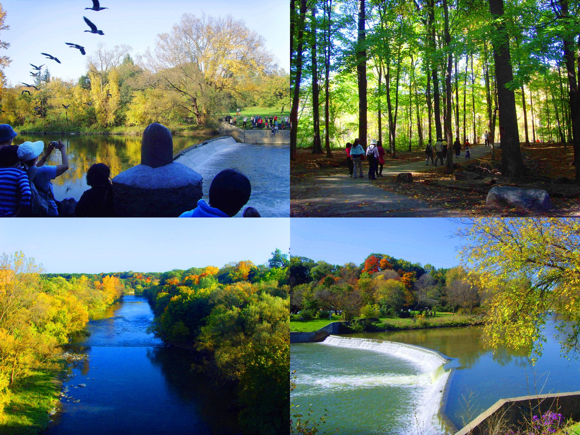
Urban Walk: Etienne Brule Park & Salmon Run
https://hikesstaging.brucetrail.org/event/etienne-brule-park-salmon-run/Sorry, the registration cut-off time for this hike has been reached.Not a member? Click here to join today!Hosting Club: Toronto
Category: Urban Walk
Location (Google Maps): Old Mill Subway StationHike Leader(s): Marlon Chen Click here to contact Hike Leader(s)
Pace: Leisurely
Terrain: Flat
Distance: 9 kmDescription
1. A 9 km leasure walk to visit Etienne Brulé Park, Humber River.2. Enjoy the autumn colors along the HUMBER RIVER
3. The best place to see the salmon run in action is along the banks of the Humber in places like Etienne Brulé Park.
4. Chinook and Coho salmon can be seen fighting the currents and leaping upstream to reach their spawning grounds.
Salmon Run Video: https://youtu.be/JA0Lwga0HQ8