
Hike Schedule
Join us for a hike! Registration required.
All hikes available to BTC members. Some hikes are open to non-members.
See Refund Policy for Paid Hikes >
TIP: The calendar view displays up to 7 hikes on a day, but often there are more. Click “View more events” to see them all.
Categories
- 24June 24, 2025
8:00 Long Hike Wiley Road Short Hills (NEW TIME)
https://hikesstaging.brucetrail.org/event/800-long-hike-wiley-road-short-hills-new-time-8/Sorry, the registration cut-off time for this hike has been reached.Not a member? Click here to join today!Hosting Club: Niagara
Location (Google Maps):
Short Hills Wiley Road Entrance
Pace: Medium
Terrain: Moderate
: 10kmDescription
Explore Short Hills and the majestic side trails of Scarlett Tanager, Hemlock. Swayze Falls and Terrace. Register for each hikeBring Poles, Sun Screen Bug Spray, snack, and dress for the weather
Dufferin Hi-Land 60th Anniversary Highlights, Hike 10:Boyne Valley Side Trail Loop
https://hikesstaging.brucetrail.org/event/dufferin-hi-land-60th-anniversary-highlights-hike-10boyne-valley-side-trail-loop/Sorry, the registration cut-off time for this hike has been reached.Not a member? Click here to join today!Hosting Club: Dufferin Hi-Land
Category: Tuesday Hike
Location (Google Maps):Dufferin Hi-Land Section, Map 20. Meet at parking lot at end of Centre Road, south of 5 Sideroad Mulmur (just north of Km 17.6
) at 9:00 am.Hike Leader(s): Les Babbage, Inge Eckerich, Julie Daley, Tony Evangelista Click here to contact Hike Leader(s)
Pace: Leisurely, Medium
Terrain: Strenuous
Distance: 6.3 km, Short hike: 3 kmDescription
Our celebration of Dufferin Hi-Land BTC’s 60th Anniversary concludes with another highlight of the section, 3 bridges crossing the Boyne River. If you’ve hiked all 10 of the hikes in this series, or otherwise hiked 60 km in Dufferin during 2025, you qualify for the 60th Anniversary badge.Today we will hike a loop consisting of the Main Trail and Boyne Valley Side Trail, with a side trip up to Murphy’s Pinnacle, where, on a clear day, you just might be able to spot the CN Tower. The short option will return to parking from the Boyne River bridges by way of Centre Road road allowance. Bring water and snacks.
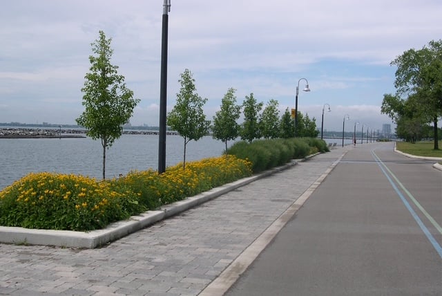
Urban Walk: High Park and Toronto Waterfront Trail
https://hikesstaging.brucetrail.org/event/urban-walk-high-park-and-toronto-waterfront-trail/Sorry, the registration cut-off time for this hike has been reached.Not a member? Click here to join today!Hosting Club: Toronto
Location (Google Maps):
High Park Subway Station Street Level (East Exit – High Park Avenue (by the bus loop)
Hike Leader(s): Miriam Stevens Click here to contact Hike Leader(s)
Pace: Leisurely (2-3 km/hr)
Terrain: Flat, Level 1 (Easy – mostly on flat, well maintained trails with hard-packed surface)
Distance: 10 KMDescription
Join us for a leisurely hike through High Park and then east along Toronto’s Waterfront Trail to Harbourfront Centre passing though many small parks including the Music Garden. Refreshments at a coffee shop on Queens Quay at Harbourfront. Bring lunch and drinking water. Dropout any time. We’ll arrive at Harbourfront Centre around 2:00 PM. This will be repeated Tuesday May 13th, Tuesday May 27th, Tuesday June 3rd, and Tuesday June 24th. No pre registration is required. Just show up 15-20 minutes before to departure time to sign in with the hike leader.