|
Sun | Mon | Tue | Wed | Thu | Fri | Sat |
|---|
1 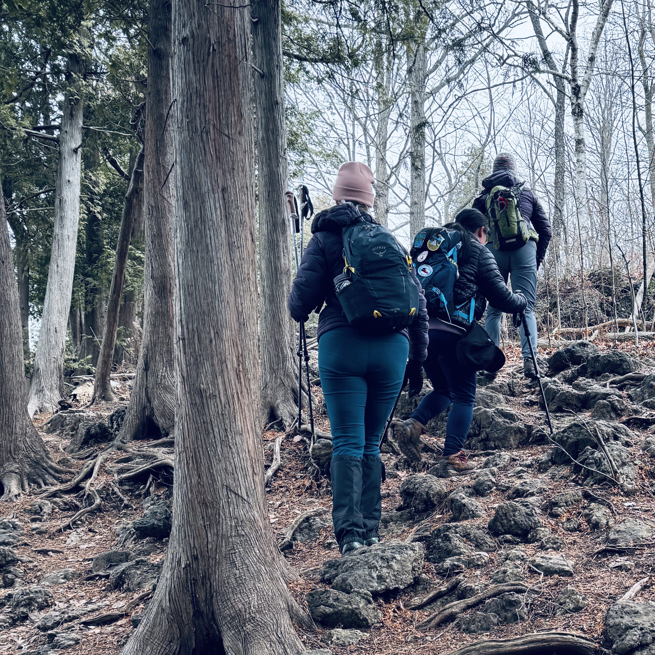 Hilton Falls (reservation required) Hilton Falls (reservation required) 9:30 AM-12:00 PM 06/01/2025 https://hikesstaging.brucetrail.org/event/hilton-falls-reservation-required/2025-06-01/  Click here for more information or to register Hosting Club: Iroquoia
Category: General Hike
Location (Google Maps): Meet in the parking lot at Hilton Falls Conservation Area at 9:15 am. Hike Leader(s): Karen Bergmann Click here to contact Hike Leader(s) Pace: Medium – 3 to 4 km/hr
Terrain: Moderate – Some hills and/or some poor footing
Distance: 8 kms Description
We will hike to the Falls and then around to Bent Rim 1 and back to the cars. Reserve your time at conservationhalton.ca
 Dufferin Hi-Land 60th Anniversary Badge End-to-End Hike #1 Dufferin Hi-Land 60th Anniversary Badge End-to-End Hike #1 9:45 AM-4:00 PM 06/01/2025 https://hikesstaging.brucetrail.org/event/dufferin-hi-land-60th-anniversary-badge-end-to-end/2025-06-01/  Click here for more information or to register Hosting Club: Dufferin Hi-Land
Category: Special Events
Location (Google Maps): Intersection of Prince of Wales Road and 20 Sideroad southeast of Honeywood. Hike Leader(s): Stuart Law Click here to contact Hike Leader(s) Pace: Medium
Terrain: Moderate, Slippery Sections Likely
Distance: 15.4 kms Description
Join us on the first of four hikes to cover the necessary 60 kms of the Dufferin Section in 2025 to earn the coveted Dufferin Hi-Land 60th Anniversary Badge. This is a shuttle hike from Lavender to 20 Sideroad. Please be prepared to use your vehicle to transport hikers and please bring a garbage bag for your dirty boots and clean footwear to change into for the ride back to the start. We will leave those things in the cars at the start so you don’t have to carry them on the hike. Please make sure you are wearing comfortable boots and layers for the weather. Please pack your icers just in case as well as bug spray and sunblock. Please bring two litres of water, a snack, a lunch and a smile. Please arrive at 9:30 to be ready to shuttle at 9:45 sharp.
 Urban Walk: Toronto Urban Badge Hike – 4 of 7 Urban Walk: Toronto Urban Badge Hike – 4 of 7 10:00 AM-1:45 PM 06/01/2025 https://hikesstaging.brucetrail.org/event/urban-walk-toronto-urban-badge-hike-4-of-7/2025-06-01/ 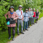 Click here for more information or to register Hosting Club: Toronto
Category: Urban Walk
Location (Google Maps): Finch Hydro Corridor Trail West Hike Leader(s): Brian Rideout Click here to contact Hike Leader(s) Pace: Moderate (3-4 km/hr)
Terrain: Flat
Distance: 11.4 km Description
Please join me at the north west corner of Finch and Weston by 10 AM. We will hike east along the Finch Hydro Corridor Trail to Bathurst St (N of Finch) (km 30.2 to km 41.6). Here is an online map with km markings of our route for all 7 hikes for the Toronto Urban Badge: https://onthegomap.com/s/c2c1hf3n Please make sure you bring at least 2 liters of water, a lunch, bug spray and sunscreen.
| 2 | 3  8:00 Long Hike Wiley Road Short Hills (NEW TIME) 8:00 Long Hike Wiley Road Short Hills (NEW TIME) 8:00 AM-10:30 AM 06/03/2025 https://hikesstaging.brucetrail.org/event/800-long-hike-wiley-road-short-hills-new-time-5/2025-06-03/ Click here for more information or to register Hosting Club: Niagara Location (Google Maps): Short Hills Wiley Road Entrance Hike Leader(s): Alan Laver Pace: Medium
Terrain: Moderate
: 10km Description
Explore Short Hills and the majestic side trails of Scarlett Tanager, Hemlock. Swayze Falls and Terrace. Register for each hike Bring Poles, Sun Screen Bug Spray, snack, and dress for the weather
 Dufferin Hi-Land 60th Anniversary Highlight Hikes, Hike 7: Laidlaw, Walter Tovell and Spillway Side Trails Dufferin Hi-Land 60th Anniversary Highlight Hikes, Hike 7: Laidlaw, Walter Tovell and Spillway Side Trails 9:00 AM-12:00 PM 06/03/2025 https://hikesstaging.brucetrail.org/event/dufferin-hi-land-60th-anniversary-highlight-hikes-hike-7-laidlaw-walter-tovell-and-spillway-side-trails/2025-06-03/ Click here for more information or to register Hosting Club: Dufferin Hi-Land
Category: Tuesday Hike
Location (Google Maps): Dufferin Hi-Land Section, Map 19. Meet at Mono Community Centre hiker parking lot at the south end of Mono Centre. Hike Leader(s): Inge Eckerich, Julie Daley, Tony Evangelista Les Babbage Click here to contact Hike Leader(s) Pace: Leisurely
Terrain: Easy
Distance: 6 km Description
Join us in celebrating the 60th anniversary of the Dufferin Hi-Land Bruce Trail Club. The Club plans to award a 60th Anniversary badge to any hiker who completes 60 km of Dufferin Hi-Land trails – Main or Side Trails. Our Tuesday Hike group is offering a series of 10 hikes, covering most of the highlights of our section that meet this requirement. If you can’t make all of the hikes, make ups are allowed. Just hike 60K in Dufferin during 2025 and you qualify for the badge Today’s hike will be a loop including the Laidlaw, Spillway and Walter Tovell trails. Bring water and snacks.
 Peninsula Wildflower Hike Series Peninsula Wildflower Hike Series 10:00 AM-6:00 PM 06/03/2025 https://hikesstaging.brucetrail.org/event/peninsula-wildflower-hike-series/2025-06-03/ 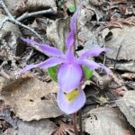 This is a Multi-Day HikeYou are signing up for the following dates:
2025-06-03, 2025-06-04, 2025-06-05 Click here for more information or to register Hosting Club: Dufferin Hi-Land
Category: Special Events
Location (Google Maps): Northeast corner of Highway 6 and Dyer’s Bay Road, south of Tobermory. Hike Leader(s): Stuart Law; Anne Armstrong; Jeannine Kralt. Click here to contact Hike Leader(s) Pace: Leisurely
Terrain: Dependent on Conditions, Easy
Distance: 3-6 kms a day Description
Join us on a three-day odyssey to find the floral treasures of the Peninsula on Flowerpot Island, the Crane River, Singing Sands, the Oliphant Fens, Petrel Point and the Bruce Alvar. A chance to work on your Peninsula Orchid badges if you are a badge person. These hikes led by longtime BTC wildflower enthusiasts Anne Armstrong and Jeannine Kralt, are a co-operative effort brought to you by the Peninsula, Iroquoia and Dufferin Hi-Lands BTC Clubs. We look forward to enjoying the camaraderie and fellowship of staying at the same accommodation and sharing a few laughs at dinners. Please bring your own breakfasts and lunches. Discount accommodation/boat package information will be made available on registration. The accommodation/boat package discount pricing will be available until May 3, 2024. Hikers to pay for the accommodation/boat package and National Park pass themselves direct.
- Urban Walk: High Park and Toronto Waterfront Trail
11:00 AM-2:00 PM 06/03/2025 https://hikesstaging.brucetrail.org/event/urban-walk-high-park-and-toronto-waterfront-trail-2/2025-06-03/ 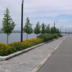 Click here for more information or to register Hosting Club: Toronto Location (Google Maps): High Park Subway Station Street Level (East Exit – High Park Avenue (by the bus loop) Hike Leader(s): Miriam Stevens Click here to contact Hike Leader(s) Pace: Leisurely (2-3 km/hr)
Terrain: Flat, Level 1 (Easy – mostly on flat, well maintained trails with hard-packed surface)
Distance: 10 KM Description
Join us for a leisurely hike through High Park and then east along Toronto’s Waterfront Trail to Harbourfront Centre passing though many small parks including the Music Garden. Refreshments at a coffee shop on Queens Quay at Harbourfront. Bring lunch and drinking water. Dropout any time. We’ll arrive at Harbourfront Centre around 2:00 PM. This will be repeated Tuesday May 13th, Tuesday May 27th, Tuesday June 3rd, and Tuesday June 24th. No pre registration is required. Just show up 15-20 minutes before to departure time to sign in with the hike leader.
| 4 - Bent Rim 2 Loop
9:30 AM-12:30 PM 06/04/2025 https://hikesstaging.brucetrail.org/event/bent-rim-2-loop/2025-06-04/ 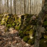 Click here for more information or to register Hosting Club: Iroquoia
Category: General Hike
Location (Google Maps): Meet in the small parking lot on 6th Line. Hike Leader(s): Karen Bergmann Click here to contact Hike Leader(s) Pace: Medium – 3 to 4 km/hr
Terrain: Moderate – Some hills and/or some poor footing
Distance: 9 kms Description
We will hike the Bent Rim 2 bike trail and back through the Halton Forest. Meet at 9:15 (earlier if possible) in the small parking lot on 6th Line, about 3 kms north of Campbellville Rd. Bring bug spray, in case the bugs have awakened.
- WEDNESDAY WALKERS – Margaret Paull ST Loop
9:30 AM-11:00 AM 06/04/2025 https://hikesstaging.brucetrail.org/event/wednesday-walkers-margaret-paull-st-loop-3/2025-06-04/ Click here for more information or to register Hosting Club: Beaver Valley Location (Google Maps): Park on the 6th Line, access from Hwy 119, Km 13.7 Map 24, Edition 31 Hike Leader(s): Margaret Yaraskavitch Click here to contact the hike leader. Pace: Medium
Terrain: Moderate
Length of Hike: 3.9 km Description
An enjoyable walk with lots of opportunities for stops and photos. We’ll walk by a creek, view a flowerpot and a waterfall, and see the E.C. Carr Observatory buildings along our route. Country laneways with farm views, as well. Please bring water and a snack.
- Evening Hike in Owen Sound followed by an Opportunity for Refreshments
7:00 PM-8:45 PM 06/04/2025 https://hikesstaging.brucetrail.org/event/evening-hike-in-owen-sound-followed-by-an-opportunity-for-refreshments-16/2025-06-04/ Click here for more information or to register Hosting Club: Sydenham
Category: An evening walk.
Location (Google Maps): Meet in the municipal parking lot by the river on the west side of 1st Ave E between 7th St E and 8th St E in Owen Sound Hike Leader(s): Harriet Nixon Click here to contact Hike Leader(s) Pace: Brisk: 4 to 5 km/h
Terrain: Moderate: Some hills and/or poor footing
Distance: Approx 6 km Description
Join us for a brisk evening hike exploring Owen Sound trails and neighbourhoods, followed by an opportunity to socialize over refreshments. There is no need to show up 15 minutes early for this hike, but we will leave promptly at 7:00 pm
| 5  8:00 am Long Hike Glen Road Jordan NEW TIME 8:00 am Long Hike Glen Road Jordan NEW TIME 8:00 AM-10:30 AM 06/05/2025 https://hikesstaging.brucetrail.org/event/800-am-long-hike-glen-road-jordan-new-time-6/2025-06-05/ Click here for more information or to register Hosting Club: Niagara Location (Google Maps): Glen Road Jordan Hike Leader(s): Alan Laver Pace: Medium
Terrain: Moderate
: 10k Description
This will be our permanent Thursday Location until Bridge repairs complete. From Glen Road explore the trail network on the escarpment towards Balls Falls and Moyer Road. You must register for each hike. Bring Poles, snack bug spray, sunscreen and a drink. Dress for the weather
- Urban Walk: Toronto Islands Evening Walk
6:00 PM-9:00 PM 06/05/2025 https://hikesstaging.brucetrail.org/event/urban-walk-toronto-islands-evening-walk-15/2025-06-05/ 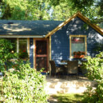 Click here for more information or to register Hosting Club: Toronto Location (Google Maps): Jack Layton Ferry Terminal, near the gates to Wards Island Ferry. Arrive 20 minutes prior to departure to check in with hike leader. From Union Station take the LRT and get off at the stop Ferry Docks.Walk up to the Ferry Docks on Queens Quay West, street level. at the foot of Bay Street. Hike Leader(s): Miriam Stevens Click here to contact Hike Leader(s) Pace: Leisurely (2-3 km/hr)
Terrain: Flat
Distance: 6-9 km Description
After a day’s work come and “cool off” on the Toronto Islands free of fumes and traffic. Enjoy the view of the city skyline and Toronto’s beautiful island parkland.
Pack a dinner for a sit down picnic. Also bring a warm jacket and flashlight.
Return fare ticket for the ferry is $9.11 for adults, $5.86 for seniors
Hikes will take place rain or shine.
Toronto Island evening hikes will take place every Thursday in May and June 2025.
Same time and same meeting place. No preregistration is required – just show up at the ferry docks at 5:40 PM and sign in with the hike leader.
| 6  Car Hike: 22th Annual Excellent Orchid Adventure Weekend (2 overnights) Car Hike: 22th Annual Excellent Orchid Adventure Weekend (2 overnights) 12:00 AM 06/06/2025 https://hikesstaging.brucetrail.org/event/car-hike-22th-annual-excellent-orchid-adventure-weekend-2-overnights/2025-06-06/ 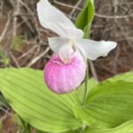 This is a Multi-Day HikeYou are signing up for the following dates and times:
2025-06-06 at
2025-06-07 at
2025-06-08 at Click here for more information or to register Hosting Club: Toronto
Category: Car Hike
Location (Google Maps): Princess Hotel
34 Bay St, Tobermory, ON N0H 2R0 Hike Leader(s): Jeanette Vincent. Brenda Menezes. David Royle. Click here to contact Hike Leader(s) Pace: Leisurely (2-3 km/hr)
Terrain: Level 2 (Intermediate – some hills and uneven surfaces, rocks and roots underfoot), Rocky, Variable
Distance: 10 – 12 Km Description
We continue Greg Vincent’s legacy of weekends away. Please join Jeanette Vincent, Brenda and David Royle as we explore the Tip o’ the Bruce, Tobermory in search of orchids and other flowers. Our search will extend to Flowerpot Island (cost approx. $60.00 for the glass bottom ferry and Parks Canada fee). The wildflowers in the Tobermory area at this time of year are wonderful and our slow paced walks will focus on these and other flowers and the area’s great views. We stay and have our meals at a comfortable hotel overlooking Little Tub Harbour. Approximately 10/12km/day. Before registering at the hotel please contact us for the price package of the hotel for the weekend. This outing is restricted to those staying with us at the Princess Hotel in Tobermory for the weekend – the hotel fills quickly. You will need a car to access this outing. Please contact the Princess Hotel for a reservation.1-519-592-8282 or info@tobermoryprincesshotel.com and mention Vincent/Royle Excellent Orchid weekend.
- Toronto BTC End to End Stained Glass Fundraiser
8:30 AM 06/06/2025 https://hikesstaging.brucetrail.org/event/toronto-btc-end-to-end-stained-glass-fundraiser/2025-06-06/ This is a Multi-Day HikeYou are signing up for the following dates:
2025-06-06, 2025-06-07, 2025-06-08 Click here for more information or to register Hosting Club: Toronto, Beaver Valley Location (Google Maps): Meet on the east side of the road where the trail crosses 4th Line. Do not park in front of the junk yard. km 17.4, Map 12 Bruce Trail Guide,, N 43.625638, W 79.990703 Hike Leader(s): Glenda Collings Click here to contact the hike leader. Pace: Medium
Terrain: Moderate, Some rocky footing, Some steep sections
Length of Hike: Between approx. 17 & 18 km Description
Join us for a a 3 day hike to earn the Stained Glass fundraiser badge. The medium hike pace will range between 3 to 4 km per hour, sometimes a bit more than 4 km per hour on easy flat terrain, with a snack and lunch break. Hikers may request a personal bio break, clothing adjustment, drink stop, etc. at any time during the hike by notifying the leader or sweep. The hikes range from approx. 17 to 18 km. Please self evaluate your ability to manage the pace and length of these hikes. Life does happen, so hikers will be able to miss one hike and make it up on their own before the end of June. A full hike schedule, with meet locations, will be sent to hikers after registration. If you have any questions please use the “Contact hike leader” option on the online schedule.
| 7 -
 School Bus Hike: Loree Forest and Swiss Meadows School Bus Hike: Loree Forest and Swiss Meadows 8:00 AM-7:00 PM 06/07/2025 https://hikesstaging.brucetrail.org/event/school-bus-hike-loree-forest-and-swiss-meadows/2025-06-07/ Trip Information
Departure Time: 08:00
Return to City Time: 19:00
Departure Point: York Mills Bus Pickup Click here for more information or to register Optional Items
Hosting Club: Toronto
Category: Bus Hike
Location (Google Maps): Loree Forest and Swiss Meadows Hike Leader(s): Martina Furrer, Roland Mark Click here to contact Hike Leader(s) Pace: Moderate (3-4 km/hr)
Terrain: Hilly, Variable Description
Join us for a great hike in the Beaver Valley section. We will hike 15 km at a 4 km/hr pace, stopping to enjoy the awesome views of Georgian Bay from various spots along the top of the escarpment. A few fun hills, hopefully some spring wildflowers, and forest cover for shade. Refreshment stop in the Village at Blue Mountain. This area has lots of poison ivy so wear long pants for protection. Also pack a lunch and two litres of water.
- School Bus Hike: Niagara E2E #6 of 6
8:30 AM-6:00 PM 06/07/2025 https://hikesstaging.brucetrail.org/event/bus-hike-niagara-e2e-6-of-6/2025-06-07/  Trip Information
Departure Time: 08:30
Return to City Time: 18:00
Departure Point: Kipling Departure Point Click here for more information or to register Optional Items
Hosting Club: Toronto
Category: Bus Hike
Location (Google Maps): Niagara Section Kms 72.3 to 81.7, plus Beamers Falls Side Trail Hike Leader(s): Felix Wan, Tim Wainwright Click here to contact Hike Leader(s) Pace: Moderate (3-4 km/hr)
Terrain: Variable
Distance: 13.0 km Description
Join us for our final walk in the Niagara E2E bus hike series. On today’s hike we’ll start at the Mountainview Conservation Area, and cross over Thirty Mile Creek and a small waterfall on our way to Beamer Memorial Conservation Area outside of Grimsby. This marks the end of the Niagara Section of the Bruce Trail, but those who wish to can continue on a loop trail around the conservation area with a side trip to Beamers Falls. There will be a refreshment stop on the way back to Toronto. Dropout point at 9.4 km. Bring a packed lunch, two litres of water, and sun/rain/bug protection as needed. Map 5 in the Bruce Trail Guide
- LETS LOOK FOR BOBOLINKS
8:45 AM-11:30 AM 06/07/2025 https://hikesstaging.brucetrail.org/event/lets-look-for-bobolinks-2/2025-06-07/ Click here for more information or to register Hosting Club: Blue Mountains
Category: Organized Hike
Location (Google Maps): Tim Hortons on First St. in Collingwood Hike Leader(s): Richard Edwards Click here to contact Hike Leader(s) Pace: Leisurely – 3 km/hr. or less
Terrain: Moderate – Some hills and/or some poor footing
Distance: 6 km Description
Please join us for this birding hike, led by birding enthusiasts Dick Edwards and Kate Jaczko. We will carpool to Cty Rd 9 west of Dunedin (map 22, km 10.6) and follow the trail north past a beautiful meadow where bobolinks nest in early June . We will look for singing males defending their territories. Past the meadow, the trail skirts a farm field and descends through forest to the Dunedin Nature Reserve. Here a mix of hardwoods, cedars, and a sparkling stream should provide more birds and spring wildflowers. The trail loops back to con. 10 where we back-track to bobolink meadow and then to our cars having completed 6 km double loop.
Spaces will be limited to 30 hikers, so please register in advance.
- Urban Walk: Toronto Urban Badge Hike – 6 of 7
10:00 AM-1:15 PM 06/07/2025 https://hikesstaging.brucetrail.org/event/urban-walk-toronto-urban-badge-hike-6-of-7/2025-06-07/  Click here for more information or to register Hosting Club: Toronto
Category: Urban Walk
Location (Google Maps): East Don River Trail Hike Leader(s): Brian Rideout Click here to contact Hike Leader(s) Pace: Moderate (3-4 km/hr)
Terrain: Flat
Distance: 9 km Description
Please join me at the south east corner of Sheppard Ave East and Leslie by 10 AM. We will hike south through several parks to Don Mills (S of Overlea) (km 51.7 to km 62.4). Here is an online map with km markings of our route for all 7 hikes for the Toronto Urban Badge: https://onthegomap.com/s/c2c1hf3n Please make sure you bring at least 2 liters of water, a lunch, bug spray and sunscreen.
 Mayor’s Walk – Grimsby 9:45am Mayor’s Walk – Grimsby 9:45am 10:00 AM-11:45 AM 06/07/2025 https://hikesstaging.brucetrail.org/event/mayors-walk/2025-06-07/  Click here for more information or to register Hosting Club: Iroquoia
Category: Mayor’s Walk
Location (Google Maps): Please arrive by 9:45 for check-in, Lion’s Club Pool parking lot 1 Elm Street, Grimsby Hike Leader(s): Ruth Moffatt Click here to contact Hike Leader(s) Pace: Medium – 3 to 4 km/hr
Terrain: Dependent on Conditions, Strenuous – Hilly with steep climbs and some poor footing
Distance: 4-5km Description
In cooperation with Ontario Trails Council, we are pleased to participate in the Mayor’s Walk. Please join Grimsby Mayor, Jeff Jordan for the Mayor’s Walk. This hike will take us from the parking lot, up Gibson Street and up the Iroquoia Bruce Trail and around to the hawk watch area and back to the pool parking lot. Please expect the distance to be about 4-5km and to take up to 2 hours. The hike up the hill is strenuous and would not be suitable for individuals who are not used to climbing. Please bring enough water and snacks and wear suitable hiking footwear.
- Pride on the Trail: A Rainbow Hike for All
11:00 AM 06/07/2025 https://hikesstaging.brucetrail.org/event/pride-on-the-trail-a-rainbow-hike-for-all/2025-06-07/ Click here for more information or to register Hosting Club: Peninsula
Category: Rainbow Hike
Location (Google Maps): Halfway Log Dump Parking Lot, Bruce Peninsula National Park Hike Leader(s): Marg Glendon & Tainin Hopkinson Click here to contact Hike Leader(s) Pace: Leisurely (2.0 – 3.0 km/h): A relaxed pace with frequent breaks and a focus on enjoyment., Medium (3.0 – 4.5 km/h): A comfortable pace for most hikers with steady progress.
Terrain: Difficult: Steep ascents/descents, rocky scrambling, and some rugged escarpment paths., Easy: Flat forested sections or lowland trails., Moderate: Rolling hills, mild slopes and rocky paths.
Distance: 2 km or 6 km Description
Join us for a family-friendly Rainbow Hike for 2SLGBTQ+ folx and allies at Halfway Log Dump. A Bruce Peninsula National Park Interpreter will accompany us on our hike, sharing information about the unique ecosytem here and providing examples of Queer Ecology in Nature. Meet at the Halfway Log Dump parking lot at the entrance to Halfway Log Dump Side Trail .Here, the Bruce Trail winds through the beautiful Bruce Peninsula National Park. Our first 1 km of hiking will be on generally flat terrain bringing us to the pristine, aquamarine water of the Georgian Bay shoreline. Here we will take time to enjoy the view and soak in the sensational signs of Spring, have lunch and explore the shore. Then, for those wishing to hike the more rugged section of the trail, we will continue north covering some demanding terrain. Good balance and stamina is required for walking this section of the trail. This out and back hike portion of the afternoon will be about 1 ½ hour in duration. Upon returning to the rest of the group at the shoreline, we will take a few minutes to share our experiences with one another. If you would prefer to continue gently exploring the shoreline rather than the longer hike, a PBTC Hike Leader will stay with this group and remain here until the other hiking group returns. If participants would like to linger longer, the rest of the group will say goodbye and return to our vehicles via Halfway Log Dump Sidetrail. In total, our hiking afternoon will take about 3 ½ hour. Outdoor compost toilets are available at the parking lot and at the shoreline. Bruce Peninsula National Park fees for admission and parking apply. No parking reservation is required at this time of year. Weather can be unpredictable at this time of year. Wear layers, hat, sturdy footwear with good tread and closed toes. Bring a back pack for snacks and lunch, water bottle, blanket for sitting, hiking poles and binoculars (optional). Interested in extending your day? Join us at the Bruce Peninsula National Park Visitor’s Centre for an informative presentation about the beauty and diversity of bird species on the Saugeen Peninsula, and current research about resident and migrating bird species living here. No registration required. Free!
- Youth Hiking Program – Discovery Hike – Cottonwood Loop
1:30 PM-4:00 PM 06/07/2025 https://hikesstaging.brucetrail.org/event/youth-hiking-program-discovery-hike-cottonwood-loop-3/2025-06-07/  Click here for more information or to register Hosting Club: Sydenham
Category: Family Hike
Location (Google Maps): Roadside parking on the east side of 11 Line, approximately 3 km north of Highway 26, at the entrance to the Cottonwood Side Trail, Map 30, Edition 31 Carpooling may be available upon request. Hike Leader(s): Jeannine Kralt Click here to contact Hike Leader(s) Pace: Leisurely: 3 km/h or less
Terrain: Easy: Mostly flat and good footing.
Distance: 2.1km Description
This hike will be a discovery hike along the Cottonwood Loop – we’ll take our time, and see what we can find. This trail is a stand-alone trail, separate from the rest of the Bruce Trail. We’ll hike through forests, near a hidden waterfall, past a particularly large cottonwood tree, and to a lookout along a ridge. This property is the original location of the Rows homestead – their farmhouse can be seen at Moreston Village at Grey Roots. The Cottonwood Loop counts towards the Junior Hiker badge and is also featured in Ron Savage’s new book, Exploring Sydenham. There will be sufficient time to find the related code en route. It’s also a great trail to use for the By the Seasons badge. As we’ll be taking our time, this hike is suitable for families, new hikers, and anyone wanting a more leisurely hike – all ages are welcome. We’ll likely take upwards of a couple of hours, depending on the group – dress in layers, bring a snack, and wear good footwear. An email re: trail conditions to expect will be sent out prior to our hike together. We’re hoping for a lovely late spring hike! If you are unable to register, or if you have any questions/concerns, please contact the hike leader (Jeannine) via the link above. Parking is roadside. Carpooling may be available upon request.
|
8  Camino Hike Camino Hike 9:00 AM-11:30 AM 06/08/2025 https://hikesstaging.brucetrail.org/event/camino-hike-2/2025-06-08/  Click here for more information or to register Hosting Club: Iroquoia
Category: Camino Hikes
Location (Google Maps): City View Park – Please enter via Dundas St onto Kerns Rd, second left to the parking area. Hike Leader(s): Ruth Moffatt Click here to contact Hike Leader(s) Pace: Medium – 3 to 4 km/hr
Terrain: Moderate – Some hills and/or some poor footing, Strenuous – Hilly with steep climbs and some poor footing, Dependent on Conditions
Distance: 8ish Description
Please join us for a Camino Hike. If you are curious about hiking a camino or would like to share information about hiking a camino, please join us for this hike. Everyone is welcome. Please bring enough water and snacks. We will hike about 8km return. Check for the weather and dress appropriately – wide brimmed hat and sunscreen is recommended as well as sturdy hiking shoes/boots and poles, if you use them.
- Yoga + Hike Fundraiser
9:30 AM-1:00 AM 06/08/2025 https://hikesstaging.brucetrail.org/event/yoga-hike-fundraiser/2025-06-08/  Click here for more information or to register Hosting Club: Caledon Hills
Category: General
Location (Google Maps): Meet at the BTC parking lot, 713377 1st Line EHS, Mono. It is easier to go north on 1st Line from Side Road 5 than it is to go south on 1st Line from Hockley Road. 1st Line is not maintained between the parking lot and Hockley Road. It is best to aim for arriving around 9:15 am, so we can start our yoga session as close to 9:30 as possible. Thanks! Hike Leader(s): Elizabeth Ganong and Sandy Green Click here to contact Hike Leader(s) Pace: Medium – 3 to 4 km/hour
Terrain: Moderate – some hills and/or some poor footing
Distance: Approximately 6.5 km Description
Join us for the CHBTC’s first Yoga + Hike Fundraiser happening at Riverside Woods. Led by Elaine Vallevand, we start with an outdoor yoga session at 9:30 am. Bring your mat! Light refreshments will be provided following our yoga session. During this break, you will have time to put your mat in your vehicle and get ready to hike. By 11 am, we should be on the trails. The approximately 6.5 km hike will allow us to continue our time together in nature. Plan to be finished before 1 pm. 100% of the proceeds will support maintaining and preserving the Bruce Trail. Our kind and giving yoga instructor is donating her time, the refreshments are donated by our generous members, and of course, our hike leaders are donating their time. Thank you for your generosity in making this inaugural CHBTC event a success! Registration opens on May 10th at 8 am! While there are no refunds for this event, you may name a person who will take your spot. Please message the hike leaders to name the person attending in your place. Thanks! Things to consider bringing: a water bottle, a mat, a blanket (if you want a larger area on the grass covered), insect repellent, sunscreen, a hat, hiking shoes/boots, poles, a snack/lunch
- Speyside to Halton Forest (E2E)
9:30 AM-12:00 PM 06/08/2025 https://hikesstaging.brucetrail.org/event/speyside-to-halton-forest-e2e/2025-06-08/  Click here for more information or to register Hosting Club: Iroquoia
Category: General Hike
Location (Google Maps): Meet at the Pear Tree parking lot at Speyside on 15 Side Road at 9:15 am. Hike Leader(s): Karen Bergmann Click here to contact Hike Leader(s) Pace: Medium – 3 to 4 km/hr
Terrain: Moderate – Some hills and/or some poor footing
Distance: 8 kms Description
This is an end to end hike. We will carpool from the parking lot on 15 Side Road to 6th Line at the Halton Agreement Forest and hike back along the Hilton Falls Side Trail, Al Shaw Side Trail and the main trail. This trail has some serious rocks and we cross a couple of creeks. Bring bug spray, just in case.
- Dufferin Hi-Land 60th Anniversary Badge End-to-End Hike #2
9:45 AM-4:00 PM 06/08/2025 https://hikesstaging.brucetrail.org/event/dufferin-hi-land-60th-anniversary-badge-end-to-end-hike-2/2025-06-08/  Click here for more information or to register Hosting Club: Dufferin Hi-Land
Category: Special Events
Location (Google Maps): Roadside parking on west side of 2nd Line E. just south 2nd Line ECL Side Trail. BTC Map 20 about .5 km south of km 25.7. Hike Leader(s): Stuart Law Click here to contact Hike Leader(s) Pace: Medium
Terrain: Slippery and Steep Sections, Strenuous
Distance: 15.6 kms Description
Join us on the second of four hikes to cover the necessary 60 kms of the Dufferin Section in 2025 to earn the coveted Dufferin Hi-Land 60th Anniversary Badge. This is a shuttle hike from 20 Sideroad to 2nd Line just south of the Oliver Creek Side Trail. We will climb the famous Kilgorie Hill – one of the most challenging climbs on the entire Bruce Trail. Please be prepared to use your vehicle to transport hikers and please bring a garbage bag for your dirty boots and clean footwear to change into for the ride back to the start. We will leave those things in the cars at the start so you don’t have to carry them on the hike. Please make sure you are wearing comfortable boots and layers for the weather. Please pack your icers just in case as well as bug spray and sunblock. Please bring two litres of water, a snack, a lunch and a smile. Please arrive at 9:30 to be ready to shuttle at 9:45 sharp.
- Urban Walk: Toronto Urban Badge Hike – 5 of 7
10:00 AM-1:00 PM 06/08/2025 https://hikesstaging.brucetrail.org/event/urban-walk-toronto-urban-badge-hike-5-of-7-2/2025-06-08/  Click here for more information or to register Hosting Club: Toronto
Category: Urban Walk
Location (Google Maps): Finch Hydro Corridor West/East Hike Leader(s): Brian Rideout Click here to contact Hike Leader(s) Pace: Moderate (3-4 km/hr)
Terrain: Flat
Distance: 9.6 km Description
Please join me at the north east corner of Bathurst and Finch by 10 AM. We will hike east on the Finch Hydro Corridor Trail and south along East Don Parklands to Sheppard and Leslie (km 41.6 to km 51.2). Here is an online map with km markings of our route for all 7 hikes for the Toronto Urban Badge: https://onthegomap.com/s/c2c1hf3n Please make sure you bring at least 2 liters of water, a lunch, bug spray and sunscreen.
| 9 | 10 - 8:00 Long Hike Wiley Road Short Hills (NEW TIME)
8:00 AM-10:30 AM 06/10/2025 https://hikesstaging.brucetrail.org/event/800-long-hike-wiley-road-short-hills-new-time-6/2025-06-10/ Click here for more information or to register Hosting Club: Niagara Location (Google Maps): Short Hills Wiley Road Entrance Hike Leader(s): Alan Laver Pace: Medium
Terrain: Moderate
: 10km Description
Explore Short Hills and the majestic side trails of Scarlett Tanager, Hemlock. Swayze Falls and Terrace. Register for each hike Bring Poles, Sun Screen Bug Spray, snack, and dress for the weather
- Dufferin Hi-Land 60th Anniversary Highlight Hikes, Hike #8: Honeywood Ridge
9:00 AM-11:30 AM 06/10/2025 https://hikesstaging.brucetrail.org/event/dufferin-hi-land-60th-anniversary-highlight-hikes-hike-8-honeywood-ridge/2025-06-10/ Click here for more information or to register Hosting Club: Dufferin Hi-Land
Category: Tuesday Hike
Location (Google Maps): Dufferin Hi-Land, Map 21. Meet at roadside parking on the northeast corner 20 Sideroad and Prince of Wales Rd. (km 40.7, Edition 31). Please note, this is a shuttle hike. Hike Leader(s): Julie Daley, Les Babbage, Inge Eckerich, Tony Evangelista Click here to contact Hike Leader(s) Pace: Leisurely
Terrain: Moderate, Slippery and Steep Sections
Distance: 5 km Description
After meeting on the 20 Sideroad, we will shuttle to our starting point on Centre Rd (km 46.7). We will hike west along the main trail, crossing Prince of Wales to Honeywood Ridge, have a snack on the edge of the forest, and continue south to our cars. Poles are suggested.
 Afternoon hike – Limehouse Conservation Area Afternoon hike – Limehouse Conservation Area 4:30 PM-6:00 PM 06/10/2025 https://hikesstaging.brucetrail.org/event/afternoon-hike-limehouse-conservation-area/2025-06-10/ 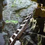 Click here for more information or to register Hosting Club: Iroquoia
Category: Afternoon/Evening Hikes
Location (Google Maps): Meet at 4:15 pm in the parking lot at Limehouse Conservation Area. Hike Leader(s): Karen Bergmann Click here to contact Hike Leader(s) Pace: Medium – 3 to 4 km/hr
Terrain: Moderate – Some hills and/or some poor footing
Distance: 7 kms Description
The trees will be leafing out so we will be surrounded by green. We will hike around the park and then briefly out along the main trail to the Todd Bardes Meadowland Side Trail and back. Bring bug spray in case they have awakened.
| 11 - Bluebirds, Meadowlarks and More
9:00 AM-12:00 PM 06/11/2025 https://hikesstaging.brucetrail.org/event/bluebirds-meadowlarks-and-more/2025-06-11/ Click here for more information or to register Hosting Club: Caledon Hills
Category: Nature Walks
Location (Google Maps): Meet at parking lot on Mono 5 Sideroad at km 45.4 where the trail crosses. Take Airport Road north on Mono Mills to 5 Sideroad. Turn east on 5 Sideroad to the parking lot on north side of road. Hike Leader(s): Gary Hall Click here to contact Hike Leader(s) Pace: Leisurely – 3 km/hour or less
Terrain: Moderate – some hills and/or some poor footing
Distance: 3 – 4 km Description
This will be a car hike. From our meeting place, we’ll make a short car pool to the Bruce Trail Parking lot on the 7th Line Mono (corner of 7th Line and Airport Road) . We’ll begin by exploring the Humber Heights property and listen and watch for Bluebirds, Meadowlarks, Indigo Buntings, Field Sparrows as well as other grassland species. We’ll then retrace our steps on Humber Heights and follow the main trail through Twin Waters (a new BTC property), Mathilde’s Way and The Gosling Forest and Nature Reserve and finish at the car park on 5 Sideroad. With the exception of a 600 metre walk along the 7th Line, the hike will be entirely on BTC properties – four in all. Bring binoculars, camera, and cell phone. The Merlin App will help identify bird songs.
- WEDNESDAY WALKERS – East of Kolapore
9:30 AM-11:30 AM 06/11/2025 https://hikesstaging.brucetrail.org/event/wednesday-walkers-east-of-kolapore-3/2025-06-11/ Click here for more information or to register Hosting Club: Beaver Valley Location (Google Maps): Park in the Kolapore parking lot, near Km 27.9, Map 25, Edition 31, for a car shuttle to the start of our hike. Hike Leader(s): Margaret Yaraskavitch Click here to contact the hike leader. Pace: Medium
Terrain: Moderate
Length of Hike: 4.7 kms + 650 m of road Description
We will walk south from 12th Sideroad and as we walk through deciduous forest, we’ll cross a piece of history, remnants of The Old Mail Road. We continue south, crossing Grey Road 19, through property that is managed by the BTC, until we return to our cars. Please bring water and a snack.
| 12 - 8:00 am Long Hike Glen Road Jordan NEW TIME
8:00 AM-10:30 AM 06/12/2025 https://hikesstaging.brucetrail.org/event/800-am-long-hike-glen-road-jordan-new-time-7/2025-06-12/ Click here for more information or to register Hosting Club: Niagara Location (Google Maps): Glen Road Jordan Hike Leader(s): Alan Laver Pace: Medium
Terrain: Moderate
: 10k Description
This will be our permanent Thursday Location until Bridge repairs complete. From Glen Road explore the trail network on the escarpment towards Balls Falls and Moyer Road. You must register for each hike. Bring Poles, snack bug spray, sunscreen and a drink. Dress for the weather
- Hockleycrest Citizen Scientist Nature Walk
9:00 AM-11:30 AM 06/12/2025 https://hikesstaging.brucetrail.org/event/hockleycrest-citizen-scientist-nature-walk/2025-06-12/  Click here for more information or to register Hosting Club: Caledon Hills
Category: Nature Walks
Location (Google Maps): Meet at the Bruce Trail Parking Lot on Mono 5 Sideroad. Google GPS Coordinates: 43.974055, -79.984988 Directions: From Airport Road, turn east onto 5 Sideroad and drive for 600 metres. The parking lot is on the left-hand side. Hike Leader(s): Sandy Green Click here to contact Hike Leader(s) Pace: Leisurely – 3 km/hour or less
Terrain: Moderate – some hills and/or some poor footing
Distance: 5.5 km Description
Pique your curiosity about the awakening forest in the Hockleycrest area. Learn to use nature identification apps Merlin, Seek and iNaturalist to collect biodiversity data along the Bruce Trail for the BTC’s iNaturalist Project. Badge seekers can work towards earning the CHBTC Citizen Scientist badge.
- Scotsdale Farm/Duff Pit
9:30 AM-12:30 PM 06/12/2025 https://hikesstaging.brucetrail.org/event/scotsdale-farm-duff-pit/2025-06-12/ 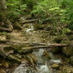 Click here for more information or to register Hosting Club: Iroquoia
Category: General Hike
Location (Google Maps): Meet in the main parking lot at Scotsdale Farm. Hike Leader(s): Karen Bergmann Click here to contact Hike Leader(s) Pace: Medium – 3 to 4 km/hr
Terrain: Moderate – Some hills and/or some poor footing
Distance: 9 kms Description
There are so many trails here that it’s hard to choose where to go. But this hike will take us down the main trail to the Side Trails of Duff Pit, North Rim, Trafalgar Rd and Great Esker to the main trail and Maureen Bennett Side Trail and finishing on the Bennett Heritage Trail. The trees will be turning green and the bugs may be out, so bring bug spray.
- Urban Walk: Toronto Islands Evening Walk
6:00 PM-9:00 PM 06/12/2025 https://hikesstaging.brucetrail.org/event/urban-walk-toronto-islands-evening-walk-16/2025-06-12/  Click here for more information or to register Hosting Club: Toronto Location (Google Maps): Jack Layton Ferry Terminal, near the gates to Wards Island Ferry. Arrive 20 minutes prior to departure to check in with hike leader. From Union Station take the LRT and get off at the stop Ferry Docks.Walk up to the Ferry Docks on Queens Quay West, street level. at the foot of Bay Street. Hike Leader(s): Miriam Stevens Click here to contact Hike Leader(s) Pace: Leisurely (2-3 km/hr)
Terrain: Flat
Distance: 6-9 km Description
After a day’s work come and “cool off” on the Toronto Islands free of fumes and traffic. Enjoy the view of the city skyline and Toronto’s beautiful island parkland.
Pack a dinner for a sit down picnic. Also bring a warm jacket and flashlight.
Return fare ticket for the ferry is $9.11 for adults, $5.86 for seniors
Hikes will take place rain or shine.
Toronto Island evening hikes will take place every Thursday in May and June 2025.
Same time and same meeting place. No preregistration is required – just show up at the ferry docks at 5:40 PM and sign in with the hike leader.
| 13 | 14 - Jeju Ole International Friendship Hike
8:30 AM-1:00 PM 06/14/2025 https://hikesstaging.brucetrail.org/event/jeju-ole-international-friendship-hike/2025-06-14/ 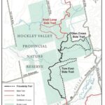 Click here for more information or to register Hosting Club: Caledon Hills
Category: General
Location (Google Maps): Meet at Hockley Road Parking Lot
43.972857, -80.056330 Directions: From ON-10 head east on Hockley Road/Dufferin County Road 7 for 5 kilometres Hike Leader(s): Sandy Green Click here to contact Hike Leader(s) Pace: Medium – 3 to 4 km/hour
Terrain: Moderate – some hills and/or some poor footing
Distance: 6.0 kilometres or 11.5 kilometres Description
All are welcome to join members and friends of the Caledon Hills Club and Sansamo Korean Hiking Club to explore the Jeju Olle Friendship Trail located in the Hockley Valley Provincial Nature Reserve. This Bruce Trail Conservancy International Friendship Trail is twinned with the Jeju Olle walking trail located on the island of Jeju, South Korea. Bring water and a snack. Sturdy shoes are recommended. We are offering two distances for everyone’s enjoyment.
- School Bus Hike – A Day at the Beach!
9:00 AM-6:00 PM 06/14/2025 https://hikesstaging.brucetrail.org/event/school-bus-hike-a-day-at-the-beach/2025-06-14/  Trip Information
Departure Time: 09:00
Return to City Time: 18:00
Departure Point: Kipling Departure Point Click here for more information or to register Optional Items
Hosting Club: Toronto
Category: Bus Hike
Location (Google Maps): Wasaga Beach – Beach Area 6 Hike Leader(s): Marijo Roy Click here to contact Hike Leader(s) Pace: Moderate (3-4 km/hr)
Terrain: Flat, Level 1 (Easy – mostly on flat, well maintained trails with hard-packed surface)
Distance: 8 km Description
Please join us for a day at Wasaga Beach. We will walk along the longest freshwater beach in the world, from Beach Area 6 to Beach Area 1. We will follow part of the Waterfront Trail, encompassing some flat paved and sandy roads. There are several public washrooms along the way. After the hike, you can enjoy swimming, visit the Nancy Island Historic Site to learn more about the War of 1812, or sightsee the area. There will be no drop-off. Please ensure you are comfortable walking 8 km at a moderate pace. Please bring your lunch, snacks, at least 2L of water, sun protection, hat, swimming suit and towel (if applicable), medications, and a First Aid kit. Back in Toronto, Kipling subway station at 6:00 p.m., traffic dependent. Nancy Island Historic Site
https://wasagabeachpark.com/nancy-island-historic-site/
 GeoHike Series #4: Lavender Hill GeoHike Series #4: Lavender Hill 9:30 AM-12:00 PM 06/14/2025 https://hikesstaging.brucetrail.org/event/geohike-series-4-lavender-hill/2025-06-14/  Click here for more information or to register Hosting Club: Dufferin Hi-Land
Category: General Hike
Location (Google Maps): Meet at Lavender Cemetery. We will car shuttle to Noisy River Provincial Nature Reserve and hike back to the cars. Hike Leader(s): Lynda Bloom; Margery Cruise Click here to contact Hike Leader(s) Pace: Medium
Terrain: Moderate, Slippery Sections Likely
Distance: 7 km Description
We will enjoy a hike in and out of woods and pastureland, passing deep crevices and lookouts. The Trail descends the Escarpment and we will cross the bridge over the Noisy River. We will spend some time discussing the geology and landscape led by a professional geologist. Come with your questions about the rocks!
- Urban Walk: Toronto Urban Badge Hike – 7 of 7
10:00 AM-1:00 PM 06/14/2025 https://hikesstaging.brucetrail.org/event/urban-walk-toronto-urban-badge-hike-7-of-7/2025-06-14/  Click here for more information or to register Hosting Club: Toronto
Category: Urban Walk
Location (Google Maps): Don River/Bayview Extension Trails Hike Leader(s): Brian Rideout Click here to contact Hike Leader(s) Pace: Moderate (3-4 km/hr)
Terrain: Flat
Distance: 9 km Description
Please join me at the south east corner of Overlea Blvd and Don Mills Rd by 10 AM. We will hike south on the Don Trail to the Distillery District (km 62.4 to km 71.4). Here is an online map with km markings of our route for all 7 hikes for the Toronto Urban Badge: https://onthegomap.com/s/c2c1hf3n Please make sure you bring at least 2 liters of water, a lunch, bug spray and sunscreen.
- Dundas Valley Loop
10:00 AM-1:00 PM 06/14/2025 https://hikesstaging.brucetrail.org/event/dundas-valley-loop-4/2025-06-14/ 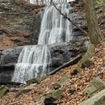 Click here for more information or to register Hosting Club: Iroquoia
Category: General Hike
Location (Google Maps): Dundas Valley Conservation Area, Dundas Hike Leader(s): Anne Armstrong Click here to contact Hike Leader(s) Pace: Leisurely – 3km/hr or less
Terrain: Dependent on Conditions, Moderate – Some hills and/or some poor footing
Distance: Approx. 10 km. Description
Join in this loop hike which visits several waterfalls including the beautiful Sherman Falls which is spectacular if there is a lot of water. Meet in the last parking lot of the Dundas Valley Conservation Area on Governors Rd. west of Dundas at 9:45 am. for a 10:00 am. start. Bring water, a snack, sunscreen and insect repellent. Hiking poles might be useful for the hills we will encounter. Parking fee in effect or a Conservation Area pass.
- 10:00 Malivoire Wine Co Hike and Wine Tasting Experience
10:00 AM-12:00 PM 06/14/2025 https://hikesstaging.brucetrail.org/event/1000-malivoire-wine-co-hike-and-wine-tasting-experience-2/2025-06-14/  Hike open to BTC Members only. Click here for more information or to register Hosting Club: Niagara
Category: Loop
Location (Google Maps): Park at Malivoire Wine Co 4260 King St, Lincoln ON Hike Leader(s): Sam Rutherford Click here to contact Hike Leader(s) Pace: Medium
Terrain: Moderate
Distance: 5 kms Description
We will hike a loop on the main trail from Malivoire Wine Co to the Margaret Reed Side Trail at Cave Springs Conservation Area and back to Malivoire Wine Co by 11:30. Upon return we will enjoy a private structured wine tasting led by one of the knowledgeable and friendly winery staff from 11:30 to 12:00 noon. The cost for the tasting experience is $12.00 per person. Please bring your $12.00 with you as I will collect it prior to the tasting to simplify the payment to Malivoire Wine Co. Thank you.
- Forest Bathing – Leading to Summer Solstice
10:30 AM-3:00 PM 06/14/2025 https://hikesstaging.brucetrail.org/event/forest-bathing-leading-to-summer-solstice/2025-06-14/ Click here for more information or to register Hosting Club: Dufferin Hi-Land
Category: Nature Walks
Location (Google Maps): Dufferin Hi-Land section, BTC Reference Guide, Map 20. Meet at the parking area on the 30th Side Road, 1.75 km east of Hurontario St., at km 12.2. For the second part of the walk, we will meet at the Bruce Trail parking lot on the 1st Line East, at km 28.3, (emergency road address # 716599). Hike Leader(s): Janice McClelland Click here to contact Hike Leader(s) Pace: Leisurely – 3 km/hour or less
Terrain: Moderate – some hills and/or some poor footing
Distance: 6.1 km Description
As we lead into the Dufferin Hi-Land summer solstice events, an invitation for experienced Forest Bathers to drink in the long, pastoral views of high fields (5 km) and then the cozy trail through forest with its interesting biological and geological features, including a natural stone bridge (a 1.1 km loop). We will observe quiet during the walk itself so that all can benefit from the unique experiences on both parts of this Forest Bathing walk. Note: we will meet on the 30th Side Road and walk south on the main trail and return to our cars on this out & back part of the day. We will then drive 7 km north from the first part of our hike to the Bruce Trail parking lot on the 1st Line East, departing from there for our second walk of the day – a loop of 1.1 km. Please bring water & lunch.
|
15 - Paid Hike (non mem/mem different price)
8:30 AM-12:00 PM 06/15/2025 https://hikesstaging.brucetrail.org/event/paid-hike-non-mem-mem-different-price/2025-06-15/ - Black Bank
9:30 AM-12:00 PM 06/15/2025 https://hikesstaging.brucetrail.org/event/black-bank/2025-06-15/ 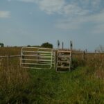 Click here for more information or to register Hosting Club: Iroquoia
Category: General Hike
Location (Google Maps): Meet roadside at 9:15 at the corner of 20th Side Road and Prince of Wales Rd, just north of Kilgorie. Hike Leader(s): Karen Bergmann Click here to contact Hike Leader(s) Pace: Medium – 3 to 4 km/hr
Terrain: Moderate – Some hills and/or some poor footing, Strenuous – Hilly with steep climbs and some poor footing
Distance: 9 kms Description
This hike will take us into a challenging valley with rocks and hills and then through a cattle pasture and over a few stiles. Black Bank is in the Dufferin Section. You are welcome to ride with me from Mississauga if you don’t want to drive. I’ll send an email a couple of days prior to the hike to remind you and see who wants to carpool.
- Urban Walk: Toronto Urban Badge Hike – 6 of 7
10:00 AM-1:15 PM 06/15/2025 https://hikesstaging.brucetrail.org/event/urban-walk-toronto-urban-badge-hike-6-of-7-2/2025-06-15/  Click here for more information or to register Hosting Club: Toronto
Category: Urban Walk
Location (Google Maps): East Don River Trail Hike Leader(s): Brian Rideout Click here to contact Hike Leader(s) Pace: Moderate (3-4 km/hr)
Terrain: Flat
Distance: 9 km Description
Please join me at the south east corner of Sheppard Ave East and Leslie by 10 AM. We will hike south through several parks to Don Mills (S of Overleigh) (km 51.7 to km 62.4). Here is an online map with km markings of our route for all 7 hikes for the Toronto Urban Badge: https://onthegomap.com/s/c2c1hf3n Please make sure you bring at least 2 liters of water, a lunch, bug spray and sunscreen.
 Basic Hike Basic Hike 4:00 PM-8:00 PM 06/15/2025 https://hikesstaging.brucetrail.org/event/basic-hike/2025-06-15/
| 16 -
 Multi-Day Hike Test Multi-Day Hike Test 6:00 AM-1:00 PM 06/16/2025 https://hikesstaging.brucetrail.org/event/multi-day-hike-test/2025-06-16/ This is a Multi-Day HikeYou are signing up for the following dates:
2025-06-16, 2025-06-17, 2025-06-18, 2025-06-19 Click here for more information or to register Hosting Club: Iroquoia
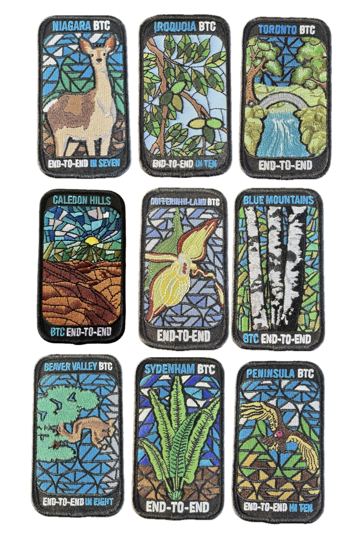
Category: Stained Glass Badge End to End Fundraiser Hike
Location (Google Maps): This is the location for each hike… Hike Leader(s): BTC Staff Click here to contact Hike Leader(s) Pace: Brisk – 4 to 5 km/hr
Terrain: Strenuous – Hilly with steep climbs and some poor footing
Distance: 25 Description
here is the information about the hike series
- Member-Only Hike
10:00 AM-12:00 PM 06/16/2025 https://hikesstaging.brucetrail.org/event/member-only-hike/2025-06-16/
| 17 - Free Hike
5:30 AM 06/17/2025 https://hikesstaging.brucetrail.org/event/free-hike/2025-06-17/ - 8:00 Long Hike Wiley Road Short Hills (NEW TIME)
8:00 AM-10:30 AM 06/17/2025 https://hikesstaging.brucetrail.org/event/800-long-hike-wiley-road-short-hills-new-time-7/2025-06-17/ Click here for more information or to register Hosting Club: Niagara Location (Google Maps): Short Hills Wiley Road Entrance Hike Leader(s): Alan Laver Pace: Medium
Terrain: Moderate
: 10km Description
Explore Short Hills and the majestic side trails of Scarlett Tanager, Hemlock. Swayze Falls and Terrace. Register for each hike Bring Poles, Sun Screen Bug Spray, snack, and dress for the weather
- Dufferin Hi-Land 60th Anniversary Highlight Hikes, Hike# 9 : Primrose Loop Side Trail to Murphy’s Pinnacle
9:00 AM-12:00 PM 06/17/2025 https://hikesstaging.brucetrail.org/event/dufferin-hi-land-60th-anniversary-highlight-hikes-hike-9-primrose-loop-side-trail-to-murphys-pinnacle/2025-06-17/ Click here for more information or to register Hosting Club: Dufferin Hi-Land
Category: Tuesday Hike
Location (Google Maps): Dufferin Hi-land. Map 20. Meet at roadside parking on Prince of Wales Rd. (County Rd. 19) where the Primrose Loop Side Trail crosses Prince of Wales Rd. From Primrose (intersection of Hwy 10 and 89) drive north for about 1.5 km. Parking is about 0.7 km north of the bridge on the east side of the road. Hike Leader(s): Tony Evangelista, Les Babbage, Inge Eckerick, Julie Daley Click here to contact Hike Leader(s) Pace: Medium
Terrain: Dependent on Conditions, Moderate
Distance: Long hike 7 km Short hike 3 km Description
Join us in celebrating the 60th anniversary of the Dufferin High-Land Bruce Trail Club. The Club plans to award a 60th Anniversary badge to any hiker who completes 60 km of Dufferin- H-Land trails- Main or Side Trails. Our Tuesday Hike group is offering a series of 10 hikes, covering most of the highlights of our section that meet this requirement. If you can’t make all of the hikes, make-ups are allowed. Just hike 60k in Dufferin during 2025 and you qualify for the badge. Today we will hike the Primrose Loop Side Trail on the west side of Prince of Wales Rd. Then, after crossing the road and returning to the cars, we will head toward the Main Trail where we will turn left towards Murphy’s Pinnacle, climb to the top, and take in some stunning views before returning to the parking area. The short hike will end after completing the Primrose Loop Side Trail. Bring snacks, water, sunscreen, and insect repellant. Hiking poles are recommended.
- Silver Creek and Walking Fern
9:30 AM-12:30 PM 06/17/2025 https://hikesstaging.brucetrail.org/event/silver-creek-and-walking-fern/2025-06-17/  Click here for more information or to register Hosting Club: Iroquoia
Category: General Hike
Location (Google Maps): Meet roadside on Fallbrook Trail at 9:15 am Hike Leader(s): Karen Bergmann Click here to contact Hike Leader(s) Pace: Medium – 3 to 4 km/hr
Terrain: Moderate – Some hills and/or some poor footing
Distance: 9 kms Description
Meeting roadside on Fallbrook Trail at Silver Creek Conservation Area, we will hike the Irwin Quarry Side Trail to the main trail and to Tenth Line. We will then hike in and back on the Walking Fern Side Trail. A challenging trail for footwork but is well worth it. Then it’s back up the main trail to the Roberts Side Trail to the cars. This hike has some crazy rocky spots and a few hilly bits. Come with water and a snack and bug spray.
| 18 - Scotsdale Farm the Easy Way
10:00 AM-12:30 PM 06/18/2025 https://hikesstaging.brucetrail.org/event/scotsdale-farm-the-easy-way-3/2025-06-18/  Click here for more information or to register Hosting Club: Iroquoia
Category: Good Companions
Location (Google Maps): Scottsdale Farm, 13807 Trafalgar Rd. Hike Leader(s): Anne Armstrong Click here to contact Hike Leader(s) Pace: Leisurely – 3km/hr or less
Terrain: Easy – Mostly flat and usually good footing
Distance: Approx. 9 km. Description
Please join in this pleasant area for hiking in one of my favourite spots. We will use blue side trails to explore this heritage farm with its early history and visit Bruce Trail’s lovely Roberts Side Trail with a delightful pond and hopefully still surrounded by yellow iris. Meet in the main parking lot at 9:45 am. for a 10:00 am. start. Bring water, a snack, sunscreen and insect repellent. Walking poles might be useful. I will send out a message the night before with my contact information.
| 19 - 8:00 am Long Hike Glen Road Jordan NEW TIME
8:00 AM-10:30 AM 06/19/2025 https://hikesstaging.brucetrail.org/event/800-am-long-hike-glen-road-jordan-new-time-8/2025-06-19/ Click here for more information or to register Hosting Club: Niagara Location (Google Maps): Glen Road Jordan Hike Leader(s): Alan Laver Pace: Medium
Terrain: Moderate
: 10k Description
This will be our permanent Thursday Location until Bridge repairs complete. From Glen Road explore the trail network on the escarpment towards Balls Falls and Moyer Road. You must register for each hike. Bring Poles, snack bug spray, sunscreen and a drink. Dress for the weather
- Caledon End to End Stained Glass Fundraiser Badge
8:30 AM 06/19/2025 https://hikesstaging.brucetrail.org/event/caledon-end-to-end-stained-glass-fundraiser-badge/2025-06-19/ This is a Multi-Day HikeYou are signing up for the following dates:
2025-06-19, 2025-06-20, 2025-06-26, 2025-06-27 Click here for more information or to register Hosting Club: Caledon Hills, Beaver Valley Location (Google Maps): First hike meets on the southwest shoulder of Willoughby Rd & Escarpment Sideroad, km 15.9, Map15, Edition 31 BTC Guidebook, N 43.831244, W 79.980588 Hike Leader(s): Glenda Collings Click here to contact the hike leader. Pace: Medium
Terrain: Moderate, Some steep sections
Length of Hike: 15.9 km + approx. 2 km to walk to parking on Boston Mills Road Description
Join us for a set of four hikes in the Caledon BTC section to earn the Stained Glass fundraiser badge. The medium hike pace will range between 3 to 4 km per hour, sometimes a bit more than 4 km per hour on easy flat terrain, with a snack and lunch break. Hikers may request a personal bio break, clothing adjustment, drink stop, etc. at any time during the hike by notifying the leader or sweep. The hikes range from approx. 18 to 19.5 km. Please self evaluate your ability to manage the pace and length of these hikes. Life does happen, so hikers will be able to miss one hike and make it up on their own before June 27. A full hike schedule, with meet locations, will be sent to hikers after registration. If you have any questions please use the “Contact hike leader” option on the online schedule.
- Urban Walk: Toronto Islands Evening Walk
6:00 PM-9:00 PM 06/19/2025 https://hikesstaging.brucetrail.org/event/urban-walk-toronto-islands-evening-walk-17/2025-06-19/  Click here for more information or to register Hosting Club: Toronto Location (Google Maps): Jack Layton Ferry Terminal, near the gates to Wards Island Ferry. Arrive 20 minutes prior to departure to check in with hike leader. From Union Station take the LRT and get off at the stop Ferry Docks.Walk up to the Ferry Docks on Queens Quay West, street level. at the foot of Bay Street. Hike Leader(s): Miriam Stevens Click here to contact Hike Leader(s) Pace: Leisurely (2-3 km/hr)
Terrain: Flat
Distance: 6-9 km Description
After a day’s work come and “cool off” on the Toronto Islands free of fumes and traffic. Enjoy the view of the city skyline and Toronto’s beautiful island parkland.
Pack a dinner for a sit down picnic. Also bring a warm jacket and flashlight.
Return fare ticket for the ferry is $9.11 for adults, $5.86 for seniors
Hikes will take place rain or shine.
Toronto Island evening hikes will take place every Thursday in May and June 2025.
Same time and same meeting place. No preregistration is required – just show up at the ferry docks at 5:40 PM and sign in with the hike leader.
| 20 - Afternoon hike – Halton Agreement Forest
4:30 PM-6:00 PM 06/20/2025 https://hikesstaging.brucetrail.org/event/afternoon-hike-halton-agreement-forest-7/2025-06-20/ - Solstice Ice Cream Walk
7:30 PM-9:30 PM 06/20/2025 https://hikesstaging.brucetrail.org/event/solstice-ice-cream-walk/2025-06-20/  Hike open to BTC Members only. Click here for more information or to register Hosting Club: Iroquoia
Category: General Hike
Location (Google Maps): It is the start of summer!! Meet by 7:15pm for a 7:30 pm departure at the gazebo on the waters edge at Bayfront Park (200 Harbour Front Drive) in Hamilton. We will walk to Princess Point and back and then have the option of having Ice Cream on the nearby hill as the sun sets on the harbour. Bring water, hat and sunglasses. There are picnic tables but I suggest bringing a chair or blanket in case it is busy. Hike Leader(s): Paul Toffoletti Click here to contact Hike Leader(s) Pace: Medium – 3 to 4 km/hr
Terrain: Easy – Mostly flat and usually good footing
Distance: 6km Description
| 21 - Urban Walk: Don Valley to The Distillery District
10:00 AM-6:00 PM 06/21/2025 https://hikesstaging.brucetrail.org/event/urban-walk-don-valley-to-the-distillery-district-3/2025-06-21/  Click here for more information or to register Hosting Club: Toronto
Category: Urban Walk
Location (Google Maps): Don River – Steeles to Distillery District Hike Leader(s): Brian Rideout Click here to contact Hike Leader(s) Pace: Moderate (3-4 km/hr)
Terrain: Flat
Distance: 27.5 km Description
This hike follows the Don River south from Steeles Ave East at Leslie St through Toronto to the Distillery District, through a series of ravines and several parks. We will detour to street level when we cross the 401 (trail closed due to construction) and again south of Pottery Rd where we take the Bayview Ave Extension (trail closed due to construction). Those who register will receive an itinerary. Please bring a lunch and at least two liters of water. Be prepared for cool / wet weather. Pub stop after at The Spaghetti Factory. Here is an online map of our route: Don Valley to The Distillery
- “Dipping Your Toes” into Forest Bathing on the Summer Solstice
10:30 AM-3:00 PM 06/21/2025 https://hikesstaging.brucetrail.org/event/dipping-your-toes-into-forest-bathing-on-the-summer-solstice/2025-06-21/ Click here for more information or to register Hosting Club: Dufferin Hi-Land
Category: Nature Walks
Location (Google Maps): Dufferin Hi-Land section, BTC Reference Guide, Map 20. Meet at the dead end of 2nd Line East (west of main trail km 24.3) Hike Leader(s): Janice McClelland Click here to contact Hike Leader(s) Pace: Leisurely – 3 km/hour or less
Terrain: Moderate – some hills and/or some poor footing
Distance: 5.5 km Description
We invite you to join us on this Forest Bathing walk where we especially welcome newcomers to hiking and/or Forest Bathing, as part of the Dufferin Hi-Land Bruce Trail Club Summer Solstice weekend. Forest Bathing is simply walking quietly along the footpath and letting nature sink into your senses. The soft gurgling of Oliver Creek, the songs of birds and the dappled light of the forest will give you peace. We will observe quiet during our walk, with plenty of time to chat and get to know each other before the walk, during our lunch break along the trail and after the walk. Please bring water & lunch. “Dip your toes into Forest Bathing!”
- Learn to Identify Flora and Fauna
1:00 PM 06/21/2025 https://hikesstaging.brucetrail.org/event/learn-to-identify-flora-and-fauna/2025-06-21/ 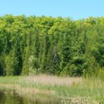 Click here for more information or to register Hosting Club: Dufferin Hi-Land
Category: Special Events
Location (Google Maps): Meet at Prince of Wales and 15 Sideroad. Hike Leader(s): Tom Thayer Click here to contact Hike Leader(s) Pace: Leisurely
Terrain: Easy, Moderate Description
Join us for a hike through Pine River Nature Reserve and learn how to use the iNaturalist App to help the Bruce Trail protect endangered/at-risk species, monitor existing species, identify invasive species that need to be removed, and learn about the plans to enhance and enrich biodiversity. Interact with the Bruce Trail Conservancy’s Conservation and Ecology specialists, meet some of our new trail ambassadors, and learn more about how the Dufferin Hi-Land Bruce Trail Club is working with the BTC to provide a sustainable and healthy future for generations to come. Please Note: You will need a mobile device with the iNaturalist App installed and updated in order to take part in this event. You can download the app from the App Store or Google Play Store. More information about the iNaturalist program is available here: https://development.brucetrail.org/what-we-do/#iNaturalist Everyone is welcome, member and non-member alike.
|
22 -
 Laura Secord Special Event Hike Laura Secord Special Event Hike 5:45 AM-2:30 PM 06/22/2025 https://hikesstaging.brucetrail.org/event/laura-secord-special-event-hike-2/2025-06-22/ Click here for more information or to register Hosting Club: Niagara
Category: Bus
Location (Google Maps): Niagara Region Office, 1815 Sir Isaac Brock Way, Thorold, ON (park near Merrittville Highway) Hike Leader(s): janet davey Click here to contact Hike Leader(s) Pace: Medium
Terrain: Moderate
Distance: 32 km Description
This is a self-led hike. Hike along the Bruce Trail from Laura Secord’s Homestead in Queenston to Decew House in Thorold. Participants will be transported by bus from check in at Niagara Region office to the start of the hike and will hike at their own pace to the final checkpoint. There will be volunteer drivers available to drive you back to your car once the hike is over. You may be asked to wear a mask in the car. Bring snacks, water and bug spray. We also recommend sunscreen, basic first aid supplies, spare socks and a cell phone. There will be 3 checkpoints (2 along the trail and one at the end) to replenish water and snacks and anyone wishing to drop out of the hike should do so at a checkpoint. Hikers are responsible for informing club volunteers of their intention to drop out. You will receive a reminder email two days before the event with further details about the hike.
- Biodiversity Walk (Summer Solstice Series)
9:30 AM-12:00 PM 06/22/2025 https://hikesstaging.brucetrail.org/event/biodiversity-walk-summer-solstice-series/2025-06-22/ Click here for more information or to register Hosting Club: Dufferin Hi-Land
Category: Special Events
Location (Google Maps): Splitrock Narrows – Bruce Trail Side Trails
Meet at Splitrock Narrows Parking Lot
755347 2nd Line East, Mono, ON
Bruce Trail App and Guide Book (ed. 31) Map 19, Mono Cliffs Hike Leader(s): N/A Pace: Leisurely
Terrain: Easy, Moderate
Distance: 3-4km Description
Join members of the Biodiversity Committee and a retired Dufferin County forester to explore how we are working to improve biodiversity in the Dufferin Hi-Land section of the trail! This leisurely walk through parts of Splitrock Narrows will focus on projects the committee has been working on, including the newly established and expanded Seed Orchard. Learn more about the various species planted and their intended uses. We will also discuss the ongoing initiatives to reduce invasive species and enhance the biodiversity around us. Bring water and snacks. Hiking poles are optional. Consider sunscreen and insect repellent. This event is not a hike. There will be no certified hike leader present. Please contact Cathy Hughes at purplecoral@hotmail.com for more information. Thanks.
- Summer Solstice Nature Walk
1:00 PM-2:00 PM 06/22/2025 https://hikesstaging.brucetrail.org/event/summer-solstice-nature-walk/2025-06-22/ Click here for more information or to register Hosting Club: Dufferin Hi-Land
Category: Special Events
Location (Google Maps): Dufferin Hi-Land Section, Map 20. Meet at parking lot at end of Centre Road, south of 5 Sideroad Mulmur (just north of Km 17.6) Hike Leader(s): Brenda Carling Click here to contact Hike Leader(s) Pace: Leisurely
Terrain: Easy
Distance: 0.5 km Description
Join us for a gentle ramble in the hills and learn a bit about what we see along the way. This short hike goes up to Murphy’s Pinnacle for some amazing vistas, and down to the river and returning on the road allowance.
| 23 - Halton Agreement Forest – How to use All Trails to navigate your hikes
9:30 AM-12:00 PM 06/23/2025 https://hikesstaging.brucetrail.org/event/halton-agreement-forest-how-to-use-all-trails-to-navigate-your-hikes/2025-06-23/  Click here for more information or to register Hosting Club: Iroquoia
Category: General Hike
Location (Google Maps): Meet roadside at 9:15 on 4th Line. Up Guelph Line from the 401, turn right on 10 Side Road and follow the curve as it becomes 4th Line. Hike Leader(s): Karen Bergmann Click here to contact Hike Leader(s) Pace: Medium – 3 to 4 km/hr
Terrain: Moderate – Some hills and/or some poor footing
Distance: 8 kms Description
We will hike around the bike trails in this lovely Forest, including The Den and The Pines. During this hike, we will learn how to use the All Trails app to find our way around the Forest. Each hiker will take turns leading us around the trails. Bring bug spray.
| 24 - 8:00 Long Hike Wiley Road Short Hills (NEW TIME)
8:00 AM-10:30 AM 06/24/2025 https://hikesstaging.brucetrail.org/event/800-long-hike-wiley-road-short-hills-new-time-8/2025-06-24/ Click here for more information or to register Hosting Club: Niagara Location (Google Maps): Short Hills Wiley Road Entrance Hike Leader(s): Alan Laver Pace: Medium
Terrain: Moderate
: 10km Description
Explore Short Hills and the majestic side trails of Scarlett Tanager, Hemlock. Swayze Falls and Terrace. Register for each hike Bring Poles, Sun Screen Bug Spray, snack, and dress for the weather
- Dufferin Hi-Land 60th Anniversary Highlights, Hike 10:Boyne Valley Side Trail Loop
9:00 AM-11:30 AM 06/24/2025 https://hikesstaging.brucetrail.org/event/dufferin-hi-land-60th-anniversary-highlights-hike-10boyne-valley-side-trail-loop/2025-06-24/ Click here for more information or to register Hosting Club: Dufferin Hi-Land
Category: Tuesday Hike
Location (Google Maps): Dufferin Hi-Land Section, Map 20. Meet at parking lot at end of Centre Road, south of 5 Sideroad Mulmur (just north of Km 17.6
) at 9:00 am. Hike Leader(s): Les Babbage, Inge Eckerich, Julie Daley, Tony Evangelista Click here to contact Hike Leader(s) Pace: Leisurely, Medium
Terrain: Strenuous
Distance: 6.3 km, Short hike: 3 km Description
Our celebration of Dufferin Hi-Land BTC’s 60th Anniversary concludes with another highlight of the section, 3 bridges crossing the Boyne River. If you’ve hiked all 10 of the hikes in this series, or otherwise hiked 60 km in Dufferin during 2025, you qualify for the 60th Anniversary badge. Today we will hike a loop consisting of the Main Trail and Boyne Valley Side Trail, with a side trip up to Murphy’s Pinnacle, where, on a clear day, you just might be able to spot the CN Tower. The short option will return to parking from the Boyne River bridges by way of Centre Road road allowance. Bring water and snacks.
- Urban Walk: High Park and Toronto Waterfront Trail
11:00 AM-2:00 PM 06/24/2025 https://hikesstaging.brucetrail.org/event/urban-walk-high-park-and-toronto-waterfront-trail/2025-06-24/  Click here for more information or to register Hosting Club: Toronto Location (Google Maps): High Park Subway Station Street Level (East Exit – High Park Avenue (by the bus loop) Hike Leader(s): Miriam Stevens Click here to contact Hike Leader(s) Pace: Leisurely (2-3 km/hr)
Terrain: Flat, Level 1 (Easy – mostly on flat, well maintained trails with hard-packed surface)
Distance: 10 KM Description
Join us for a leisurely hike through High Park and then east along Toronto’s Waterfront Trail to Harbourfront Centre passing though many small parks including the Music Garden. Refreshments at a coffee shop on Queens Quay at Harbourfront. Bring lunch and drinking water. Dropout any time. We’ll arrive at Harbourfront Centre around 2:00 PM. This will be repeated Tuesday May 13th, Tuesday May 27th, Tuesday June 3rd, and Tuesday June 24th. No pre registration is required. Just show up 15-20 minutes before to departure time to sign in with the hike leader.
| 25 - Cootes Paradise South Shore Trails
9:30 AM-12:00 PM 06/25/2025 https://hikesstaging.brucetrail.org/event/cootes-paradise-south-shore-trails/2025-06-25/  Hike open to BTC Members only. Click here for more information or to register Hosting Club: Iroquoia
Category: Good Companions
Location (Google Maps): Princess Point parking lot – see map below Hike Leader(s): Ted Bossence Click here to contact Hike Leader(s) Pace: Medium – 3 to 4 km/hr
Terrain: Moderate – Some hills and/or some poor footing
Distance: 7.5 km Description We will walk the trails to and from the McMaster University campus on mostly good trails with a few hills along the way. Please be at the start point by 9:15 am and we will leave by 9:30 (PLEASE NOTE THE EARLIER START TIME). RBG parking pass or paid parking at Princess Point. Bring bug repellant, sunscreen, water and a snack. I will cancel in the case of rain – please check your email the evening before the hike. I will email you the day before the hike with contact information for cancellations after 3:30 pm on the day prior to the hike.
- Terra Cotta/Heritage Road loop
9:30 AM-12:00 PM 06/25/2025 https://hikesstaging.brucetrail.org/event/terra-cotta-heritage-road-loop-2/2025-06-25/  Click here for more information or to register Hosting Club: Iroquoia
Category: General Hike
Location (Google Maps): Roadside on Winston Churchill Blvd, just north of Terra Cotta Conservation Area. Meet at 9:15 am, earlier if you can, as parking is limited. Hike Leader(s): Karen Bergmann Click here to contact Hike Leader(s) Pace: Medium – 3 to 4 km/hr
Terrain: Moderate – Some hills and/or some poor footing
Distance: 8.5 kms Description
Hiking along the main trail, across Heritage Rd and around to the Rockside Side Trail and back on the main trail to the cars. This trail has some easy parts and some challenging rocky parts, so come prepared. There’s a bit of road walking. Bring bug spray.
| 26 - 8:00 am Long Hike Glen Road Jordan NEW TIME
8:00 AM-10:30 AM 06/26/2025 https://hikesstaging.brucetrail.org/event/800-am-long-hike-glen-road-jordan-new-time-9/2025-06-26/ Click here for more information or to register Hosting Club: Niagara Location (Google Maps): Glen Road Jordan Hike Leader(s): Alan Laver Pace: Medium
Terrain: Moderate
: 10k Description
This will be our permanent Thursday Location until Bridge repairs complete. From Glen Road explore the trail network on the escarpment towards Balls Falls and Moyer Road. You must register for each hike. Bring Poles, snack bug spray, sunscreen and a drink. Dress for the weather
- Urban Walk: Toronto Islands Evening Walk
6:00 PM-9:00 PM 06/26/2025 https://hikesstaging.brucetrail.org/event/urban-walk-toronto-islands-evening-walk-18/2025-06-26/ 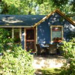 Click here for more information or to register Hosting Club: Toronto Location (Google Maps): Jack Layton Ferry Terminal, near the gates to Wards Island Ferry. Arrive 20 minutes prior to departure to check in with hike leader. From Union Station take the LRT and get off at the stop Ferry Docks.Walk up to the Ferry Docks on Queens Quay West, street level. at the foot of Bay Street. Hike Leader(s): Miriam Stevens Click here to contact Hike Leader(s) Pace: Leisurely (2-3 km/hr)
Terrain: Flat
Distance: 6-9 km Description
After a day’s work come and “cool off” on the Toronto Islands free of fumes and traffic. Enjoy the view of the city skyline and Toronto’s beautiful island parkland.
Pack a dinner for a sit down picnic. Also bring a warm jacket and flashlight.
Return fare ticket for the ferry is $9.11 for adults, $5.86 for seniors
Hikes will take place rain or shine.
Toronto Island evening hikes will take place every Thursday in May and June 2025.
Same time and same meeting place. No preregistration is required – just show up at the ferry docks at 5:40 PM and sign in with the hike leader.
| 27 | 28 - Peninsula Sunrise Series: Burnt Point Loop & Lookout Tower
4:30 AM 06/28/2025 https://hikesstaging.brucetrail.org/event/peninsula-sunrise-series-burnt-point-loop-lookout-tower/2025-06-28/  Click here for more information or to register Hosting Club: Peninsula
Category: Sunrise Hike
Location (Google Maps): Parking Lot at Dyers Bay Rd & Hwy 6, Northern Bruce Peninsula, ON N0H 1Z0 Hike Leader(s): Kathleen Stahlbaum Click here to contact Hike Leader(s) Pace: Leisurely (2.0 – 3.0 km/h): A relaxed pace with frequent breaks and a focus on enjoyment.
Terrain: Easy: Flat forested sections or lowland trails., Moderate: Rolling hills, mild slopes and rocky paths.
Distance: ~6 km Description
Experience the magic of dawn on the Bruce Trail with the Sunrise Hike Series offered by the Peninsula Bruce Trail Club. These early morning hikes provide a perfect opportunity to awaken your senses, boost your energy, and immerse yourself in the tranquility of nature as the sun paints the sky with breathtaking hues. As we make our way through scenic forest trails, we’ll pause to witness the first light shimmering on the turquoise waters of Georgian Bay – a sight that will surely leave you in awe! Beyond the beauty, morning light helps regulate your circadian rhythm, elevating your mood, boosting energy levels and improving sleep quality. Whether you’re looking to start your day with a sense of calm, capture stunning sunrise photos, or simply reconnect with nature, these hikes offer a unique and inspiring way to greet the day. On Saturday June 28th, join us in hiking the Burnt Point Loop where we’ll experience the sun rising over the Bay from the edge of the shoreline as well as the iconic Bruce Peninsula National Park Visitor’s Center Lookout Tower. We’ll have the joy of taking in the stunning colours of the sky as the first light sparkles on the stunning turquoise waters. This peaceful sunrise hike is the perfect way to connect with nature, capture some incredible photos, and start the day with fresh air and inspiration. Whether you’re a morning person or just love a good adventure, come experience the magic of dawn from one of the best vantage points on the Bruce Peninsula! Don’t forget to bring a headlamp or flashlight (preferably with a red light setting) as we begin our adventure in the pre-dawn quiet. Join us and discover how a sunrise hike can nourish your mind, body, and spirit—setting the tone for a brighter, more balanced day. This hike is approximately 5-6 kms in length. Expect to be on the trail for 2-3 hours (+ additional time for travel from our rendezvous point). Pace will be leisurely with ample time to enjoy the sunrise, take some photographs, and nourish yourself! How to prepare - Get a good night’s sleep
- Bring lots of water and a snack (breakfast and/or coffee are recommended if that’s your thing!)
- Bring a headlamp or flashlight (preferably with a red light setting)
- Wear waterproof hiking boots (There will be mud!)
- Hiking poles are recommended but not necessary
- Bring insect repellant or wear protective clothing
- Bring sunscreen
LIMITED SPACE AVAILABLE! We will be carpooling to the Bruce Peninsula National Park Visitor’s Center from the parking lot at the corner of Highway 6 and Dyer’s Bay Rd. You will be required to pay for entry to the park.
- Bus Hike: Mystery Hike
8:30 AM-6:00 PM 06/28/2025 https://hikesstaging.brucetrail.org/event/bus-hike-mystery-hike/2025-06-28/  Trip Information
Departure Time: 08:30
Return to City Time: 18:00
Departure Point: York Mills Bus Pickup Click here for more information or to register Optional Items
Hosting Club: Toronto
Category: Bus Hike
Location (Google Maps): The location will be revealed the date of the hike. The destination will be within an approximately 90 minute drive from York Mills Station. Hike Leader(s): Tom Swales, Felix Wan Click here to contact Hike Leader(s) Pace: Moderate (3-4 km/hr)
Terrain: Level 2 (Intermediate – some hills and uneven surfaces, rocks and roots underfoot)
Distance: 12-14 km Description
Join us on fun day for a moderate level 12 km hike on a trail stewarded by one of our fellow member trail associations of Hike Ontario. The location will be within a 90 minute drive from York Mills (subject to traffic conditions). Like the Bruce Trail, the trail follows one of the geological features of Ontario. After the hike there will be the options to enjoy a lovely white sand beach with scenic views, a local festival, or a pub/restaurant in a picturesque waterfront community. This will be a new hike and not a repeat of any hike on the schedule. That’s all the clues you’ll get. An enjoyable day is promised.
- Summer Solstice HIstorical Hike
9:30 AM-1:15 PM 06/28/2025 https://hikesstaging.brucetrail.org/event/dhlbtc-60th-anniversary-historical-hike/2025-06-28/ Click here for more information or to register Hosting Club: Dufferin Hi-Land
Category: Special Events
Location (Google Maps): Ed. 31 Map 20 Km. 33.8 Parking corner of River Rd. and Centre Rd. Hike Leader(s): Bryan Foley Click here to contact Hike Leader(s) Pace: Leisurely
Terrain: Moderate
Distance: Short 3kM Long 5,5km Description
Join me, as together we hike back through history. We will explore the origins of the hamlet of Kilgorie, River Road. Who were the early settlers ? What is the story behind the remains of the Dufferin Light and Power Company ? As we walk further along the trail ,we’ll find out who Grant and Grace Bell were, the role they and others played in the establishment and early development of the Dufferin Hi-Land Club
- Lion’s Head Look One Day Hike – around 16 km Loop – for adventures and enthusiasts (who loves to drive and hike)
9:45 AM-4:30 PM 06/28/2025 https://hikesstaging.brucetrail.org/event/lions-head-look-one-day-hike-around-16-km-loop-for-adventures-and-enthusiasts-who-loves-to-drive-and-hike/2025-06-28/  Click here for more information or to register Hosting Club: Iroquoia, Peninsula
Category: Good Companions
Location (Google Maps): Lion’s Head Provincial Nature Reserve -Lion’s Head Parking Rd at the end of Cemetery Rd. Hike Leader(s): Corina Seceleanu Click here to contact Hike Leader(s) Pace: Medium – 3 to 4 km/hr
Terrain: Strenuous – Hilly with steep climbs and some poor footing
Distance: 16.5 Km Description
Let’s embark on an unforgettable adventure as we explore the breathtaking Lion’s Head area on Saturday, June 28th,2025. This hike, both exhilarating and rewarding, will take us along a 16.5 km loop that showcases the wonders of the Bruce Peninsula section. Our journey begins at the Cemetery Rd parking lot, where we’ll set off hiking counterclockwise on the main trail. Along the way, we’ll visit incredible landmarks including Gun Point, McKay Harbour, Lion’s Head Point, and the spectacular Lookout. Experience the thrill of crossing the 45th parallel twice, a reminder that you’re in a truly remarkable location. As the trail winds its way through awe-inspiring vistas and tranquil scenery, we’ll eventually connect to the Ilse Hanel Side Trail, leading us back to our starting point. Whether you’re a seasoned hiker or simply looking for a challenge, this loop offers the perfect blend of beauty and endurance, promising countless moments of discovery and joy. If you crave adventure and long hikes with unforgettable rewards, this experience is not to be missed! Expectations: This is a difficult hike but we’ll hike at various paces to allow ourselves to enjoy and immerse in an endless beauty of this exploration. Expect to be on-trail 6.5- 7 hours. Breaks will be taken for lunch, snacks, photography and to appreciate the scenery. Meeting Time: Please arrive no later than 15 minutes prior to the scheduled time. Participant Requirements: - Intermediate/experienced hikers, comfortable with longer distances and elevation gains.
- Must be physically fit for group hiking and mentally prepared for an endurance hike
- Proper hiking boots, layered clothing, and wet weather gear. Hiking poles recommended
- Essentials: Lunch, snacks, water (2L min) , bug spray, sunscreen and your enthusiasm
- Breaks for photography and appreciation of local flora and fauna.
Please note: be prepared for a long drive (if you live around the GTA) round trip (around 6.5- 7h) as well for a long hike around 7 h. This is full day adventure. Any question or inquiry please contact, the Hike Leader! ** For anyone wishing to carpool from GTAA ( meeting point at : Dixie Go Station at 2445 Dixie Rd. Missisauga, ON L4Y 2A1 coordinates 43.608362, -79.579350; cross the Walmart) please meet me at 5:50 am , Saturday June 28th. It’s customary that if you’re a passenger in a carpool, that a donation towards expense of getting there and return would be appreciated. Please contact me if anyone whishes to participate ! Thank you! Till then happy trails, everyone!
- Learn to Hike (Summer Solstice Series)
10:00 AM-12:00 PM 06/28/2025 https://hikesstaging.brucetrail.org/event/learn-to-hike-summer-solstice-series/2025-06-28/  Click here for more information or to register Hosting Club: Dufferin Hi-Land
Category: Special Events
Location (Google Maps): Mono Community Centre, Mono Centre Hike Leader(s): Margery Cruise;Brenda Carling Click here to contact Hike Leader(s) Pace: Leisurely
Terrain: Easy
Distance: 5 km Description
We will introduce you to the essentials of hiking. Our hike will start from the Community Centre Parking lot (look for Bruce Trail sign). We will cross Mono Centre Road, enter Mono Cliffs Park, hike along the main trail (Cliff Top Trail), walk over a small bridge over a stream, stop to admire the lakes, then follow the trail over boardwalks and up the cliff. We will go down some stairs to the base of the cliff and follow the Walter Tovell side trail back to the start. New hikers, families, seasoned hikers are all welcome! No dogs please. Please bring snacks, water, your energy. Even more fun – you can earn a “My first hike on the Bruce Trail” badge! Nominal charge of $15 ($10 for BTC members).
- Pride Hike
10:00 AM-12:00 PM 06/28/2025 https://hikesstaging.brucetrail.org/event/pride-hike/2025-06-28/  Click here for more information or to register Hosting Club: Caledon Hills
Category: Introductory
Location (Google Maps): From Hwy #10 north of Orangeville, turn east on Hockley Road.
Drive for 1.1 km.
Continue straight onto Side Road 5 for 1.6 km.
Turn left onto 1st Line EHS for 900 metres.
Continue straight into the parking lot. ***DO NOT take 1st Line EHS south from Hockley Road. It is NOT maintained. Google Maps may suggest this impassable route. Hike Leader(s): Dylan “Lana” Hubbard Click here to contact Hike Leader(s) Pace: Leisurely – 3 km/hour or less
Terrain: Easy – mostly flat and usually good footing
Distance: 4.5 km Description
Celebrate Pride together in nature. This community hike will be a leisurely 5 km loop on a well-maintained forested trail. Wear comfortable, sturdy shoes. Bring sunscreen, bug spray, a picnic lunch, and a beverage. Light refreshments prepared by members of our club will also be served. Everyone will receive a Bruce Trail Conservancy Pride Badge. This hiking event is a 2SLBGTQIA+ safe space. The CHBTC is committed to providing an inclusive and welcoming environment. Everyone is invited to join
|
29 - Duncan Escarpment Provincial Park
10:00 AM-1:00 PM 06/29/2025 https://hikesstaging.brucetrail.org/event/duncan-escarpment-provincial-park-2/2025-06-29/  Click here for more information or to register Hosting Club: Iroquoia, Beaver Valley
Category: General Hike
Location (Google Maps): Duncan Escarpment Provincial Park – small parking lot on Side Road 9. If you would like to carpool from Mississauga, please contact the Hike Leader. Hike Leader(s): Karen Bergmann Click here to contact Hike Leader(s) Pace: Medium – 3 to 4 km/hr
Terrain: Strenuous – Hilly with steep climbs and some poor footing
Distance: 11 kms Description
Time for an adventure in the Beaver Valley section! This loop hike is challenging and so rewarding! Takes about 2 hours drive from the GTA. We’ll hike on the main trail and a couple of side trails in a loop. There are hilly parts and plenty of rocks and roots. Bring water and a snack/lunch. If you would like to carpool from Mississauga, I am happy to have a few people ride with me. I will send an email a couple of days prior to the hike.
- Urban Walk: Toronto Urban Badge Hike – 7 of 7
10:00 AM-1:00 PM 06/29/2025 https://hikesstaging.brucetrail.org/event/urban-walk-toronto-urban-badge-hike-7-of-7-2/2025-06-29/ 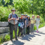 Click here for more information or to register Hosting Club: Toronto
Category: Urban Walk
Location (Google Maps): Don River/Bayview Extension Trails Hike Leader(s): Brian Rideout Click here to contact Hike Leader(s) Pace: Moderate (3-4 km/hr)
Terrain: Flat
Distance: 9 km Description
Please join me at the south east corner of Overlea Blvd and Don Mills Rd by 10 AM. We will hike south on the Don Trail to the Distillery District (km 62.4 to km 71.4). Here is an online map with km markings of our route for all 7 hikes for the Toronto Urban Badge: https://onthegomap.com/s/c2c1hf3n Please make sure you bring at least 2 liters of water, a lunch, bug spray and sunscreen.
| 30 | July | July | July | July | July |