
Hike Schedule
Join us for a hike! Registration required.
All hikes available to BTC members. Some hikes are open to non-members.
See Refund Policy for Paid Hikes >
TIP: The calendar view displays up to 7 hikes on a day, but often there are more. Click “View more events” to see them all.
Categories
- 18May 18, 2025
Sunday Only (Niagara End 2 End)
https://hikesstaging.brucetrail.org/event/sunday-only-niagara-end-2-end-2/Sorry, the registration cut-off time for this hike has been reached.Not a member? Click here to join today!Hosting Club: Niagara
Category: Hike
Location (Google Maps): Sunday May 18: Brock University Parking Lot 3A Merrittville Highway St CatharinesHike Leader(s): Mary Ann Enns Click here to contact Hike Leader(s)
Pace: Medium
Terrain: ModerateDescription
This is the NBTC Annual End to End 1 day hike from Balls Falls to Brock University. This hike is in conjunction with Niagara’s End 2 End in Three.Distance 27 km
Please arrive by 6.30am to check in. Buses will depart promptly at 7am. Hikers will be transported by bus to Balls Falls where they will hike at their own pace to final checkpoint at Brock University.
Checkpoint volunteers stations will be approximately every 10 kms, offering nutritious snacks and water refills. Checkpoint coordinates will be provided at the beginning of your hike.
Trail Angels will provide assistance. A list of Trail Angels and their contact information will also be available at the beginning of the hike.
Pack for weather and terrain. A cell phone is important to bring, appropriate footwear, poles if preferred, basic first aid and trail map or app. Hikers are responsible for informing the organizing personnel of their intention to drop out during the hike.
Fee includes bus and checkpoints.
Proceeds support Niagara Bruce Club which in turn supports The Bruce Trail Conservancy mission to “Preserving a ribbon of wilderness for everyone forever”

Warblers and Waterfowl
https://hikesstaging.brucetrail.org/event/warblers-and-waterfowl/Sorry, the registration cut-off time for this hike has been reached.Not a member? Click here to join today!Hike open to BTC Members only.
Hosting Club: Peninsula
Category: Birding
Location (Google Maps): Meet at the boat launch at the west end of Isaac Lake Road. Please arrive a few minutes early.Hike Leader(s): Marg Glendon Click here to contact Hike Leader(s)
Pace: Leisurely (2.0 – 3.0 km/h): A relaxed pace with frequent breaks and a focus on enjoyment.
Terrain: Easy: Flat forested sections or lowland trails.
Distance: 2-3 kmDescription
Join local birding enthusiast and retired outdoor educator, Peter Rasberry, for some Spring birding at the Isaac Lake Management Area Saturday, May 18, 2025. 223 species have been recorded here on eBird between October 2014 and December 2024. This date should put us smack in the middle of spring migration which bodes well for both warblers and waterfowl, and a host of other songbirds! All levels of birding welcome! This hike is a family friendly hike – a “walk, sit/stand, listen/observe” type of hike. Binoculars would be helpful. A head bug net may be helpful. Wear a hat, longsleeved shirt/pants, and sunblock. Bring a light backpack to carry water, snacks, bird ID guides, insect repellent and personal materials.A portapottie is available at the boat launch. A portable sit-stool/lawn chair is optional. Binoculars and bird ID guides are available to borrow from your local Bruce County library – book ahead. This bird hike will be about 2 hours in duration. Participants are welcome to linger longer after the group hike.
Scotsdale Farm to Silver Creek return
https://hikesstaging.brucetrail.org/event/scotsdale-farm-to-silver-creek-return/Sorry, the registration cut-off time for this hike has been reached.Not a member? Click here to join today!Hosting Club: Iroquoia
Category: General Hike
Location (Google Maps): Meet in the main parking lot at Scotsdale Farm.Hike Leader(s): Karen Bergmann Click here to contact Hike Leader(s)
Pace: Medium – 3 to 4 km/hr
Terrain: Moderate – Some hills and/or some poor footing
Distance: 11 kmsDescription
Meet in the main parking lot at Scotsdale Farm on Trafalgar Road at 9:15 am. We will hike up the Bennet Side Trail to the main trail and along Snows Creek to the Fallbrook Farm Side Trail, back to the main trail and down the loop to the other end of the Bennet Side Trail. There are some rocky bits to this hike with a few hills. Bring a snack as needed. We should see beautiful spring wildflowers and hear lots of birds.Richard Reble Memorial Hike - Waterdown
https://hikesstaging.brucetrail.org/event/richard-reble-memorial-hike-waterdown/Sorry, the registration cut-off time for this hike has been reached.Not a member? Click here to join today!Hosting Club: Iroquoia, Dufferin Hi-Land
Category: General Hike
Location (Google Maps): City View Park, Waterdown. Second left south of Dundas Street (Hwy #5) on Kerns Road.Hike Leader(s): Stuart Law Click here to contact Hike Leader(s)
Pace: Leisurely
Terrain: Dependent on Conditions, Moderate, Slippery Sections Likely
Distance: 12 kmsDescription
Please join us on a 12 km hike to the Great Falls in Smoky Hollow and back in memory of a hike leader friend of the trail and a friend of many: Richard Reble. Richard was an energetic hike leader that introduced many to the joy of the trail and the camaraderie that comes along with it. He was a fearless advocate for the environment. Everyone welcome whether you knew Richard personally or not. He would be pleased that you just showed up for the hike. Optional pub stop after. Please wear hiking boots and dress for the weather. It could be muddy. Bring a smile, a lunch, bug spray and some water.Urban Walk: Central Don Parks
https://hikesstaging.brucetrail.org/event/urban-walk-central-don-parks-3/Sorry, the registration cut-off time for this hike has been reached.Not a member? Click here to join today!Hosting Club: Toronto
Category: Urban Walk
Location (Google Maps):Meet front entrance Civic Garden Centre Pavilion, Toronto Botanical Gardens – Leslie Street & Lawrence Avenue.
Take Bus #54 Lawrence or #51 Leslie from Eglinton Station on Line 1Hike Leader(s): Tom Swales Click here to contact Hike Leader(s)
Pace: Moderate (3-4 km/hr)
Terrain: Variable, Level 2 (Intermediate – some hills and uneven surfaces, rocks and roots underfoot)
Distance: 10-12 kmDescription
We’ll hike a couple of loops on side trails through Wilket Creek, Sunnybrook, ET Seton, and Serena Gundy Parks. Enjoy the trilliums and other wildflowers in the wooded areas of Sunnybrook as well as the gardens of the Toronto Botanical Gardens at the start of the hike. Bring lunch and water. Hiking boots recommended. Those who wish may join us for a post-hike refreshment stop at Corks Beer & Wine Bar in Longo’s in Leaside. - 19May 19, 2025
Monday only (Niagara End 2 End)
https://hikesstaging.brucetrail.org/event/monday-only-niagara-end-2-end/Sorry, the registration cut-off time for this hike has been reached.Not a member? Click here to join today!Hosting Club: Niagara
Category: Hike
Location (Google Maps): Monday May 19: Queenston Heights Park, Niagara Parkway, Niagara on the Lake 43’159314-79.055405Hike Leader(s): Mary Ann Enns Click here to contact Hike Leader(s)
Pace: Medium
Terrain: Moderate
Distance: 27 kmDescription
This is the NBTC Annual End to End Event in 1 day hike from Brock University to Queenston Cairn. This hike is in conjunction with Niagara’s End to End in Three.Distance 27 km.
Please arrive by 6.30am to check in. Buses will depart promptly at 7am. Hikers will be transported by bus to Brock University, where they will hike at their own pace to final checkpoint at the Queenston Cairn.
Checkpoint volunteer stations will be approximately every 10km offering nutritious snacks and replenish water. Checkpoint coordinates will be provide at the beginning of your hike.
Trail Angels will provide assistance. A list of Trail Angels and their contact information will also be available at the beginning of the hike.
Pack for weather and terrain. A cell phone is important to bring, appropriate footwear, poles if you prefer, basic first aid and trail map or app
Fee includes bus, checkpoint and parking in Queenston. Parking passing will provided on your arrival.
Proceeds support the Niagara Bruce Club with in turn supports The Bruce Tail Conservancy mission to ” Preserving a ribbon of wilderness for everyone forever”.
DATE CHANGE - Urban Walk: Leslie Street Spit Bird Watching
https://hikesstaging.brucetrail.org/event/urban-walk-leslie-street-spit-bird-watching-3/Sorry, the registration cut-off time for this hike has been reached.Not a member? Click here to join today!Hosting Club: Toronto
Category: Urban Walk
Location (Google Maps):Entrance to Tommy Thompson Park at Leslie St and Unwin Ave.
Hike Leader(s): Ray Berzins Click here to contact Hike Leader(s)
Pace: Leisurely (2-3 km/hr)
Terrain: Flat
Distance: 7 kmDescription
Expect an email by 8AM on Day of Hike to check if hike is Cancelled due to bad weather.For first 3.5 km we will try to observe as much as possible along natural footpaths, so wear long pants, long stockings and whatever else will protect you from ticks. Bring binoculars. After lunch the nature walk will end and hikers can use the Multi-use Trail to continue walking to the end of the spit or return back to the park entrance by 2PM. It will be cooler and more windy than inland so bring warm clothing and a warm beverage with your lunch.
Smokey Head-White Bluff Provincial Nature Reserve
https://hikesstaging.brucetrail.org/event/smokey-head-white-bluff-provincial-nature-reserve/Sorry, the registration cut-off time for this hike has been reached.Not a member? Click here to join today!Hike open to BTC Members only.
Hosting Club: Sydenham
Category: General Hike
Location (Google Maps): Forty Hills parking area at the end of the Richardson side trail (west of 87.4 on map 38)Hike Leader(s): Cindy Paczkowski Click here to contact Hike Leader(s)
Pace: Leisurely: 3 km/h or less
Terrain: Moderate: Some hills and/or poor footing, There might be muddy sections., There might be sections with water on the trail.
Distance: 11 kmDescription
We will follow the white blazed trail north along the bluff to Reed’s dump for 5 km. We will return via Blasing, Walter Brewer and White Bluff side trails. Expect amazing views, interesting geology, and wildflowers. It is suggested you wear long pants or at least long socks to protect from ticks and possible poison ivy. There will likely be biting insects so please bring bug spray or netting. Also, wear supportive footwear and poles are recommended. Bring water and a snack. You will be contacted by email by 8 am of the day of the hike should there be any cancellation due to inclement weather. - 20May 20, 2025
8:00 Long Hike Wiley Road Short Hills (NEW TIME)
https://hikesstaging.brucetrail.org/event/800-long-hike-wiley-road-short-hills-new-time-3/Sorry, the registration cut-off time for this hike has been reached.Not a member? Click here to join today!Hosting Club: Niagara
Location (Google Maps):
Short Hills Wiley Road Entrance
Pace: Medium
Terrain: Moderate
: 10kmDescription
Explore Short Hills and the majestic side trails of Scarlett Tanager, Hemlock. Swayze Falls and Terrace. Register for each hikeBring Poles, Sun Screen Bug Spray, snack, and dress for the weather
Blue Loop Hikes #3 - Canada Goose and Vanderleck - Rescheduled from March 24
https://hikesstaging.brucetrail.org/event/blue-loop-hikes-3-canada-goose-and-vanderleck/Sorry, the registration cut-off time for this hike has been reached.Not a member? Click here to join today!Hosting Club: Iroquoia, Toronto
Category: General Hike
Location (Google Maps): Parking Area, 22 Side Road, Immediately west of Fourth LineHike Leader(s): Pati Greenwood, Jeff Dowsett Click here to contact Hike Leader(s)
Pace: Medium – 3 to 4 km/hr
Terrain: Moderate – Some hills and/or some poor footing
Distance: 11 kmDescription
NOTE – THIS HIKE HAS BEEN RESCHEDULED FROM MARCH 24This is a series of loop hikes exploring various BT Blue trails in wintry and early spring conditions. Join us for one, some or all.
Today’s hike will explore the main trail and the Canada Goose, 17 Side Road and a portion of the Vanderleck Side Trails in an 11 km loop.
Bring a snack and plenty of water, and other hydration as needed. Wear hiking boots and bring hiking poles. Icers may also be required.
Please arrive at the meeting place by 8:15 am as we will leave promptly at 8:30 am.
Dufferin Hi-Land 60th Anniversary Highlight Hikes, Hike 5: Kilgorie/ Pine River Nature Reserve
https://hikesstaging.brucetrail.org/event/dufferin-hi-land-60th-anniversary-highlight-hikes-hike-5-kilgorie-pine-river-nature-reserve/Sorry, the registration cut-off time for this hike has been reached.Not a member? Click here to join today!Hosting Club: Dufferin Hi-Land
Category: Tuesday Hike
Location (Google Maps):(Google Maps) Dufferin Highland Section, Map 20. Meet at roadside parking (km33.8) on Centre Rd (Kilgorie) 30 m south of River Rd. for a 9:30 am start.
Hike Leader(s): Tony Evangelista, Les Babbage, Inge Eckerich, Julie Daley Click here to contact Hike Leader(s)
Pace: Medium
Terrain: Moderate, Slippery and Steep Sections
Distance: Long hike: 6.5 Km Short hike 3.4 KmDescription
Join us in celebrating the 60th anniversary of the Dufferin Hi-Land Bruce Trail Club. The Club plans to award a 60th anniversary badge to any hiker who completes 6o km of Dufferin Hi-Land trails-Main or Side Trails. Our Tuesday Hike group is offering a series of 10 hikes, covering most of the highlights of our section that meet this requirement. If you can’t make all the hikes, make-ups are allowed. Just hike 60 K in Dufferin during 2025 and you qualify for the badge.Today, starting from the parking area in Kilgorie, we will hike the Main Trail along the riverbank past the ruins of a hydro-generating station. Next, the Bell Lookout Side Trail offers a breathtaking view of the Pine River Valley. We will then travel through the Pine River Valley and Carl Alexander Side Trails. Returning to the Main Trail, we will take the Kilgorie Side Trail back to our cars. The short hike will exclude the Pine River Valley and Carl Alexander Side Trails and return to the parking area via Main Trail and Kilgorie Side Trail.
Bring water, snacks, and insect repellant as well as sunscreen. Hiking poles are recommended.
- 21May 21, 2025
The Ups and Downs of Beaver Valley
https://hikesstaging.brucetrail.org/event/the-ups-and-downs-of-beaver-valley/Sorry, the registration cut-off time for this hike has been reached.Not a member? Click here to join today!Hosting Club: Sydenham
Category: General Hike
Location (Google Maps): If you are coming from Owen Sound, meet at the Parking lot on the south side of Grey Road 18, just east of Highway 6, where the rail trail crosses the road, at 08:15. We will car pool to the hike start from here. For those coming from different directions, meet at the Bruce Trail parking on Graham’s Hill Road (Concession Rd 12), just east of Vandeleur on Grey Road 32 at 08:45. The municipal address of the parking / hike start is 466066 Concession Road 12, Grey Highlands. We will start hiking promptly at 9 am.Hike Leader(s): Fran Turner Click here to contact Hike Leader(s)
Pace: Medium: 3 to 4 km/h
Terrain: Strenuous: Hilly with steep climbs and some poor footing.
Distance: 13 kmDescription
This hike is for hardy hikers who enjoy the ups and downs of escarpment hiking. We will ascend and descend the escarpment slope several times. We begin with Graham’s Hill Road (down and up!) and then proceed north along the East side of the valley, then traverse the valley via the Crossover Side Trail and return south on the West side of the valley. Bring a lunch, plenty of water and something to sit upon.WEDNESDAY WALKERS - South of Loree
https://hikesstaging.brucetrail.org/event/wednesday-walkers-south-of-loree-2/Sorry, the registration cut-off time for this hike has been reached.Not a member? Click here to join today!Hosting Club: Beaver Valley
Location (Google Maps): Meet at the corner of Sideroad 21 and the 4th Line. By the entrance of the Intercept Side Trail, km 2.3 The Bruce Trail Reference, Edition 31
Hike Leader(s): Margaret Yaraskavitch Click here to contact the hike leader.
Pace: Medium
Terrain: Moderate
Length of Hike: 7 kmDescription
This hike is in the Loree area. We’ll walk a step creekside section to reach the lookout over Nottawasaga Bay. From there, we’ll head out of Sideroad 21 to an area with a beautiful glowing stream. After crossing Sideroad 21 again, we’ll enter the Len Gentler Memorial Forest but we’ll only use the Len Gentler Side Trail to make our way back to our trailhead. A little bit of road walking finishes our hike.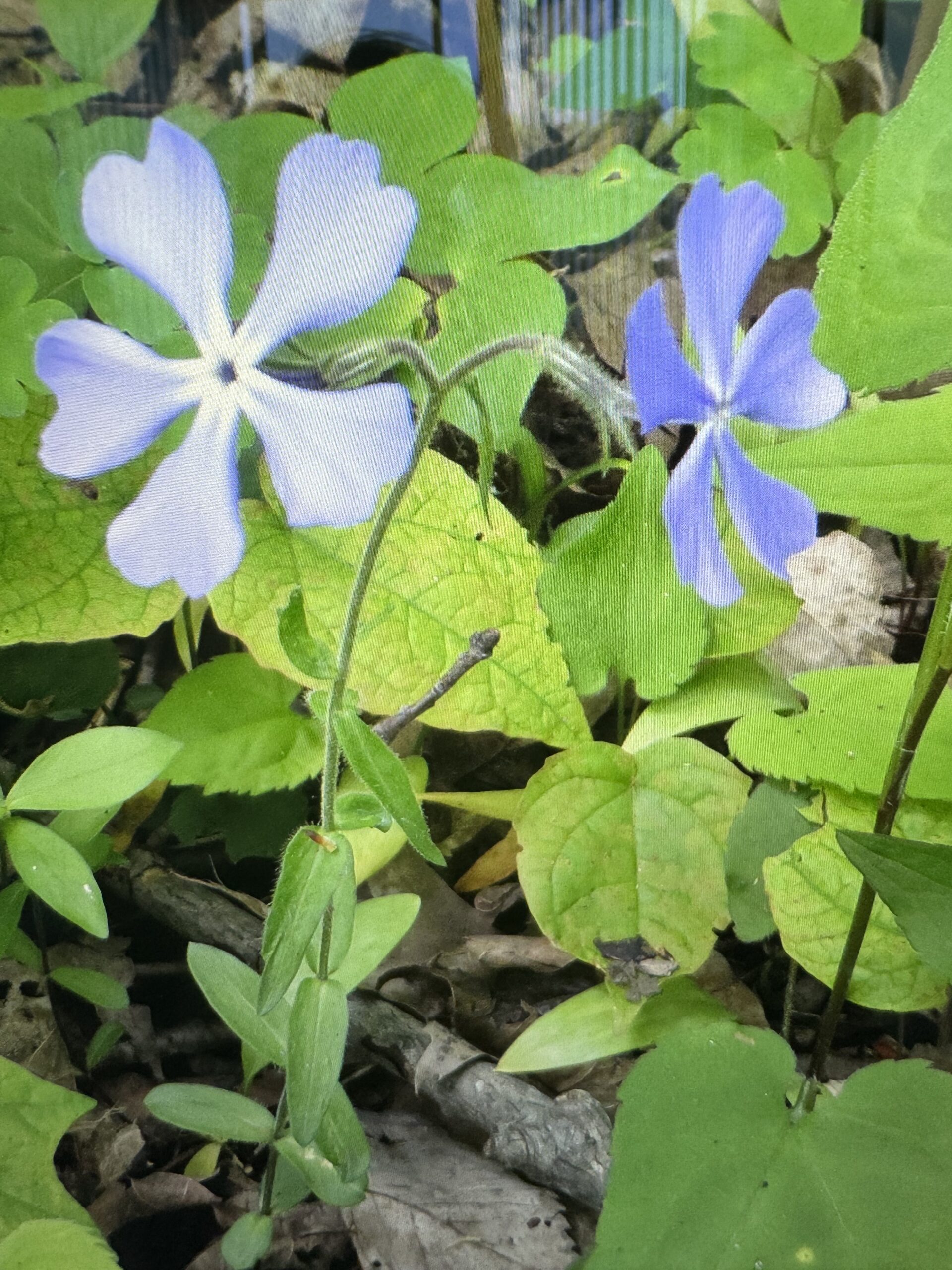
Searching for Wildflowers
https://hikesstaging.brucetrail.org/event/searching-for-wildflowers/Sorry, the registration cut-off time for this hike has been reached.Not a member? Click here to join today!Hosting Club: Iroquoia
Category: Good Companions
Location (Google Maps): Hilton Falls conservation Area Campbellville Rd. between Guelph Line and Highway 25, north of the 401Hike Leader(s): Anne Armstrong Click here to contact Hike Leader(s)
Pace: Leisurely – 3km/hr or less
Terrain: Easy – Mostly flat and usually good footing, Moderate – Some hills and/or some poor footing
Distance: Approx. 11 km.Description
This is a great area for searching for wildflowers. We will hike the many trails, especially the Beaver Meadow where the flowers grow in amongst the rocks and along the sides of the trails. Lots of ferns also grow. Meet in the main parking lot at 9:45 am. for a 10:00 am. start. Bring water, sunscreen, insect repellent and poles if using. You will need to make a reservation with Halton Conservation Authority Parks for entry.
Leader” Anne Armstrong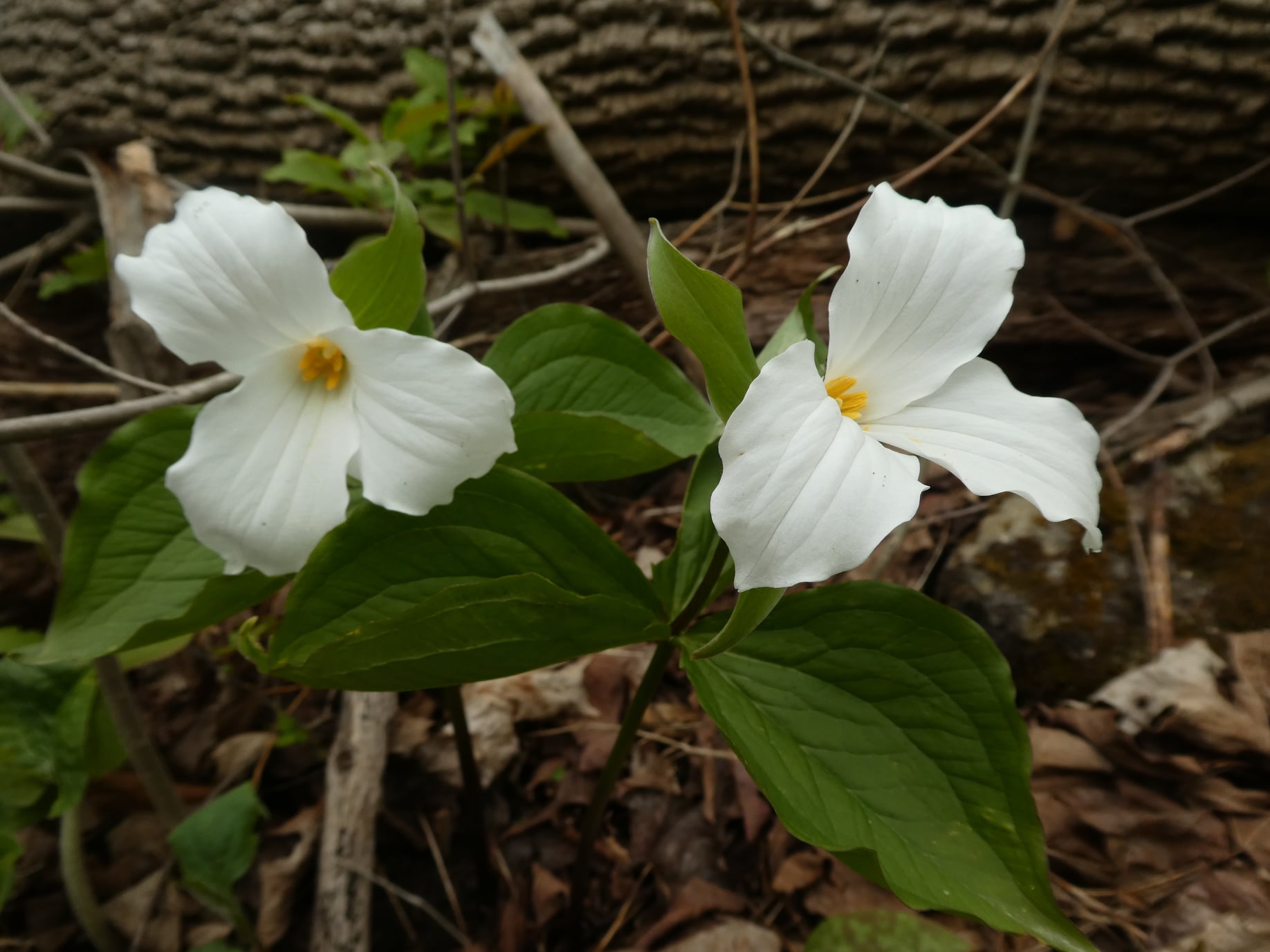
Afternoon hike - Halton Agreement Forest
https://hikesstaging.brucetrail.org/event/afternoon-hike-halton-agreement-forest-6/Sorry, the registration cut-off time for this hike has been reached.Not a member? Click here to join today!Hosting Club: Iroquoia
Category: Afternoon/Evening Hikes
Location (Google Maps): Meet roadside on 4th Line. Up Guelph Line from the 401, turn right on 10 Side Road and follow the curve as it becomes 4th Line.Hike Leader(s): Karen Bergmann Click here to contact Hike Leader(s)
Pace: Medium – 3 to 4 km/hr
Terrain: Moderate – Some hills and/or some poor footing
Distance: 6 kmsDescription
We will hike around the bike trails in this lovely Forest. Expect to see lots of Trillium and other wildflowers.