
Hike Schedule
Join us for a hike! Registration required.
All hikes available to BTC members. Some hikes are open to non-members.
See Refund Policy for Paid Hikes >
TIP: The calendar view displays up to 7 hikes on a day, but often there are more. Click “View more events” to see them all.
Categories
- 08March 8, 2025
East Point Park Bird Sanctuary, Scarborough, ON
https://hikesstaging.brucetrail.org/event/car-hike-bethesda-trail-richmond-hill-2/Sorry, the registration cut-off time for this hike has been reached.Not a member? Click here to join today!Hosting Club: Toronto
Location (Google Maps): East Point Park Bird Sanctuary, Scarborough, ON
parking lot at the end of Beech grove Dr.Hike Leader(s): Mohammad Aghamiri Click here to contact Hike Leader(s)
Pace: Moderate (3-4 km/hr)
Terrain: Flat, Variable
Distance: 12-14Description
We will hike along lake Ontario to Scarborough Bluffs.Please bring hiking poles, proper closing and shoes and lots of smile,
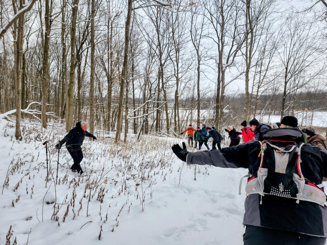
9:00 am Celebrate Winter with Tai Chi at Woodend
https://hikesstaging.brucetrail.org/event/900-am-celebrate-winter-with-tai-chi-at-woodend/Sorry, the registration cut-off time for this hike has been reached.Not a member? Click here to join today!Hosting Club: Niagara
Category: Loop
Location (Google Maps):Woodend Conservation Area – km 15.5; Enter from Taylor Rd., 140 north of Warner Rd.
Hike Leader(s): Karen Couch Click here to contact Hike Leader(s)
Pace: Medium
Terrain: Moderate
Distance: 6 kmDescription
The celebration of Winter 2025 continues! Join in a hike that includes intermittent simple Tai Chi movement breaks led by Mike VanNatter. Gaiters, hiking poles and/or icers are recommended, depending on the conditions.This hike counts as 1 of 15 needed for a 2024/2025 Winter badge.
JJ Cooper Park (Chamberlain Crescent)
https://hikesstaging.brucetrail.org/event/jj-cooper-park-chamberlain-crescent/Sorry, the registration cut-off time for this hike has been reached.Not a member? Click here to join today!Hosting Club: Blue Mountains
Category: Organized Hike
Location (Google Maps): Tim Hortons, First Street, CollingwoodHike Leader(s): David Little Click here to contact Hike Leader(s)
Pace: Medium – 3 to 4 km/hr
Terrain: Easy – Mostly flat and usually good footing
Distance: 7kmDescription
We meet at the parking lot behind Tim Horton’s on First Street in Collingwood. Then we do a car shuttle to JJ Cooper Park to begin our hike following the Black Ash Creek back to our cars.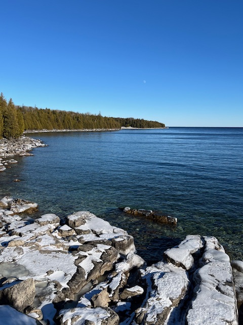
Family Day in Tobermory – Bruce Trail Hike (Rescheduled)
https://hikesstaging.brucetrail.org/event/family-day-in-tobermory-bruce-trail-hike-rescheduled/Sorry, the registration cut-off time for this hike has been reached.Not a member? Click here to join today!Hosting Club: Peninsula
Category: Winter Hikes
Location (Google Maps): Bruce Peninsula National Park at the Visitor’s Centre located at 120 Chi sin tib dek Rd, Tobermory ON. Meet at the front of the Visitor’s Centre.Hike Leader(s): Shawn Radcliffe Click here to contact Hike Leader(s)
Pace: Leisurely (2.0 – 3.0 km/h): A relaxed pace with frequent breaks and a focus on enjoyment., Medium (3.0 – 4.5 km/h): A comfortable pace for most hikers with steady progress.
Terrain: Moderate: Rolling hills, mild slopes and rocky paths.
Distance: 4.8 kmDescription
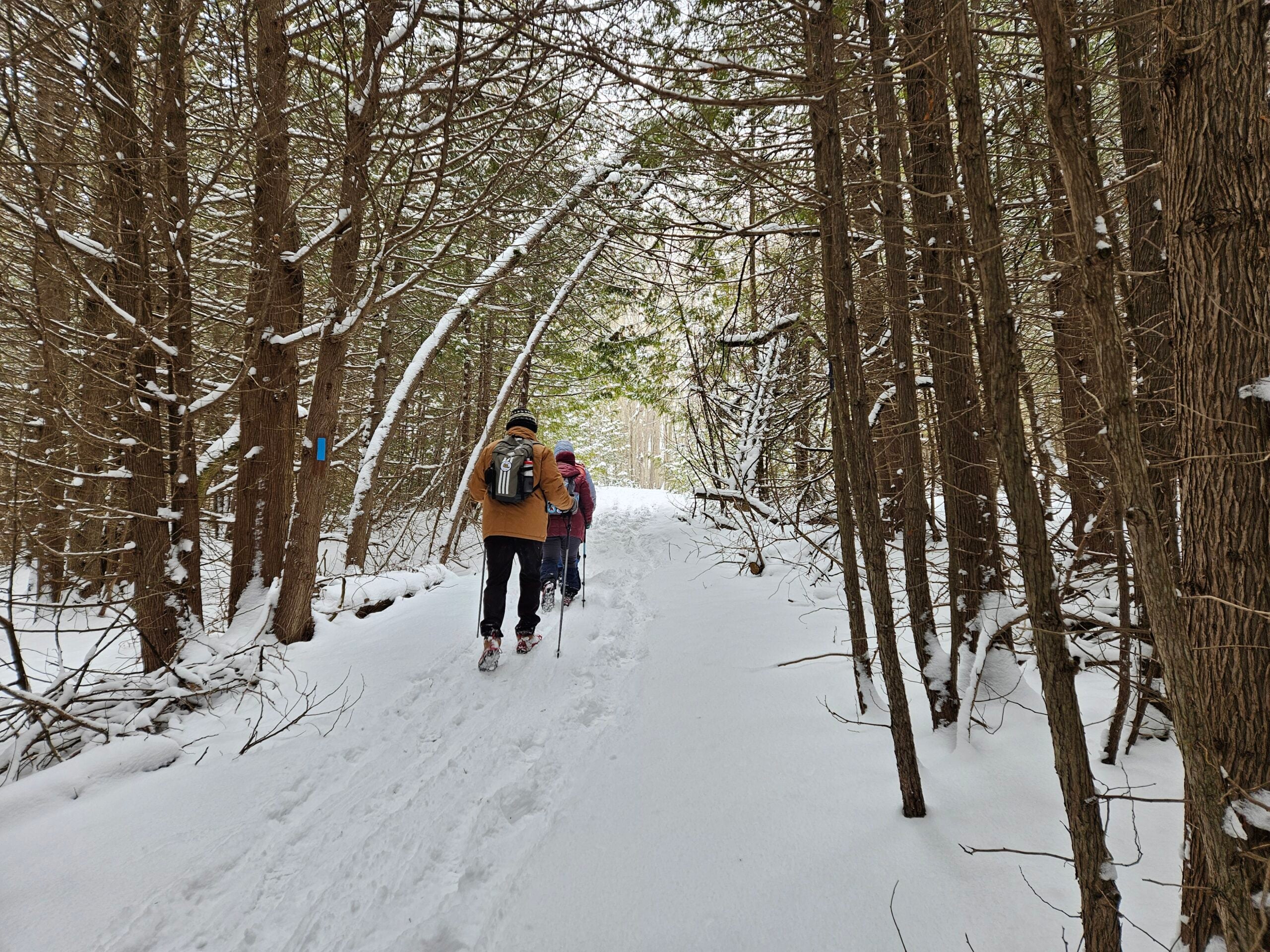
Family Day in Tobermory! Bruce Trail Hike, Campfire at the Bruce Peninsula National Park Visitor Centre and Family Activities at the Tobermory Community Centre!Our Family Day hike starts at the BPNP Visitor’s Centre. We will hike the Main Bruce Trail to the Burnt Loop Side Trail. This is a lovely winter hike (~4.8 km) through an enchanting forest with pretty views of Georgian Bay, Flower Pot and Bear’s Rump Islands taking approximately 2 1/2 hours. We will hike at steady pace with brief stops for drinks/snacks and water views.
The terrain on the first part of this trail is level, however the Burnt Loop Side Trail is a meandering, rocky trail with some short ups and downs and includes a short rocky beach section. If snow is deep, the remainder of the hike may be challenging for some. For those wishing to return to the Visitor Centre after reaching our first lookout (~1 km), a PBTC Hike Leader will return with you while the rest of the hiking group continues.
Winter hikes require extra thought and preparation. Weather can be unpredictable. Be prepared to bring snowshoes, icers and gators (optional). Hiking poles are essential for winter hikes. Make sure to wear layers of clothing, warm winter hat, winter hiking boots and mittens. Bring a light backpack for water and snacks.
Don’t have your own snowshoes? No problem! Arrive early to the Park Visitors Centre to borrow a pair of snowshoes for this hike (limited supplies).
After the hike, everyone is welcome to gather together by the fireplace or outdoor campfire at the Visitor’s Centre. Indoor washrooms are available here. The hike is free. However, park admission and parking fees apply.
Saturday Shorts: Riverside Woods Nature Reserve
https://hikesstaging.brucetrail.org/event/saturday-shorts-riverside-woods-nature-reserve-2/Sorry, the registration cut-off time for this hike has been reached.Not a member? Click here to join today!Hike open to BTC Members only.
Hosting Club: Caledon Hills
Category: General
Location (Google Maps): Meet at 10 am at the BTC parking lot, 713377 1st Line EHS, Mono. Go north on 1st Line from Side Road 5. Access is closed going south on 1st Line from Hockley Road during the winter. It is best to aim for arriving around 9:45, so we can start hiking as close to 10 am as possible. Thanks!Hike Leader(s): Elizabeth Ganong Click here to contact Hike Leader(s)
Pace: Medium – 3 to 4 km/hour
Terrain: Moderate – some hills and/or some poor footing
Distance: Between 4 and 5 kmDescription
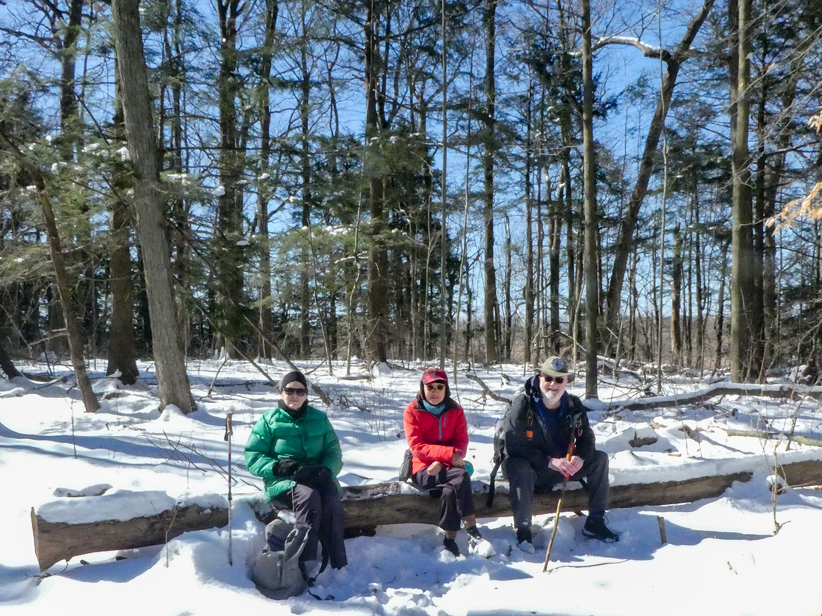
Looking to get out on a Saturday but not give up your whole day? Saturday Shorts, a hiking series, will get you out in a small group on a short hike. This Saturday’s hike explores Riverside Woods on side trails and gentler nature reserve trails on a 4 or 5 km route. Be prepared for winter conditions by bringing warm gear, poles, and icers. You are encouraged to bring water and a snack. No dogs please.Registrants can expect a reminder/update message one or two days before the hike.
If desired, this hike may be used towards the Caledon Winter Hiking Badge (5 winter hikes in the Caledon section that are 1 ½ hours or longer in length). Please keep a log of your hikes and follow the directions on the CHBTC website under Club Badges to receive your badge.
Urban Walk: Waterfront Trail 9/11 – Ajax GO to Pickering GO
https://hikesstaging.brucetrail.org/event/urban-walk-waterfront-trail-9-11-ajax-go-to-pickering-go-2/Sorry, the registration cut-off time for this hike has been reached.Not a member? Click here to join today!Hike open to BTC Members only.
Hosting Club: Toronto
Category: GO Train Hike
Location (Google Maps): CanadaHike Leader(s): Brian Rideout Click here to contact Hike Leader(s)
Pace: Moderate (3-4 km/hr)
Terrain: Flat
Distance: 11 kmDescription
Please join me under the clock in the Great Hall at Union Station by 9:05 am. We will take the eastbound Lakeshore Train departing Union Station GO at 9:20 am, arriving Ajax GO at 10:15 am. You may choose to join the group at Ajax GO Station.We will hike south to Lake Ontario (washrooms in the park), west to Sandy Beach Rd, and north to Bayly St with a pub stop at Irish Times adjacent to Pickering GO. Trains to Toronto depart at 25 minutes and 55 minutes after the hour.
Here is an online map of our route (please click on the link): Ajax to Pickering
You can buy a GO Transit day pass for $10.
Make Up Hike Winter Badge Series Hike 4 of 4
https://hikesstaging.brucetrail.org/event/make-up-hike-winter-badge-series-hike-4-of-4/Sorry, the registration cut-off time for this hike has been reached.Not a member? Click here to join today!Hosting Club: Dufferin Hi-Land
Category: General Hike
Location (Google Maps): Map 19 Km 6.8 Ed. 31 Bottom of 1st Line EHS, 2 km South of 25 SideroadHike Leader(s): Bryan and Carol Foley Click here to contact Hike Leader(s)
Pace: Medium
Terrain: Moderate
Distance: 8.5 kmDescription
NOTE THIS IS A MAKE UP HIKE FOR THOSE WHO HAVE DONE THE FIRST 3 HIKES OR THOSE WHO PREVIOUSLY REGISTERED ONLY. This is a on/off trail hike SNOW SHOES ARE MANDATORY. Parking is limited I will guide hikers so all cars will fit within the legal boundaries. Mind the Ditches Bring snowshoes, water, Headlamp Dress appropriately for the weather. Please arrive by 6:15 pm ready to go at 6:30 - 09March 9, 2025
Terra Cotta/Heritage Road loop
https://hikesstaging.brucetrail.org/event/terra-cotta-heritage-road-loop/Sorry, the registration cut-off time for this hike has been reached.Not a member? Click here to join today!Hosting Club: Iroquoia
Category: General Hike
Location (Google Maps): Roadside on Winston Churchill Blvd, just north of Terra Cotta Conservation Area. Meet at 9:15 am, earlier if you can, as parking is limited.Hike Leader(s): Karen Bergmann Click here to contact Hike Leader(s)
Pace: Medium – 3 to 4 km/hr
Terrain: Moderate – Some hills and/or some poor footing
Distance: 8.5 kmsDescription
Hiking along the main trail, across Heritage Rd and around to the Rockside Side Trail and back on the main trail to the cars. This trail has some easy parts and some challenging rocky parts, so come prepared. There’s a bit of road walking. Bring icers for your boots.10:00 Behind Brock
https://hikesstaging.brucetrail.org/event/1000-behind-brock-5/Sorry, the registration cut-off time for this hike has been reached.Not a member? Click here to join today!Hosting Club: Niagara
Category: In and Out
Location (Google Maps): decew house Decew Road. West of Meritt HighwayHike Leader(s): Sylvia Wheeler Click here to contact Hike Leader(s)
Pace: Medium
Terrain: Moderate
Distance: 10 kmDescription
Urban Walk: Waterfront Trail 8/11 – Beechgrove (Port Union) to Pickering
https://hikesstaging.brucetrail.org/event/urban-walk-waterfront-trail-8-11-beechgrove-to-pickering/Sorry, the registration cut-off time for this hike has been reached.Not a member? Click here to join today!Hosting Club: Toronto
Category: GO Train Hike
Location (Google Maps): CanadaHike Leader(s): Brian Rideout Click here to contact Hike Leader(s)
Pace: Moderate (3-4 km/hr)
Terrain: Flat
Distance: 11.9 kmDescription
Please meet me at Kennedy Station by 10:04 am. We will take the 86 Scarborough bus departing 10:19 am. We will transfer to the 54 Lawrence Ave bus, arriving at Port Union Rd at 10:54 am. We start hiking 11:00 am.We will hike south to Lake Ontario and along the Waterfront Trail through Port Union and Rouge Hill to Pickering GO. The estimated distance is 9.8 km. Here is an online map of our route – Port Union to Pickering.
Bring a snack, at least 2 liters of water, and icers. Dress for cold weather.
Kemble Wetlands
https://hikesstaging.brucetrail.org/event/kemble-wetlands/Sorry, the registration cut-off time for this hike has been reached.Not a member? Click here to join today!Hosting Club: Sydenham
Category: Snowshoe Hike
Location (Google Maps): Georgian BluffsHike Leader(s): Danuta Valleau Click here to contact Hike Leader(s)
Pace: Leisurely: 3 km/h or less
Terrain: Moderate: Some hills and/or poor footing
Distance: approx 4 kmDescription
Conditions will dictate whether or not this will be a snowshoe hike. After meeting at the Galaxy in Owen Sound (don’t forget to arrive 15 min early) we will carpool to the start of the hike.The conditions are likely to be wet in places but there are several options (side trails) on the property that will afford great views and some rocky trails. Walking poles or sticks are an asset.
- 10March 10, 2025
Blue Loop Hikes #1 - City View Park
https://hikesstaging.brucetrail.org/event/blue-loop-hikes-1-city-view-park/Sorry, the registration cut-off time for this hike has been reached.Not a member? Click here to join today!Hosting Club: Iroquoia
Category: General Hike
Location (Google Maps): City View Park Parking LotHike Leader(s): Pati Greenwood, Jeff Dowsett Click here to contact Hike Leader(s)
Pace: Medium – 3 to 4 km/hr
Terrain: Moderate – Some hills and/or some poor footing
Distance: 11 kmDescription
This is a series of loop hikes exploring various BT Blue trails in wintry and early spring conditions. Join us for one, some or all.Today’s hike will follow the main trail and explore the Eric Best, King, and City View Park Side Trails in an 11 km loop.
Bring a snack and plenty of water, and other hydration as needed. Wear hiking boots and bring hiking poles. Icers may also be required.
Please arrive at the meeting place by 8:15 am as we will leave promptly at 8:30 am.

Avon Trail End to End (+ the Side Trails)
https://hikesstaging.brucetrail.org/event/avon-trail-end-to-end-the-side-trails/Sorry, the registration cut-off time for this hike has been reached.Not a member? Click here to join today!This is a Multi-Day Hike
You are signing up for the following dates:
2025-03-10, 2025-03-11, 2025-03-12, 2025-03-13, 2025-03-14, 2025-03-15, 2025-03-16Hosting Club: Iroquoia
Category: Special Event
Location (Google Maps): Conestogo to St. Mary’sHike Leader(s): Ruth Moffatt Click here to contact Hike Leader(s)
Pace: Brisk – 4 to 5 km/hr, Medium – 3 to 4 km/hr
Terrain: Dependent on Conditions, Moderate – Some hills and/or some poor footing
Distance: Varies 20-24km per dayDescription
Occasionally hikes are offered outside of the Bruce Trail as a way to reach our members that live in other areas. It is also a way to highlight other hiking trails in Ontario and to promote/support them.Please join us for an end to end hike on the Avon Trail from March 10 until March 16. We will start in Conestogo and make our way to St. Mary’s and hike the side trails along the way (with the exception of the Wildwood South Trail). The total distance over the 7 days is about 153km. Please do not overestimate your ability for this series of hikes. It is a group hike but everyone is expected to keep pace with the person in front of them. Please do not register for this hike unless you can commit to all 7 days.
Please bring ample water and enough food for a full day hike. There will be a short morning break and lunch break. Everyone is expected to participate in the car shuttle in a fair manner – please ensure you have a minimum of 4 seatbelts available.
Membership with the Avon Trail is strongly encouraged. https://avontrail.ca/membership-levels/
If you are looking to complete other trails for the Hike Ontario badges, this one will fit in nicely. https://hikeontario.com/programs/long-distance-hiker-awards/
Completion of this series will qualify you for 2 badges plus the 50th anniversary badge (optional). Please note, if you have not completed the Wildwood Challenge club fundraiser held in October each year, you can complete the Wildwood South Trail 11.5km during this week and I will provide a shuttle for you.

Sweetwater Series - Hike 1 - Terra Cotta
https://hikesstaging.brucetrail.org/event/sweetwater-series-hike-1-terra-cotta/Sorry, the registration cut-off time for this hike has been reached.Not a member? Click here to join today!Hosting Club: Caledon Hills
Category: General
Location (Google Maps): P1 – At Terra Cotta Conservation Area (entry fee – $8 per person at the gate)14452 Winston Churchill Blvd, Halton Hills
Hike Leader(s): Jennie Greenfield; Elizabeth Ganong Click here to contact Hike Leader(s)
Pace: Medium – 3 to 4 km/hour
Terrain: Moderate – some hills and/or some poor footing
Distance: 6 kmDescription
This series of five hikes celebrates the glorious sugar maple as we move from winter towards spring. The trails are all in or near the Caledon section of the Bruce Trail and range from 7 to 10 km in length.Register individually for one, a few, or all of the Sweetwater Badge Hikes taking place on Mondays.
Participants who complete the five hikes will be eligible to receive a Sweetwater badge. (Note: If you wish to purchase a badge, the cost is $10.00 for BTC members and $15.00 for non-members.)
Hike 1 is a loop hike on the Terra Cotta Conservation Area trails past some tap lines and a sugar shack.
Moderate – difficult under winter conditions
Bring your choice of hydration and snacks. Hiking boots and icers/crampons are required.
Participants will be notified the night before if a hike must be cancelled due to inclement weather.
Ross McLean Loop
https://hikesstaging.brucetrail.org/event/ross-mclean-loop/Sorry, the registration cut-off time for this hike has been reached.Not a member? Click here to join today!Hosting Club: Sydenham
Category: Snowshoe Hike
Location (Google Maps): Roadside parking at the end of Lundy Road. Please do not block the lane access for farm machinery. Parking location is found on map 34 and is provided in the gps information.Hike Leader(s): Cindy Paczkowski Click here to contact Hike Leader(s)
Pace: Leisurely: 3 km/h or less
Terrain: Moderate: Some hills and/or poor footing, There might be icy and slippery sections., There might be muddy sections., There might be sections with water on the trail.
Distance: 3 kmDescription
This hike has some interesting geological features including fossils and an underground waterfall. We skirt the shore of Bass Lake with some beautiful views. This hike also holds a clue if you are doing the Exploring Sydenham challenge. Bring both snowshoes and hiking spikes. I imagine we will still have lots of snow left in March this year! - 11March 11, 2025
Caledon Double End to End Challenge and Fundraiser
https://hikesstaging.brucetrail.org/event/caledon-double-end-to-end-challenge-and-fundraiser/Sorry, the registration cut-off time for this hike has been reached.Not a member? Click here to join today!Hike open to BTC Members only.
This is a Multi-Day Hike
You are signing up for the following dates:
2025-03-11, 2025-03-12, 2025-03-13, 2025-03-18, 2025-03-19, 2025-03-20Hosting Club: Caledon Hills, Sydenham
Category: Fundraiser
Location (Google Maps): First Hike Only: Roadside parking at the north end of Chinguacousy RdHike Leader(s): Margaret O’Dell Click here to contact Hike Leader(s)
Pace: Brisk: 4 to 5 km/h, Fast: more than 5 km/h
Terrain: Strenuous: Hilly with steep climbs and some poor footing.Description
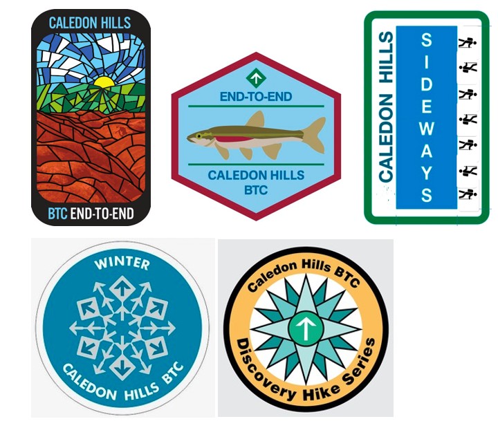
Join me on this fundraising series to complete two End to Ends of Caledon in March earning both the new Caledon Stained Glass badge and the Redside Dace E2E badge. The cost of both badges is included in your registration fee.Over 6 scheduled hikes, we will hike out and back to complete two End to Ends of the Caledon Hills Bruce Trail section from Cheltenham Badlands to Mono Centre.
A detailed schedule with meeting locations will be sent prior to the start of the series.
There is no car shuttle. We will meet at a convenient location between the start and finish points.
This is a challenger series. Hikes will average 24 km in distance and we will be hiking at a brisk to fast pace, depending on the conditions of the trail. Be sure of your ability prior to joining this series. There are no Refunds!
If there is a risk of inclement weather affecting road conditions, the hike leader will reschedule the hike. Make-up dates will be discussed with registrants.
If you have any questions or concerns about this series, please contact me using the Contact form.
Caledon Hills Fandango Pentango (9 hikes, 5 badges)
https://hikesstaging.brucetrail.org/event/caledon-hills-fandango-pentango-9-hikes-5-badges/Sorry, the registration cut-off time for this hike has been reached.Not a member? Click here to join today!Hike open to BTC Members only.
This is a Multi-Day Hike
You are signing up for the following dates and times:
2025-03-11 at 08:15
2025-03-12 at 08:15
2025-03-13 at 08:15
2025-03-18 at 08:15
2025-03-19 at 08:15
2025-03-25 at 08:15
2025-03-26 at 08:15
2025-04-01 at 08:15
2025-04-02 at 08:15Hosting Club: Caledon Hills
Category: End-to-End
Location (Google Maps): Mono Community Centre (County Rd. 8)Hike Leader(s): Heather Murch Click here to contact Hike Leader(s)
Pace: Brisk – 4 to 5 km/hour
Terrain: Strenuous – hilly with steep climbs and some poor footing
Distance: 21.1 kmDescription
It’s been 5 years since the Quadrango Fandango and so it seems fitting the hike series be renamed to celebrate those 5 years! There will be 5 badges awarded to those who complete 9 hikes over 4 weeks; mostly on Tuesday/Wednesday.March 11/12/13, 18/19/25/26 and April 1 & 2 with the 3rd held in reserve should we need to cancel a hike due to inclement weather.
The hikes are no more than 22 km.
The registration fee includes 5 badges.
Exciting new badges:
1. Badlands Stained Glass series (fundraiser E2E) $30
2. Redside Dace, a little at-risk fish (independent E2E) $10
3. Sideways (40 km of side trails) $10
We will also meet the requirements for:
4. Frosty-Five badge (5 hikes by Mar 20) $10
5. Discovery badge (learn along the way!) $10Participants must be BTC members and pay for all badges ($70) when registering; as a fundraiser for the Caledon Hills Club of the BTC. The badges will be awarded on the final hike of the series.
There will be no shuttling; all hikes are in & out so you can make up a hike on your own if needed. Carpooling is encouraged to minimize parking requirements. We’ll start in the north at the Mono Community Centre. The hikes range from 17.9 to 21.6 km. I’ll send out the full itinerary a few days before we start.
Expect winter conditions – icers are required and snow shoes are recommended. You’ll need layered clothing, boots & poles and a raincoat. Bring lots of water, a snack and lunch. You’ll want to arrive by 8:00 am as the hikes start at 8:15 sharp.
Also expect to have fun! We will be challenged by Caledon Hills in the winter and we will also do some learning along the way. I’m looking forward to this adventure!
Urban Walk: Valley View Park Thornhill
https://hikesstaging.brucetrail.org/event/urban-walk-valley-view-park-thornhill-62/Sorry, the registration cut-off time for this hike has been reached.Not a member? Click here to join today!Hosting Club: Toronto
Location (Google Maps): Parking lot is inside Sycamore Drive East of Bayview , north of Bayview Reservoir Park Playground
Hike Leader(s): Mohammad Aghamiri Click here to contact Hike Leader(s)
Pace: Moderate (3-4 km/hr)
Terrain: Level 2 (Intermediate – some hills and uneven surfaces, rocks and roots underfoot)
Distance: 7-8 kmDescription
We will explore Valleyview and Maple View parks, and walk along German Mill Creak,In return we stop in Huntington park and have snack under beautiful shed ,Even it is considered Urban walk, but it is urban hike as we have some up and down hills and tree roots, please bring your Ice cleats and hiking poles
9:00 Long Hike Louth CHANGE OF LOCATION
https://hikesstaging.brucetrail.org/event/900-long-hike-wiley-road-short-hills-49/Sorry, the registration cut-off time for this hike has been reached.Not a member? Click here to join today!Hosting Club: Niagara
Location (Google Maps): Staff Avenue Jordan
Hike Leader(s): Alan Laver Click here to contact Hike Leader(s)
Pace: Medium
Terrain: Moderate
Distance: 10kmDescription
Change of Location due to flooding at ShorthillsBring Poles, Icers, snack, and dress for the weather
9:15 Short Hike, Rotary Park
https://hikesstaging.brucetrail.org/event/915-short-hike-short-hills/Sorry, the registration cut-off time for this hike has been reached.Not a member? Click here to join today!Hosting Club: Niagara
Category: In and Out
Location (Google Maps): 376 Regional Road 69 (Pelham Road), St. Catharines L2S OA2Hike Leader(s): Sheila Massey Click here to contact Hike Leader(s)
Pace: Medium
Terrain: Moderate
Distance: 6 kmDescription
Hike the main and side trails in Short Hills Provincial Park. Wear hiking boots and bring water. In the event of icy conditions, it is highly recommended to wear icers.Scotsdale Farm
https://hikesstaging.brucetrail.org/event/scotsdale-farm-2/Sorry, the registration cut-off time for this hike has been reached.Not a member? Click here to join today!Hosting Club: Dufferin Hi-Land
Category: Tuesday Hike
Location (Google Maps): (Google Maps) Toronto Section, Map 13. Meet at the Scotsdale Farm parking lot, northeast of Trafalgar Rd, about 1 km north of 27 Sideroad.Hike Leader(s): Tony Evangelista, Inge Eskerich, Julie Daley, Les Babbage Click here to contact Hike Leader(s)
Pace: Medium
Terrain: Moderate, Slippery Sections Likely
Distance: 9.3 km or 4.2 kmDescription
We will hike the Main, Bennett Heritage, and Maureen Smith Side Trails loop. The shorter hike will loop back on the Maureen Smith and Main Trail at Eighth Line.Bring water and snacks. Icers or snowshoes may be required. Hiking poles are recommended.
Optional coffee/lunch stop after the hike–Main Street Market in Glen Williams
Halton Agreement Forest
https://hikesstaging.brucetrail.org/event/halton-agreement-forest-10/Sorry, the registration cut-off time for this hike has been reached.Not a member? Click here to join today!Hosting Club: Iroquoia
Category: General Hike
Location (Google Maps): Meet at the corner of 10 Side Road and 4th Line at 9:15 am.Hike Leader(s): Karen Bergmann Click here to contact Hike Leader(s)
Pace: Medium – 3 to 4 km/hr
Terrain: Moderate – Some hills and/or some poor footing
Distance: 8 kmsDescription
We will hike the bike trails around a big loop. Bring icers. Hike is dependent on weather.City View Park to Waterdown
https://hikesstaging.brucetrail.org/event/city-view-park-to-waterdown/Sorry, the registration cut-off time for this hike has been reached.Not a member? Click here to join today!Hosting Club: Caledon Hills
Category: Tuesday Hikers
Location (Google Maps): Meet at City View Park in Burlington. BTC Map 9. From QEW come north on Brant St., then left at Dundas. Then left at Kerns Rd. Enter City View Park at the second entrance on Kerns Rd. south of Dundas St.Hike Leader(s): Peter Leeney Click here to contact Hike Leader(s)
Pace: Medium – 3 to 4 km/hour
Terrain: Moderate – some hills and/or some poor footing
Distance: 10 kmDescription
From City View Park we will hike west to Waterdown, return by the same route.