
Hike Schedule
Join us for a hike! Registration required:
All hikes available to BTC members. Some hikes are open to non-members.
TIP: The calendar view displays up to 7 hikes on a day, but often there are more. Click “More events” to see them all.
Categories
- 03January 3, 2025
Car Hike: Iroquoia winter E2E 4/6
https://hikesstaging.brucetrail.org/event/car-hike-iroquoia-winter-e2e-4-6-2/Sorry, the registration cut-off time for this hike has been reached.Not a member? Click here to join today!Hike open to BTC Members only.
Hosting Club: Toronto
Category: Car Hike
Location (Google Maps):West of km 77.1 on Dundas St. N 43.357909,W 79.862011
Hike Leader(s): Smadar Junkin Click here to contact Hike Leader(s)
Pace: Brisk (4-5 km/hr)
Terrain: Level 2 (Intermediate – some hills and uneven surfaces, rocks and roots underfoot)
Distance: 19 kmDescription
4th hike of the Iroquoia winter E2E. We will car shuttle to Sydenham Lookout and hike back. Please bring icers, snowshoes and 2 litres of water. Hike date may changed due to bad winter conditions. Be 15 minutes early. Expect to be moving at a pace of 4.5 km per hour.
Niagara-on-the-Lake Tour
https://hikesstaging.brucetrail.org/event/niagara-on-the-lake-tour/Sorry, the registration cut-off time for this hike has been reached.Not a member? Click here to join today!Hosting Club: Niagara
Category: Urban
Location (Google Maps): Park on King St near Centre St, just outside of Veteran’s Memorial ParkHike Leader(s): Margaret Northfield Click here to contact Hike Leader(s)
Pace: Medium
Terrain: Easy
Distance: 6-7kmDescription
Each Friday we will explore different neighbourhoods, trails and parkland throughout Historic Niagara-on-the-Lake.Moderate pace with some weeks entirely on sidewalks and roads while others may include a mix of trails and paved pathways. Great way to build up endurance for longer more strenuous hikes.
Prepare for cooler windy conditions on open parkland and along Lake Ontario and Niagara River trails.
Plan to stay for conversation and a warm cup of coffee or tea at Sweets & Swirls, Community Centre, Niagara Stone Road, NOTL
Margaret Northfield & Robin Garrett
Pop-Up Scotsdale Farm to Limehouse Hike
https://hikesstaging.brucetrail.org/event/pop-up-scotsdale-farm-to-limehouse-hike/Sorry, the registration cut-off time for this hike has been reached.Not a member? Click here to join today!Hosting Club: Dufferin Hi-Land
Category: General Hike
Location (Google Maps): Parking Lot across from Limehouse Public School on south side of 22 Sideroad near the wooden fence around the old junkyard.Hike Leader(s): Stuart Law Click here to contact Hike Leader(s)
Pace: Medium
Terrain: Slippery and Steep Sections, Moderate
Distance: 18 kmsDescription
Join us for a walk in the woods from Scotsdale Farm to Limehouse taking in the main trail and some side trails. There will be snow on the ground so please make sure you have your icers on. Please bring a smile, a warm drink, some water, a snack and a lunch. This is a shuttle hike so please be prepared to drive other hikers and please bring a garbage bag and change of footwear for drive at the end of the hike.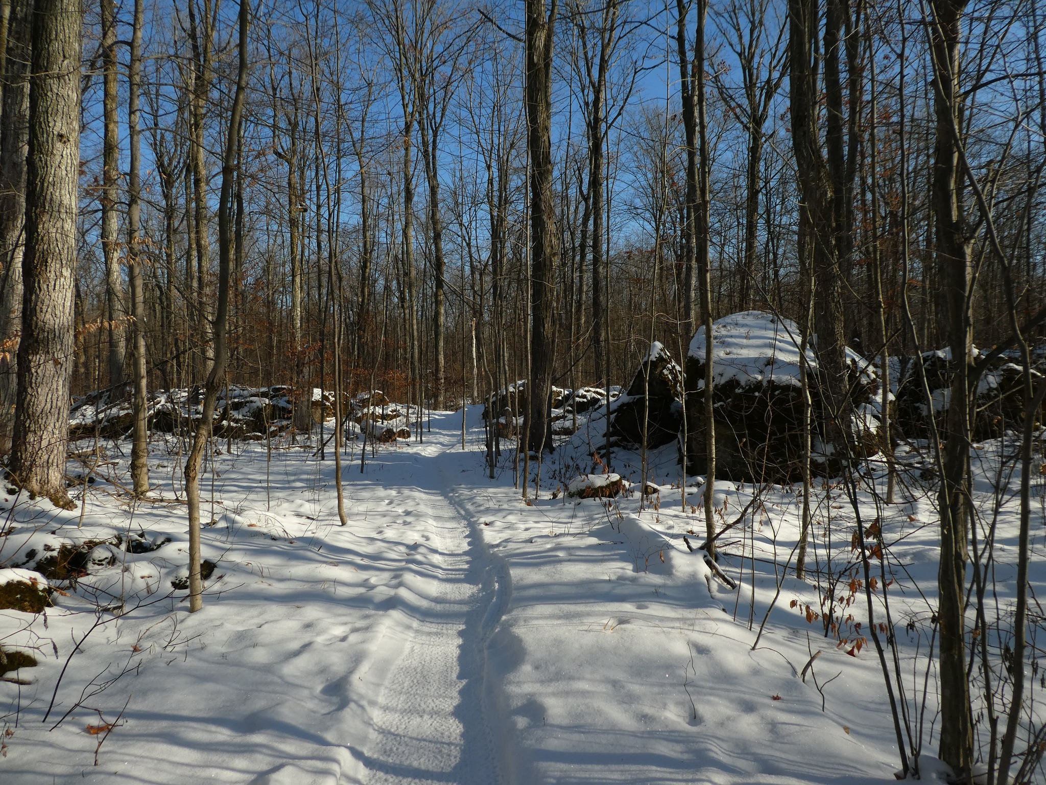
Halton Agreement Forest
https://hikesstaging.brucetrail.org/event/halton-agreement-forest/Sorry, the registration cut-off time for this hike has been reached.Not a member? Click here to join today!Hosting Club: Iroquoia
Category: General Hike
Location (Google Maps): Meet at the corner of 10 Side Road and 4th Line at 9:15 am.Hike Leader(s): Karen Bergmann Click here to contact Hike Leader(s)
Pace: Medium – 3 to 4 km/hr
Terrain: Moderate – Some hills and/or some poor footing
Distance: 8 kmsDescription
We will hike the bike trails around a big loop. Bring icers. Hike is dependent on weather. - 04January 4, 2025
Niagara Winter End to End Challenge series
https://hikesstaging.brucetrail.org/event/niagara-winter-end-to-end-challenge-series/Sorry, the registration cut-off time for this hike has been reached.Not a member? Click here to join today!Hike open to BTC Members only.
This is a Multi-Day Hike
You are signing up for the following dates:
2025-01-04, 2025-01-05, 2025-01-18, 2025-01-19, 2025-02-02, 2025-02-08, 2025-02-09Hosting Club: Niagara, Sydenham
Category: Fundraiser
Location (Google Maps): Hike #1 only: Firemen’s Park – km 7.0 Enter from Dorchester Rd, 1km north of Mountain Rd
Schedule will be provided for remaining meeting locationsHike Leader(s): Margaret O’Dell Click here to contact Hike Leader(s)
Pace: Brisk: 4 to 5 km/h, Fast: more than 5 km/h
Terrain: Moderate: Some hills and/or poor footing, Strenuous: Hilly with steep climbs and some poor footing., There are crevices or holes which may be hidden by layers of snow. Hike with extreme caution., There might be icy and slippery sections., There might be muddy sections.Description
Join me on this fundraising series to complete two End to Ends of Niagara during the winter months, thereby earning a trifecta of badges.Over the 7 scheduled hikes, we will hike out and back to complete the Niagara Stained Glass End to End badge, the Winter End to End badge, and the Winter badge for hiking 15 hikes during the winter season.
A detailed schedule with meeting locations will be sent prior to the start of the series.
There is no car shuttle. We will meet at one end, hike out and back, or at a convenient location between the start and finish points.
This is a challenger series. Hikes will average between 21 and 25 km in distance and we will be hiking at a brisk to fast pace, depending on the conditions of the trail. Be sure of your ability prior to joining this series. There are no Refunds!
You must be present for the entire series in order to earn all the badges. In addition to the $30 fee for the Stained Glass badge, the Hike Leader will collect funds ($10 per badge) for Winter E2E and Winter badge prior to the end of the series, and submit the names and log of hikes to NBTC directly.
If the temperature is expected to trend below 15C and/or inclement weather is forecast that will affect road conditions, the hike leader will reschedule the hike. March 1st and 2nd will be the rescheduled dates if needed.
Equipment: Dress for winter: Layers! Waterproof boots, gaiters, icers, poles, are recommended. Carry adequate hydration and readily accessible snacks. Pack extra socks, extra gloves/mitts. We will be on the trail for upwards of 5-6 hours and will keep moving as much as possible to keep warm and complete the hike.
If you have any questions or concerns about this series, please contact me using the Contact form.
Car Hike: Glasgow Village Uxbridge
https://hikesstaging.brucetrail.org/event/car-hike-glasgow-village-uxbridge-2/Sorry, the registration cut-off time for this hike has been reached.Not a member? Click here to join today!Hosting Club: Toronto
Category: Car Hike
Location (Google Maps): Free parking lot at South intersection of Webb Road and Conssetion Road 3Hike Leader(s): Mohammad Aghamiri Click here to contact Hike Leader(s)
Pace: Moderate (3-4 km/hr)
Terrain: Hilly, Level 2 (Intermediate – some hills and uneven surfaces, rocks and roots underfoot)
Distance: 14-15kmDescription
It is winter time bring your icers and proper clothing with you
School Bus Hike: Hilton Falls
https://hikesstaging.brucetrail.org/event/school-bus-hike-hilton-falls/Sorry, the registration cut-off time for this hike has been reached.Not a member? Click here to join today!Trip Information
Departure Time: 08:30
Return to City Time: 17:30
Departure Point: York Mills Bus PickupOptional Items
Admission To Hilton Falls Conservation Area - Adult ($10.50 Less 20% Group Disc.) ($8.40)
Admission To Hilton Falls Conservation Area - Senior ($8.25 Less 20% Group Disc.) ($6.60)
Admission To Hilton Falls Conservation Area - Child ($7.25 Less 20% Group Disc.) ($5.75)Hosting Club: Toronto
Category: Bus Hike
Location (Google Maps): Hilton Falls Conservation Area, MiltonHike Leader(s): Tom Swales, Celia Ho Click here to contact Hike Leader(s)
Pace: Moderate (3-4 km/hr)
Terrain: Level 2 (Intermediate – some hills and uneven surfaces, rocks and roots underfoot), Variable
Distance: 10-12 kmDescription
Join us on our first Saturday hike of 2025 to explore Hilton Falls Conservation Area near Milton, ON. Depending on conditions we will hike the Hilton Falls Trail (to the falls!), the 8 km Beaver Dam Loop, and the Red Oak Trail. Icers will be mandatory. Bring snowshoes, if you have them (if they will be useful will be determined based on amount of snowfall at the time). There will be a 45-60 minute refreshment stop in Milton after the hike before returning to Toronto. Fit beginners with icers and appropriate clothing for the weather conditions welcome. Note: A Fee will be charged for Conservation Area entry (will be collected on the bus). Conservation Halton will providing group discounted rates. Upon registration please select adult, senior, or child (up to high school age) rate so the total rate for the bus can be calculated.Car Hike: Scotsdale Farm!
https://hikesstaging.brucetrail.org/event/car-hike-scotsdale-farm-10/Sorry, the registration cut-off time for this hike has been reached.Not a member? Click here to join today!Hosting Club: Caledon Hills
Category: General
Location (Google Maps): Scotsdale Farm, Map 13. Directions; from Highway 401, head north on Trafalgar Road past Georgetown. Trafalgar briefly merges with Highway 7 for about 3 km before separating to the right at the village of Silver Creek. At the stop light in Silver Creek, continue north on Trafalgar Road for about 1 km to the entrance of Scotsdale Farm on your right. Drive in about half a kilometre to reach the parking area.Hike Leader(s): Dylan “Lana” Hubbard Click here to contact Hike Leader(s)
Pace: Medium – 3 to 4 km/hour
Terrain: Moderate – some hills and/or some poor footing
Distance: 13 kmDescription
Join us for a loop hike along the main Bruce Trail and its scenic side trails, including the stunning Great Esker Side Trail. After the hike, if enough people are interested, we’ll gather at The Shepherd’s Crook in Georgetown for refreshments and good company.Please dress appropriately for the weather, bring plenty of water, and pack some snacks. Note that parts of the trail are rocky, so poles are highly recommended.
ICERS ARE REQUIRED.
We are committed to fostering an inclusive and welcoming environment. This hike is an LGBTQ+ safe space, and everyone is encouraged to join us!
Chedoke to Iroquoia Heights
https://hikesstaging.brucetrail.org/event/chedoke-to-iroquoia-heights/Sorry, the registration cut-off time for this hike has been reached.Not a member? Click here to join today!Hosting Club: Iroquoia
Category: General Hike
Location (Google Maps): Chedoke Parking Lot, Hamilton, ONHike Leader(s): Mike Gill Click here to contact Hike Leader(s)
Pace: Medium – 3 to 4 km/hr
Terrain: Moderate – Some hills and/or some poor footing
Distance: 10kmDescription
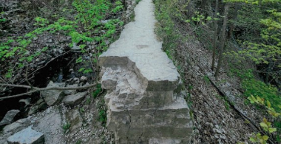
Meeting at the Chedoke Parking Lot we will climb the Radial Trail into Iroquoia Heights returning along Scenic Dr. We’ll take the stairs down at Cliffview and exit halfway for a final small loop and return to the parking lot.To bring:
- dress for the weather
- wear appropriate footwear
- icers
- water and snack
Niagara Gorge, American side
https://hikesstaging.brucetrail.org/event/niagara-gorge-american-side-3/Sorry, the registration cut-off time for this hike has been reached.Not a member? Click here to join today!Hike open to BTC Members only.
Hosting Club: Niagara
Category: In and Out
Location (Google Maps):Whirlpool State Park, Niagara Scenic Pkwy, Niagara Falls, NY 14303, United States
Hike Leader(s): Marion Hanover Click here to contact Hike Leader(s)
Pace: Medium
Terrain: Easy
Distance: 8 kmDescription
Let’s explore the Niagara gorge from the American side. Proper documentation needed to cross into the United States. A car pool from St Catharines Glendale Carpool lot at 9:00am will be arranged.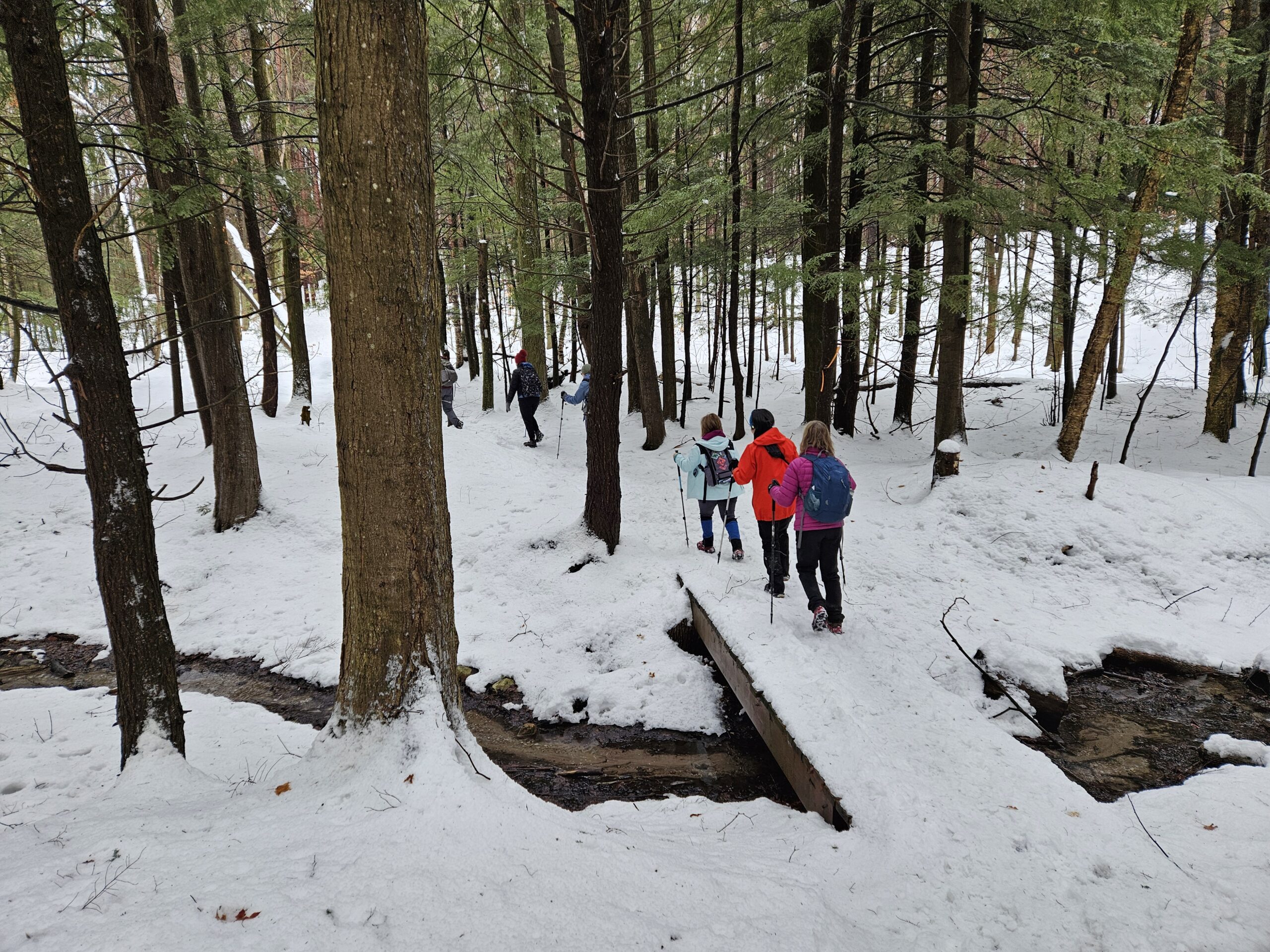
Cancelled... Saturday Shorts: Glen Haffy
https://hikesstaging.brucetrail.org/event/saturday-shorts-glen-haffy-2/Sorry, the registration cut-off time for this hike has been reached.Not a member? Click here to join today!Hike open to BTC Members only.
Hosting Club: Caledon Hills
Category: General
Location (Google Maps): Meet at 10 am at the roadside parking on Coolihans Sideroad, km 35.0 Map 17, near where the Trail crosses the road. This is just west of the intersection of Glen Haffy Road and Coolihans Sideroad. It is best to aim for arriving around 9:45, so we can start hiking as close to 10 am as possible. Thanks!Hike Leader(s): Elizabeth Ganong Click here to contact Hike Leader(s)
Pace: Medium – 3 to 4 km/hour
Terrain: Moderate – some hills and/or some poor footing
Distance: Approximately 4 to 5 kmDescription
Looking to get out on a Saturday but not give up your whole day? Saturday Shorts, a hiking series, will get you out in a small group on a short hike. This Saturday’s hike is at Glen Haffy. If the trails are snow-covered, we’ll hike the main Bruce Trail and Glen Haffy’s red loop, which makes a route under 4 km. If trail conditions permit, we may use a slightly longer route, about 5 km. Be prepared for winter conditions by bringing warm gear, poles, and icers. You are encouraged to bring water and a snack. No dogs please.The hike leader for this hike is Elizabeth Ganong. Registrants can expect a reminder/update message one or two days before the hike.
If desired, this hike may be used towards the Caledon Winter Hiking Badge (5 winter hikes in the Caledon section that are 1 ½ hours or longer in length). Please keep a log of your hikes and follow the directions on the CHBTC website under Club Badges to receive your badge.
Hiking + Eating + Lights at Uxbridge
https://hikesstaging.brucetrail.org/event/hiking-eating-lights-at-uxbridge/Sorry, the registration cut-off time for this hike has been reached.Not a member? Click here to join today!Hosting Club: Toronto
Category: Car Hike
Location (Google Maps): Wilder Forest trail head off Brock RdHike Leader(s): Alina Lin
Pace: Moderate (3-4 km/hr)
Terrain: Hilly, Level 2 (Intermediate – some hills and uneven surfaces, rocks and roots underfoot), Variable
Distance: 12kmDescription
Let us kick off the new year 2025 with an eventful trip to Uxbridge!
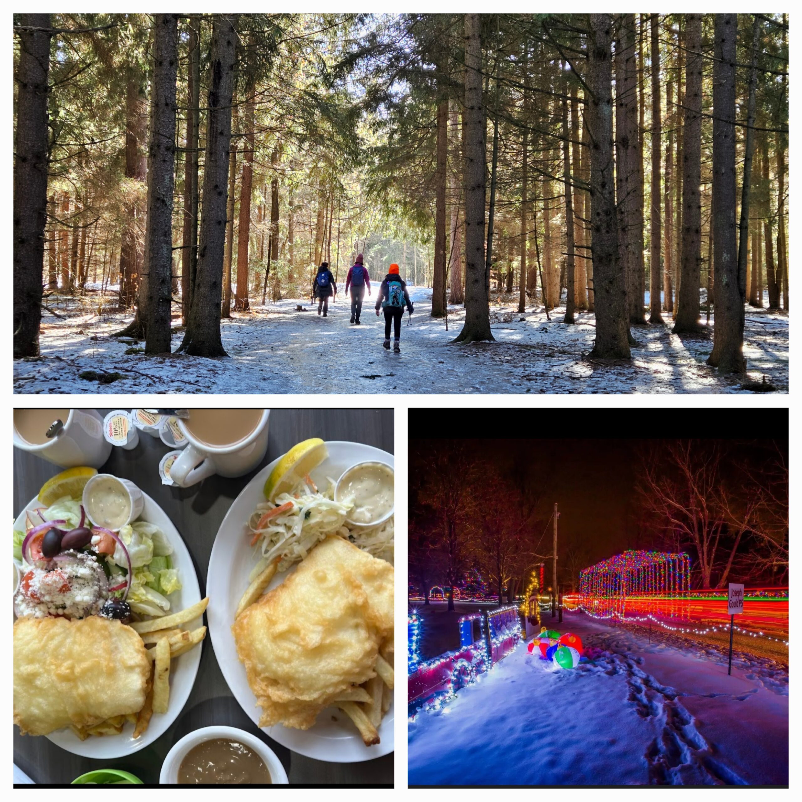
Uxbridge has been hosting the Optimist Fantasy of Lights, one of Canada’s biggest Christmas light exhibits, for 18 years! Over 100 light displays are lovingly put together by community groups, businesses, schools, churches, families, and others from all around the Uxbridge area. What makes this event even more inspiring is its purpose: to raise funds to support local youth programs. There is no entry fee or ticket required, but donations (cash or tap) at the exit are encouraged and go directly toward these initiatives.Since driving all the way to Uxbridge just for the light show might feel like a missed opportunity, I’ve organized a full day of activities:
- Hiking (11:00am – 3:30pm) . Meet at the trail head parking (GPS : 44.019492, -79.134499, next to 2499 Brock Road, Uxbridge). A scenic 11-13 km hike starting from Brock Road. The route includes the Wilder Forest, Oak Ridges Trail, and Walker Woods before looping back. Expect snowy and icy trails—please bring your microspikes/icers for safe footing. Pack a hot beverage and a light snack to keep your energy up. No pets.
- Eating (4:00pm – 5:30pm): After the hike, we’ll refuel with a delicious meal at Joy’s Fish & Chips (307 Toronto St S Unit 15, Uxbridge, ON L9P 1S9), a locally renowned spot.
- Lighting (6:00pm – 8:00pm): The Fantasy of Lights event begins at 6:00 PM at 55 Elgin Park Dr, Uxbridge, ON L9P 1Z6. You can find more details on their website: https://www.uxbridgeoptimist.com/fantasy-of-lights. I encourage everyone to consider making a donation at the exit to support this amazing cause. You’re welcome to spend as much or as little time at the exhibit as you like.
Let’s make this a memorable start to the new year with hiking, eating, and lighting! You are welcome to join all or any part of this three-part trip. Please dress appropriately for the weather and activities. If you plan to attend the light show, bring an extra layer as it’ll be colder in the evening.
- 05January 5, 2025
Car Hike: Iroquoia Winter E2E 6/6
https://hikesstaging.brucetrail.org/event/car-hike-iroquoia-winter-e2e-6-6-2/Sorry, the registration cut-off time for this hike has been reached.Not a member? Click here to join today!Hike open to BTC Members only.
Hosting Club: Toronto
Category: Car Hike
Location (Google Maps):Twiss rd at #8. N 43.429065,W 79.927324
Hike Leader(s): Smadar Junkin Click here to contact Hike Leader(s)
Pace: Brisk (4-5 km/hr)
Terrain: Level 2 (Intermediate – some hills and uneven surfaces, rocks and roots underfoot)
Distance: 17 kmDescription
Last hike, badge day! We will car shuttle to Glen Eden, we will walk to highway 401 bridge and back ( about 0.5 km extra). Glen Eden is a paid parking. I’ll have details closer to the hike day. If anyone has a parking pass please let me know. Everyone is expected to share in the paring cost. Hike is about 7 km shorter than indicated on the map because of winter closure for hiking in the ski area. Bring icers, snowshoes and 2litres of water. Date may change due to extreme winter conditions.Fundraiser/Stained Glass Badge End-to-End Series
https://hikesstaging.brucetrail.org/event/fundraiser-stained-glass-badge-end-to-end-series/Sorry, the registration cut-off time for this hike has been reached.Not a member? Click here to join today!This is a Multi-Day Hike
You are signing up for the following dates and times:
2025-01-05 at 08:30
2025-01-12 at 08:30
2025-01-19 at 08:30
2025-01-26 at 08:30
2025-02-02 at 08:30Hosting Club: Caledon Hills
Category: Cheltenham Badlands Stained Glass E2E Badge
Location (Google Maps): Meet at km 15.9, roadside parking along the southwest shoulder of Willoughby Road near Escarpment Sideroad intersection, 43.831244, -79.980588. (Map 15, Edition 31)Directions: From Hwy #10 head west on Escarpment Sideroad for approximately 1.5 km.
Hike Leader(s): Sandy Green and Lana Hubbard Click here to contact Hike Leader(s)
Pace: Medium – 3 to 4 km/hour
Terrain: Moderate – some hills and/or some poor footing
Distance: 16 kilometresDescription
Earn the Cheltenham Badlands Stained Glass/Fundraiser badge, which is part of the collectable Bruce Trail Clubs stained glass-themed fundraiser set. This five-hike end-to-end series takes place on Sundays in January and February. Hike distances range from 13 km to 16 km. Bring snacks and your choice of hydration. Icers/crampons are required. Participants take turns shuttling. Full hike details will be sent through the auto-response message.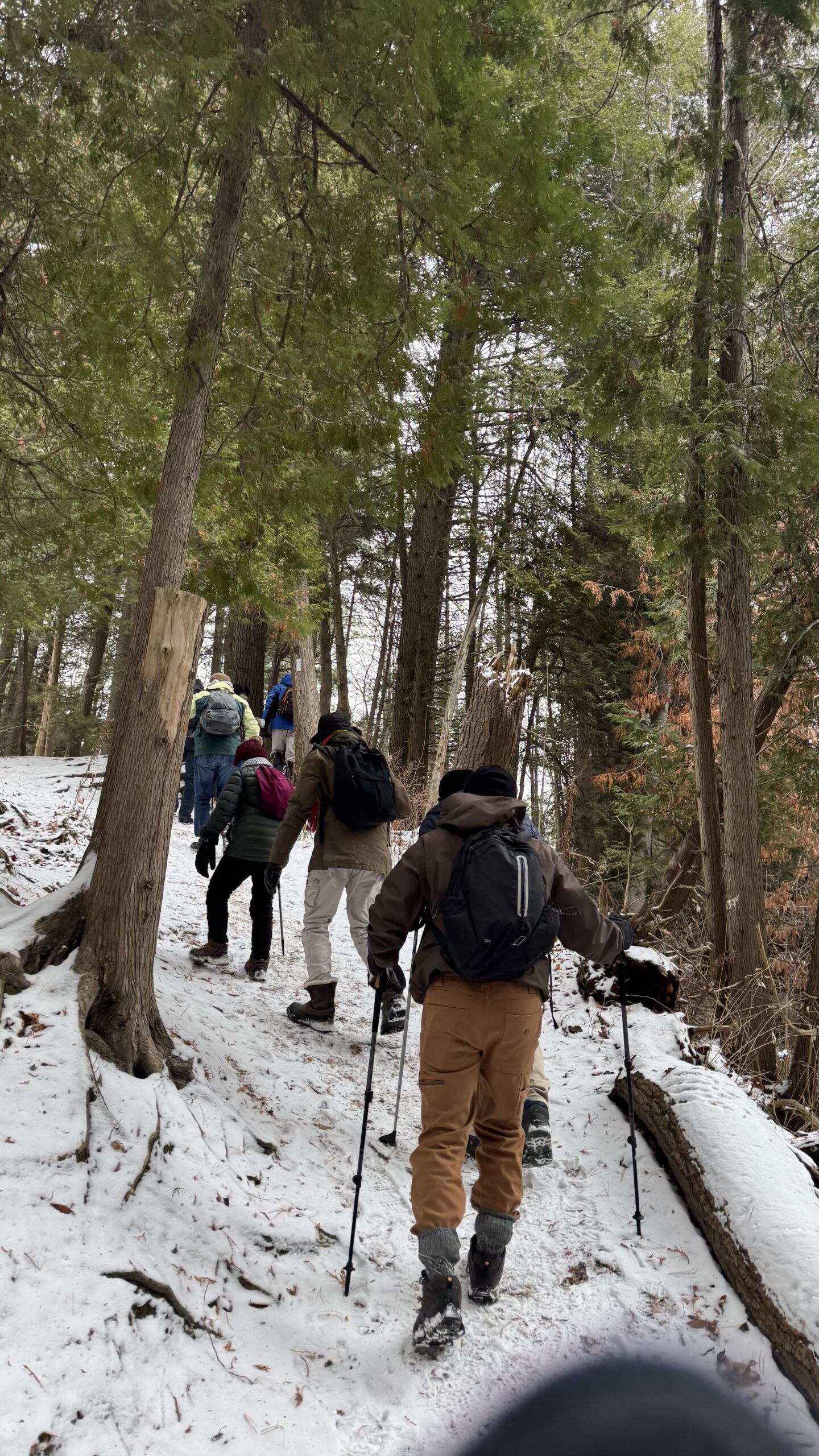
Car Hike: Exploring Uxbridge Trails (Wilder Forest, Walker Woods, and Glen Major Forest)
https://hikesstaging.brucetrail.org/event/car-hike-exploring-uxbridge-trails-wilder-forest-walker-woods-and-glen-major-forest-3/Sorry, the registration cut-off time for this hike has been reached.Not a member? Click here to join today!Hosting Club: Toronto, Peninsula
Location (Google Maps):
2499 Brock Rd, Uxbridge, ON L9P 1R4. We will meet at the East Duffins Headwaters parking lot at the WILDER FOREST trail head. As soon as you got off the Brock Road, passing the horse back riding facility, there is a free designated parking lot 70 meters down the lane to your right. It includes a sign board for East Duffins Headwaters with a map of the trails. Please do not park on the lane or in the horse back riding property.
Hike Leader(s): Amir Alemohammad Click here to contact Hike Leader(s)
Pace: Moderate (3-4 km/hr)
Terrain: Hilly, Level 2 (Intermediate – some hills and uneven surfaces, rocks and roots underfoot), Variable
Distance: Approx.12-14 KmDescription
Join us for a delightful winter hike in Uxbridge, as we explore Wilder Forest, Walker Woods, and Glen Major Forest on a scenic loop starting from Brock Road. We’ll pass Concession Road 6, heading west and back, while also venturing onto several side trails for even more stunning views.What to Expect:
•Beautiful scenic views and lookouts facing south
•A mix of hilly and flat terrain
•Frequent 2-minute breaks for hydration and photos, with a 10-20 minute lunch/snack stop
•Stay on designated trails at all times
What to Bring and Wear:
•Winter boots and icers (mandatory)
•Hiking poles (recommended)
•At least 2 liters of water
•Your favorite snacks and lunch (pack your own refreshments for an outdoor meal)
•Dress in layers for variable weather; cold and windy conditions are likely
Important Details:
•Stay on the designated trails
•Be prepared for the elements and enjoy the adventure!
Looking forward to seeing you on the trail!
Don’t forget your camera and a smile as we explore the beauty of the Uxbridge trails!
10:00 Decew to Morningstar Mill
https://hikesstaging.brucetrail.org/event/1000-decew-to-morningstar-mill-4/Sorry, the registration cut-off time for this hike has been reached.Not a member? Click here to join today!Hosting Club: Niagara
Category: In and Out
Location (Google Maps): Decew House St CatharinesHike Leader(s): Sylvia Wheeler Click here to contact Hike Leader(s)
Terrain: Moderate
Distance: 5kDescription
Hike the main trail from Decew House, along the edge of Lake Moodie and on to Morningstar Mill - 06January 6, 2025
Hike 1 of 5 - Toronto Winter E2E
https://hikesstaging.brucetrail.org/event/hike-1-of-5-toronto-winter-e2e/Sorry, the registration cut-off time for this hike has been reached.Not a member? Click here to join today!Hike open to BTC Members only.
Hosting Club: Caledon Hills
Category: End-to-End
Location (Google Maps): Meet at 9:15 am at BTC Pear Tree Parking Lot, on 15 Sideroad, 200 m southwest of Halton Rd. 25Shuttle to start at Hilton Falls (parking fee at Hilton Falls)
Hike Leader(s): Jennie Greenfield Click here to contact Hike Leader(s)
Pace: Medium – 3 to 4 km/hour
Terrain: Moderate – some hills and/or some poor footing, Strenuous – hilly with steep climbs and some poor footing
Distance: 11.9 kmDescription
This is hike 1 of 5 of a Toronto E2E in no particular order or direction.Toronto Boundary sign north past Hilton Falls Conservation Area climbing the escarpment. Following the escarpment the trail has several look out points, crosses the Dufferin Quarry Bridge and continues on through escarpment forest. Rough footing.
0 to 11.4 + .5 of road from Hilton Falls = 11.9 km total