
Hike Schedule
Join us for a hike! Registration required:
All hikes available to BTC members. Some hikes are open to non-members.
TIP: The calendar view displays up to 7 hikes on a day, but often there are more. Click “More events” to see them all.
Categories
- 17January 17, 2025

Winterloops #1 - Dundas Valley
https://hikesstaging.brucetrail.org/event/winterloops-1-dundas-valley/Sorry, the registration cut-off time for this hike has been reached.Not a member? Click here to join today!Hosting Club: Iroquoia
Category: General Hike
Location (Google Maps): Dundas Valley Conservation Centre – main parking lot off Governor’s RoadHike Leader(s): Pati Greenwood, Jeff Dowsett Click here to contact Hike Leader(s)
Pace: Medium – 3 to 4 km/hr
Terrain: Moderate – Some hills and/or some poor footing, Slippery Sections Likely
Distance: 10 kmDescription
This is series of five winter loop hikes along the Bruce Trail, join us for one or all. Today’s hike will be through the Dundas Valley Conservation Area on the main Bruce Trail, Conservation trails and BT side trails. Bring water and snacks. Wear layers for winter weather, bring icers and hiking poles.Park in the main Parking lot located at 650 Governor’s Road. Parking fees will be required. See the Hamilton Conservation Authority for more information: https://conservationhamilton.ca/admissions-fees/
Please arrive at 8:15 am as we will leave promptly at 8:30 am.
Niagara-on-the-Lake Tour
https://hikesstaging.brucetrail.org/event/niagara-on-the-lake-tour-5/Sorry, the registration cut-off time for this hike has been reached.Not a member? Click here to join today!Hosting Club: Niagara
Category: Urban
Location (Google Maps): Meet on King St near Centre St, just outside of Veteran’s Memorial ParkHike Leader(s): Margaret Northfield Click here to contact Hike Leader(s)
Pace: Medium
Terrain: Easy
Distance: 6-7kmDescription
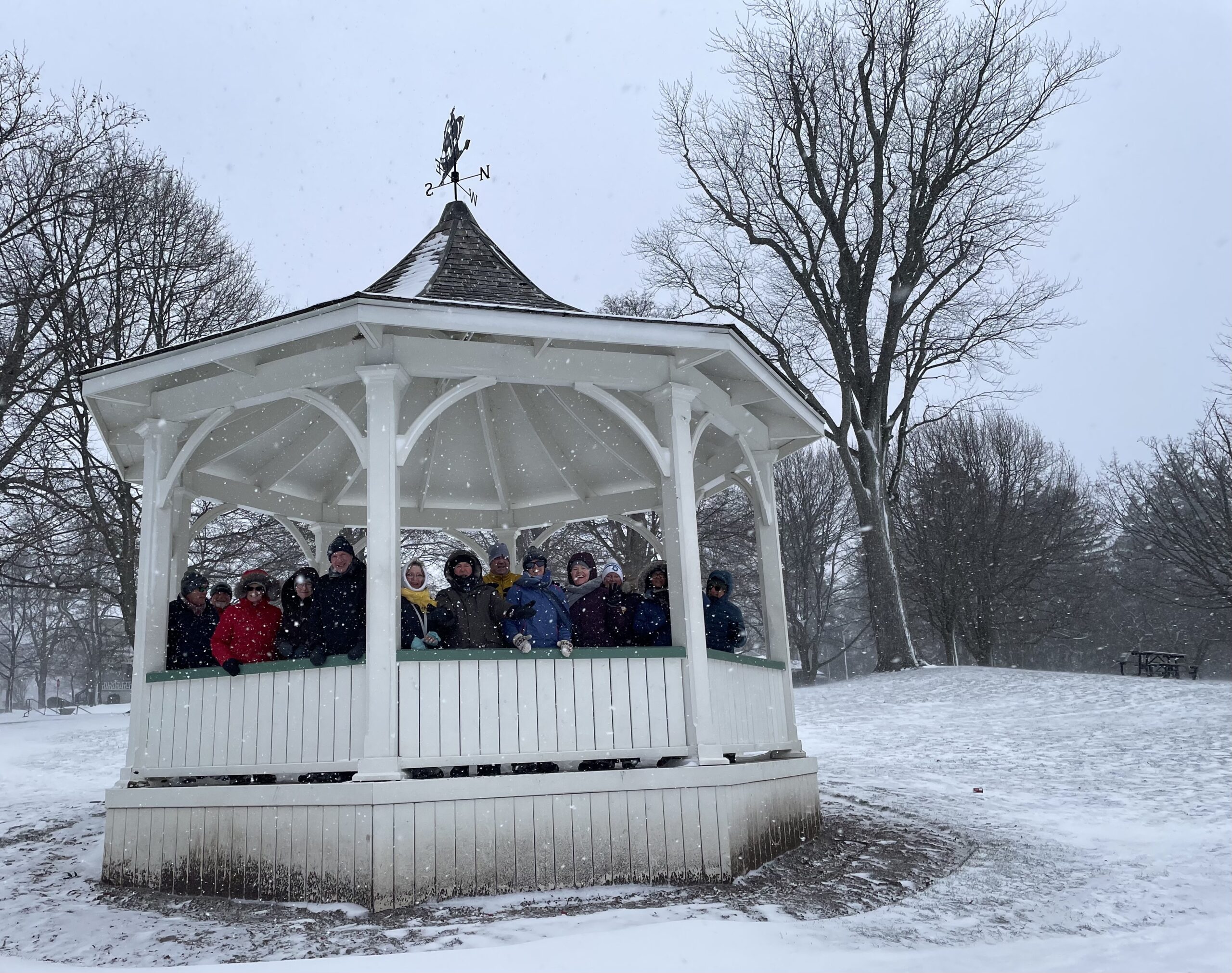
Each Friday we will explore some history of Niagara-on-the-Lake while getting a moderate paced walk. Discover where the Niagara River meets Lake Ontario. Experience the Heritage District, woods and the Niagara Parkway.Some weeks may be totally on sidewalks and roads while others may include a mix of trail and paved pathways.
Great way to build up endurance for longer more strenuous hikes.
Plan to stay for conversation and a coffee at Sweets & Swirls, Community Centre, Niagara Stone Rd., NOTL
Margaret & Robin
Dundas Valley Loops
https://hikesstaging.brucetrail.org/event/dundas-valley-loops/Sorry, the registration cut-off time for this hike has been reached.Not a member? Click here to join today!Hosting Club: Dufferin Hi-Land
Category: General Hike
Location (Google Maps): Iroquoia Section, Map 8. Dundas Valley Conservation Area Parking Lot P3. Take DVCA Trail Centre Entrance off Governors Road, near km 51.8.Hike Leader(s): Stuart Law Click here to contact Hike Leader(s)
Pace: Medium
Terrain: Moderate
Distance: 15 kmsDescription
Join us on a lovely series of trail loops in the Dundas Valley. We take in part of the Bruce Trail and several DVCA trails. Lots of ups and downs. Please bring icers, a warm drink, water, a snack for “elevensies”, lunch, hiking boots, poles and lots of smiles. Entrance fee to DVCA in effect at gate. Please arrive at 9:00 to be ready to hike at 9:15.Harrison Park Snowshoe & Lunch
https://hikesstaging.brucetrail.org/event/harrison-park-snowshoe-lunch-2/Sorry, the registration cut-off time for this hike has been reached.Not a member? Click here to join today!Hosting Club: Sydenham
Category: Snowshoe Hike
Location (Google Maps):Parking lot in front of Harrison Park Inn
Hike Leader(s): Maureen McFarland Click here to contact Hike Leader(s)
Pace: Medium: 3 to 4 km/h
Terrain: Moderate: Some hills and/or poor footing, Strenuous: Hilly with steep climbs and some poor footing.
Distance: 6 kmDescription
We will snowshoe the Harrison Park Loop followed by lunch at The Milk Maid in downtown Owen Sound. Harrison Park Inn is closed this week. If snow conditions permit, we will take the main trail on the east side. This is a technical snowshoe and is suitable for fit, experienced snowshoers. This is a beautiful section, with interesting geological features and towering cliffs. We’ll take time to enjoy the scenery and aim to be downtown for lunch around 1:00 pm. Walking poles are recommended for this hike. Please use the reply tohike leader form to let me know if you plan to join us for lunch.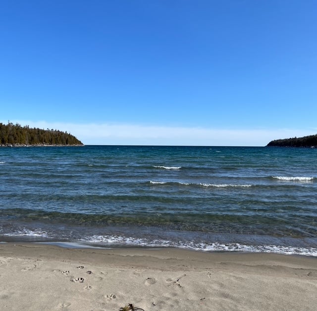
Fun Friday Hike - Dunks Bay
https://hikesstaging.brucetrail.org/event/fun-friday-hike-dunks-bay/Sorry, the registration cut-off time for this hike has been reached.Not a member? Click here to join today!Hosting Club: Peninsula
Category: Winter Hikes
Location (Google Maps): 120 Chi sin tib dek Rd, Tobermory, ON N0H 2R0Hike Leader(s): Owen and Marg Glendon Click here to contact Hike Leader(s)
Pace: Leisurely (2.0 – 3.0 km/h): A relaxed pace with frequent breaks and a focus on enjoyment.
Terrain: Moderate: Rolling hills, mild slopes and rocky paths.
Distance: ~4-5 kmDescription
Meet at at the BPNP Visitors Centre a few minutes early. At 10 a.m., we will start our “out-and-back” back hike (~4-5 km) here and follow the Main Trail through a “tunnel” of Cedar and Pine trees leading us to the sweet little beach of Dunks Bay. Here, before returning to the Visitors Centre, we will consider an option to extend our hike along the Main Trail – depending on time and weather conditions. This trail section is generally flat and rocky. If we extend our hike, there will be some short ups and downs along the south shore of Dunks Bay. Our hike time will be ~ 2 – 2 ½ hours. Bring water, snacks and icers. Winter hiking requires extra preparation – wear layers of clothing, warm winter hiking boots, hat, face covering (if windy) and mittens. Hiking poles and gators are recommended. If the trail has a few inches or more of snow – bring your snowshoes. If you don’t have snowshoes, check in at the BPNP Visitor’s Centre to borrow snowshoes for this hike. At hike’s end, enjoy lunch (bring your own) by the fire at the Visitors Centre. Then, consider catching a movie here – one of the Friday Film Series at the BPNP – by donation. All other park fees apply. - 18January 18, 2025
Coach Trip: Arrowhead Provincial Park
https://hikesstaging.brucetrail.org/event/coach-trip-arrowhead-provincial-park/Sorry, the registration cut-off time for this hike has been reached.Not a member? Click here to join today!Trip Information
Departure Time: 08:00
Return to City Time: 18:45
Departure Point: York Mills Bus PickupTrip Activities
Ski ($0.01)
Winter hike ($0.01)
Optional Items
Pick up at HWY 400 & Major Mac ($0.01)Hosting Club: Toronto
Category: Coach Trips
Location (Google Maps): Arrowhead Provincial ParkHike Leader(s): Martina Furrer, George Lennon, Robin Crombie Click here to contact Hike Leader(s)
Pace: Moderate (3-4 km/hr)
Terrain: Level 2 (Intermediate – some hills and uneven surfaces, rocks and roots underfoot), VariableDescription
No trail fees at Arrowhead. Registration cost includes park admission.Bus departs 10 York Mills Rd at 8 AM and HWY 400 and Major Mackenzie Dr Park and Ride at 8:20 AM. If you wish to be picked up at HWY 400 and Major Mac, select that option when you register. Please arrive 15 minutes before departure.
Join us for an awesome day of winter fun in Arrowhead Provincial Park. For information about trail conditions visit: https://www.ontarioparks.com/snowreport/detail/arrowhead. For information about the park visit: https://www.ontarioparks.com/park/arrowhead.
Join George and Robin for a fun guided hike, or enjoy self-guided skiing on trails groomed for classic and skate skiing. After skiing or snowshoeing spend some time ice skating (if open) in the forest.
Ski, skate and snowshoe rentals available.
There are no food services in the park. Pack water/tea and lunch.
We will leave the park at 4 PM. Bring a snack (finger food) to share on the bus ride home.
Policy for running this trip: To run this trip we need 40 registrants 8 days in advance. We may cancel the trip on short notice if there is substantial risk of trail or resort closure due to major weather warnings. If there is enough snow to ski and conditions are marginal or better, we will go. Marginal conditions mean not ideal skiing conditions. For example, wet snow, a thin bumpy base, or some icy patches. If TBTC cancels the trip, we will refund your coach fare. No refund if you cancel.
Car Hike: Boyne Valley Provincial Park!
https://hikesstaging.brucetrail.org/event/car-hike-boyne-valley-provincial-park-3/Sorry, the registration cut-off time for this hike has been reached.Not a member? Click here to join today!Hosting Club: Caledon Hills
Category: General
Location (Google Maps): Boyne Valley Provincial Park, Map 20 of the BTC Trail Guide. County Rd. 19 (Prince of Wales Rd.) Parking Area – west of km 15.2 – approximately 80 metres south of the Prince of Wales Side Trail.Hike Leader(s): Dylan “Lana” Hubbard Click here to contact Hike Leader(s)
Pace: Medium – 3 to 4 km/hour
Terrain: Strenuous – hilly with steep climbs and some poor footing
Distance: 17 kmDescription
Join us for an invigorating hike starting from the parking lot on Prince of Wales Rd. We’ll explore the Prince of Wales Side Trail, Primrose Loop Side Trail, main trail, and Boyne Valley Side Trail, looping back via the main trail and Prince of Wales Side Trail. Along the way, we’ll hike up the short side trail to Murphy’s Pinnacle, where you’ll be rewarded with a stunning view of the surrounding landscape – great for Instagram!Bring lunch, plenty of water, and hiking poles if you use them, as the trail is hilly. Dress for the weather. Icers are required.
PACE IS MEDIUM
This hike is a 2SLGBTQIA+ friendly space. Everyone is welcome to join us for this adventure and enjoy the beauty of the trails together.
Car Hike: Cherry Beach
https://hikesstaging.brucetrail.org/event/car-hike-cherry-beach-2/Sorry, the registration cut-off time for this hike has been reached.Not a member? Click here to join today!Hosting Club: Toronto
Category: Car Hike
Location (Google Maps): Free parking lot at the end of Cherry Street TorontoHike Leader(s): Mohammad Aghamiri Click here to contact Hike Leader(s)
Pace: Moderate (3-4 km/hr)
Terrain: Flat, Level 1 (Easy – mostly on flat, well maintained trails with hard-packed surface)
Distance: 12-14 kmDescription
We will walk along lake Ontario, visiting ponds ,swans and light house
• Please dress appropriately for the weather.
• We will have short water ,picture and a 15 minute snack break. Everyone is welcome!
Toogood Pond to Milne Conservation Park
https://hikesstaging.brucetrail.org/event/toogood-pond-to-milne-conservation-park/Sorry, the registration cut-off time for this hike has been reached.Not a member? Click here to join today!Hosting Club: Niagara, Toronto
Category: Urban
Location (Google Maps): 276 Main St Unionville, Unionville, ON L3R 3M3Hike Leader(s): Mehrnoush Ahmadi Click here to contact Hike Leader(s)
Pace: Medium
Terrain: Easy
Distance: 11 kmDescription
Beautiful and easy urban path for hiking.“This hike is not recommended for experienced hikers who prefer to walk leisurely.”
• Please dress appropriately for the weather. Waterproof hiking boots, ice cleats, and trekking poles are required. A windproof jacket and gaiters are recommended.
• We will have short water breaks and a 15-minute snack break.See you there!

Queenston Hike
https://hikesstaging.brucetrail.org/event/900-queenston-hike-3/Sorry, the registration cut-off time for this hike has been reached.Not a member? Click here to join today!Hosting Club: Niagara
Category: Loop
Location (Google Maps):Queenston Heights Park, 14184 Niagara Pkwy, Niagara-on-the-Lake, ON L0S 1J0
Hike Leader(s): Dan Wilson Click here to contact Hike Leader(s)
Pace: Medium
Terrain: Moderate
Distance: 7kmDescription
Meet at the Queenston Heights parking lot near the restrooms. Icers may be required, depending on the weather. Parking fees may apply.
Saturday Shorts: Hockleycrest
https://hikesstaging.brucetrail.org/event/saturday-shorts-hockleycrest-2/Sorry, the registration cut-off time for this hike has been reached.Not a member? Click here to join today!Hike open to BTC Members only.
Hosting Club: Caledon Hills
Category: General
Location (Google Maps): Meet at 10 am at the Mono 5 Sideroad parking area at km 45.4 on the north side of the road where the Trail crosses. This is east of Airport Road. It is best to aim for arriving around 9:45, so we can start hiking as close to 10 am as possible. Thanks!Hike Leader(s): Dan Revington; Elizabeth Ganong Click here to contact Hike Leader(s)
Pace: Medium – 3 to 4 km/hour
Terrain: Moderate – some hills and/or some poor footing
Distance: Approximately 5 kmDescription
Looking to get out on a Saturday but not give up your whole day? Saturday Shorts, a hiking series, will get you out in a small group on a short hike. Following the main Bruce Trail and side trails, this Saturday’s hike takes us through Hockleycrest. Be prepared for winter conditions on our approximately 5 km route by bringing warm gear, poles, and icers. You are encouraged to bring water and a snack. No dogs please.The hike leader for this hike is Dan Revington. Registrants can expect a reminder/update message from Dan one or two days before the hike.
If desired, this hike may be used towards the Caledon Winter Hiking Badge (5 winter hikes in the Caledon section that are 1 ½ hours or longer in length). Please keep a log of your hikes and follow the directions on the CHBTC website under Club Badges to receive your badge.

From Christie Lake to Webster Falls and Back
https://hikesstaging.brucetrail.org/event/from-christie-lake-to-webster-falls-and-back/Sorry, the registration cut-off time for this hike has been reached.Not a member? Click here to join today!Hike open to BTC Members only.
Hosting Club: Iroquoia
Category: General Hike
Location (Google Maps): Christie Lake Conservation AreaHike Leader(s): Victoria Best Click here to contact Hike Leader(s)
Pace: Medium – 3 to 4 km/hr
Terrain: Easy – Mostly flat and usually good footing, Moderate – Some hills and/or some poor footing
Distance: 9 kmDescription
Arrive at 9:45 for a 10:00AM departure.
Directions to Meeting Place: From Highway 5 West, enter Christie Lake Conservation Area and turn left (east) at the T intersection after the entrance kiosk. Continue to the end of the road to the parking lot nearest to the Christie Lake Marina Pavilion.
Hamilton Conservation Authority pass or fee on entry.
This is a there and back hike along Spencer Creek including a breathtaking view of Webster’s Falls in winter.
Dress appropriately for the weather and for slippery trail conditions.
Bring a snack and beverage, hiking boots, and icers.
No dogs please.
Urban Walk; Waterfront Trail 2/11 - Mississauga Waterfront
https://hikesstaging.brucetrail.org/event/urban-walk-waterfront-trail-2-11-mississauga-waterfront-2/Sorry, the registration cut-off time for this hike has been reached.Not a member? Click here to join today!Hosting Club: Toronto
Category: Urban Walk
Location (Google Maps): Mississauga Waterfront TrailHike Leader(s): Brian Rideout Click here to contact Hike Leader(s)
Pace: Moderate (3-4 km/hr)
Terrain: Flat
Distance: 8.9 kmDescription
Please join me at Union Station under the clock inside the Great Hall no later than 9:00 am. We will take the Lakeshore West train departing 9:14 am, arriving 9:42 am (subject to GO Transit schedule changes). If you want to meet us in Port Credit, please be there by 9:42 am. We start hiking no later than 10:00 am. Consider purchasing the $10 day pass for the GO train for use with your smart phone. Some of you may find the regular senior rate is cheaper. Purchase your ticket / pass in advance.We will hike from Port Credit to Long Branch along the shoreline. The estimated distance is 8.9 km. Here is an online map of our route – Port Credit to Long Branch
Bring a snack, at least 2 liters of water, and icers. Dress for cold weather.
Boyds Crevice Trail
https://hikesstaging.brucetrail.org/event/boyds-crevice-trail/Sorry, the registration cut-off time for this hike has been reached.Not a member? Click here to join today!Hosting Club: Sydenham
Category: Snowshoe Hike
Location (Google Maps): Georgian BluffsHike Leader(s): Danuta Valleau Click here to contact Hike Leader(s)
Pace: Leisurely: 3 km/h or less
Terrain: Moderate: Some hills and/or poor footing
Distance: approx 4 kmDescription
Map 31: We will carpool from the Municipal Parking Lot on 1st Ave E to the start of the hike at the end of 11th Concession south of Superior St.Snowshoe or walk along rail trail and onto main trail at km 86.5 – follow main trail in southerly direction exploring rock crevasses – returning on same trail.
Urban Walk: South Humber and Swansea Theatre Hike
https://hikesstaging.brucetrail.org/event/urban-walk-south-humber-and-swansea-theatre-hike-4/Sorry, the registration cut-off time for this hike has been reached.Not a member? Click here to join today!Hosting Club: Toronto
Location (Google Maps): Meet for a 3:00 PM departure from the TTC Route #79 Scarlett Road bus stop at the south east corner of Scarlett Road and Eglinton Avenue West.
Hike Leader(s): Miriam Stevens, Tom Swales Click here to contact Hike Leader(s)
Pace: Leisurely (2-3 km/hr)
Terrain: Variable
Distance: 9 – 10 kmDescription
Join us for a leisurely hike (3kms/hour- no runners!) south on the Humber River Trail and through the Swansea neighborhood. There are 3 steep staircases on the route. Optional drop out at the Old Mill subway station.
Suitable for beginners and families. We will follow the Humber River Trail to the Old Mill and then hike parts of the Swansea neighborhood to Runnymede Road and Bloor Street West which is the end of the hike across from the Runnymede subway station.After the hike you may choose to join us for dinner at 6:00 PM at either Ali Baba Mediterranean/Italian (Yes, that’s right – now with pasta options!) Cuisine or at a nearby pub, as you wish.
We will attend the play at 8 PM at the village Players, 2190 Bloor Street West. This evening’s performance will be Ripcord by David-Lindsay AbaireCall the Theatre directly 416 767 7702 to reserve your ticket($29.00 adults and seniors) and mention that you are with the Bruce Trail Conservancy, Toronto Club.
Anyone is welcome to come for the hike only, join us for the theatre performance, or, join us for all three: Hike, dinner and play at the theatre. Paid parking is available off Kennedy Avenue north of Bloor Street West (behind theatre building).

Evening, Snowshoe Adventure badge #1 - Loree Forest
https://hikesstaging.brucetrail.org/event/evening-snowshoe-adventure-badge-1-loree-forest/Sorry, the registration cut-off time for this hike has been reached.Not a member? Click here to join today!Hosting Club: Beaver Valley
Location (Google Maps): Meet on the north shoulder of 21st Sideroad, east of km 8.3, Map 24 near the road allowance that we use to walk up into Loree, with your car front facing into the wide shoulder. Fee for parking. N 44.513082, W 80.386155
Hike Leader(s): Glenda Collings Click here to contact the hike leader.
Pace: Medium
Terrain: Moderate
Length of Hike: Aprox. 5.1 kmDescription
Hike #1 Moonlight Hike: We will hike up the road allowance into Loree forest, then do a loop around and back down to our cars. On winter hikes we may encounter bare ground, light snow, deep snow, or ice. Please bring snowshoes and icers. Participants should have some experience with snowshoeing. Wear appropriate clothing for the weather plus water and a snack. Headlamps may be worn, however, if it’s a bright full moon, it is magical to hike without a light.COVID-19 Precautions Before, During and After your Hike
- Each hiker joining a Bruce Trail Club organized hike must perform a self-screening check before hiking.
Find Ontario’s self-assessment tool here: https://covid-19.ontario.ca/self-assessment/ - If you are experiencing COVID-19 symptoms, stay home.
Other Guidelines
- Arrive 15 minutes before the start of the hike.
- Wear sturdy footwear and appropriate attire for the weather and the terrain.
Hiking poles are a good idea in any season, especially if the terrain is rocky or slippery. In winter, snowshoes or icers/crampons are needed when conditions dictate.
Wearing appropriate clothing and footwear prevents injuries and shows consideration for a safe and positive group hiking experience. - Always carry I.D. and your health card.
- Bring sufficient water and snacks (or lunch if indicated). A minimum of 1L of water is recommended on all hikes, and 3L is recommended for long, challenging hikes in the heat of the summer.
- Bring sunscreen and insect repellent (for spring and summer hikes).
- Bring your own first aid kit.
- Please leave dogs at home.
- Each hiker joining a Bruce Trail Club organized hike must perform a self-screening check before hiking.
- 19January 19, 2025
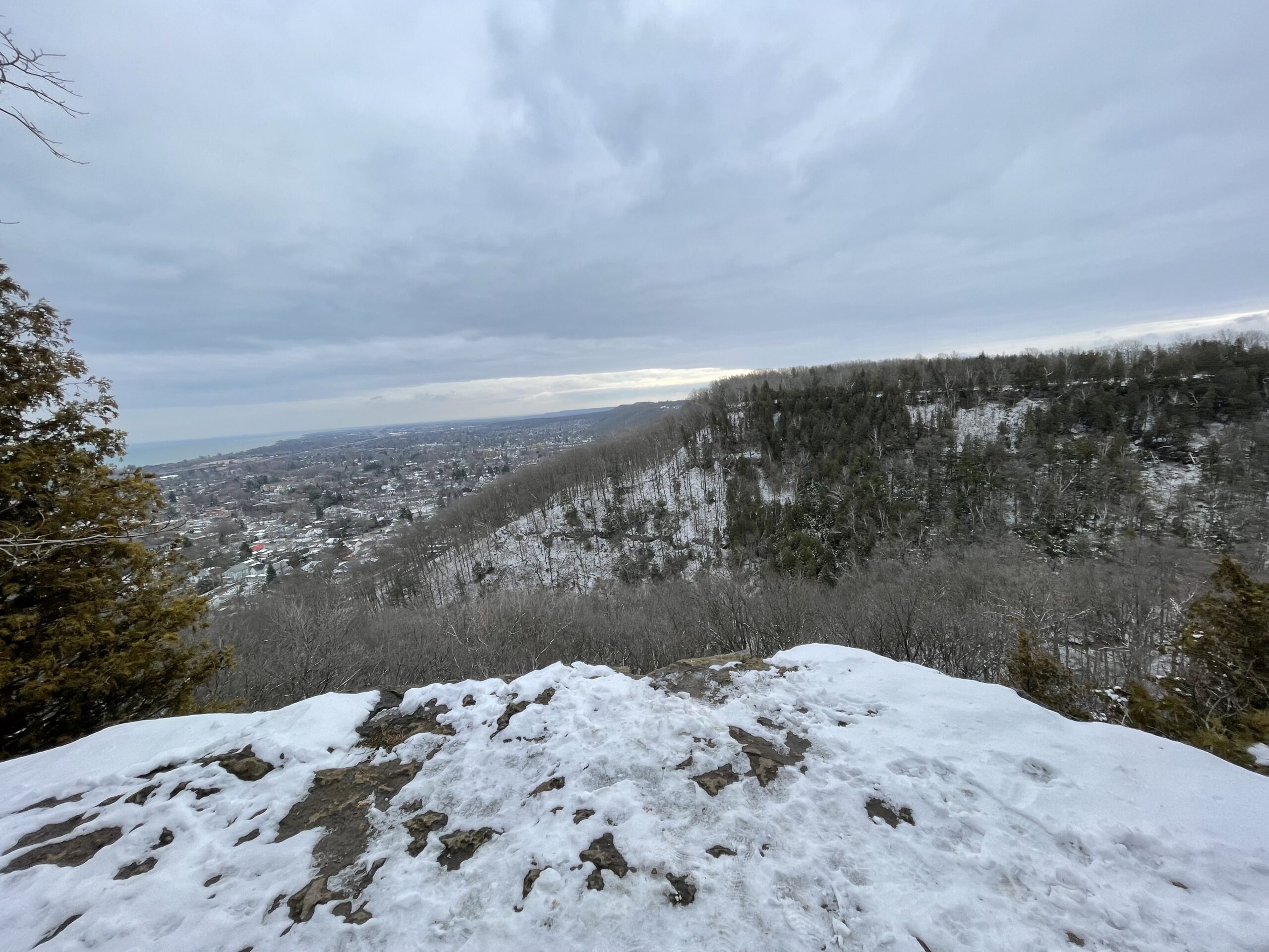
Sunday Ramble - Beamer
https://hikesstaging.brucetrail.org/event/sunday-ramble-beamer/Sorry, the registration cut-off time for this hike has been reached.Not a member? Click here to join today!Hosting Club: Iroquoia
Category: General Hike
Location (Google Maps): Grimsby Lions Club Pool parking lotHike Leader(s): Carol Swanson Click here to contact Hike Leader(s)
Pace: Medium – 3 to 4 km/hr
Terrain: Easy – Mostly flat and usually good footing, Strenuous – Hilly with steep climbs and some poor footing
Distance: 5kmDescription
Bring water, snack and icers.
Urban Walk: Waterfront Trail 1/11 - Rattray Marsh
https://hikesstaging.brucetrail.org/event/urban-walk-waterfront-trail-1-11-rattray-marsh/Sorry, the registration cut-off time for this hike has been reached.Not a member? Click here to join today!Hosting Club: Toronto
Category: Urban Walk
Location (Google Maps): Mississauga Waterfront TrailHike Leader(s): Brian Rideout Click here to contact Hike Leader(s)
Pace: Moderate (3-4 km/hr)
Terrain: Flat
Distance: 9.3 kmDescription
Please join me at Union Station under the clock inside the Great Hall no later than 9:00 am. We will take the 9:14 train to Clarkson, arriving 9 :51 am. If you want to meet us in Clarkson be there at that time. We start hiking at 10:00 am. Consider purchasing the $10 day pass for the GO train for use with your smart phone. Some of you may find the regular senior rate is cheaper.We will hike from Clarkson to Port Credit through Rattray Marsh and along the shoreline. The estimated distance is 9.9 km. Here is an online map of our route Rattray Marsh to Port Credit
Bring a snack, at least 2 liters of water, and icers. Dress for cold weather.

Pine River Discovery Hike
https://hikesstaging.brucetrail.org/event/pine-river-discovery-hike-3/Sorry, the registration cut-off time for this hike has been reached.Not a member? Click here to join today!Hosting Club: Dufferin Hi-Land
Category: General Hike
Location (Google Maps): Second Line and 15 Sideroad in Mulmur Ontario. From Orangeville, head north on hwy #10 to hwy #89. Turn left and head west to county road #124. Turn right and head north to 15 Sideroad. Turn right and follow to 2nd line. Parking is on the east side of 2nd Line, just north of 15 Sideroad. Do not try and come across 15 sideroad from east to west. It is a snowmobile trail at this time of the year.Hike Leader(s): Tom Thayer, Susan Bate Click here to contact Hike Leader(s)
Pace: Medium
Terrain: Dependent on Conditions, Moderate
Distance: 6 kmDescription
We will be exploring the winter wonders that the Pine River Nature Reserve offers during the winter.This is a snowshoe hike so please be sure to bring your snowshoes. Should the weather not behave and snow is not in abundance, we will still do the hike but icer’s would be recommended in this case as there is sure to still be icy patches within the reserve.
Bring snowshoes, icer’s, mitts, hats, food, and dress according to the weather.
- 20January 20, 2025No events