
Hike Schedule
Join us for a hike! Registration required.
All hikes available to BTC members. Some hikes are open to non-members.
See Refund Policy for Paid Hikes >
TIP: The calendar view displays up to 7 hikes on a day, but often there are more. Click “View more events” to see them all.
Categories
- 11January 11, 2025
Coach Trip: Skiers Highlands Nordic, Hikers Guided Hike on Bruce Trail or Highlands Nordic
https://hikesstaging.brucetrail.org/event/coach-trip-skiers-highlands-nordic-hikers-bruce-trail/Sorry, the registration cut-off time for this hike has been reached.Not a member? Click here to join today!Hosting Club: Toronto
Category: Coach Trip
Location (Google Maps): Highlands Nordic, DuntroonHike Leader(s): Martina Furrer, Michael Humpage, Tim Wainwright Click here to contact Hike Leader(s)
Pace: Moderate (3-4 km/hr)
Terrain: Level 2 (Intermediate – some hills and uneven surfaces, rocks and roots underfoot), Rocky, VariableDescription
Join us for an awesome day of winter fun in Duntroon.Cross-country skiers: Glide through forests and fields on 25 km of trails groomed for classic and skate skiing. Enjoy amazing views (you can see Georgian Bay) and warm up with a hot drink and fresh baked treat in Highlands’ cozy chalet. Classic ($28) and skate ski ($45) rentals available. All cross-country skiing is self-guided. Ski passes are $30 per person.
Winter hikers, Option 1: Join Michael Humpage and Tim Wainwright for a fun guided hike on the Bruce Trail with great views and good company. The group will be out all day and eat lunch on the trail. Depending on conditions you may need snowshoes, microspikes, or just boots. Option 2: Join Lisa Lifshitz for a guided snowshoe hike on Highlands’ trails. Those staying on resort will need to purchase trail passes ($20); snowshoe rentals ($18) are available for those who stay on resort.
Trail fees will be collected in cash on the bus. We will leave the resort at 4 PM.
Departure 1: 8:30 AM, 10 York Mills Rd
Departure 2: 8:50 AM, HWY 400 and Major Mackenzie Dr Park and Ride
Please arrive at the pick-up location 15 minutes before departure. The bus waits for no one.
Policy for running this trip: To run this trip we need 40 registrants 8 days in advance. We may cancel the trip on short notice if there is substantial risk of trail or resort closure due to major weather warnings. If there is enough snow to ski and conditions are marginal or better, we will go. Marginal conditions mean not ideal skiing conditions. For example, wet snow, a thin bumpy base, or some icy patches. If TBTC cancels the trip, we will refund your coach fare. No refund if you cancel.
Car Hike: Hockley Valley Provincial Park
https://hikesstaging.brucetrail.org/event/car-hike-hockley-valley-provincial-park-2/Sorry, the registration cut-off time for this hike has been reached.Not a member? Click here to join today!Hosting Club: Caledon Hills
Category: General
Location (Google Maps): Hockley Valley Nature Reserve, Map 18. To reach the meeting point, drive north on Hwy 10 from Orangeville and turn right onto Hockley Road. Continue approximately 5 km east until you see the parking area on your left, directly across the road from the Black Birch restaurant.Hike Leader(s): Dylan “Lana” Hubbard Click here to contact Hike Leader(s)
Pace: Medium – 3 to 4 km/hour
Terrain: Strenuous – hilly with steep climbs and some poor footing
Distance: 15 kmDescription
Join us for a 14 km hike through the Nature Preserve, known for being one of the most challenging and hilly sections of the Bruce Trail. Get ready for a workout.We will be hiking at a moderate pace.
and please bring icers.
We are committed to providing an inclusive and welcoming environment. This hike is an 2SLGBTQIA+ safe space, and everyone is welcome to join us!
Car Hike: Exploring Uxbridge Trails (Wilder Forest, Walker Woods, and Glen Major Forest)
https://hikesstaging.brucetrail.org/event/car-hike-exploring-uxbridge-trails-wilder-forest-walker-woods-and-glen-major-forest-5/Sorry, the registration cut-off time for this hike has been reached.Not a member? Click here to join today!Hosting Club: Toronto
Category: Car Hike
Location (Google Maps):2499 Brock Rd, Uxbridge, ON L9P 1R4. We will meet at the East Duffins Headwaters parking lot at the WILDER FOREST trail head. As soon as you got off the Brock Road, passing the horse back riding facility, there is a free designated parking lot 70 meters down the lane to your right. It includes a sign board for East Duffins Headwaters with a map of the trails. Please do not park on the lane or in the horse back riding property.
Hike Leader(s): Amir Alemohammad Click here to contact Hike Leader(s)
Pace: Moderate (3-4 km/hr)
Terrain: Hilly, Level 2 (Intermediate – some hills and uneven surfaces, rocks and roots underfoot), Variable
Distance: Approx.14-16 KmDescription
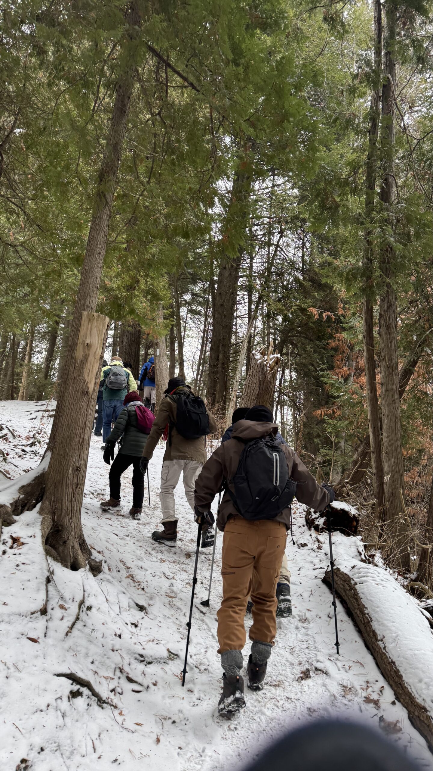
Join us for a delightful winter hike in Uxbridge, as we explore Wilder Forest, Walker Woods, and Glen Major Forest on a scenic loop starting from Brock Road. We’ll pass Concession Road 6, heading west and back, while also venturing onto several side trails for even more stunning views.What to Expect:
•Beautiful scenic views and lookouts facing south
•A mix of hilly and flat terrain
•Frequent 2-minute breaks for hydration and photos, with a 10-20 minute lunch/snack stop
•Stay on designated trails at all times
What to Bring and Wear:
•Winter boots and icers (mandatory)
•Hiking poles (recommended)
•At least 2 liters of water
•Your favorite snacks and lunch (pack your own refreshments for an outdoor meal)
•Dress in layers for variable weather; cold and windy conditions are likely
Important Details:
•Stay on the designated trails
•Be prepared for the elements and enjoy the adventure!
Looking forward to seeing you on the trail!
Don’t forget your camera and a smile as we explore the beauty of the Uxbridge trails!
Car Hike: Boyd conservation park
https://hikesstaging.brucetrail.org/event/car-hike-boyd-conservation-park/Sorry, the registration cut-off time for this hike has been reached.Not a member? Click here to join today!Hosting Club: Toronto
Category: Car Hike
Location (Google Maps): Free parking lot before main entrance of parkHike Leader(s): Mohammad Aghamiri Click here to contact Hike Leader(s)
Pace: Moderate (3-4 km/hr)
Terrain: Level 2 (Intermediate – some hills and uneven surfaces, rocks and roots underfoot), Variable
Distance: 12-14 kmDescription
Let’s hike Boyd conservation park trails through beautiful valleys.It is winter time,please bring your ice cleats and proper clothing and hiking poles are recommended
Niagara Stained Glass E2E in 6 (3 weekends)
https://hikesstaging.brucetrail.org/event/niagara-stained-glass-e2e-in-6-3-weekends/Sorry, the registration cut-off time for this hike has been reached.Not a member? Click here to join today!Hosting Club: Niagara, Iroquoia
Category: Stained Glass Badge End to End Fundraiser Hike
Location (Google Maps): Various locations going from west to east. The schedule will be mailed to registered hikers on January 2 (or earlier upon request).Hike Leader(s): Freddy Wang Click here to contact Hike Leader(s)
Pace: Brisk – 4 to 5 km/hr
Terrain: Dependent on Conditions, Moderate – Some hills and/or some poor footing
Distance: Generally 13-18 kmDescription
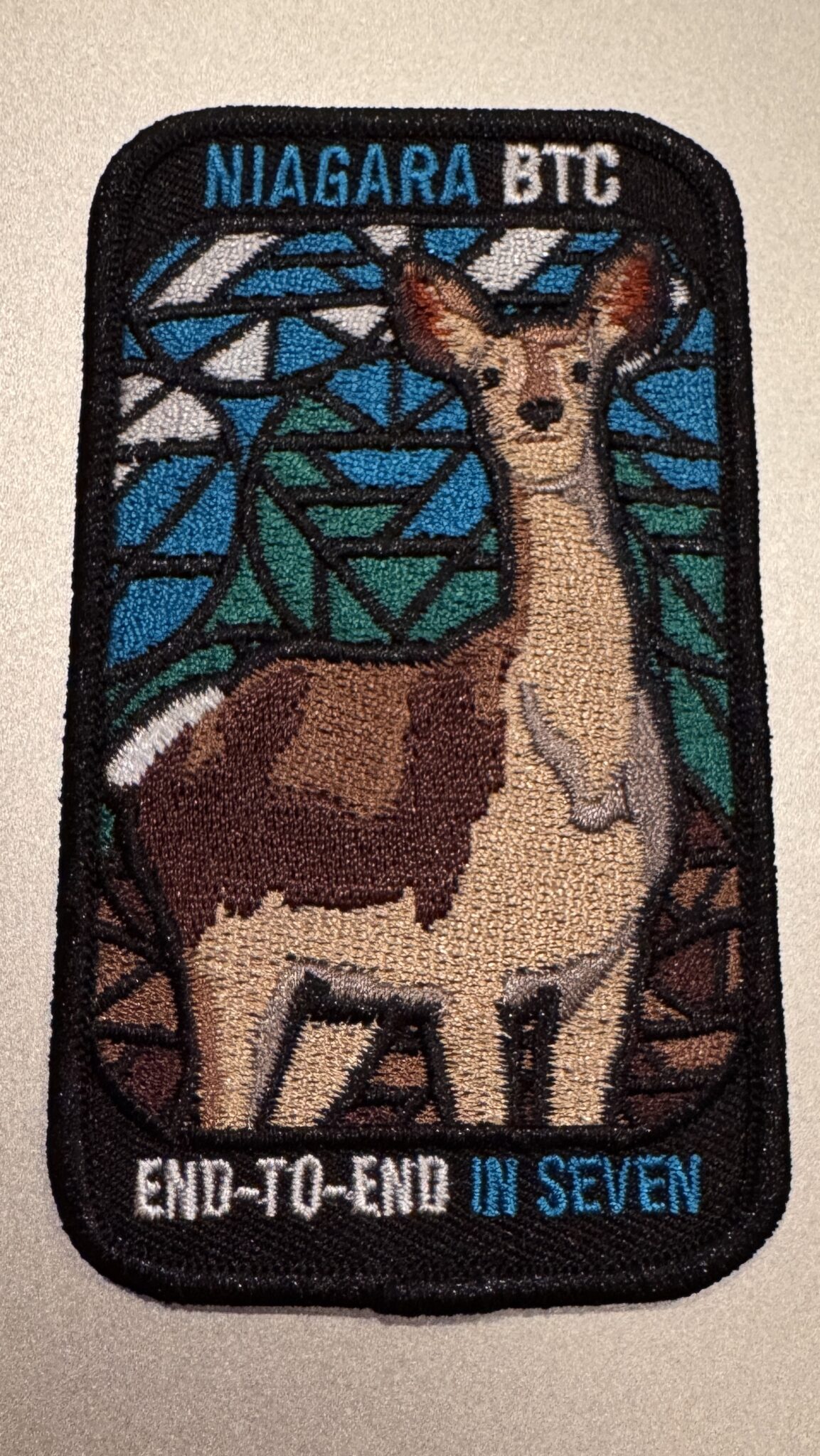
OverviewThis is a special series of 6 hikes to complete the Niagara section of the Bruce Trail over three weekends (January 11, 18 and 25). There is an accomplishment badge, included in the registration fee – which was designed by Joe Borges and features the White-Tailed Deer. The fee goes towards supporting the Niagara Bruce Trail Club, which in turn supports the mission of the Bruce Trail Conservancy, which is: “Preserving a ribbon of wilderness, for everyone, forever.”
For this E2E in 6, we will be following the main trail eastbound starting in Grimsby and finishing in Queenston Heights. Please note that you are signing up for the entire series of six hikes as a Group Hike. This series is geared to experienced hikers with the expectation of a 4.0 to 5.0 km/hr pace maintained over a 13 to 18 km hike.
This hike is intended to be at a Brisk pace. Please be honest about your degree of physical fitness prior to registration. It is a group hike so it is important you are able to keep pace with the person in front of you.
Hikers will be expected to wear proper hiking footwear and layered clothing. Sufficient snacks, water (preferably warm), hiking poles, and weather-appropriate gear are recommended. Icers may be necessary on certain days.
A maximum of 1 of the 6 hikes can be self-completed as a result of scheduling challenges. You must still complete the distance you have missed. If you miss more than one but still complete the distances on your own, you may apply for the Niagara Club’s regular or Winter End to End badge.
Please note there are no refunds!
TRANSPORTATION
This series will require car shuttling, so you must be willing to drive or to be a passenger. The route has been selected to avoid the need for paid parking.
9:00 In & Around Port Weller on Several Lakefront Trails
https://hikesstaging.brucetrail.org/event/900-in-around-port-weller-on-several-lakefront-trails/Sorry, the registration cut-off time for this hike has been reached.Not a member? Click here to join today!Hosting Club: Niagara
Category: Loop
Location (Google Maps):Happy Rolph’s Animal Farm; 650 Read Rd., St Catharines
Hike Leader(s): Karen Couch Click here to contact Hike Leader(s)
Pace: Medium
Terrain: Easy
Distance: 9 kmsDescription
This hike follows several trails maintained by the City of St. Catharines. Birders should bring binoculars as we will follow a portion of the Lake Ontario shoreline.Trails are generally wide dirt paths.
Prepare for the wind chill as much of the hike is on open parkland.
Joker Hill
https://hikesstaging.brucetrail.org/event/joker-hill/Sorry, the registration cut-off time for this hike has been reached.Not a member? Click here to join today!Hosting Club: Niagara, Toronto
Category: Hike
Location (Google Maps): 17100 Bathurst St, Newmarket, ON L3X 1Y6Hike Leader(s): Mehrnoush Ahmadi Click here to contact Hike Leader(s)
Pace: Medium
Terrain: Moderate, Strenuous
Distance: ~8kmDescription
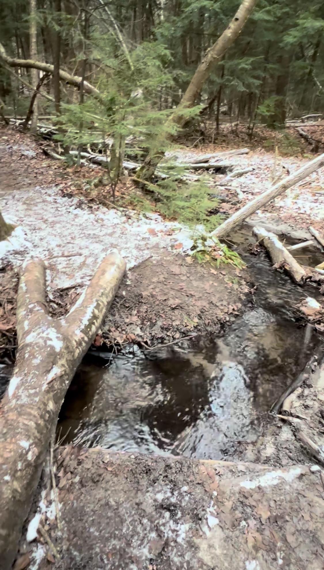
I invite you to explore Jokers Hill! Enjoy peaceful trails, beautiful landscapes, and the perfect setting for a refreshing outdoor adventure. Take a break and reconnect with nature today!
• Please dress appropriately for the weather. Waterproof hiking boots, ice cleats, and trekking poles are required. A windproof jacket and gaiters are recommended.
• We will have short water breaks and a 15-minute snack break.
Everyone is welcome!
See you there!
CANCELLED - Chedoke and Durand for Coffee
https://hikesstaging.brucetrail.org/event/chedoke-and-durand-for-coffee/Sorry, the registration cut-off time for this hike has been reached.Not a member? Click here to join today!Hosting Club: Iroquoia
Category: General Hike
Location (Google Maps): Chedoke Parking Lot, Hamilton, ONHike Leader(s): Mike Gill Click here to contact Hike Leader(s)
Pace: Medium – 3 to 4 km/hr
Terrain: Easy – Mostly flat and usually good footing
Distance: 9kmDescription
Sorry to cancel the hike. I’ve been feeling off for the past 24 hours and have now discovered that I’m running a fever.Registered hikers should have received a notice by email.
-Mike, Hike Leader BTC
———————
We’ll head up the Escarpment to West 5th and return through the Durand neighbourhood where we’ll pause for a rejuvenating coffee at Durand Coffee along the way.
BE SURE TO…
- dress for the weather
- wear appropriate footwear
- bring icers
- bring water
Sorry…no dogs, please.

Urban Walk: Waterfront Trail 1/11 - Rattray Marsh
https://hikesstaging.brucetrail.org/event/urban-walk-waterfront-trail-1-11-rattray-marsh-2/Sorry, the registration cut-off time for this hike has been reached.Not a member? Click here to join today!Hosting Club: Toronto
Category: Urban Walk
Location (Google Maps): Mississauga Waterfront TrailHike Leader(s): Brian Rideout Click here to contact Hike Leader(s)
Pace: Moderate (3-4 km/hr)
Terrain: Flat
Distance: 9.3 kmDescription
Please join me at Union Station under the clock inside the Great Hall no later than 9:00 am. We will take the 9:14 train to Clarkson, arriving 9 :51 am. If you want to meet us in Clarkson be there at that time. We start hiking at 10:00 am. Consider purchasing the $10 day pass for the GO train for use with your smart phone. Some of you may find the regular senior rate is cheaper.We will hike from Clarkson to Port Credit through Rattray Marsh and along the shoreline. The estimated distance is 9.9 km. Here is an online map of our route Rattray Marsh to Port Credit
Bring a snack, at least 2 liters of water, and icers. Dress for cold weather.
Saturday Shorts: Hockley Valley Provincial Nature Reserve
https://hikesstaging.brucetrail.org/event/saturday-shorts-hockley-valley-provincial-nature-reserve/Sorry, the registration cut-off time for this hike has been reached.Not a member? Click here to join today!Hike open to BTC Members only.
Hosting Club: Caledon Hills
Category: General
Location (Google Maps): Meet at 10 am at the parking area (10 cars) on 3rd Line, north of Hockley Road. (Note: We are not meeting at the main parking area on Hockley Road. Go north on 3rd Line. The parking area is on the east side of the road.) It is best to aim for arriving around 9:45, so we can start hiking as close to 10 am as possible. Thanks!Hike Leader(s): Dan Revington; Elizabeth Ganong Click here to contact Hike Leader(s)
Pace: Medium – 3 to 4 km/hour
Terrain: Moderate – some hills and/or some poor footing, Strenuous – hilly with steep climbs and some poor footing
Distance: Approximately 4 kmDescription
Looking to get out on a Saturday but not give up your whole day? Saturday Shorts, a hiking series, will get you out in a small group on a short hike. This Saturday’s hike is a hilly challenge as we use side trails and the main trail to make a 4 km loop in the Hockley Valley Nature Reserve. Be prepared for winter conditions by bringing warm gear, poles, and icers. You are encouraged to bring water and a snack. No dogs please.The hike leader for this hike is Dan Revington. Registrants can expect a reminder/update message from Dan one or two days before the hike.
If desired, this hike may be used towards the Caledon Winter Hiking Badge (5 winter hikes in the Caledon section that are 1 ½ hours or longer in length). Please keep a log of your hikes and follow the directions on the CHBTC website under Club Badges to receive your badge.
Winter Badge Series Hike #1 of 4
https://hikesstaging.brucetrail.org/event/winter-badge-series-hike-2-of-4/Sorry, the registration cut-off time for this hike has been reached.Not a member? Click here to join today!Hosting Club: Dufferin Hi-Land
Category: General Hike
Location (Google Maps): Map 20 Km 12.2 (Ed. 31) ( 30th Sideroad Mono On 500m east of Hurontario )Hike Leader(s): Bryan and Carol Foley Click here to contact Hike Leader(s)
Pace: Leisurely
Terrain: Moderate
Distance: 6.5 kmDescription
Start 6:30 pm PROMPT ! NO WAITING FOR LATE COMMERS Please arrive by 6:15pm Roadside Parking on south side of 30th Sideroad only. Mind the ditches. In and back hike. Bring Snack, Water, Headlamp ( Flashlight ) , Dress for the weather , Snow Shoes or Icers may be required If in doubt contact hike leader. - 12January 12, 2025

Car Hike: Jefferson Forest and Bond Lake
https://hikesstaging.brucetrail.org/event/car-hike-jefferson-forest-and-bond-lake-2/Sorry, the registration cut-off time for this hike has been reached.Not a member? Click here to join today!Hosting Club: Toronto
Category: Car Hike
Location (Google Maps):1235-1245 Bethesda Side Rd, Richmond Hill, ON L4E 1A2 ( Bethesda Trail Head Parking lot)
Hike Leader(s): Amir Alemohammad Click here to contact Hike Leader(s)
Pace: Moderate (3-4 km/hr)
Terrain: Hilly, Level 2 (Intermediate – some hills and uneven surfaces, rocks and roots underfoot), Variable
Distance: 14-15 kmDescription
Join us for a wonderful hike in Jefferson Forest and have a snack/lunch beside the Bond Lake with amazing winter views. We will hike among tall trees and bushes of the Jefferson Forest and across the Bayview-Yonge corridor to reach to the Bond Lake and back. Winter boots and icers mandatory, poles recommended, bring at least 2L of water, snack/lunch and dress according to the weather conditions. Please avoid parking along the road.Please arrive @8:15 AM for start 8:30 AM.

Speyside to Vanderleck ST return
https://hikesstaging.brucetrail.org/event/speyside-to-vanderleck-st-return-3/Sorry, the registration cut-off time for this hike has been reached.Not a member? Click here to join today!Hosting Club: Iroquoia
Category: General Hike
Location (Google Maps): Meet at the Speyside Pear Tree parking lot on 15 Side Road at 9:15 am.Hike Leader(s): Karen Bergmann Click here to contact Hike Leader(s)
Pace: Medium – 3 to 4 km/hr
Terrain: Moderate – Some hills and/or some poor footing
Distance: 8 kmsDescription
We will hike the main trail from Speyside, to the Al Shaw ST, Hilton Falls ST and onto the Vanderleck ST up to 17 Side Road and then return the same way. There are some very technical (rocky) sections on this hike but no major hills. Bring icers for your boots.
Sunday Ramble - Redhill Valley
https://hikesstaging.brucetrail.org/event/sunday-ramble-redhill-valley/Sorry, the registration cut-off time for this hike has been reached.Not a member? Click here to join today!Hosting Club: Iroquoia
Category: General Hike
Location (Google Maps): Red Hill Valley Trail – South Parking lotHike Leader(s): Carol Swanson Click here to contact Hike Leader(s)
Pace: Medium – 3 to 4 km/hr
Terrain: Moderate – Some hills and/or some poor footing, Strenuous – Hilly with steep climbs and some poor footing
Distance: 5-6 KmDescription
Bring water, snack and icersUrban Walk: Downtown Toronto PATH
https://hikesstaging.brucetrail.org/event/urban-walk-downtown-toronto-path/Sorry, the registration cut-off time for this hike has been reached.Not a member? Click here to join today!Hosting Club: Toronto
Category: Urban Walk
Location (Google Maps): Meet in the Great Hall of Union Station by the information desk with the clock over it.Hike Leader(s): Tom Swales Click here to contact Hike Leader(s)
Pace: Leisurely (2-3 km/hr)
Terrain: Flat
Distance: 6 kmDescription
We will explore underground Toronto through the PATH network discovering art, museums, and other hidden secrets. The theme will be tunnels of Toronto. As well walking through the underground pedestrian pathways of the PATH we’ll talk about tunnels that were the foundation of Toronto’s PATH network and other tunnels around the city. After the walk there will be an optional lunch stop at Cork’s Beer and Wine Bar at Maple Leaf Square.Snowshoe Exploring Sydenham Hike 26
https://hikesstaging.brucetrail.org/event/snowshoe-exploring-sydenham-hike-26/Sorry, the registration cut-off time for this hike has been reached.Not a member? Click here to join today!Hosting Club: Sydenham
Category: Snowshoe Hike
Location (Google Maps): The Owen Sound Galaxy Cinema parking lot. Meet at the tall “Galaxy Centre” sign next to the traffic lights.Hike Leader(s): Bill Snel Click here to contact Hike Leader(s)
Pace: Leisurely: 3 km/h or less
Terrain: Moderate: Some hills and/or poor footing
Distance: 5 kmDescription
We will carpool to do a snowshoe hike of one of the Derby Forest loops. This is hike 26 in the book, Exploring Sydenham. If you do not have a book and would like one ($30) let me know by using the “Contact hike leader” link. - 13January 13, 2025
Beamsville Hike
https://hikesstaging.brucetrail.org/event/32282/Sorry, the registration cut-off time for this hike has been reached.Not a member? Click here to join today!Hosting Club: Niagara
Category: In and Out
Location (Google Maps): Meet in parking lot at Kinsmen Park, BeamsvilleHike Leader(s): Kathleen Manson Click here to contact Hike Leader(s)
Pace: Fast
Terrain: Moderate
Distance: 8kmDescription
You must register for this hike.We will head east and visit Cave Springs CA and return.
It is mostly level with some hills and a lot of tricky footing.
Hiking poles are highly recommended. Wear supportive hiking boots with good tread. There are a lot of rocks and crevices. Icers will be required if it is icy, they are not very helpful in just snow.
Please arrive 15 minutes early.
If your plans change, please self-cancel as soon as possible so that other members may take your spot.
Hike Leader reserves the right to modify the hike.

Hike 2 of 5 - Toronto Winter E2E
https://hikesstaging.brucetrail.org/event/hike-2-of-5-toronto-winter-e2e/Sorry, the registration cut-off time for this hike has been reached.Not a member? Click here to join today!Hike open to BTC Members only.
Hosting Club: Caledon Hills
Category: End-to-End
Location (Google Maps): Meet at 9:15 at Scotsdale FarmShuttle to 10th Line
Hike Leader(s): Jennie Greenfield Click here to contact Hike Leader(s)
Pace: Medium – 3 to 4 km/hour
Terrain: Moderate – some hills and/or some poor footing, Strenuous – hilly with steep climbs and some poor footing
Distance: 9.96 kmDescription
Hike 2 of 5, this time heading south on the main trail from 10th line into Silver Creek Conservation area. Begins with a steep climb to the top of the escarpment and follows along the edge of Silver Creek Valley. The trail descends down and back up the escarpment, then passes through mature woods, some wetlands and along fields. Bennett Heritage Trail to the parking.Some Hills
38.8 to 29.8 + 0.96 side trails = 9.96 km

Cold Creek
https://hikesstaging.brucetrail.org/event/cold-creek-3/Sorry, the registration cut-off time for this hike has been reached.Not a member? Click here to join today!Hike open to BTC Members only.
Hosting Club: Caledon Hills
Category: General
Location (Google Maps): Meet at 10 am at the main gate entrance. Park roadside near the gate. The GPS coordinates are for the main gate entrance. Please do not drive into the park past the main gate, as we are starting out on the loop from this point. The park address is 14125 11th Concession, King (near Nobleton).Hike Leader(s): Elizabeth Ganong Click here to contact Hike Leader(s)
Pace: Medium – 3 to 4 km/hour
Terrain: Easy – mostly flat and usually good footing, Moderate – some hills and/or some poor footing
Distance: Approximately 6 kmDescription
Cold Creek Conservation Area packs so much variety into a short hike, making a 6 km loop. Come and hike it in the winter season! Be prepared for winter conditions by bringing warm gear, icers, and poles. Bring water and a snack, if desired. There will be a short break. No dogs please.
1st Full Moon for 2025 Wolf Moon - Meet 17:45pm
https://hikesstaging.brucetrail.org/event/1st-full-moon-for-2025-wolf-moon-meet-1745pm/Sorry, the registration cut-off time for this hike has been reached.Not a member? Click here to join today!Hosting Club: Iroquoia
Category: General Hike
Location (Google Maps): RBG ArboretumHike Leader(s): Madeline Grady Click here to contact Hike Leader(s)
Pace: Medium – 3 to 4 km/hr
Terrain: Moderate – Some hills and/or some poor footing
Distance: 7Description
1st Full moon for 2025. Park in the lot to the left just as you enter. Parking fee may be in force. We need to be inside before 6 pm, the gates close at 6pm and only allow for exits after closure.We’ll hike to and along the shore line to start. There are some nice look outs along the trail. Mostly even walking with some ups and downs. Dress for the weather, hiking boots, poles and icers are recommended. Bring a snack and a drink. A head light too in case the moon doesn’t cooperate.

Moonlit Hike Series - Wolf (or Spirit) Moon (Hike 4 of a 6 part series)
https://hikesstaging.brucetrail.org/event/moonlit-hike-series-wolf-or-spirit-moon-hike-4-of-a-6-part-series/Sorry, the registration cut-off time for this hike has been reached.Not a member? Click here to join today!Hosting Club: Sydenham, Peninsula
Category: Moonlit Hike Series
Location (Google Maps): 388 Cape Chin North Rd – Bruce Trail Roadside Parking. Just past the Cape Chin Micro Farm.Hike Leader(s): Bill Floyd and Natalie Mechalko Click here to contact Hike Leader(s)
Pace: Leisurely (2.0 – 3.0 km/h): A relaxed pace with frequent breaks and a focus on enjoyment.
Terrain: Easy: Flat forested sections or lowland trails.
Distance: 6km (in/out)Description
🌕 Full Moon Hike Series: Part 4 of 6 🌕Join us for a captivating evening hike through the recently acquired 533 acres by the Bruce Trail Conservancy at Cape Chin!
Date: Monday, January 13th
Time: 6:00pmMoonrise: 4:40pm
Sunset: 5:04pm
Hike length: 6 km (in/out). Note: This hike is longer than the previous full moon hikes.
Durati0n: 3 hours
Location: Cape Chin Trailhead. Parking along the road. Just past the Cape Chin Micro Farm
We’ll traverse a scenic 3 km flat trail that meanders through beautiful forest and meadow areas, culminating at a stunning architecturally-designed home on the estate. This is the perfect spot to take a break and soak in the breathtaking views of Georgian Bay—especially under the glow of the full moon! Bring something to sit on, a snack, water or hot beverage.
Important Notes:
- If there’s little to no snow, expect an easy hike on somewhat flat terrain.
- In case of significant snowfall, feel free to bring snowshoes to help pave the way for others. Please note – the hike will be more difficult if there is a lot of snow.
I will update the trail conditions the closer we get to the hike date – probably the Thursday or Friday before the hike.
What to bring:
- Illuminate the path with a red light headlamp (or flashlight).
- Sturdy boots
- Appropriate clothing for the weather conditions (layers are great)
- Hiking poles could be helpful (but not mandatory)
- something to sit on, snack, water or hot beverage
Don’t miss this opportunity to connect with nature and enjoy the night sky! We hope for clear skies to make the evening even more special.
Wolf Moon Moonlight hike-Eleventh Line Loop
https://hikesstaging.brucetrail.org/event/wolf-moon-moonlight-hike-eleventh-line-loop/Sorry, the registration cut-off time for this hike has been reached.Not a member? Click here to join today!Hosting Club: Blue Mountains
Category: Organized Hike
Location (Google Maps): Hike meets in the parking lot behind Tim Hortons on First St. in Collingwood.Hike Leader(s): David Little Click here to contact Hike Leader(s)
Pace: Leisurely – 3 km/hr. or less
Terrain: Easy – Mostly flat and usually good footing
Distance: 5 kmDescription
We will drive to a suitable start point for a hike through the many loop
trails off the Eleventh Line, just west of Collingwood. The trails are mostly in the trees
and well sheltered. The hike will be about two hours. Bring a snack and water.
January’s full moon is commonly known as the Wolf Moon in Native American
cultures. These ancient tribes named this moon when wolves howled in hunger outside the Villages. It is also known as the Old Moon. Moonlight Badge available for $10.
7:00 pm Moonlight Night Hike in Niagara-on-the-Lake
https://hikesstaging.brucetrail.org/event/700-pm-moonlight-night-hike-in-niagara-on-the-lake-8/Sorry, the registration cut-off time for this hike has been reached.Not a member? Click here to join today!Hosting Club: Niagara
Category: Night
Location (Google Maps):Veteran’s Memorial Park, park just outside the park on King St.
Hike Leader(s): Robin Garrett Click here to contact Hike Leader(s)
Pace: Medium
Terrain: Easy
Distance: 6-7 kmDescription
Moonlight Night Hike – Take in the magic of the rising moon over Lake Ontario and the Niagara River. This hike includes a stop to connect with your senses – sights, sounds, smells and the rhythm of your breath. Counts towards your night hike badge (5 night hikes). - 14January 14, 2025
9:00 Long Hike Wiley Road Short Hills
https://hikesstaging.brucetrail.org/event/900-long-hike-wiley-road-short-hills-40/Sorry, the registration cut-off time for this hike has been reached.Not a member? Click here to join today!Hosting Club: Niagara
Location (Google Maps):
Short Hills Wiley Road Entrance
Pace: Medium
Terrain: Moderate
: 10kmDescription
Explore Short Hills and the majestic side trails of Scarlett Tanager, Hemlock. Swayze Falls and Terrace. Register for each hikeBring Poles, Icers, snack, and dress for the weather
9:15 Short Hike - Short Hills Park, Pelham Rd
https://hikesstaging.brucetrail.org/event/915-short-hike-short-hills-park-pelham-rd-16/Sorry, the registration cut-off time for this hike has been reached.Not a member? Click here to join today!Hosting Club: Niagara
Category: Hike
Location (Google Maps): Short Hills Provincial Park, Pelham Rd entranceHike Leader(s): Debbie Demizio Click here to contact Hike Leader(s)
Pace: Medium
Terrain: Moderate
Distance: ~ 6kmsDescription
Hike the main and side trails in Short Hills Provincial Park. Bring hiking boots and water. In the event of icy trail conditions, icers are highly recommended.Silver Creek- Great Esker Side Trail
https://hikesstaging.brucetrail.org/event/silver-creek-great-esker-side-trail-4/Sorry, the registration cut-off time for this hike has been reached.Not a member? Click here to join today!Hosting Club: Dufferin Hi-Land
Category: Tuesday Hike
Location (Google Maps):Toronto Section, Map 13, Meet at intersection of 8th Line and 27th Sideroad, just north of Km 32.2 at 9.30 am
Hike Leader(s): Inge Eckerich, Les Babbage, Julie Daley, Tony Evangelista Click here to contact Hike Leader(s)
Pace: Leisurely
Terrain: Moderate
Distance: 6.0 kmDescription
We will hike a loop on the Main trail and Great Esker side trail. Short hike can return at any time. Icers and/or snowshoes may be required.Island Lake, SUNSET/MOON-LIGHT HIKE
https://hikesstaging.brucetrail.org/event/island-lake-sunset-moon-light-hike/Sorry, the registration cut-off time for this hike has been reached.Not a member? Click here to join today!Hosting Club: Caledon Hills
Category: Tuesday Hikers
Location (Google Maps): Meet at Vicki Barron Lakeside Trail Parking.
After driving through Orangeville traffic lights on Highway 10, turn right on Hockley Rd., keep straight on Sideroad 5, turn right on Hurontario Street to the car parking.Hike Leader(s): Mohammad Shafiq Click here to contact Hike Leader(s)
Pace: Medium – 3 to 4 km/hour
Terrain: Easy – mostly flat and usually good footing
Distance: 10-11 kmDescription
Will hike around Island Lake, may take diversion into the side trail for a total of 10-11 km, completing a loop around the lake.
The hike starts one hour before sunset and continues after sunset under Moon-light,
Bring head light / flash light.
For dressing take into account weather conditions, bring icers just in case there is snow on the trails.
Bring a warm drink.
Check your email before leaving, 2:00 pm, hike may be cancelled if driving conditions are hazardous.
There is optional refreshment stop after hike at Orangeville, will decide during hike.