
Hike Schedule
Join us for a hike! Registration required.
All hikes available to BTC members. Some hikes are open to non-members.
See Refund Policy for Paid Hikes >
TIP: The calendar view displays up to 7 hikes on a day, but often there are more. Click “View more events” to see them all.
Categories
- 29September 29, 2024
Bruce Trail Conservancy and Vieni Estates Presents: A Celebration of Partnership And Community
https://hikesstaging.brucetrail.org/event/bruce-trail-conservancy-and-vieni-estates-presents-a-celebration-of-partnership-and-community/Sorry, the registration cut-off time for this hike has been reached.Not a member? Click here to join today!Hosting Club: Niagara, Iroquoia, Toronto, Caledon Hills, Dufferin Hi-Land, Blue Mountains, Beaver Valley, Sydenham, Peninsula
Category: Event Hikes
Location (Google Maps): Vieni Estates WineryHike Leader(s): Bess Maclaughlin Nakashima, Sam Rutherford Click here to contact Hike Leader(s)
Pace: Leisurely, Medium
Terrain: Moderate
Distance: 3-5kmDescription
Join us in celebrating the ongoing relationship between Vieni Estates and the Bruce Trail Conservancy. Sam Rutherford will be guiding you on a 1-and-a-half-hour hike starting at Vieni Estates. We will return to our starting point for a wine tasting and lunch.Let’s celebrate this ongoing relationship as we look to the future!
10:00am Invasive Honeysuckle Removal - Work Party - 2024
https://hikesstaging.brucetrail.org/event/1000am-invasive-honeysuckle-removal-work-party-2024/Sorry, the registration cut-off time for this hike has been reached.Not a member? Click here to join today!Hosting Club: Niagara
Location (Google Maps):
Parking is available in the triangle at the intersection of Thirty Road & Ridge Road.
Hike Leader(s): Alicia Aitchison Click here to contact Hike Leader(s)
Pace: Leisurely
Distance: ~2km
Description
This event is to work on removing invasive honeysuckle from the BTC Thirty Mile Creek Nature Reserve off Thirty Road in Grimsby.We will meet for 10 am at the designated parking area at the intersection of Thirty Road & Ridge Road East and walk in together.
Invasive honeysuckle removal methods depend on size – small being pulled by hand and hung on tree branches by the roots to dry out, medium sized pulled through the use of extractigators (special shovel like tools that help pry out the small shrubs) & large having to be cut with chain saws. We hope to have many volunteers on site and we will tackle this area in one day/one work party per year.
Join us at ten am and stay as long as you can – it’s an easy walk out for those that just want to work for an hour or two. If you plan on staying longer pack a lunch & don’t forget lots of water, long pants, long sleeves, work gloves & sturdy footwear.Volunteers make a difference – come out and join us for a fun work day.
contact Alicia Aitchison – aliciaaitchison1@gmail.com with any questions.
Please register so we know how many people to expect & we can keep everybody informed if anything changes.

Car Hike: Hike #9 to earn the Dufferin Hi-Land Youth and/or Side Trails Badge!
https://hikesstaging.brucetrail.org/event/car-hike-hike-9-to-earn-the-dufferin-hi-land-youth-and-or-side-trails-badge/Sorry, the registration cut-off time for this hike has been reached.Not a member? Click here to join today!Hosting Club: Toronto, Dufferin Hi-Land
Category: Car Hike
Location (Google Maps): We will meet at roadside parking on 15 Sideroad at Prince of Wales Road. Note that the only access to this location is from River Road, 500 m west of Kilgorie. Look for a small road sign, “15 Sideroad”, on a sharp curve on River Road. (Map 20 of the Bruce Trail Reference Guide, Edition 31).Hike Leader(s): Monica Pasquali Click here to contact Hike Leader(s)
Pace: Leisurely (2-3 km/hr)
Terrain: Variable
Distance: 7.7 kmDescription
Calling all families with children who love hiking and earning badges!!!This is the ninth in a series of ten hikes that will be offered throughout 2024 on a roughly monthly basis so that children who are 15 years of age and younger can earn the Dufferin Hi-Land Adventurer Youth Badge and their parents/guardians can earn the Dufferin Hi-Land Side Trails Badge at the same time!!! Details regarding the requirements for each badge can be found here: https://dufferinbrucetrailclub.org/dufferin-bruce-trail-club-badges/ Each of the ten hikes will be a loop hike so no car shuttles will be needed, and each hike will cover a distance of approximately 6-9 km hiked at a leisurely pace (2-3 km/h) so children and adults alike can participate.
This ninth hike will be a late summer/early autumn hike to explore the following three side trails: part of the Pine River Valley ST, the Carl Alexander ST, and the Melodonna ST. Please dress appropriately for a late summer/early autumn hike by dressing in layers (wear an inner layer that wicks sweat away from your skin, a middle layer that keeps you warm, and an outer layer that protects you from wind and rain), wearing a sunhat, and wearing comfortable footwear that has good traction. Hiking poles or walking sticks are an asset since they will help keep you balanced if the ground is muddy/slippery. As well, make sure you bring enough water and food for a 3-4 hour hike since we’ll be covering a total distance of approximately 7.7 km.
Hopefully you’ll be able to join me on Sunday, September 29th! Until then, happy hiking, everyone!

Geology Hike #2 Silent Valley
https://hikesstaging.brucetrail.org/event/geology-hike-2-silent-valley/Sorry, the registration cut-off time for this hike has been reached.Not a member? Click here to join today!Hike open to BTC Members only.
Hosting Club: Sydenham
Category: Geology Hike
Location (Google Maps): BT roadside parking at dead end of 2nd Concession South, north of Grey Road 18. Map 30, ed. 31, near km 34.5, southern end of Silent Valley Sidetrail. You have an option to meet at the north-east corner of the parking lot at Home Depot on Highway 26 on the east side of Owen Sound and carpool from there. Carol will meet there at 9:30 am.Hike Leader(s): Carol Graham-Mullin Click here to contact Hike Leader(s)
Pace: Leisurely: 3 km/h or less
Terrain: Easy: Mostly flat and good footing., Moderate: Some hills and/or poor footing, Strenuous: Hilly with steep climbs and some poor footing.
Distance: 5.7 kmDescription
Loop hike of Silent Valley. Geology Hike # 2 in series of 16 hikes from Beth’s newest book “Walking Through Time”.Join Beth Gilhespy and Carol Mullin for this exploration of Silent Valley. Fascinating escarpment geology along with ancient cedars, rare ferns, fossils and more !
Copies of Beth’s book, “Walking through Time” will be available for purchase at the end of the hike. A special member’s only price of $37.00 , cash, cheque or etransfer. A Sydenham Bruce Trail Geology Badge has been developed. Details can be shared from hike leader during hike.
- 30September 30, 2024
Peninsula E2E
https://hikesstaging.brucetrail.org/event/peninsula-e2e/Sorry, the registration cut-off time for this hike has been reached.Not a member? Click here to join today!Hike open to BTC Members only.
This is a Multi-Day Hike
You are signing up for the following dates and times:
2024-09-30 at 08:30
2024-10-01 at 07:30
2024-10-02 at 07:30
2024-10-03 at 07:30
2024-10-07 at 08:30
2024-10-08 at 07:30
2024-10-09 at 07:30
2024-10-10 at 07:30Hosting Club: Iroquoia, Caledon Hills, Peninsula
Category: End-to-End
Location (Google Maps): Halfway Dump (Capacity 80) No reservation needed after Sept 2.Hike Leader(s): Heather Murch Click here to contact Hike Leader(s)
Pace: Brisk – 4 to 5 km/hour
Terrain: Strenuous – hilly with steep climbs and some poor footing
Distance: 24.4 kmDescription
Hikes are co-led by Heather Murch (Caledon Hills) & Steven White (Iroquoia)This is an opportunity to achieve a Peninsula E2E badge (Heather) or donate to the Bruce Trail and earn a beautiful Peninsula E2E ‘stained glass’ badge (Steve).
We are a group of friends who are hiking Cairn to Cairn starting after Labour Day and finishing before Christmas. We’ve decided this year to hike right through Club Boundaries. It helps us to maintain a more consistent number of km’s for each hike and it reduces the complexity of having to end at a certain spot (Club Boundary); which quite often don’t have parking right there.
We will generally be hiking the Peninsula section southbound; starting in Tobermory. We will hike 10.7 km into Sydenham (past Wiarton) on the last day.
You’re welcome to join us for the Peninsula section provided you can keep up to a pace that exceeds 4 km/hour.Rest of itinerary to be sent the week before our first hike.
Hikers should wear layered clothing, hiking boots, poles, hat, and bring lunch, snacks, water, raingear
Peninsula End to End - Stained Glass Fundraiser
https://hikesstaging.brucetrail.org/event/peninsula-end-to-end-stained-glass-fundraiser/Sorry, the registration cut-off time for this hike has been reached.Not a member? Click here to join today!Hike open to BTC Members only.
This is a Multi-Day Hike
You are signing up for the following dates and times:
2024-09-30 at 08:30
2024-10-01 at 07:30
2024-10-02 at 07:30
2024-10-03 at 07:30
2024-10-07 at 08:30
2024-10-08 at 07:30
2024-10-09 at 07:30
2024-10-10 at 07:30Hosting Club: Iroquoia, Caledon Hills, Peninsula
Category: Stained Glass Badge End to End Fundraiser Hike
Location (Google Maps): Halfway Dump Rd, Tobermory (Capacity 80) No reservation needed after Sept 2.Hike Leader(s): Steven White Click here to contact Hike Leader(s)
Pace: Brisk – 4 to 5 km/hr
Terrain: Strenuous – Hilly with steep climbs and some poor footing
Distance: 24.4Description
Hikes are co-led by Heather Murch (Caledon Hills) & Steven White (Iroquoia)This is an opportunity to achieve a Peninsula E2E badge (Heather) or donate to the Bruce Trail and earn a beautiful Peninsula E2E ‘stained glass’ badge (Steve).
We are a group of friends who are hiking Cairn to Cairn starting after Labour Day and finishing before Christmas. We’ve decided this year to hike right through Club Boundaries. It helps us to maintain a more consistent number of km’s for each hike and it reduces the complexity of having to end at a certain spot (Club Boundary); which quite often don’t have parking right there.
We will generally be hiking the Peninsula section south; starting in Tobermory. We will hike 10.7 km into Sydenham (past Wiarton) on the last day.
You’re welcome to join us for the Peninsula section provided you can keep up to a pace that exceeds 4 km/hour.Rest of itinerary to be sent the week before our first hike.
Hikers should wear layered clothing, hiking boots, poles, hat, and bring lunch, snacks, water, raingear
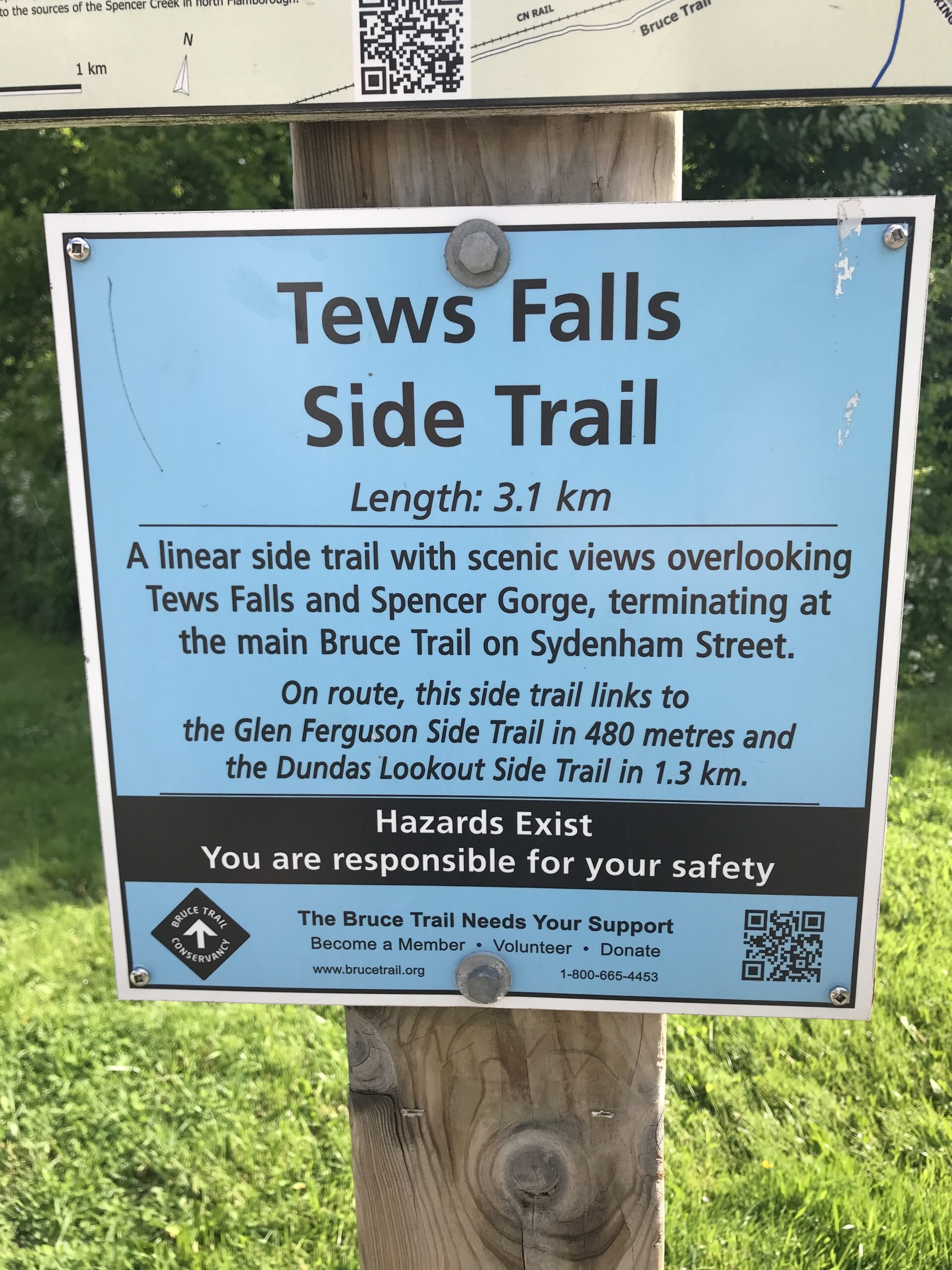
Loop Hike #7 - Tews Falls
https://hikesstaging.brucetrail.org/event/loop-hike-7-tews-falls/Sorry, the registration cut-off time for this hike has been reached.Not a member? Click here to join today!Hosting Club: Iroquoia
Category: General Hike
Location (Google Maps): Rock Chapel Sanctuary parking lot. Fee required. Enter from Rock Chapel Road, 1.5 KM south of Highway 5, 1.8 KM west of Highway 6.Hike Leader(s): Pati Greenwood, Jeff Dowsett Click here to contact Hike Leader(s)
Pace: Medium – 3 to 4 km/hr
Terrain: Moderate – Some hills and/or some poor footing
Distance: 13 KMDescription
From the parking lot, we will follow the Main trail and the Tews Falls Side Trail up to Tews Falls, returning via the Glen Ferguson Side Trail for a 13 KM loop. Bring plenty of water and a snack. Please arrive at 8:15 am as we will depart promptly at 8:30 am.
Hike 4 of 7 - Caledon HIlls E2E
https://hikesstaging.brucetrail.org/event/hike-4-of-7-caledon-hills-e2e/Sorry, the registration cut-off time for this hike has been reached.Not a member? Click here to join today!Hosting Club: Caledon Hills
Category: End-to-End
Location (Google Maps): Meet at 9:15 at the Parking Lot on 7th Line, just east of Airport Road.
Shuttle to Innis Lake Road and Finnerty SideroadHike Leader(s): Jennie Greenfield Click here to contact Hike Leader(s)
Pace: Medium – 3 to 4 km/hour
Terrain: Moderate – some hills and/or some poor footing, Strenuous – hilly with steep climbs and some poor footing
Distance: 12.02 kmDescription
Hike 4 of 7 – Caledon Hills E2EThe trail heads north on Innis Lake Road then onto a road allowance descending into the Dingle, and continues up and down through Glen Haffy Conservation Area, across Highway 9, past a reservoir and crossing the Humber River and more hills to 7th Line.
31.5 to 43.3 + 0.22 side trails = 12.02 km (Edition 31)
This hike can be logged towards the “60 for 60th Anniversary” badge
- 01October 1, 2024
8:00 Long Hike Wiley Road Short Hills
https://hikesstaging.brucetrail.org/event/800-long-hike-wiley-road-short-hills-56/Sorry, the registration cut-off time for this hike has been reached.Not a member? Click here to join today!Hosting Club: Niagara
Location (Google Maps):
Short Hills Wiley Road Entrance
Pace: Medium
Terrain: Moderate
: 10kmDescription
Explore Short Hills and the majestic side trails of Scarlett Tanager, Hemlock. Swayze Falls and Terrace. Register for each hikeBring Poles, Sunscreen, bug spray water, snack, and dress for the weather
Car Hike: Blue Mountain E2E Stain Glass Badge
https://hikesstaging.brucetrail.org/event/car-hike-blue-mountain-e2e-stain-glass-badge/Sorry, the registration cut-off time for this hike has been reached.Not a member? Click here to join today!Hike open to BTC Members only.
This is a Multi-Day Hike
You are signing up for the following dates and times:
2024-10-01 at 08:30
2024-10-02 at 08:30
2024-10-03 at 08:30Hosting Club: Toronto
Category: Car Hike
Location (Google Maps): Day 1- Km 51.9 Dufferin, Mulmur -Nottawasaga Townline, at the cemetery. Coordinates N 44.268777,W 80.156810 map 21
Day 2- 380 meters north of km 46.8 coordinates N 44.430927,W 80.275390
Day 3- same as day 2Hike Leader(s): Smadar junkin Click here to contact Hike Leader(s)
Pace: Brisk
Terrain: Challenging, Hilly
Distance: 21.9 kmDescription
Welcome to the Blue Mountain fund raising hike series. The funds collected for this section are used to maintain the pledge of “ Ribbon Of Wilderness For Everyone Forever”. On this hike series you will be allowed to miss one hike that you will need to make up on your own to qualify for the stain glass badge.
on day one we will shuttle to km 21.9 , paid parking. Everyone will be required to pay their share of the parking. We will hike back to km0.0.
on day two we will shuttle to the same place, everyone is required to pay their share of the parking. We will hike 25 km. On day three we will shuttle to the end of the Blue Mountain section and hike back. 20 km.
Bring 2 litres of water, snacks, lunch. Be at the meeting place 15 minutes early so we can leave by 8:30. Everyone is required to take turns in the car shuttles.Urban Walk: Valley View Park Thornhill
https://hikesstaging.brucetrail.org/event/urban-walk-valley-view-park-thornhill-20/Sorry, the registration cut-off time for this hike has been reached.Not a member? Click here to join today!Hosting Club: Toronto
Location (Google Maps): Parking lot at the corner of Bayview Ave, and Sycamore Dr. South of Highway 7
Sycamore Dr. is 3blocks south of highway 7 and 2 blocks north of John Street, parking lot is across plaza of Dollarama and Star boxHike Leader(s): Mohammad Aghamiri Click here to contact Hike Leader(s)
Pace: Moderate (3-4 km/hr)
Terrain: Level 2 (Intermediate – some hills and uneven surfaces, rocks and roots underfoot)
Distance: 7-8 kmDescription
We will explore Valleyview and Maple view parks, and walk along German Mill Creek, for a distance of 7-8 km. Difficulty Level: 2 (Moderate)9:15 Short hike - Pelham Road, Short Hills
https://hikesstaging.brucetrail.org/event/915-short-hike-pelham-road-short-hills-87/Sorry, the registration cut-off time for this hike has been reached.Not a member? Click here to join today!Hosting Club: Niagara
Category: Loop
Location (Google Maps): Short Hills Provincial Park, Pelham Road entranceHike Leader(s): janet davey Click here to contact Hike Leader(s)
Pace: Medium
Terrain: Moderate
Distance: 6 kmsDescription
Hike the main and side trails in Short Hills Provincial Park. Bring hiking boots, water, sunscreen and bug spray. Be sure to check yourself for ticks at the end of the hike.Tuesday Hikes 20 Year Anniversary End-to-End - Hike 3
https://hikesstaging.brucetrail.org/event/tuesday-hikes-20-year-anniversary-end-to-end-hike-3/Sorry, the registration cut-off time for this hike has been reached.Not a member? Click here to join today!Hosting Club: Dufferin Hi-Land
Category: Tuesday Hike
Location (Google Maps):Dufferin Hi-Land Map 20, Km 17.6. Meet at Bruce Trail parking lot at end of Centre Rd, south of 5 Sideroad.
Hike Leader(s): Tony Evangelista;Inge Eckerich;Les Babbage;Julie Daley Click here to contact Hike Leader(s)
Pace: Leisurely
Terrain: Moderate
Distance: 5.4 km; No drop out.Description
In 2004 a group of Dufferin Hi-Land BTC members began organizing Tuesday hikes. For their first venture, they hiked a 10 hike/10 week end-to-end series of the DH section. Join us as we recreate this series to celebrate the 20th anniversary of Tuesday hiking and recognize the pioneers who started it all.Hike 3 will take us from 30 Sideroad to Bruce Trail parking at the end of Centre Rd. We will car shuttle from Centre Rd back to 30 Sideroad parking.
Bring water, snacks and sun screen.
Terra Cotta
https://hikesstaging.brucetrail.org/event/terra-cotta-14/Sorry, the registration cut-off time for this hike has been reached.Not a member? Click here to join today!Hosting Club: Caledon Hills
Category: Tuesday Hikers
Location (Google Maps): Meet at Winston Churchill Blvd., intersection with Caledon Trailway.
Driving direction: North on Highway 410, continue north on Highway 10, left on King Street, right on Winston Churchill Blvd; drive 1 kilometre to roadside parking close to Caledon Trailway.Hike Leader(s): Mohammad Shafiq Click here to contact Hike Leader(s)
Pace: Medium – 3 to 4 km/hour
Terrain: Moderate – some hills and/or some poor footing
Distance: 12 kmDescription
Will hike Terra Cotta Side Trail and main Bruce Trail. Bring water, snack, poles and bug spray.
Hike Leaders phone contact for the day of hike: 416-566-0503.
Beaver Bites #5 of 8
https://hikesstaging.brucetrail.org/event/beaver-bites-5-of-8/Sorry, the registration cut-off time for this hike has been reached.Not a member? Click here to join today!Hosting Club: Beaver Valley
Location (Google Maps): Park on Graham’s Hill Road at km 74.2, Map 27, ED 31
Hike Leader(s): Kristina Rettie Click here to contact the hike leader.
Pace: Medium
Terrain: Moderate, Some rocky footing, Some steep sections, Strenuous
Length of Hike: 12.8kmDescription
This loop hike will take us on Graham’s Hill Side Trail, Campbell’s Hill Side Trail and Valley Crossover Side Trail. We will use the main Bruce Trail to piece it all together.Add on – Mushroom Hunter Badge. Let’s go hunting for mushrooms and other fungi. The magic of the search is in the slowing down and noticing. From the forest floor to trunks of trees, keep a keen eye out as you search for a minimum of 20 different varieties of fungi.
Bring a snack and water
Please no dogs
Text Kristina @ 519-410-9077 for morning of cancellations.
COVID-19 Precautions Before, During and After your Hike
- Each hiker joining a Bruce Trail Club organized hike must perform a self-screening check before hiking.
Find Ontario’s self-assessment tool here: https://covid-19.ontario.ca/self-assessment/ - If you are experiencing COVID-19 symptoms, stay home.
- Personal Protective Equipment:
- Hikers may choose to wear masks
Transportation
It is the Bruce Trail Conservancy’s current policy that car shuttles are allowed. It is at the discrepancy of individual hike leaders to make that decision.
Other Guidelines
- Arrive 15 minutes before the start of the hike.
- Wear sturdy footwear and appropriate attire for the weather and the terrain.
Hiking poles are a good idea in any season, especially if the terrain is rocky or slippery. In winter, snowshoes or icers/crampons are needed when conditions dictate.
Wearing appropriate clothing and footwear prevents injuries and shows consideration for a safe and positive group hiking experience. - Always carry I.D. and your health card.
- Bring sufficient water and snacks (or lunch if indicated). A minimum of 1L of water is recommended on all hikes, and 3L is recommended for long, challenging hikes in the heat of the summer.
- Bring sunscreen and insect repellent (for spring and summer hikes).
- Bring your own first aid kit.
- Please leave dogs at home.
60 for the 60th Anniversary Badge Hike Series - #8 of 10
https://hikesstaging.brucetrail.org/event/60-for-the-60th-anniversary-badge-hike-series-8-of-10-2/Sorry, the registration cut-off time for this hike has been reached.Not a member? Click here to join today!Hosting Club: Caledon Hills
Category: General
Location (Google Maps): Roadside parking on the 4th Line EHS at the entrance to the Peter Beecham Side Trail; km 54.9, Map 18.Hike Leader(s): Marilyn Ross 416-895-8254 Click here to contact Hike Leader(s)
Pace: Leisurely – 3 km/hour or less
Terrain: Moderate – some hills and/or some poor footing
Distance: 6 kmDescription
Join Marilyn and Joyce on this 2 hour, 6 km hike which is the 8th in the series of hikes for the new “60 for the 60th Anniversary” badge. We will hike west to the 3rd Line EHS and include the Griffith Ravine Side Trail on the return. Hike one, a few, or all 10 hikes. Join any hike and make up the rest on your own as long as a record is kept of their hikes to submit on completion to obtain their badge. Participants who complete all 10 hikes will be eligible to purchase the “60 for the 60th” badge.
Bring poles, and hydration. - Each hiker joining a Bruce Trail Club organized hike must perform a self-screening check before hiking.
- 02October 2, 2024
WEDNESDAY WALKERS - Webwood Falls
https://hikesstaging.brucetrail.org/event/wednesday-walkers-webwood-falls/Sorry, the registration cut-off time for this hike has been reached.Not a member? Click here to join today!Hosting Club: Beaver Valley
Location (Google Maps): Meet in the BTC parking lot on Grey Road 40, Km 105.7 Map 28 Edition 31
Hike Leader(s): Margaret Yaraskavitch Click here to contact the hike leader.
Pace: Medium
Terrain: Moderate
Length of Hike: 4.6 kmDescription
We gather in the somewhat new BTC parking lot on Grey Road 40. Our Trail takes us a short distance across a field and then into a forest. Then it’s a country walk beside farm fields towards Webwood Falls. We will view the Falls and poke around the old Harwood Farm to see features left behind from farmstead days. They we return back to our vehicles.COVID-19 Precautions Before, During and After your Hike
- Each hiker joining a Bruce Trail Club organized hike must perform a self-screening check before hiking.
Find Ontario’s self-assessment tool here: https://covid-19.ontario.ca/self-assessment/ - If you are experiencing COVID-19 symptoms, stay home.
Other Guidelines
- Arrive 15 minutes before the start of the hike.
- Wear sturdy footwear and appropriate attire for the weather and the terrain.
Hiking poles are a good idea in any season, especially if the terrain is rocky or slippery. In winter, snowshoes or icers/crampons are needed when conditions dictate.
Wearing appropriate clothing and footwear prevents injuries and shows consideration for a safe and positive group hiking experience. - Always carry I.D. and your health card.
- Bring sufficient water and snacks (or lunch if indicated). A minimum of 1L of water is recommended on all hikes, and 3L is recommended for long, challenging hikes in the heat of the summer.
- Bring sunscreen and insect repellent (for spring and summer hikes).
- Bring your own first aid kit.
- Please leave dogs at home.
Christie Lake
https://hikesstaging.brucetrail.org/event/christie-lake-3/Sorry, the registration cut-off time for this hike has been reached.Not a member? Click here to join today!Hosting Club: Iroquoia
Category: Good Companions
Location (Google Maps):Christie Lake Conservation Area largest parking lot.
Hike Leader(s): Craig Sim Click here to contact Hike Leader(s)
Pace: Medium – 3 to 4 km/hr
Terrain: Moderate – Some hills and/or some poor footing
Distance: 10-11k (approximate)Description
Drive straight in from entrance, main parking lot to your right turn from stop sign at T junction. Either Hamilton Conservation Area membership or parking fees apply. Loop of lake as well as an upstream extension across the road, exact route may vary. Wear boots or strong footwear. One side of loop flat, other has some moderate hills. Prepare for variable conditions and footing if wet conditions, easy in ideal conditions. Dress in layers appropriate to weather. Bring water and snack. Hike leaves at 10am.Evening Hike in Owen Sound followed by an Opportunity for Refreshments
https://hikesstaging.brucetrail.org/event/evening-hike-in-owen-sound-followed-by-an-opportunity-for-refreshments-9/Sorry, the registration cut-off time for this hike has been reached.Not a member? Click here to join today!Hosting Club: Sydenham
Category: An evening walk.
Location (Google Maps): Municipal parking lot on 1st Ave East between 7th St and 8th St in Owen SoundHike Leader(s): Harriet Nixon Click here to contact Hike Leader(s)
Pace: Brisk: 4 to 5 km/h
Terrain: Moderate: Some hills and/or poor footing
Distance: Approx 5 kmDescription
Join us for an evening hike exploring Owen Sound neighbourhoods followed by an opportunity for refreshments. We will check out the salmon run at the Fish Dam during this hike. There is no need to show up 15 minutes early for this hike, but we will leave promptly at 7 pm. - Each hiker joining a Bruce Trail Club organized hike must perform a self-screening check before hiking.