
Hike Schedule
Join us for a hike! Registration required.
All hikes available to BTC members. Some hikes are open to non-members.
See Refund Policy for Paid Hikes >
TIP: The calendar view displays up to 7 hikes on a day, but often there are more. Click “View more events” to see them all.
Categories
- 26September 26, 2024
8:00 am Long Hike Jordan to Moyer / Louth
https://hikesstaging.brucetrail.org/event/800-am-long-hike-jordan-to-moyer-louth-81/Sorry, the registration cut-off time for this hike has been reached.Not a member? Click here to join today!Hosting Club: Niagara
Location (Google Maps):
Jordan Hollow Park 3039 King St Jordan
Pace: Medium
Terrain: Moderate
: 10kDescription
From Jordan Hollow Hike the main trail to Upper and Lower Balls Falls, Moyer Road or Louth and Return. You must register for each hike. Bring Poles, sunscreen, bug spray , snack and a drink and dress for the weatherUrban hike: Valley View Park Thornhill 40
https://hikesstaging.brucetrail.org/event/urban-hike-valley-view-park-thornhill/Sorry, the registration cut-off time for this hike has been reached.Not a member? Click here to join today!Hosting Club: Toronto
Location (Google Maps): Parking lot at the corner of Bayview Ave, and Sycamore Dr. South of Highway 7
Sycamore Dr. is 3blocks south of highway 7 and 2 blocks north of John Street, parking lot is across plaza of Dollarama and Star boxHike Leader(s): Mohammad Aghamiri Click here to contact Hike Leader(s)
Pace: Moderate (3-4 km/hr)
Terrain: Level 2 (Intermediate – some hills and uneven surfaces, rocks and roots underfoot)
Distance: 7-8 kmDescription
We will explore Valleyview and Maple view parks, and walk along German Mill Creek for approximately 7-8 km Difficulty Level 2: (Intermediate)Hiking Around Jordan
https://hikesstaging.brucetrail.org/event/hiking-around-jordan-3/Sorry, the registration cut-off time for this hike has been reached.Not a member? Click here to join today!Hosting Club:
Location (Google Maps): Shoarishon Park (formerly Jordan Hollow)
Hike Leader(s): Bill Russell Click here to contact Hike Leader(s)
Pace: Medium
Terrain: ModerateDescription
Hiking in and around Jordan, Jim Rainforth Trail and Balls Falls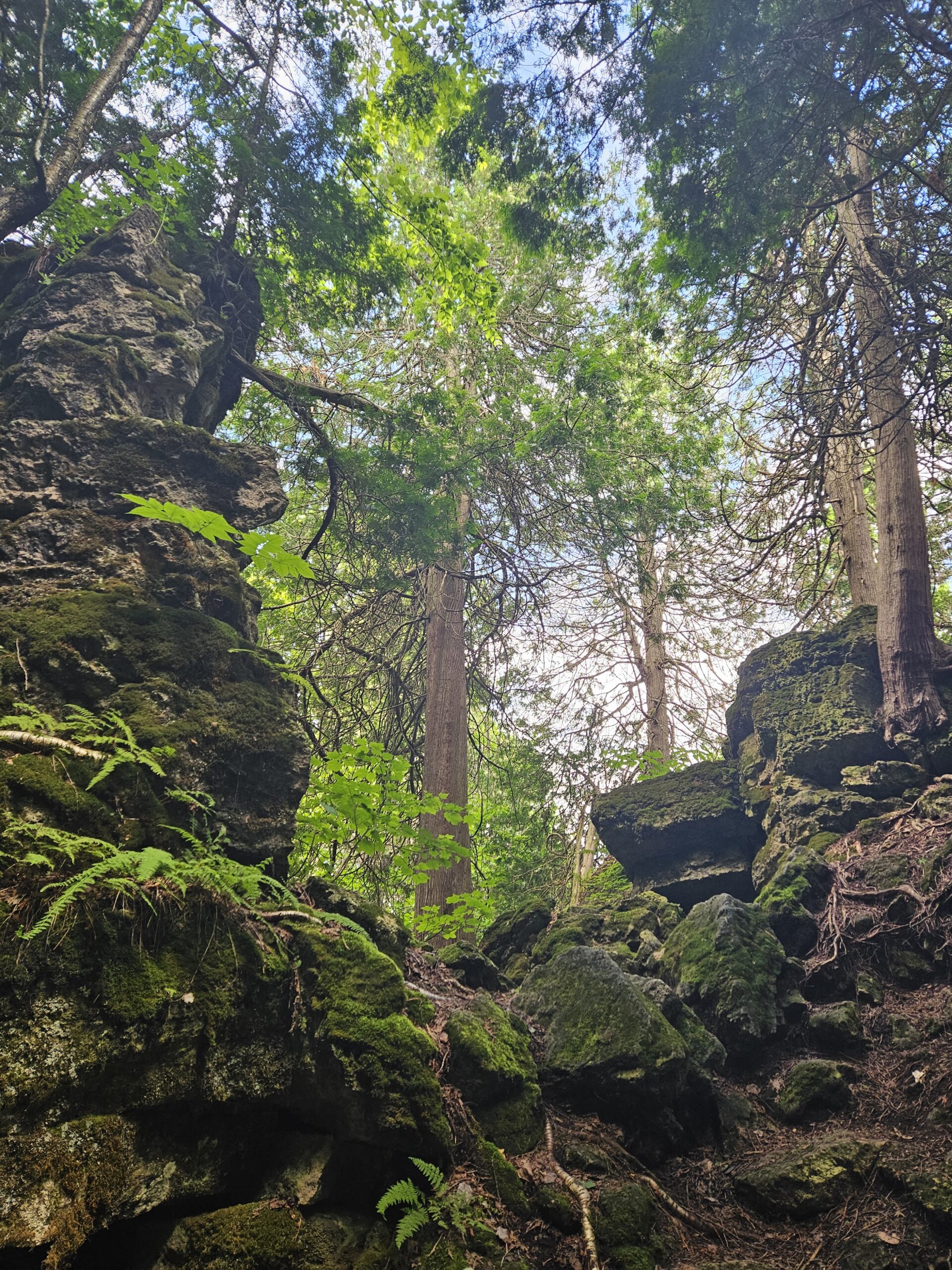
Walk and Talk Rocks: Mono Cliffs
https://hikesstaging.brucetrail.org/event/walk-and-talk-rocks-mono-cliffs/Sorry, the registration cut-off time for this hike has been reached.Not a member? Click here to join today!Hike open to BTC Members only.
Hosting Club: Caledon Hills
Category: General
Location (Google Maps): Meet at 9:30 am at the parking lot at Mono Community Centre. The centre is located at 754483 Mono Centre Rd. Please park in the gravel surface lot.Hike Leader(s): Elizabeth Ganong Click here to contact Hike Leader(s)
Pace: Leisurely – 3 km/hour or less
Terrain: Moderate – some hills and/or some poor footing
Distance: Approximately 9.5 kmDescription
CANCELLED: Due to illness, this hike has been cancelled for September 26th. It will be re-posted soon with the hike date of Thursday, October 10th. Our apologies.Let’s rock it out and explore the geology of Mono Cliffs. (This is a repeat of the geology hike offered on August 29th.) We’ll hike mainly at a leisurely pace over the approximately 9.5 km route as we cover many of the highlights of Mono Cliffs Provincial Park. Dr. Kathy Wallace will provide an introductory-level look at the geology of the park that welcomes your curiosity. Plan on a lunch break at a spectacular look-out, a total time out around four or four and a half hours, and having your way of engaging with the trail expanded. This interactive hike was created for a small group. No dogs please.
Niagara End-to-End Hike 4 of 6
https://hikesstaging.brucetrail.org/event/niagara-end-to-end-hike-4-of-6/Sorry, the registration cut-off time for this hike has been reached.Not a member? Click here to join today!Hosting Club: Caledon Hills
Category: End-to-End
Location (Google Maps): Meet at DeCew House Heritage Park, km 29.9 (Map 3), 500 m west of Merrittville Highway. Shuttle to start at Short Hills Provincial Park.Hike Leader(s): Nancy Mooney Click here to contact Hike Leader(s)
Pace: Medium – 3 to 4 km/hour
Terrain: Moderate – some hills and/or some poor footing
Distance: 42.3 – 29.9 + trail from parking = 12.7 km totalDescription
This is the fourth hike in the series and involves Short Hills Provincial Park, Swayze Falls, Terrace Creek and Falls, Twelve Mile Creek, DeCew Falls, and Lake Moodie.
Mount Nemo Views
https://hikesstaging.brucetrail.org/event/mount-nemo-views-2/Sorry, the registration cut-off time for this hike has been reached.Not a member? Click here to join today!Hosting Club: Iroquoia
Category: Thursday Group
Location (Google Maps): Mount Nemo Conservation Area, 5317 Guelph Line, BurlingtonHike Leader(s): Anne Armstrong Click here to contact Hike Leader(s)
Pace: Leisurely – 3km/hr or less
Terrain: Moderate – Some hills and/or some poor footing
Distance: Approx. 6 – 7 km.Description
Mount Nemo provides some wonderful views from the top of the Niagara Escarpment, looking east to Mississauga, Toronto and north east to Milton and Rattlesnake Point. Join us as we hike the trails of Mount Nemo with its varied terrain from flat trails to negotiating rocky areas. Meet in the main parking lot of Mount Nemo CA on Guelph Line at 9:45 am. for a 10:00 start. Park reservation through Halton Parks is necessary for entry. Bring water, a snack, sunscreen and insect repellent. (Hopefully there won’t be any!) Hiking poles would be useful. An e-mail will be sent out a few days before the hike.
Leader: Anne ArmstrongInternational Friendship Trail Official Opening at MNRCC (Cape Chin)
https://hikesstaging.brucetrail.org/event/international-friendship-trail-official-opening-at-mnrcc-cape-chin/Sorry, the registration cut-off time for this hike has been reached.Not a member? Click here to join today!Hosting Club: Peninsula
Location (Google Maps): Meet us inside the gate at Maple Cross Nature Reserve to hike the latest BTC International Friendship Trail! Join Jackie Randle and other International Trail Members for the official opening of the BTC’s second Friendship Trail in the Peninsula Club with the Southwest Coast Path. The Friendship Trail will cover the loop created by the Cape Chin Meadow Side Trail and the main trail at Cape Chin creating a loop of about 10km.
Hike Leader(s): Tamara Wilson Click here to contact Hike Leader(s)
Pace: Leisurely
Terrain: Moderate
Distance: 6kmDescription
From restored meadows, wetlands, hardwood and softwood forests including the spectacular views from Cape Chin and other escarpment views – this new Friendship Trail loop with the Southwest Coast Path in the UK. will have it all! - 27September 27, 2024
Car Hike: Tobermory Fall Hiking Weekend (2 overnights)
https://hikesstaging.brucetrail.org/event/car-hike-tobermory-fall-hiking-weekend-2-overnights/Sorry, the registration cut-off time for this hike has been reached.Not a member? Click here to join today!This is a Multi-Day Hike
You are signing up for the following dates:
2024-09-27, 2024-09-28, 2024-09-29Hosting Club: Toronto
Category: Car Hike
Location (Google Maps): Princess Hotel
34 Bay St, Tobermory, ON N0H 2R0Hike Leader(s): Jeanette Vincent. Click here to contact Hike Leader(s)
Pace: Moderate (3-4 km/hr)
Terrain: Rocky, Variable
Distance: 13 -15kmDescription
We continue Greg Vincent’s legacy of weekends away. Please join Jeanette Vincent, as we explore the Tip o’ the Bruce, Tobermory in the Fall. The beauty of this area of the Bruce Peninsula every season is wonderful! We will take in a number of walks using side trails and the Bruce Trail. Approximately 13-15km/day. We stay and have our meals at a comfortable hotel overlooking Little Tub Harbour. This outing is restricted to those staying with us at the Princess Hotel in Tobermory for the weekend – the hotel fills quickly. You will need a car to access this outing. Please contact the Princess Hotel for a reservation.1-519-592-8282 or info@tobermoryprincesshotel.com and mention Vincent/Royle Fall weekend.Before registering at the hotel please contact Jeanette: vincentjeanette1604@gmail.com | 519-588-5916 For prices and more details.

9:00 am Niagara-on-the-Lake Tour
https://hikesstaging.brucetrail.org/event/900-am-niagara-on-the-lake-tour-25/Sorry, the registration cut-off time for this hike has been reached.Not a member? Click here to join today!Hosting Club: Niagara
Category: Urban
Location (Google Maps): Veterans Memorial Park, park just outside the park on King StreetHike Leader(s): Robin Garrett Click here to contact Hike Leader(s)
Pace: Medium
Terrain: Easy
Distance: 6-7 kmDescription
Each Friday we will explore different neighbourhoods, trails and parkland throughout Historic Niagara-on-the-Lake.Moderate pace with some weeks entirely on sidewalks and roads while others may include a mix of trails and paved pathways. Great way to build up endurance for longer more strenuous hikes.
Prepare for cooler windy conditions on open parkland and along Lake Ontario and Niagara River trails.
Plan to stay for conversation and a warm cup of coffee or tea at Sweets & Swirls, Community Centre, Niagara Stone Road, NOTL
Truth and Reconciliation Orange Shirt Day hike at Island Lake
https://hikesstaging.brucetrail.org/event/truth-and-reconciliation-orange-shirt-day-hike-at-island-lake/Sorry, the registration cut-off time for this hike has been reached.Not a member? Click here to join today!Hosting Club: Caledon Hills
Category: General
Location (Google Maps): Island Lake, Orangeville. Meet at parking spot P3. Park address is: 673067 Hurontario St., Orangeville, ON L9W 2Y9Hike Leader(s): GG Click here to contact Hike Leader(s)
Pace: Medium – 3 to 4 km/hour
Terrain: Easy – mostly flat and usually good footing, Moderate – some hills and/or some poor footing
Distance: 8 kmDescription
An easy-moderate-introductory level hike at Island Lake with Truth and Reconciliation Orange Shirt Day top of mind. We will hike the mostly flat main loop with scenic vistas, lake spanning bridges with opportunities for various wildlife viewing.We will meet up with a warm up walk around the park’s tales on the trail which is currently featuring ‘Phyllis’s Orange Shirt’. We will then head over to the main loop and end at the newly constructed Crane Gathering Space. I’ll share site specific brief points as we share the space in conversation. Building in extra time for conversation, hydration breaks etc. Hiking footwear and/or stable shoes (no sandals), poles, water, snack, appropriate clothing , bug spray, sunscreen. There are buggy spots and no shade trail areas. Bathrooms on site.
Note: this is a pay for entry/parking TRCA managed site (~$8), for information: https://cvc.ca/discover-our-parks/island-lake/
Meet up at 8:45 AM please with 9:00 AM sharp start in parking spot P3. Park address is: 673067 Hurontario St., Orangeville, ON L9W 2Y9
- 28September 28, 2024

Sydenham in 6 Challenger Series - Fundraiser
https://hikesstaging.brucetrail.org/event/sydenham-in-6-challenger-series-fundraiser-2/Sorry, the registration cut-off time for this hike has been reached.Not a member? Click here to join today!Hike open to BTC Members only.
This is a Multi-Day Hike
You are signing up for the following dates and times:
2024-09-28 at 07:45
2024-09-29 at 07:00
2024-10-19 at 07:45
2024-10-20 at 07:00
2024-11-02 at 07:45
2024-11-03 at 07:00Hosting Club: Sydenham
Category: Fundraiser
Location (Google Maps):Hike Leader(s): Margaret O’Dell, Kristina Rettie Click here to contact Hike Leader(s)
Pace: Fast: more than 5 km/h
Terrain: Strenuous: Hilly with steep climbs and some poor footing., There are crevices or holes which may be hidden by layers of snow. Hike with extreme caution., There might be icy and slippery sections., There might be muddy sections., There might be sections with water on the trail.Description
This is a Challenger series of hikes; we will complete the entire 171.6 km of the Sydenham section in 6 hikes. At the same time, we will be raising funds in support of the Sydenham Bruce Trail Club to earn the new Hart’s Tongue Stained Glass badge. The cost of the badge is included in your registration fee. There are no refunds permitted for this series. You are registering for 6 hikes, please review the dates carefully to ensure you are able to participate fully. Registration is limited to 6 persons.- This hike series is intended for experienced distance hikers only. Hikers must be able to sustain the distance and maintain a fast pace.
- If a hiker is unable to keep pace with the group, or finds the distance too challenging, their future hike registrations may be canceled by the hike leader.
- Be very aware of your ability to join this series.
- Hikes will average 4.5 km per hour including breaks, moving pace is 5 km per hour;
- Expect to be on-trail for 7 – 8 hours;
- Meeting time is scheduled for 7:45am each Saturday to allow for extra travel time, on Sunday we will meet at 7:00am; arrive no later than 15 minutes prior to the meeting time;
- Hikers must carry sufficient hydration, accessible snacks, lunch, first-aid kit, rain gear, extra socks, and possibly protective boot covers (i.e. bags);
- Hikers will be expected to participate in shuttling hikers to the start and to drive shuttlers back to their car. Responsibility will be shared equally;
- Any applicable parking fees will be shared within the group.
Summary of the itinerary:
- Sep 28: Blantyre to Bognor Marsh: 27 km
- Sep 29: Bognor Marsh to Bayview Escarpment: 28.1 km
- Oct 19: Bayview Escarpment to Hwy 6/10 Owen Sound: 31.6 km
- Oct 20: Hwy 6/10 Owen Sound to East Linton: 28.9 km
- Nov 2: East Linton to Dodd’s Hill Side Trail: 29.2 km
- Nov 3: Dodd’s Hill Side Trail to Bluewater Beach Park Wiarton: 26.8 km
A detailed schedule will be provided in advance of the series to registered hikers.

School Bus Hike: Boyne Valley and Primrose - ** CANCELLED Due to Low Registration **
https://hikesstaging.brucetrail.org/event/school-bus-hike-boyne-valley-and-primrose/Sorry, the registration cut-off time for this hike has been reached.Not a member? Click here to join today!Hosting Club: Toronto
Category: Cancelled
Location (Google Maps): Bruce Trail parking lot at Prince Of Wales RdHike Leader(s): Amir Alemohammad, Michael Humpage, Mehrnoush Ahmadi Click here to contact Hike Leader(s)
Pace: Moderate (3-4 km/hr)
Terrain: Hilly, Level 2 (Intermediate – some hills and uneven surfaces, rocks and roots underfoot), Variable
Distance: 14kmDescription
Bus departs 10 York Mills Rd at 8:00 AM and Major Mackenzie Dr and HWY 400 Park and Ride at 8:30 AM. If you wish to be picked up at the Major Mackenzie Dr and HWY 400 Park and Ride, type ‘yes’ in the additional information field. Please arrive 15 minutes before departure.Join us for an early fall hike in Boyne Valley Provincial Park, a hidden gem along the BT. We will explore the Primrose ST and will head into the Boyne Valley Park to reach the Murphy’s Pinnacle. After hiking in the valley we will make a loop return to the parking lot at Prince of Wales Rd. We will have frequent short stops for water and bio breaks and a 20 minute stop for lunch. Please bring water, snacks/lunch and dress according to the weather condition. Be prepared for early morning chilled air at this time of the season. Boots are mandatory and poles are recommended. A short stop for refreshments in Shelbourne down town if enough time. We do love pets but they are not allowed in this hike.
Drop out after 8K at the 1EHS Rd.
Steeltown Stomp 2024
https://hikesstaging.brucetrail.org/event/steeltown-stomp-2024/Sorry, the registration cut-off time for this hike has been reached.Not a member? Click here to join today!Hosting Club: Iroquoia
Category: Steeltown Stomp
Location (Google Maps): Mohawk 4 Ice Centre, 710 Mountain Brow Blvd., Hamilton ON, L8T 5A9. Please park at the north end of the parking lot.Event Coordinator(s): Samar Smith Click here to contact Event Coordinator(s)
Event Start Times: 8:00 AM, 8:15 AM, 8:30 AM, 8:45 AMPace: Brisk – 4 to 5 km/hr, Fast – 5+ km/hr
Terrain: Strenuous – Hilly with steep climbs and some poor footing
Distance: Hike approximately 23 kms and climb up and down approximately 2000 steps.Description
Looking for a distance and strength challenge? The Steeltown Stomp is just what you’ve been looking for!Climb up and down approximately 2000 steps of the escarpment stairs, and hike over 23 kilometres in the Iroquoia Bruce Trail Club’s annual Steeltown Stomp.
This is a self-guided hike along the Bruce Trail, the Escarpment Rail Trail, and the Chedoke Radial Trail, climbing up and down the 7 sets of stairs along the Hamilton Escarpment as you go.
Everyone who completes the route and goes through the two checkpoints will earn the coveted Steeltown Stomp badge.
Please Note: This is an arduous hike and requires a high level of fitness due to the stair climbing required.
Fee: $35 fee includes checkpoint snacks, badge, and helps to support the Bruce Trail Conservancy in its mission to preserve a ribbon of wilderness, for everyone, forever.
Check in: At the registration booth set up at the north end of the parking lot of the Mohawk 4 Ice Centre. We have set up staggered start times – choose 8:00, 8:15, 8:30, or 8:45 when you register and you will start the hike as you are checked in. This is not a race, and you will not be timed.
Checkpoints: Start and end at the Mohawk 4 Ice Centre. There is a turnaround checkpoint at the Chedoke Golf Course, and then you hike back to the starting point.
Route: Follow the yellow blazes…special yellow blazes will be set up to mark the route. In addition, the route has been set up on the AllTrails app. If you have this downloaded on your phone, you can follow the route using the app.
Outbound route … https://www.alltrails.com/explore/map/steeltown-stomp-outbound-1-58c2ac6?u=m?u=m
Inbound route … https://www.alltrails.com/explore/map/steeltown-stomp-inbound-c89ca36?u=m
What to bring: Bring your own water. You will be able to refill your own water bottles at public water fountains along the route. Wear comfortable, sturdy shoes (hiking boots are not necessary), and dress for the weather. Protect yourself from insects and sun.
Safety Precautions: Normal hiker etiquette and safety precautions apply…https://development.brucetrail.org/explore-the-trail/#Bruce-Trail-101
Donations: If you are interested in contributing further to the BTC, please click here.
FAQ’s:
What if it rains? This is a rain or shine event.
What if I need to drop out? As we are in an urban area, there are places to meet a taxi or a ride along the way. This must be arranged by you, the participant. If you have to drop out during the event, please let us know per the contact information below.
How long will it take to finish? We estimate that the hike will take between 3 and 5 hours.
Are dogs allowed? No. The stairs will be too crowded during this event.
Contact: Leslie Ho at Steeltownstomp2024@gmail.com
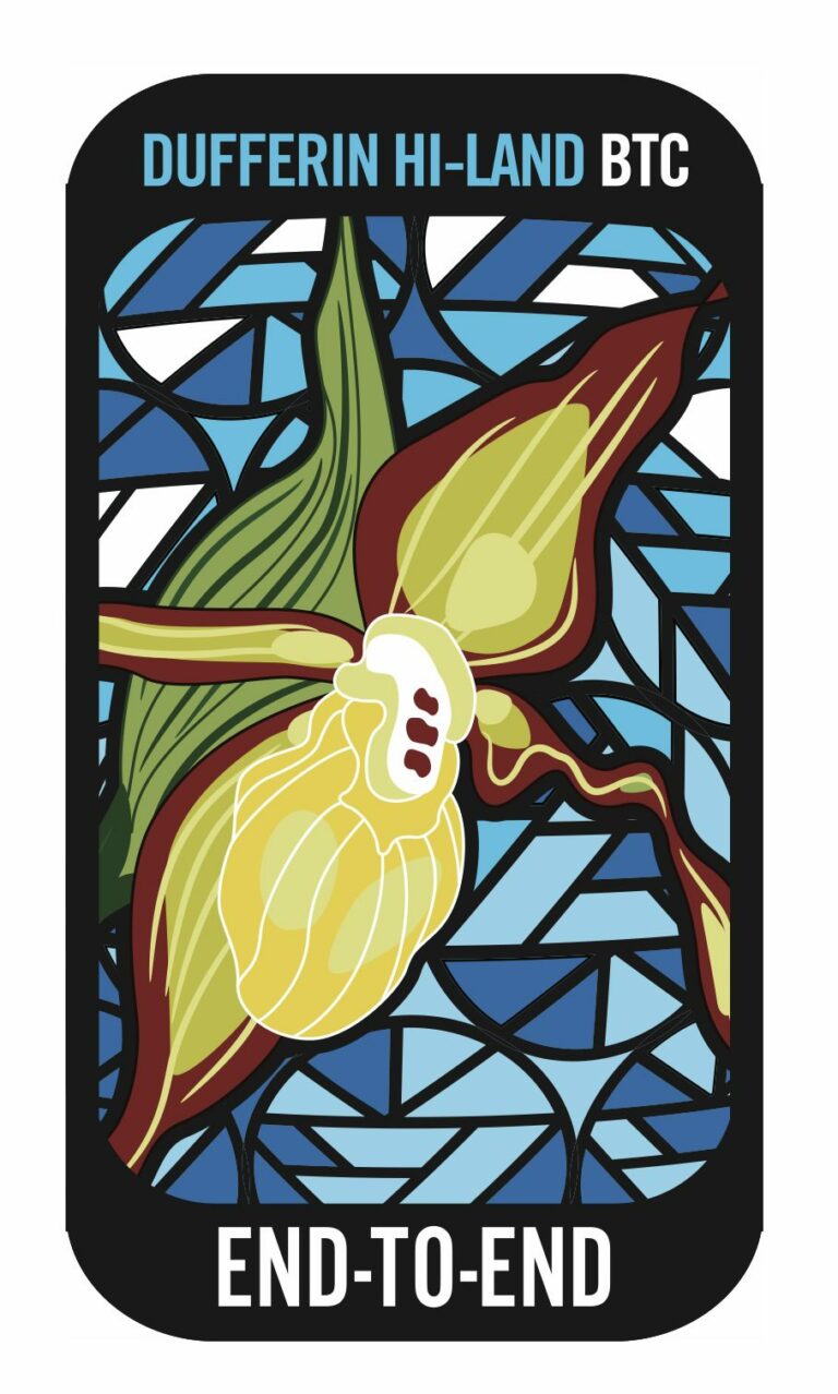
Dufferin Hi-Lands End to End in 3 Hikes ~ Stained Glass Fundraiser Badge
https://hikesstaging.brucetrail.org/event/dufferin-hi-lands-end-to-end-in-3-hikes-stained-glass-fundraiser-badge/Sorry, the registration cut-off time for this hike has been reached.Not a member? Click here to join today!This is a Multi-Day Hike
You are signing up for the following dates:
2024-09-28, 2024-09-29, 2024-10-05Hosting Club: Caledon Hills, Dufferin Hi-Land
Category: End-to-End
Location (Google Maps): Mono Community Center – west of km 72.2, 200 m south of Mono Centre.Hike Leader(s): Roopa Dindigal Click here to contact Hike Leader(s)
Pace: Medium – 3 to 4 km/hour
Terrain: Moderate – some hills and/or some poor footing
Distance: 19.4 + 450 metresDescription
This series of hikes is a Fundraiser for the Dufferin Hi-Land Bruce Trail Club. All proceeds fund the activities of the Club directly. You are signing up for 3 hikes and must be present at 3 hikes to receive the beautiful Stained Glass Lady Slippers End-to-End badge, included in your registrationWe will hike North to Southbound, on Hike #1 -Sept 28th we will hike from Road Side Parking on 1st line km 19.4 to Mono Community Center -19.4 km + 450 metres.
A detailed schedule for the full series, with dates and meeting locations, will be provided when you register.
This hike series is meant for experienced distance hikers, please keep in mind your ability to join this series.
- Please dress according to the weather presented that day
- Hikes will average 4 km per hour including breaks
- Expect to be on trail for 4 – 5 hours
- Meeting time is scheduled for an early start at 8:00 am so that we’re on the trail at the earliest part of the day
- You must arrive no later than 15 minutes before the meeting time to organize the shuttle & have your vehicle passenger ready, as everyone will be taking a turn either to start the hike or get drivers back at the end of the day.
- Hikers must carry sufficient hydration, accessible snacks, small lunch, first-aid kit, rain gear, extra socks, bug spray, etc; check the weather as you pack your gear
- If you have any questions or concerns, please use the Contact the Hike Leader above.
Car Hike: Erindale Park Mississauga
https://hikesstaging.brucetrail.org/event/car-hike-erindale-park-mississauga-3/Sorry, the registration cut-off time for this hike has been reached.Not a member? Click here to join today!Hosting Club: Toronto
Category: Car Hike
Location (Google Maps): Erindale Park, Dundas Street West,
park in parking lotHike Leader(s): Mohammad Aghamiri Click here to contact Hike Leader(s)
Pace: Moderate (3-4 km/hr)
Terrain: Variable
Distance: 14-15 kmDescription
We will hike Credit River North,and will see nice views of Credit River .And we will see Salmons heading upstreamTruth and Reconciliation Orange Shirt Day Dunedin Ravine Nature Reserve
https://hikesstaging.brucetrail.org/event/truth-and-reconciliation-orange-shirt-day-dunedin-ravine-nature-reserve/Sorry, the registration cut-off time for this hike has been reached.Not a member? Click here to join today!Hosting Club: Blue Mountains
Category: Register in person the morning of hike.
Location (Google Maps): Hike meets in the parking lot behind Tim Hortons on First St. in Collingwood.Hike Leader(s): Annette Sandberg Click here to contact Hike Leader(s)
Pace: Medium – 3 to 4 km/hr
Terrain: Moderate – Some hills and/or some poor footing
Distance: 6 kmDescription
We will head to the Dunedin Ravine Nature Reserve parking on 6/7 Sideroad and Concession 10.
Following the white blazed trail south on Concession 10, we enter the nature preserve on the east side. This area covers mixed terrain and provides a chance to experience a variety of habitats. The trail follows along the banks of a tributary of the Noisy River. After crossing Concession 10,we proceed through some farmers fields to a great view at the bench. We will then return following the road. Bring a snack or lunch and water.

Urban Walk; Humber Valley Recreational Trail
https://hikesstaging.brucetrail.org/event/urban-walk-humber-valley-recreational-trail/Sorry, the registration cut-off time for this hike has been reached.Not a member? Click here to join today!Hosting Club: Toronto
Category: Urban Walk
Location (Google Maps): Humber Recreational Trail, TorontoHike Leader(s): Brian Rideout Click here to contact Hike Leader(s)
Pace: Moderate (3-4 km/hr)
Terrain: Flat, Level 1 (Easy – mostly on flat, well maintained trails with hard-packed surface)
Distance: 26.4 kmDescription
Meet at the north east corner of Steeles Ave W and Kipling Ave by 10:00 am. The hike starts on time so don’t be late.This hike follows the Humber Recreational Trail south from Steeles Ave West at Kipling Ave through Toronto to Lake Ontario. The pub stop after is at Firkin on Bay. The bus to Old Mill Station stops in front of the pub.
Please bring a lunch and at least two liters of water. Be prepared for cool / wet weather.
This is the itinerary
0.0 km – 10:00 am – Steeles Ave W at Kipling Ave
4.3 km – 11:15 am – Finch Ave W at Islington Ave
8.4 km – 12:35 pm – 25 minute lunch – near Weston Rd and Sheppard Ave W (on trail behind and south of school)
12.0 km – 2:05 pm – Weston Rd and Oak St
15.8 km – 3:00 pm – Eglinton Ave W at Scarlet Rd
19.2 km – 4:00 pm – Dundas St W
23.7 km – 5:15 pm – Stephen – Berry Rd at Drive
26.4 km – 6:00 pm – Firkin on BayHere is an online map of our route: Humber Recreational Trail – https://onthegomap.com/s/vjskof0f
Note: Registration closes 48 hours before the start of the hike.
This hike is at capacity Car Hike: Where Geology and Biodiversity meet HIke with Beth Gilhespy geologist and author
https://hikesstaging.brucetrail.org/event/car-hike-where-geology-and-biodiversity-meet-hike-with-beth-gilhespy-geologist-and-author/Sorry, the registration cut-off time for this hike has been reached.Not a member? Click here to join today!Hosting Club: Toronto
Category: Car Hike
Location (Google Maps): Toronto section Silver Creek Map13 Edition 31 Parking at the Silver Creek Outdoor Education Centre Km 36.2 Fallbrook Trail NW of 27 Sideroad
THis hike is at its capacity no further registrationsHike Leader(s): Lynn McFerran Click here to contact Hike Leader(s)
Pace: Leisurely (2-3 km/hr)
Terrain: Rocky, Variable
Distance: 6-8 kmDescription
This hike is another of the Biodiversity Team education hikes to help hikers learn more about the region where we hike. Beth is a geologist and has led hikes in various part of the Bruce Trail sharing her knowledge about the geology of the area. The Silver Creek section has lots of interesting geological features.This will be a great day out hiking and learning.
Please dress for the day, Hiking boots recommended, bring your lunch, water and snacks. This hike will go rain or shine.
Mountains to Sea Greenway Friendship Trail - Iroquoia Bruce Trail Club
https://hikesstaging.brucetrail.org/event/mountains-to-sea-greenway-friendship-trail-iroquoia-bruce-trail-club/Sorry, the registration cut-off time for this hike has been reached.Not a member? Click here to join today!Hosting Club: Iroquoia
Category: Special Event
Location (Google Maps): City View Park off of Kerns Rd, Burlington. Enter off of Dundas StHike Leader(s): Ruth Moffatt Click here to contact Hike Leader(s)
Pace: Leisurely – 3km/hr or less
Terrain: Dependent on Conditions, Moderate – Some hills and/or some poor footing, Slippery and Steep Sections
Distance: Approximately 10kmDescription
Welcome to the launch of the Mountains to Sea Greenway Friendship Trail. We will meet at City View park at 9:45 to check-in. There will be an unveiling ceremony for the friendship trail opening at 10:00am followed by the hike which will take us southbound to Grindstone Greek, turnaround and return to City View Park. The terrain is variable, a few hills. Pace will be leisurely. The hike will take us about 2.5- 3 hours.This section of the Bruce Trail is twinned with the Tefuye Historical Trail of the Mountains to Sea Greenway (MSTW) in Taiwan.
Located in southwestern Taiwan, MSTW is a 177 km long-distance hike from Yanshuei River estuary to Mt. Jade, the highest peak in East Asia, at 3,952 meters above sea level. It spans across several forest biomes and aquatic ecosystems at different altitudes. It also links up Han culture, and Austronesian peoples such as Siraya, Tsou, and Bunun, making it a window into the cultural richness of Taiwan.
Tefuye Historical Trail (MSTW 26) is 6.4 km long. The route was initially a hunting path used by the Tsou people. During the Japanese colonial rule (1895-1945), the Japanese built a railway along this historical trail to transport red cypress and Taiwan cypress logged in the Alishan area. Now there are remains of the old railway and wooden bridges along the trail. The blueprint of the MSTW began in 2007 as a grassroots river protection project, and in 2018, the forestry bureau, along with 13 government agencies along the MSTW, and Taiwan Thousand Miles Trail Association (TMI Trail) formed a cross-sector/inter-municipal collaboration to jointly promote and maintain the MSTW.
You can find an English guidebook to the Mountains to Sea Greenway here.
Mountains to Sea Greenway
https://development.brucetrail.org/International-friendship-trails/

Oktoberfest Family & Friends Hike - Blue Series
https://hikesstaging.brucetrail.org/event/oktoberfest-family-friends-hike-blue-series/Sorry, the registration cut-off time for this hike has been reached.Not a member? Click here to join today!Hosting Club: Peninsula
Category: Peninsula Blue Series
Location (Google Maps):Hike Leader(s): Bill Floyd Click here to contact Hike Leader(s)
Pace: Leisurely
Terrain: Easy
Distance: ~ 4kmDescription
Join us for a free, family and friends hike starting from the Rotary Hall in Lion’s Head! Guided hike and a free bbq hot dog at the Rotary Hall afterwards – what a great recipe for a fun afternoon !!This Family & Friends Friendly Oktoberfest Fun hike is designed for both adults and adults with children.
We will leave the Rotary Hall and take the Lion’s Head Village Side Trail to the waterfront Bruce Trail with beautiful views of Isthmus Bay. We will then enjoy the Bannister’s Hill Side Trail loop (1 km) and explore the caves on the Williams’ Cave Side Trail. We will then make our way back to the Rotary Hall. The hike will take approximately two hours. The Rotary Club of Northern Bruce Peninsula is hosting their 2nd Annual Oktoberfest Day at the Rotary Hall on Saturday, September 28th. Please note that Oktoberfest 2024 officially runs from September 21 to October 6. For more information go to lionsheadoktoberfest.com
Thank you to the Rotary Club for generously offering each hiker a free hot dog after the hike!! Our friends from Tagwerk Bier are also sponsoring this event.
We will keep a pace that is appropriate for children, and modify the route if required due to weather.
Meet at the Rotary Centre at 1 p.m. 55 Main St, Lion’s Head.
Note: if you are bringing children, please also register them separately for the hike so we know how many people to expect. Thank you!
If you have questions, please contact both Bill at barriebill@gmail.com and Marie-Josie at Marie-josev@hotmail.com. One of us will get back to you shortly.
- 29September 29, 2024

Car Hike: Hike #9 to earn the Dufferin Hi-Land Youth and/or Side Trails Badge!
https://hikesstaging.brucetrail.org/event/car-hike-hike-9-to-earn-the-dufferin-hi-land-youth-and-or-side-trails-badge/Sorry, the registration cut-off time for this hike has been reached.Not a member? Click here to join today!Hosting Club: Toronto, Dufferin Hi-Land
Category: Car Hike
Location (Google Maps): We will meet at roadside parking on 15 Sideroad at Prince of Wales Road. Note that the only access to this location is from River Road, 500 m west of Kilgorie. Look for a small road sign, “15 Sideroad”, on a sharp curve on River Road. (Map 20 of the Bruce Trail Reference Guide, Edition 31).Hike Leader(s): Monica Pasquali Click here to contact Hike Leader(s)
Pace: Leisurely (2-3 km/hr)
Terrain: Variable
Distance: 7.7 kmDescription
Calling all families with children who love hiking and earning badges!!!This is the ninth in a series of ten hikes that will be offered throughout 2024 on a roughly monthly basis so that children who are 15 years of age and younger can earn the Dufferin Hi-Land Adventurer Youth Badge and their parents/guardians can earn the Dufferin Hi-Land Side Trails Badge at the same time!!! Details regarding the requirements for each badge can be found here: https://dufferinbrucetrailclub.org/dufferin-bruce-trail-club-badges/ Each of the ten hikes will be a loop hike so no car shuttles will be needed, and each hike will cover a distance of approximately 6-9 km hiked at a leisurely pace (2-3 km/h) so children and adults alike can participate.
This ninth hike will be a late summer/early autumn hike to explore the following three side trails: part of the Pine River Valley ST, the Carl Alexander ST, and the Melodonna ST. Please dress appropriately for a late summer/early autumn hike by dressing in layers (wear an inner layer that wicks sweat away from your skin, a middle layer that keeps you warm, and an outer layer that protects you from wind and rain), wearing a sunhat, and wearing comfortable footwear that has good traction. Hiking poles or walking sticks are an asset since they will help keep you balanced if the ground is muddy/slippery. As well, make sure you bring enough water and food for a 3-4 hour hike since we’ll be covering a total distance of approximately 7.7 km.
Hopefully you’ll be able to join me on Sunday, September 29th! Until then, happy hiking, everyone!
Bruce Trail Conservancy and Vieni Estates Presents: A Celebration of Partnership And Community
https://hikesstaging.brucetrail.org/event/bruce-trail-conservancy-and-vieni-estates-presents-a-celebration-of-partnership-and-community/Sorry, the registration cut-off time for this hike has been reached.Not a member? Click here to join today!Hosting Club: Niagara, Iroquoia, Toronto, Caledon Hills, Dufferin Hi-Land, Blue Mountains, Beaver Valley, Sydenham, Peninsula
Category: Event Hikes
Location (Google Maps): Vieni Estates WineryHike Leader(s): Bess Maclaughlin Nakashima, Sam Rutherford Click here to contact Hike Leader(s)
Pace: Leisurely, Medium
Terrain: Moderate
Distance: 3-5kmDescription
Join us in celebrating the ongoing relationship between Vieni Estates and the Bruce Trail Conservancy. Sam Rutherford will be guiding you on a 1-and-a-half-hour hike starting at Vieni Estates. We will return to our starting point for a wine tasting and lunch.Let’s celebrate this ongoing relationship as we look to the future!
10:00am Invasive Honeysuckle Removal - Work Party - 2024
https://hikesstaging.brucetrail.org/event/1000am-invasive-honeysuckle-removal-work-party-2024/Sorry, the registration cut-off time for this hike has been reached.Not a member? Click here to join today!Hosting Club: Niagara
Location (Google Maps):
Parking is available in the triangle at the intersection of Thirty Road & Ridge Road.
Hike Leader(s): Alicia Aitchison Click here to contact Hike Leader(s)
Pace: Leisurely
Distance: ~2km
Description
This event is to work on removing invasive honeysuckle from the BTC Thirty Mile Creek Nature Reserve off Thirty Road in Grimsby.We will meet for 10 am at the designated parking area at the intersection of Thirty Road & Ridge Road East and walk in together.
Invasive honeysuckle removal methods depend on size – small being pulled by hand and hung on tree branches by the roots to dry out, medium sized pulled through the use of extractigators (special shovel like tools that help pry out the small shrubs) & large having to be cut with chain saws. We hope to have many volunteers on site and we will tackle this area in one day/one work party per year.
Join us at ten am and stay as long as you can – it’s an easy walk out for those that just want to work for an hour or two. If you plan on staying longer pack a lunch & don’t forget lots of water, long pants, long sleeves, work gloves & sturdy footwear.Volunteers make a difference – come out and join us for a fun work day.
contact Alicia Aitchison – aliciaaitchison1@gmail.com with any questions.
Please register so we know how many people to expect & we can keep everybody informed if anything changes.

Geology Hike #2 Silent Valley
https://hikesstaging.brucetrail.org/event/geology-hike-2-silent-valley/Sorry, the registration cut-off time for this hike has been reached.Not a member? Click here to join today!Hike open to BTC Members only.
Hosting Club: Sydenham
Category: Geology Hike
Location (Google Maps): BT roadside parking at dead end of 2nd Concession South, north of Grey Road 18. Map 30, ed. 31, near km 34.5, southern end of Silent Valley Sidetrail. You have an option to meet at the north-east corner of the parking lot at Home Depot on Highway 26 on the east side of Owen Sound and carpool from there. Carol will meet there at 9:30 am.Hike Leader(s): Carol Graham-Mullin Click here to contact Hike Leader(s)
Pace: Leisurely: 3 km/h or less
Terrain: Easy: Mostly flat and good footing., Moderate: Some hills and/or poor footing, Strenuous: Hilly with steep climbs and some poor footing.
Distance: 5.7 kmDescription
Loop hike of Silent Valley. Geology Hike # 2 in series of 16 hikes from Beth’s newest book “Walking Through Time”.Join Beth Gilhespy and Carol Mullin for this exploration of Silent Valley. Fascinating escarpment geology along with ancient cedars, rare ferns, fossils and more !
Copies of Beth’s book, “Walking through Time” will be available for purchase at the end of the hike. A special member’s only price of $37.00 , cash, cheque or etransfer. A Sydenham Bruce Trail Geology Badge has been developed. Details can be shared from hike leader during hike.