
Hike Schedule
Join us for a hike! Registration required.
All hikes available to BTC members. Some hikes are open to non-members.
See Refund Policy for Paid Hikes >
TIP: The calendar view displays up to 7 hikes on a day, but often there are more. Click “View more events” to see them all.
Categories
- 24September 24, 2024
8:00 Long Hike Wiley Road Short Hills
https://hikesstaging.brucetrail.org/event/800-long-hike-wiley-road-short-hills-55/Sorry, the registration cut-off time for this hike has been reached.Not a member? Click here to join today!Hosting Club: Niagara
Location (Google Maps):
Short Hills Wiley Road Entrance
Pace: Medium
Terrain: Moderate
: 10kmDescription
Explore Short Hills and the majestic side trails of Scarlett Tanager, Hemlock. Swayze Falls and Terrace. Register for each hikeBring Poles, Sunscreen, bug spray water, snack, and dress for the weather
Urban hike: Valley View Park Thornhill
https://hikesstaging.brucetrail.org/event/urban-hike-valley-view-park-thornhill-4/Sorry, the registration cut-off time for this hike has been reached.Not a member? Click here to join today!Hosting Club: Toronto
Location (Google Maps): Parking lot at the corner of Bayview Ave, and Sycamore Dr. South of Highway 7
Sycamore Dr. is 3blocks south of highway 7 and 2 blocks north of John Street, parking lot is across plaza of Dollarama and Star boxHike Leader(s): Mohammad Aghamiri Click here to contact Hike Leader(s)
Pace: Moderate (3-4 km/hr)
Terrain: Level 2 (Intermediate – some hills and uneven surfaces, rocks and roots underfoot)
Distance: 7-8 kmDescription
We will explore Valleyview and Maple view parks, and walk along German Mill Creek for approximate 7-8 km. Difficulty Level: 2 (Intermediate)Caledon Hills Section in Six Hikes
https://hikesstaging.brucetrail.org/event/caledon-hills-section-in-six-hikes-2/Sorry, the registration cut-off time for this hike has been reached.Not a member? Click here to join today!Hike open to BTC Members only.
Hosting Club: Caledon Hills
Category: End-to-End
Location (Google Maps): Meet at 9:15 am at Mono 5 Sideroad parking, km 45.4, where the trail crosses. Shuttle to start at Hockley Rd.Hike Leader(s): Elizabeth Ganong Click here to contact Hike Leader(s)
Pace: Medium – 3 to 4 km/hour
Terrain: Moderate – some hills and/or some poor footing, Strenuous – hilly with steep climbs and some poor footing
Distance: 61.1 – 45.4 + 0.250 from parking = 16 km totalDescription
CANCELLED: Due to illness, this hike has been cancelled for September 24th. It will be re-posted soon with a new date. Our apologies.This is the second hike in the series and takes us through the Hockley Valley Resort, pine plantations, hills and valleys.
Please be prepared to help with shuttling hikers at the beginning and at the end of the hike. Bring water and snacks. There will be a break. No dogs please.
Participants who complete all 6 hikes with the co-leaders, Doris Harper and Elizabeth Ganong, will be eligible to purchase the 60th Anniversary End to End badge and the 60 for the 60th Anniversary badge from the hike leaders at the end of the 6th hike. Hike one, a few, or all 6 hikes. Join any hike, complete the rest on your own, and record the hikes in a log. Check the CHBTC website for submission details.
9:15 Short hike - Pelham Road, Short Hills
https://hikesstaging.brucetrail.org/event/915-short-hike-pelham-road-short-hills-84/Sorry, the registration cut-off time for this hike has been reached.Not a member? Click here to join today!Hosting Club: Niagara
Location (Google Maps): Short Hills Provincial Park, Pelham Road entrance
Hike Leader(s): janet davey Click here to contact Hike Leader(s)
Pace: Medium
Terrain: Moderate
Distance: 6 kmsDescription
Hike the main and side trails in Shorthills Provincial Park. Bring hiking boots, water, sunscreen and bug spray. Please help prevent the spread of invasive species by cleaning your boots following the hike. Please check yourself for ticks following the hike.Tuesday Hikes 20 Year Anniversary End-to-End - Hike 2
https://hikesstaging.brucetrail.org/event/tuesday-hikes-20-year-anniversary-end-to-end-hike-2/Sorry, the registration cut-off time for this hike has been reached.Not a member? Click here to join today!Hosting Club: Dufferin Hi-Land
Category: Tuesday Hike
Location (Google Maps):Dufferin Hi-Land Map 19, Km 12.2. Meet at roadside parking on 30 Sideroad Mono about 0.8 km east of Hurontario St.
Hike Leader(s): Inge Eckerich;Les Babbage;Tony Evangelista;Julie Daley Click here to contact Hike Leader(s)
Pace: Leisurely
Terrain: Easy
Distance: 5.4 km; Drop out can be arranged at Km 8.9 for a 2.12 km hike.Description
In 2004 a group of Dufferin Hi-Land BTC members began organizing Tuesday hikes. For their first venture, they hiked a 10 hike/10 week end-to-end series of the DH section. Join us as we recreate this series to celebrate the 20th anniversary of Tuesday hiking and recognize the pioneers who started it all.Hike 2 will take us from 1st Line EHS parking, where the trail leaves Mono Cliffs Provincial Park up 1st Line and through fields and woods to 30 Sideroad. We will car shuttle from 30 Sideroad to 1st Line parking, leaving a car on 1st Line where the trail leaves the road, if required.
Bring water, snacks and sun screen.

Beaver Bites #4 of 8
https://hikesstaging.brucetrail.org/event/beaver-bites-4-of-8/Sorry, the registration cut-off time for this hike has been reached.Not a member? Click here to join today!Hosting Club: Beaver Valley
Location (Google Maps): Park on Sideroad 22B at km 95.7, Map 27, ED 31
Hike Leader(s): Kristina Rettie Click here to contact the hike leader.
Pace: Medium
Terrain: Moderate, Some rocky footing, Some steep sections, Strenuous
Length of Hike: 11kmDescription
This is a loop hike that will take us on Fairmount Side Trail, past Webwood Falls then on the mail trail back to our cars.Add on – Mushroom Hunter Badge. Let’s go hunting for mushrooms and other fungi. The magic of the search is in the slowing down and noticing. From the forest floor to trunks of trees, keep a keen eye out as you search for a minimum of 20 different varieties of fungi.
Bring a snack and water
Please no dogs
Text Kristina @ 519-410-9077 for morning of cancellations.
COVID-19 Precautions Before, During and After your Hike
- Each hiker joining a Bruce Trail Club organized hike must perform a self-screening check before hiking.
Find Ontario’s self-assessment tool here: https://covid-19.ontario.ca/self-assessment/ - If you are experiencing COVID-19 symptoms, stay home.
- Personal Protective Equipment:
- Hikers may choose to wear masks
Transportation
It is the Bruce Trail Conservancy’s current policy that car shuttles are allowed. It is at the discrepancy of individual hike leaders to make that decision.
Other Guidelines
- Arrive 15 minutes before the start of the hike.
- Wear sturdy footwear and appropriate attire for the weather and the terrain.
Hiking poles are a good idea in any season, especially if the terrain is rocky or slippery. In winter, snowshoes or icers/crampons are needed when conditions dictate.
Wearing appropriate clothing and footwear prevents injuries and shows consideration for a safe and positive group hiking experience. - Always carry I.D. and your health card.
- Bring sufficient water and snacks (or lunch if indicated). A minimum of 1L of water is recommended on all hikes, and 3L is recommended for long, challenging hikes in the heat of the summer.
- Bring sunscreen and insect repellent (for spring and summer hikes).
- Bring your own first aid kit.
- Please leave dogs at home.
CANCELLED - 60 for the 60th Anniversary Badge Hike Series - #8 of 10
https://hikesstaging.brucetrail.org/event/60-for-the-60th-anniversary-badge-hike-series-8-of-10/Sorry, the registration cut-off time for this hike has been reached.Not a member? Click here to join today!Hosting Club: Caledon Hills
Category: General
Location (Google Maps): Roadside parking on the 4th Line EHS at the entrance to the Peter Beecham Side Trail; km 54.9, Map 18.Hike Leader(s): Marilyn Ross 416-895-8254 Click here to contact Hike Leader(s)
Pace: Leisurely – 3 km/hour or less
Terrain: Moderate – some hills and/or some poor footing
Distance: 6 kmDescription
Join Marilyn and Joyce on this 2 hour, 6 km hike which is the 8th in the series of hikes for the new “60 for the 60th Anniversary” badge. We will hike west to the 3rd Line EHS and include the Griffith Ravine Side Trail on the return. Hike one, a few, or all 10 hikes. Join any hike and make up the rest on your own as long as a record is kept of their hikes to submit on completion to obtain their badge. Participants who complete all 10 hikes will be eligible to purchase the “60 for the 60th” badge.
Bring poles, and hydration. - Each hiker joining a Bruce Trail Club organized hike must perform a self-screening check before hiking.
- 25September 25, 2024
Beaver Valley Stained Glass End to End (Sep25, Oct 15,16,21,22,23)
https://hikesstaging.brucetrail.org/event/beaver-valley-stained-glass-end-to-end-sep26-oct-1516212223/Sorry, the registration cut-off time for this hike has been reached.Not a member? Click here to join today!This is a Multi-Day Hike
You are signing up for the following dates:
2024-09-25, 2024-10-15, 2024-10-16, 2024-10-21, 2024-10-22, 2024-10-23Hosting Club: Iroquoia, Caledon Hills, Beaver Valley
Category: Stained Glass Badge End to End Fundraiser Hike
Location (Google Maps): Corner of Sideroad 22C & 3rd Line C and hike 7.4km in Sydenham and 17.4km in BV. We will shuttle to ST Vincent-Sydenham Townline in Sydenham Section and hike back.Hike Leader(s): Steven White Click here to contact Hike Leader(s)
Pace: Brisk – 4 to 5 km/hr
Terrain: Strenuous – Hilly with steep climbs and some poor footing
Distance: 23.9kmDescription
This is the third section in our Cairn to Cairn hike series this fall. Heather Murch and I are co-leading these hikes. Strong hikers are welcome to join for sections or individual hikes, but will need to register for each end to end section series. This series of hikes are 20-24 kms per day and due to parking or hike length, some hikes cover more than one section. There is another End to End hike series posted by Heather for those who want to hike and not receive this special Stained Glass badge.We meet at 7:30 – hikers should arrive early and be ready to shuttle at that time. We will take turns and everyone is expected to participate in the shuttling. Any parking costs will be shared.
Hikers should wear layered clothing, bring rainwear, poles, hiking boots, hat, water, snacks, lunch, bug spray, sunblock and be prepared for changing weather this time of year.
Hiking itinerary with parking coordinates will be emailed to registered hikers.
Beaver Valley E2E (modified; includes some km's in Sydenham & Blue Mountains)
https://hikesstaging.brucetrail.org/event/beaver-valley-e2e-modified-includes-some-kms-in-sydenham-blue-mountains/Sorry, the registration cut-off time for this hike has been reached.Not a member? Click here to join today!Hike open to BTC Members only.
This is a Multi-Day Hike
You are signing up for the following dates and times:
2024-09-25 at 07:30
2024-10-15 at 07:30
2024-10-16 at 07:30
2024-10-21 at 07:30
2024-10-22 at 07:30
2024-10-23 at 07:30Hosting Club: Iroquoia, Caledon Hills, Beaver Valley
Category: End-to-End
Location (Google Maps): Roadside parking – km 99.9 (Map 27) at the corner of Sideroad 22C & 3rd Line CHike Leader(s): Heather Murch Click here to contact Hike Leader(s)
Pace: Brisk – 4 to 5 km/hour
Terrain: Moderate – some hills and/or some poor footing
Distance: 23.9 kmDescription
This is the third section in our Cairn to Cairn hike series this fall. Heather Murch and Steve White are co-leading these hikes. Strong hikers are welcome to join for sections or individual hikes, but will need to register for each end to end section series.This series includes hikes between 20-24 kms per day and due to parking or hike length, some hikes include km’s from Sydenham and Blue Mountains Clubs.
We meet at 7:30 – hikers should arrive before that time. We will take turns and everyone is expected to participate in the shuttling. Any parking costs will be shared.
There is another End to End hike series posted by Steve for those who want to hike and donate to the Bruce Trail through the special Stained Glass hikes.
Hikers should wear layered clothing, bring rainwear, poles, hiking boots, hat, water, snacks, lunch, bug spray, sunblock and be prepared for changing weather this time of year.
Hiking itinerary with parking coordinates will be emailed to registered hikers.Beaver Valley Geology Badge Hike #6/8
https://hikesstaging.brucetrail.org/event/beaver-valley-geology-badge-hike-6-8/Sorry, the registration cut-off time for this hike has been reached.Not a member? Click here to join today!Hosting Club: Blue Mountains
Category: Cancelled
Location (Google Maps): Hike meets in the parking lot behind Tim Hortons on First St. in Collingwood.Hike Leader(s): Annette Sandberg Click here to contact Hike Leader(s)
Pace: Medium – 3 to 4 km/hr
Terrain: Moderate – Some hills and/or some poor footing
Distance: 8.8Description
Wodehouse Karst (Southern Route): Rock Outcrop in Bowles Gully at Stop 9 (Pages 98-100) At Bowles Gully two Escarpment rock layers – the Amabel Dolostone and the Manitoulin Dolostone – outcrop along the sides of the steep ski hill.WEDNESDAY WALKERS - New Siegerman Area Trail
https://hikesstaging.brucetrail.org/event/wednesday-walkers-new-siegerman-area-trail/Sorry, the registration cut-off time for this hike has been reached.Not a member? Click here to join today!Hosting Club: Beaver Valley
Location (Google Maps): Park on Sideroad 22C Km 99.9 Map 27 Edition 31
Hike Leader(s): Margaret Yaraskavitch Click here to contact the hike leader.
Pace: Medium
Terrain: Moderate, Some rocky footing, Some steep sections
Length of Hike: 6 kmDescription
Reroutes, for the better, happened in the area of the Siegerman property! We’ll walk on a road allowance to the newly designed Siegerman Main Trail. Lovely views of a stream here. We’ll walk uphill and then walk a loop using the Allan Side Trail. Then we return on the Main Trail to our parked vehicles.COVID-19 Precautions Before, During and After your Hike
- Each hiker joining a Bruce Trail Club organized hike must perform a self-screening check before hiking.
Find Ontario’s self-assessment tool here: https://covid-19.ontario.ca/self-assessment/ - If you are experiencing COVID-19 symptoms, stay home.
Other Guidelines
- Arrive 15 minutes before the start of the hike.
- Wear sturdy footwear and appropriate attire for the weather and the terrain.
Hiking poles are a good idea in any season, especially if the terrain is rocky or slippery. In winter, snowshoes or icers/crampons are needed when conditions dictate.
Wearing appropriate clothing and footwear prevents injuries and shows consideration for a safe and positive group hiking experience. - Always carry I.D. and your health card.
- Bring sufficient water and snacks (or lunch if indicated). A minimum of 1L of water is recommended on all hikes, and 3L is recommended for long, challenging hikes in the heat of the summer.
- Bring sunscreen and insect repellent (for spring and summer hikes).
- Bring your own first aid kit.
- Please leave dogs at home.
- Each hiker joining a Bruce Trail Club organized hike must perform a self-screening check before hiking.
- 26September 26, 2024
8:00 am Long Hike Jordan to Moyer / Louth
https://hikesstaging.brucetrail.org/event/800-am-long-hike-jordan-to-moyer-louth-81/Sorry, the registration cut-off time for this hike has been reached.Not a member? Click here to join today!Hosting Club: Niagara
Location (Google Maps):
Jordan Hollow Park 3039 King St Jordan
Pace: Medium
Terrain: Moderate
: 10kDescription
From Jordan Hollow Hike the main trail to Upper and Lower Balls Falls, Moyer Road or Louth and Return. You must register for each hike. Bring Poles, sunscreen, bug spray , snack and a drink and dress for the weatherUrban hike: Valley View Park Thornhill 40
https://hikesstaging.brucetrail.org/event/urban-hike-valley-view-park-thornhill/Sorry, the registration cut-off time for this hike has been reached.Not a member? Click here to join today!Hosting Club: Toronto
Location (Google Maps): Parking lot at the corner of Bayview Ave, and Sycamore Dr. South of Highway 7
Sycamore Dr. is 3blocks south of highway 7 and 2 blocks north of John Street, parking lot is across plaza of Dollarama and Star boxHike Leader(s): Mohammad Aghamiri Click here to contact Hike Leader(s)
Pace: Moderate (3-4 km/hr)
Terrain: Level 2 (Intermediate – some hills and uneven surfaces, rocks and roots underfoot)
Distance: 7-8 kmDescription
We will explore Valleyview and Maple view parks, and walk along German Mill Creek for approximately 7-8 km Difficulty Level 2: (Intermediate)Hiking Around Jordan
https://hikesstaging.brucetrail.org/event/hiking-around-jordan-3/Sorry, the registration cut-off time for this hike has been reached.Not a member? Click here to join today!Hosting Club:
Location (Google Maps): Shoarishon Park (formerly Jordan Hollow)
Hike Leader(s): Bill Russell Click here to contact Hike Leader(s)
Pace: Medium
Terrain: ModerateDescription
Hiking in and around Jordan, Jim Rainforth Trail and Balls FallsNiagara End-to-End Hike 4 of 6
https://hikesstaging.brucetrail.org/event/niagara-end-to-end-hike-4-of-6/Sorry, the registration cut-off time for this hike has been reached.Not a member? Click here to join today!Hosting Club: Caledon Hills
Category: End-to-End
Location (Google Maps): Meet at DeCew House Heritage Park, km 29.9 (Map 3), 500 m west of Merrittville Highway. Shuttle to start at Short Hills Provincial Park.Hike Leader(s): Nancy Mooney Click here to contact Hike Leader(s)
Pace: Medium – 3 to 4 km/hour
Terrain: Moderate – some hills and/or some poor footing
Distance: 42.3 – 29.9 + trail from parking = 12.7 km totalDescription
This is the fourth hike in the series and involves Short Hills Provincial Park, Swayze Falls, Terrace Creek and Falls, Twelve Mile Creek, DeCew Falls, and Lake Moodie.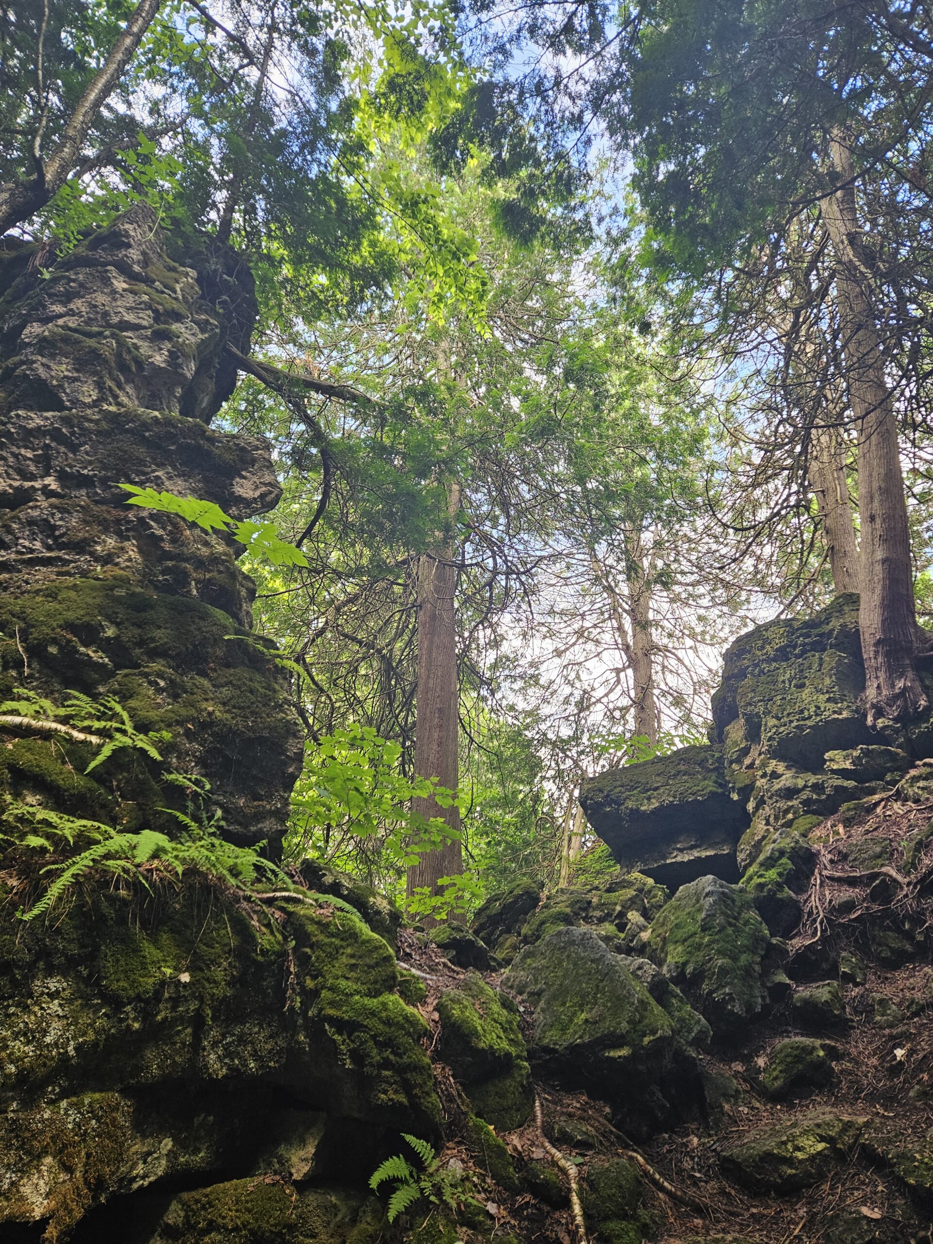
Walk and Talk Rocks: Mono Cliffs
https://hikesstaging.brucetrail.org/event/walk-and-talk-rocks-mono-cliffs/Sorry, the registration cut-off time for this hike has been reached.Not a member? Click here to join today!Hike open to BTC Members only.
Hosting Club: Caledon Hills
Category: General
Location (Google Maps): Meet at 9:30 am at the parking lot at Mono Community Centre. The centre is located at 754483 Mono Centre Rd. Please park in the gravel surface lot.Hike Leader(s): Elizabeth Ganong Click here to contact Hike Leader(s)
Pace: Leisurely – 3 km/hour or less
Terrain: Moderate – some hills and/or some poor footing
Distance: Approximately 9.5 kmDescription
CANCELLED: Due to illness, this hike has been cancelled for September 26th. It will be re-posted soon with the hike date of Thursday, October 10th. Our apologies.Let’s rock it out and explore the geology of Mono Cliffs. (This is a repeat of the geology hike offered on August 29th.) We’ll hike mainly at a leisurely pace over the approximately 9.5 km route as we cover many of the highlights of Mono Cliffs Provincial Park. Dr. Kathy Wallace will provide an introductory-level look at the geology of the park that welcomes your curiosity. Plan on a lunch break at a spectacular look-out, a total time out around four or four and a half hours, and having your way of engaging with the trail expanded. This interactive hike was created for a small group. No dogs please.
International Friendship Trail Official Opening at MNRCC (Cape Chin)
https://hikesstaging.brucetrail.org/event/international-friendship-trail-official-opening-at-mnrcc-cape-chin/Sorry, the registration cut-off time for this hike has been reached.Not a member? Click here to join today!Hosting Club: Peninsula
Location (Google Maps): Meet us inside the gate at Maple Cross Nature Reserve to hike the latest BTC International Friendship Trail! Join Jackie Randle and other International Trail Members for the official opening of the BTC’s second Friendship Trail in the Peninsula Club with the Southwest Coast Path. The Friendship Trail will cover the loop created by the Cape Chin Meadow Side Trail and the main trail at Cape Chin creating a loop of about 10km.
Hike Leader(s): Tamara Wilson Click here to contact Hike Leader(s)
Pace: Leisurely
Terrain: Moderate
Distance: 6kmDescription
From restored meadows, wetlands, hardwood and softwood forests including the spectacular views from Cape Chin and other escarpment views – this new Friendship Trail loop with the Southwest Coast Path in the UK. will have it all!
Mount Nemo Views
https://hikesstaging.brucetrail.org/event/mount-nemo-views-2/Sorry, the registration cut-off time for this hike has been reached.Not a member? Click here to join today!Hosting Club: Iroquoia
Category: Thursday Group
Location (Google Maps): Mount Nemo Conservation Area, 5317 Guelph Line, BurlingtonHike Leader(s): Anne Armstrong Click here to contact Hike Leader(s)
Pace: Leisurely – 3km/hr or less
Terrain: Moderate – Some hills and/or some poor footing
Distance: Approx. 6 – 7 km.Description
Mount Nemo provides some wonderful views from the top of the Niagara Escarpment, looking east to Mississauga, Toronto and north east to Milton and Rattlesnake Point. Join us as we hike the trails of Mount Nemo with its varied terrain from flat trails to negotiating rocky areas. Meet in the main parking lot of Mount Nemo CA on Guelph Line at 9:45 am. for a 10:00 start. Park reservation through Halton Parks is necessary for entry. Bring water, a snack, sunscreen and insect repellent. (Hopefully there won’t be any!) Hiking poles would be useful. An e-mail will be sent out a few days before the hike.
Leader: Anne Armstrong - 27September 27, 2024
Car Hike: Tobermory Fall Hiking Weekend (2 overnights)
https://hikesstaging.brucetrail.org/event/car-hike-tobermory-fall-hiking-weekend-2-overnights/Sorry, the registration cut-off time for this hike has been reached.Not a member? Click here to join today!This is a Multi-Day Hike
You are signing up for the following dates:
2024-09-27, 2024-09-28, 2024-09-29Hosting Club: Toronto
Category: Car Hike
Location (Google Maps): Princess Hotel
34 Bay St, Tobermory, ON N0H 2R0Hike Leader(s): Jeanette Vincent. Click here to contact Hike Leader(s)
Pace: Moderate (3-4 km/hr)
Terrain: Rocky, Variable
Distance: 13 -15kmDescription
We continue Greg Vincent’s legacy of weekends away. Please join Jeanette Vincent, as we explore the Tip o’ the Bruce, Tobermory in the Fall. The beauty of this area of the Bruce Peninsula every season is wonderful! We will take in a number of walks using side trails and the Bruce Trail. Approximately 13-15km/day. We stay and have our meals at a comfortable hotel overlooking Little Tub Harbour. This outing is restricted to those staying with us at the Princess Hotel in Tobermory for the weekend – the hotel fills quickly. You will need a car to access this outing. Please contact the Princess Hotel for a reservation.1-519-592-8282 or info@tobermoryprincesshotel.com and mention Vincent/Royle Fall weekend.Before registering at the hotel please contact Jeanette: vincentjeanette1604@gmail.com | 519-588-5916 For prices and more details.
Truth and Reconciliation Orange Shirt Day hike at Island Lake
https://hikesstaging.brucetrail.org/event/truth-and-reconciliation-orange-shirt-day-hike-at-island-lake/Sorry, the registration cut-off time for this hike has been reached.Not a member? Click here to join today!Hosting Club: Caledon Hills
Category: General
Location (Google Maps): Island Lake, Orangeville. Meet at parking spot P3. Park address is: 673067 Hurontario St., Orangeville, ON L9W 2Y9Hike Leader(s): GG Click here to contact Hike Leader(s)
Pace: Medium – 3 to 4 km/hour
Terrain: Easy – mostly flat and usually good footing, Moderate – some hills and/or some poor footing
Distance: 8 kmDescription
An easy-moderate-introductory level hike at Island Lake with Truth and Reconciliation Orange Shirt Day top of mind. We will hike the mostly flat main loop with scenic vistas, lake spanning bridges with opportunities for various wildlife viewing.We will meet up with a warm up walk around the park’s tales on the trail which is currently featuring ‘Phyllis’s Orange Shirt’. We will then head over to the main loop and end at the newly constructed Crane Gathering Space. I’ll share site specific brief points as we share the space in conversation. Building in extra time for conversation, hydration breaks etc. Hiking footwear and/or stable shoes (no sandals), poles, water, snack, appropriate clothing , bug spray, sunscreen. There are buggy spots and no shade trail areas. Bathrooms on site.
Note: this is a pay for entry/parking TRCA managed site (~$8), for information: https://cvc.ca/discover-our-parks/island-lake/
Meet up at 8:45 AM please with 9:00 AM sharp start in parking spot P3. Park address is: 673067 Hurontario St., Orangeville, ON L9W 2Y9

9:00 am Niagara-on-the-Lake Tour
https://hikesstaging.brucetrail.org/event/900-am-niagara-on-the-lake-tour-25/Sorry, the registration cut-off time for this hike has been reached.Not a member? Click here to join today!Hosting Club: Niagara
Category: Urban
Location (Google Maps): Veterans Memorial Park, park just outside the park on King StreetHike Leader(s): Robin Garrett Click here to contact Hike Leader(s)
Pace: Medium
Terrain: Easy
Distance: 6-7 kmDescription
Each Friday we will explore different neighbourhoods, trails and parkland throughout Historic Niagara-on-the-Lake.Moderate pace with some weeks entirely on sidewalks and roads while others may include a mix of trails and paved pathways. Great way to build up endurance for longer more strenuous hikes.
Prepare for cooler windy conditions on open parkland and along Lake Ontario and Niagara River trails.
Plan to stay for conversation and a warm cup of coffee or tea at Sweets & Swirls, Community Centre, Niagara Stone Road, NOTL