
Hike Schedule
Join us for a hike! Registration required.
All hikes available to BTC members. Some hikes are open to non-members.
See Refund Policy for Paid Hikes >
TIP: The calendar view displays up to 7 hikes on a day, but often there are more. Click “View more events” to see them all.
Categories
- 16September 16, 2024

Hike 2 of 7 - Caledon Hills E2E
https://hikesstaging.brucetrail.org/event/hike-2-of-7-caledon-hills-e2e/Sorry, the registration cut-off time for this hike has been reached.Not a member? Click here to join today!Hosting Club: Caledon Hills
Category: End-to-End
Location (Google Maps): Meet at 9:15 at Willoughby Road.
Shuttle to start at Creditview Rd. and the Grange Side Road.Hike Leader(s): Jennie Greenfield Click here to contact Hike Leader(s)
Pace: Medium – 3 to 4 km/hour
Terrain: Moderate – some hills and/or some poor footing, Strenuous – hilly with steep climbs and some poor footing
Distance: 12.15 kmDescription
Hike 2 of 7 for Caledon Hills E2E. Follows recent trail changes around the Forks of the Credit area5.2 to 15.9 + 1.45 side trails = 12.15 km (Edition 31)
This hike can be logged towards the “60 for 60th Anniversary” badge
- 17September 17, 2024
8:00 Long Hike Wiley Road Short Hills
https://hikesstaging.brucetrail.org/event/800-long-hike-wiley-road-short-hills-54/Sorry, the registration cut-off time for this hike has been reached.Not a member? Click here to join today!Hosting Club: Niagara
Location (Google Maps):
Short Hills Wiley Road Entrance
Pace: Medium
Terrain: Moderate
: 10kmDescription
Explore Short Hills and the majestic side trails of Scarlett Tanager, Hemlock. Swayze Falls and Terrace. Register for each hikeBring Poles, Sunscreen, bug spray water, snack, and dress for the weather
Urban hike: Valley View Park Thornhill
https://hikesstaging.brucetrail.org/event/urban-hike-valley-view-park-thornhill-9/Sorry, the registration cut-off time for this hike has been reached.Not a member? Click here to join today!Hosting Club: Toronto
Location (Google Maps): Parking lot at the corner of Bayview Ave, and Sycamore Dr. South of Highway 7
Sycamore Dr. is 3blocks south of highway 7 and 2 blocks north of John Street, parking lot is across plaza of Dollarama and Star boxHike Leader(s): Mohammad Aghamiri Click here to contact Hike Leader(s)
Pace: Moderate (3-4 km/hr)
Terrain: Level 2 (Intermediate – some hills and uneven surfaces, rocks and roots underfoot)
Distance: 7-8 kmDescription
We will explore Valleyview and Maple view parks, and walk along German Mill Creek for a distance of 7-8 km. Difficulty Level: 2 (Intermediate)Caledon Hills Section in Six Hikes
https://hikesstaging.brucetrail.org/event/caledon-hills-section-in-six-hikes/Sorry, the registration cut-off time for this hike has been reached.Not a member? Click here to join today!Hike open to BTC Members only.
Hosting Club: Caledon Hills
Category: End-to-End
Location (Google Maps): Meet at 9:15 am at the Hockley Road parking area, km 61.1. Shuttle to start at Mono Centre.Hike Leader(s): Elizabeth Ganong Click here to contact Hike Leader(s)
Pace: Medium – 3 to 4 km/hour
Terrain: Moderate – some hills and/or some poor footing, Strenuous – hilly with steep climbs and some poor footing
Distance: 72.4 – 61.1 + 0.750 and 0.250 side trails and road = 12.3 km totalDescription
This is the first hike in the series going from the north to the south of the Caledon Hills section. The trail will take us through the Whitetail Refuge Nature Reserve, up and down hills, over bridges, and through the Hockley Valley Provincial Nature Reserve.Please be prepared to help with shuttling hikers at the beginning and at the end of the hike. Bring water and snacks. There will be a break. No dogs please.
Participants who complete all 6 hikes with the co-leaders, Doris Harper and Elizabeth Ganong, will be eligible to purchase the 60th Anniversary End to End badge and the 60 for the 60th Anniversary badge from the hike leaders at the end of the 6th hike. Hike one, a few, or all 6 hikes. Join any hike, complete the rest on your own, and record the hikes in a log. Check the CHBTC website for submission details.
9:15 Short Hike - Short Hills Park, Pelham Rd
https://hikesstaging.brucetrail.org/event/915-short-hike-short-hills-park-pelham-rd-11/Sorry, the registration cut-off time for this hike has been reached.Not a member? Click here to join today!Hosting Club: Niagara
Category: Hike
Location (Google Maps): Pelham Rd entrance, Short Hills Provincial ParkHike Leader(s): Debbie Demizio Click here to contact Hike Leader(s)
Pace: Medium
Terrain: Moderate
Distance: ~ 6kmsDescription
Hike the main and side trails in Short Hills Provincial Park. Bring hiking boots, water, sunscreen and bug spray.Tuesday Hikes 20 Year Anniversary End-to-End - Hike 1
https://hikesstaging.brucetrail.org/event/tuesday-hikes-20-year-anniversary-end-to-end-hike-1/Sorry, the registration cut-off time for this hike has been reached.Not a member? Click here to join today!Hosting Club: Dufferin Hi-Land
Category: Tuesday Hike
Location (Google Maps): Dufferin Hi-Land Map 19. Meet at Mono Community Centre Hiker Parking area on 2nd Line in the village of Mono Centre.Hike Leader(s): Les Babbage;Inge Eckerich;Tony Evangelista;Julie Daley Click here to contact Hike Leader(s)
Pace: Leisurely
Terrain: Moderate
Distance: 7.2 km; Drop out can be arranged at Km 2.2 for a 2.6 km hike.Description
In 2004 a group of Dufferin Hi-Land BTC members began organizing Tuesday hikes. For their first venture, they hiked a 10 hike/10 week end-to-end series of the DH section. Join us as we recreate this series to celebrate the 20th anniversary of Tuesday hiking and recognize the pioneers who started it all.
Hike 1 will take us from 1st Line EHS parking, where the trail leaves Mono Cliffs Provincial Park through the Park to the Caledon Hills/Dufferin Hi-Land boundary. We will car shuttle from the Community Centre to 1st Line parking, leaving a car at the north end of 2nd Line, if required.
Bring water, snacks and sun screen.

Beaver Bites #3 of 8
https://hikesstaging.brucetrail.org/event/beaver-bites-3-of-8/Sorry, the registration cut-off time for this hike has been reached.Not a member? Click here to join today!Hosting Club: Beaver Valley
Location (Google Maps): Park on 7A, km 82.4, Map 26, ED 31
Hike Leader(s): Kristina Rettie Click here to contact the hike leader.
Pace: Medium
Terrain: Moderate, Some rocky footing, Some steep sections, Strenuous
Length of Hike: 12.5kmDescription
On this hike we will take the main trail south to Stone Foundation Side Trail, Wodehouse Karst Side Trail and Kimberley Forest Side Trail.Add on – Mushroom Hunter Badge. Let’s go hunting for mushrooms and other fungi. The magic of the search is in the slowing down and noticing. From the forest floor to trunks of trees, keep a keen eye out as you search for a minimum of 20 different varieties of fungi.
Bring a snack and water!
Please no dogs
Text Kristina @ 519-410-9077 for morning of cancellations.
COVID-19 Precautions Before, During and After your Hike
- Each hiker joining a Bruce Trail Club organized hike must perform a self-screening check before hiking.
Find Ontario’s self-assessment tool here: https://covid-19.ontario.ca/self-assessment/ - If you are experiencing COVID-19 symptoms, stay home.
- Personal Protective Equipment:
- Hikers may choose to wear masks
Transportation
It is the Bruce Trail Conservancy’s current policy that car shuttles are allowed. It is at the discrepancy of individual hike leaders to make that decision.
Other Guidelines
- Arrive 15 minutes before the start of the hike.
- Wear sturdy footwear and appropriate attire for the weather and the terrain.
Hiking poles are a good idea in any season, especially if the terrain is rocky or slippery. In winter, snowshoes or icers/crampons are needed when conditions dictate.
Wearing appropriate clothing and footwear prevents injuries and shows consideration for a safe and positive group hiking experience. - Always carry I.D. and your health card.
- Bring sufficient water and snacks (or lunch if indicated). A minimum of 1L of water is recommended on all hikes, and 3L is recommended for long, challenging hikes in the heat of the summer.
- Bring sunscreen and insect repellent (for spring and summer hikes).
- Bring your own first aid kit.
- Please leave dogs at home.

Afternoon Hike - Halton Agreement Forest
https://hikesstaging.brucetrail.org/event/afternoon-hike-halton-agreement-forest-4/Sorry, the registration cut-off time for this hike has been reached.Not a member? Click here to join today!Hosting Club: Iroquoia
Category: Afternoon/Evening Hikes
Location (Google Maps): Meet roadside on 10 Side Road, just east of Guelph Line, north of Campbellville.Hike Leader(s): Karen Bergmann Click here to contact Hike Leader(s)
Pace: Medium – 3 to 4 km/hr
Terrain: Moderate – Some hills and/or some poor footing
Distance: About 8 kmsDescription
We will hike around several of the bike trails. Please bring bug spray/bug net, as this Forest is very buggy. - Each hiker joining a Bruce Trail Club organized hike must perform a self-screening check before hiking.
- 18September 18, 2024
The Heights of Pretty River
https://hikesstaging.brucetrail.org/event/the-heights-of-pretty-river/Sorry, the registration cut-off time for this hike has been reached.Not a member? Click here to join today!Hosting Club: Sydenham
Category: General Hike
Location (Google Maps): Meet at the Bruce Trail parking lot on the South side of Grey Road 40 just East of Grey Road 7 (GPS Coordinates: 44.508360,-80.557128). Please arrive at the meeting spot at 08:15, so we can start the carpool promptly at 08:30. We will carpool to the start of the hike at Petun Conservation Area, just north of Pretty River Provincial Park. If anyone wishes to drive directly to the hike start, it is a small parking lot on the east side of 2nd Line, at the Petun Conservation Area. I have put the coordinates in the map link. For those who are carpooling, we’ll have a 25 min drive to the hike start and will be hiking by 09:00. Please note that there is a $10 fee to park at the conservation area.Hike Leader(s): Fran Turner Click here to contact Hike Leader(s)
Pace: Brisk: 4 to 5 km/h
Terrain: Strenuous: Hilly with steep climbs and some poor footing.
Distance: 12 kmDescription
Are you in the mood for a challenging hike? Join us as we climb up and down the escarpment and enjoy the forested trails of Pretty River Provincial Park. This hike includes a visit to the Highest Point on the Bruce trail – take a photo and impress your friends! We will traverse 7.5 km of main trail as well as the John Haigh side trail, the Pretty River side trail, and the Black Ash side trail. This is a rewarding hike, intended for fit and experienced hikers. Bring a lunch and plenty of water.Beaver Valley Geology Badge Hike #5/8
https://hikesstaging.brucetrail.org/event/beaver-valley-geology-badge-hike-5-8/Sorry, the registration cut-off time for this hike has been reached.Not a member? Click here to join today!Hosting Club: Blue Mountains
Category: Register online ONLY
Location (Google Maps): Hike meets in the parking lot behind Tim Hortons on First St. in Collingwood.Hike Leader(s): Annette Sandberg Click here to contact Hike Leader(s)
Pace: Leisurely – 3 km/hr. or less
Distance: 3,2
Description
Falling Waters: Waterfall on Stew Hilts Side Trail at Stop 3 (Page 86) At the lovely waterfall on the Stew Hilts Side Trail water trickles over the hard Manitoulin Dolostone layer and falls onto the soft Queenston Shale.WEDNESDAY WALKERS - Valley Crest and Sligo Side Trail
https://hikesstaging.brucetrail.org/event/wednesday-walkers-valley-crest-and-sligo-side-trail/Sorry, the registration cut-off time for this hike has been reached.Not a member? Click here to join today!Hosting Club: Beaver Valley
Location (Google Maps): Meet on the south side shoulder of Sideroad 19 at Km 92.3 Map 27 Edition 31
Hike Leader(s): Margaret Yaraskavitch Click here to contact the hike leader.
Pace: Medium
Terrain: Moderate, Some rocky footing
Length of Hike: 8 kmsDescription
This hike is a little longer than other Wednesday Walker hikes but the terrain is quite flat. We’ll walk through strips of BTC protected land near fields with views across the Valley. From there, we use the Sligo Side Trail and then loop back on to the Main Trail. On this route, we’ll stop in a couple of places to talk about (historic) tree planting practices.COVID-19 Precautions Before, During and After your Hike
- Each hiker joining a Bruce Trail Club organized hike must perform a self-screening check before hiking.
Find Ontario’s self-assessment tool here: https://covid-19.ontario.ca/self-assessment/ - If you are experiencing COVID-19 symptoms, stay home.
Other Guidelines
- Arrive 15 minutes before the start of the hike.
- Wear sturdy footwear and appropriate attire for the weather and the terrain.
Hiking poles are a good idea in any season, especially if the terrain is rocky or slippery. In winter, snowshoes or icers/crampons are needed when conditions dictate.
Wearing appropriate clothing and footwear prevents injuries and shows consideration for a safe and positive group hiking experience. - Always carry I.D. and your health card.
- Bring sufficient water and snacks (or lunch if indicated). A minimum of 1L of water is recommended on all hikes, and 3L is recommended for long, challenging hikes in the heat of the summer.
- Bring sunscreen and insect repellent (for spring and summer hikes).
- Bring your own first aid kit.
- Please leave dogs at home.
Car Hike: Midweek Fitness Hike from the Crawford Conservation Area to the Rattlesnake Point and back (about 14 km)
https://hikesstaging.brucetrail.org/event/car-hike-midweek-fitness-hike-from-the-crawford-conservation-area-to-the-rattlesnake-point-and-back-about-14-km/Sorry, the registration cut-off time for this hike has been reached.Not a member? Click here to join today!Hosting Club: Toronto
Category: Car Hike
Location (Google Maps): Crawford Lake Conservation AreaHike Leader(s): Natalia Svechnikova Click here to contact Hike Leader(s)
Pace: Moderate (3-4 km/hr)
Terrain: Hilly, Level 2 (Intermediate – some hills and uneven surfaces, rocks and roots underfoot), Rocky, Variable
Distance: About 14 kmDescription
Please join me for a moderate midweek fitness hike in the Crawford Lake conservation area.We will meet at the main entrance to the visitors centre accessible from the parking road off Conservation Road. You would have to pass the gate. The gate fee can be paid online $10.50 or in person a t the gate $12 plus HST. The gate is open from 10 am to 4 pm.
We will hike from the Crawford Lake to the Rattlesnake Point Conservation Area and back keeping up a moderate speed of about 3.5 km/h. The hike should take about 4.5 hours including a short lunch break at one of the lookouts in the Rattlesnake Point Conservation Area.
If the weather is not favorable (light rain or muddy condition after rainfall), I would shorten the hike to about 10 km.
- Each hiker joining a Bruce Trail Club organized hike must perform a self-screening check before hiking.
- 19September 19, 2024
8:00 am Long Hike Jordan to Moyer / Louth
https://hikesstaging.brucetrail.org/event/800-am-long-hike-jordan-to-moyer-louth-80/Sorry, the registration cut-off time for this hike has been reached.Not a member? Click here to join today!Hosting Club: Niagara
Location (Google Maps):
Jordan Hollow Park 3039 King St Jordan
Pace: Medium
Terrain: Moderate
: 10kDescription
From Jordan Hollow Hike the main trail to Upper and Lower Balls Falls, Moyer Road or Louth and Return. You must register for each hike. Bring Poles, sunscreen, bug spray , snack and a drink and dress for the weatherUrban Walk: Valley View Park Thornhill
https://hikesstaging.brucetrail.org/event/urban-walk-valley-view-park-thornhill-11/Sorry, the registration cut-off time for this hike has been reached.Not a member? Click here to join today!Hosting Club: Toronto
Location (Google Maps): Parking lot at the corner of Bayview Ave, and Sycamore Dr. South of Highway 7
Sycamore Dr. is 3blocks south of highway 7 and 2 blocks north of John Street, parking lot is across plaza of Dollarama and Star boxHike Leader(s): Mohammad Aghamiri Click here to contact Hike Leader(s)
Pace: Moderate (3-4 km/hr)
Terrain: Level 2 (Intermediate – some hills and uneven surfaces, rocks and roots underfoot)
Distance: 7-8 kmDescription
We will explore Valleyview and Maple view parks, and walk along German Mill Creek, for a distance of 7-8 km. Difficulty Level:2 (Moderate)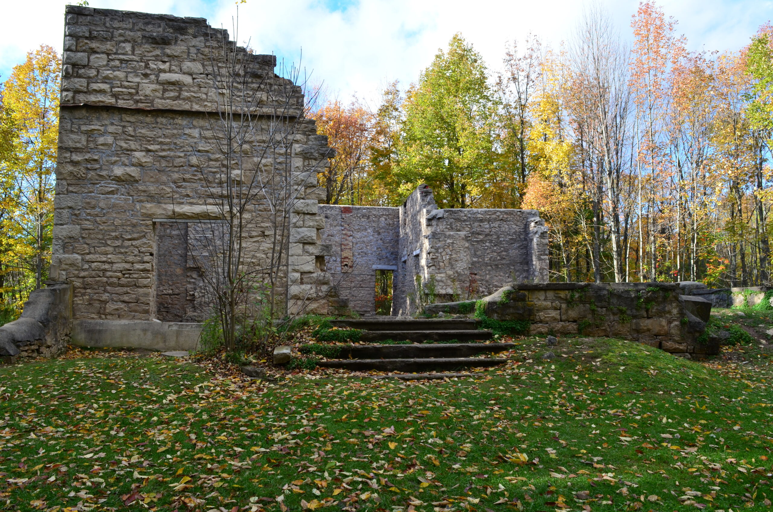
Peninsula Blue Series: Spiriting down the side trails
https://hikesstaging.brucetrail.org/event/spiriting-down-the-side-trails/Sorry, the registration cut-off time for this hike has been reached.Not a member? Click here to join today!Hosting Club: Peninsula
Category: Peninsula Blue Series
Location (Google Maps): Meet at the Bluewater Park parking lot beside Dockside Willie’s – 402 William St., WiartonHike Leader(s): Pat Turner Click here to contact Hike Leader(s)
Pace: Medium
Terrain: Moderate
Distance: about 8km totalDescription
This hike will take us on the first 2 side trails (blue trails) of the Peninsula section of the Bruce Trail. The first, the Wiarton Side Trail, runs from the main trail through the town of Wiarton for 1.8 km to meet the Spirit Rock Side Trail (our second side trail), in the Spirit Rock Conservation Area. This first part of the hike is an urban hike which includes a climb up the side of Hwy 6 to the top of the escarpment. The 2.8 km long Spirit Rock Side Trail loop features passing by the Corran, the ruins of an old mansion with a fascinating history. There is an option, while on the Spirit Rock Side Trail to climb down the spiral staircase to the lookout if the group wishes. 3 hours approximately.This hike will include steep ascents and descents, possible poison ivy, uneven terrain and heights. Over the ankle hiking boots are strongly recommended. Please bring water, snacks and clothing appropriate for last few days of summer.
Hiking Around Jordan
https://hikesstaging.brucetrail.org/event/hiking-around-jordan-2/Sorry, the registration cut-off time for this hike has been reached.Not a member? Click here to join today!Hosting Club: Niagara
Location (Google Maps): Shoarishon Park (formerly Jordan Hollow)
Hike Leader(s): Bill Russell Click here to contact Hike Leader(s)
Pace: Medium
Terrain: ModerateDescription
Hiking in and around Jordan, Jim Rainforth Trail and Balls FallsNiagara End-to-End Hike 3 of 6
https://hikesstaging.brucetrail.org/event/niagara-end-to-end-hike-3-of-6/Sorry, the registration cut-off time for this hike has been reached.Not a member? Click here to join today!Hosting Club: Caledon Hills
Category: End-to-End
Location (Google Maps): Meet at Short Hills Provincial Park, off Roland Rd. km 42.3 (Map 3); (Toilet available!). Shuttle to start at parking on Glen Rd. km 55.5.Hike Leader(s): Nancy Mooney Click here to contact Hike Leader(s)
Pace: Medium – 3 to 4 km/hour
Terrain: Moderate – some hills and/or some poor footing, Strenuous – hilly with steep climbs and some poor footing
Distance: 55.5 – 42.3 + trail to parking = 13.5 km totalDescription
This is the third hike of the series and the trail will take us through Louth Conservation Area, to Fifteen Mile Creek and Rockway Falls and Short Hills Provincial Park.