
Hike Schedule
Join us for a hike! Registration required:
All hikes available to BTC members. Some hikes are open to non-members.
TIP: The calendar view displays up to 7 hikes on a day, but often there are more. Click “More events” to see them all.
Categories
- 14September 14, 2024

Iroquoia Club End-to-End – 4 days (Two concurrent weekends)
https://hikesstaging.brucetrail.org/event/iroquoia-club-end-to-end-4-days-two-concurrent-weekends-2/Sorry, the registration cut-off time for this hike has been reached.Not a member? Click here to join today!This is a Multi-Day Hike
You are signing up for the following dates and times:
2024-09-14 at 07:00
2024-09-15 at 07:00
2024-09-21 at 07:00
2024-09-22 at 07:00Hosting Club: Iroquoia
Category: Special Event
Location (Google Maps): Two different bus loading locations (one for each wknd) will be provided to registered hikers only. Unregistered hikers who show up will not be permitted to board the buses.Hike Leader(s): Parvinder Sachdeva Click here to contact Hike Leader(s)
Pace: Brisk – 4 to 5 km/hr
Terrain: Dependent on Conditions
Distance: 122km (30-35 each day) – Self-paced with checkpoint deadlinesDescription
Please join us for the annual Iroquoia Bruce Trail Club self-paced End-to-End. You can enjoy and complete the entire club distance of 122 km over four days (approximately 30-35km each day).Please be honest about your physical abilities. These 4 days are not recommended for new hikers or anyone who hasn’t completed these distances recently.
The registration fee is non-refundable.The hikes will traverse the varied and often strenuous terrain from Grimbsy in the south, to the 401 in Milton. You will pass many waterfalls and beautiful vistas. Checkpoint stations will be approximately every 10 km offering snacks, water refill, and assistance. Please bring your own First Aid Kit.
The hike is $95 for members and $110 for non-members and includes bus transportation from the meeting point to the hike starting point, refreshments, parking, permit costs, and the official E2E badge. The fee is non-refundable. After costs, the proceeds go to the Iroquoia Bruce Trail Club who supports The Bruce Trail Conservancy mission of “Preserving a ribbon of wilderness, for everyone, forever.”
Registration opens at 8am on April 1, 2024 for Bruce Trail Conservancy members only. You may be a member of any club. If any spots are still available after the first two weeks, registration will also be opened for non-members at a cost of $110. Like last year, it may be limited to only one bus.
Details will be emailed to participants once registration is received. As mentioned, these are longer hikes and are not suitable for beginning hikers. For both events, hikers are expected to maintain an average pace of 4 km/hr (or more). Hikers will be required to reach each checkpoint on each day by a prescribed time in order to continue, and ensure everyone is off the trail before dark. Please be aware that volunteers are running this event and will be waiting.
Space is limited, hikes go rain or shine, and no dogs are permitted on this event. For questions, please contact Parvinder Sachdeva at pavvysingh@gmail.com
Bus Hike: McCrae Lake-Yellow Blaze
https://hikesstaging.brucetrail.org/event/bus-hike-mccrae-lake-yellow-blaze/Sorry, the registration cut-off time for this hike has been reached.Not a member? Click here to join today!Trip Information
Departure Time: 08:00
Return to City Time: 18:30
Departure Point: York Mills Bus PickupOptional Items
Hosting Club: Toronto
Category: Bus Hike
Location (Google Maps):Meet in front of York Mills Centre across from the Shell gas station.
Hike Leader(s): Roland Mark, Martina Furrer Click here to contact Hike Leader(s)
Pace: Fast (5 km/hr or greater), Moderate (3-4 km/hr)
Terrain: Variable
Distance: Approximately between 16 to 17 kmDescription
This hike is a to and back from the McCrae Lake parking lot to the McCrae Lake Rapids. There are no dropouts because of the lack of access roads to the trail. There are plenty of ups/downs, but the ups are not very steep or long. There are also places with large rock outcroppings that can be slippery after a rainfall. There are numerous stream crossings supported by branches and fallen logs. Depending on the environmental condition at the time of the hike, crossing can be slippery and hazardous. If you are uncertain about your abilities to use the makeshift bridges, then avoid them and walking through the stream. The streams are very shallow, but can be muddy.
There will be mosquitos so bring bug net or bug repellent, but remember do not spray bug repellent in the bus. You will have plenty of time once we get off the bus to apply the bug repellent.
Bring 2 liters of water, snacks, and a lunch. Also bring your first-aid kit and any medication that you may need for the hike.
Dress in layers and use your common sense to make sure your attire is appropriate for the weather condition at the time of the hike. Your footwear should be sturdy and waterproof. If you have hiking poles, then this is the trip to bring them along, but please review the hiking pole etiquette. Note: This is hike is geared toward experienced hikers.Car Hike: Rouge National Park Scarborough
https://hikesstaging.brucetrail.org/event/car-hike-rouge-national-park-scarborough-4/Sorry, the registration cut-off time for this hike has been reached.Not a member? Click here to join today!Hosting Club: Toronto
Category: Car Hike
Location (Google Maps): Rouge Park, Zoo Road Parking Lot, off Meadowvale Road north of Sheppard Ave,Hike Leader(s): Mohammad Aghamiri Click here to contact Hike Leader(s)
Pace: Moderate (3-4 km/hr)
Terrain: Hilly, Level 2 (Intermediate – some hills and uneven surfaces, rocks and roots underfoot)
Distance: 14-17 kmDescription
Will hike Orchard trail and return through Vista Trail to the parking lot Difficulty; Level: 2 (Moderate)THIS HIKE MAY BE CONSIDERED AS URBAN FOR THOSE WHOM USE PUBLIC TRANSPORT BUT NOTE THAt IT IS 14 TO 17 KM HIKE OVER SOME HILLY TERRAIN
TAKE THE BUS FOR TORONTO ZOO AND GET OFF AT LAST STOP BEFORE THE ZOO AND TURN RIGHT TOWARDS PARKING LOT OF ROUGE PARK.
Sydenham Series #6 - Inglis Falls to Indian Acres Road
https://hikesstaging.brucetrail.org/event/sydenham-series-6-inglis-falls-to-indian-acres-road/Sorry, the registration cut-off time for this hike has been reached.Not a member? Click here to join today!Hosting Club: Dufferin Hi-Land
Category: General Hike
Location (Google Maps): Inglis Falls Conservation Area. Enter from Inglis Falls Road, 500 m north of County Road 18 on Falls Road. BTC Map 32, km 92.0.Hike Leader(s): Stuart Law Click here to contact Hike Leader(s)
Pace: Medium
Terrain: Dependent on Conditions, Slippery Sections Likely, Slippery and Steep Sections, Moderate
Distance: 21.2 kmsDescription
Join us on the sixth of our 10 Sydenham E2E Series shuttle hikes. Inglis Falls, Jones Falls, crevices and an abandoned railway. Peaceful rural Ontario. Woods. Some road walking. Please bring a garbage bag and a change of footwear for the shuttle (we will be muddy) and please be prepared to drive fellow hikers before or after the hike. Please bring a smile, 3L of water, bug spray, a snack and a lunch. Hiking boots mandatory. Poles and gaiters recommended. Please arrive at 8:45 am to be prepared to shuttle at 9:00 am sharp.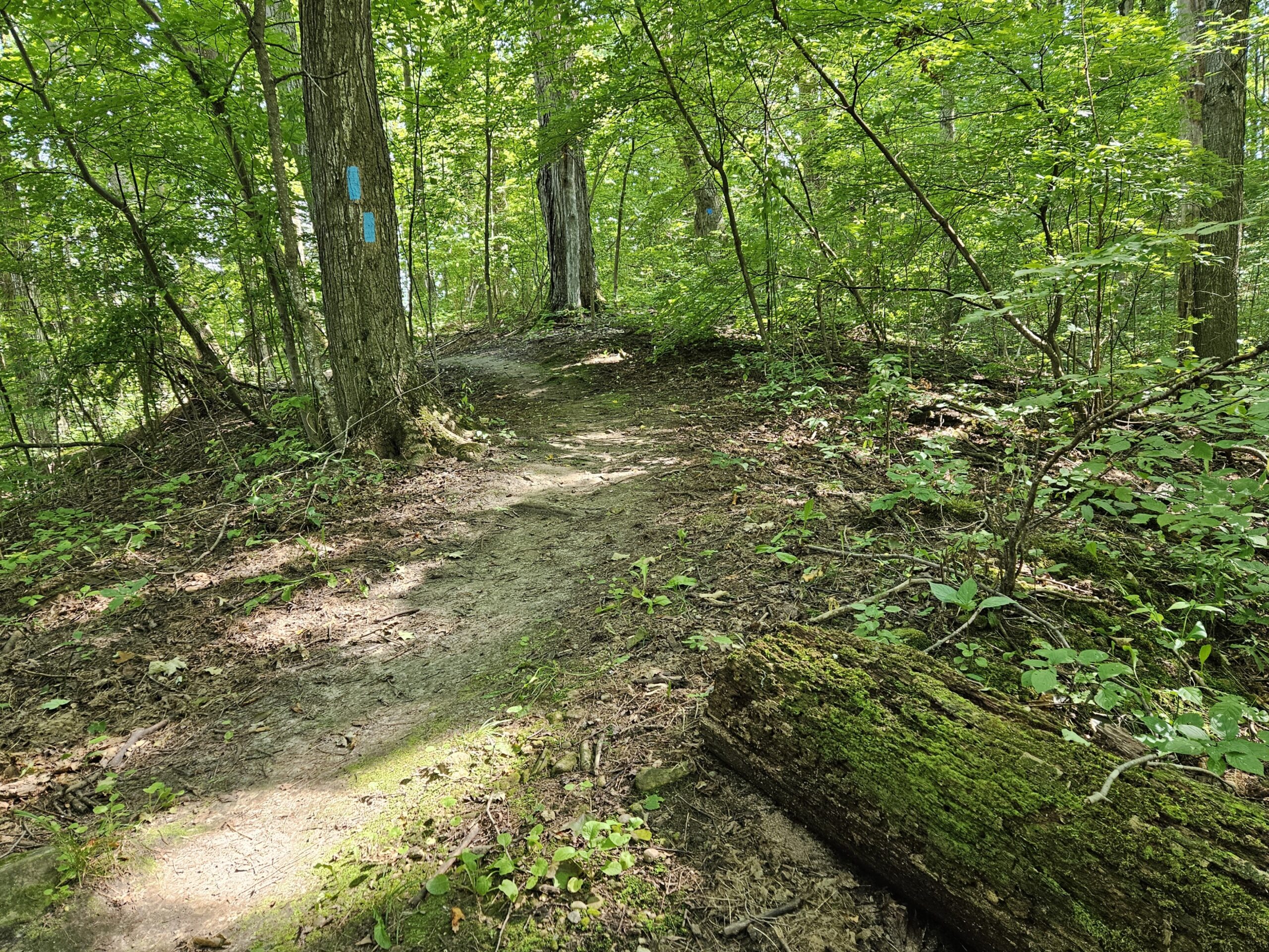
Saturday Shorts: Riverside Woods
https://hikesstaging.brucetrail.org/event/saturday-shorts-riverside-woods/Sorry, the registration cut-off time for this hike has been reached.Not a member? Click here to join today!Hike open to BTC Members only.
Hosting Club: Caledon Hills
Category: General
Location (Google Maps): Meet at 9 am at the BTC parking lot, 713377 1st Line EHS, Mono. It is easier to go north on 1st Line from Side Road 5 than it is to go south on 1st Line from Hockley Road.Hike Leader(s): Elizabeth Ganong Click here to contact Hike Leader(s)
Pace: Medium – 3 to 4 km/hour
Terrain: Moderate – some hills and/or some poor footing, Strenuous – hilly with steep climbs and some poor footing
Distance: Approximately 6.5 kmDescription
Looking to get out on a Saturday but not give up your whole day? Saturday Shorts, a hiking series, will get you out in a small group on a short hike. This Saturday’s hike is another hilly one as we use all side trails to explore Riverside Woods (just south of Hockley Valley Nature Reserve). We’ll hike for about 6.5 km, including walking out to 2nd Line to take a closer look at the heritage house currently owned by the Bruce Trail. Bring water and a snack, if desired. There will be a short break. No dogs please.Louth Conservation
https://hikesstaging.brucetrail.org/event/louth-conservation-2/Sorry, the registration cut-off time for this hike has been reached.Not a member? Click here to join today!Hike open to BTC Members only.
Hosting Club: Niagara
Category: In and Out
Location (Google Maps): Meet at Louth Conservation area parking lot (Staff Ave.)Hike Leader(s): Vince Zvonar Click here to contact Hike Leader(s)
Pace: Brisk
Terrain: Strenuous
Distance: 14Description
American Chestnut planting at Russel
https://hikesstaging.brucetrail.org/event/american-chestnut-planting-at-russel/Sorry, the registration cut-off time for this hike has been reached.Not a member? Click here to join today!Hosting Club: Dufferin Hi-Land
Category: Special Events
Location (Google Maps): BTC Parking Lot on 1st Line E, just south of 10 Sideroad (44.148246, -80.118529)Hike Leader(s): Tom Thayer Click here to contact Hike Leader(s)
Pace: Leisurely
Terrain: Easy, Moderate
Distance: N/ADescription
Come help the BTC and Dufferin Hi-Land Bruce Trail Club plant American Chestnut trees at our Russel property! The BTC is working with the Canadian Chestnut Council to preserve this endangered species by planting potentially resistant American Chestnut seedlings on BTC protected areas along the Niagara Escarpment.Registration is optional but recommended so that we can keep you up to date on any event changes.
You can be a part of this effort by helping us plant 120 of these trees on the Russel property in the Dufferin Hi-Land section. Bring gardening/work gloves and a shovel if you have one. Wear long pants and closed-toed shoes, dress for the weather and bring water and sun protection. No experience necessary – training will be provided!
Where: BTC Parking Lot on 1st Line E, just south of 10 Sideroad (44.148246, -80.118529)
Urban Walk: South Humber and Swansea Theatre Hike
https://hikesstaging.brucetrail.org/event/urban-walk-south-humber-and-swansea-theatre-hike/Sorry, the registration cut-off time for this hike has been reached.Not a member? Click here to join today!Hosting Club: Toronto
Category: Urban Walk
Location (Google Maps): Meet for a 3:00 PM departure from the TTC Route #79 Scarlett Road bus stop at the south east corner of Scarlett Road and Eglinton Avenue West.Hike Leader(s): Miriam Stevens, Tom Swales Click here to contact Hike Leader(s)
Pace: Leisurely
Terrain: Variable
Distance: 9 – 10 kmDescription
Join us for a leisurely hike (3kms/hour- no runners!) south on the Humber River Trail and through the Swansea neighborhood. There are 3 steep staircases on the route. Optional drop out at the Old Mill subway station.
Suitable for beginners and families. We will follow the Humber River Trail to the Old Mill and then hike parts of the Swansea neighborhood to Runnymede Road and Bloor Street West which is the end of the hike across from the Runnymede subway station.After the hike you may choose to join us for dinner at 6:00 PM at either Ali Baba Mediterranean/Italian Cuisine (yes, that’s right – now serving pasta options!) or at a nearby pub, as you wish.
We will attend the play at 8 PM at the village Players, 2190 Bloor Street West. This evening’s performance is Rumors by Neil Simon.Call the Theatre directly 416 767 7702 to reserve your ticket($29.00 adults and seniors) and mention that you are with the Bruce Trail Conservancy, Toronto Club.
Anyone is welcome to come for the hike only, join us for the theatre performance, or, join us for all three: Hike, dinner and play at the theatre. Paid parking is available off Kennedy Avenue north of Bloor Street West (behind theatre building).
- 15September 15, 2024

Car Hike: Jefferson Forest and Bond Lake
https://hikesstaging.brucetrail.org/event/car-hike-jefferson-forest-and-bond-lake/Sorry, the registration cut-off time for this hike has been reached.Not a member? Click here to join today!Hosting Club: Toronto
Category: Car Hike
Location (Google Maps): 1235-1245 Bethesda Side Rd, Richmond Hill, ON L4E 1A2 ( Bethesda Trail Head Parking lot)Hike Leader(s): Amir Alemohammad Click here to contact Hike Leader(s)
Pace: Moderate (3-4 km/hr)
Terrain: Hilly, Level 2 (Intermediate – some hills and uneven surfaces, rocks and roots underfoot), Variable
Distance: 12-14 kmDescription
Join us for a wonderful hike in Jefferson Forest and have a snack/lunch beside the Bond Lake with amazing early fall views. We will hike among tall trees and bushes of the Jefferson Forest and across the Bayview-Yonge corridor to reach to the Bond Lake. Boots mandatory, poles recommended, bring at least 2L of water, bug spray, sunscreen, snack/lunch and dress according to the weather conditions. Sorry dogs are not allowed in this hike. Please avoid parking along the road. Difficulty Level: 2 (Moderate)Please arrive @8:00 AM for start 8:15 AM.
Sydenham Series #7 - Indian Acres Road to Dawson Road
https://hikesstaging.brucetrail.org/event/sydenham-series-7-indian-acres-road-to-dawson-road/Sorry, the registration cut-off time for this hike has been reached.Not a member? Click here to join today!Hosting Club: Dufferin Hi-Land
Category: General Hike
Location (Google Maps): End of Dawson Road just east of the Lindenwood Management Area. BTC Map 34, km 129.6.Hike Leader(s): Stuart Law Click here to contact Hike Leader(s)
Pace: Medium
Terrain: Dependent on Conditions, Slippery Sections Likely, Slippery and Steep Sections, Moderate
Distance: 16.6 kmsDescription
Join us on the seventh of our 10 Sydenham E2E Series shuttle hikes. Peaceful rural Ontario. Woods. A journey north along the escarpment through The Glen and Lindenwood. Please bring a garbage bag and a change of footwear for the shuttle (we will be muddy) and please be prepared to drive fellow hikers before or after the hike. Please bring a smile, 3L of water, bug spray, a snack and a lunch. Hiking boots mandatory. Poles and gaiters recommended. Please arrive at 8:45 am to be prepared to shuttle at 9:00 am sharp.
Urban Walk: McMichael Art Gallery via William Granger Greenway (Humber Trail)
https://hikesstaging.brucetrail.org/event/urban-walk-mcmichael-art-gallery-via-william-granger-greenway-humber-trail/Sorry, the registration cut-off time for this hike has been reached.Not a member? Click here to join today!Hosting Club: Toronto
Category: Urban Walk
Location (Google Maps): Meet no later than 09.30 am at the Vaughan Metropolitan Centre TTC station. From there, we will use YRT public transport buses to get to our hiking starting point (if using a Presto Card the YRT bus is free under the “One Fare” program). If you prefer to drive meet us at the corner of Napa Valley Ave and Islington Ave at 10:30 (there is a Tim Horton’s at the corner). Please contact the hike leader for meeting instructions and parking options if driving to the start of the hike.Hike Leader(s): Leonora Rochwerger Click here to contact Hike Leader(s)
Pace: Moderate (3-4 km/hr)
Terrain: Flat, Level 1 (Easy – mostly on flat, well maintained trails with hard-packed surface)
Distance: 8.5 kmDescription
Join us for a 8.5 km hike along the William Granger Greenway (Humber Trail), to the McMichael Art Gallery and back. We will spend time at the Art Gallery, where you will have the option of visiting the current exhibits and/or exploring the beautiful grounds. Entrance to the Gallery is free on that day. Difficulty Level: Easy – flat terrain, packed gravel and paved surfacesRoute map: https://onthegomap.com/s/n5vnrdkv
How to get there and get home: We will meet as a group no later than 09.30 at the Vaughan Metropolitan Centre TTC station. From there, we will use YRT public transport buses to get to our hiking starting point.
If you are driving, you can meet us at the corner of Napa Valley and Islington at 10:30 (there is a Tim Horton’s at the corner). Please contact the hike leader for meeting instructions and parking options.
To go back, we will use YRT public transport to return to Vaughan TTC station.
What to bring: Proper walking /hiking shoes, at least 2 litres of water, sunscreen, hat, bug repellent if used and a packed lunch. Lunch is also available at the Gallery cafe. Appropriate clothing for the weather. No dogs allowed.
For more information about the Art Gallery, visit: https://mcmichael.com/
Ball's Falls Hike 10km + Farm Fruit Pick Up
https://hikesstaging.brucetrail.org/event/balls-falls-hike-10km-farm-fruit-pick-up/Sorry, the registration cut-off time for this hike has been reached.Not a member? Click here to join today!Hosting Club: Toronto
Category: Car Hike
Location (Google Maps): Jordan Hollow Park, GPS (43.142022, -79.372672)Hike Leader(s): Alina Lin
Pace: Moderate (3-4 km/hr)
Terrain: Challenging, Hilly, Level 2 (Intermediate – some hills and uneven surfaces, rocks and roots underfoot), Rocky, Variable
Distance: Approximately 10 kmDescription
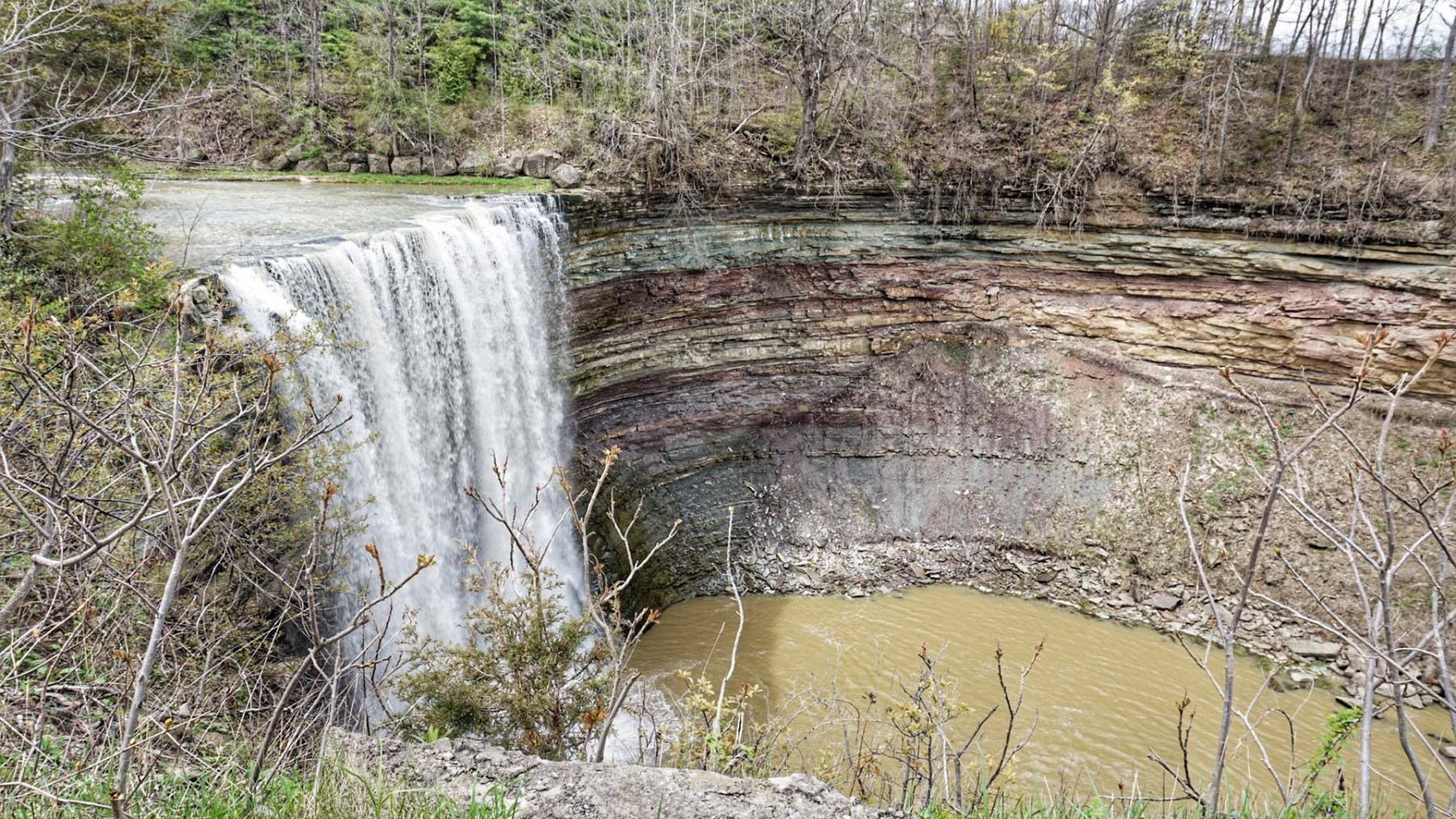
We will hike along the Bruce Trail and side trails for around 10KM, in and around the Ball’s Falls Conservation area. The hike will last about two and half hours.Bring lunch and at least 1L of water. Wear proper clothing for the weather. Hiking boots are strongly recommended. No dogs or kids under 13 years of old. Difficulty Level: 2 (Moderate)
After hike, you are welcome to join me for some fun of picking-up-your-own-fruit at Cherry Avenue Farms, for blue plums, and at Lipsitt Orchards, for grapes. Picking up your own activity is optional and there are fees charged by the farms. According to the information given, the entrance fee for Cherry Avenue Farms is $8 per person and comes with a 2L basket for filling. For grape pick up, Lipsitt Orchards may offer different sized basket at different prices.
Exploring Sydenham Hike #15
https://hikesstaging.brucetrail.org/event/exploring-sydenham-hike-15/Sorry, the registration cut-off time for this hike has been reached.Not a member? Click here to join today!Hosting Club: Sydenham
Category: General Hike
Location (Google Maps):Meet in the north-east corner of the parking lot at Home Depot on Highway 26 on the east side of Owen Sound.
Hike Leader(s): Bill Snel Click here to contact Hike Leader(s)
Pace: Leisurely: 3 km/h or less
Terrain: Moderate: Some hills and/or poor footing
Distance: 2.7 kmDescription
We will carpool to do a loop hike of Sydenham Forest East. This is hike #15 in the book, Exploring Sydenham. There is one secret to locate. If you do not have a book and would like one ($30) let me know by using the “Contact hike leader” link.
2:00 pm NBTC Landowner Appreciation Celebration 2024
https://hikesstaging.brucetrail.org/event/200-pm-nbtc-landowner-appreciation-celebration-2024/Sorry, the registration cut-off time for this hike has been reached.Not a member? Click here to join today!Hike open to BTC Members only.
Hosting Club: Niagara
Category: Leisurely
Location (Google Maps): Ball’s Falls Conservation Area – Centre for Conservation, Elgin Room – 3292 Sixth Ave. Lincoln. Park in the main parking area it is free for the event.Hike Leader(s): Sam Rutherford Click here to contact Hike Leader(s)
Pace: Leisurely
Terrain: Easy
Distance: 1 kmDescription
Attention all pastry chefs and fans of the Great Canadian Baking Show! Why not use your culinary skills to impress our valued landowners?We are looking for hand held treats (ex. squares, tarts, cookies, shortbreads, brownies) for our annual Landowner Appreciation Celebration. We are asking bakers to bring along some homemade sweets for 6-8 people to enjoy.
The event will feature biodiversity hikes which you can sign up for on the day along with information from the biodiversity committee and BTC land stewardship. NBTC merchandise will be available for purchase at the event. Appetizers catered by Smoke & Barrel Niagara. Cash bar. Prize draws. Live music with Brad Boland. Come out and say thank you to our landowners for allowing us to hike across their private properties.

3:00 pm Biodiversity Hikes at Ball’s Falls – Landowner Appreciation Celebration
https://hikesstaging.brucetrail.org/event/300-pm-biodiversity-hikes-at-balls-falls-landowner-appreciation-celebration/Sorry, the registration cut-off time for this hike has been reached.Not a member? Click here to join today!Hike open to BTC Members only.
Hosting Club: Niagara
Category: Loop
Location (Google Maps): Ball’s Falls Conservation Area, Centre for Conservation, Glen Elgin Room, 3292 Sixth Ave., Lincoln. Park in the main parking area it is free for the event.Hike Leader(s): Sam Rutherford Click here to contact Hike Leader(s)
Pace: Leisurely
Terrain: Easy
Distance: 5 kmsDescription
Join us on this Biodiversity Hike led by NBTC nature hike leaders & learn about the ecosystems in this area in recognition of our LANDOWNER APPRECIATION CELEBRATION! Please meet at the Glen Elgin Room and we will split into smaller groups leaving at 3:00 and 3:30 pm depending on numbers.Come for the hike but stay for the celebration! There will be food by Smoke & Barrel Niagara, a cash bar, prize raffle, biodiversity displays, merchandise sales, live music by Brad Boland and much more! A great opportunity to meet our Niagara landowners and to say thank you for allowing us to cross their private properties.
- 16September 16, 2024
Hike 2 of 7 - Caledon Hills E2E
https://hikesstaging.brucetrail.org/event/hike-2-of-7-caledon-hills-e2e/Sorry, the registration cut-off time for this hike has been reached.Not a member? Click here to join today!Hosting Club: Caledon Hills
Category: End-to-End
Location (Google Maps): Meet at 9:15 at Willoughby Road.
Shuttle to start at Creditview Rd. and the Grange Side Road.Hike Leader(s): Jennie Greenfield Click here to contact Hike Leader(s)
Pace: Medium – 3 to 4 km/hour
Terrain: Moderate – some hills and/or some poor footing, Strenuous – hilly with steep climbs and some poor footing
Distance: 12.15 kmDescription
Hike 2 of 7 for Caledon Hills E2E. Follows recent trail changes around the Forks of the Credit area5.2 to 15.9 + 1.45 side trails = 12.15 km (Edition 31)
This hike can be logged towards the “60 for 60th Anniversary” badge
- 17September 17, 2024
8:00 Long Hike Wiley Road Short Hills
https://hikesstaging.brucetrail.org/event/800-long-hike-wiley-road-short-hills-54/Sorry, the registration cut-off time for this hike has been reached.Not a member? Click here to join today!Hosting Club: Niagara
Location (Google Maps):
Short Hills Wiley Road Entrance
Pace: Medium
Terrain: Moderate
: 10kmDescription
Explore Short Hills and the majestic side trails of Scarlett Tanager, Hemlock. Swayze Falls and Terrace. Register for each hikeBring Poles, Sunscreen, bug spray water, snack, and dress for the weather
Urban hike: Valley View Park Thornhill
https://hikesstaging.brucetrail.org/event/urban-hike-valley-view-park-thornhill-9/Sorry, the registration cut-off time for this hike has been reached.Not a member? Click here to join today!Hosting Club: Toronto
Location (Google Maps): Parking lot at the corner of Bayview Ave, and Sycamore Dr. South of Highway 7
Sycamore Dr. is 3blocks south of highway 7 and 2 blocks north of John Street, parking lot is across plaza of Dollarama and Star boxHike Leader(s): Mohammad Aghamiri Click here to contact Hike Leader(s)
Pace: Moderate (3-4 km/hr)
Terrain: Level 2 (Intermediate – some hills and uneven surfaces, rocks and roots underfoot)
Distance: 7-8 kmDescription
We will explore Valleyview and Maple view parks, and walk along German Mill Creek for a distance of 7-8 km. Difficulty Level: 2 (Intermediate)9:15 Short Hike - Short Hills Park, Pelham Rd
https://hikesstaging.brucetrail.org/event/915-short-hike-short-hills-park-pelham-rd-11/Sorry, the registration cut-off time for this hike has been reached.Not a member? Click here to join today!Hosting Club: Niagara
Category: Hike
Location (Google Maps): Pelham Rd entrance, Short Hills Provincial ParkHike Leader(s): Debbie Demizio Click here to contact Hike Leader(s)
Pace: Medium
Terrain: Moderate
Distance: ~ 6kmsDescription
Hike the main and side trails in Short Hills Provincial Park. Bring hiking boots, water, sunscreen and bug spray.Caledon Hills Section in Six Hikes
https://hikesstaging.brucetrail.org/event/caledon-hills-section-in-six-hikes/Sorry, the registration cut-off time for this hike has been reached.Not a member? Click here to join today!Hike open to BTC Members only.
Hosting Club: Caledon Hills
Category: End-to-End
Location (Google Maps): Meet at 9:15 am at the Hockley Road parking area, km 61.1. Shuttle to start at Mono Centre.Hike Leader(s): Elizabeth Ganong Click here to contact Hike Leader(s)
Pace: Medium – 3 to 4 km/hour
Terrain: Moderate – some hills and/or some poor footing, Strenuous – hilly with steep climbs and some poor footing
Distance: 72.4 – 61.1 + 0.750 and 0.250 side trails and road = 12.3 km totalDescription
This is the first hike in the series going from the north to the south of the Caledon Hills section. The trail will take us through the Whitetail Refuge Nature Reserve, up and down hills, over bridges, and through the Hockley Valley Provincial Nature Reserve.Please be prepared to help with shuttling hikers at the beginning and at the end of the hike. Bring water and snacks. There will be a break. No dogs please.
Participants who complete all 6 hikes with the co-leaders, Doris Harper and Elizabeth Ganong, will be eligible to purchase the 60th Anniversary End to End badge and the 60 for the 60th Anniversary badge from the hike leaders at the end of the 6th hike. Hike one, a few, or all 6 hikes. Join any hike, complete the rest on your own, and record the hikes in a log. Check the CHBTC website for submission details.

Beaver Bites #3 of 8
https://hikesstaging.brucetrail.org/event/beaver-bites-3-of-8/Sorry, the registration cut-off time for this hike has been reached.Not a member? Click here to join today!Hosting Club: Beaver Valley
Location (Google Maps): Park on 7A, km 82.4, Map 26, ED 31
Hike Leader(s): Kristina Rettie Click here to contact the hike leader.
Pace: Medium
Terrain: Moderate, Some rocky footing, Some steep sections, Strenuous
Length of Hike: 12.5kmDescription
On this hike we will take the main trail south to Stone Foundation Side Trail, Wodehouse Karst Side Trail and Kimberley Forest Side Trail.Add on – Mushroom Hunter Badge. Let’s go hunting for mushrooms and other fungi. The magic of the search is in the slowing down and noticing. From the forest floor to trunks of trees, keep a keen eye out as you search for a minimum of 20 different varieties of fungi.
Bring a snack and water!
Please no dogs
Text Kristina @ 519-410-9077 for morning of cancellations.
COVID-19 Precautions Before, During and After your Hike
- Each hiker joining a Bruce Trail Club organized hike must perform a self-screening check before hiking.
Find Ontario’s self-assessment tool here: https://covid-19.ontario.ca/self-assessment/ - If you are experiencing COVID-19 symptoms, stay home.
- Personal Protective Equipment:
- Hikers may choose to wear masks
Transportation
It is the Bruce Trail Conservancy’s current policy that car shuttles are allowed. It is at the discrepancy of individual hike leaders to make that decision.
Other Guidelines
- Arrive 15 minutes before the start of the hike.
- Wear sturdy footwear and appropriate attire for the weather and the terrain.
Hiking poles are a good idea in any season, especially if the terrain is rocky or slippery. In winter, snowshoes or icers/crampons are needed when conditions dictate.
Wearing appropriate clothing and footwear prevents injuries and shows consideration for a safe and positive group hiking experience. - Always carry I.D. and your health card.
- Bring sufficient water and snacks (or lunch if indicated). A minimum of 1L of water is recommended on all hikes, and 3L is recommended for long, challenging hikes in the heat of the summer.
- Bring sunscreen and insect repellent (for spring and summer hikes).
- Bring your own first aid kit.
- Please leave dogs at home.
Tuesday Hikes 20 Year Anniversary End-to-End - Hike 1
https://hikesstaging.brucetrail.org/event/tuesday-hikes-20-year-anniversary-end-to-end-hike-1/Sorry, the registration cut-off time for this hike has been reached.Not a member? Click here to join today!Hosting Club: Dufferin Hi-Land
Category: Tuesday Hike
Location (Google Maps): Dufferin Hi-Land Map 19. Meet at Mono Community Centre Hiker Parking area on 2nd Line in the village of Mono Centre.Hike Leader(s): Les Babbage;Inge Eckerich;Tony Evangelista;Julie Daley Click here to contact Hike Leader(s)
Pace: Leisurely
Terrain: Moderate
Distance: 7.2 km; Drop out can be arranged at Km 2.2 for a 2.6 km hike.Description
In 2004 a group of Dufferin Hi-Land BTC members began organizing Tuesday hikes. For their first venture, they hiked a 10 hike/10 week end-to-end series of the DH section. Join us as we recreate this series to celebrate the 20th anniversary of Tuesday hiking and recognize the pioneers who started it all.
Hike 1 will take us from 1st Line EHS parking, where the trail leaves Mono Cliffs Provincial Park through the Park to the Caledon Hills/Dufferin Hi-Land boundary. We will car shuttle from the Community Centre to 1st Line parking, leaving a car at the north end of 2nd Line, if required.
Bring water, snacks and sun screen.

Afternoon Hike - Halton Agreement Forest
https://hikesstaging.brucetrail.org/event/afternoon-hike-halton-agreement-forest-4/Sorry, the registration cut-off time for this hike has been reached.Not a member? Click here to join today!Hosting Club: Iroquoia
Category: Afternoon/Evening Hikes
Location (Google Maps): Meet roadside on 10 Side Road, just east of Guelph Line, north of Campbellville.Hike Leader(s): Karen Bergmann Click here to contact Hike Leader(s)
Pace: Medium – 3 to 4 km/hr
Terrain: Moderate – Some hills and/or some poor footing
Distance: About 8 kmsDescription
We will hike around several of the bike trails. Please bring bug spray/bug net, as this Forest is very buggy. - Each hiker joining a Bruce Trail Club organized hike must perform a self-screening check before hiking.