
Hike Schedule
Join us for a hike! Registration required.
All hikes available to BTC members. Some hikes are open to non-members.
See Refund Policy for Paid Hikes >
TIP: The calendar view displays up to 7 hikes on a day, but often there are more. Click “View more events” to see them all.
Categories
- 27July 27, 2024
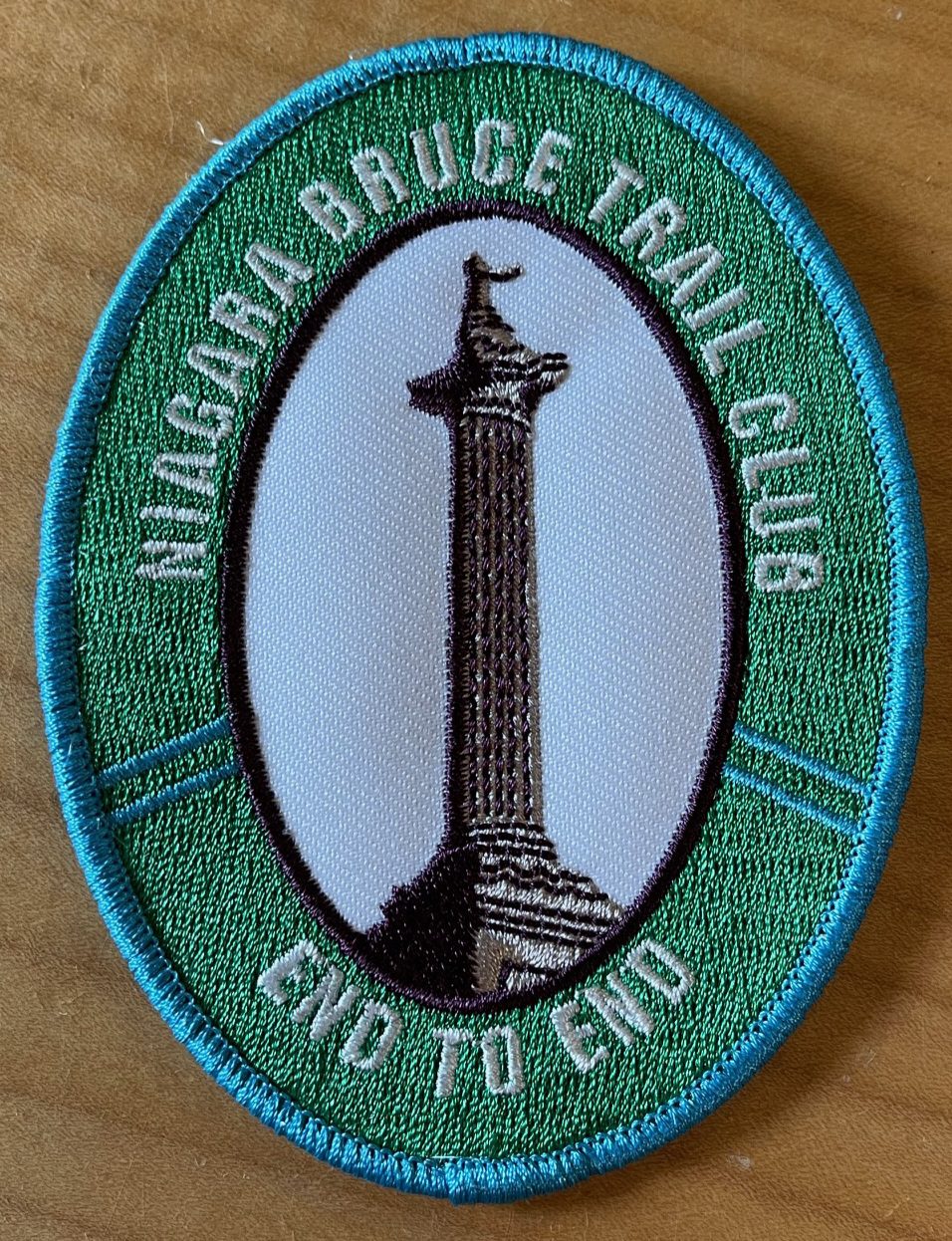
New Badge! Niagara E2E Hike #5
https://hikesstaging.brucetrail.org/event/new-badge-niagara-e2e-hike-5/Sorry, the registration cut-off time for this hike has been reached.Not a member? Click here to join today!Hike open to BTC Members only.
Hosting Club: Niagara
Category: Car Pool
Location (Google Maps): Meet at Queenston Heights Park, km 0.0. Park near the cairn. N43.157826 W79.052045
Carpool back to Woodend Conservation AreaHike Leader(s): Lauren Doig Click here to contact Hike Leader(s)
Pace: Medium
Terrain: Moderate
Distance: 15.5 kmDescription
Badge Day for those who have completed all 5 hikes! Bring snacks and plenty of water. Poles are recommended. Be prepared for the weather. Bring $10 for the new badge if you have completed all 5 hikes.RIM 2 RIM Badge Hike #2 Mad River Rim (Second in a series of 3 for the Rim2Rim badge)
https://hikesstaging.brucetrail.org/event/early-start-hike-2-rim-2-rim-badge-mad-river-rim-second-in-a-series-of-3-for-the-rim2rim-badge/Sorry, the registration cut-off time for this hike has been reached.Not a member? Click here to join today!Hosting Club: Blue Mountains
Category: Register online ONLY
Location (Google Maps): Meet at trailheadHike Leader(s): Hart Fischer Click here to contact Hike Leader(s)
Pace: Medium – 3 to 4 km/hr
Terrain: Moderate – Some hills and/or some poor footing
Distance: 10 kmDescription
about 10 km with almost 400m elevation gain. Park your car in the Devil’s Glen Provincial Park Parking Lot [44.36161, -80.20824] The hike starts here. Follow the white blazed trail south and down to the Devil’s Glen Country Club Parking Lot. Proceed east on the blue blazed Mad River Side Trail. Continue parallel to the Mad River, through Glen Huron and south on Conc 8 S.CR #62 until you come to Sideroad 15-16 Nottawasaga. Here you will see both white and blue blazes. This is a shared Bruce Trail/ Ganaraska Trail section. Continue up the hill until you see the Ganaraska Trail End Marker – a large boulder close to the Devil’s Glen Country Club Gate. Turn around and head back to the cars. For a detailed map… [go to https://www.alltrails.com/explore/map/r2r-2-a666587Car Hike: Wilder Forest Uxbridge 145
https://hikesstaging.brucetrail.org/event/car-hike-wilder-forest-uxbridge-8/Sorry, the registration cut-off time for this hike has been reached.Not a member? Click here to join today!Hosting Club: Toronto
Location (Google Maps): 2499 Brock Road, Uxbridge, ON there is a free parking when you enter the road off brock road beside Horse training facility
Hike Leader(s): Mohammad Aghamiri Click here to contact Hike Leader(s)
Pace: Moderate
Terrain: Hilly, Variable
Distance: 14-17 kmDescription
We will explore Wilder forest and the beautiful scenery of Uxbridge forests.Car Hike: Bethesda Trail Richmond Hill
https://hikesstaging.brucetrail.org/event/car-hike-bethesda-trail-richmond-hill-29/Sorry, the registration cut-off time for this hike has been reached.Not a member? Click here to join today!Hosting Club: Toronto
Location (Google Maps): Free parking lot at the head of trail Bethesda Side Road off Bayview Ave. across Wilcox lake
Hike Leader(s): Mohammad Aghamiri Click here to contact Hike Leader(s)
Pace: Moderate (3-4 km/hr)
Terrain: Hilly, Level 2 (Intermediate – some hills and uneven surfaces, rocks and roots underfoot)
Distance: 14-15 kmDescription
Join us to explore the trails of York Regional Forest and the Oak Ridges Corridor at Jefferson Forest and Bond lake,From parking lot we hike thought Jefferson forest and continue to Bond Lake and have snack beside the lake and return to parking around 13 to 13.30
8:30 Trails and Waterways in St. Catharines
https://hikesstaging.brucetrail.org/event/830-trails-and-waterways-in-st-catharines/Sorry, the registration cut-off time for this hike has been reached.Not a member? Click here to join today!Hosting Club: Niagara
Category: Loop
Location (Google Maps): One St. Paul Crescent.Hike Leader(s): Faye Perkins Click here to contact Hike Leader(s)
Pace: Medium
Terrain: Easy
Distance: 7.5 kmDescription
Originally known as Ashquasing (that which lies at the end), the Twelve Mile Creek has served all the locals well. The original name was provided by the Mississaugas, and they inhabited the area some 9500 to 2900 years ago. After becoming a waterway for transportation, industry, and electrical power, it is recognized as the only cold water stream in the Niagara Region. It has now become one of my favourite running routes, and along with the Downtown St. Catharines Business Association, we are determined to have more walkers, hikers and runners experience its natural beauty.In 1829, the first Welland Canal began its operation and it used the waters and path of the Twelve-Mile Creek to connect Lake Ontario to Lake Erie. There is a lot to discover and to learn!
Please bring water, snacks, a hat and bug spray. There will be a block party immediately following the hike, so come and hang out with us.
Car Hike: Scotsdale Farm!
https://hikesstaging.brucetrail.org/event/car-hike-scotsdale-farm-7/Sorry, the registration cut-off time for this hike has been reached.Not a member? Click here to join today!Hosting Club: Caledon Hills
Category: General
Location (Google Maps): Scotsdale Farm, Map 13. Directions; from Highway 401, head north on Trafalgar Road past Georgetown. Trafalgar briefly merges with Highway 7 for about 3 km before separating to the right at the village of Silver Creek. At the stop light in Silver Creek, continue north on Trafalgar Road for about 1 km to the entrance of Scotsdale Farm on your right. Drive in about half a kilometre to reach the parking area.Hike Leader(s): Dylan “Lana” Hubbard Click here to contact Hike Leader(s)
Pace: Medium – 3 to 4 km/hour
Terrain: Moderate – some hills and/or some poor footing
Distance: 11 kmDescription
Description
Join us for a loop hike along the main Bruce Trail and various side trails, including the scenic Great Esker Side Trail. After the hike, everyone is welcome to gather at the Shepard’s Crook in Georgetown for refreshments.We are committed to providing an inclusive and welcoming environment. This hike is an LGBTQ+ safe space, and everyone is welcome to join us.
Car Hike: Nottawasaga Lookout Nature Reserve and Standing Rock
https://hikesstaging.brucetrail.org/event/car-hike-nottawasaga-lookout-nature-reserve-and-standing-rock/Sorry, the registration cut-off time for this hike has been reached.Not a member? Click here to join today!Hosting Club: Toronto, Blue Mountains
Category: Car Hike
Location (Google Maps): Where Pretty River Access Trail leaves Pretty River Rd. N44.424089, W80.288414Hike Leader(s): Ross Estrella Click here to contact Hike Leader(s)
Pace: Moderate
Terrain: Hilly, Rocky
Distance: 11.5 kmsDescription
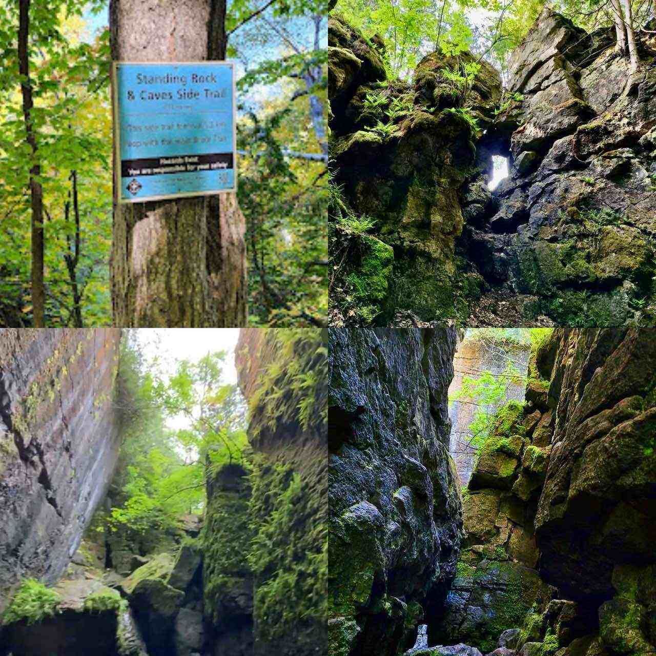
The beauty of hiking is about savouring the experience, cherishing the views and the chance to connect with nature and people. Join me in hiking the scenic Nottawasaga Lookout Nature Reserve and the Standing Rock and Caves Side Trail. Let’s enjoy the amazing beauty of it’s cliffs, crevices and ravine habitants along the forested slope that offers the cross section of the Escarpment flora, fauna and topography. We’ll be at moderate pace of 3-4 kph to enjoy the beautiful landscape. Bring snack, lunch and sufficient water to quinch your thirst. Bring sun screen, sun head protection and bug spray in the event our friendly mosquitoes welcome us. Hiking shoe and poles are strongly recommended. Please dress appropriately as to weather forecast. Have your personal medications and health card with you at all times. Please arrive fifteen minutes early.Balsam Wetlands Nature Reserve
https://hikesstaging.brucetrail.org/event/two-hike-day-hike-1-balsam-wetlands-nature-reserve/Sorry, the registration cut-off time for this hike has been reached.Not a member? Click here to join today!Hosting Club: Blue Mountains
Category: Register in person the morning of hike.
Location (Google Maps): Hike meets in the parking lot behind Tim Hortons on First St. in Collingwood.Hike Leader(s): Mary-Lynne Chenard Click here to contact Hike Leader(s)
Pace: Leisurely – 3 km/hr. or less
Terrain: Moderate – Some hills and/or some poor footing
Distance: 6.5 kmDescription
This hike is through the 284 acres of Balsam Wetlands. We will park at km 34.2 on Concession 10 South and proceed hiking across a farmer’s field and continue through a pine forest. This hike has recently been realigned so that it no longer follows the Highlands Nordic cross country ski trail and now goes through woodlands and some 9 interesting rock formations to the Duntroon Quarry. We will then follow the white trail passing some deep crevices to the Bruce Trail parking lot off 91. Hikers will then be shuttled back to the cars. Bring a snack and water.
Bus Hike: Mount Nemo
https://hikesstaging.brucetrail.org/event/bus-hike-mount-nemo/Sorry, the registration cut-off time for this hike has been reached.Not a member? Click here to join today!Trip Information
Departure Time: 09:00
Return to City Time: 18:00
Departure Point: York Mills Bus PickupOptional Items
Pick-Up At Lisgar GO Station (Mississauga) ($.01)Hosting Club: Toronto
Category: Bus Hike
Location (Google Maps): Mount Nemo Conservation Area – Smokey HollowHike Leader(s): Miriam Stevens, Tom Swales Click here to contact Hike Leader(s)
Pace: Moderate
Terrain: Hilly, Rocky
Distance: 10 kmDescription
Join us for a moderate paced hike with magnificent views along the Niagara Escarpment. A few short hills. One “mini canyon” accessible by wooden steps. We will take lots of stops for water breaks and to take in the views at the lookout points. Dropouts at 3 km and 6 km. Hiking boots are required. Refreshment stop at Tim Hortons and Longos on Highway 5. Bring lunch for a lunch break on the trail and plenty of drinking water (at least 2 Litres). Return to Toronto by 6:00 PM. Departing York Mills with an optional pick-up at Lisgar GO Station NW Mississauga (Winston Churchill Blvd/Hwy 401) – If you wish to be picked up at Lisgar GO Station select this option when registering.Bayview Escarpment Provincial Reserve
https://hikesstaging.brucetrail.org/event/bayview-escarpment-provincial-reserve/Sorry, the registration cut-off time for this hike has been reached.Not a member? Click here to join today!Hosting Club: Sydenham
Category: General Hike
Location (Google Maps): Meet in the north-east corner of the parking lot at Home Depot on Highway 26 on the east side of Owen Sound.Hike Leader(s): Ian Mills Click here to contact Hike Leader(s)
Pace: Fast: more than 5 km/h, Medium: 3 to 4 km/h
Terrain: Moderate: Some hills and/or poor footing, There might be muddy sections., There might be sections with water on the trail.
Distance: 12 kmDescription
We will loop along the Main Trail through the Bayview Escarpment Provincial Nature Reserve starting at km 52.7 to 44.6 then follow the River Kwai Side Trail to return to our starting point via a short section again on the Main Trail – BTC Map # 30 edition. If you are interested in visiting Coffin Ridge for refreshments afterwards, please email the Hike Leader.
Baking for Conservation
https://hikesstaging.brucetrail.org/event/baking-for-conservation/Sorry, the registration cut-off time for this hike has been reached.Not a member? Click here to join today!Hosting Club: Peninsula
Location (Google Maps): Cape Chin North Area. Address will be shared upon registration.
Hike Leader(s): Marg Glendon Click here to contact Hike Leader(s)
Description
Support local conservation and stewardship! Baking for Conservation is a unique and intimate culinary experience and fundraiser. Combine your interest in baking with your love for the Bruce Trail. Learn how to make delicious baked scones with scone accompaniments of whipped ricotta with honey and compound butter with lemon in a beautiful, large home kitchen. This lovely home setting is nestled at the forest fringe near Cape Chin North with the sound of the gentle waves of Georgian Bay washing up on the nearby shore. You will make the scones and toppings and then enjoy a delightful scone-tea party. All supplies are provided. Take home recipes and tips are provided by our certified culinary host, Laura Tilly. Optional – join us for a short post-event hike for views of picturesque Georgian Bay and see examples of local conservation and stewardship projects. Free will donation. All proceeds will be dedicated to Bruce Trail Conservancy for local PBTC Conservation and Stewardship projects. Please consider donating generously. Tax receipt will be given upon registration for donations over $20.