
Hike Schedule
Join us for a hike! Registration required.
All hikes available to BTC members. Some hikes are open to non-members.
See Refund Policy for Paid Hikes >
TIP: The calendar view displays up to 7 hikes on a day, but often there are more. Click “View more events” to see them all.
Categories
- 20July 20, 2024
Coach Trip: Silent Lake Provincial Park
https://hikesstaging.brucetrail.org/event/coach-trip-silent-lake-provincial-park/Sorry, the registration cut-off time for this hike has been reached.Not a member? Click here to join today!Hosting Club: Toronto
Category: Day Coach Trips
Location (Google Maps): Silent Lake Provincial ParkHike Leader(s): Martina Furrer, Andrew Proczek, Duro Vukman, Tom Swales, Leila Damband Kh Click here to contact Hike Leader(s)
Pace: Moderate
Distance: 15
Description
Register by June 21stJoin us for a fun summer day at beautiful Silent Lake Provincial Park in the heart of the Kawarthas. Hike the Silent Lake loop (15 km, 4 km/hr or more pace, no dropouts) with Martina, then cool off with a dip in Silent Lake. Or hike the Silent Lake loop at slightly slower pace with Andrew, Leila and Duro, with no time for swimming. Enjoy gorgeous views and some challenging rocks. Or join Tom for a shorter hike at a slightly slower pace and then enjoy the beach. Or come and enjoy a day on the water (self-guided) on a motorboat free lake. Canoes and kayaks can be rented at Silent Lake, or bring along your inflatable SUP.
Bring lunch, water, snacks, and your swimming gear.
No refreshment stop but there are washrooms and drinking water taps by the day use beach, and you can purchase ice cream and cold drinks in the park store.
Bus departs 10 York Mills Rd at 7:30 AM. Registration cost includes bus fare and park admission.

New Badge! Niagara E2E Hike #4
https://hikesstaging.brucetrail.org/event/new-badge-niagara-e2e-hike-4/Sorry, the registration cut-off time for this hike has been reached.Not a member? Click here to join today!Hike open to BTC Members only.
Hosting Club: Niagara
Category: Car Pool
Location (Google Maps): Meet at Woodend Conservation Area. Carpool back to Decew House Heritage ParkHike Leader(s): Lauren Doig Click here to contact Hike Leader(s)
Pace: Medium
Terrain: Moderate
Distance: 14.4 kmDescription
Bring snacks and plenty of water and electrolytes. Poles are recommended. Be prepared for the weather.Happy valley
https://hikesstaging.brucetrail.org/event/car-hike-hike-of-2-lakes-2/Sorry, the registration cut-off time for this hike has been reached.Not a member? Click here to join today!Hosting Club: Toronto
Location (Google Maps): Park along 16th Sideroad
Hike Leader(s): Mohammad Aghamiri Click here to contact Hike Leader(s)
Pace: Moderate
Terrain: Variable
Distance: 14-17 kmDescription
Some safety procedures during the hike:
1-Hikers must stay between the leader and the sweep.
2-Hikers must advise the leader or the sweep if they wish to leave the group.
3- Hikers must follow the whistle instructions: 1 blast- stay where you are; 2 blasts come to the leader; 3 blasts – come to the leader quickly.
4-Hike leader may request volunteers to stop at trail intersections, they need to help hikers to the direction the group walk and wait till they see the sweep .
5-Hikers have to make sure they can see the persons behind and in front of them.
Car Hike: Hockley Valley!
https://hikesstaging.brucetrail.org/event/car-hike-hockley-valley-5/Sorry, the registration cut-off time for this hike has been reached.Not a member? Click here to join today!Hosting Club: Caledon Hills
Category: General
Location (Google Maps): Hockley Valley Nature Preserve, Map 18. To reach the meeting point, drive north on Hwy 10 from Orangeville and turn right onto Hockley Road. Continue approximately 5 km east until you see the parking area on your left, directly across the road from the Black Birch restaurant.Hike Leader(s): Dylan “Lana” Hubbard Click here to contact Hike Leader(s)
Pace: Medium – 3 to 4 km/hour
Terrain: Strenuous – hilly with steep climbs and some poor footing
Distance: 14 kmDescription
THIS HIKE HAS BEEN CANCELLED DUE TO INCLEMENT WEATHERJoin us for a 14 km hike through the Nature Preserve, known for being one of the most challenging and hilly sections of the Bruce Trail. Get ready for a workout, After the hike, those interested are welcome to join me at the Hockley Valley Resort for refreshments.
We are committed to providing an inclusive and welcoming environment. This hike is an 2SLGBTQIA+ safe space, and everyone is welcome to join us!

Fabulous Fern Hike
https://hikesstaging.brucetrail.org/event/fabulous-fern-hike/Sorry, the registration cut-off time for this hike has been reached.Not a member? Click here to join today!Hosting Club: Peninsula
Category: Botany Hike
Location (Google Maps): South end of Cathedral Drive at entrance to Jack Poste SidetrailHike Leader(s): Marg Glendon Click here to contact Hike Leader(s)
Pace: Leisurely, Medium
Terrain: Difficult, Moderate
Distance: ~5-7 kmDescription
Ferns can tell you a lot about the forest habitat. They are considered an “eco-indicator” – telling us about the type, moisture, nutrients and temperature of soil. The type of fern can also tell you about what kind of wildflowers to look for in the same area. Ferns are one of the oldest plants on earth. Did you know they existed at the time of dinosaurs, some growing to over 100 feet tall! While you won’t see ferns that tall, PBTC Trail Ambassador Rhiannon Carruthers will help us learn how to identify ferns on this hike. Ferns identified on this hike will contribute toward the PBTC Fern Badge. If time allows, we will see the Hope Bay Glacial Potholes located here, too. This hike is a hike-stop-talk paced hike over uneven and at times more demanding terrain. Good balance is required.CANCELLED FAMILY FUN HIKE Nottawasaga Bluffs and Keyhole Loop
https://hikesstaging.brucetrail.org/event/family-fun-hike-nottawasaga-bluffs-and-keyhole-loop-2/Sorry, the registration cut-off time for this hike has been reached.Not a member? Click here to join today!Hosting Club: Blue Mountains
Category: Cancelled
Location (Google Maps): Hike meets in the parking lot behind Tim Hortons on First St. in Collingwood.Hike Leader(s): Kelly-Leigh Thomas Click here to contact Hike Leader(s)
Pace: Medium – 3 to 4 km/hr
Terrain: Moderate – Some hills and/or some poor footing
Distance: 5 kmDescription
We will drive to the parking lot on 15/16 Sideroad in Singhampton then commence a loop hike through the Nottawasaga Bluffs. There will be great views and varied terrain. Fun scrambling over and down rocks and crawling through the Keyhole! Bring a snack and water.Skinners Bluff & Slough of Despond
https://hikesstaging.brucetrail.org/event/skinners-bluff-slough-of-despond/Sorry, the registration cut-off time for this hike has been reached.Not a member? Click here to join today!Hosting Club: Sydenham
Category: General Hike
Location (Google Maps): The Owen Sound Galaxy Cinema parking lot. Meet at the tall “Galaxy Centre” sign next to the traffic lights.Hike Leader(s): Ian Mills Click here to contact Hike Leader(s)
Pace: Medium: 3 to 4 km/h
Terrain: Moderate: Some hills and/or poor footing, There might be muddy sections., There might be sections with water on the trail.
Distance: 8 kmDescription
We will hike the Slough of Despond Side Trail looping via The President’s Path Side Trail returning to our starting point then taking the Main Trail to an outstanding viewing opportunity before returning via Chris Walker Side Trail. BTC Map # 34 – Edition 31. - 21July 21, 2024
Scotsdale Farm Great Esker
https://hikesstaging.brucetrail.org/event/scotsdale-farm-great-esker-2/Sorry, the registration cut-off time for this hike has been reached.Not a member? Click here to join today!Hosting Club: Iroquoia
Category: General Hike
Location (Google Maps): Scotsdale Farm 8th Line parking lotHike Leader(s): Karen Bergmann Click here to contact Hike Leader(s)
Pace: Medium – 3 to 4 km/hr
Terrain: Moderate – Some hills and/or some poor footing
Distance: 10 kmsDescription
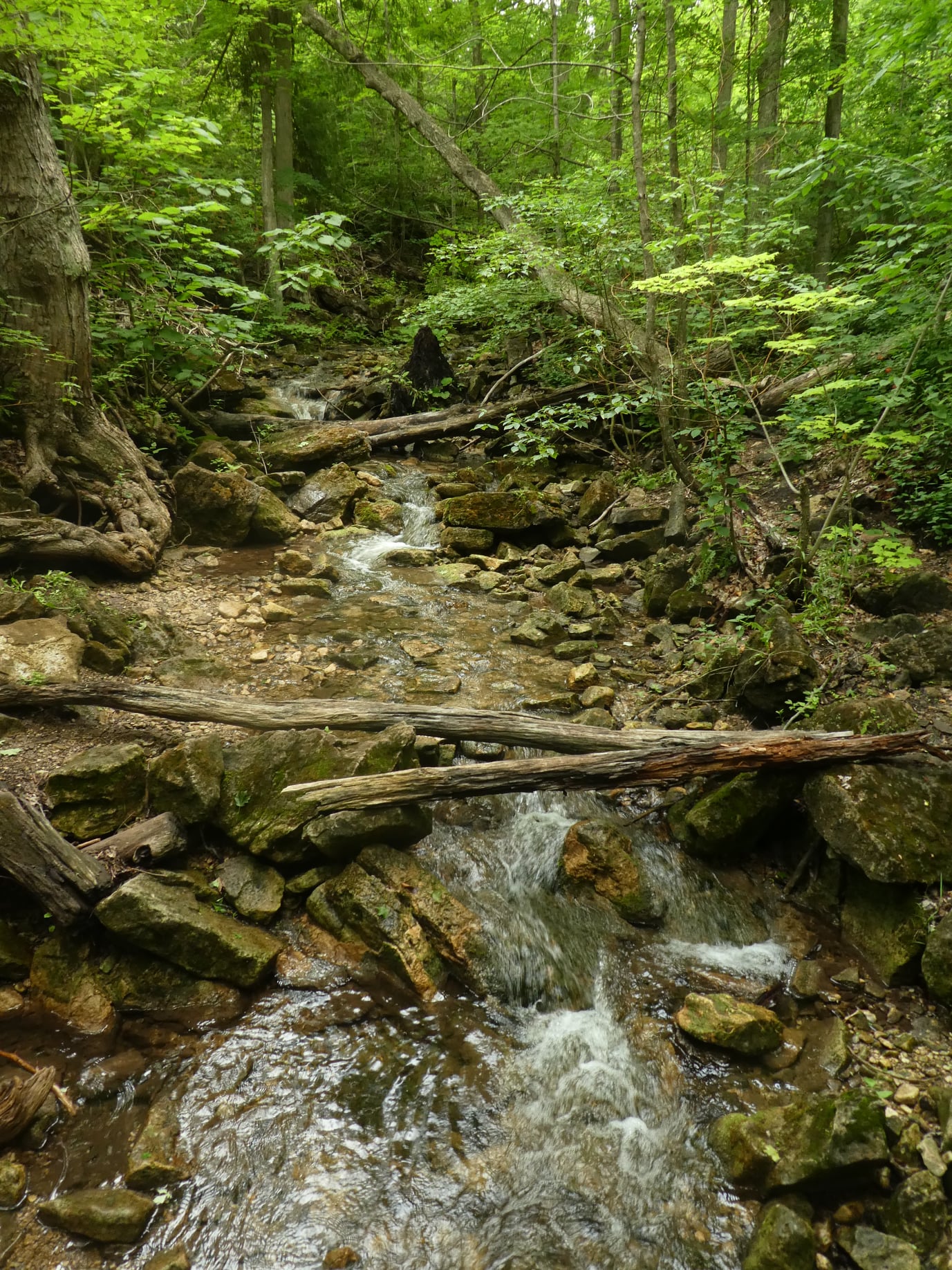
Meet in the parking lot off 8 Line at 9:15 am. We’ll hike the Maureen Smith Side Trail to the main trail and around the Great Esker Side Trail, back to the main trail and the Bennet Heritage Side Trail for a total of about 10 kms. There are some hills. Bring bug spray/bug net, water and a snack.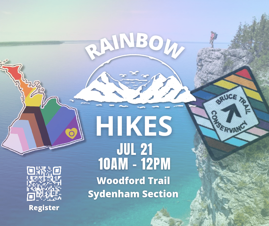
Rainbow Hike: Summer in Woodford
https://hikesstaging.brucetrail.org/event/rainbow-hike-summer-in-woodford/Sorry, the registration cut-off time for this hike has been reached.Not a member? Click here to join today!Hosting Club: Sydenham
Category: Health & Nature Hike
Location (Google Maps):Hike Leader(s): Margaret O’Dell Click here to contact Hike Leader(s)
Pace: Leisurely: 3 km/h or less
Terrain: Moderate: Some hills and/or poor footing, Strenuous: Hilly with steep climbs and some poor footing.
Distance: 4.8 kmDescription
Join us on a Rainbow Hike for 2SLGBTQ+ folx and allies, while we explore the Woodford Escarpment.This hike begins at the Woodford Community Hall in the hamlet of Woodford.
We will enter a mixed hardwood forest, passing the stone foundation of a Pioneer Church, then the remnants of an old limestone kiln ingeniously constructed from a glacial pothole. The trail continues through the forest, passing over a “disappearing waterfall” (dry at this time of year), then alongside the foundation of a settler’s barn and cabin, before reaching a narrow crevice.
Woodford crevices are exciting to explore slowly. It is a short, very narrow passage through the escarpment with strenuous terrain. In the summer the passage walls are cool. You’ll feel the air-conditioning emitting from the rocks of the crevice. At the same time, its a short but adventurous exploration! If anyone is claustrophobic or chooses not to follow the narrow crevice, there is a By-Pass trail to follow instead. At the end of the first section of crevices, the trail climbs up to the top of the escarpment where hikers can visual follow the passage from above. Once through both sections of crevices, the trail reaches the Woodford Escarpment Side Trail which will will follow to return to the parking area. Together with the main trail, this forms a 3 km loop hike.
Once back to Woodford Community Hall, we’ll continue south, crossing Hwy 26 and following the main trail for about 500 metres before reaching the Crevice Springs Side Trail. This trail descends the talus slope and continues northward through a mature cedar forest, crossing numerous springs before ascending through an interesting crevice, known locally as “the hole-in-the-wall”. Together with the main trail, this forms a 1.4 km hike.
What to Bring: Please carry a backpack with snacks and at least one litre of water and/or electrolytes. Sunscreen and insect repellent are recommended.
What to wear: Light sweat-wicking clothing is best in summer to keep you cool. Sturdy shoes with a good tread on rocky surfaces with socks. No open-toed shoes or “croc” style please.

10:00 Malivoire Wine Co Hike and Wine Tasting Experience
https://hikesstaging.brucetrail.org/event/1000-malivoire-wine-co-hike-and-wine-tasting-experience/Sorry, the registration cut-off time for this hike has been reached.Not a member? Click here to join today!Hike open to BTC Members only.
Hosting Club: Niagara
Category: Loop
Location (Google Maps): Park at Malivoire Wine Co 4260 King St, Lincoln ONHike Leader(s): Sam Rutherford Click here to contact Hike Leader(s)
Pace: Medium
Terrain: Moderate
Distance: 5 kmsDescription
We will hike a loop on the main trail from Malivoire Wine Co to the Margaret Reed Side Trail at Cave Springs Conservation Area and back to Malivoire Wine Co by 11:30. Upon return we will enjoy a private structured wine tasting led by one of the knowledgeable and friendly winery staff from 11:30 to 12:00 noon. The cost for the tasting experience is $12.00 per person. Please bring your $12.00 with you as I will collect it prior to the tasting to simplify the payment to Malivoire Wine Co. Thank you.
Car Hike: Hike #7 to earn the Dufferin Hi-Land Youth and/or Side Trails Badge!
https://hikesstaging.brucetrail.org/event/car-hike-hike-7-to-earn-the-dufferin-hi-land-youth-and-or-side-trails-badge/Sorry, the registration cut-off time for this hike has been reached.Not a member? Click here to join today!Hosting Club: Toronto, Dufferin Hi-Land
Category: Car Hike
Location (Google Maps): We will meet at roadside parking on Prince of Wales Road/County Road 19 south of 5 Sideroad – where the Primrose Loop ST crosses the road (Map 20 of the Bruce Trail Reference Guide, Edition 31).Hike Leader(s): Monica Pasquali Click here to contact Hike Leader(s)
Pace: Leisurely
Terrain: Variable
Distance: 6.6 kmDescription
Calling all families with children who love hiking and earning badges!!!This is the seventh in a series of ten hikes that will be offered throughout 2024 on a roughly monthly basis so that children who are 15 years of age and younger can earn the Dufferin Hi-Land Adventurer Youth Badge and their parents/guardians can earn the Dufferin Hi-Land Side Trails Badge at the same time!!! Details regarding the requirements for each badge can be found here: https://dufferinbrucetrailclub.org/dufferin-bruce-trail-club-badges/ Each of the ten hikes will be a loop hike so no car shuttles will be needed, and each hike will cover a distance of approximately 6-9 km hiked at a leisurely pace (2-3 km/h) so children and adults alike can participate.
This seventh hike will be a summer hike to continue exploring some side trails within Boyne Valley Provincial Park, specifically the Primrose Loop Side Trail and the Prince of Wales Side Trail. Please dress appropriately for a summer hike by dressing in lightweight and breathable clothing, wearing a sunhat, and wearing comfortable footwear that has good traction. It is also advised that you bring sunscreen, bug spray, a light sweater, and suitable rain apparel in case conditions require their use. As well, make sure you bring enough water and food for a 2-3 hour hike since we’ll be covering a total distance of approximately 6.6 km.
Hopefully you’ll be able to join me on Sunday, July 21st! Until then, happy hiking, everyone!
Exploring Sydenham hike 12
https://hikesstaging.brucetrail.org/event/exploring-sydenham-hike-12/Sorry, the registration cut-off time for this hike has been reached.Not a member? Click here to join today!Hosting Club: Sydenham
Category: General Hike
Location (Google Maps):Meet in the north-east corner of the parking lot at Home Depot on Highway 26 on the east side of Owen Sound.
Hike Leader(s): Bill Snel Click here to contact Hike Leader(s)
Pace: Leisurely: 3 km/h or less
Terrain: Moderate: Some hills and/or poor footing
Distance: 4.5 kmDescription
We will carpool to do a loop hike in the Bayview Nature Reserve. This is hike 12 in the book Exploring Sydenham. If you do not have a book and would like one ($30) let me know by using the “Contact hike leader” link.Urban Walk: Toronto Waterfront
https://hikesstaging.brucetrail.org/event/urban-walk-toronto-waterfront/Sorry, the registration cut-off time for this hike has been reached.Not a member? Click here to join today!Hosting Club: Toronto
Category: Urban Walk
Location (Google Maps): Meet outside Farm Boy Grocery, 207 Queen’s Quay West (Queen’s Quay Terminal)Hike Leader(s): Danny Pivnick Click here to contact Hike Leader(s)
Pace: Moderate
Terrain: Flat
Distance: 8 kmsDescription
Meet down at Harbourfront and then join us on a lovely summer afternoon walk along the Toronto Waterfront Trail. We will end the walk at Woodbine Park. Please stick around after the walk to enjoy the free Bob Marley Tribute Concert beginning at 6:30 p.m. and that is part of the very popular Beaches Jazz Festival. - 22July 22, 2024No events
- 23July 23, 2024

Lambton Shores “What 3 Words”
https://hikesstaging.brucetrail.org/event/lambton-shores-what-3-words/Sorry, the registration cut-off time for this hike has been reached.Not a member? Click here to join today!Hike open to BTC Members only.
Hosting Club: Iroquoia
Category: Special Event
Location (Google Maps): Lambton Shores Nature Trails – Ausable River Valley TrailHike Leader(s): Ruth Moffatt Click here to contact Hike Leader(s)
Pace: Brisk – 4 to 5 km/hr, Medium – 3 to 4 km/hr
Terrain: Dependent on Conditions, Easy – Mostly flat and usually good footing, Moderate – Some hills and/or some poor footing
Distance: About 10-12kmDescription
Occasionally hikes are put on the schedule for hikes outside of the Bruce Trail. This one is near Grand Bend, Ontario and involves a 2 hour drive there and a 2 hour drive back, possible closer to 3 depending on road construction and traffic.This hike is limited to 6 participants in one vehicle. We will travel from Niagara making a pick up at the carpool parking lot in Grimsby (sw corner of the QEW/Casablanca) in the Go Bus parking lot and another stop at the carpool lot on Wilson St West, Ancaster
https://maps.app.goo.gl/5na64ayjFoBckPRz9?g_st=com.google.maps.preview.copy
From there we will travel to Parkhill, as above.
More hikers can come if someone else wishes to drive or you can meet us there. Just let me know through contact on this form. Registration is still necessary but the number of hikers can be increased if need be.
We will hike the two required trails in the Ausable River Valley https://img1.wsimg.com/blobby/go/72882546-4158-474e-bfd0-32a9f78441a3/downloads/Ausable%20River%20Valley%20%26%20Mystery%20Falls.pdf?ver=1720533688263The badge is free but donations would be gratefully accepted by the Lambton Shores Nature Trails. Please bring the printed log with you which will need to be completed and submitted to the club. Someone from the club will be meeting us with the badges at the turnaround spot.
Gas expense will be shared amongst the passengers. Please bring enough supplies in your backpack for a full day of hiking – 2l of water, lunch, snacks, first aid kit etc.Check for weather conditions and bring appropriate gear for the weather. If there is extreme weather forecast, the hike will be cancelled.
8:00 Long Hike Wiley Road Short Hills
https://hikesstaging.brucetrail.org/event/800-long-hike-wiley-road-short-hills-46/Sorry, the registration cut-off time for this hike has been reached.Not a member? Click here to join today!Hosting Club: Niagara
Location (Google Maps):
Short Hills Wiley Road Entrance
Pace: Medium
Terrain: Moderate
: 10kmDescription
Explore Short Hills and the majestic side trails of Scarlett Tanager, Hemlock. Swayze Falls and Terrace. Register for each hikeBring Poles, Sunscreen, bug spray water, snack, and dress for the weather

Niagara E2E #2- New Badge
https://hikesstaging.brucetrail.org/event/niagara-e2e-2-new-badge/Sorry, the registration cut-off time for this hike has been reached.Not a member? Click here to join today!Hosting Club: Niagara
Category: Car Pool
Location (Google Maps): Meet at the entrance to DeCew House Heritage Park, ThoroldHike Leader(s): Margaret Northfield Click here to contact Hike Leader(s)
Pace: Medium
Terrain: Moderate
Distance: 14.4kmDescription
Earn the new E2E badge by completing the Niagara Section of the Bruce Trail in 5 hikes. This series will run each Tuesday morning for 5 consecutive weeks. If you are unable to attend all the hikes you can keep a log and complete the missed hikes at another time. You will still be able to earn the badge once all the sections are complete. Badges will be available for purchase at the end of the 5th hike. $10 for members, $15 for non members.This is a carpool hike. Please arrive 15 minutes early so we can arrange carpooling. Driving is voluntary but we encourage all hikers to take their turn to help out. Bring water and a snack. The hikes go rain or shine. Poles, weather appropriate clothing, sturdy hiking shoes and bug spray are recommended.
We will carpool to Woodend Conservation and hike back to the cars at DeCew House.
Urban Walk: Valley View and Maple view Parks Thornhill
https://hikesstaging.brucetrail.org/event/urban-walk-valley-view-and-maple-view-parks-thornhill-3/Sorry, the registration cut-off time for this hike has been reached.Not a member? Click here to join today!Hosting Club: Toronto
Category: Urban Walk
Location (Google Maps): 45 Willowbrook road, park at school parking,Use bus 91 from finch station to WILLOWBROOK stop
Hike Leader(s): Mohammad Aghamiri Click here to contact Hike Leader(s)
Pace: Moderate
Terrain: Variable
Distance: 7-8 kmDescription
We will explore Valleyview and Maple view parks, and walk along German Mills Creek,9:15 Short hike - Pelham Road, Short Hills
https://hikesstaging.brucetrail.org/event/915-short-hike-pelham-road-short-hills-79/Sorry, the registration cut-off time for this hike has been reached.Not a member? Click here to join today!Hosting Club: Niagara
Location (Google Maps): Pelham Road entrance, Short Hills Provincial Park
Hike Leader(s): janet davey Click here to contact Hike Leader(s)
Pace: Medium
Terrain: Moderate
Distance: 6 kmsDescription
Hike the main and side trails in Shorthills Provincial Park. Bring hiking boots, water, sunscreen and bug spray. Please help prevent the spread of invasive species by cleaning your boots following the hike. Please check yourself for ticks following the hike.