
Hike Schedule
Join us for a hike! Registration required.
All hikes available to BTC members. Some hikes are open to non-members.
See Refund Policy for Paid Hikes >
TIP: The calendar view displays up to 7 hikes on a day, but often there are more. Click “View more events” to see them all.
Categories
- 02June 2, 2024
Peninsula in 6 Challenger Series A Hike #6 Halfway Dump to Peninsula Terminus
https://hikesstaging.brucetrail.org/event/peninsula-in-6-challenger-series-a-hike-6-halfway-dump-to-peninsula-terminus-2/Sorry, the registration cut-off time for this hike has been reached.Not a member? Click here to join today!Hike open to BTC Members only.
Hosting Club: Peninsula
Category: General Hike
Location (Google Maps):Peninsula Terminus 45.236000, -81.594000
Street Parking availableHike Leader(s): Margaret O’Dell Click here to contact Hike Leader(s)
Pace: Brisk: 4 to 5 km/h, Fast: more than 5 km/h
Terrain: Strenuous: Hilly with steep climbs and some poor footing.
Distance: 25.2 KmDescription
Hike #6 of 6 Halfway Log Dump to Peninsula TerminusPeninsula in 6 Challenger Series
Complete 162.4 km section from Wiarton to Tobermory in 6 hikes.- You must sign up for EACH hike individually. The series is spread-out over 2 weeks, and 3 weekends. You are not automatically accepted into either series as a whole.
- This hike series is intended for experienced distance hikers only. Hikers must demonstrate recent experience completing hikes exceeding 25 km over difficult terrain and at a brisk pace;
- If a hiker is unable to keep pace with the group, or finds the distance too challenging, their future hike registrations may be canceled by the hike leader.
- Be very aware of your ability to join this series.
- Hikes will average 4.5 km per hour including breaks, moving pace is 5 km per hour;
- Expect to be on-trail for 7 – 9 hours;
- Meeting time is scheduled for 7:00am; arrive no later than 15 minutes prior to the meeting time;
- Hikers must carry sufficient hydration, accessible snacks, lunch, first-aid kit, rain gear, extra socks, and possibly protective boot covers (i.e. bags);
- Hikers will be expected to participate in shuttling hikers to the start and to drive shuttlers back to their car. Responsibility will be shared equally;
- Any applicable parking fees will be shared within the group.

Toronto Urban Badge Hike - 7 of 7
https://hikesstaging.brucetrail.org/event/toronto-urban-badge-hike-7-of-7-3/Sorry, the registration cut-off time for this hike has been reached.Not a member? Click here to join today!Hosting Club: Toronto
Category: Urban Walk
Location (Google Maps):Toronto
Hike Leader(s): Brian Rideout Click here to contact Hike Leader(s)
Pace: Moderate
Terrain: Flat
Distance: 9 kmDescription
Please join me at the south east corner of Overlea Blvd and Don Mills Rd by 10 AM. We will hike south on the Don Trail to the Distillery District (km 62.4 to km 71.4). Here is an online map with km markings of our route for all 7 hikes for the Toronto Urban Badge.Please make sure you bring at least 2 liters of water, a lunch, bug spray and sunscreen.
- 03June 3, 2024
Birding with Rod
https://hikesstaging.brucetrail.org/event/birding-with-rod/Sorry, the registration cut-off time for this hike has been reached.Not a member? Click here to join today!Hosting Club: Peninsula
Location (Google Maps): Otter Lake Nature Reserve. Bruce Trail Map 39. Meet at the Otter Lake SideTrail entrance on Cape Chin Road North. Roadside Parking. GPS Coordinates 45.113223, -81.3166099. Car pool if possible.
Hike Leader(s): Marg Glendon Click here to contact Hike Leader(s)
Pace: Leisurely
Terrain: Easy, Moderate
Distance: ~2 1/2 KMDescription
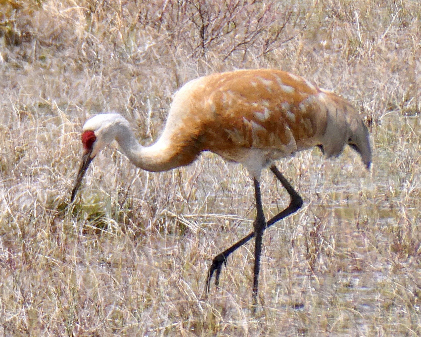
We continue our series of Spring Easy Hikes with respected, local birder – Rod Steinacher – at Otter Lake Nature Reserve. Rod will offer bird identification support and share his knowledge about birds during our avian adventure. Otter Lake Nature Reserve is part of a provincially significant wetland complex comprised of a marsh, thicket swamp, deciduous swamp, fen and Otter Lake itself. This wetland supports a variety of marsh birds, fish, amphibians, and reptiles. Some of the threatened bird species include the Meadowlark, Bob-o-link and Red-headed Woodpecker. This slow-paced hike will be a “walk-stop-listen-watch” hike and will traverse relatively flat, but uneven terrain. Plan on 2 ½ hours. What to bring: Bring a light backpack to carry water, snacks, binoculars, sunscreen, insect repellent and your favourite bird ID resource.Optional: Camera, lightweight portable stool and nature journal. Download the Merlin and/or Seek app (both free) on your phone. This will be used for ID purposes only -not for calling. What to wear: Sturdy footwear with good tread. The trail may be muddy in places. Wear a hat and sun protective clothing.
- 04June 4, 2024
NEW TIME 8:00 Long Hike Wiley Road Short Hills
https://hikesstaging.brucetrail.org/event/new-time-800-long-hike-wiley-road-short-hills-5/Sorry, the registration cut-off time for this hike has been reached.Not a member? Click here to join today!Hosting Club: Niagara
Location (Google Maps):
Short Hills Wiley Road Entrance
Hike Leader(s): Alan Laver Click here to contact Hike Leader(s)
Pace: Medium
Terrain: Moderate
Distance: 10kmDescription
Explore Short Hills and the majestic side trails of Scarlett Tanager, Hemlock. Swayze Falls and Terrace. Register for each hike
Bring Poles bug spray water, snack, and dress for the weather
9:15 Short hike - Pelham Road, Short Hills
https://hikesstaging.brucetrail.org/event/915-short-hike-pelham-road-short-hills-75/Sorry, the registration cut-off time for this hike has been reached.Not a member? Click here to join today!Hosting Club: Niagara
Category: Loop
Location (Google Maps): Short Hills Provincial Park, Pelham Road entranceHike Leader(s): janet davey Click here to contact Hike Leader(s)
Pace: Medium
Terrain: Moderate
Distance: 6 kmsDescription
Hike the main and side trails in Short Hills Provincial Park. Bring hiking boots, water, sunscreen and bug spray. Please check yourself for ticks after the hike. - 05June 5, 2024
LETCHWORTH STATE PARK, FLT LETCHWORTH BRANCH TRAIL
https://hikesstaging.brucetrail.org/event/letchworth-state-park-flt-letchworth-branch-trail/Sorry, the registration cut-off time for this hike has been reached.Not a member? Click here to join today!Hike open to BTC Members only.
Hosting Club: Niagara
Category: Car Pool
Location (Google Maps): Parking lot on Lakeshore Road at corner of Beatrice St., Fort Erie, OntarioHike Leader(s): Marion Hanover Click here to contact Hike Leader(s)
Pace: Fast
Terrain: Strenuous
Distance: 35 KMDescription
NOTE: THIS HIKE IS EXTREME IN TERMS OF DISTANCE AND PACE. Another Letchworth State Park hike will be hosted in September which will be moderate in pace and distance, thereby appealing to the average interest of this hiking community.Letchworth State Park, renowned as the “Grand Canyon of the East,” is one of the most scenically magnificent areas in the eastern U.S. The Genesee River roars through the gorge over three major waterfalls between cliffs–as high as 600 feet in some places–surrounded by lush forests.
The plan is to meeting in Fort Erie at 6am and carpool 1.5 hours to Letchworth State Park. At that point we will need to spot cars at either end of the park, taking approximately 1 hour. Hikers must be able to hike 4.5 km/hour to cover 35 km over a 8-8.5 hour period. There is an overall 1820 feet elevation gain along the trail. The Letchworth Trail is a branch of the FLT. For more about FLT (Finger Lakes Trail) https://fingerlakestrail.org/plan-hikes-finger-lakes-trail/about-the-finger-lakes-trail/
Proper documentation for travel to the USA is required. Costs for gas, tolls and park entrance will be shared amongst participants in the vehicle that you will be car pooling in.
Barrow Bay Staircase, Peninsula
https://hikesstaging.brucetrail.org/event/barrow-bay-staircase-peninsula-3/Sorry, the registration cut-off time for this hike has been reached.Not a member? Click here to join today!Hosting Club: Blue Mountains
Category: Organized Hike
Location (Google Maps): Tim Horton’s, First Street CollingwoodHike Leader(s): Dick Edwards Click here to contact Hike Leader(s)
Pace: Medium – 3 to 4 km/hr
Terrain: Strenuous – Hilly with steep climbs and some poor footing
Distance: 7 kmDescription
This has a short shuttle. We will drive from Collingwood to Lions Head (2 hours) and follow Cty. Rd. 9 to km 67.9 at the junction of the Barrow Bay Side Trail which has now become the white blazed trail after printing Edition 31. We follow this NEW trail to a very steep descent down the Escarpment to the Georgian Bay shore. We then follow a moderately rugged path just inside the tree line for 2km along an unspoiled rocky shoreline. We then head back up via a steep zig zag among huge boulders until we meet a formerly impassable cliff, now conquered by a spectacular wooden staircase built in 2020 by volunteers from the Peninsula BTC. We will take a moment to appreciate the hard work and beautiful views before continuing on an easy peasy walk to our end point. The trail features cliffs, spectacular lookouts, and dense forests. A long drive home but what a spectacular new section of our fabulous footpath to have experienced. Bring snacks, lunch and water. Available parking: S Shore Rd.Good Companions - Dundas Valley from Sanctuary Park (Note: 9:30 Start Time)
https://hikesstaging.brucetrail.org/event/good-companions-dundas-valley-from-sanctuary-park-note-930-start-time/Sorry, the registration cut-off time for this hike has been reached.Not a member? Click here to join today!Hosting Club: Iroquoia
Category: Good Companions
Location (Google Maps):Parking lot for Sanctuary Park – See map and address below (if parking lot is full, park on adjacent side streets)
Hike Leader(s): Ted Bossence Click here to contact Hike Leader(s)
Pace: Medium – 3 to 4 km/hr
Terrain: Strenuous – Hilly with steep climbs and some poor footing
Distance: 8 kmDescription
From Sanctuary Park we will hike the Spring Creek trail and parts of the Sawmill trail to the Trail Centre. After a break, (washrooms “should” be available at the trail centre) we will walk to the south side of the rail trail and take the Main Loop, Sulphur Creek, local access trails and rail trail back to the parking lot.Please arrive 10 minutes before the start time. I will be leaving at 9:30 am. Bring water, sunscreen, insect repellant, a first aid kit and a snack. Poles are highly recommended due to the number of hills and some hills may be slippery if it has rained recently. I will cancel the hike in case of rain. Please check your email the evening before the hike in case of a cancellation. If you must cancel after the 3:30pm Tuesday cut-off time I will be sending contact info on the Tuesday.
WEDNESDAY WALKERS -Kolapore to Metcalfe
https://hikesstaging.brucetrail.org/event/wednesday-walkers-kolapore-to-metcalfe/Sorry, the registration cut-off time for this hike has been reached.Not a member? Click here to join today!Hosting Club: Beaver Valley
Location (Google Maps): Meet in the Metcalfe Rock parking lot, just south of km 27.9, Map 25, Edition 31
Hike Leader(s): Margaret Yaraskavitch Click here to contact the hike leader.
Pace: Medium
Terrain: Moderate
Length of Hike: 5.5kmsDescription
We will meet in the Metcalfe Rock parking lot and then arrange ourselves to shuttle to the Kolapore Parking lot. The hike starts by getting some road walking out of the way. Then it’s a varied walk past pasture/field/meadow, through cedar stands and under deciduous forest canopy to the base of Metcalfe Rock. Please bring water and a snack.COVID-19 Precautions Before, During and After your Hike
- Each hiker joining a Bruce Trail Club organized hike must perform a self-screening check before hiking.
Find Ontario’s self-assessment tool here: https://covid-19.ontario.ca/self-assessment/ - If you are experiencing COVID-19 symptoms, stay home.
Other Guidelines
- Arrive 15 minutes before the start of the hike.
- Wear sturdy footwear and appropriate attire for the weather and the terrain.
Hiking poles are a good idea in any season, especially if the terrain is rocky or slippery. In winter, snowshoes or icers/crampons are needed when conditions dictate.
Wearing appropriate clothing and footwear prevents injuries and shows consideration for a safe and positive group hiking experience. - Always carry I.D. and your health card.
- Bring sufficient water and snacks (or lunch if indicated). A minimum of 1L of water is recommended on all hikes, and 3L is recommended for long, challenging hikes in the heat of the summer.
- Bring sunscreen and insect repellent (for spring and summer hikes).
- Bring your own first aid kit.
- Please leave dogs at home.
- Each hiker joining a Bruce Trail Club organized hike must perform a self-screening check before hiking.