
Hike Schedule
Join us for a hike! Registration required.
All hikes available to BTC members. Some hikes are open to non-members.
See Refund Policy for Paid Hikes >
TIP: The calendar view displays up to 7 hikes on a day, but often there are more. Click “View more events” to see them all.
Categories
- 28May 28, 2024
NEW TIME 8:00 Long Hike Wiley Road Short Hills
https://hikesstaging.brucetrail.org/event/new-time-800-long-hike-wiley-road-short-hills-4/Sorry, the registration cut-off time for this hike has been reached.Not a member? Click here to join today!Hosting Club: Niagara
Location (Google Maps):
Short Hills Wiley Road Entrance
Pace: Medium
Terrain: Moderate
: 10kmDescription
Explore Short Hills and the majestic side trails of Scarlett Tanager, Hemlock. Swayze Falls and Terrace. Register for each hike
Bring Poles bug spray water, snack, and dress for the weather

Summer Fen Series: Oliphant Fen & Petrel Point
https://hikesstaging.brucetrail.org/event/summer-fen-series-oliphant-fen-petrel-point/Sorry, the registration cut-off time for this hike has been reached.Not a member? Click here to join today!Hosting Club: Sydenham, Peninsula
Category: Botany Hike
Location (Google Maps): Oliphant Fen – North Entrance to Lorraine Brown BoardwalkHike Leader(s): Jeannine Kralt Click here to contact Hike Leader(s)
Pace: Leisurely: 3 km/h or less
Terrain: Easy: Mostly flat and good footing.
Distance: 3kmDescription
Join the Sydenham and Peninsula Bruce Trail Clubs for a hike series focusing on fens. Fens are unique coastal wetlands occurring along the escarpment, meadow marshes that have conditions that are favourable for a variety of interesting species including orchids.This easy hiking series will begin at Oliphant Fen, with a participant carpool to Petrel Point, returning to Oliphant thereafter. Observations count towards the PBTC Orchid Badge.
Come to one of the hikes or several to see how the fens change through the seasons. Carpooling encouraged – contact the hike leader if you are in need of a ride (no guarantees, but attempts will be made to help coordinate). Please plan to arrive 15 minutes in advance of the hike start time.
Please contact Jeannine, the hike leader, if you have any questions or concerns (link on this page).
9:15 Short Hike - Short Hills Park, Pelham Rd
https://hikesstaging.brucetrail.org/event/915-short-hike-short-hills-park-pelham-rd-5/Sorry, the registration cut-off time for this hike has been reached.Not a member? Click here to join today!Hosting Club: Niagara
Category: Hike
Location (Google Maps): Short Hills Provincial Park, Pelham Rd lotHike Leader(s): Debbie Demizio Click here to contact Hike Leader(s)
Pace: Medium
Terrain: Moderate
Distance: ~ 6kmsDescription
Hike the main and side trails in Short Hills Provincial Park. Bring hiking boots, water, sunscreen and bug spray.Halton Regional Forest
https://hikesstaging.brucetrail.org/event/halton-regional-forest-8/Sorry, the registration cut-off time for this hike has been reached.Not a member? Click here to join today!Hosting Club: Caledon Hills
Category: Tuesday Hikers
Location (Google Maps): Parking at: 10 Side Road and 4th Line Nassagaweya (trail entrance to Halton Regional Forest).
From Highway 401 West, turn right (north) on Guelph Line, right on 10 Side Rd. The road bends northwards and becomes 4th Line Nassagaweya; roadside parking at the bend.Hike Leader(s): Mohammad Shafiq Click here to contact Hike Leader(s)
Pace: Medium – 3 to 4 km/hour
Terrain: Moderate – some hills and/or some poor footing
Distance: 12 kmDescription
Will hike trails in Halton Regional Forest and Hilton Falls Conservation Area; beautiful and winding trails are relatively flat with some rocky parts. Snack break at Hilton Falls, possibly around fire pit.
Bring water and snack of your choice.
Dress according to weather, poles are recommended, bring sunscreen and bugs spray.
Hike leader cell phone: 416-566-0503 (note that reception in hiking area is usually poor, leave a messages to callback).60 for the 60th Anniversary Badge Hike Series - #4 of 10
https://hikesstaging.brucetrail.org/event/60-for-the-60th-anniversary-badge-hike-series-4-of-10/Sorry, the registration cut-off time for this hike has been reached.Not a member? Click here to join today!Hosting Club: Caledon Hills
Category: General
Location (Google Maps): Roadside parking on the south side of Dunby Rd. at the trail entrance; km 67.8, Map 18. On Hockley Rd. turn left (north) on the 3rd Line to Dunby Rd.Hike Leader(s): Louise Carberry 905-699-7523 Click here to contact Hike Leader(s)
Pace: Leisurely – 3 km/hour or less
Terrain: Moderate – some hills and/or some poor footing
Distance: 6 kmDescription
Join Louise, Marilyn and Joyce on this 2 hour, 6 km hike which is the 4th in the series of hikes for the new “60 for the 60th Anniversary” badge. We will hike south through the Hockley Valley Provincial Nature Reserve and back. Hike one, a few, or all 10 hikes. Join any hike and make up the rest on your own as long as a record is kept of their hikes to submit on completion to obtain their badge. Participants who complete all 10 hikes will be eligible to purchase the “60 for the 60th” badge.
Bring poles, and hydration. - 29May 29, 2024
John Haigh Side Trail - Upper Pretty River
https://hikesstaging.brucetrail.org/event/john-haigh-side-trail-upper-pretty-river/Sorry, the registration cut-off time for this hike has been reached.Not a member? Click here to join today!Hosting Club: Blue Mountains
Category: Register in person the morning of hike.
Location (Google Maps): Hike meets in the parking lot behind Tim Hortons on First St. in Collingwood.Hike Leader(s): Flo Kusiak Click here to contact Hike Leader(s)
Pace: Leisurely – 3 km/hr. or less, Medium – 3 to 4 km/hr
Terrain: Moderate – Some hills and/or some poor footing
Distance: 6 kmDescription
We will drive to the junction of the 2nd Line and the 6th Sideroad, then commence a loop hike through the upper level of the Pretty River Provincial Park. Following the John Haigh Side Trail, we will hike south to join the white blazed trail, then head north to km 52.6. From here we will head west along the 6th Sideroad back to the cars. Bring a snack and water.WEDNESDAY WALKERS - East of Kolapore
https://hikesstaging.brucetrail.org/event/wednesday-walkers-east-of-kolapore-2/Sorry, the registration cut-off time for this hike has been reached.Not a member? Click here to join today!Hosting Club: Beaver Valley
Location (Google Maps): Park in the Kolapore parking lot, near Km 27.9, Map 25, Edition 31, for a car shuttle to the start of our hike.
Hike Leader(s): Margaret Yaraskavitch Click here to contact the hike leader.
Pace: Medium
Terrain: Moderate
Length of Hike: 4.7 kms + 650 m of roadDescription
We will walk south from 12th Sideroad and as we walk through deciduous forest, we’ll cross a piece of history, remnants of The Old Mail Road. We continue south, crossing Grey Road 19, through property that is managed by the BTC, until we return to our cars. Please bring water and a snack.COVID-19 Precautions Before, During and After your Hike
- Each hiker joining a Bruce Trail Club organized hike must perform a self-screening check before hiking.
Find Ontario’s self-assessment tool here: https://covid-19.ontario.ca/self-assessment/ - If you are experiencing COVID-19 symptoms, stay home.
Other Guidelines
- Arrive 15 minutes before the start of the hike.
- Wear sturdy footwear and appropriate attire for the weather and the terrain.
Hiking poles are a good idea in any season, especially if the terrain is rocky or slippery. In winter, snowshoes or icers/crampons are needed when conditions dictate.
Wearing appropriate clothing and footwear prevents injuries and shows consideration for a safe and positive group hiking experience. - Always carry I.D. and your health card.
- Bring sufficient water and snacks (or lunch if indicated). A minimum of 1L of water is recommended on all hikes, and 3L is recommended for long, challenging hikes in the heat of the summer.
- Bring sunscreen and insect repellent (for spring and summer hikes).
- Bring your own first aid kit.
- Please leave dogs at home.
Good Companions - Dundas Driving Park to Tews Falls and Return
https://hikesstaging.brucetrail.org/event/good-companions-dundas-driving-park-to-tews-falls-and-return-3/Sorry, the registration cut-off time for this hike has been reached.Not a member? Click here to join today!Hosting Club: Iroquoia
Category: Good Companions
Location (Google Maps):Dundas Driving Park – Main parking area – See map below
Hike Leader(s): Ted Bossence Click here to contact Hike Leader(s)
Pace: Medium – 3 to 4 km/hr
Terrain: Strenuous – Hilly with steep climbs and some poor footing
Distance: 7.5 kmDescription
We will walk, following city streets, to the Tews Falls Side trail. We will ascend the escarpment and onwards to view Tews Falls. We will then return with a stop at the Dundas Peak Viewpoint and retrace our steps back to the Dundas Driving Park. Bring water, sunscreen, bug repellant and a snack. Hiking poles recommended. Please arrive at the car park by 9:45 am in order to be walking by 10:00 am. I will send contact info a day or two before the hike with contact info should you need to cancel after 4:00 pm on Tuesday May 28. I will inform you if the hike is cancelled due to rain. Please check your email the evening before the hike. - Each hiker joining a Bruce Trail Club organized hike must perform a self-screening check before hiking.
- 30May 30, 2024
NEW TIME 8:00 am Long Hike Jordan to Moyer / Louth
https://hikesstaging.brucetrail.org/event/new-time-800-am-long-hike-jordan-to-moyer-louth-3/Sorry, the registration cut-off time for this hike has been reached.Not a member? Click here to join today!Hosting Club: Niagara
Location (Google Maps):
Jordan Hollow Park 3039 King St Jordan
Hike Leader(s): Alan Laver Click here to contact Hike Leader(s)
Pace: Medium
Terrain: Moderate
Distance: 10kDescription
From Jordan Hollow Hike the main trail to Upper and Lower Balls Falls, Moyer Road or Louth and Return. You must register for each hike. Bring Poles, sunscreen, bug spray , snack and a drink and dress for the weather
9:15 Short Hike, Jordan Hollow
https://hikesstaging.brucetrail.org/event/915-short-hike-jordan-hollow-112/Sorry, the registration cut-off time for this hike has been reached.Not a member? Click here to join today!Hosting Club: Niagara
Category: Hike
Location (Google Maps): Jordan Hollow Park, Jordan StationHike Leader(s): Bill Russell Click here to contact Hike Leader(s)
Pace: Medium
Terrain: Strenuous
Distance: 6kDescription
Hike the main and side trails around Jordan and Balls Falls. Bring hiking boots, water, sunscreen and bug spray.Beaver Valley End-to-End Hike 6 of 9
https://hikesstaging.brucetrail.org/event/beaver-valley-end-to-end-hike-6-of-9/Sorry, the registration cut-off time for this hike has been reached.Not a member? Click here to join today!Hosting Club: Caledon Hills
Category: End-to-End
Location (Google Maps): Meet at 3rd Line off of Fox Ridge Rd. km 39.3, Map 27 (Ed. 31). Shuttle to start at Beaver Valley Lookout.Hike Leader(s): Nancy Mooney Click here to contact Hike Leader(s)
Pace: Medium – 3 to 4 km/hour
Terrain: Moderate – some hills and/or some poor footing, Strenuous – hilly with steep climbs and some poor footing
Distance: 39.3 – 50.0 + 0.8 from parking = 11.5 km totalDescription
This is the sixth hike in the series and includes Old Baldy Lookout and McCluskey’s Rock.
Nature Seekers - Exploring the Hockleycrest Area
https://hikesstaging.brucetrail.org/event/nature-seekers-exploring-the-hockleycrest-area/Sorry, the registration cut-off time for this hike has been reached.Not a member? Click here to join today!Hosting Club: Caledon Hills
Category: Introductory
Location (Google Maps): Meet at the Bruce Trail Parking Lot on Mono 5 Sideroad on the north side of the road where the Trail crosses. Google GPS Coordinates: 43.974055, -79.984988Directions: From Airport Road turn east onto 5 Sideroad and drive for 600 metres. The parking lot is on the left hand side.
Hike Leader(s): Sandy Green Click here to contact Hike Leader(s)
Pace: Leisurely – 3 km/hour or less
Terrain: Moderate – some hills and/or some poor footing
Distance: 5.5 kilometresDescription
Loop through the Hockleycrest area on main and side trails. Bring your choice of hydration and snacks. Sturdy footwear is highly recommended. This hike can be counted towards your 60 for the 60th Connecting People With Nature badge.
Urban Walk: Toronto Islands Evening Walk - Cancelled
https://hikesstaging.brucetrail.org/event/urban-walk-toronto-islands-evening-walk-5/Sorry, the registration cut-off time for this hike has been reached.Not a member? Click here to join today!Hosting Club: Toronto
Location (Google Maps): Jack Layton Ferry Terminal, near the gates to Wards Island Ferry. Arrive 20 minutes prior to departure to check in with hike leader.
From Union Station take the LRT and get off at the stop Ferry Docks.Walk up to the Ferry Docks on Queens Quay West, street level. at the foot of Bay Street.
Hike Leader(s): Miriam Stevens Click here to contact Hike Leader(s)
Pace: Leisurely
Terrain: Flat
Distance: 6-9 kmDescription
*** Cancelled – Toronto Island Evening Walks will resume Thursday June 6th. **After a day’s work come and “cool off” on the Toronto Islands free of fumes and traffic. Enjoy the view of the city skyline and Toronto’s beautiful island parkland.
Pack a dinner for a sit down picnic. Food is not available for purchase on the Islands early in the season. Also bring a warm jacket and flashlight.
Return fare ticket for the ferry approx $10.00 less for seniors.
Hikes will take place rain or shine.
Toronto Island evening hikes will take place every THURSDAY in MAY and JUNE 2024.
Same time and same meeting place. No preregistration is required – just show up at the ferry docks at 5:40 PM and sign with the hike leader.** As of the publication of the hike entry the start date of the Spring schedule is not available – current departure time to Wards Island is 6:00 PM, check back closer to the date to confirm the time **
- 31May 31, 2024
8:45am - An Orchid and Wildflower Hike - Peninsula Club with Brian Popelier and Ruth Moffatt
https://hikesstaging.brucetrail.org/event/845am-an-orchid-and-wildflower-hike-peninsula-club-with-brian-popelier-and-ruth-moffatt/Sorry, the registration cut-off time for this hike has been reached.Not a member? Click here to join today!Hike open to BTC Members only.
Hosting Club: Iroquoia, Peninsula
Category: Special Event
Location (Google Maps): Plan to arrive by 8:45am at the Bruce Peninsula National Park Visitor’s Centre 120 Chi sin tib dek Rd, Tobermory. Parking fees apply.
We will then car shuttle to the Bruce Alvar, Singing Sands, Crane River and return to the Visitor’s Centre for a hike out to Burnt Point Loop and return. This hike will be open to 20 registrants.Hike Leader(s): Ruth Moffatt Click here to contact Hike Leader(s)
Pace: Leisurely – 3km/hr or less, Medium – 3 to 4 km/hr
Terrain: Easy – Mostly flat and usually good footing, Moderate – Some hills and/or some poor footing
Distance: Less than 15km in totalDescription
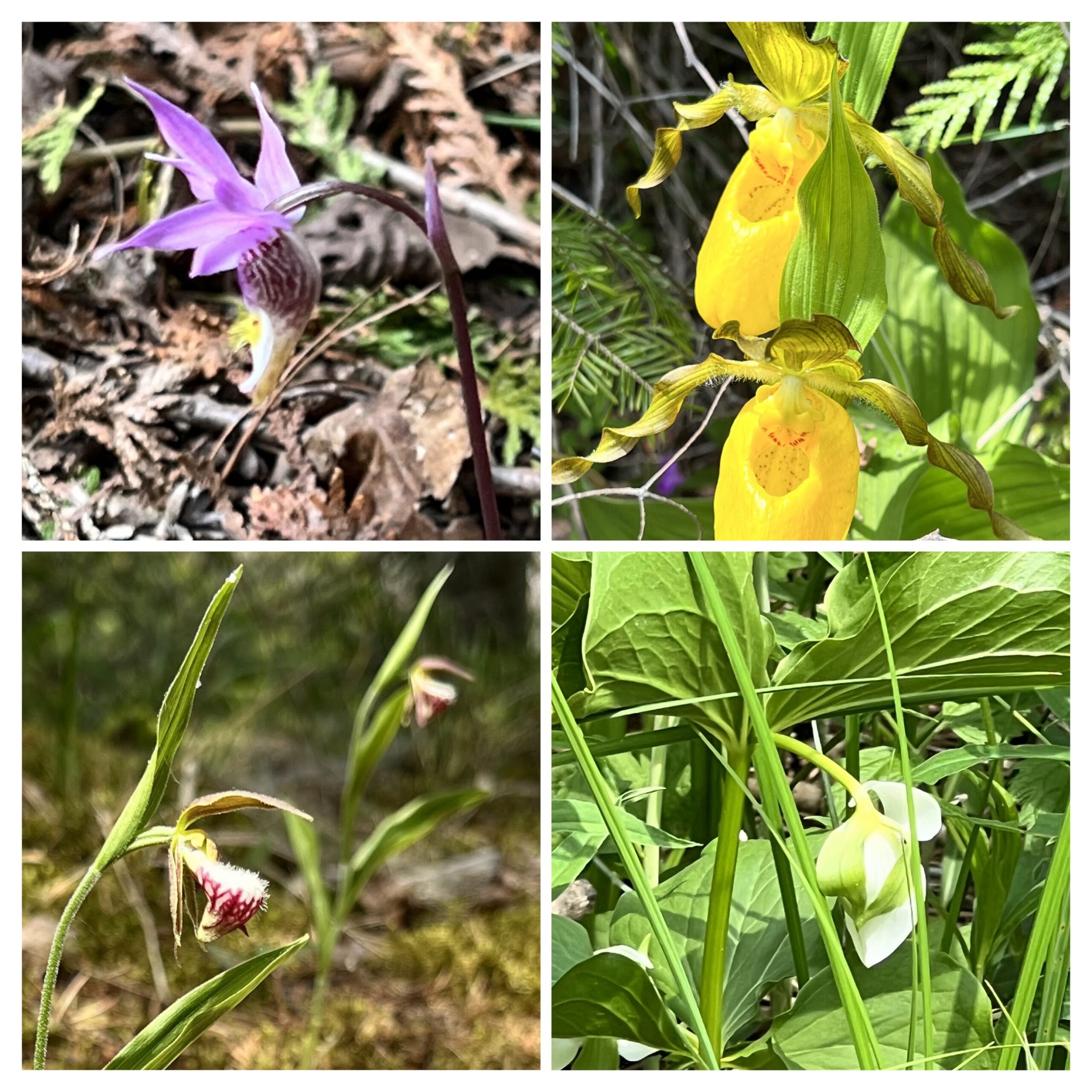
Please join Brian Popelier, Land Stewardship Coordinator and Ecologist, Bruce Trail Conservancy Staff and Ruth Moffatt for a leisurely, but steady hike to 4 different spots on the Saugeen Bruce Peninsula in a search for unusual wildflowers and orchids. All orchids can count toward your Peninsula Club Orchid Badge. After meeting at the Visitor’s Centre at 8:45am we will proceed to the Bruce Alvar at 9:00am where we will park alongside Hwy 6 – be very careful getting in and out of your vehicles here as it is a busy highway.From there we will proceed to Crane River Picnic Grounds 5739 Hwy 6 in search of the nodding trillium and other wildflowers.
After this, we will visit Singing Sands 126 Dorcas Bay Rd, Tobermory to look for orchids that thrive in this sandy environment.
Returning to the Visitor’s Centre for a hike out to Burnt Loop in search of a few more elusive orchids.
Please bring lunch, snacks, plenty of water as well as sun screen, a brimmed hat and bug spray. This hike will go rain or shine.
Kindly let Ruth know if you can be a driver for the car shuttle. We will need at least 3-4 vehicles.
Donations after the outing will be gratefully accepted for the Bruce Trail Conservancy.
Niagara-on-the-Lake Tour
https://hikesstaging.brucetrail.org/event/niagara-on-the-lake-tour-53/Sorry, the registration cut-off time for this hike has been reached.Not a member? Click here to join today!Hosting Club: Niagara
Category: Urban
Location (Google Maps): Park on King St near Centre St, just outside of Veteran’s Memorial ParkHike Leader(s): Margaret Northfield Click here to contact Hike Leader(s)
Pace: Medium
Terrain: Easy
Distance: 6-7kmDescription
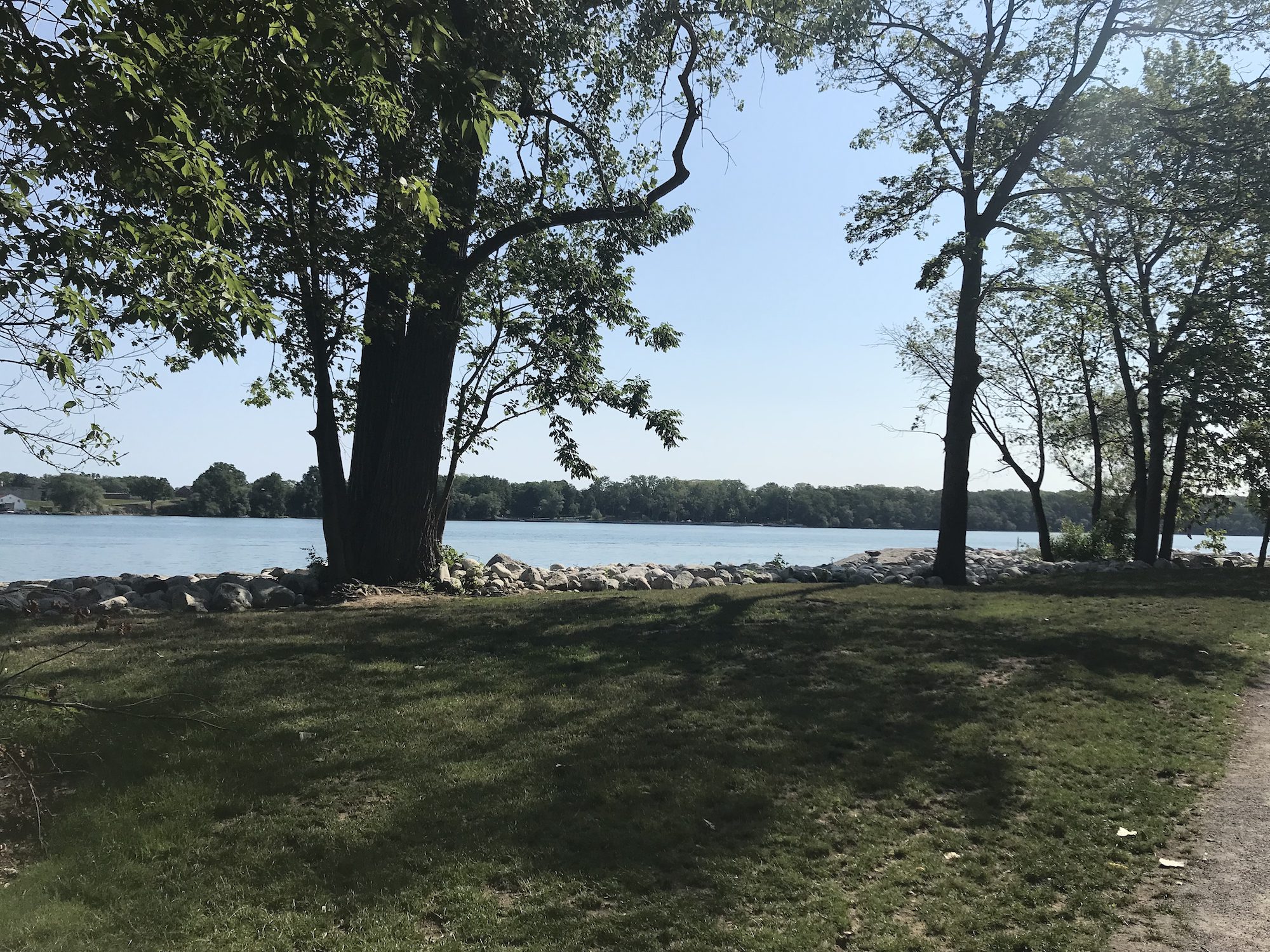
Each Friday we will explore different neighbourhoods, trails and parkland throughout Historic Niagara-on-the-Lake.
Moderate pace with some weeks entirely on sidewalks and roads while others may include a mix of trails and paved pathways. Great way to build up endurance for longer more strenuous hikes.
Prepare for cooler windy conditions on open parkland and along Lake Ontario and Niagara River trails.
Plan to stay for conversation and a warm cup of coffee or tea at Sweets & Swirls, Community Centre, Niagara Stone Road, NOTL
Robin Garrett & Margaret Northfield