
Hike Schedule
Join us for a hike! Registration required.
All hikes available to BTC members. Some hikes are open to non-members.
See Refund Policy for Paid Hikes >
TIP: The calendar view displays up to 7 hikes on a day, but often there are more. Click “View more events” to see them all.
Categories
- 19May 19, 2024
Sunday Only Niagara End 2 End. Self Led Hike
https://hikesstaging.brucetrail.org/event/sunday-only-niagara-end-2-end-self-led-hike/Sorry, the registration cut-off time for this hike has been reached.Not a member? Click here to join today!Hosting Club: Niagara
Category: Event Hikes
Location (Google Maps): Brock University Parking Lot 3A Merrittville Highway, St Catharines 43.115423-79.247160Hike Leader(s): Mary Ann Enns Click here to contact Hike Leader(s)
Pace: Medium
Terrain: Moderate
Distance: 27 kmDescription
Thank for registering for this NBTC Annual Niagara One Day Hike from Balls Falls to Brock University . This hike is inn conjunction with the 3 Day E 2 End Hike. Participants will be transported be transported by bus with check in no later than 6.45am, ( Bus will leave no later than 7am).Hikers will hike at their own pace to end at Brock University. This hike is a self led hike. At 27km.
Pack for weather and terrain, cell phone, snacks, bug spray, appropriate footwear, poles if you prefer, basic first aid supplies, train map or app. There will be volunteers set up at a designated checkpoints to provide light refreshment. You will receive volunteer Trail Angel contacts if unable to reach checkpoint areas.
Registration Cost: Members $40.00, Child Members $25.00 Non Members $50.00, Child nn members $30.00
Contact hike leader: Mary Ann Enns maryannenns@gmail.com
Trail Angel contracts and Designated Checkpoint areas, will be provided to you on day of hike
Monday only Niagara End 2 End. Self led hike
https://hikesstaging.brucetrail.org/event/monday-only-niagara-end-2-end-self-led-hike/Sorry, the registration cut-off time for this hike has been reached.Not a member? Click here to join today!Hosting Club: Niagara
Category: Event Hikes
Location (Google Maps): Queenston Heights Park, Niagara River Parkway, Niagara on the Lake 43.159314- 79.055405Hike Leader(s): Mary Ann Enns Click here to contact Hike Leader(s)
Pace: Medium
Terrain: Moderate
Distance: 28kmDescription
Hikers will hike at their pace to the end to Brock University. The hike is a self lead hike. At 27km. ** Please register by 6.45. Buses leave a precisely 7 am.Pack for weather and terrain, cell phone, snacks, bug spray, appropriate footwear, poles if you prefer, basic first aid supplies, trail maps or App.
Registration Cost: Members $40.00, Child Members $25.00, Non Members $50.00, Child Non Members $30.00
There will be volunteer Checkpoints set for refreshments and Trail Angels for assistance if unable to reach a CheckPoint. This will be provided at your arrival. Parking is paid for.
Birding at Black Creek Provincial Park
https://hikesstaging.brucetrail.org/event/birding-at-black-creek-provincial-park/Sorry, the registration cut-off time for this hike has been reached.Not a member? Click here to join today!Hosting Club: Peninsula
Location (Google Maps): Parking lot at Black Creek Provincial Park. 81 Old Womans River Rd, Lion’s Head, ON N0H 1W0
What3Words Address: ///suggestive.ledges.yellowing.Hike Leader(s): Owen Glendon Click here to contact Hike Leader(s)
Pace: Leisurely, Medium
Terrain: Easy, Moderate
Distance: ~3-3 1/2 kmDescription
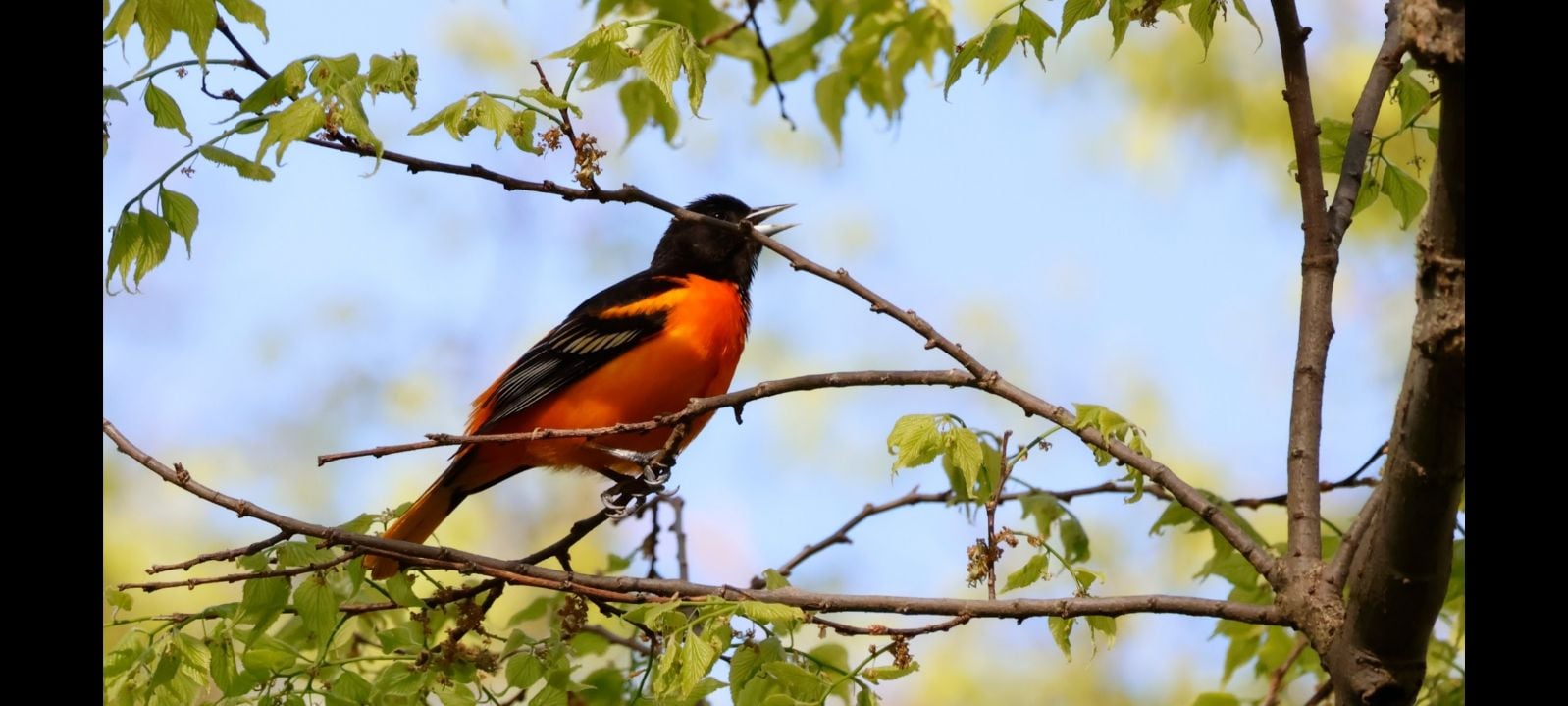
Join local Bird Enthusiast – Rod Sein – for a “ Birding Discovery Hike” at Black Creek Provincial Park. What will we see? Recent sightings include a wide variety of Ducks and Geese, Shorebirds, Warblers, Tree Swallows and Sparrows.This is a “walk-stop-listen” pace. No dogs please. No birding experience necessary. Bring your “listening ear” to help identify our feathered friends at the shore and in the nearby forest. Carry a backpack for your waterbottle, light snacks, any bird ID that you might have and binoculars. Dress according to the weather – it can be unpredictable at this time of year. Optional: bug net hat, gators, insect repellent.
Bus Hike: Forks of the Credit to explore the seasonal Lilacs blooming!!
https://hikesstaging.brucetrail.org/event/bus-hike-forks-of-the-credit-to-explore-the-seasonal-lilacs-bloomings/Sorry, the registration cut-off time for this hike has been reached.Not a member? Click here to join today!Trip Information
Departure Time: 08:30
Return to City Time: 18:00
Departure Point: York Mills Bus PickupOptional Items
Hwy 400 & Hwy 7 MTO Car Pool Lot Pickup ($.01)Hosting Club: Toronto, Caledon Hills
Category: Bus Hike
Location (Google Maps): Forks of the Credit Provincial ParkHike Leader(s): Amir Alemohammad, Mohammed Aghamiri, Mehrnoush Ahmadi Click here to contact Hike Leader(s)
Pace: Moderate
Terrain: Hilly, Variable
Distance: 12-14 KmDescription
Bus departs 10 York Mills Rd at 830 AM and HWY 7 and HWY 400 MTO Car Pool Lot at 8:50 AM. If you wish to be picked up at the HWY 7 and HWY MTO Car Pool Lot, select this option when registering. Please arrive 15 minutes before departure. The bus waits for no one.Join us for a wonderful hike in the Forks of the Credit Provincial Park when the lilac blossoms are blooming everywhere. We will hike main and sidetrails to explore the Credit river and it’s beautiful surroundings. Bring your snack/lunch for a wonderful by the river stop. Dress according to the weather conditions and bring at least 2L of water. Refreshments/ice cream after the hike in the village of Belfountain if there is enough time.
Bus departs 10 York Mills Rd at 8:3o AM, and should be back in the city by 6 PM.
Car Hike: A trek, a token, and a treat for youth in the Toronto section!
https://hikesstaging.brucetrail.org/event/car-hike-a-trek-a-token-and-a-treat-for-youth-in-the-toronto-section/Sorry, the registration cut-off time for this hike has been reached.Not a member? Click here to join today!Hosting Club: Toronto
Category: Car Hike
Location (Google Maps): We will meet at the parking lot of the Silver Creek Outdoor Education Centre located at 13500 Fallbrook Trail, Georgetown. (Map 13 of the Bruce Trail Reference Guide, Edition 31)Hike Leader(s): Monica Pasquali Click here to contact Hike Leader(s)
Pace: Leisurely, Moderate
Terrain: Rocky, Variable
Distance: 6.5 kmDescription
Calling all youth who are 25 years old and younger! Celebrate the May long weekend with a trek, a token, and a treat in the Toronto section of the Bruce Trail!First, we’ll do an out-and-back trek (approximately 6.5 km total) to explore Silver Creek Conservation Area, including the Irwin Quarry and Roberts side trails as well as the main trail atop the escarpment.
While on our hike, I will provide assistance to participants who are 25 years old and younger who are interested in earning a token: the BTC Youth Council Scavenger Hunt Badge (https://development.brucetrail.org/2024-youth-council-scavenger-hunt/)! Together we will strive to find and photograph at least 10 out of the 16 required plants, animals, and fungi. After the hike, participants will need to share their photographs with the Bruce Trail Conservancy’s iNaturalist project and then they’ll be eligible for a FREE badge!!!
Afterwards, we’ll make the short 10-minute drive to Whimsy Street Treats (90 Main Street South, Georgetown) in order to treat ourselves to some delicious soft serve ice cream or donuts (or both!) before we head home.
You should bring enough water and food for a 2-hour hike, comfortable hiking shoes, sun and bug protection, appropriate clothing for the weather, a camera or smartphone if you are a youth who wants to work on the BTC Youth Council Scavenger Hunt Badge, and money if you intend to join us at Whimsy Street Treats after the hike.

Birding Hike: Colonel Sam Smith Park to the Arsenal Lands
https://hikesstaging.brucetrail.org/event/birding-hike-colonel-sam-smith-park-to-the-arsenal-lands/Sorry, the registration cut-off time for this hike has been reached.Not a member? Click here to join today!Hosting Club: Toronto
Category: Urban Walk
Location (Google Maps): Power House Recreation Centre, Colonel Samuel Smith Park Dr. Coming by transit you can take TTC bus# 44 from Kipling Station at 9:21 (scheduled every 9 minutes) to the end. Look for the tall Powerhouse Smokestack. It is about 50 metres from the stop. Coming by car follow Kipling Avenue to Lake Shore Blvd and keep straight. Kipling Avenue becomes Colonel Samuel Smith Park Drive. Follow to the end parking lot which has free parking. On the way you will pass the Powerhouse smokestack on the left. After parking your car walk back to the Powerhouse meetup spot. Please arrive 15 minutes early.Hike Leader(s): Andrew Proczek Click here to contact Hike Leader(s)
Pace: Leisurely, Moderate
Terrain: Flat
Distance: 9-10 KmsDescription
Please join me and foremost local birder, Peter Sproule, for an enjoyable walk through Colonel Sam Smith Park and westward to Marie Curtis Park and the former Arsenal Lands. Peter won’t know exactly what birds are arriving or migrating through until the day before, but we can expect Warblers, Swallows and a variety of shore birds. Peter will be photographing them and so you will be able to see them up close on his camera. You can see the birds with the naked eye but a pair of binoculars will certainly enhance your experience.Invited to the hike are the former TBTC Bus Hike team of Monica Feran and Tessa Shelvey. If you ever joined their hikes in the years prior to Covid please attend this event for a meet and greet opportunity. They will be happy to see you.
In case you cannot do a lot of walking and you will have your car, you can chose to return to your car when we will be leaving Colonel Sam Smith Park with the option of meeting the group at Marie Curtis Park. There is one small park in between but most of the birding will take place at Sam Smith and Marie Curtis Parks including the former Arsenal Lands. Driver’s instructions will be given.
Public washrooms: Ken Cox Community Centre (open from 9 am) opposite the #44 Bus Loop stop; The Powerhouse Recreation Centre will likely be open and there is also a Porta Potty in front; Marie Curtis Park by the boardwalk.

Urban Walk: Whitby Shores and Lynde Shores
https://hikesstaging.brucetrail.org/event/urban-walk-whitby-shores-and-lynde-shores/Sorry, the registration cut-off time for this hike has been reached.Not a member? Click here to join today!Hosting Club: Toronto
Category: Urban Walk
Location (Google Maps): Whitby, OntarioHike Leader(s): Brian Rideout Click here to contact Hike Leader(s)
Pace: Moderate
Terrain: Flat
Distance: 12.5 KMDescription
Please read carefully. Some details have changed since the original posting.On Sunday May 19, 2024, please join me by 9:05 am under the clock in the Great Hall of Union Station. We will take the 9:20 am eastbound train to Whitby. We will hike a loop that will take us south to Lake Ontario, west and north to Victoria St, west to Lynde Shores Conversation where we will do a loop down to Lake Ontario and back, and then to the pub stop before returning to Whitby GO and back for a distance of (new) 12.5 km. There are washrooms at Union Station, Whitby GO and on the train. Bring at least two liters of water and a light snack. Our pub stop will be The Royal Oak – Whitby Shores at km 11.7.
Here is an online map (new) of our route: Whitby Shores and Lynde Shores
You can buy a GO Transit day pass for $10 here https://tickets.gotransit.com/en-us/?&ticket_adult=1&start_address=UN&end_address=WH

H. I. P. - Hiking Tips and Basic Survival Skills Workshop, and Urban Hike in High Park
https://hikesstaging.brucetrail.org/event/h-i-p-hiking-tips-and-basic-survival-skills-workshop-and-urban-hike-in-high-park/Sorry, the registration cut-off time for this hike has been reached.Not a member? Click here to join today!Hosting Club: Toronto
Category: TBTC Special Events
Location (Google Maps): High Park Nature Centre, just North of the Tennis CourtsHike Leader(s): Marijo Roy Click here to contact Hike Leader(s)
Pace: Leisurely
Terrain: Variable
Distance: n/aDescription
Let’s get started on the right (hiking) foot!Please join us for a workshop on hiking tips and basic survival skills. Topics covered include proper gear/clothing/footwear, essentials to carry in your backpack, priority survival skills (water, fire, shelter), First Aid, communication, navigation, and more. Please note that this is a hands-on workshop. Children 9 and over are welcome. A one-hour hike will follow the workshop in beautiful High Park.
- 20May 20, 2024
Wildflower Search
https://hikesstaging.brucetrail.org/event/wildflower-search/Sorry, the registration cut-off time for this hike has been reached.Not a member? Click here to join today!Hosting Club: Iroquoia
Category: Good Companions
Location (Google Maps): Hilton Falls Conservation Area, 4528 Campbellville Rd., MiltonHike Leader(s): Anne Armstrong Click here to contact Hike Leader(s)
Pace: Leisurely – 3km/hr or less
Terrain: Moderate – Some hills and/or some poor footing
Distance: 10 – 11 km.Description
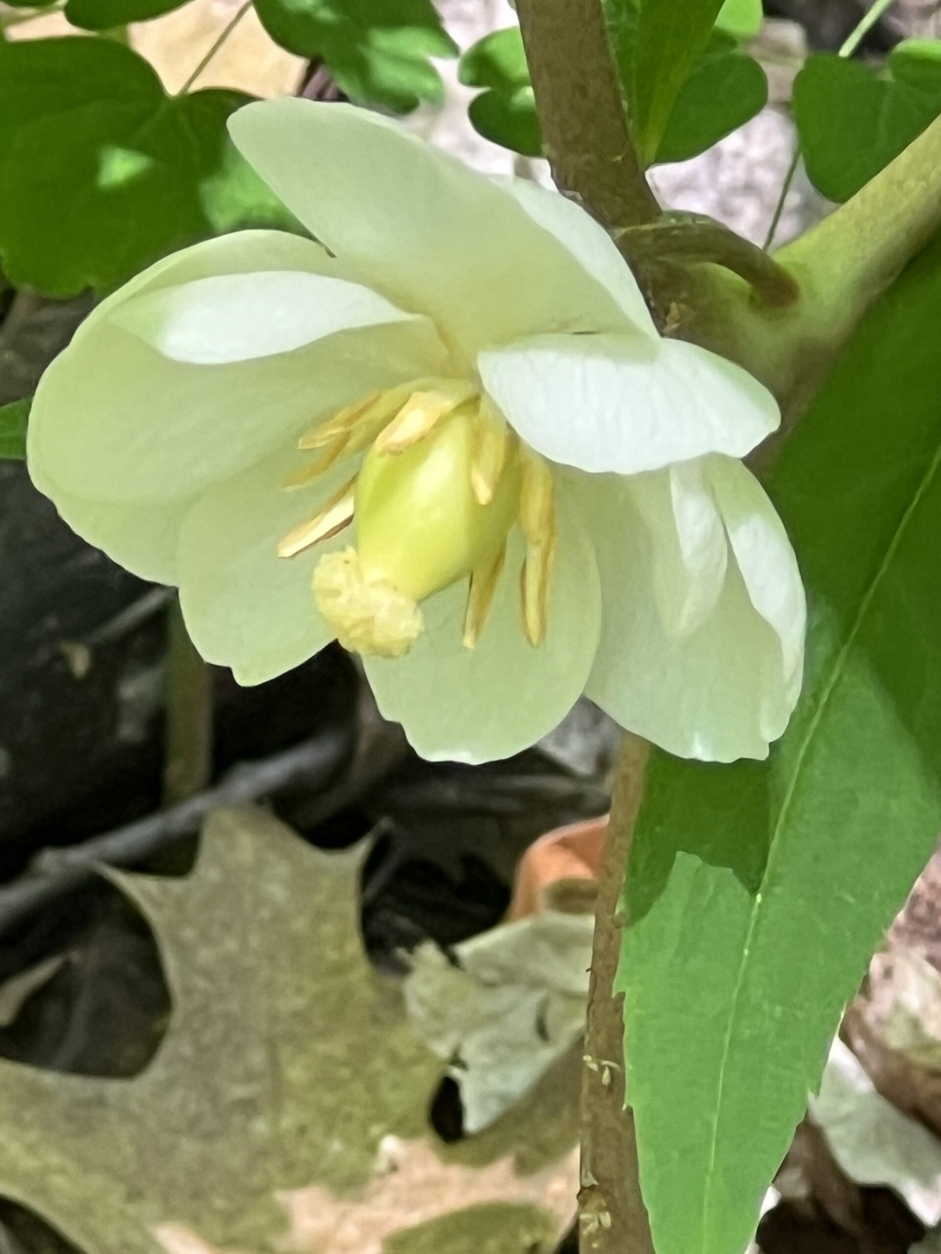
Please join us for this hike as we search for wildflowers on the wonderful trails of this beautiful conservation area. We will be looking for newer wildflowers as the season progresses. Please meet in the main parking lot at 9:45 am. for a 10:00 am. start. Bring water, a snack, sunscreen and insect repellent. Poles might be helpful. I will contact you a couple of days before the hike to give contact details.
Leader: Anne Armstrong - 21May 21, 2024
NEW TIME 8:00 Long Hike Wiley Road Short Hills
https://hikesstaging.brucetrail.org/event/new-time-800-long-hike-wiley-road-short-hills-3/Sorry, the registration cut-off time for this hike has been reached.Not a member? Click here to join today!Hosting Club: Niagara
Location (Google Maps):
Short Hills Wiley Road Entrance
Pace: Medium
Terrain: Moderate
: 10kmDescription
Explore Short Hills and the majestic side trails of Scarlett Tanager, Hemlock. Swayze Falls and Terrace. Register for each hike
Bring Poles bug spray water, snack, and dress for the weather
9:15 Short Hike - Short Hills Park, Pelham Rd
https://hikesstaging.brucetrail.org/event/915-short-hike-short-hills-park-pelham-rd-4/Sorry, the registration cut-off time for this hike has been reached.Not a member? Click here to join today!Hosting Club: Niagara
Category: Hike
Location (Google Maps): Short Hills Provincial Park, Pelham Rd lotHike Leader(s): Debbie Demizio Click here to contact Hike Leader(s)
Pace: Medium
Terrain: Moderate
Distance: ~ 6kmsDescription
Hike the main and side trails in Short Hills Provincial Park. Bring hiking boots, water, sunscreen and bug spray.Kilgorie- Pine River Nature Reserve
https://hikesstaging.brucetrail.org/event/kilgorie-pine-river-nature-reserve/Sorry, the registration cut-off time for this hike has been reached.Not a member? Click here to join today!Hosting Club: Dufferin Hi-Land
Category: Tuesday Hike
Location (Google Maps): (Google Maps) Dufferin Highland Section, Map 20. For carpooling meet at Superberger (Hwy 10 & 89) at 9:00 am. Otherwise, meet at roadside parking (km33.8) on Centre Rd (Kilgorie) 30 m south of River Rd. for a 9:30 am start.Hike Leader(s): Tony Evangelista, Les Babbage, Inge Eckerich, Julie Daley Click here to contact Hike Leader(s)
Pace: Medium
Terrain: Slippery and Steep Sections
Distance: Long hike: 6.5 Km Short hike 3.4 KmDescription
From Kilgorie we will hike on the Main Trail along the riverbank past the ruins of a hydro generating station. Next, the Bell Lookout Side Trail will provide a scenic view of the Pine River Valley. We will then travel through the Pine River Valley Side Trail and The Carl Alexander Side Trail. Returning to the Main Trail, we will then take the Kilgorie Side Trail back to the parking area. The short hike will exclude the Pine River Valley and Carl Alexander Side Trails and return the the parking at Kilgorie via Main Trail and Kilgorie Side Trail.Looping through Duncan Crevice Caves Provincial Nature Reserve - Beaver Valley Section
https://hikesstaging.brucetrail.org/event/looping-through-duncan-crevice-caves-provincial-nature-reserve-beaver-valley-section/Sorry, the registration cut-off time for this hike has been reached.Not a member? Click here to join today!Hosting Club: Caledon Hills
Category: Tuesday Hikers
Location (Google Maps): Beaver Valley Section, Map 25 of the BTC Guide
Meet at 10 am in the parking area (Metcalfe Parking) 100 m south of where the main trail crosses the 10th Line on the east side. If lot is full, roadside parking is available in specific areas on the west side of the 10th Line.Hike Leader(s): Doris Harper Click here to contact Hike Leader(s)
Pace: Medium – 3 to 4 km/hour
Terrain: Moderate – some hills and/or some poor footing
Distance: 9 kmDescription
This 9 km scenic loop hike has interesting and varied terrain and can include an exploration of the interesting but challenging short Metcalfe Crevice Side Trail.Bring water/ beverage of choice, snacks/lunch; hiking poles optional, hiking boots recommended.
Parking may be limited, car pool recommended if possible.

Afternoon Hike - Hilton Falls (reservation required)
https://hikesstaging.brucetrail.org/event/afternoon-hike-hilton-falls-reservation-required/Sorry, the registration cut-off time for this hike has been reached.Not a member? Click here to join today!Hosting Club: Iroquoia, Toronto
Category: Afternoon/Evening Hikes
Location (Google Maps): Parking lot at Hilton Falls Conservation AreaHike Leader(s): Karen Bergmann Click here to contact Hike Leader(s)
Pace: Medium – 3 to 4 km/hr
Terrain: Moderate – Some hills and/or some poor footing
Distance: 7 kmsDescription
We will hike around the main and side trails and see the Falls. Reserve your time at conservationhalton.ca Bring your camera as I expect we’ll see some spring wildflowers. And bring bug spray.
8:00 pm Moonlight Night Hike in Niagara-on-the-Lake
https://hikesstaging.brucetrail.org/event/800-pm-moonlight-night-hike-in-niagara-on-the-lake-7/Sorry, the registration cut-off time for this hike has been reached.Not a member? Click here to join today!Hosting Club: Niagara
Category: Night
Location (Google Maps): Veteran’s Memorial Park, park just outside the park on King St.Hike Leader(s): Robin Garrett Click here to contact Hike Leader(s)
Pace: Medium
Terrain: Easy
Distance: 6-7 kmDescription
Moonlight Night Hike – Take in the magic of the rising moon over Lake Ontario and the Niagara River. This hike includes a stop to connect with your senses – sights, sounds, smells and the rhythm of your breath. Counts towards your night hike badge (5 night hikes). - 22May 22, 2024
Boyne Valley
https://hikesstaging.brucetrail.org/event/boyne-valley-6/Sorry, the registration cut-off time for this hike has been reached.Not a member? Click here to join today!Hosting Club: Blue Mountains
Category: Register in person the morning of hike.
Location (Google Maps): Hike meets in the parking lot behind Tim Hortons on First St. in Collingwood.Hike Leader(s): David Little Click here to contact Hike Leader(s)
Pace: Medium – 3 to 4 km/hr
Terrain: Moderate – Some hills and/or some poor footing
Distance: 14 kmDescription
We will drive to the parking area on Centre Road, south of the 5
Sideroad, at the edge of the forest in Dufferin Hi-Land section. We will proceed to make
a two loop hike through the Boyne Valley Provincial Park. The hike will include great
views from Murphy’s Pinnacle. Bring a snack or lunch and water.WEDNESDAY WALKERS - Margaret Paull ST Loop
https://hikesstaging.brucetrail.org/event/wednesday-walkers-margaret-paull-st-loop-2/Sorry, the registration cut-off time for this hike has been reached.Not a member? Click here to join today!Hosting Club: Beaver Valley
Location (Google Maps): Park on the 6th Line, Km 13.7 Map 24, Edition 31
Hike Leader(s): Margaret Yaraskavitch Click here to contact the hike leader.
Pace: Medium
Terrain: Moderate
Length of Hike: 3.9 kmDescription
An enjoyable walk with lots of opportunities for stops and photos. We’ll walk by a creek, view a flowerpot and a waterfall, and see the E.C. Carr Observatory buildings along our route. Country laneways with farm views, as well. Please bring water and a snack.COVID-19 Precautions Before, During and After your Hike
- Each hiker joining a Bruce Trail Club organized hike must perform a self-screening check before hiking.
Find Ontario’s self-assessment tool here: https://covid-19.ontario.ca/self-assessment/ - If you are experiencing COVID-19 symptoms, stay home.
Other Guidelines
- Arrive 15 minutes before the start of the hike.
- Wear sturdy footwear and appropriate attire for the weather and the terrain.
Hiking poles are a good idea in any season, especially if the terrain is rocky or slippery. In winter, snowshoes or icers/crampons are needed when conditions dictate.
Wearing appropriate clothing and footwear prevents injuries and shows consideration for a safe and positive group hiking experience. - Always carry I.D. and your health card.
- Bring sufficient water and snacks (or lunch if indicated). A minimum of 1L of water is recommended on all hikes, and 3L is recommended for long, challenging hikes in the heat of the summer.
- Bring sunscreen and insect repellent (for spring and summer hikes).
- Bring your own first aid kit.
- Please leave dogs at home.
- Each hiker joining a Bruce Trail Club organized hike must perform a self-screening check before hiking.