
Hike Schedule
Join us for a hike! Registration required.
All hikes available to BTC members. Some hikes are open to non-members.
See Refund Policy for Paid Hikes >
TIP: The calendar view displays up to 7 hikes on a day, but often there are more. Click “View more events” to see them all.
Categories
- 13May 13, 2024

Birding with Brian
https://hikesstaging.brucetrail.org/event/birding-with-brian/Sorry, the registration cut-off time for this hike has been reached.Not a member? Click here to join today!Hosting Club: Peninsula
Location (Google Maps): Meet at Crooked Toe Road and Boundary Road (Neyaashiinigmiing). GPS Coordinates: N 44.873790, W 81.075044 (Bruce Trail Reference Guide Edition 31, Map 36. Carpool if possible. Parking courtesy of Chippewas of Nawash.
Hike Leader(s): Marg Glendon Click here to contact Hike Leader(s)
Pace: Leisurely
Terrain: Easy, Moderate
Distance: ~3 KMDescription
Join Brian Popelier, BTC Ecologist, for a birding adventure at the Glassford Wetland to observe the early Spring arrival of some of our feathered friends.This property consists of a variety of habitats including forested areas, open meadows, hay fields and wetlands. A large pond is surrounded by well-developed open aquatic, marsh and willow-dogwood thickets which provide a diverse array of migratory and breeding birds, including waterfowl and marsh birds. At least 94 bird species have been recorded on the property. Notable species include Sandhill Crane, Sora, Osprey, Bobolink and Virginia Rail. At least 13 warbler species have been observed during spring and fall migration.Bring a light backpack to carry your water bottle, snacks, camera and binoculars. Weather at this time of year can still be unpredictable – dress according to the weather conditions. Sturdy hiking shoes or boots and long sleeved protective clothing are recommended.
The terrain is generally flat with uneven terrain. There may be some wet areas on the trail.
No washrooms on site.
- 14May 14, 2024
NEW TIME 8:00 Long Hike Wiley Road Short Hills
https://hikesstaging.brucetrail.org/event/new-time-800-long-hike-wiley-road-short-hills-2/Sorry, the registration cut-off time for this hike has been reached.Not a member? Click here to join today!Hosting Club: Niagara
Location (Google Maps):
Short Hills Wiley Road Entrance
Pace: Medium
Terrain: Moderate
: 10kmDescription
Explore Short Hills and the majestic side trails of Scarlett Tanager, Hemlock. Swayze Falls and Terrace. Register for each hike
Bring Poles bug spray water, snack, and dress for the weather
Beaver Valley to Rocklyn Creek
https://hikesstaging.brucetrail.org/event/beaver-valley-to-rocklyn-creek/Sorry, the registration cut-off time for this hike has been reached.Not a member? Click here to join today!Hosting Club: Sydenham
Category: General Hike
Location (Google Maps): We’ll meet at the Bruce Trail parking on the South side of Grey Road 40, just East of Grey Rd 7. We will do a quick car shuttle to our starting point on Deviation Road.Hike Leader(s): Fran Turner Click here to contact Hike Leader(s)
Pace: Brisk: 4 to 5 km/h
Terrain: Moderate: Some hills and/or poor footing
Distance: 14.5 kmDescription
This is the perfect hike for those who seek a lesser travelled route and a longer hike. We will hike through quiet forests and across creeks and waterfalls. We should see lots of trilliums carpeting the forest floor. There are numerous scenic lookouts from the escarpment cliffs. The terrain is not steep but there are many uneven rocky spots. Please bring a snack and lots of water.9:15 Short Hike - Short Hills Park, Pelham Rd
https://hikesstaging.brucetrail.org/event/915-short-hike-short-hills-park-pelham-rd-3/Sorry, the registration cut-off time for this hike has been reached.Not a member? Click here to join today!Hosting Club: Niagara
Category: Hike
Location (Google Maps): Short Hills Provincial Park, Pelham Rd lotHike Leader(s): Debbie Demizio Click here to contact Hike Leader(s)
Pace: Medium
Terrain: Moderate
Distance: ~ 6kmsDescription
Hike the main and side trails in Short Hills Provincial Park. Bring hiking boots, water, sunscreen and bug spray.Duncan Caves/Metcalf Rock Loop
https://hikesstaging.brucetrail.org/event/duncan-caves-metcalf-rock-loop-3/Sorry, the registration cut-off time for this hike has been reached.Not a member? Click here to join today!Hosting Club: Dufferin Hi-Land
Category: Tuesday Hike
Location (Google Maps):(Google Maps): Beaver Valley Section Map 25. We will meet at the SuperBurger parking lot (north-west corner of Hwy 89/Hwy 10 intersection) for carpooling at 8:30 am. Otherwise meet at the parking area at km 27.9, 100 meters south of where the Main Trail crosses the 10th Line on the east side for a 9:30 start.
Hike Leader(s): Inge Eckerich, Julie Daley ,Tony Evangalista, Les Babbage Click here to contact Hike Leader(s)
Pace: Leisurely
Terrain: Moderate
Distance: Long Hike 10 km Short Hike 5 kmDescription
We will hike through the Duncan Cave Provincial Nature Reserve and the Chuck Grant Side Trail/Main Trail Loop. The short hike will end at the parking area at km 33.3 and car shuttle back to Metcalfe Rock parking.Bring lunch, water and snacks. Sunscreen, insect repellant and hiking poles are recommended.
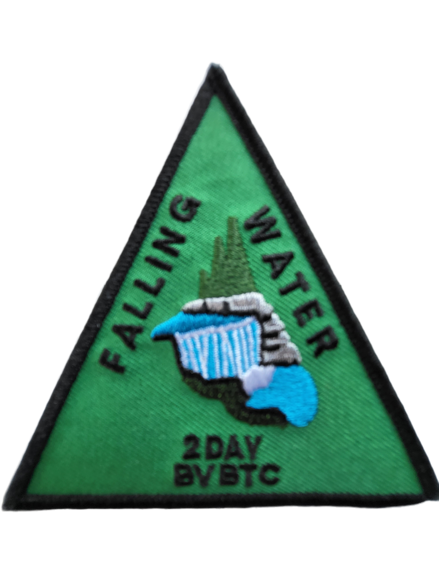
2 day Falling Water-Beaver Valley
https://hikesstaging.brucetrail.org/event/2-day-falling-water-beaver-valley/Sorry, the registration cut-off time for this hike has been reached.Not a member? Click here to join today!This is a Multi-Day Hike
You are signing up for the following dates:
2024-05-14, 2024-05-15Hosting Club: Beaver Valley
Location (Google Maps): Meet in the South end of the Beaver Valley Ski Club lower parking lot off Grey Road 30 both days. We will shuttle to our starting point at Hoggs Falls.
Hike Leader(s): Kristina Rettie Click here to contact the hike leader.
Pace: Brisk
Terrain: Some rocky footing, Some steep sections, Strenuous
Length of Hike: Approx 30k over 2 daysDescription
2 day Falling Water BadgeOver the course of two days we will hike this challenging loop that takes us on both the east and west sides of the Beaver Valley.
These hikes are intended for experienced hikers that are able to hike 4-5km per hour for a minimum of 18k. Please be honest about your pace before signing up.
Bring lots of water and a snacks
Please no dogs
Please text Kristina @ 519-410-9077 for morning of cancellations
COVID-19 Precautions Before, During and After your Hike
- Each hiker joining a Bruce Trail Club organized hike must perform a self-screening check before hiking.
Find Ontario’s self-assessment tool here: https://covid-19.ontario.ca/self-assessment/ - If you are experiencing COVID-19 symptoms, stay home.
- Personal Protective Equipment:
- Hikers may choose to wear masks
Transportation
It is the Bruce Trail Conservancy’s current policy that car shuttles are allowed. It is at the discrepancy of individual hike leaders to make that decision.
Other Guidelines
- Arrive 15 minutes before the start of the hike.
- Wear sturdy footwear and appropriate attire for the weather and the terrain.
Hiking poles are a good idea in any season, especially if the terrain is rocky or slippery. In winter, snowshoes or icers/crampons are needed when conditions dictate.
Wearing appropriate clothing and footwear prevents injuries and shows consideration for a safe and positive group hiking experience. - Always carry I.D. and your health card.
- Bring sufficient water and snacks (or lunch if indicated). A minimum of 1L of water is recommended on all hikes, and 3L is recommended for long, challenging hikes in the heat of the summer.
- Bring sunscreen and insect repellent (for spring and summer hikes).
- Bring your own first aid kit.
- Please leave dogs at home.
CANCELLED - Split Rock Narrows plus Mono Cliffs
https://hikesstaging.brucetrail.org/event/spllt-rock-narrows-plus-mono-cliffs-3/Sorry, the registration cut-off time for this hike has been reached.Not a member? Click here to join today!Hosting Club: Caledon Hills
Category: Tuesday Hikers
Location (Google Maps): CANCELLED – Split Rock Narrows parking lot. Northeast of km 8.9 off of 2nd Line EHS at the beginning of the Splitrock Side Trail. From Hwy 10, turn east on 25 Sideroad then north on 2nd line EHS.Hike Leader(s): Barbara Euler 416-578-1744 Click here to contact Hike Leader(s)
Pace: Medium – 3 to 4 km/hour
Terrain: Easy – mostly flat and usually good footing
Distance: 11 kmDescription
Since Mono Cliffs is often very busy, we will start and end our hike outside the boundaries of the provincial park. There is a variety of terrain and viewpoints and we hope to see some spring wildflowers. Lunch at McCarston’s Lake.Visitors and guests welcome.
- Each hiker joining a Bruce Trail Club organized hike must perform a self-screening check before hiking.
- 15May 15, 2024
Car Hike: Blue Mountain E2E 2/3
https://hikesstaging.brucetrail.org/event/car-hike-blue-mountain-e2e-2-3/Sorry, the registration cut-off time for this hike has been reached.Not a member? Click here to join today!Hike open to BTC Members only.
This is a Multi-Day Hike
You are signing up for the following dates and times:
2024-05-15 at 08:30Hosting Club: Toronto, Blue Mountains
Category: Car Hike
Location (Google Maps): Map 22- Km 21.9, Nattawasaga Bluffs Conservation Area. Coordinates N 44.342784,W 80.210628Hike Leader(s): Smadar Junkin Click here to contact Hike Leader(s)
Pace: Brisk
Terrain: Challenging, Hilly
Distance: 25 kmDescription
Second hike in the Blue Mountain E2E series. This is the longest hike of the series. Beautiful, hilly and challenging. Please bring 2litres of water. Follow the Covid 19 protocols. Arrive 15 minutes early. The meeting place parking is a paid parking, everyone is expected to pay thief share of the parking fees. We will shuttle to km 46.8 and hike back.Lavender
https://hikesstaging.brucetrail.org/event/lavender-5/Sorry, the registration cut-off time for this hike has been reached.Not a member? Click here to join today!Hosting Club: Blue Mountains
Category: Register in person the morning of hike.
Location (Google Maps): Hike meets in the parking lot behind Tim Hortons on First St. in Collingwood.Hike Leader(s): Allison Thomas Click here to contact Hike Leader(s)
Pace: Medium – 3 to 4 km/hr
Terrain: Moderate – Some hills and/or some poor footing
Distance: 13 kmDescription
We will park at Lavender Cemetery roadside parking about 0.5 km
east of Lavender Hill Rd. on Mulmur-Nottawasaga Townline. We will hike from
the cemetery over to the start of the Blue Mountains section and continue up to
County Road 9. We will then retrace our steps back to the cars. This hike offers a
variety of terrain, along crevices, through forest, fields and alongside the Noisy
River and a beautiful wetland. Bring a snack or lunch and water.WEDNESDAY WALKERS - Loree Forest
https://hikesstaging.brucetrail.org/event/wednesday-walkers-loree-forest-2/Sorry, the registration cut-off time for this hike has been reached.Not a member? Click here to join today!Hosting Club: Beaver Valley
Location (Google Maps): Paid parking on the shoulder of the 21st Side Road. Map 24, Edition 31 (Arrangements can be made in advance to shuttle to the trailhead.)
Hike Leader(s): Glenda Collings Click here to contact the hike leader.
Pace: Medium
Terrain: Easy
Length of Hike: 6.5 kmsDescription
We will take the access road into Loree Forest where we will then walk a loop. Most of the Trail is flat. There will be views of Nottawasaga Bay and a walk through a mature deciduous forest. Then we take the access road back to our parking area. A popular well-enjoyed route. Please bring water and a snack.COVID-19 Precautions Before, During and After your Hike
- Each hiker joining a Bruce Trail Club organized hike must perform a self-screening check before hiking.
Find Ontario’s self-assessment tool here: https://covid-19.ontario.ca/self-assessment/ - If you are experiencing COVID-19 symptoms, stay home.
Other Guidelines
- Arrive 15 minutes before the start of the hike.
- Wear sturdy footwear and appropriate attire for the weather and the terrain.
Hiking poles are a good idea in any season, especially if the terrain is rocky or slippery. In winter, snowshoes or icers/crampons are needed when conditions dictate.
Wearing appropriate clothing and footwear prevents injuries and shows consideration for a safe and positive group hiking experience. - Always carry I.D. and your health card.
- Bring sufficient water and snacks (or lunch if indicated). A minimum of 1L of water is recommended on all hikes, and 3L is recommended for long, challenging hikes in the heat of the summer.
- Bring sunscreen and insect repellent (for spring and summer hikes).
- Bring your own first aid kit.
- Please leave dogs at home.
Good Companions - Spring Valley - Ancaster
https://hikesstaging.brucetrail.org/event/good-companions-spring-valley-ancaster-4/Sorry, the registration cut-off time for this hike has been reached.Not a member? Click here to join today!Hosting Club: Iroquoia
Category: Good Companions
Location (Google Maps):Ancaster Little League Ball Park – Jerseyville Rd (across from the Ancaster Lions Outdoor Pool) – See map below
Hike Leader(s): Ted Bossence Click here to contact Hike Leader(s)
Pace: Medium – 3 to 4 km/hr
Terrain: Strenuous – Hilly with steep climbs and some poor footing
Distance: 8 – 10 km depending on whether we follow the Headwaters Trail to the end or notDescription
We will follow the Spring Valley Trail, Martins Road, Headwaters Trail etc. in the western part of the Dundas Valley . Bring sunscreen, bug repellant, water and a snack (poles would also be useful). If I cancel due to rain I will notify you by email no later than the night before, so please check your emails before you leave for the hike. Please arrive 10 minutes before the 10:00am time since I will be leaving promptly at 10:00.I will send contact info the day before the hike for those who cancel after 4:00 pm the day before the hike.
- Each hiker joining a Bruce Trail Club organized hike must perform a self-screening check before hiking.
- 16May 16, 2024
NEW TIME 8:00 am Long Hike Jordan to Moyer / Louth
https://hikesstaging.brucetrail.org/event/new-time-800-am-long-hike-jordan-to-moyer-louth/Sorry, the registration cut-off time for this hike has been reached.Not a member? Click here to join today!Hosting Club: Niagara
Category: In and Out
Location (Google Maps):Jordan Hollow Park 3039 King St Jordan
Hike Leader(s): Alan Laver Click here to contact Hike Leader(s)
Pace: Medium
Terrain: Moderate
Distance: 10kDescription
From Jordan Hollow Hike the main trail to Upper and Lower Balls Falls, Moyer Road or Louth and Return. You must register for each hike. Bring Poles, sunscreen, bug spray , snack and a drink and dress for the weather
Car Hike: Blue Mountain E2E 3/3
https://hikesstaging.brucetrail.org/event/car-hike-blue-mountain-e2e-3-3/Sorry, the registration cut-off time for this hike has been reached.Not a member? Click here to join today!Hike open to BTC Members only.
This is a Multi-Day Hike
You are signing up for the following dates and times:
2024-05-16 at 08:30Hosting Club: Toronto, Blue Mountains
Category: Car Hike
Location (Google Maps): Map # 23- North of km 46.8, 380 meters north of the main trail crossing on Pretty River Rd. Coordinated N 44.430927,W 80.275390Hike Leader(s): Smadar Junkin Click here to contact Hike Leader(s)
Pace: Brisk
Terrain: Challenging, Hilly
Distance: 23 kmDescription
Hike #3 of 3. Badge day! Beautiful and hilly. This is a brisk pace hike. The pace is expected to be 4 to 4.5 km per hour. Hikers are expected to follow the Covid 19 protocols. Bring 2 litres of water. Aim to get there 15 minutes early. We will shuttle to km 67.3 and walk back.9:15 Short Hike, Jordan Hollow
https://hikesstaging.brucetrail.org/event/915-short-hike-jordan-hollow-110/Sorry, the registration cut-off time for this hike has been reached.Not a member? Click here to join today!Hosting Club: Niagara
Category: Hike
Location (Google Maps): Jordan Hollow Park, Jordan StationHike Leader(s): Bill Russell Click here to contact Hike Leader(s)
Pace: Medium
Terrain: Strenuous
Distance: ~ 6kmsDescription
Hike the main and side trails around Jordan and Balls Falls. Bring hiking boots, water, sunscreen and bug spray.Beaver Valley End-to-End Hike 5 of 9
https://hikesstaging.brucetrail.org/event/beaver-valley-end-to-end-hike-5-of-9/Sorry, the registration cut-off time for this hike has been reached.Not a member? Click here to join today!Hosting Club: Caledon Hills
Category: End-to-End
Location (Google Maps): Meet at Beaver Valley Lookout, north of km 50, Map 26 (Ed. 31) on the west side of Grey Rd. 13. Shuttle to start at Hogg’s Falls.Hike Leader(s): Nancy Mooney Click here to contact Hike Leader(s)
Pace: Medium – 3 to 4 km/hour
Terrain: Moderate – some hills and/or some poor footing, Strenuous – hilly with steep climbs and some poor footing
Distance: 65.1 – 50.0 +0.8 to parking = 15.9 km totalDescription
This is the fifth hike of the series and takes us on our way up the east side of the valley. This falling waters section includes Boyne and Beaver Rivers, Hogg’s Falls, Eugenia Falls, views over Cuckoo Valley, penstocks.
Annual Bluebell Hike
https://hikesstaging.brucetrail.org/event/annual-bluebell-hike/Sorry, the registration cut-off time for this hike has been reached.Not a member? Click here to join today!Hosting Club: Iroquoia
Category: General Hike
Location (Google Maps): Sixteen Mile Creek Valley, OakvilleHike Leader(s): Anne Armstrong Click here to contact Hike Leader(s)
Pace: Leisurely – 3km/hr or less
Terrain: Moderate – Some hills and/or some poor footing
Distance: Approx. 10 km.Description
Sixteen Mile Creek Valley is home to many wildflowers, especially the beautiful Virginia Bluebells. Please join us for a hike into the valley in search of these gorgeous wildflowers plus others. Meet in the parking lot next to the playing fields on the southeast corner of River Glen Blvd. and Neyagawa Blvd. Please arrive by 9:45 am. for a 10:00 am. start. Bring water, sunscreen, insect repellent and a snack. Hiking poles might be useful.
Leader: Anne Armstrong
Urban Walk: Toronto Islands Evening Walk
https://hikesstaging.brucetrail.org/event/urban-walk-toronto-islands-evening-walk-3/Sorry, the registration cut-off time for this hike has been reached.Not a member? Click here to join today!Hosting Club: Toronto
Location (Google Maps): Jack Layton Ferry Terminal, near the gates to Wards Island Ferry. Arrive 20 minutes prior to departure to check in with hike leader.
From Union Station take the LRT and get off at the stop Ferry Docks.Walk up to the Ferry Docks on Queens Quay West, street level. at the foot of Bay Street.
Hike Leader(s): Miriam Stevens Click here to contact Hike Leader(s)
Pace: Leisurely
Terrain: Flat
Distance: 6-9 kmDescription
After a day’s work come and “cool off” on the Toronto Islands free of fumes and traffic. Enjoy the view of the city skyline and Toronto’s beautiful island parkland.
Pack a dinner for a sit down picnic. Food is not available for purchase on the Islands early in the season. Also bring a warm jacket and flashlight.
Return fare ticket for the ferry approx $10.00 less for seniors.
Hikes will take place rain or shine.
Toronto Island evening hikes will take place every THURSDAY in MAY and JUNE 2024.
Same time and same meeting place. No preregistration is required – just show up at the ferry docks at 5:40 PM and sign with the hike leader.