
Hike Schedule
Join us for a hike! Registration required.
All hikes available to BTC members. Some hikes are open to non-members.
See Refund Policy for Paid Hikes >
TIP: The calendar view displays up to 7 hikes on a day, but often there are more. Click “View more events” to see them all.
Categories
- 07April 7, 2024
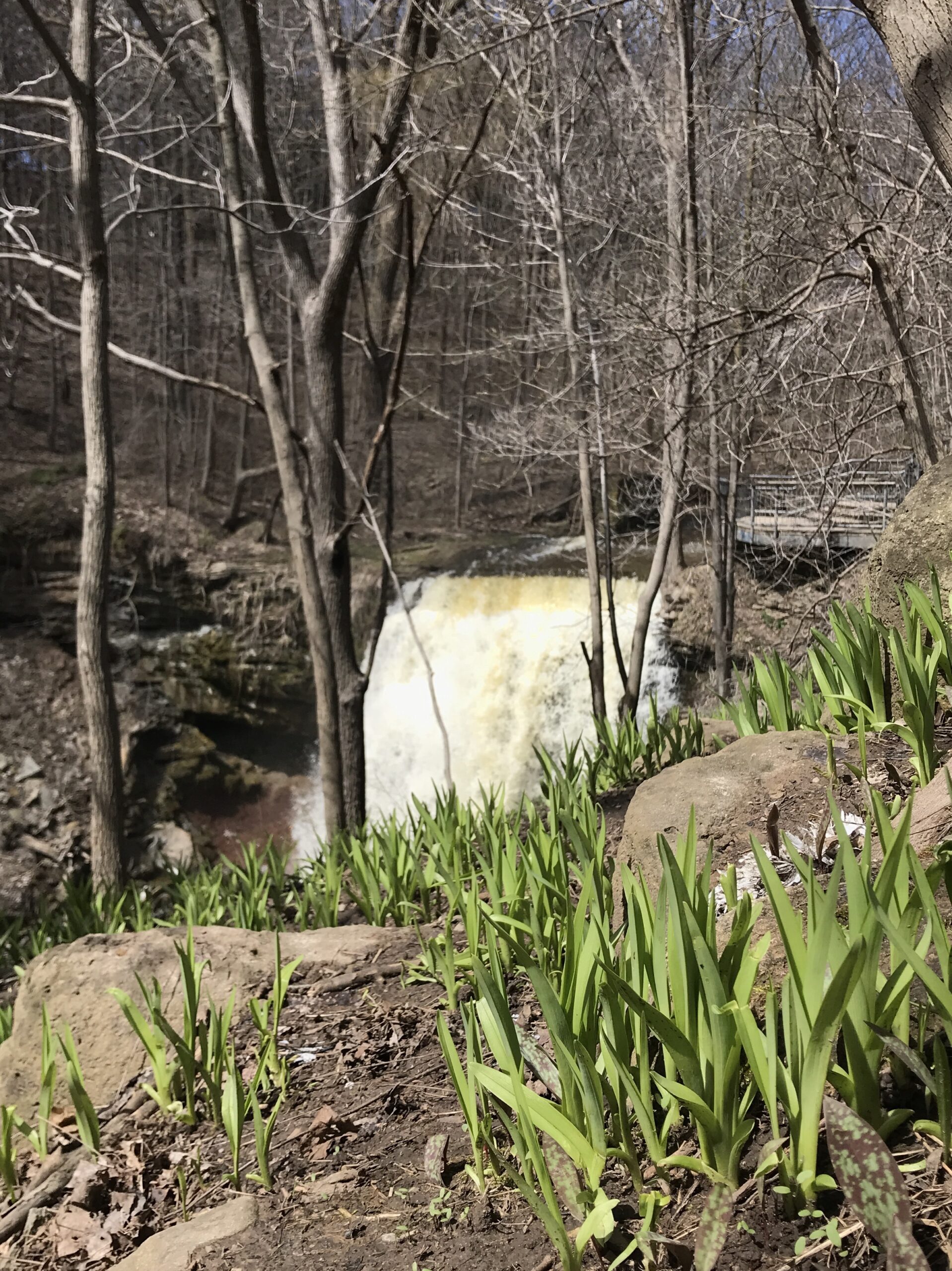
Smokey Hollow Loop (includes 3 Side Trails)
https://hikesstaging.brucetrail.org/event/smokey-hollow-loop-includes-3-side-trails/Sorry, the registration cut-off time for this hike has been reached.Not a member? Click here to join today!Hosting Club: Iroquoia
Category: General Hike
Location (Google Maps):Hike Leader(s): Freddy Wang Click here to contact Hike Leader(s)
Pace: Medium – 3 to 4 km/hr
Terrain: Strenuous – Hilly with steep climbs and some poor footing
Distance: 6Description
We will meet at the parking lot for the Smokey Hollow Waterfall on Mill St.We’ll be hiking along the main trail to the Norman Pearson Side Trail, connect with the McNally Side Trail, then head back to our starting spot, with a detour to complete the Eric Best Side Trail loop along the way.
Bring water, snacks, and clothing layers. Poles are optional. Depending on trail conditions, icers may be beneficial, especially as there are some hills.
Boots are advised as there may be some muddy sections.
Please arrive at 8:45 am as we will leave promptly at 9:00 am.
Check your email before leaving home. Please contact the hike leader if you need to cancel last minute.
Thank you.

Caledon E2E in 4
https://hikesstaging.brucetrail.org/event/caledon-e2e-in-4/Sorry, the registration cut-off time for this hike has been reached.Not a member? Click here to join today!This is a Multi-Day Hike
You are signing up for the following dates and times:
2024-04-07 at 09:30
2024-04-14 at 09:30
2024-04-28 at 09:30
2024-05-05 at 09:30Hosting Club: Iroquoia, Caledon Hills
Category: General Hike
Location (Google Maps):Hike Leader(s): Robert House Click here to contact Hike Leader(s)
Pace: Brisk – 4 to 5 km/hr, Medium – 3 to 4 km/hr
Terrain: Moderate – Some hills and/or some poor footing
Distance: Varies but around 18km per hikeDescription
Please join us in hiking the Caldeon section over 4 Sundays in April and May. We will be hiking northbound. Each day we will be meeting at the end point and then shuttling to the starting point. Each days route is below.We will be hiking in spring so please be prepared for a mix of weather, pack rain gear, sweater, icers, and extra socks. Bring enough water for 4 to 5 hours, snacks and lunch.
For those interested in badges, costs are 10 for members and 15 for non-members. Please visit the clubs badge page to see the two E2E badges that are available. I will coordinate ordering and picking up badges for the group.
Anyone coming from Niagara or Iroqouia sections please consider car pooling. Message me and I will make connections to rides.
GPS coordinates for parking will be emailed to the group before the first hike.
https://caledonbrucetrail.ca/hiking/club-badges/
Route:
Day 1: Spirit Tree to Willoughby Road 17.25KM
Day 2: Willoughy Road to Coolihans SR 19.02KM
Day 3: Coolihans SR to Peter Beecham Side Trail 20KM
Day 4: Peeter Beecham to Mono Community Centre 17.95 KM

Toronto Urban Badge Hike - 2 of 7
https://hikesstaging.brucetrail.org/event/toronto-urban-badge-hike-2-of-7-3/Sorry, the registration cut-off time for this hike has been reached.Not a member? Click here to join today!Hosting Club: Toronto
Category: Urban Walk
Location (Google Maps):Toronto, Ontario, Canada
Hike Leader(s): Brian Rideout Click here to contact Hike Leader(s)
Pace: Moderate
Terrain: Flat
Distance: 10.9 kmDescription
Please join me at the south east corner of Eglinton and Scarlett by 10 AM. We will hike south on the Humber Recreational Trail to Lakeshore Blvd and Ellis (km 19.2 to km 8.3). Here is an online map with km markings of our route for all 7 hikes for the Toronto Urban Badge.Please make sure you bring at least 2 liters of water, a lunch, bug spray and sunscreen.
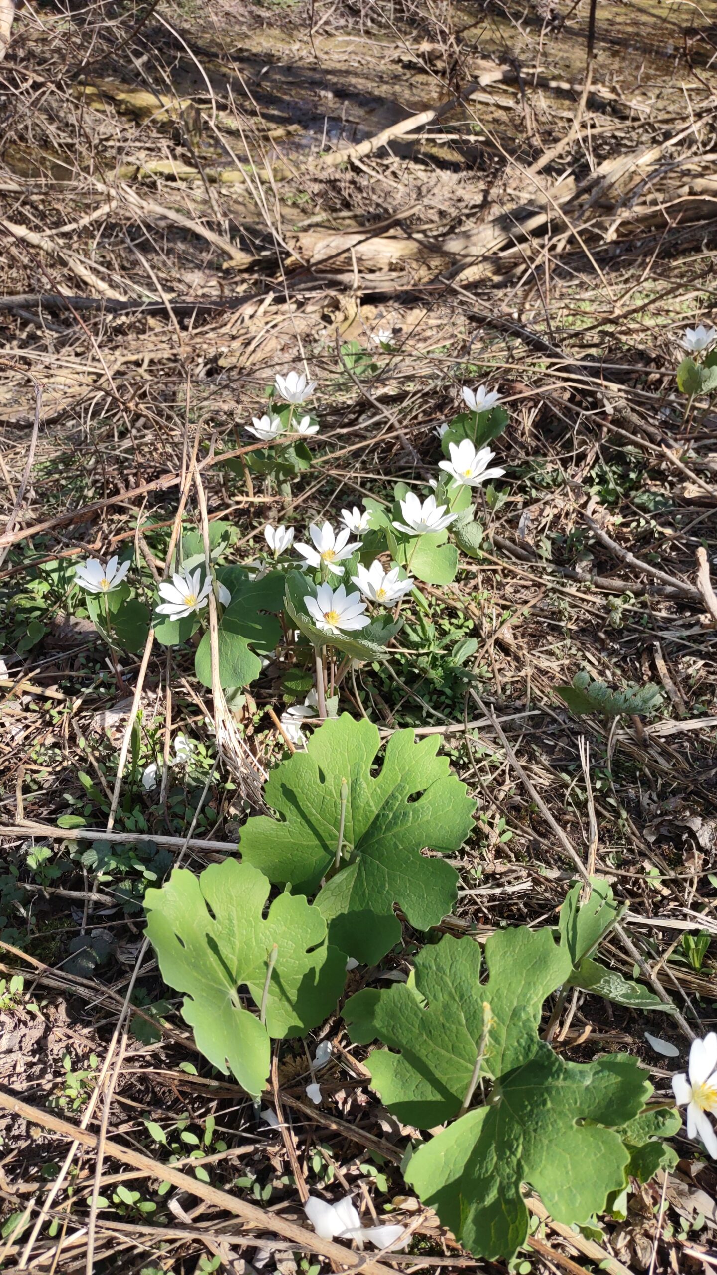
Meadowvale Village Bloodroot hike/tour and Levi Creek Loop
https://hikesstaging.brucetrail.org/event/meadowvale-village-bloodroot-hike-tour-and-levi-creek-loop/Sorry, the registration cut-off time for this hike has been reached.Not a member? Click here to join today!Hosting Club: Toronto
Category: Urban Walk
Location (Google Maps): Meet me at Kipling Terminal by 9:15 for a 9:25 departure on MiWay bus #11. We will change to bus #42, leaving Goreway Dr North of Derry Rd at 9:47. Coming directly to the hike, park at Credit Valley Conservation Authority Parking, 1255 Old Derry Road, Mississauga. Please arrive by 10:50.Hike Leader(s): Andrew Proczek Click here to contact Hike Leader(s)
Pace: Leisurely, Moderate
Terrain: Flat
Distance: 11-12 kmDescription
Come join me and Story Teller Terry Wilson for a continuation of the Fall Pumpkin Pie tour/hike. The star attraction this time around will be a Bloodroot mound, coveted for years by Terry and his nature lover mother, Rosemary. Bloodroot which tends to grow in floodplains and along streams is one of the earliest spring flowers and the white blooms last barely a week. Hopefully our timing will catch the first blooms. As always we will meet Terry at his extraordinary ‘shed size’ miniature village depicting Meadowvale Village as it looked in pioneer days. At our lunch stop I will be raffling Terry’s latest book, “Rosemary’s Little Book” released after our last hike/tour. Raffle tickets only $1 each. Terry will remain with us as we hike the Levi Creek Loop which passes by the original location of the village train station.Public washrooms at 1.5 km, 4 km and nature stop during the last leg of the hike.
The route: https://onthegomap.com/s/prj66i3u
Exploring Sydenham hike 1
https://hikesstaging.brucetrail.org/event/explore-sydenham-hike-1/Sorry, the registration cut-off time for this hike has been reached.Not a member? Click here to join today!Hosting Club: Sydenham
Category: General Hike
Location (Google Maps): Meet in the north-east corner of the parking lot at Home Depot on Highway 26 on the east side of Owen Sound.Hike Leader(s): Bill Snel Click here to contact Hike Leader(s)
Pace: Leisurely: 3 km/h or less
Terrain: Moderate: Some hills and/or poor footing
Distance: 4.5 kmDescription
We will carpool to do a loop hike which will take us on the Walters Falls Side Trail and past the falls. This is hike 1 in the book Exploring Sydenham. It has a secret to be located.