
Hike Schedule
Join us for a hike! Registration required.
All hikes available to BTC members. Some hikes are open to non-members.
See Refund Policy for Paid Hikes >
TIP: The calendar view displays up to 7 hikes on a day, but often there are more. Click “View more events” to see them all.
Categories
- 03April 3, 2024
Hockley Valley on the 4th Line - Part 1
https://hikesstaging.brucetrail.org/event/hockley-valley-on-the-4th-line-part-1/Sorry, the registration cut-off time for this hike has been reached.Not a member? Click here to join today!Hike open to BTC Members only.
Hosting Club: Blue Mountains
Category: Register in person the morning of hike.
Location (Google Maps): Hike meets in the parking lot behind Tim Hortons on First St. in Collingwood.Hike Leader(s): Hart Fischer Click here to contact Hike Leader(s)
Pace: Medium – 3 to 4 km/hr
Terrain: Moderate – Some hills and/or some poor footing
Distance: 12 kmDescription
We will park on the 4th Line in the Caledon Hills section and beginning at
km 54.5, we will hike to km 49.0 (Airport Road) and return. The trail descends by way of
switchback, passes through valleys and climbs the eastern ridge. Bring a snack or lunch
and water.Wednesday Walkers - Johnston's Sideroad to Hogg's Falls CANCELLED
https://hikesstaging.brucetrail.org/event/wednesday-walkers-johnstons-sideroad-to-hoggs-falls/Sorry, the registration cut-off time for this hike has been reached.Not a member? Click here to join today!Hosting Club: Beaver Valley
Location (Google Maps): Meet in the Hogg’s Falls parking lot at km 65.1, Map 26, Edition 31
Hike Leader(s): Glenda Collings Click here to contact the hike leader.
Pace: Medium
Terrain: Moderate, Some rocky footing, Some steep sections
Length of Hike: 6.6 kmDescription
This will be a car shuttle hike, meeting at Hogg’s Falls to shuttle to Johnston’s Sideroad, then hiking back to Hogg’s Falls. We will be hiking the Sendero Pacifico Friendship Trail. Members of our club have visited Costa Rica a number of times to connect with the people of the area and assist with building and maintaining their trail. The hike today may be muddy so be prepared to get dirty:) Bring water and a snack and dress appropriately for the weather.COVID-19 Precautions Before, During and After your Hike
- Each hiker joining a Bruce Trail Club organized hike must perform a self-screening check before hiking.
Find Ontario’s self-assessment tool here: https://covid-19.ontario.ca/self-assessment/ - If you are experiencing COVID-19 symptoms, stay home.
Other Guidelines
- Arrive 15 minutes before the start of the hike.
- Wear sturdy footwear and appropriate attire for the weather and the terrain.
Hiking poles are a good idea in any season, especially if the terrain is rocky or slippery. In winter, snowshoes or icers/crampons are needed when conditions dictate.
Wearing appropriate clothing and footwear prevents injuries and shows consideration for a safe and positive group hiking experience. - Always carry I.D. and your health card.
- Bring sufficient water and snacks (or lunch if indicated). A minimum of 1L of water is recommended on all hikes, and 3L is recommended for long, challenging hikes in the heat of the summer.
- Bring sunscreen and insect repellent (for spring and summer hikes).
- Bring your own first aid kit.
- Please leave dogs at home.
Dundas Driving Park to Dundas Peak and Tew's Falls return
https://hikesstaging.brucetrail.org/event/dundas-driving-park-to-dundas-peak-and-tews-falls-return/Sorry, the registration cut-off time for this hike has been reached.Not a member? Click here to join today!Hosting Club: Iroquoia
Category: Good Companions
Location (Google Maps): Dundas Driving ParkHike Leader(s): Craig Sim Click here to contact Hike Leader(s)
Pace: Medium – 3 to 4 km/hr
Terrain: Strenuous – Hilly with steep climbs and some poor footing
Distance: 8k (approximate)Description
A strenuous, hilly, up and down hike with great views. We park and meet in Dundas Driving Park not far from the washrooms, and follow city streets to trail leading to Dundas Peak and Tew’s Falls. Wear sturdy hiking shoes or hiking boots, layers of clothing appropriate to weather, bring water and snack. Optional outing for beverage/food after. - Each hiker joining a Bruce Trail Club organized hike must perform a self-screening check before hiking.
- 04April 4, 2024
Urban Walk: Valley View and Maple view Parks Thornhill
https://hikesstaging.brucetrail.org/event/car-hike-valley-view-and-maple-view-parks-thornhill-2/Sorry, the registration cut-off time for this hike has been reached.Not a member? Click here to join today!Hosting Club: Toronto
Location (Google Maps): Parking lot at the corner of Bayview Ave, and Sycamore Dr. South of Highway 7
Sycamore Dr. is 2 blocks south of highway 7,parking lot is across plaza of Dollarama and Star boxHike Leader(s): Mohammad Aghamiri Click here to contact Hike Leader(s)
Pace: Moderate
Terrain: Variable
Distance: 7-8 kmDescription
We will explore Valleyview and Maple view parks, and walk along German Mill Creek,9:00 am Long Hike Jordan to Moyer / Louth
https://hikesstaging.brucetrail.org/event/900-am-long-hike-jordan-to-moyer-louth-58/Sorry, the registration cut-off time for this hike has been reached.Not a member? Click here to join today!Hosting Club: Niagara
Category: In and Out
Location (Google Maps):Jordan Hollow Park 3039 King St Jordan
Hike Leader(s): Alan Laver Click here to contact Hike Leader(s)
Pace: Medium
Terrain: Moderate
Distance: 10kDescription
From Jordan Hollow Hike the main trail to Upper and Lower Balls Falls, Moyer Road or Louth and Return. You must register for each hike. Bring Poles, sunscreen, bug spray , snack and a drink and dress for the weather
9:15 Short Hike, Jordan Hollow
https://hikesstaging.brucetrail.org/event/915-short-hike-jordan-hollow-103/Sorry, the registration cut-off time for this hike has been reached.Not a member? Click here to join today!Hosting Club: Niagara
Category: Hike
Location (Google Maps): Jordan Hollow Park, Jordan StationHike Leader(s): Bill Russell Click here to contact Hike Leader(s)
Pace: Medium
Terrain: Moderate
Distance: ~ 6kmsDescription
Hike the main and side trails around Jordan and Ball’s Falls. Bring hiking boots, water, sunscreen and bugspray.Eclipse Program at W.J. McCallion Planetarium (McMaster University)
https://hikesstaging.brucetrail.org/event/eclipse-program-at-w-j-mccallion-planetarium-mcmaster-university-2/Sorry, the registration cut-off time for this hike has been reached.Not a member? Click here to join today!Hike open to BTC Members only.
Hosting Club: Iroquoia
Category: Special Event
Location (Google Maps): W.J. McCallion Planetarium, Burke Science Building
McMaster University, Hamilton, ONHike Leader(s): BTC Staff Click here to contact Hike Leader(s)
Description
This year, for the first time in almost 375 years, a total solar eclipse will be casting a shadow across the Niagara Escarpment. This means that on April 8, 2024 the moon will pass between the sun and the earth and sections of the Bruce Trail, particularly in the south, will be prime viewing locations.To celebrate this once-in-a-lifetime event, the Bruce Trail Conservancy (BTC) is hosting three FREE eclipse-themed planetarium programs for BTC members, offered by the W. J. McCallion Planetarium at McMaster University.
In this one-hour program in the unique domed planetarium, we’ll learn all about eclipses in general, how to view the upcoming solar eclipse safely, and what exactly to expect on April 8.
* * * * * *
Our group will meet outside the Burke Science Building at 6:30 pm. Program starts promptly at 7:00 pm and doors do not reopen.
Be prepared for paid parking on campus.
Directions and parking rates: https://planetarium.physics.mcmaster.ca/directions/
* * * * * *
Seating is limited and registration is required. Limit of two tickets per membership.
- 05April 5, 2024

9:00 Niagara-on-the-Lake Tour
https://hikesstaging.brucetrail.org/event/900-niagara-on-the-lake-tour-15/Sorry, the registration cut-off time for this hike has been reached.Not a member? Click here to join today!Hosting Club: Niagara
Category: Urban
Location (Google Maps): Meet on King St near Centre St, Niagara-on-the-LakeHike Leader(s): Margaret Northfield Click here to contact Hike Leader(s)
Pace: Medium
Terrain: Easy
Distance: 6-7kmDescription
Each Friday we will explore different neighbourhoods, trails and parkland throughout Historic Niagara-on-the-Lake.
Moderate pace with some weeks entirely on sidewalks and roads while others may include a mix of trails and paved pathways. Great way to build up endurance for longer more strenuous hikes.
Prepare for cooler windy conditions on open parkland and along Lake Ontario and Niagara River trails.
Plan to stay for conversation and a warm cup of coffee or tea at Sweets & Swirls, Community Centre, Niagara Stone Road, NOTL
Spring & Migration Monitor Hike
https://hikesstaging.brucetrail.org/event/spring-migration-monitor-hike-4/Sorry, the registration cut-off time for this hike has been reached.Not a member? Click here to join today!Hosting Club: Peninsula
Location (Google Maps): km 106.0 in the 31st Ed Ref manual – by the Cape Chin Mail Boxes, don’t go down the hill
Hike Leader(s): Tamara Wilson Click here to contact Hike Leader(s)
Pace: Leisurely
Terrain: Difficult
Distance: 6kmDescription
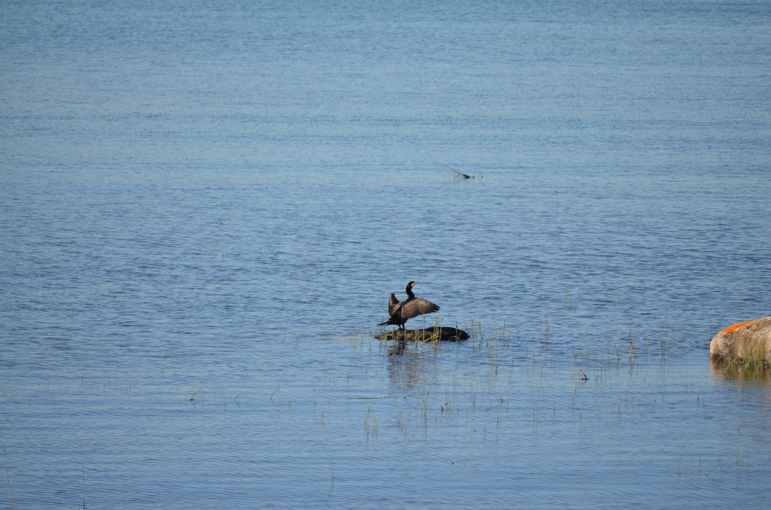
Leaving the Cape Chin N mailbox parking area, we will progress south on the Main Trail to km 104.3 and head right on Cape Chin Meadows ST, crossing Cape Chin Rd N to the Otter Lake ST. We will hike to the birding platform, spending a few minutes to take in any new migration arrivals and harbingers of spring. After a break at the birding platform we will continue on Otter Lake ST back to our parked cars. Depending on what we see, this hike could take up to 2 hours. Note: though a short distance, the ground will be rocky and uneven in places. Along the shores of Otter Lake, there could be some mud. - 06April 6, 2024
Car Hike: Toronto E2E 3/3
https://hikesstaging.brucetrail.org/event/car-hike-toronto-e2e-3-3-2/Sorry, the registration cut-off time for this hike has been reached.Not a member? Click here to join today!Hike open to BTC Members only.
Hosting Club: Toronto
Category: Car Hike
Location (Google Maps):We will meet at km 48.3 (GPS N43.750866, W79.951452) at Boston Mills Rd. just west of the Mississauga Rd intersection.
Hike Leader(s): Jacquie Van Dyke Click here to contact Hike Leader(s)
Pace: Moderate
Terrain: Variable
Distance: 21 kmDescription
The third of three hikes to complete the Toronto E2E which includes the extra 5.5 km unmarked reroute of the closure of main trail due to bridge work near 10th Line on Terra Cotta CA. This bridge work was expected to be completed by April 1 but unfortunately has been extended to April 21. It’s badge day and hikers may wish to visit the Spirit Tree after the hike.It’s early spring so mud may abound! Be prepared with poles and gaitors. Hiking boots/shoes are mandatory. We’ll stop for snacks and lunch so bring 2L of water, snacks, and your lunch.
Be prepared to shuttle if you haven’t already had a turn.
Bus Hike: Blue Mountains End to End Part VI of VI Noisy River
https://hikesstaging.brucetrail.org/event/bus-hike-blue-mountains-end-to-end-part-vi-of-vi/Sorry, the registration cut-off time for this hike has been reached.Not a member? Click here to join today!Trip Information
Departure Time: 08:00
Return to City Time: 19:00
Departure Point: York Mills Bus PickupOptional Items
Hosting Club: Toronto
Category: Bus Hike
Location (Google Maps): Noisy RiverHike Leader(s): George Lennon and Michael Humpage Click here to contact Hike Leader(s)
Pace: Moderate
Terrain: Variable
Distance: 10.5 kmDescription
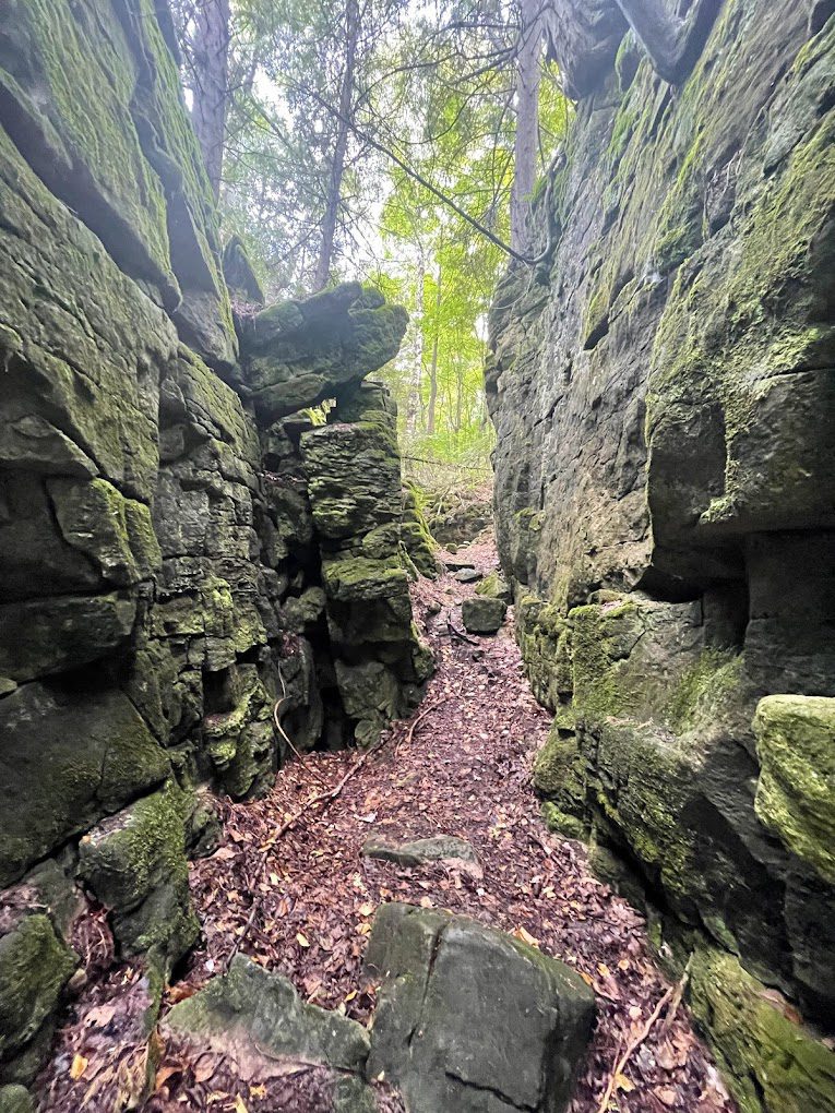
Bus departs 10 York Mills Rd at 8:00 AM and Major Mackenzie Dr and HWY 400 Park and Ride at 8:20 AM. If you wish to be picked up at the Major Mackenzie Dr and HWY 400 Park and Ride, type ‘yes’ in the additional information field. Please arrive 15 minutes before departure. The bus waits for no one.The trail follows a small stream for a short distance and then goes through a mixture of open field, mature forest. The trail crosses the Noisy River and proceeds past several deep crevices and lookouts through the Noisy River Provincial Park. There are some steep sections near the river. We end our journey near the village of Lavender. We will celebrate the completion of our end-to-end journey with a party afterwards in Shelburne. Everyone who has ordered a badge will be mailed about a week prior to the trip reminding them that they have ordered a badge. If someone has ordered a badge and not yet paid, the hike leaders will collect the $10 in cash for the cost of the badge on the morning of the day of this final hike.
Updated mask policy:
Proper fitting N95/KN95 masks continue to be strongly recommended while riding the bus. However, effective March 1st 2024 the use of face masks will no longer be mandatory which is consistent with other clubs, commercial outings, and public transit systems in our area. Hike leaders will not be enforcing their use on the bus/coach. If not feeling well hikers are asked to stay home. If you have a persistent cough please wear a mask in respect of your fellow hikers.
Car Hike: Happy Valley
https://hikesstaging.brucetrail.org/event/car-hike-happy-valley/Sorry, the registration cut-off time for this hike has been reached.Not a member? Click here to join today!Hosting Club: Toronto
Category: Car Hike
Location (Google Maps): Happy Valley, Oak Ridges Trail,16th Sideroad & Weston RoadHike Leader(s): Mohammad Aghamiri Click here to contact Hike Leader(s)
Pace: Moderate
Terrain: Variable
Distance: 14-17 kmDescription
Come and join the group to view nice scenery and look out of Happy valleySome safety procedures during the hike:
1-Hikers must stay between the leader and the sweep.
2-Hikers must advise the leader or the sweep if they wish to leave the group.
3- Hikers must follow the whistle instructions: 1 blast- stay where you are; 2 blasts come to the leader; 3 blasts – come to the leader quickly.
4-Hike leader may request volunteers to stop at trail intersections, they need to help hikers to the direction the group walk and wait till they see the sweep .
5-Hikers have to make sure they can see the persons behind and in front of them.
Thames Valley Trail End to End - 6 days straight
https://hikesstaging.brucetrail.org/event/thames-valley-trail-end-to-end-6-days-straight/Sorry, the registration cut-off time for this hike has been reached.Not a member? Click here to join today!This is a Multi-Day Hike
You are signing up for the following dates and times:
2024-04-06 at 08:30
2024-04-07 at 08:30
2024-04-08 at 08:30
2024-04-09 at 08:30
2024-04-10 at 08:30
2024-04-11 at 08:30Hosting Club: Iroquoia
Category: Special Event
Location (Google Maps): Various locations (meeting spots and start locations) will be sent to all registered hikers. We will hike from the south end to the north end.Hike Leader(s): Ruth Moffatt Click here to contact Hike Leader(s)
Pace: Brisk – 4 to 5 km/hr, Medium – 3 to 4 km/hr
Terrain: Dependent on Conditions, Moderate – Some hills and/or some poor footing
Distance: Varies but should be between 17-22km per dayDescription
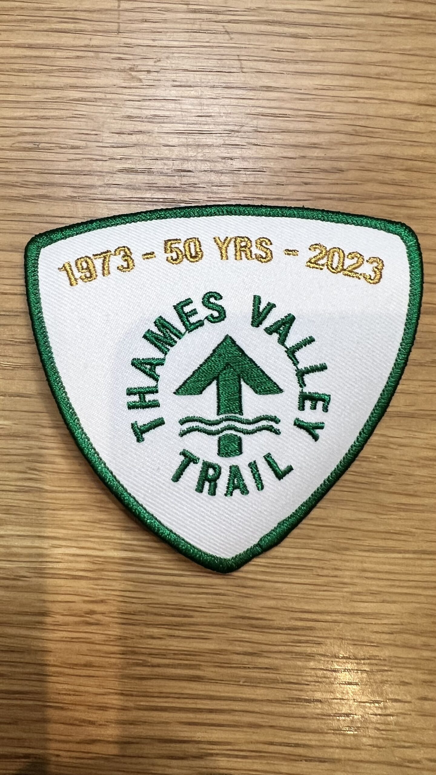
This multi-day hike is a Thames Valley ETE hike from the start on Southdel Rd to the finish in St. Mary’s – about 110km. It is their 50th anniversary so a special badge will be available on our last day of hiking at a cost TBA. You may also consider membership in the Thames Valley Club. https://tvta.caPlease ensure you are physically capable of multi-day hiking and are available for each day of the hike. This is a car shuttle hike and everyone will be asked to share in the car shuttling – please ensure your car is car shuttle ready. Please dress for the expected weather, pack enough water and food for each day and bring your icers in case the trail is still icy. Poles are also suggested.
The trail is a mixture of road walking, rugged trail and urban hiking through London. It may also be quite wet.
The hike will be limited to 10 hikers including the hike leader.
If you have any questions, please reach out to ruthdmoffatt @ gmail. com.
Old Baldy
https://hikesstaging.brucetrail.org/event/27334/Sorry, the registration cut-off time for this hike has been reached.Not a member? Click here to join today!Hosting Club: Blue Mountains
Category: Register in person the morning of hike.
Location (Google Maps): Hike meets in the parking lot behind Tim Hortons on First St. in Collingwood.Hike Leader(s): Annette Sandberg Click here to contact Hike Leader(s)
Pace: Medium – 3 to 4 km/hr
Terrain: Moderate – Some hills and/or some poor footing, Strenuous – Hilly with steep climbs and some poor footing
Distance: 5 kmDescription
We park on County Road 13 at km 46.8 and hike up the escarpment on
the white blazed trail to Old Baldy and Mac Kirk Side Trail. This is a lollipop hike. Trail
passes lookouts and you can birdwatch for turkey vultures and buteo hawks. Bring a
snack or lunch and water.
9:00 Woodend to Fireman's Park
https://hikesstaging.brucetrail.org/event/900-woodend-to-firemans-park/Sorry, the registration cut-off time for this hike has been reached.Not a member? Click here to join today!Hosting Club: Niagara
Category: Loop
Location (Google Maps): Park at the entrance to Woodend Conservation Area, Taylor Rd, Niagara-on-the-LakeHike Leader(s): Margaret Northfield Click here to contact Hike Leader(s)
Pace: Medium
Terrain: Moderate
Distance: 13-14kmDescription
Hike around Woodend, through the Screaming Tunnel and into Fireman’s Park. We will take a different route back to our cars.
9:00 Niagara Glen Hike
https://hikesstaging.brucetrail.org/event/900-niagara-glen-hike-5/Sorry, the registration cut-off time for this hike has been reached.Not a member? Click here to join today!Hosting Club: Niagara, Dufferin Hi-Land
Category: Loop
Location (Google Maps):Meet at the Niagara Glen Nature Centre parking lot, 3050 Niagara Parkway, Niagara Falls. This is located between the Whirlpool Golf Course and the Niagara Botanical Gardens, on the river side of the Niagara Parkway. Parking fees may apply.
Hike Leader(s): Dan Wilson Click here to contact Hike Leader(s)
Pace: Medium
Terrain: Strenuous
Distance: 10kmDescription
Hike deep in the Niagara Gorge, along stairways cut into the rock and rugged paths that wind through this pristine pocket of Carolinian Forest. View ancient geological formations and fossils dating back millions of years, while hiking along the turbulent rapids of the Niagara River. This is a strenuous hike and there is a chance hikers will get wet. Depending on weather conditions, bring water, a snack, icers, gaiters and hiking poles, if necessary. Dress in layers. 🙂Spring Grind 2024 Hike Series: Hike 2 of 5 - Dundas Valley Conservation Area
https://hikesstaging.brucetrail.org/event/spring-grind-2024-hike-series-hike-2-of-5-dundas-valley-conservation-area/Sorry, the registration cut-off time for this hike has been reached.Not a member? Click here to join today!Hosting Club: Dufferin Hi-Land
Category: General Hike
Location (Google Maps): Meet at the Sanctuary Park parking lot on Sanctuary Dr., DundasHike Leader(s): Gilles Gagnon Click here to contact Hike Leader(s)
Pace: Brisk, Medium
Terrain: Dependent on Conditions, Moderate, Slippery and Steep Sections
Distance: 21 to 24 kmDescription
This is the second of five “small group” hikes from March through to June, progressively increasing in both length and total ascent. We’ll start with a 19 km/ 450 meter ascent hike, progressing to 25 km with up to approximately 1000 meters of ascent over the 4 month period. By its nature, these hikes will suit experienced hikers who want to up their game. This hike is a loop hike within the Dundas Valley Conservation Area. Normally, icers are required this time of year. Have them available just in case.Eclipse Program at W.J. McCallion Planetarium (McMaster University)
https://hikesstaging.brucetrail.org/event/eclipse-program-at-w-j-mccallion-planetarium-mcmaster-university-3/Sorry, the registration cut-off time for this hike has been reached.Not a member? Click here to join today!Hike open to BTC Members only.
Hosting Club: Iroquoia
Category: Special Event
Location (Google Maps): W.J. McCallion Planetarium, Burke Science Building
McMaster University, Hamilton, ONHike Leader(s): BTC Staff Click here to contact Hike Leader(s)
Description
This year, for the first time in almost 375 years, a total solar eclipse will be casting a shadow across the Niagara Escarpment. This means that on April 8, 2024 the moon will pass between the sun and the earth and sections of the Bruce Trail, particularly in the south, will be prime viewing locations.To celebrate this once-in-a-lifetime event, the Bruce Trail Conservancy (BTC) is hosting three FREE eclipse-themed planetarium programs for BTC members, offered by the W. J. McCallion Planetarium at McMaster University.
In this one-hour program in the unique domed planetarium, we’ll learn all about eclipses in general, how to view the upcoming solar eclipse safely, and what exactly to expect on April 8.
* * * * * *
Our group will meet outside the Burke Science Building at 12:30 pm. Program starts promptly at 1:00 pm and doors do not reopen.
Be prepared for paid parking on campus.
Directions and parking rates: https://planetarium.physics.mcmaster.ca/directions/
* * * * * *
Seating is limited and registration is required. Limit of two tickets per membership.