
Hike Schedule
Join us for a hike! Registration required.
All hikes available to BTC members. Some hikes are open to non-members.
See Refund Policy for Paid Hikes >
TIP: The calendar view displays up to 7 hikes on a day, but often there are more. Click “View more events” to see them all.
Categories
- 18April 18, 2024
9:00 am Long Hike Jordan to Moyer / Louth
https://hikesstaging.brucetrail.org/event/900-am-long-hike-jordan-to-moyer-louth-60/Sorry, the registration cut-off time for this hike has been reached.Not a member? Click here to join today!Hosting Club: Niagara
Location (Google Maps):
Jordan Hollow Park 3039 King St Jordan
Pace: Medium
Terrain: Moderate
: 10kDescription
From Jordan Hollow Hike the main trail to Upper and Lower Balls Falls, Moyer Road or Louth and Return. You must register for each hike. Bring Poles, sunscreen, bug spray , snack and a drink and dress for the weather
9:15 Short Hike, Jordan Hollow
https://hikesstaging.brucetrail.org/event/915-short-hike-jordan-hollow-106/Sorry, the registration cut-off time for this hike has been reached.Not a member? Click here to join today!Hosting Club: Niagara
Category: Hike
Location (Google Maps): Jordan Hollow Park, Jordan StationHike Leader(s): Bill Russell Click here to contact Hike Leader(s)
Pace: Medium
Terrain: Moderate
Distance: ~ 6kmsDescription
Hike the main and side trails around Jordan and Ball’s Falls. Bring hiking boots, water, sunscreen and bug spray.Beaver Valley End-to-End Hike 1 of 9
https://hikesstaging.brucetrail.org/event/beaver-valley-end-to-end-hike-1-of-9/Sorry, the registration cut-off time for this hike has been reached.Not a member? Click here to join today!Hosting Club: Caledon Hills
Category: End-to-End
Location (Google Maps): Meet at 9:15 am at the new parking area off Grey Rd. 40, 650 m east of Grey Rd. 7; km 105.7, Map 28 (Ed. 31). Shuttle to start at Blantyre (or alternative parking).Hike Leader(s): Nancy Mooney Click here to contact Hike Leader(s)
Pace: Medium – 3 to 4 km/hour
Terrain: Moderate – some hills and/or some poor footing
Distance: km 117.3 – 105.7 = 11.6 km totalDescription
This is the first hike of a series to complete the Beaver Valley Section going from the north to the south. It includes Anthea’s Waterfall, hardwood bush, fields and deep crevices.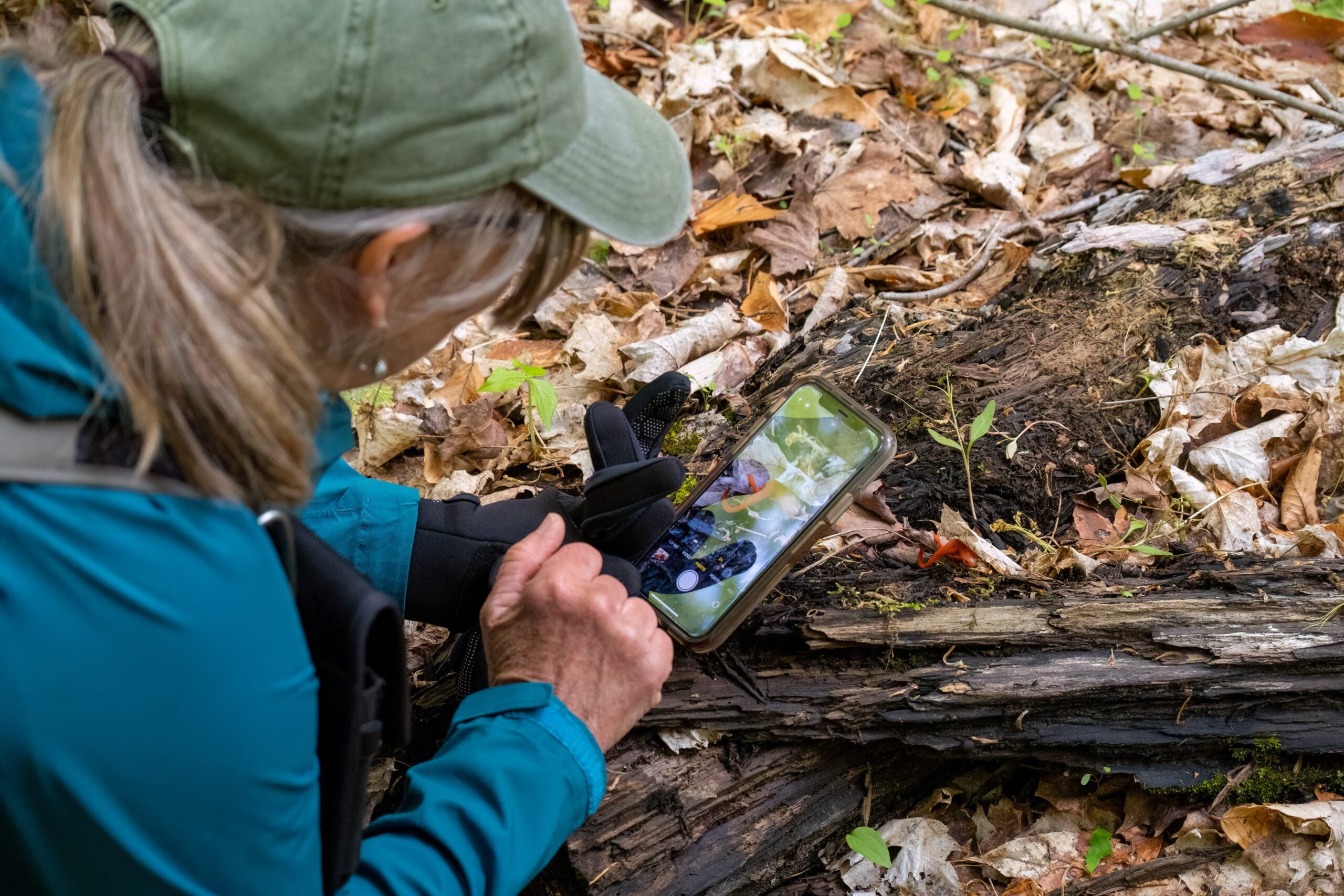
Nature Seekers Exploring Whitetail Refuge Nature Reserve
https://hikesstaging.brucetrail.org/event/nature-seekers-exploring-whitetail-refuge-nature-reserve/Sorry, the registration cut-off time for this hike has been reached.Not a member? Click here to join today!Hosting Club: Caledon Hills
Category: Nature Walks
Location (Google Maps): Meet at the Mono Community Centre, 200 m south of Mono Centre (County Road 8). 44.026195, -80.071516Directions: From ON-10 head east onto Dufferin Rd. 8/Mono Centre Rd. for 6.0 km. The Community Centre is on the right.
Hike Leader(s): Sandy Green Click here to contact Hike Leader(s)
Pace: Leisurely – 3 km/hour or less
Terrain: Moderate – some hills and/or some poor footing
Distance: 5 kilometresDescription
Join with other friends of the Caledon Hills Club to leisurely explore the emergence of spring on our Whitetail Refuge Nature Reserve. Bring your choice of hydration and snacks. Sturdy footwear is highly recommended. This hike can be counted towards the 60 for the 60th Anniversary Badge.
Hilton Falls and Beyond
https://hikesstaging.brucetrail.org/event/hilton-falls-and-beyond/Sorry, the registration cut-off time for this hike has been reached.Not a member? Click here to join today!Hosting Club: Iroquoia
Category: Thursday Group
Location (Google Maps): Hilton Falls Conservation Area, Campbellville Rd.Hike Leader(s): Phillip Armstrong Click here to contact Hike Leader(s)
Pace: Leisurely – 3km/hr or less
Terrain: Moderate – Some hills and/or some poor footing
Distance: 10 km.Description
Join us for a hike on some of the various trails within this conservation area. We will hike to the falls and then cross the creek to explore some of the trails beyond. Who knows, we may spot some early Spring wildflowers including some good patches of Walking Fern. Some of the trails will be rocky. Bring water, a snack, sunscreen and insect repellent (hopefully not needed!). Hiking poles will be useful for some sections.
Leader: Phill Armstrong You will be contacted a few days before to receive more contact information. - 19April 19, 2024
Car Hike: Toronto E2E in 4 and biodiversity badge (1of4)
https://hikesstaging.brucetrail.org/event/car-hike-toronto-e2e-in-4-and-biodiversity-badge-1of4/Sorry, the registration cut-off time for this hike has been reached.Not a member? Click here to join today!Hike open to BTC Members only.
Hosting Club: Toronto
Category: Car Hike
Location (Google Maps): Km 12.1, map 12. Southeast side of 15 sideroad. Coordinates N 43.582968,W 79.971787Hike Leader(s): Smadar Junkin Click here to contact Hike Leader(s)
Pace: Moderate
Terrain: Rocky, Variable
Distance: 12.1Description
This is a 4 hikes series that will include the E2E and the biodiversity badges options. You can choose the regular E2E badge for the $5.00 or the fundraising stain glass badge for $30.00. Hikers are expected to bring the money on the first hike of the series. Children age 8 and up are invited to join this hike for the great opportunity to engage, enjoy and learn about nature. 2 of the hikes in this series on a TDSB PA days). Children must be accompanied by a parent/ guardian.If you are interested in getting the biodiversity badge, please read about it on the Toronto BTC page to familiarize yourself with the requirements.
after each hike we will have a treat. Children can earn the youth Toronto BTC badge at no cost. Make sure that your child/ grandchild can hike the distance posted.
we will shuttle to km 0.0 and hike back. Everyone is expected to shuttle at least once during the 4 outings.
9:00 Niagara-on-the-Lake Tour
https://hikesstaging.brucetrail.org/event/900-niagara-on-the-lake-tour-17/Sorry, the registration cut-off time for this hike has been reached.Not a member? Click here to join today!Hosting Club: Niagara
Location (Google Maps): Meet on King St near Centre St, Niagara-on-the-Lake
Hike Leader(s): Margaret Northfield Click here to contact Hike Leader(s)
Pace: Medium
Terrain: Easy
Distance: 6-7kmDescription
Each Friday we will explore different neighbourhoods, trails and parkland throughout Historic Niagara-on-the-Lake.
Moderate pace with some weeks entirely on sidewalks and roads while others may include a mix of trails and paved pathways. Great way to build up endurance for longer more strenuous hikes.
Prepare for cooler windy conditions on open parkland and along Lake Ontario and Niagara River trails.
Plan to stay for conversation and a warm cup of coffee or tea at Sweets & Swirls, Community Centre, Niagara Stone Road, NOTL
Spring Ephemeral Hike Series: Woodford Escarpment
https://hikesstaging.brucetrail.org/event/spring-ephemeral-hike-series-woodford-escarpment/Sorry, the registration cut-off time for this hike has been reached.Not a member? Click here to join today!Hosting Club: Sydenham
Category: Botany Hike
Location (Google Maps): Woodford Community Centre Parking LotHike Leader(s): Jeannine Kralt Click here to contact Hike Leader(s)
Pace: Leisurely: 3 km/h or less
Terrain: Moderate: Some hills and/or poor footing
Distance: 4kmDescription
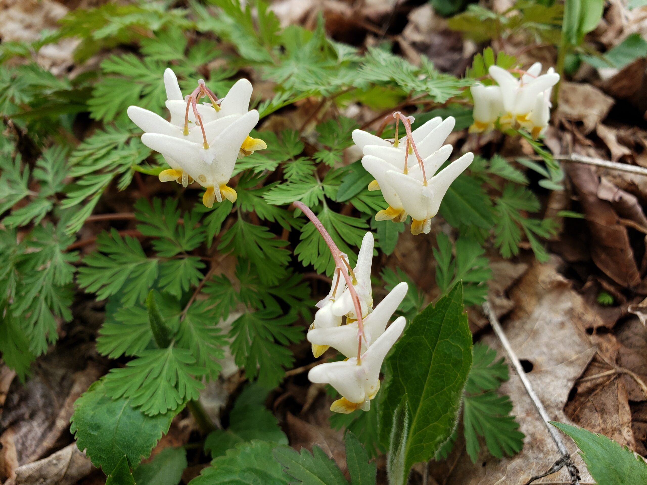
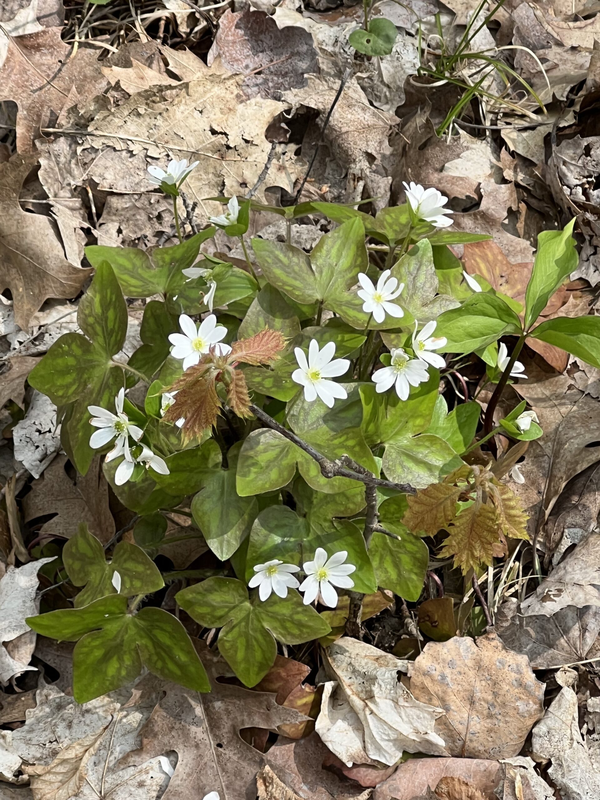
The second in our series of spring ephemeral hikes – Woodford Escarpment has a wide variety of spring ephemerals, including both native Dicentra species, Bloodroot, Trout Lilies, Wild Ginger and Violets, amongst others. We’ll see what we can find. We’ll be completing a loop including the Woodford Escarpment Side Trail. Portions of this trail are quite rocky, with some up and downhill sections – good footwear is a must. There is an optional bypass of a stretch through a notable crevice.This leisurely hike will be a classic Discovery Hike, with a focus on spring wildflowers – participants are encouraged to ask questions, and we’ll briefly stop to look at things we find. This section also has interesting geology, which can briefly be discussed if participants are interested. Photographers welcome. There is a chance that this hike might be moved slightly, given the warmer end to winter this year (it’s been hard to predict timing). Participants will be contacted in advance if that is to be the case.
This hike also appears in Ron Savage’s book Exploring Sydenham – sufficient time will be available to locate the code.
Carpooling encouraged – get in touch with the hike leader if you are in need of a ride. Please plan to arrive 15 minutes in advance of the start time. An email confirming conditions will be sent out in advance of the hike. Please contact Jeannine via the hike leader contact form should there be any questions or concerns.
Afternoon Hike - Crawford Lake (reservation required)
https://hikesstaging.brucetrail.org/event/afternoon-hike-crawford-lake-reservation-required/Sorry, the registration cut-off time for this hike has been reached.Not a member? Click here to join today!Hosting Club: Iroquoia
Category: Afternoon/Evening Hikes
Location (Google Maps): Meet at 4:15 pm in the first parking lot at Crawford Lake.Hike Leader(s): Karen Bergmann Click here to contact Hike Leader(s)
Pace: Medium – 3 to 4 km/hr
Terrain: Moderate – Some hills and/or some poor footing
Distance: 5 kmsDescription
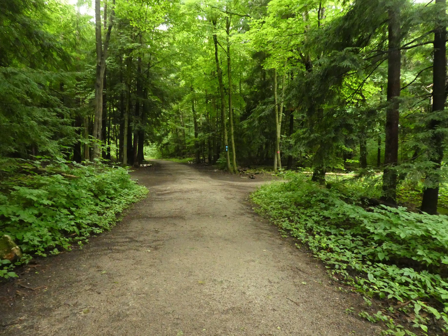
We will hike the loop around the park, which includes both side trails and main trail. - 20April 20, 2024

Fort to Fort ENTIRE 2 DAY, April 20, 21, 2024
https://hikesstaging.brucetrail.org/event/fort-to-fort-entire-2-day-april-20-21-2024/Sorry, the registration cut-off time for this hike has been reached.Not a member? Click here to join today!This is a Multi-Day Hike
You are signing up for the following dates and times:
2024-04-20 at 06:45
2024-04-21 at 06:45Hosting Club: Niagara
Category: Event Hikes
Location (Google Maps):Kingsbridge Park, Chippawa, Ont
Pace: Medium
Terrain: Easy
Distance: 57 kmDescription
This is a self led hike
Hike the entire length of the Niagara Parkway, from Fort George to Fort Erie, over two days. Enjoy approximately 27 KM each day of beautiful river scenery. Small hills involved but mostly paved paths with some road walking.*****Currently, the bridge at Black Creek (Day 2 of hike) is under repair and expected to open by April 26th. If that is the case, then there will be a 3 km reroute on the 2nd day, making Day 2 30 km.
Meet at Kingsbridge Park each day at 6:45. You will be bussed to starting point each day.
Masks are optional on buses.
Registration is $65 (members) or $75 (non-members). Fee includes bus, checkpoints and badge.
Event Coordinator: Lauren Doig, ldoig52@gmail.com
Fort to Fort FIRST DAY ONLY April 20, 2024
https://hikesstaging.brucetrail.org/event/fort-to-fort-first-day-only-april-20-2024/Sorry, the registration cut-off time for this hike has been reached.Not a member? Click here to join today!Hosting Club: Niagara
Category: Urban
Location (Google Maps):Kingsbridge Park, Niagara Parkway, Niagara Falls, ON
Pace: Medium
Terrain: Easy
Distance: 27kmDescription
This is a self led hike.Meet at Kingsbridge Park at 6:45 a.m. You will be bussed to Fort George. Hike from Fort George to Kingsbridge Park , approximately 27 km. Small hills involved but mostly paved paths with some road walking. 2 checkpoints along the way. This hike is for hikers who are only going to do Day 1 of the Fort to Fort.
Masks are optional on buses.
Registration is $50 for one day. Fee includes bus and checkpoints .
Event Co-ordinator: Lauren Doig, ldoig52@gmail.com
Peninsula in 6 Challenger Series A Hike #1 Bluewater Park to Jones Bluff
https://hikesstaging.brucetrail.org/event/peninsula-in-6-challenger-series-a-hike-1-bluewater-park-to-jones-bluff/Sorry, the registration cut-off time for this hike has been reached.Not a member? Click here to join today!Hike open to BTC Members only.
Hosting Club: Peninsula
Location (Google Maps): Jones Bluff Roadside Parking, Boundary Road
Capacity: 4
Coordinates: 44.877725, -81.071134Hike Leader(s): Margaret O’Dell Click here to contact Hike Leader(s)
Distance: 32.1 Km
Description
Hike #1 of 6 Bluewater Park to Jones BluffPeninsula in 6 Challenger Series
Complete 162.4 km section from Wiarton to Tobermory in 6 hikes.- You must sign up for EACH hike individually. The series is spread-out over 2 weeks, and 3 weekends. You are not automatically accepted into either series as a whole.
- This hike series is intended for experienced distance hikers only. Hikers must demonstrate recent experience completing hikes exceeding 25 km over difficult terrain and at a brisk pace;
- If a hiker is unable to keep pace with the group, or finds the distance too challenging, their future hike registrations may be canceled by the hike leader
- Be very aware of your ability to join this series.
- Hikes will average 4.5 km per hour including breaks, moving pace is 5 km per hour;
- Expect to be on-trail for 7 – 9 hours;
- Meeting time is scheduled for 7:00am; arrive no later than 15 minutes prior to the meeting time;
- Hikers must carry sufficient hydration, accessible snacks, lunch, first-aid kit, rain gear, extra socks, and possibly protective boot covers (i.e. bags);
- Hikers will be expected to participate in shuttling hikers to the start and to drive shuttlers back to their car. Responsibility will be shared equally;
- Any applicable parking fees will be shared within the group.
Dufferin End to End Fundraiser Hike for the Stained Glass Badge - 3 concurrent days - April 20, 21, 22, 2024
https://hikesstaging.brucetrail.org/event/dufferin-end-to-end-fundraiser-hike-for-the-stained-glass-badge-3-concurrent-days-april-20-21-22-2024/Sorry, the registration cut-off time for this hike has been reached.Not a member? Click here to join today!This is a Multi-Day Hike
You are signing up for the following dates and times:
2024-04-20 at 08:00
2024-04-21 at
2024-04-22 atHosting Club: Iroquoia, Dufferin Hi-Land
Category: Special Event
Location (Google Maps): Dufferin Hi-Land End to End
April 20/24 – 17km Meet in front of the Lavender Cemetery (Capacity 10 vehicles) Car shuttle to Roadside pkg on 15 Sideroad at Prince of Wales Rd (Cap 7 vehicles)
44.172483, -80.157538
April 21/24 – 17.3km Meet on roadside parking 15 Sideroad and Prince of Wales as above and car shuttle to Roadside parking on 1st Line East below 5 Sideroad (Cap 5)
44.119199, -80.112593
April 22/24 – 20km Meet at the Mono Community Centre (Cap 40) 44.026195, -80.071516 Car shuttle to 1st Line East as above (Cap 5)Hike Leader(s): Ruth Moffatt Click here to contact Hike Leader(s)
Pace: Brisk – 4 to 5 km/hr, Medium – 3 to 4 km/hr
Terrain: Dependent on Conditions, Moderate – Some hills and/or some poor footing, Slippery and Steep Sections, Slippery Sections Likely
Distance: 17-20km per dayDescription
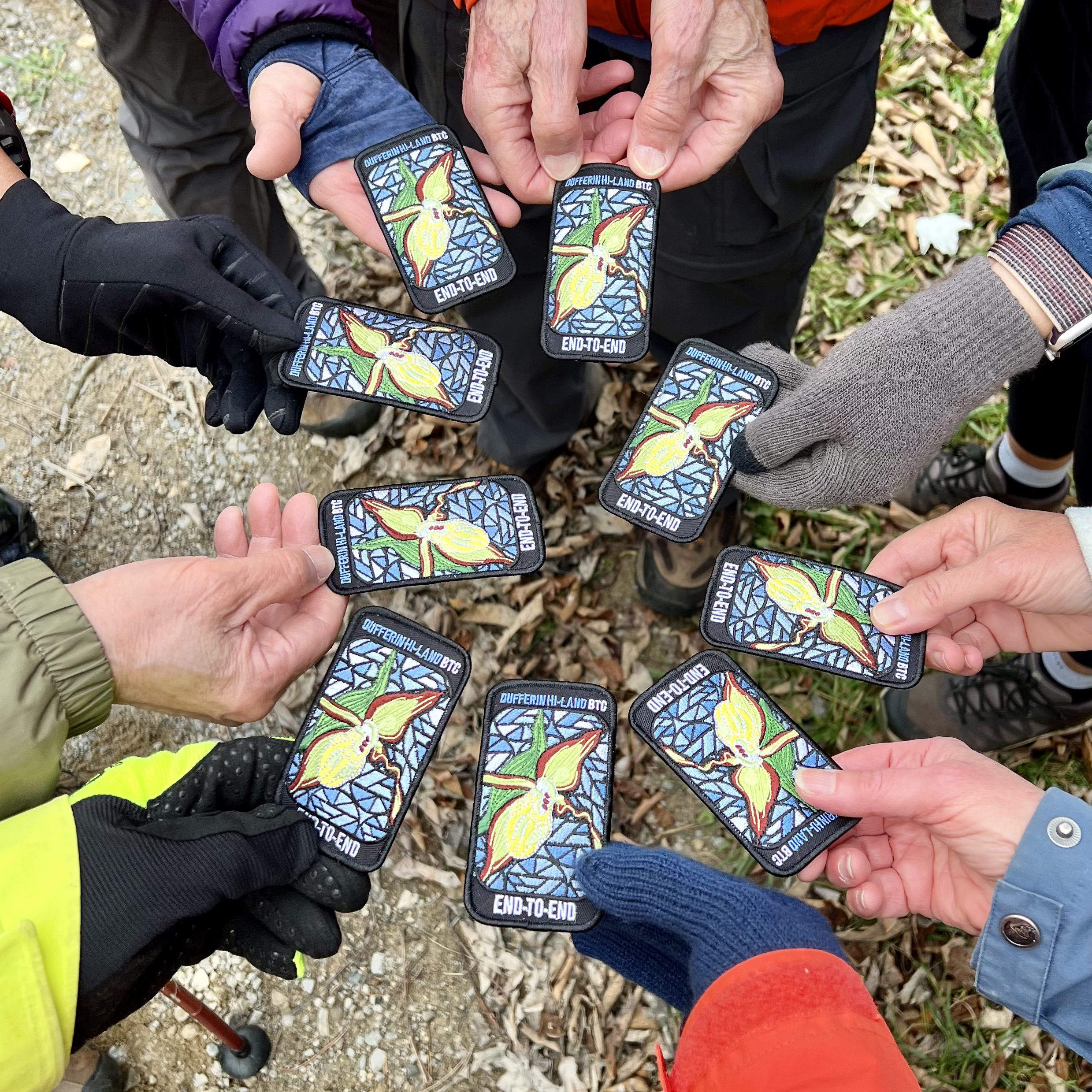
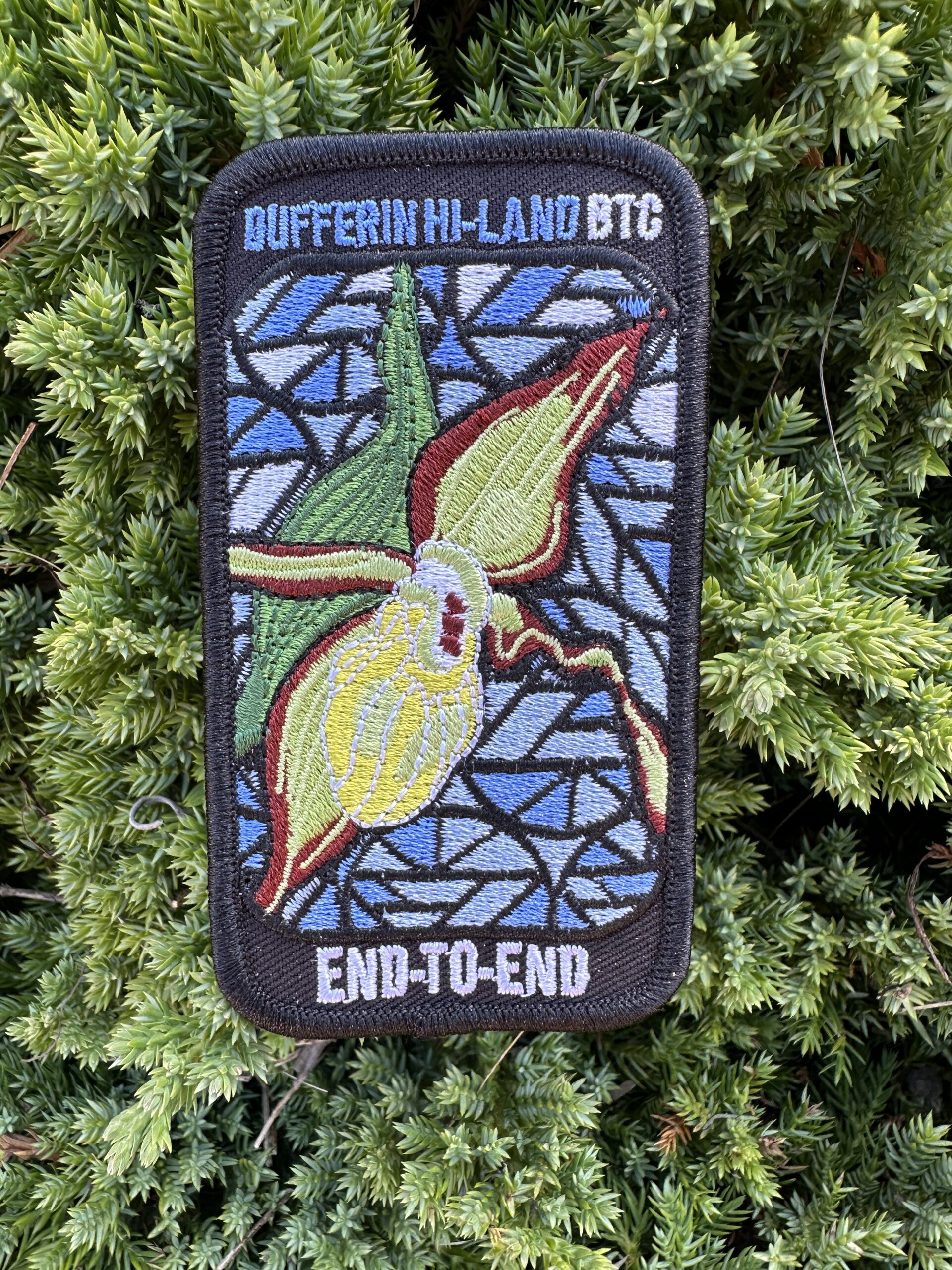
This is a special series of 3 hikes to complete the Dufferin Hi-Land section of the Bruce Trail. The organization, guidance, logistics and the Yellow Lady Slipper stained glass badge is included in your fee which is non-refundable. Proceeds support the Dufferin Hi-Land Bruce Trail Club which in turn supports the Bruce Trail Conservancy mission to “Preserving a ribbon of wilderness, for everyone, forever.”Please note that you are signing up for the entire series of 3 hikes as a Group Hike. The Dufferin Hi-Land in 3 is geared to experienced distance hikers with the expectation of a 3 to 5.0 km/ hr. pace maintained over a 15km plus day. The section is approximately 55km km so daily distances are based on available parking. No dropout points have been established and therefore hikers who must drop out, will be responsible for their own transportation back to their vehicle. Please note that transportation back to your vehicle is very limited in this section. Please be honest about your hiking abilities. We will hike at a steady pace but there will be plenty of time to take pictures and to enjoy the flora and fauna. This particular set of 3 hikes is intended to be Medium/Brisk. Please be honest about your degree of physical fitness and ability prior to registration. It is a group hike so it is important you are able to keep pace with the person in front of you.
Attire and Daily Hikes.
Hikers will be expected to be wearing proper hiking boots and layered clothing with the expectation of cool and possible wet weather. Sufficient food and water for a full day of hiking is required as well as hiking poles (if you use them), and wet weather gear is strongly recommended. Bug spray and sun screen as you require. Clothing adjustments, bio-breaks are as needed. Please let the sweep person know and they will wait for you. A morning break around 10am and a 10-15 minute on-trail lunch break will be scheduled. An afternoon break will be based on our expected finish time. Depending on weather conditions, these times may vary. Everyone must carry a First Aid kit.
Missing Hikes/Making-up Hike
Since this is a 3 day hike, it is expected that everyone registered will plan to attend all three days. Since this is a car shuttle hike, please ensure your vehicle is car shuttle ready. All participants will be expected to take turns either driving to the start or driving the drivers back at the end of the day. Carpooling to our meeting spot with 2 people in the car is generally ok but if more than that, please let the hike leader know.
Leave No Trace
Please remember, like all hikes, this is a Leave No Trace hike. Pack out whatever you pack in. Do not toss anything onto or into any sections of the trail. We will also try to leave the trail better than we found it so we will be collecting trail trash we might see along the way.
Daily
We meet for each hike by at least 7:45am each day with the hope that we can leave as soon as everyone has arrived and no later than 8am. This meeting locations are indicated above. The schedule is subject to change.
Car Hike: Wilder Forest Uxbridge
https://hikesstaging.brucetrail.org/event/car-hike-wilder-forest-uxbridge-5/Sorry, the registration cut-off time for this hike has been reached.Not a member? Click here to join today!Hosting Club: Toronto
Category: Car Hike
Location (Google Maps): 2499 Brock Road, Uxbridge, ON there is a free parking when you enter the road off brock road beside Horse training facilityHike Leader(s): Mohammad Aghamiri Click here to contact Hike Leader(s)
Pace: Moderate
Terrain: Hilly, Variable
Distance: 14-17 kmDescription
We will explore Wilder forest and the beautiful scenery of Uxbridge forests.Bus Hike: Hill Fun in Hockley Valley and Mono Cliffs
https://hikesstaging.brucetrail.org/event/bus-hike-hill-fun-in-hockley-valley-and-mono-cliffs/Sorry, the registration cut-off time for this hike has been reached.Not a member? Click here to join today!Trip Information
Departure Time: 08:30
Return to City Time: 18:00
Departure Point: York Mills Bus PickupOptional Items
Hosting Club: Toronto, Caledon Hills, Dufferin Hi-Land
Category: Bus Hike
Location (Google Maps): Hockley Valley and Mono CliffsHike Leader(s): Martina Furrer, Roland Mark, Leonora Rochwerger and Tim Wainwright Click here to contact Hike Leader(s)
Pace: Fast, Moderate
Terrain: Hilly, Variable
Distance: Fast (18 km), moderate (13 km)Description
Join us for an awesome hike with great views and fun hills. We will split into two groups and hike north from Hockley Valley to the Split Rock Side Trail. Moderate group will hike about 13 km. Fast group will hike about 18 km. Refreshments after if time allows.Bus departs 10 York Mills Rd at 8:3o AM, and should be back in the city by 6 PM.
Dufferin Hi-Land Stained Glass Badge Fundraiser Hike - Weekend E2E in 3
https://hikesstaging.brucetrail.org/event/dufferin-hi-land-stained-glass-badge-fundraiser-hike-weekend-e2e-in-3/Sorry, the registration cut-off time for this hike has been reached.Not a member? Click here to join today!This is a Multi-Day Hike
You are signing up for the following dates and times:
2024-04-20 at 08:30
2024-04-27 at 08:30
2024-05-04 at 08:30Hosting Club: Iroquoia, Dufferin Hi-Land
Category: General Hike
Location (Google Maps):Hike Leader(s): Freddy Wang Click here to contact Hike Leader(s)
Pace: Brisk – 4 to 5 km/hr, Medium – 3 to 4 km/hr
Terrain: Moderate – Some hills and/or some poor footing, Strenuous – Hilly with steep climbs and some poor footing
Distance: Varies – 17-20 km per dayDescription
This is a special series of 3 hikes (April 20, April 27, and May 4) proceeding northbound to complete the Dufferin Hi-Land section of the Bruce Trail. The organization, guidance, logistics and the Yellow Lady Slipper stained glass badge is included in your fee which is non-refundable. Proceeds support the Dufferin Hi-Land Bruce Trail Club which in turn supports the Bruce Trail Conservancy mission to “Preserving a ribbon of wilderness, for everyone, forever.”The Dufferin Hi-Land in 3 is geared to experienced distance hikers with the expectation of a 3 to 5 km/hr pace maintained over a 17 km to 20 km day. The section is approximately 55 km km so daily distances are based on available parking. No dropout points have been established and therefore hikers who must drop out, will be responsible for their own transportation back to their vehicle. Please note that transportation back to your vehicle is very limited in this section.
This particular set of 3 hikes is intended to be Medium/Brisk. Please be honest about your degree of physical fitness and ability prior to registration. It is a group hike so it is important you are able to keep pace with the person in front of you.
Hikers will be expected to be wearing proper hiking boots and layered clothing with the expectation of cool and possible wet weather. Sufficient food and water for a full day of hiking is required as well as hiking poles (if you use them), and wet weather gear is strongly recommended.
Missing Hikes/Making-up Hike
Since this is a 3-day hike, it is expected that everyone registered will plan to attend all three days.
TRANSPORTATION
Since this is a car shuttle hike, please ensure your vehicle is car shuttle ready. All participants will be expected to take turns either driving to the start or driving the drivers back at the end of the day. Carpooling to our meeting spot with 2 people in the car is generally ok but if more than that, please let the hike leader know.
April 20 (20km):
Meet at the Mono Community Centre (Cap 40) 44.026195, -80.071516
Car shuttle to 1st Line East (Cap 5) 44.119199, -80.112593
April 27 (17.3km):
Meet on roadside parking 15 Sideroad and Prince of Wales (Cap 7) 44.172483, -80.157538
Car shuttle to Roadside parking on 1st Line East below 5 Sideroad (Cap 5) 44.119199, -80.112593
May 4 (17km):
Meet in front of the Lavender Cemetery (Capacity 10)
Car shuttle to Roadside pkg on 15 Sideroad at Prince of Wales Rd (Cap 7)
44.172483, -80.157538Spring Grind 2024 Hike Series: Hike 3 of 5 - Hockley Valley
https://hikesstaging.brucetrail.org/event/spring-grind-2024-hike-series-hike-3-of-5-hockley-valley/Sorry, the registration cut-off time for this hike has been reached.Not a member? Click here to join today!Hosting Club: Dufferin Hi-Land
Category: General Hike
Location (Google Maps): Meeting point at Bruce Trail Parking 44, Mono 5 SideroadHike Leader(s): Gilles Gagnon Click here to contact Hike Leader(s)
Pace: Brisk, Medium
Terrain: Slippery and Steep Sections, Strenuous
Distance: 17 kmDescription
This is the third of five “small group” hikes from March through to June, progressively increasing in both length and total ascent. We’ll start with a 19 km/450 meter ascent hike, progressing to 25 km with up to approximately 1000 meters of ascent over the 4 month period. By its nature, these hikes will suit experienced hikers who want to up their game. In this hike, we’ll shuttle to the BTC parking area on the east side of 1st line EHS and hike back to our meet point, up and out of Hockley Valley. Icers may be required due to steep icy sections. Have them available just in case.Black Ash Creek ST Fern Crevice loop
https://hikesstaging.brucetrail.org/event/balsam-side-trail-loop-fern-crevice/Sorry, the registration cut-off time for this hike has been reached.Not a member? Click here to join today!Hosting Club: Blue Mountains
Category: Register in person the morning of hike.
Location (Google Maps): Hike meets in the parking lot behind Tim Hortons on First St. in Collingwood.Hike Leader(s): Mary Jane McIntyre Click here to contact Hike Leader(s)
Pace: Leisurely – 3 km/hr. or less
Terrain: Moderate – Some hills and/or some poor footing
Distance: 6 kmDescription
We will drive to the Black Ash Creek Side Trail parking lot on the 2nd Line
(Parking fee: $10). This will be a hike to recognize and celebrate our Indigenous
peoples. We will start on this new side trail and then pick up the white blazed trail in the
Petun Conservation Area. We will continue along until we cross the road at the Russ
McConnell Side Trail. Following the side trail we reconnect with the white blazed trail
taking us around the escarpment to take in all the views. We will continue on to the
John Haigh Side Trail.There will be a little hiking on the road to get back to the cars.
Bring a snack and water.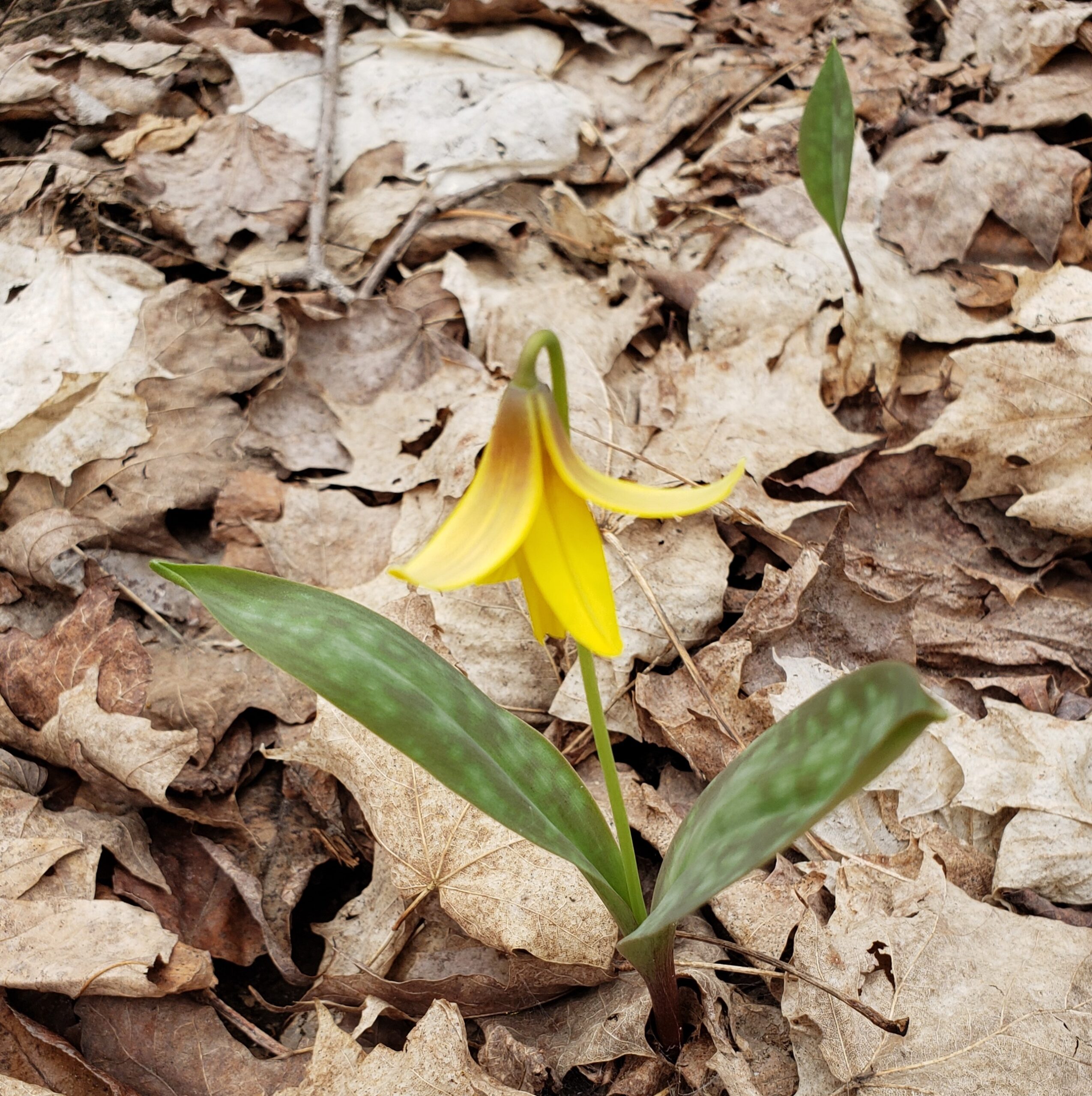
NEW DATE Spring Ephemeral Hike Series: Massie Forest
https://hikesstaging.brucetrail.org/event/spring-ephemeral-hike-series-massie-forest/Sorry, the registration cut-off time for this hike has been reached.Not a member? Click here to join today!Hosting Club: Sydenham
Category: Botany Hike
Location (Google Maps): Massie Hills Management Area parking lot off of Concession Road 6S (South of Sideroad 6)Hike Leader(s): Jeannine Kralt Click here to contact Hike Leader(s)
Pace: Leisurely: 3 km/h or less
Terrain: Easy: Mostly flat and good footing.
Distance: Upwards of 5km+Description
The first in our series of spring ephemeral hikes – Massie Forest has a notable population of Hepatica, Spring Beauty, Trout Lilies and White Trillium amongst others. We’ll see what we can find. We’ll be hiking part of the Spey River Side Trail, and possibly small portions of the main trail. These sections are relatively easy strolls (fairly flat).This leisurely hike will be a classic Discovery Hike, with a focus on spring wildflowers – participants are encouraged to ask questions, and we’ll briefly stop to look at things we find. Photographers welcome. There is a chance that this hike might be moved slightly, given the warmer end to winter this year (it’s been hard to predict timing). Participants will be contacted in advance if that is to be the case.
This hike also appears in Ron Savage’s book Exploring Sydenham – sufficient time will be available to locate the code.
Carpooling encouraged – get in touch with the hike leader if you are in need of a ride. Please plan to arrive 15 minutes in advance of the start time. An email confirming conditions will be sent out in advance of the hike. Please contact Jeannine via the hike leader contact form should there be any questions or concerns.
7 Rivers Hike Series - #2 of 7 - Nottawasaga River
https://hikesstaging.brucetrail.org/event/7-rivers-hike-series-south-2-of-4-nottawasaga-river/Sorry, the registration cut-off time for this hike has been reached.Not a member? Click here to join today!Hike open to BTC Members only.
Hosting Club: Dufferin Hi-Land
Category: General Hike
Location (Google Maps): BTC parking Lot west of the Black Birch Restaurant on Hockley Road.Hike Leader(s): Margery Cruise Click here to contact Hike Leader(s)
Pace: Medium
Terrain: Moderate
Distance: 13.1 kmDescription
We will walk along the Hockley Road Side Trail, then climb north on the main trial and follow the Tom East Side Trail. We turn right and head north along the main trail to the Isabel East Trail which we follow in a loop back to the Main Trail. Then, we hike north to the far end of Cam Snell Side Trail and follow this Side Trail back to the main trail. From there, we follow the main trail back to Hockley Road ignoring the enticing side trails that we have already covered.This a badge hike – if you have done all 7 hikes, you have earned a badge.
The Great Wildflower Hunt
https://hikesstaging.brucetrail.org/event/the-great-wildflower-hunt/Sorry, the registration cut-off time for this hike has been reached.Not a member? Click here to join today!Hosting Club: Iroquoia
Category: Good Companions
Location (Google Maps): Hilton Falls Conservation Area, 4985 Campbellville Rd., MiltonHike Leader(s): Anne Armstrong Click here to contact Hike Leader(s)
Pace: Leisurely – 3km/hr or less
Terrain: Moderate – Some hills and/or some poor footing
Distance: 9 – 10 km.Description
Join us for this hike at Hilton Falls Conservation Area as we begin the annual search for early wildflowers. Hopefully we’ll spot some. Meet in the parking lot of Hilton Falls Conservation Area at 9:45 am. for a 10:00 am. start. Bring water, a snack and sunscreen as well as hiking poles if using. We will do a there and back/ loop hike taking us around the Beaver Meadows loop as well as a stop at the falls. A reservation through Halton Parks is required.
Leader: Anne Armstrong
Toronto Urban Badge Hike - 2 of 7
https://hikesstaging.brucetrail.org/event/toronto-urban-badge-hike-2-of-7-4/Sorry, the registration cut-off time for this hike has been reached.Not a member? Click here to join today!Hosting Club: Toronto
Location (Google Maps):
Toronto, Ontario, Canada
Hike Leader(s): Brian Rideout Click here to contact Hike Leader(s)
Pace: Moderate
Terrain: Flat
Distance: 10.9 kmDescription
Please join me at the south east corner of Eglinton and Scarlett by 10 AM. We will hike south on the Humber Recreational Trail to Lakeshore Blvd and Ellis (km 19.2 to km 8.3). Here is an online map with km markings of our route for all 7 hikes for the Toronto Urban Badge.Please make sure you bring at least 2 liters of water, a lunch, bug spray and sunscreen.
Nature Seekers Exploring Whitetail Refuge Nature Reserve
https://hikesstaging.brucetrail.org/event/nature-seekers-exploring-whitetail-refuge-nature-reserve-2/Sorry, the registration cut-off time for this hike has been reached.Not a member? Click here to join today!Hosting Club: Caledon Hills
Category: Nature Walks
Location (Google Maps): Meet at the Mono Community Centre, 200 m south of Mono Centre (County Road 8). 44.026195, -80.071516Directions: From ON-10 head east onto Dufferin Rd. 8/Mono Centre Rd. for 6.0 km. The Community Centre is on the right.
Hike Leader(s): Sandy Green Click here to contact Hike Leader(s)
Pace: Leisurely – 3 km/hour or less
Terrain: Moderate – some hills and/or some poor footing
Distance: 5 kilometresDescription
Join with other friends of the Caledon Hills Club to leisurely explore the emergence of spring on our Whitetail Refuge Nature Reserve. Bring your choice of hydration and snacks. Sturdy footwear is highly recommended. This hike can be used towards earning the 60 for the 60th commemorative badge.Urban Walk: Humber River to High Park
https://hikesstaging.brucetrail.org/event/urban-walk-humber-river-to-high-park/Sorry, the registration cut-off time for this hike has been reached.Not a member? Click here to join today!Hosting Club: Toronto
Category: Urban Walk
Location (Google Maps): Old Mill Subway StationHike Leader(s): Danny Pivnick Click here to contact Hike Leader(s)
Pace: Moderate
Terrain: Flat
Distance: 8 KmsDescription
Join us for an afternoon walk in Toronto’s West End. Beginning at Old Mill subway station, we will make our way south following a part of the Humber River. Upon reaching Lake Ontario, we will have a chance for some photos before crossing the beautiful Humber Bay Arch Bridge. We will then follow the Waterfront Trail and head up into High Park where we will hopefully be able to enjoy the beginning of the short-lived Cherry Blossom season. The walk will then end in High Park. - 21April 21, 2024
Fort to Fort SECOND DAY ONLY April 21, 2024
https://hikesstaging.brucetrail.org/event/fort-to-fort-second-day-only-april-21-2024/Sorry, the registration cut-off time for this hike has been reached.Not a member? Click here to join today!Hosting Club: Niagara
Category: Event Hikes
Location (Google Maps):Kingsbridge Park, Chippawa, Ontario
Pace: Medium
Terrain: Easy
Distance: 30.5 km ( could be 27 km if bridge at Black Creek is open)Description
This is a self led hike.
Meet at Kingsbridge Park at 6:45. You will be bussed to Old Fort Erie. Hike back to Kingsbridge Park from Old Fort Erie. Terrain is flat with mostly paved paths. At present, the bridge at Black Creek is under repair and scheduled to reopen on April 26th so there is a 3 km reroute, making the distance 30.5 km. If the bridge is repaired by April 21st, then route will be around 27 km. There are 2 checkpoints along the way.Masks are optional on buses.
Registration is $50. (members) , $60 (non-members) for 1 day. Fee includes bus and checkpoints .
Event Coordinator: Lauren Doig, ldoig52@gmail.com
Peninsula in 6 Challenger Series A Hike #2 Jones Bluff to Rush Cove
https://hikesstaging.brucetrail.org/event/peninsula-in-6-challenger-series-a-hike-2-jones-bluff-to-rush-cove/Sorry, the registration cut-off time for this hike has been reached.Not a member? Click here to join today!Hike open to BTC Members only.
Hosting Club: Peninsula
Location (Google Maps): Rush Cove Parking Lot
Capacity: 10
Coordinates: 44.958806, -81.143985Hike Leader(s): Margaret O’Dell Click here to contact Hike Leader(s)
Pace: Fast
Terrain: Difficult
Distance: 27.7 KmDescription
Hike #2 of 6 Jones Bluff to Rush CovePeninsula in 6 Challenger Series
Complete 162.4 km section from Wiarton to Tobermory in 6 hikes.- You must sign up for EACH hike individually. The series is spread-out over 2 weeks, and 3 weekends. You are not automatically accepted into either series as a whole.
- This hike series is intended for experienced distance hikers only. Hikers must demonstrate recent experience completing hikes exceeding 25 km over difficult terrain and at a brisk pace;
- If a hiker is unable to keep pace with the group, or finds the distance too challenging, their future hike registrations may be canceled by the hike leader.
- Be very aware of your ability to join this series.
- Hikes will average 4.5 km per hour including breaks, moving pace is 5 km per hour;
- Expect to be on-trail for 7 – 9 hours;
- Meeting time is scheduled for 7:00am; arrive no later than 15 minutes prior to the meeting time;
- Hikers must carry sufficient hydration, accessible snacks, lunch, first-aid kit, rain gear, extra socks, and possibly protective boot covers (i.e. bags);
- Hikers will be expected to participate in shuttling hikers to the start and to drive shuttlers back to their car. Responsibility will be shared equally;
- Any applicable parking fees will be shared within the group.

TBTC Annual General Meeting - Biodiversity Hike / Nature Photography Hike / Hike with Peter Around The Centre - From Kipling Station
https://hikesstaging.brucetrail.org/event/tbtc-annual-general-meeting-biodiversity-hike-nature-photography-hike-hike-with-andrew-around-the-centre/Sorry, the registration cut-off time for this hike has been reached.Not a member? Click here to join today!Trip Information
Departure Time: 08:30
Return to City Time: 16:45
Departure Point: Kipling Departure PointOptional Items
Nature Photography Hike w/ Marie-Josee and Nijole ($.01)
Biodiversity Hike w/ KJ and Monica ($.01)
Hike Around The Conservation Area w/ Peter ($.01)
Bus Ride Only - I will Spend the time before the meeting independently. ($.01)Hosting Club: Toronto
Category: Bus Hike
Location (Google Maps): Kortright Centre for Conservation
9550 Pine Valley Dr
Woodbridge ON L4H 2Z6Hike Leader(s): KJ Chong; Nijole Mockevicius; Monica Pasquali; Peter Leeney; Marie-Josée Roy; Click here to contact Hike Leader(s)
Pace: Leisurely, Moderate
Terrain: Variable
Distance: n/aDescription
Please join us for a morning hike around the Kortright Centre for Conservation. After the hike, we will arrive at the Kortright Centre for lunch before the AGM starts.Three hikes will be offered:
- Biodiversity Hike – Join us for a 3-4 km hike to learn about the importance of local areas like Kortright Conservation Area and the Bruce Trail, the 7 principles of “Leave No Trace”, and all the organisms around us. Come to share your knowledge and learn from others!
- Nature Photography Hike – Join our Club’s hike leader Nijole Mockevicius, an avid photographer. Nijole will be discussing – together with the participants – and applying basic camera techniques for the most common nature images taken along the trails. Bring your DSLR camera, iPad, iPhone, or other devices.
- Hike with Andrew – Join Peter Leeney for an intermediate 7.7 km perimeter loop hike on all of the Kortright Centre For Conservation trails. Some hills. Strong beginners welcome.
Choose your preferred hike upon registration.
Note that you must register separately for the AGM and Lunch on Eventbrite – https://rb.gy/ptjlov
TBTC Annual General Meeting - Biodiversity Hike / Nature Photography Hike / Hike with Peter Around The Centre - From York Mills Station
https://hikesstaging.brucetrail.org/event/tbtc-annual-general-meeting-biodiversity-hike-nature-photography-hike-hike-with-andrew-around-the-centre-from-york-mills-station/Sorry, the registration cut-off time for this hike has been reached.Not a member? Click here to join today!Trip Information
Departure Time: 08:30
Return to City Time: 16:45
Departure Point: York Mills Bus PickupOptional Items
Nature Photography Hike w/ Marie-Josee and Nijole ($.01)
Biodiversity Hike w/ KJ and Monica ($.01)
Hike Around The Conservation Area w/ Peter ($.01)
Bus Ride Only - I will Spend the time before the meeting independently. ($.01)Hosting Club: Toronto
Category: Bus Hike
Location (Google Maps):Kortright Centre for Conservation
9550 Pine Valley Dr
Woodbridge ON L4H 2Z6Hike Leader(s): KJ Chong; Nijole Mockevicius; Monica Pasquali; Peter Leeney; Marie-Josée Roy; Click here to contact Hike Leader(s)
Terrain: Variable
Distance: n/aDescription
Please join us for a morning hike around the Kortright Centre for Conservation. After the hike, we will arrive at the Kortright Centre for lunch before the AGM starts.Three hikes will be offered:
- Biodiversity Hike – Join us for a 3-4 km hike to learn about the importance of local areas like Kortright Conservation Area and the Bruce Trail, the 7 principles of “Leave No Trace”, and all the organisms around us. Come to share your knowledge and learn from others!
- Nature Photography Hike – Join our Club’s hike leader Nijole Mockevicius, an avid photographer. Nijole will be discussing – together with the participants – and applying basic camera techniques for the most common nature images taken along the trails. Bring your DSLR camera, iPad, iPhone, or other devices.
- Hike with Peter – Join Peter Leeney for an intermediate 7.7 km perimeter loop hike on all of the Kortright Centre For Conservation trails. Some hills. Strong beginners welcome.
Choose your preferred hike upon registration. The bus from York Mills will proceed to the Kortright Centre where we will meet those who arrived from Kipling Station and you will join your chosen hike.
Note that you must register separately for the AGM and Lunch on Eventbrite at: https://rb.gy/ptjlov
TBTC AGM Car Hike Kortright
https://hikesstaging.brucetrail.org/event/tbtc-agm-car-hike-kortright-2/Sorry, the registration cut-off time for this hike has been reached.Not a member? Click here to join today!Hosting Club: Toronto
Category: Car Hike
Location (Google Maps):Kortright Centre for Conservation
Hike Leader(s): Frank Ye & Jen Zhang Click here to contact Hike Leader(s)
Pace: Moderate
Terrain: Variable
Distance: 9 KMDescription
Join us for a morning hike around the Kortright Centre for Conservation trails in Kleinberg before the club’s AGM in 2024. Meet Frank and Jen by the entrance to the visitor centre.Note that you must register separately for the AGM and Lunch on Eventbrite – https://rb.gy/ptjlov
Car Hike: Toronto E2E in 4 and a biodiversity badge (2of4)
https://hikesstaging.brucetrail.org/event/car-hike-toronto-e2e-in-4-and-a-biodiversity-badge-2of4/Sorry, the registration cut-off time for this hike has been reached.Not a member? Click here to join today!Hike open to BTC Members only.
Hosting Club: Toronto
Category: Cancelled
Location (Google Maps): Km 12.1, same as hike one on April 19.Hike Leader(s): Smadar Junkin Click here to contact Hike Leader(s)
Pace: Moderate
Terrain: Hilly, Variable
Distance: 15.2 kmDescription
Second hike in the series. Please read about it on the hike calendar at April 19. We will shuttle to km 26.6 and hike back. Note that this is the longest hike in the series and make sure that your accompanying child, if one is coming with you can handle the distance.Merrit island loop
https://hikesstaging.brucetrail.org/event/merrit-island-loop/Sorry, the registration cut-off time for this hike has been reached.Not a member? Click here to join today!Hosting Club: Niagara
Category: Loop
Location (Google Maps): Merritt Island Park. Up Cross Streete. Library on right. Keep going to end where park is.Hike Leader(s): Sylvia Wheeler Click here to contact Hike Leader(s)
Pace: Medium
Terrain: Easy
Distance: 10 kmDescription

Toronto Urban Badge Hike - 3 of 7
https://hikesstaging.brucetrail.org/event/toronto-urban-badge-hike-3-of-7-3/Sorry, the registration cut-off time for this hike has been reached.Not a member? Click here to join today!Hosting Club: Toronto
Category: Urban Walk
Location (Google Maps):Toronto, Ontario, Canada
Hike Leader(s): Brian Rideout Click here to contact Hike Leader(s)
Pace: Moderate
Terrain: Flat
Distance: 10.4 kmDescription
Please join me at the south west corner of Lakeshore Blvd West and Ellis by 10 AM. We will hike east along the Waterfront Trail to the Distillery District (km 8.3 to km 71.4). Here is an online map with km markings of our route for all 7 hikes for the Toronto Urban Badge.Please make sure you bring at least 2 liters of water, a lunch, bug spray and sunscreen.

11:00 Taylor Property Nature Walk and Pull Party
https://hikesstaging.brucetrail.org/event/1100-taylor-property-nature-walk-and-pull-party/Sorry, the registration cut-off time for this hike has been reached.Not a member? Click here to join today!Hosting Club: Niagara
Category: In and Out
Location (Google Maps): Taylor Property, Leonard Crescent, Lincoln, Beamsville, ONHike Leader(s): Helen Hermansen Click here to contact Hike Leader(s)
Pace: Leisurely
Terrain: Moderate
Distance: about 3 kmDescription
Welcome to my first Pull-Party! We will park on Leonard Crescent in Lincoln (south of Beamsville) to explore the Taylor Property. On the way in we will look at the spring ephemeral flowers and learn to recognize the two invasive plants, garlic mustard and greater celandine, which we will be pulling out on our return.The trail may be muddy so rubber boots are an option. Also bring gardening gloves and a snack to enjoy during the break.
This is a beautiful section of the trail so we won’t work too hard!
Note that the orange sap if the the greater celandine is irritating to skin and eyes, and both unpalatable and toxic if ingested; And it can stain your clothes. Much to learn about this plant.
Exploring Sydenham hike 2
https://hikesstaging.brucetrail.org/event/exploring-sydenham-hike-2/Sorry, the registration cut-off time for this hike has been reached.Not a member? Click here to join today!Hosting Club: Sydenham
Category: General Hike
Location (Google Maps): Meet in the north-east corner of the parking lot at Home Depot on Highway 26 on the east side of Owen Sound.Hike Leader(s): Bill Snel Click here to contact Hike Leader(s)
Pace: Leisurely: 3 km/h or less
Terrain: Easy: Mostly flat and good footing.
Distance: ~5 kmDescription
We will carpool to do a loop hike of some of the Massie Forest trails. This is hike 2 in the book Exploring Sydenham. It has a secret to be located.