
Hike Schedule
Join us for a hike! Registration required.
All hikes available to BTC members. Some hikes are open to non-members.
See Refund Policy for Paid Hikes >
TIP: The calendar view displays up to 7 hikes on a day, but often there are more. Click “View more events” to see them all.
Categories
- 13April 13, 2024
Car Hike: Rouge National Park Scarborough
https://hikesstaging.brucetrail.org/event/car-hike-rouge-national-park-scarborough/Sorry, the registration cut-off time for this hike has been reached.Not a member? Click here to join today!Hosting Club: Toronto
Category: Car Hike
Location (Google Maps): Rouge Park, Zoo Road Parking Lot, off Meadowvale Road north of Sheppard AveHike Leader(s): Mohammad Aghamiri Click here to contact Hike Leader(s)
Pace: Moderate
Terrain: Hilly, Variable
Distance: 14-17 kmDescription
Will explore Toronto part of Rouge park along Rouge river and Little Rouge Creek,Some safety procedures during the hike:
1-Hikers must stay between the leader and the sweep.
2-Hikers must advise the leader or the sweep if they wish to leave the group.
3- Hikers must follow the whistle instructions: 1 blast- stay where you are; 2 blasts come to the leader; 3 blasts – come to the leader quickly.
4-Hike leader may request volunteers to stop at trail intersections, they need to help hikers to the direction the group walk and wait till they see the sweep .
5-Hikers have to make sure they can see the persons behind and in front of them.
Bus Hike: Martina's Birthday Fundraiser Hike
https://hikesstaging.brucetrail.org/event/bus-hike-martinas-birthday-hike/Sorry, the registration cut-off time for this hike has been reached.Not a member? Click here to join today!Trip Information
Departure Time: 08:30
Return to City Time: 18:00
Departure Point: York Mills Bus PickupOptional Items
Hosting Club: Toronto
Category: Bus Hike
Location (Google Maps): Wilder Forest, Walker Woods and Glen MajorHike Leader(s): Matina Furrer, Roland Mark Click here to contact Hike Leader(s)
Pace: Moderate
Terrain: Hilly, Variable
Distance: 15Description
Birthday fundraiser hike: Join Martina, Roland, and guest leader Ida Weippert for a fun spring hike (15 km at a 4 km/hr pace, dropout after 12 km) in Wilder Forest, Walker Woods and Glen Major. Hopefully we’ll get to enjoy the first wildflowers of the season.If you’re feeling generous please make a donation to the Bruce Trail Conservancy to help buy habitat for our forest friends. Donations are appreciated even if you can’t make it to the hike.
Afterwards we’ll stop for treats at Annina’s Bakeshop in Goodwood.
Hockley Valley on the 4th Line - Part 2
https://hikesstaging.brucetrail.org/event/hockley-valley-on-the-4th-line-part-2-2/Sorry, the registration cut-off time for this hike has been reached.Not a member? Click here to join today!Hosting Club: Blue Mountains
Category: Register on-line or sign-in morning of hike
Location (Google Maps): Hike meets in the parking lot behind Tim Hortons on First St. in Collingwood.Hike Leader(s): Hart Fischer Click here to contact Hike Leader(s)
Pace: Medium – 3 to 4 km/hr
Terrain: Moderate – Some hills and/or some poor footing, Strenuous – Hilly with steep climbs and some poor footing
Distance: 7 kmDescription
We will park on 4th Line in the Caledon Hills section, begin at km 55.1 and hike to the Hockley Valley Resort service road. For the next 1.1 km the trail will traverse the Resort’s ski facilities. A long descent occurs after the maintenance sheds. The length is determined by group ability. Can be 5km before retracing steps, but easily shortened if required. Bring a snack or lunch and water.
Hike Leaders Hike/Social
https://hikesstaging.brucetrail.org/event/hike-leaders-hike-social/Sorry, the registration cut-off time for this hike has been reached.Not a member? Click here to join today!Hosting Club: Iroquoia
Category: Special Event
Location (Google Maps): We will meet at the Calcium Pits roadside parking on Twiss Rd, Milton (just south of Camp Manitou- Boy Scout camp and just north of Derry Rd.) at 9am sharp. See link below for directions.
We encourage carpooling, where possible, as this roadside parking area has limited room for cars. There is plenty of parking at nearby Kilbride Park, behind Kilbride School at the end of Panton St. If you would like to meet there, a vehicle for 7 + the driver will be leaving at 8:30am.Hike Leader(s): Karen Capindale-Smith Click here to contact Hike Leader(s)
Pace: Medium – 3 to 4 km/hr
Terrain: Moderate – Some hills and/or some poor footing
Distance: 9 kmDescription
This is an in and out hike intended for all Iroquoia Hike Leaders whether you are currently a Hike Leader or are interested in becoming one. Everyone is welcome and this is a great hike to ask questions. We will have an optional social afterwards at a local restaurant/cafe or a tailgate lunch if the weather is nice.
From the parking lot we will proceed past the calcium pits toward Guelph Line (GL). We will cross GL and enter Crawford Lake Conservation Area and make our way to the Info Centre via Crawford Lake for a snack/bio break. Then we will proceed to the Nassagawaya Canyon Look Out before making our way back to the cars.You may very well need your icers as April can bring any type of conditions. Please dress for the weather. Bring water and snacks in addition to all the other backpack essentials.
9:30 Exploring Port Weller West
https://hikesstaging.brucetrail.org/event/930-exploring-port-weller-west/Sorry, the registration cut-off time for this hike has been reached.Not a member? Click here to join today!Hosting Club: Niagara
Category: Loop
Location (Google Maps): Charles Ansell Park, 320 Lakeshore Road, St, Catharines
corner of Bunting Road and Lakeshore RoadHike Leader(s): Sheila Massey Click here to contact Hike Leader(s)
Pace: Medium
Terrain: Easy
Distance: 7kDescription
Karen Couch is leading a hike in Port Weller East and I will lead a hike on the West side. On this hike we will walk along the Welland Canal and follow a trail to Malcolmson Eco Park. On the grounds are a historic greenhouse, native gardens, unique birdhouses and areas which have been revitalized with trees and prairie grasses. This park is a bird lover’s paradise. After we leave the Park we will follow a trail to Sunset Beach and then to the Walker Creek Trail, walk a bit of the neighbourhood, have a look at floral murals at Port Weller Communuty Centre and return to Malcolmson Park following more trails and ending up at the parking lot at Charles Ansell. There will be frequent stops.7 Rivers Hike Series - #1 of 7 - Humber River
https://hikesstaging.brucetrail.org/event/7-rivers-hike-series-south-1-of-4-humber-river/Sorry, the registration cut-off time for this hike has been reached.Not a member? Click here to join today!Hike open to BTC Members only.
Hosting Club: Dufferin Hi-Land
Category: General Hike
Location (Google Maps): Parking Lot East of Airport Road past the Taoist Tai Chi Centre on Mono 5 Sideroad.Hike Leader(s): Margery Cruise Click here to contact Hike Leader(s)
Pace: Medium
Terrain: Moderate, Strenuous
Distance: 11.4 kmDescription
We will hike south crossing Mono 5 Sideroad until we reach 7th Line EHS. We walk south along to the road to the inukshuk. Here we head east to the viewpoint looking out over the Humber Valley. Next, we hike down past the Glen Haffy Side Trail. We remain on the main trail and continue to the bridge over the Humber River. Then we will turn around and return north to the parking lot.This a badge hike – if you have done all 7 hikes, you have earned a badge.

Car Hike: Short Hills Provincial Park Hike - 11KM
https://hikesstaging.brucetrail.org/event/car-hike-short-hills-provincial-park-hike-11km/Sorry, the registration cut-off time for this hike has been reached.Not a member? Click here to join today!Hosting Club: Toronto
Category: Car Hike
Location (Google Maps): Short Hills Roland Rd Parking lotHike Leader(s): Alina Lin
Pace: Moderate
Terrain: Challenging, Hilly, Rocky
Distance: 11kmDescription
Meet at the parking lot off of Roland Rd, south west area of Short Hills Provincial Park. GPS 43.090278, -79.305073.- Sturdy hiking boots are required as the terrain will be rocky and hilly;
- Bring at least 1L water;
- Bring snacks
- Wear for the weather
- No dogs. No drop out.

Toronto Urban Badge Hike - 1 of 7
https://hikesstaging.brucetrail.org/event/toronto-urban-badge-hike-1-of-7-4/Sorry, the registration cut-off time for this hike has been reached.Not a member? Click here to join today!Hosting Club: Toronto
Location (Google Maps):
Toronto, Ontario, Canada
Hike Leader(s): Brian Rideout Click here to contact Hike Leader(s)
Pace: Moderate
Terrain: Flat
Distance: 11 kmDescription
Please join me at the south west corner of Finch and Weston by 10 AM. We will hike south on the Humber Recreational Trail to Scarlet and Eglinton (km 30.2 to km 19.2). Here is an online map with km markings of our route for all 7 hikes for the Toronto Urban Badge.Please make sure you bring at least 2 liters of water, a lunch, bug spray and sunscreen.
Tawse Winery Hike and Private Tasting Experience
https://hikesstaging.brucetrail.org/event/tawse-winery-hike-and-private-tasting-experience/Sorry, the registration cut-off time for this hike has been reached.Not a member? Click here to join today!Hike open to BTC Members only.
Hosting Club: Niagara
Category: In and Out
Location (Google Maps): Park at Tawse Winery 3955 Cherry Avenue VinelandHike Leader(s): Sam Rutherford Click here to contact Hike Leader(s)
Pace: Medium
Terrain: Moderate
Distance: 6kDescription
We will hike on the main trail from Tawse Winery to the Margaret Reed Side Trail located in Cave Springs Conservation Area and return back to Tawse Winery by 11:30. Upon return we will enjoy a private structured tasting led by one of the knowledgeable and friendly winery staff from 11:30 to 12:00 noon. The cost for the tasting experience is now $12.50 per person. You will also enjoy a 20% discount on bottle purchases that day. Please bring your $12.50 with you as I will collect it prior to the tasting to simplify the payment to Tawse Winery. Thank you.Sydenham Series #1 - Rocklyn Creek to Massie Hills
https://hikesstaging.brucetrail.org/event/sydenham-series-1-rocklyn-creek-to-bighead-river/Sorry, the registration cut-off time for this hike has been reached.Not a member? Click here to join today!Hosting Club: Dufferin Hi-Land, Sydenham
Category: General Hike
Location (Google Maps): BTC parking lot off 6th Concession South (west side of road) north of Sideroad 3, south of Sideroad 6. BTC Map 29. 44.509124, -80.810665. Please arrive at 9:45 am.Hike Leader(s): Stuart Law Click here to contact Hike Leader(s)
Pace: Medium
Terrain: Moderate, Slippery Sections Likely
Distance: 18.2 kmsDescription
Join us on the first of our 10 Sydenham E2E Series shuttle hikes. Peaceful rural Ontario. Woods. Beautiful, terraced Rocklyn Creek. Bighead River. Some road walking. Please bring a garbage bag and a change of footwear for the shuttle (we will be muddy) and please be prepared to drive fellow hikers before or after the hike. Please bring a smile, 2L of water, a warm drink, a snack and a lunch. Hiking boots mandatory. Poles and gaiters recommended. Please arrive at 9:45 am to be prepared to shuttle at 10:00 am sharp. - 14April 14, 2024
Sydenham Series #2- Woodford to Massie Hills
https://hikesstaging.brucetrail.org/event/sydenham-series-2-woodford-to-massie-hills/Sorry, the registration cut-off time for this hike has been reached.Not a member? Click here to join today!Hosting Club: Dufferin Hi-Land, Sydenham
Category: General Hike
Location (Google Maps): BTC parking lot off 6th Concession South (west side of road) north of Sideroad 3, south of Sideroad 6. BTC Map 29. 44.509124, -80.810665. Please arrive at 8:45 am.Hike Leader(s): Stuart Law Click here to contact Hike Leader(s)
Pace: Medium
Terrain: Slippery and Steep Sections, Strenuous
Distance: 19 kmsDescription
Join us on the second of our 10 Sydenham E2E Series shuttle hikes. Peaceful rural Ontario. Woods. Rocky technical terrain. Very wet and muddy at Bognor Marsh. Some road walking. Please bring a garbage bag and a change of footwear for the shuttle (we will be muddy) and please be prepared to drive fellow hikers before or after the hike. Please bring a smile, 2L of water, a warm drink, a snack and a lunch. Hiking boots mandatory. Poles and gaiters recommended. Please arrive at 8:45 am to be prepared to shuttle at 9:00 am sharp.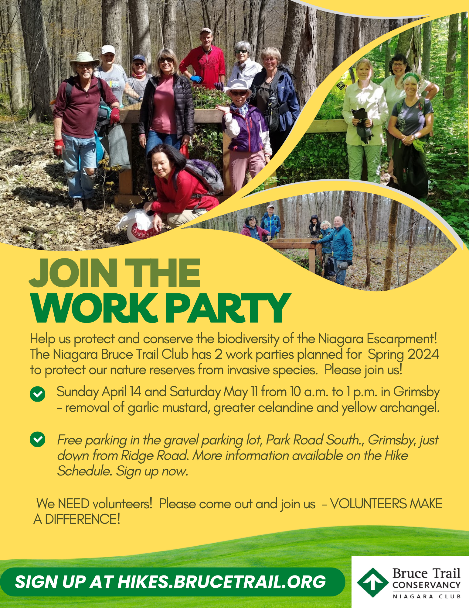
CANCELLED! 10:00 GARLIC MUSTARD HIKE - HELP US FILL THE CRIB!
https://hikesstaging.brucetrail.org/event/1000-garlic-mustard-hike-help-us-fill-the-crib-6/Sorry, the registration cut-off time for this hike has been reached.Not a member? Click here to join today!Hosting Club: Niagara
Category: Cancelled
Location (Google Maps):We will meet at gravel parking lot on Park Road South, Grimsby just down the hill from Ridge Road.
Hike Leader(s): Alicia Aitchison Click here to contact Hike Leader(s)
Pace: Leisurely
Terrain: Easy
Distance: ~4 kmDescription
GARLIC MUSTARD HIKES – Join us & HELP US FILL THE CRIB! We will hike in from Ridge Road – picking the invasive garlic mustard & greater celandine along the trail side along the way – bring a bag to fill (reusable grocery bag or garbage bag work well). Once we hike into the crib location we will dump our bags into the crib and pick garlic mustard in that area for a while & then hike back out. There are lots of spring ephemerals along the way to admire – mayapples, trout lilies, wild ginger and many others – reducing the invasive species will give these natives a chance to thrive!Long sleeves are recommended & don’t forget your work gloves.
If parking fills up at the bottom of the hill there is room for a couple of cars to park at the trail head at Ridge Road.
We are only hosting two work parties this year at this location so we need as many volunteers as possible!
- you must register and submit a completed waiver for this hike
- Students under 16 MUST be accompanied by a parent/guardian on this hike (please refer to the BTC link https://brucetrailorg.b-cdn.net/wp-content/uploads/2022/06/VOL.05.01_Minors_Volunteering_Policy_-_Approved_February_2016.pdf )
- 16 or more but under 18? Bring a waiver signed by a guardian.
- students wishing to receive community service hours (4Hours) MUST bring service forms from school
- Please wear clothes for work – long pants tucked into socks, appropriate footwear (no sandals), long sleeves and work gloves
Car Hike: Mono Cliffs
https://hikesstaging.brucetrail.org/event/car-hike-mono-cliffs-6/Sorry, the registration cut-off time for this hike has been reached.Not a member? Click here to join today!Hosting Club: Toronto, Dufferin Hi-Land
Category: Car Hike
Location (Google Maps): Mono Cliffs Provincial Park, Map 19Hike Leader(s): Al Brown Click here to contact Hike Leader(s)
Pace: Moderate
Terrain: Flat, Variable
Distance: 14 kmDescription
We will complete a loop hike through the Park including the Splitrock side trail north of it. The terrain is generally flat to rolling and occasionally rocky, relatively easy hiking. Given the early end to winter spring flowers may be out for our viewing pleasure. After the hike those interested may meet at the Hockley Valley resort for refreshments.To get to the meeting point take Hwy 10 north from Orangeville. Turn right at Camilla onto Mono Centre Road. Follow it to the village of Mono. Turn right onto a gravel lane just before you get to the community centre (on your right as you approach the village). Parking is on the graveled areas behind the tennis court.
A Hike Leader’s Hike - For TBTC Hike Leaders & Prospective Hike Leaders (BUT ANYONE WELCOME)
https://hikesstaging.brucetrail.org/event/a-hike-leaders-hike-for-tbtc-hike-leaders/Sorry, the registration cut-off time for this hike has been reached.Not a member? Click here to join today!Hike open to BTC Members only.
Hosting Club: Toronto
Category: TBTC Special Events
Location (Google Maps): Streetsville Memorial Park, 335 Church St., bottom of the hill, in the parking lot near the Culham Trail and the bridge to the island. You can access Church St. from Queen St. which is an extension of Mississauga Rd.
If coming by public transit, meet Andrew at Kipling Terminal by 8:50 to take the #29 Guelph GO Transit Bus at 9 am to Erin Mills Station. We will transfer to #21 Lisgar GO Transit bus leaving at 9:45 to Streetsville Go STN and arriving at 9:55. Presto Card users will now have their TTC Fare deducted from the GO Transit fare making the adult return fare $5.50. Use washrooms at Streetsville station before walking 9 minutes to the meeting point. If coming by transit from the east end or downtown Toronto you may alternatively meet Tom in the Great Hall of Union Station at 8:30 to take the westbound Lakeshore GO Train to Clarkson where we will transfer to the same #21 Lisgar GO Bus those coming with Andrew from Kipling will board at Erin Mills.Hike Leader(s): Andrew Proczek, Tom Swales
Pace: Moderate
Terrain: Flat
Distance: 12.5Description
This is a hike for current Toronto Bruce Trail Club Hike Leaders to meet some of the other Toronto Bruce Trail Club Hike Leaders and those interested in becoming Hike Leaders and would like an opportunity to ask questions before taking the Hike Ontario Certified Hike Leader Training scheduled for June. However anyone is welcome to join us. Hiking Director Tom Swales and other Hike Leaders who have taken the Hike Ontario Certified Hike Leader (CHL) Course will be available to answer questions about the course, the process of becoming a Certified TBTC Hike Leader, and expectations of a Hike Leader. There will be further opportunities to mingle after the hike at a local pub.We will hike on the Culham Trail from Streetsville to Credit Meadows Park and return. Lunch will be at km 6.3 by the Credit River. The is a pleasant and fairly easy hike with only one major hill. We will be walking on packed gravel, dirt and grass trails as well as a short section of paved trail near River Grove Park.
Urban Walk: Waterfront Trail - Ajax GO to Pickering GO
https://hikesstaging.brucetrail.org/event/urban-walk-waterfront-trail-ajax-go-to-pickering-go/Sorry, the registration cut-off time for this hike has been reached.Not a member? Click here to join today!Hosting Club: Toronto
Category: Urban Walk
Location (Google Maps): Durham Waterfront TrailHike Leader(s): Brian Rideout Click here to contact Hike Leader(s)
Pace: Moderate
Terrain: Flat
Distance: 11 kmDescription
Please join me under the clock in the Great Hall at Union Station by 9:05 am. We will take the eastbound Lakeshore Train departing Union Station GO at 9:20 am, arriving Ajax GO at 10:15 am. You may choose to join the group at Ajax GO Station.We will hike south to Lake Ontario (washrooms in the park), west to Sandy Beach Rd, and north to Bayly St with a pub stop at Irish Times adjacent to Pickering GO. Trains to Toronto depart at 25 minutes and 55 minutes after the hour.
Here is an online map of our route (please click on the link): Ajax to Pickering
You can buy a GO Transit day pass for $10.
- 15April 15, 2024
Peninsula Bruce Trail Club: End-to-End 8-Day Hiking Series - Please read description before registering
https://hikesstaging.brucetrail.org/event/peninsula-bruce-trail-club-end-to-end-8-day-hiking-series/Sorry, the registration cut-off time for this hike has been reached.Not a member? Click here to join today!This is a Multi-Day Hike
You are signing up for the following dates and times:
2024-04-15 at 08:00
2024-04-16 at 08:00
2024-04-22 at 08:00
2024-04-23 at 08:00
2024-04-29 at 08:00
2024-04-30 at 08:00
2024-05-06 at 08:00
2024-05-07 at 08:00Hosting Club: Peninsula
Location (Google Maps): Hike 1 – Meeting Location Wiarton Bluewater Park
Hike Leader(s): Caley Doran Click here to contact Hike Leader(s)
Pace: Medium
Terrain: Difficult, Moderate
Distance: Varies by hikeDescription
Event Type: Multi-Day HikeOpen to Bruce Trail Conservancy (BTC) Members Only.
Non-members can join by signing up for a one-year BTC membership [$75] before registering at Bruce Trail Conservancy Memberships.
Participant Limit: Maximum of 17 participants, including the hike leader and sweep.
Scheduled Dates:
- April 15, 16, 22, 23, 29, 30, 2024
- May 6, 7, 2024
Registration Fees:
- BTC Members: $50
- Includes Badge Fee
- To Confirm Your Registration E-transfer $50 to HikeWithPBTC@gmail.com
- Note: No refunds, hiker substitutions, or guest hikers. Registration fee does not include BPNP entry fee. Parking charges will be shared equally among participants.
Hike Leadership:
- Led by PBTC Certified Hike Leader Caley Doran.
- Pace: Medium
- Terrain: Moderate/Difficult
- Average Hike Distance: Approximately 19-25 KM per day
Hike Overview:
- Complete the Peninsula section of the Bruce Trail over 8 hikes.
- Direction: Northbound from Wiarton to Tobermory.
- Group Hike Format: Participants commit to the entire series.
- Intermediate/experienced hikers comfortable with challenges, including longer distances and elevation gains.
- Expected Pace: 3 – 4 km/hr over 19-25 km
- Total Distance: Approximately 165km with no dropout points.
- Time allocated for photography and appreciating the local flora and fauna.
Participant Requirements:
- Assess and ensure physical fitness for group hiking.
- Attire: Proper hiking boots, layered clothing for varying weather, and wet weather gear. Hiking poles recommended.
- Essentials: Sufficient food [lunch], snacks and water for a full day, bug spray.
- Breaks: Morning, 15-30 minute on-trail lunch, and afternoon breaks, weather-dependent.
- Participant is required to sign a BTC Waiver of Liability
Fee:
- Covers badge fee.
- Surplus supports Peninsula Bruce Trail Club’s hike program
Transportation:
- Each hike in this series will involve a car shuttle, and all participants will take their turn as a shuttle driver. Ensure your vehicle is passenger ready for the shuttle.
- Typical Meeting Time: 8 AM
- Schedule will be based on daily hiking distance
Environmental Responsibility:
- Adherence to Leave No Trace principles.
- Collective effort in trail cleanliness.
- Note: Dogs are not permitted on this hike.
Accommodations:
- Early reservations recommended.
- Suggested locations: Near meeting points or centrally in Lion’s Head.
- Options include motels, campgrounds, hostels, and B&Bs.
Schedule and Communication:
- Detailed itinerary sent prior to each hike.
- Schedule subject to change.
Join us for this memorable hiking adventure and be part of a community dedicated to preserving and enjoying the natural beauty of the Bruce Trail.

Afternoon Hike - Silver Creek area
https://hikesstaging.brucetrail.org/event/afternoon-hike-silver-creek-area/Sorry, the registration cut-off time for this hike has been reached.Not a member? Click here to join today!Hosting Club: Iroquoia
Category: Afternoon/Evening Hikes
Location (Google Maps): Meet at 4:15 roadside on Fallbrook Trail at Silver Creek Conservation Area.Hike Leader(s): Karen Bergmann Click here to contact Hike Leader(s)
Pace: Medium – 3 to 4 km/hr
Terrain: Moderate – Some hills and/or some poor footing
Distance: 7 kmsDescription
We will hike around the Roberts ST and Irwin Quarry ST and then cross the road to the main trail and around a couple of side trails that you may not have known were there. - 16April 16, 2024
Urban Walk: Valley View and Maple view Parks Thornhill
https://hikesstaging.brucetrail.org/event/urban-walk-valley-view-and-maple-view-parks-thornhill-2/Sorry, the registration cut-off time for this hike has been reached.Not a member? Click here to join today!Hosting Club: Toronto
Location (Google Maps): Parking lot at the corner of Bayview Ave, and Sycamore Dr. South of Highway 7
Sycamore Dr. is 2 blocks south of highway 7,parking lot is across plaza of Dollarama and Star boxHike Leader(s): Mohammad Aghamiri Click here to contact Hike Leader(s)
Pace: Moderate
Terrain: Variable
Distance: 7-8 kmDescription
We will explore Valleyview and Maple view parks, and walk along German Mill Creek,9:00 Long Hike Wiley Road Short Hills
https://hikesstaging.brucetrail.org/event/900-long-hike-wiley-road-short-hills-30/Sorry, the registration cut-off time for this hike has been reached.Not a member? Click here to join today!Hosting Club: Niagara
Location (Google Maps):
Short Hills Wiley Road Entrance
Pace: Medium
Terrain: Moderate
: 10kmDescription
Explore Short Hills and the majestic side trails of Scarlett Tanager, Hemlock. Swayze Falls and Terrace. Register for each hike
Bring Poles water, snack, and dress for the weather
Woodford to north end of Bognor Marsh Conservation Area (Concession 4)
https://hikesstaging.brucetrail.org/event/woodford-to-north-end-of-bognor-marsh-conservation-area-concession-4/Sorry, the registration cut-off time for this hike has been reached.Not a member? Click here to join today!Hosting Club: Sydenham
Category: General Hike
Location (Google Maps): Meet at Roadside Parking at the south end of 4th Concession N – go South from Highway 26 to parking area at the end of the 4th Concession N . The landmark for turning south off Highway 26 is the Woodford Baptist Church. From here we will do a car shuttle to the Woodford Community Centre which will be our starting point.Hike Leader(s): Fran Turner Click here to contact Hike Leader(s)
Pace: Brisk: 4 to 5 km/h
Terrain: Strenuous: Hilly with steep climbs and some poor footing.
Distance: 8 kmDescription
This is a lovely hike through the forest along the top of the escarpment. We will take the Crevice Springs Side Trail at the start of the hike and enjoy passing through the Hole-in-the-Wall crevice. We’ll stop for a drink and snack at the Waisberg Side Trail Lookout. When we reach the north end of Bognor Marsh Conservation Area, we’ll turn north and head back to the cars.9:15 Short Hike - Rotary Park
https://hikesstaging.brucetrail.org/event/915-short-hike-rotary-park-12/Sorry, the registration cut-off time for this hike has been reached.Not a member? Click here to join today!Hosting Club: Niagara
Category: Hike
Location (Google Maps): Rotary Park, 376 Regional Rd 69, St. CatharinesHike Leader(s): Debbie Demizio Click here to contact Hike Leader(s)
Pace: Medium
Terrain: Moderate
Distance: ~ 6kmsDescription
Hike around Twelve Mile Creek. Bring hiking boots, water, sunscreen and bug spray.Boston Mills / Mississauga Rd
https://hikesstaging.brucetrail.org/event/boston-mills-mississauga-rd/Sorry, the registration cut-off time for this hike has been reached.Not a member? Click here to join today!Hosting Club: Caledon Hills
Category: Tuesday Hikers
Location (Google Maps): Parking at Boston Mills Rd., just west of its intersection with Mississauga Rd.
Driving directions: From Highway 410 north, continue on Highway 10, left on King Street, right on Mississauga Rd., left on Boston Mills Rd. to the parking at dead end.Hike Leader(s): Mohammad Shafiq Click here to contact Hike Leader(s)
Pace: Medium – 3 to 4 km/hour
Terrain: Moderate – some hills and/or some poor footing
Distance: 14 kmDescription
Main Bruce Trail and Rockside Side Trail, there and back; will hike about 6 km reaching into Terra Cotta and return after snack break.
Bring water, snack, sunscreen and insect repellent, poles are recommended.
After hike there is optional stop at nearby coffee place, Coywolf Coffee, McLaughlin Rd.Hockley Valley South Side
https://hikesstaging.brucetrail.org/event/hockley-valley-south-side-6/Sorry, the registration cut-off time for this hike has been reached.Not a member? Click here to join today!Hosting Club: Dufferin Hi-Land
Category: Tuesday Hike
Location (Google Maps):Caledon Hills Section, Map 18. The parking lot is located south of Hockley Road at 5th Line EHS. Take Hwy 10 north and just north of Orangeville turn right (east) on Hockley Road. Drive 7 km and turn right on 5th Line to the parking lot on your left.
Hike Leader(s): Tony Evangelista, Les Babbage, Inge Eckerich, Julie Daley Click here to contact Hike Leader(s)
Pace: Medium
Terrain: Slippery and Steep Sections, Strenuous
Distance: Long Hike:10.6 km; Short Hike: 3 kmDescription
From the parking lot, we will climb the Hockley Heights Side Trail to the Main Trail and turn left. At km 51.4 we will enter the Glacier Valley Side Trail and loop back to the Main Trail. Then heading west to km 56.2, we will turn right and hike back through the Griffith Ravine Side Trail to rejoin the Main Trail. Returning to the parking area will be via the Hemlock Ridge Side Trail. The short hike will complete the Glacier Valley Side Trail loop and return to the parking lot.Bring lunch, water, and snacks. Hiking poles are recommended.