
Hike Schedule
Join us for a hike! Registration required.
All hikes available to BTC members. Some hikes are open to non-members.
See Refund Policy for Paid Hikes >
TIP: The calendar view displays up to 7 hikes on a day, but often there are more. Click “View more events” to see them all.
Categories
- 02March 2, 2024

Caledon Hills in 4
https://hikesstaging.brucetrail.org/event/caledon-hills-in-4/Sorry, the registration cut-off time for this hike has been reached.Not a member? Click here to join today!This is a Multi-Day Hike
You are signing up for the following dates:
2024-03-02, 2024-03-09, 2024-03-16, 2024-03-23Hosting Club: Iroquoia, Caledon Hills
Category: General Hike
Location (Google Maps): Location
4th line ehs, by peter beecham side trail
n43.976327-w80.026621
Park alongside the road
Arrive for 08:15 so we can depart at 08:30
no fee
Edition 31 map 19Hike Leader(s): Dave Salt Click here to contact Hike Leader(s)
Pace: Brisk – 4 to 5 km/hr
Terrain: Slippery and Steep Sections
Distance: Roughly 20k each of the 4 days ( 71.3 total )Description
DescriptionCome out and hike the Caledon Hills over the first four Saturdays of March. ( Mar-02,09,16,23) Once you complete all 4 hikes, you will qualify for 2 badges; Caledon Hills NEW E2E Badge and for the 60th Anniversary Badge. The cost of each badge is $10.00 for BTC members, $15.00 for non BT members . By completing the four hikes before Mar-21, and putting in a minimum of 7.5 hours, we also have the winter badge option.
Please dress according to the weather presented that day. Bring enough food and water (electrolytes) for a long day of hiking. This is a car shuttle hike. Please have your vehicle ready as everyone will be taking a turn either to drive us all to the start point of our hike or to get our drivers back at the end of the day.
I will send out a schedule a week prior to the first hiking day to all registered participants.
The first day will be at the Mono Community Center and we will be walking south.You may sign up for any number of the 4 hikes but if you complete all 4 hikes you will qualify for the badges at $10 each.
Conditions may be difficult due to spring weather. Please ensure you are physically able to hike at a brisk pace (4-5km/hr) for a minimum of 5hrs.
Please arrive 15 min ahead of time.
COVID-19 Precautions Before, During and After your Hike
Each hiker joining a Bruce Trail Club organized hike must perform a self-screening check before hiking.
Find Ontario’s self-assessment tool here: https://covid-19.ontario.ca/self-assessment/
If you are experiencing COVID-19 symptoms, stay home.
TransportationIt is the Bruce Trail Conservancy’s current policy that car shuttles are allowed. It is at the discrepancy of individual hike leaders to make that decision.
Other Guidelines
Arrive 15 minutes before the start of the hike.
Wear sturdy footwear and appropriate attire for the weather and the terrain.
Hiking poles are a good idea in any season, especially if the terrain is rocky or slippery. We will require icers/crampons for this hike.
Wearing appropriate clothing and footwear for the weather.
Always carry I.D. and your health card.
Bring sufficient water and snacks (and or lunch). A minimum of 1.5L of water is recommended.
Bring sunscreen
Bring your own first aid kit.
Please leave dogs at home.Car Hike: Wilder Forest Uxbridge
https://hikesstaging.brucetrail.org/event/car-hike-wilder-forest-uxbridge-3/Sorry, the registration cut-off time for this hike has been reached.Not a member? Click here to join today!Hosting Club: Toronto
Location (Google Maps): 2499 Brock Road, Uxbridge, ON there is a free parking when you enter the road off brock road beside Horse training facility
Hike Leader(s): Mohammad Aghamiri Click here to contact Hike Leader(s)
Pace: Moderate
Terrain: Variable
Distance: 14-17KMDescription
We will explore Wilder forest and the beautiful scenery of Uxbridge forests.McCluskey's Rock
https://hikesstaging.brucetrail.org/event/mccluskeys-rock-6/Sorry, the registration cut-off time for this hike has been reached.Not a member? Click here to join today!Hosting Club: Blue Mountains
Category: Register in person the morning of hike.
Location (Google Maps): Hike meets in the parking lot behind Tim Hortons on First St. in Collingwood.Hike Leader(s): Annette Sandberg Click here to contact Hike Leader(s)
Pace: Medium – 3 to 4 km/hr
Terrain: Moderate – Some hills and/or some poor footing
Distance: 8 kmDescription
We will park on Sideroad 7B at km 43.5 in the Beaver Valley section. The in/out hike proceeds north on the white blazed trail which winds along the top of the escarpment before descending through a crack to the bottom. We then climb to the top again before descending once more to km 39.3. We get to enjoy it all over again as we retrace our steps back to the cars. Bring a snack or lunch and water. - 03March 3, 2024
Iroquoia Odyssey #6 - Burlington to Kilbride
https://hikesstaging.brucetrail.org/event/iroquoia-odyssey-6-burlington-to-kilbride/Sorry, the registration cut-off time for this hike has been reached.Not a member? Click here to join today!Hosting Club: Dufferin Hi-Land
Category: General Hike
Location (Google Maps): Parking lot behind Kilbride Public School in Kilbride. North end of Panton Street. Northwestern end of the Kilbride Side Trail near km 96.8 BTC map 10.Hike Leader(s): Stuart Law Click here to contact Hike Leader(s)
Pace: Medium
Terrain: Moderate, Slippery and Steep Sections, Slippery Sections Likely
Distance: 17 kmsDescription
Join us on the sixth of seven shuttle hikes to complete the Iroquoia Section. We will climb Mount Nemo, cross the Bronte Creek valley, learn why Bronte Creek is called Bronte Creek, learn about an explosion that could be heard for miles around, then head into Halton gem, Kilbride. Some road walking. Hiking boots, icers and poles essential. Please dress in layers for the weather. Mitts a good idea. Please bring a smile, warm drink, water, a snack and a lunch. Please meet at 8:45 am to be ready to shuttle at 9 am. Please bring a garbage bag and footwear to change into for the shuttle after the hike (it might be muddy).
CHBTC Frosty 5 & 60 for the 60th Anniversary Badge Combo
https://hikesstaging.brucetrail.org/event/chbtc-frosty-five-60th-anniversary-badge-combo-7/Sorry, the registration cut-off time for this hike has been reached.Not a member? Click here to join today!Hosting Club: Caledon Hills
Category: General
Location (Google Maps): Meet north of the intersection of Cataract Road and Mississauga Road at the Elora Cataract Trailway Trail Head. Google Coordinates: 43.813120, -80.028656Directions: From ON-10 head west on Charleston Sideroad/Peel Regional Rd. 24 for 5.5 km. Turn left onto Mississauga Rd. and drive for 1.0 km. Park on west shoulder.
Hike Leader(s): Sandy Green, Dan Revington, and Roopa Dindigal Click here to contact Hike Leader(s)
Pace: Medium – 3 to 4 km/hour
Terrain: Strenuous – hilly with steep climbs and some poor footing
Distance: 12 kilometresDescription
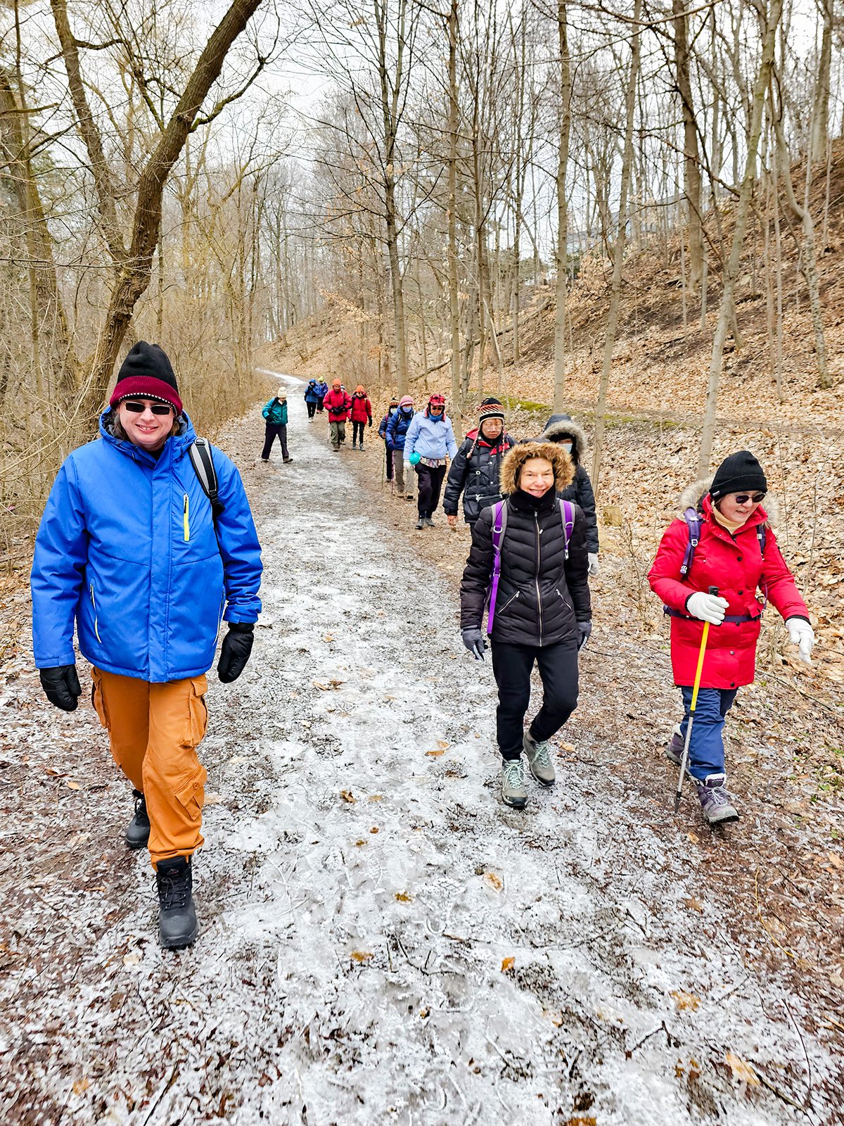
Register individually for one, a few, or all of the Frosty 5 and 60 for the 60th Anniversary Badge Combo hikes. Participants who complete five hikes will be eligible to receive a CHBTC Winter badge and a 60th Anniversary badge. This hike explores trails within the Forks of the Credit Provincial Park. Bring your choice of hydration and snacks. Hiking boots and icers/crampons are required. Hikes in the series take place on select Wednesdays and Sundays. (Note: If you wish to purchase badges, the cost of each badge is $10.00 for BTC members and $15.00 for non-members.)
Urban Walk: Waterfront Trail 7/8 - Brimley
https://hikesstaging.brucetrail.org/event/urban-walk-waterfront-trail-7-8-brimley-3/Sorry, the registration cut-off time for this hike has been reached.Not a member? Click here to join today!Hosting Club: Toronto
Category: Urban Walk
Location (Google Maps): Scarborough Waterfront TrailHike Leader(s): Brian Rideout Click here to contact Hike Leader(s)
Pace: Moderate
Distance: 11.4 km
Description
Please join me at Kennedy Station by 10:15 am. We will take the 12 Kingston Rd bus departing 10:30 am, arriving 10:45 am.We will hike along Kingston Rd, down to and east olong the Lake on the Doris MacCarthy Trail to Guildwood and then to Beechgrove Dr. The estimated distance is 11.4 km. Here is an online map of our route – Brimley to BeechgroveBring a snack, at least 2 liters of water, and icers. Dress for cold weather. - 04March 4, 2024
9:00 Beamsville Hike
https://hikesstaging.brucetrail.org/event/900-beamsville-hike-2/Sorry, the registration cut-off time for this hike has been reached.Not a member? Click here to join today!Hosting Club: Niagara
Category: In and Out
Location (Google Maps): Parking lot for Kinsmen Park, BeamsvilleHike Leader(s): Kathleen Manson Click here to contact Hike Leader(s)
Pace: Fast
Terrain: Moderate
Distance: 10Description
We will be walking the Bruce Trail in Beamsville. The group will decide which direction to go in.Inglis Falls and Smith Bush
https://hikesstaging.brucetrail.org/event/inglis-falls-and-smith-bush-2/Sorry, the registration cut-off time for this hike has been reached.Not a member? Click here to join today!Hosting Club: Sydenham
Category: General Hike
Location (Google Maps): Meet in the parking lot behind the Grey-Sauble Conservation Authority head office.
237897 Inglis Falls Road, Owen SoundHike Leader(s): Franziska Edney Click here to contact Hike Leader(s)
Pace: Medium: 3 to 4 km/h
Terrain: Strenuous: Hilly with steep climbs and some poor footing., There might be icy and slippery sections.
Distance: 5.2 kmDescription
We will hike a loop from the GSCA parking lot along the blue and white trail to Inglis Falls, enjoy the sights, and cross the road into Smith Bush. There we will follow the white trail again to Grey Rd 5 and finish the loop on the blue Creamery Hill Side trail back to the cars. The climb up to the falls has a steep section, icers might be needed, or snow shoes, depending on the weather and conditions. Poles are advised. Map 32. If you have questions, contact the hike leader at 519 379 2573. - 05March 5, 2024
Urban hike: Valley View Park Thornhill
https://hikesstaging.brucetrail.org/event/urban-hike-valley-view-park-thornhill-2/Sorry, the registration cut-off time for this hike has been reached.Not a member? Click here to join today!Hosting Club: Toronto
Location (Google Maps): Parking lot at the corner of Bayview Ave, and Sycamore Dr. South of Highway 7
Hike Leader(s): Mohammad Aghamiri Click here to contact Hike Leader(s)
Pace: Moderate
Terrain: Hilly
Distance: 7-8 kmDescription
We will explore Valleyview and Huntington park and walk along German Mill Creek,It is winter time and trail is hilly bring proper clothing, ,hiking boots ,and ice cleats.
9:00 Rockway Long Hike
https://hikesstaging.brucetrail.org/event/900-rockway-long-hike/Sorry, the registration cut-off time for this hike has been reached.Not a member? Click here to join today!Hosting Club: Niagara
Category: In and Out
Location (Google Maps): Meet at Rockway Parking lot on Pelham RdHike Leader(s): Lynskie Click here to contact Hike Leader(s)
Pace: Medium
Terrain: Strenuous
Distance: +/- 10kmsDescription
To avoid the muddy conditions, we will be meeting at Rockway Parking lot instead of Short Hills. We’ll hike out for 75 minutes then back to the parking lot. Bring water, poles, and icers if slippery. Please check the weather and dress appropriately.
9:15 Short Hike - Short Hills Park, Pelham Rd
https://hikesstaging.brucetrail.org/event/short-hike-short-hills-park-pelham-rd-4/Sorry, the registration cut-off time for this hike has been reached.Not a member? Click here to join today!Hosting Club: Niagara
Category: Loop
Location (Google Maps): Short Hills Provincial Park, Pelham Rd. St CatharinesHike Leader(s): Debbie Demizio Click here to contact Hike Leader(s)
Pace: Medium
Terrain: Moderate
Distance: 6kDescription
Hike the main and side trails of Short Hills Provincial Park. Bring hiking boots, icers, and water. This hike qualifies for the Winter hiking badge. See website for details. https://niagarabrucetrail.club/badges/Speyside, Map 12
https://hikesstaging.brucetrail.org/event/speyside-map-12-5/Sorry, the registration cut-off time for this hike has been reached.Not a member? Click here to join today!Hosting Club: Caledon Hills
Category: Tuesday Hikers
Location (Google Maps): Pear Tree parking lot, 15 Sideroad.
Driving directions: From Highway 401 going west, turn right (north) on Road 25, left on 15 Sideroad, drive about 300 m to Pear Tree parking lot on the left.Hike Leader(s): Mohammad Shafiq
Pace: Medium – 3 to 4 km/hour
Terrain: Moderate – some hills and/or some poor footing
Distance: 12 kmDescription
Will hike southwards from the parking lot, main Bruce Trail, Al Shaw Side Trail and parts of Hilton Falls Side Trail, there and back.
Dress according to weather, poles are recommended, keep icers in the bagpack.
Bring water and snack.
Hike leaders phone contact for hiking day: 416-566-0503The Dingle Trail, Caledon
https://hikesstaging.brucetrail.org/event/the-dingle-trail-caledon-2/Sorry, the registration cut-off time for this hike has been reached.Not a member? Click here to join today!Hosting Club: Dufferin Hi-Land
Category: Tuesday Hike
Location (Google Maps): Caledon Hills, Map 17
Meet at parking on Innis Lake Rd, just north of Finnerty Sideroad (31.7)Hike Leader(s): Julie Daley, Les Babbage, Inge Eckerich, Tony Evangelista Click here to contact Hike Leader(s)
Pace: Medium
Terrain: Dependent on Conditions, Moderate, Slippery and Steep Sections
Distance: 8 km, short hike 3kmDescription
We will hike north to the end of Innis Lake Rd, where we enter the Dingle. After 3 km we will hike a short portion of the Oak Ridges Moraine Trail to a lookout, then return along the main trail. The shorter hike will turn back as we enter the Dingle. Please come prepared for the weather and bring a snack.