
Hike Schedule
Join us for a hike! Registration required.
All hikes available to BTC members. Some hikes are open to non-members.
See Refund Policy for Paid Hikes >
TIP: The calendar view displays up to 7 hikes on a day, but often there are more. Click “View more events” to see them all.
Categories
- 14March 14, 2024
Urban Walk: Valley View Park Thornhill
https://hikesstaging.brucetrail.org/event/urban-walk-valley-view-park-thornhill-16/Sorry, the registration cut-off time for this hike has been reached.Not a member? Click here to join today!Hosting Club: Toronto
Location (Google Maps): Parking lot at the corner of Bayview Ave, and Sycamore Dr. South of Highway 7
Hike Leader(s): Mohammad Aghamiri Click here to contact Hike Leader(s)
Pace: Moderate
Terrain: Hilly
Distance: 7-8 kmDescription
We will explore Valleyview and Huntington park and walk along German Mill Creek,It is winter time and trail is hilly bring proper clothing, ,hiking boots ,and ice cleats.
9:00 am Long Hike Jordan to Moyer / Louth
https://hikesstaging.brucetrail.org/event/900-am-long-hike-jordan-to-moyer-louth-61/Sorry, the registration cut-off time for this hike has been reached.Not a member? Click here to join today!Hosting Club: Niagara
Location (Google Maps):
Jordan Hollow Park 3039 King St Jordan
Pace: Medium
Terrain: Moderate
: 10kDescription
From Jordan Hollow Hike the main trail to Upper and Lower Balls Falls, Moyer Road or Louth and Return. You must register for each hike. Bring Poles, sunscreen, bug spray , snack and a drink and dress for the weather
9:15 Short Hike, Jordan Hollow
https://hikesstaging.brucetrail.org/event/915-short-hike-jordan-hollow-100/Sorry, the registration cut-off time for this hike has been reached.Not a member? Click here to join today!Hosting Club: Niagara
Category: Loop
Location (Google Maps): Jordan Hollow Park, 3039 King St., Jordan StationPace: Medium
Terrain: Moderate
Distance: ~ 6kmsDescription
Hike the main and side trails around Jordan and Ball’s Falls. Bring hiking boots, water and icers. This hike qualifies for the Winter hiking badge. See website for details. https://niagarabrucetrail.club/badges/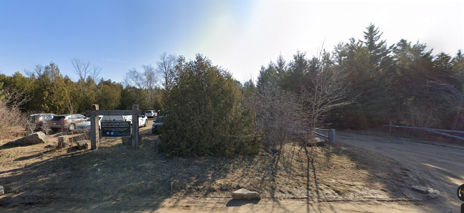
Fletcher Creek Preserve, Puslinch, HCA Property
https://hikesstaging.brucetrail.org/event/fletcher-creek-preserve-puslinch-hca-property-4/Sorry, the registration cut-off time for this hike has been reached.Not a member? Click here to join today!Hosting Club: Iroquoia
Category: General Hike
Location (Google Maps):Park at Fletcher Creek Ecological Preserve on Concession 7 just north of Gore Rd , Puslinch
HCA passes can be used or $8.00 per vehicleHike Leader(s): Cathie Green Click here to contact Hike Leader(s)
Pace: Medium – 3 to 4 km/hr
Terrain: Easy – Mostly flat and usually good footing
Distance: Approx. 10 kmsDescription
Easy, Moderate hike – Fletcher’s Creek Preserve is an abandoned quarry site that has been rehabilitated and is located at the headwaters of the Spencer Creek watershed
We will loop hike through the preserve as well as an adjacent trail that also was part of the quarry back in the day-lots of local history- it was the area swimming hole and some still use it.
Wear appropriate clothing and footwear for the weather-could be wet. Bring water, snack, hiking poles, cell
Please feel free to call or text me if you have any concerns or questions Cathie 416-931-2095 cathiekygreen@gmail.com
10;00 Merrit island loop
https://hikesstaging.brucetrail.org/event/1000-merrit-island-loop/Sorry, the registration cut-off time for this hike has been reached.Not a member? Click here to join today!Hosting Club: Niagara
Category: Loop
Location (Google Maps): Merritt Island Park. Go North on Cross street to parking lot and play ground. Pass library on your right. Keep going.Hike Leader(s): Sylvia Wheeler Click here to contact Hike Leader(s)
Pace: Leisurely
Terrain: Easy
Distance: 10 kmDescription
Hike along the Welland Canal on paved and mud free trails - 15March 15, 2024
9:00 am Niagara-on-the-Lake Tour
https://hikesstaging.brucetrail.org/event/900-am-niagara-on-the-lake-tour-20/Sorry, the registration cut-off time for this hike has been reached.Not a member? Click here to join today!Hosting Club: Niagara
Location (Google Maps): Veterans Memorial Park, park just outside the park on King Street
Hike Leader(s): Robin Garrett Click here to contact Hike Leader(s)
Pace: Medium
Terrain: Easy
Distance: 6-7 kmDescription
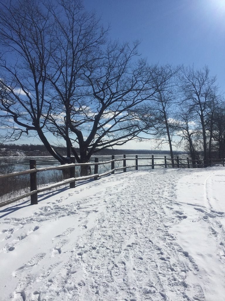
Each Friday we will explore different neighbourhoods, trails and parkland throughout Historic Niagara-on-the-Lake.Moderate pace with some weeks entirely on sidewalks and roads while others may include a mix of trails and paved pathways. Great way to build up endurance for longer more strenuous hikes.
Prepare for cooler windy conditions on open parkland and along Lake Ontario and Niagara River trails.
Plan to stay for conversation and a warm cup of coffee or tea at Sweets & Swirls, Community Centre, Niagara Stone Road, NOTL
Spring & Migration Monitor Hike
https://hikesstaging.brucetrail.org/event/spring-migration-monitor-hike-3/Sorry, the registration cut-off time for this hike has been reached.Not a member? Click here to join today!Hosting Club: Peninsula
Location (Google Maps): Km 106 in the 31st Ed Ref Manual, at the Cape Chin North mail boxes before going down the escarpment
Hike Leader(s): Tamara Wilson Click here to contact Hike Leader(s)
Pace: Leisurely
Terrain: Difficult
Distance: 6kmDescription
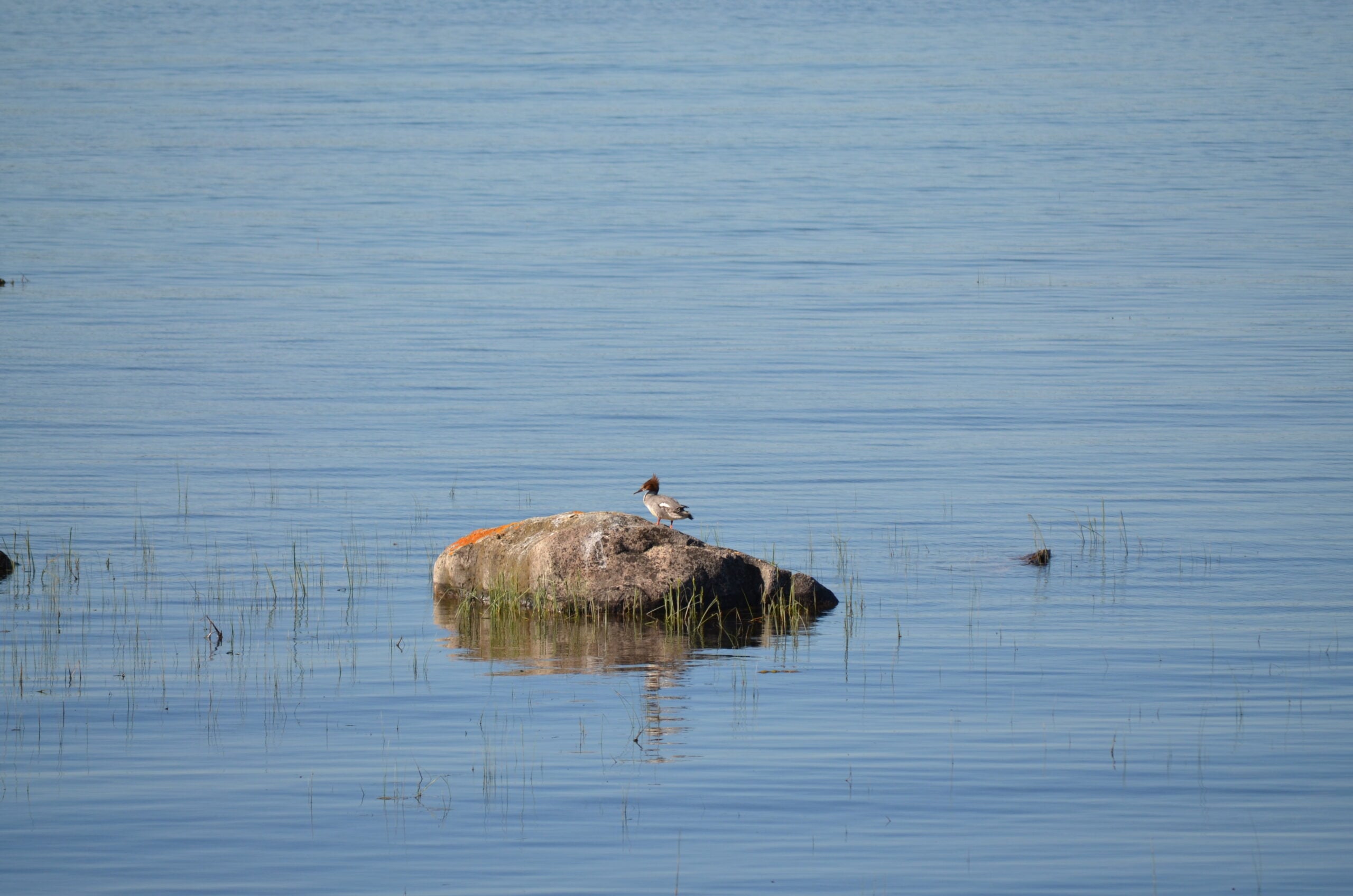
Leaving the Cape Chin N mailbox parking area, we will progress south on the Main Trail to km 104.3 and head left on Cape Chin Meadows ST, crossing Cape Chin Rd N to the Otter Lake ST at . We will hike to the birding platform, spending a few minutes to take in any new migration arrivals and harbingers of spring. After a break at the birding platform we will continue on Otter Lake ST back to our parked cars. Depending on what we see, this hike could take up to 2 hours. Note: though a short distance, the ground will be rocky and uneven in places. Along the shores of Otter Lake, there could be some mud. - 16March 16, 2024
Car Hike: Hike of 2 lakes King city
https://hikesstaging.brucetrail.org/event/car-hike-hike-of-2-lakes-king-city-12/Sorry, the registration cut-off time for this hike has been reached.Not a member? Click here to join today!Hosting Club: Toronto
Location (Google Maps): Park along Fairfield Dr. or Dufferin Street, Gather at trail head on Dufferin Street.
HIKE STARTS 8:AMHike Leader(s): Mohammad Aghamiri Click here to contact Hike Leader(s)
Pace: Moderate
Terrain: Variable
Distance: 14-17KMDescription
We will hike in trails around Seneca lake and Mary Lake,pass by Eaton and visit Pine farm where you can enjoy coffee,tea,apple pie during our snack time.Some safety procedures during the hike:
1-Hikers must stay between the leader and the sweep.
2-Hikers must advise the leader or the sweep if they wish to leave the group.
3- Hikers must follow the whistle instructions: 1 blast- stay where you are; 2 blasts come to the leader; 3 blasts – come to the leader quickly.
4-Hike leader may request volunteers to stop at trail intersections, they need to help hikers to the direction the group walk and wait till they see the sweep .
5-Hikers have to make sure they can see the persons behind and in front of them.
CANCELLED Winter Coach Trip: Highlands Nordic (Duntroon)
https://hikesstaging.brucetrail.org/event/winter-coach-trip-highlands-nordic-duntroon-4/Sorry, the registration cut-off time for this hike has been reached.Not a member? Click here to join today!Hosting Club: Toronto
Category: Cancelled
Location (Google Maps): Highlands NordicHike Leader(s): Martina Furrer, Duro Vukman, Celia Ho Click here to contact Hike Leader(s)
Description
Cancelled because spring appears to be here to stay.Bus departs 10 York Mills Rd at 8:30 AM and Major Mackenzie Dr and HWY 400 Park and Ride at 8:50 AM. If you wish to be picked up at the Major Mackenzie Dr and HWY 400 Park and Ride, select that option when you register. Please arrive 15 minutes before departure. The bus waits for no one.
Join us for an awesome day of x-country skiing and snowshoeing/winter hiking. For trail conditions and information about the resort visit https://highlandsnordic.ca/.
Snowshoers: Join Duro and Celia for a guided snowshoe hike on the beautiful Bruce Trail. You must have your own snowshoes (or rent in the city) to participate in this hike. Pack lunch and water; you will be on the trail all day.
Skiers: Spend your day gliding through forests and fields on trails expertly groomed for classic and skate skiing. Enjoy beautiful views of the countryside and Georgian Bay. All skiing is self-guided.
Coach fares must be paid online when you register. Trail fees will be collected in cash on the bus. Masks are recommended while on the bus.
Hiking 101
https://hikesstaging.brucetrail.org/event/hiking-101/Sorry, the registration cut-off time for this hike has been reached.Not a member? Click here to join today!Hosting Club: Toronto
Category: Car Hike
Location (Google Maps): Meeting Location
GPS N:43.307417, W:79.911580 – on the north end of Old Gueph Rd. Hamilton, Ontario. – From Hwy 403 take exit to Hwy 6 North, then take ramp towards Old York Rd. Turn left at Old Guelph Rd. to parking lot. Please arrive fifteen minutes early.Hike Leader(s): Ross Estrella Click here to contact Hike Leader(s)
Pace: Moderate
Terrain: Variable
Distance: 12 kmsDescription
Hiking 101Now that warm weather is fast approaching you may want to prepare to enjoy the outdoors. This special trip is for those interested in learning the basics of hiking and how to make the most of your hiking experience. This is (OTTLT) – on the trail learning and training. We’ll cover the essentials – the gears you need, hiking tips and trail etiquette. Learn the different type gears and what to expect during the hikes. We’ll cover the importance of Mountaineers/Hikers Creed! – Take nothing but pictures, Leave nothing but footprints, and Kill nothing but time. These principles will help preserve the natural beauty of our trails for generation to come. At the end of this trip, you’ll have the knowledge and confidence you need to get out there and hit our amazing trails! Whether you’re a beginner looking to explore or a seasoned hiker who just need a refresher, this Hiking 101 is perfect for you. You’ll have the oppurtunity to connect with other experts and make new friends. You’ll learn more about the Bruce Trail. During this trip we’ll do a 12 km in/out hike, on a moderate terrain at medium pace. Please bring snack/lunch, 2 liter of water. Sunscreen, sun head protection, bug spray and hiking poles if available. Wear appropriate clothing for the weather and hiking shoe.
9:00 Louth Conservation
https://hikesstaging.brucetrail.org/event/900-louth-conservation/Sorry, the registration cut-off time for this hike has been reached.Not a member? Click here to join today!Hosting Club: Niagara
Category: In and Out
Location (Google Maps): Meet at Louth Conservation area parking lot on Staff Ave. Hike east to Effingham Rd and back.Hike Leader(s): Vince Zvonar Click here to contact Hike Leader(s)
Pace: Medium
Terrain: Strenuous
Distance: 12Description
Petun Conservation Area
https://hikesstaging.brucetrail.org/event/petun-conservation-area-3/Sorry, the registration cut-off time for this hike has been reached.Not a member? Click here to join today!Hosting Club: Blue Mountains
Category: Register in person the morning of hike.
Location (Google Maps): Hike meets in the parking lot behind Tim Hortons on First St. in Collingwood.Hike Leader(s): Annette Sandberg Click here to contact Hike Leader(s)
Pace: Medium – 3 to 4 km/hr
Terrain: Moderate – Some hills and/or some poor footing
Distance: 7.3 kmDescription
We will park on the 2nd Line where we will start the hike to the Petun Conservation area. Here we meet up with the Petun Side Trail at the top of Osler
Bluff and will follow the blue blazed trail to form a loop back to the cars. Bring a snack or
lunch and water.
9:30 Chloe Cooley Commemorative Hike
https://hikesstaging.brucetrail.org/event/930-chloe-cooley-commemorative-hike-2/Sorry, the registration cut-off time for this hike has been reached.Not a member? Click here to join today!Hosting Club: Niagara
Category: In and Out
Location (Google Maps): Queenston Heights Park, Niagara River Parkway, Niagara-on-the-LakeHike Leader(s): Karen Couch Click here to contact Hike Leader(s)
Pace: Medium
Terrain: Easy
Distance: 7 kmsDescription
Chloe Cooley’s brave act of resistance on 14 MAR 1793, paved the way to freedom for so many Black enslaved men, women and children like her. This set the stage for the great freedom movement of enslaved African Americans known as the Underground Railroad. We will hike to where her bravery took place. This hike will take us along the General Brock Side Trail (GBST) and on then on the Niagara Parkway (NP). The GBST’s terrain is hilly/moderate, whereas the NP is flat/easy. We will then retrace our steps back.The terrain may be icy and/or snow covered. Hiking poles and icers are advised, depending on the conditions.
PLEASE NOTE: This hike counts as 1 of the 3 required hikes towards the Black History badge. If you will have hiked 3 hikes in this series, and are interested in receiving a badge, remember to bring your $10. This applies to anyone who has not already received this badge.
For more information about Chloe Cooley click on the link below.
https://www.ctvnews.ca/lifestyle/canada-post-honours-chloe-cooley-with-stamp-for-black-history-month-1.6256243
Car Hike: Scotsdale Farm
https://hikesstaging.brucetrail.org/event/car-hike-scotsdale-farm-5/Sorry, the registration cut-off time for this hike has been reached.Not a member? Click here to join today!Hosting Club: Toronto
Category: Car Hike
Location (Google Maps): Scotsdale Farm, Map 13Hike Leader(s): Al Brown Click here to contact Hike Leader(s)
Pace: Moderate
Terrain: Variable
Distance: 13 kmDescription
We will complete a loop hike on the mail Bruce Trail and side trails including the Great Esker side trail. Trail conditions are expected to be late winter/early spring. After the hike those interested are invited to meet at the Shepard’s Crook in Georgetown for refreshments.Directions: From the 4o1 go north on Trafalgar Road pasts Georgetown. Trafalgar merges with Hwy 7 for about 3 km then separates to the right at the village of Silver Creek. From the stop light at Silver Creek go north on Trafalgar about 1 km to the entrance of Scotsdale Farm on your right. Drive in to the parking area about half a km.
- 17March 17, 2024

Urban Walk: Wincott Wetland and Humber Creek to Historic Lambton House, St. Patrick's Day Hike
https://hikesstaging.brucetrail.org/event/urban-walk-wincott-wetland-and-humber-creek-to-historic-lambton-house-st-patricks-day-hike/Sorry, the registration cut-off time for this hike has been reached.Not a member? Click here to join today!Hosting Club: Toronto
Category: Urban Walk
Location (Google Maps): 125 metres west of Dixon Road & Islington Avenue intersection, south side at entrance to Wincott Park. If arriving early, meet me at the Tim Hortons inside the No Frills Plaza SE corner at 10 am to use the washrooms and to stay warm. We will leave the Tim Hortons at 10:20 to walk to Wincott Park entrance. If driving to the hike, park on Northcrest Road, assessable via Fenley Dr and Poynter Dr from Islington Ave. Follow the path around the pond to the entrance of the park at Dixon Road to meet the group. Transit users can come either via Islington Bus 37 from Islington Subway running every 11 minutes or via Lawrence West Bus 52 to Pearson Airport running every 12 minutes.Hike Leader(s): Andrew Proczek Click here to contact Hike Leader(s)
Pace: Moderate
Terrain: Flat, Variable
Distance: 10 – 13 kmDescription
This is a partial repeat of my January hike along the little known Humber Creek, except that this time we will not be crossing the Humber River to the east side at Raymore Park but heading south along the Humber Trail to James Gardens and finishing at Historic Lambton House on Old Dundas Street. Lambton House is the last remaining building from the former Humber River hamlet of Lambton Mills and will be open for family St. Patrick’s Day festivities. For those interested in extending the hike, I will lead us another 3 km to Old Mill Road where those wanting to access the Subway can walk up to Old Mill Station and the rest of us wanting a post hike fellowship pub stop can join me at Bryden’s (Jane & Bloor).Washrooms at Tim Hortons (0 km); James Gardens (7.5 km); and Lampton House (10 km)
The route: https://onthegomap.com/s/ekhvi4ot

1:00pm St. Patrick's Day Family Hike
https://hikesstaging.brucetrail.org/event/100pm-st-patricks-day-family-hike/Sorry, the registration cut-off time for this hike has been reached.Not a member? Click here to join today!Hosting Club: Niagara
Category: In and Out
Location (Google Maps): Glenridge Quarry Naturalization Site – 1860 Sir Isaac Brock Way, St. Catharines, ONHike Leader(s): Faye Perkins Click here to contact Hike Leader(s)
Pace: Leisurely
Terrain: Moderate
Distance: 7 kmDescription
The ‘green’ of St. Patrick’s Day reminds us of the Emerald Isle of Ireland, that spring is nearly here, and the importance of nature around us. Lucky us, to have the beauty of the Bruce Trail connected to the Glendridge Quarry Naturalization geosite and the work of the Niagara GeoPark that seamlessly connects our urban and natural environments. Come join us for a hike through this central geosite and along the Escarpment to Hydro Hill, and then back through the Brock Univeristy campus. The hike is organized for different abilities, and will provide parents and others the opportunity to adapt the hike to their physical needs. Listening to music from Ireland prior to the hike is recommended. Wear something green to welcome spring!Nels Maher and Edmonstone loops
https://hikesstaging.brucetrail.org/event/nels-maher-and-edmonstone-loops/Sorry, the registration cut-off time for this hike has been reached.Not a member? Click here to join today!Hosting Club: Sydenham
Category: General Hike
Location (Google Maps): GXTHike Leader(s): Danuta Valleau Click here to contact Hike Leader(s)
Pace: Leisurely: 3 km/h or less
Terrain: Moderate: Some hills and/or poor footing
Distance: 3 kmDescription
Deep snow will require snowshoes, icy conditions will require non-slip soles/icers.We will carpool to Kemble and start of Nels Maher Side Trail which leads through mixed forest to join the main trail at km 143.9. First part is easy. The main trail skirts the escarpment crossing Kemble Rock Rd., and the Edmonstone Side trail at km 145.7 will return us to the parking area. We may see early wildflowers, as well as many fern species, including the at risk Hart’s Tongue Fern.