
Hike Schedule
Join us for a hike! Registration required.
All hikes available to BTC members. Some hikes are open to non-members.
See Refund Policy for Paid Hikes >
TIP: The calendar view displays up to 7 hikes on a day, but often there are more. Click “View more events” to see them all.
Categories
- 23February 23, 2024
Car Hike: Caledon E2E and winter badge 4/4
https://hikesstaging.brucetrail.org/event/car-hike-caledon-e2e-and-winter-badge-4-4-2/Sorry, the registration cut-off time for this hike has been reached.Not a member? Click here to join today!Hike open to BTC Members only.
Hosting Club: Toronto
Category: Car Hike
Location (Google Maps):Km 51.8 Coordinates N 43.993572,W 80.014057
Hike Leader(s): Smadar Junkin Click here to contact Hike Leader(s)
Pace: Brisk
Terrain: Challenging, Variable
Distance: 21Description
Last hike in the series. Badges day. We will shuttle to the end of the Caledon section and walk back on the new section of the trail. Bring snowshoes and icers. Bring 2 litres of water. Check your email for change of date because of bad weather. We will follow covid 19 rules.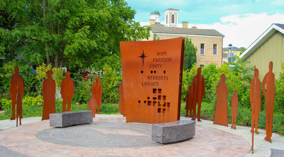
9:00 NOTL BLACK HISTORY SERIES – #4 of 4: The Early Niagara Community
https://hikesstaging.brucetrail.org/event/900-notl-black-history-series-4-of-4-the-early-niagara-community/Sorry, the registration cut-off time for this hike has been reached.Not a member? Click here to join today!Hosting Club: Niagara
Category: Urban
Location (Google Maps):Veteran’s Memorial Park, Park on King St (at Centre) just outside the park
Hike Leader(s): Robin Garrett Click here to contact Hike Leader(s)
Pace: Medium
Terrain: Easy
Distance: 6 kmDescription
Since 1995, the government in Canada officially recognized February as Black History Month; a time when Canadians are invited to reflect, educate and engage in the ongoing fight against anti-Black racism and discrimination. During this and the other hikes in this series, you will learn about some of those who fought enslavement, and how they were pivotal in shaping our society to be as diverse as it is today.Check out this link for a brief overview of this topic by the Niagara-on-the-Lake Museum.
Wear extra warm clothing given that we will be stopping several times. While the terrain is easy, consider bringing your poles and/or micro spikes when the terrain is icy.
Please note: Hikes are offered by volunteers who have committed to their own learning to be able to offer informative and contemplative hike experiences. These hikes are open to all and offered in a spirit of mutual learning and inclusion.
9:15 NOTL BLACK HISTORY SERIES - #4 of 4: The Early Niagara Community
https://hikesstaging.brucetrail.org/event/915-notl-black-history-series-4-of-4-the-early-niagara-community/Sorry, the registration cut-off time for this hike has been reached.Not a member? Click here to join today!Hosting Club: Niagara
Category: Urban
Location (Google Maps):Veteran’s Memorial Park. Park on King St. at Centre
Hike Leader(s): Karen Couch Click here to contact Hike Leader(s)
Pace: Medium
Terrain: Easy
Distance: 5.2 kmDescription
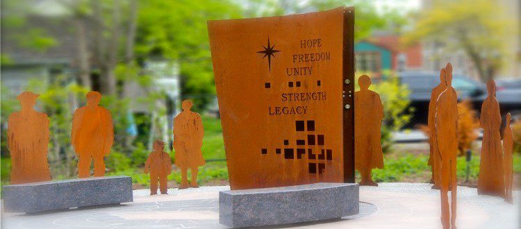
Since 1995, the government in Canada officially recognized February as Black History Month; a time when Canadians are invited to reflect, educate and engage in the ongoing fight against anti-Black racism and discrimination. This hike will give us an opportunity to celebrate the strength and perseverance of the early Black community**Wear extra warm clothing as we will be stopping several times.
**While the terrain is easy, consider bringing your walking sticks and/or footwear with micro spikes. Sidewalks and streets may be icy.
PLEASE NOTE: Hikes are offered by volunteers who have committed to their own learning to be able to offer informative and contemplative hike experiences. These hikes are open to all and offered in a spirit of mutual leaning and inclusion.
9:30 NOTL BLACK HISTORY SERIES - #4 of 4: The Early Niagara Community
https://hikesstaging.brucetrail.org/event/930-notl-black-history-series-4-of-4-the-early-niagara-community-2/Sorry, the registration cut-off time for this hike has been reached.Not a member? Click here to join today!Hosting Club: Niagara
Category: Urban
Location (Google Maps):Veteran’s Memorial Park. Park on King St. at Centre
Hike Leader(s): Suzanne Gourluck Click here to contact Hike Leader(s)
Pace: Medium
Terrain: Easy
Distance: 5.2 kmDescription
Since 1995, the government in Canada officially recognized February as Black History Month; a time when Canadians are invited to reflect, educate and engage in the ongoing fight against anti-Black racism and discrimination. This hike will give us an opportunity to celebrate the strength and perseverance of the early Black community**Wear extra warm clothing as we will be stopping several times.
**While the terrain is easy, consider bringing your walking sticks and/or footwear with micro spikes. Sidewalks and streets may be icy.
PLEASE NOTE: Hikes are offered by volunteers who have committed to their own learning to be able to offer informative and contemplative hike experiences. These hikes are open to all and offered in a spirit of mutual leaning and inclusion.
#1/4 Feb 23 -26 Sydenham Bruce Trail - Boyd Crevice Hike 6KM
https://hikesstaging.brucetrail.org/event/sydenham-bruce-trail-boyd-crevice-hike-6km/Sorry, the registration cut-off time for this hike has been reached.Not a member? Click here to join today!Hosting Club: Toronto, Sydenham
Category: Car Hike
Location (Google Maps): 11th Concession & CP Rail TrailHike Leader(s): Alina Lin Click here to contact Hike Leader(s)
Pace: Moderate
Terrain: Challenging, Hilly, Rocky
Distance: 6KMDescription
This is one of the four day hikes scheduled from Feb 23 to 26. If you are interested in participating in all four hikes and staying in an Airbnb with some of us, please reach out to me.
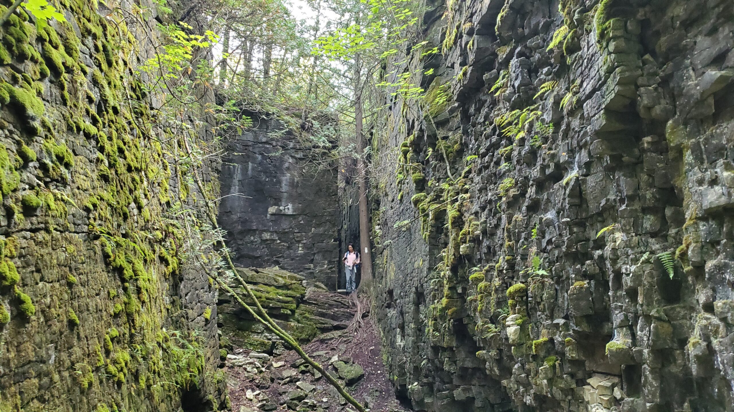
Meetup location: parking where 11th Concession intersects the rail trail. GPS coordinates: 44.553479, -80.908903. This will be a go-and-back hike along the Bruce Trail main trail starting from 11th Concession to 10th Concession. We will stop at the Boyd Crevices for photo break and admire the spectacular crevices between those giant dolostone blocks.
It may not be clear ahead of time whether snowshoes are needed or just icers will be sufficient. Come prepared for anything. Icers/microspikes are a must-have.
- 24February 24, 2024
Car Hike: Cherry Beach Downtown Toronto
https://hikesstaging.brucetrail.org/event/car-hike-cherry-beach-downtown-toronto-5/Sorry, the registration cut-off time for this hike has been reached.Not a member? Click here to join today!Hosting Club: Toronto
Location (Google Maps): Cherry Beach Parking Lot, at the foot of Cherry Street (Free Parking)
Hike Leader(s): Mohammad Aghamiri Click here to contact Hike Leader(s)
Pace: Moderate
Terrain: Flat
Distance: 14-17KMDescription
We will hike along the waterfront trail. Dress warmly, bring icers and hot drinks.Some safety procedures during the hike:
1-Hikers must stay between the leader and the sweep.
2-Hikers must advise the leader or the sweep if they wish to leave the group.
3- Hikers must follow the whistle instructions: 1 blast- stay where you are; 2 blasts come to the leader; 3 blasts – come to the leader quickly.
4-Hike leader may request volunteers to stop at trail intersections, they need to help hikers to the direction the group walk and wait till they see the sweep .
5-Hikers have to make sure they can see the persons behind and in front of them.
Car Hike: Caledon section
https://hikesstaging.brucetrail.org/event/car-hike-caledon-winter-badge/Sorry, the registration cut-off time for this hike has been reached.Not a member? Click here to join today!This is a Multi-Day Hike
You are signing up for the following dates and times:
2024-02-24 at 09:00
2024-03-02 at 09:00Hosting Club: Toronto
Category: Car Hike
Location (Google Maps): Caledon Bruce trailHike Leader(s): Lindita Kalo Click here to contact Hike Leader(s)
Pace: Fast, Moderate
Terrain: Variable
Distance: 8-13KmDescription
If you working on Caledon 60th anniversary badge those hikes are for you. Distance and coordinate to meet will be e- mailed after registering. Loops or drive back to cars.
Hikers should anticipate winter conditions-boots,icers,snow shoes if needed.We will take turns shttling from meeting place and take the shuttle driver back to their cars when neeed.
We will hike within 3-4k per hour. Please ensure you are physically able to manage pace and distance on winter conditions. Please be true of your physical level.The leader may change the hike dates due to winter conditions. Closer to hike dates more detail e-mail will be send to hikers.
Arrive 15 minutes early. Some paid parking.Cancelled: Winter Coach Trip: Mansfield Outdoor Centre
https://hikesstaging.brucetrail.org/event/winter-coach-trip-mansfield-outdoor-centre/Sorry, the registration cut-off time for this hike has been reached.Not a member? Click here to join today!Hosting Club: Toronto
Category: Cancelled
Location (Google Maps): Mansfield Outdoor CentreHike Leader(s): Martina Furrer, Brenda Dalglish, Celia Ho Click here to contact Hike Leader(s)
Description
Bus departs 10 York Mills Rd at 9:00 AM and Major Mackenzie Dr and HWY 400 Park and Ride at 9:20 AM. If you wish to be picked up at the Major Mackenzie Dr and HWY 400 Park and Ride, select that option when you register. Please arrive 15 minutes before departure. The bus waits for no one.Join us for an awesome day of x-country skiing and snowshoeing/winter hiking. For trail conditions and information about the resort visit: https://mansfieldoutdoorcentre.ca/
Snowshoers: Join Brenda and Celia for a guided snowshoe hike at beautiful Mansfield. Pack lunch and water; you will be on the trail all day.
Skiers: Spend your day gliding through Mansfield’s forests and fields on trails expertly groomed for classic and skate skiing. All skiing is self-guided.
Classic ski ($35 + HST) and snowshoe ($25 + HST) rentals available; quantities are limited.
Coach fares must be paid online when you register. Trail fees will be collected in cash on the bus. Masks are mandatory while on the bu
9:00 Niagara Glen Hike
https://hikesstaging.brucetrail.org/event/900-niagara-glen-hike-4/Sorry, the registration cut-off time for this hike has been reached.Not a member? Click here to join today!Hosting Club: Niagara
Category: Loop
Location (Google Maps): Meet at the Niagara Glen Nature Centre parking lot, 3050 Niagara Parkway, Niagara Falls. This is located between the Whirlpool Golf Course and the Niagara Botanical Gardens, on the river side of the Niagara Parkway. Parking fees may apply.Hike Leader(s): Dan Wilson Click here to contact Hike Leader(s)
Pace: Medium
Terrain: Strenuous
Distance: 10kmDescription
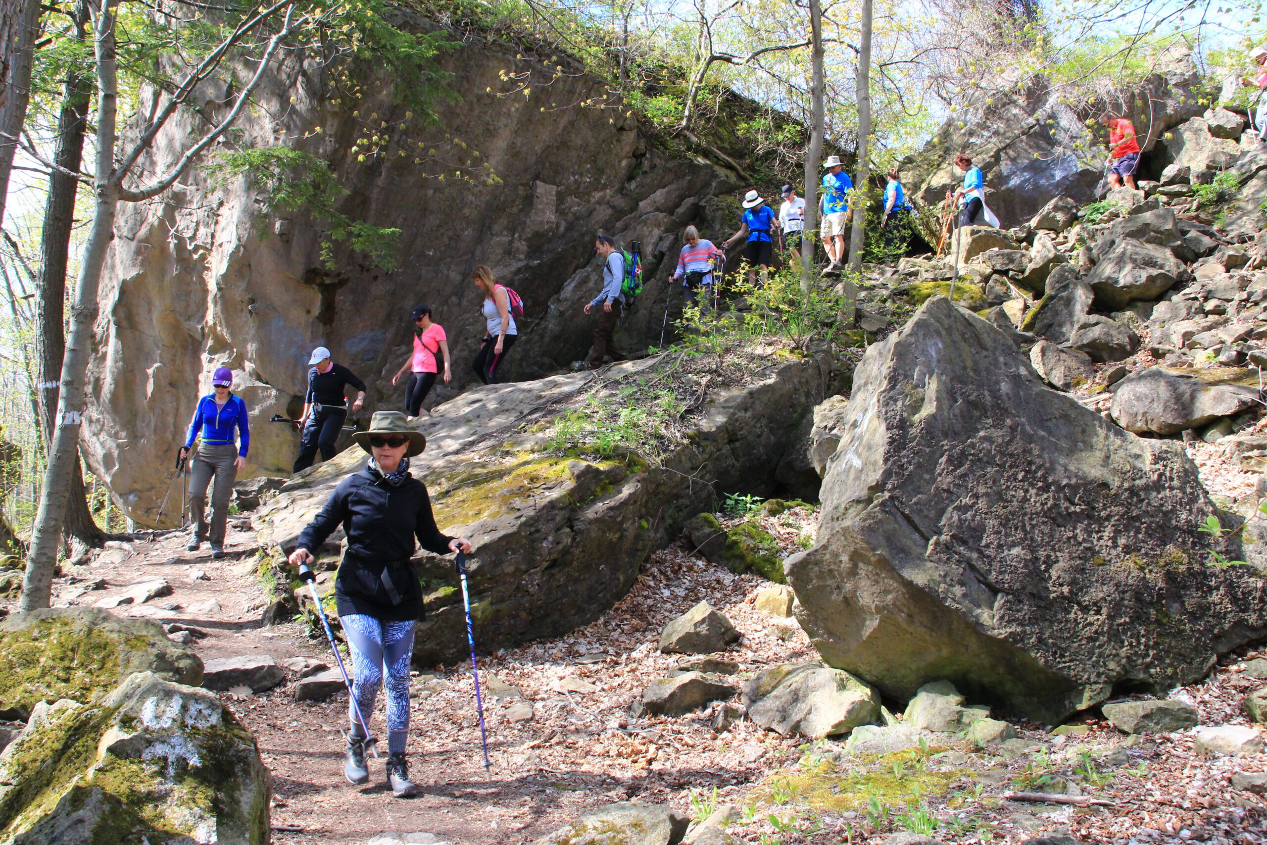
Hike deep in the Niagara Gorge, along stairways cut into the rock and rugged paths that wind through this pristine pocket of Carolinian Forest. View ancient geological formations and fossils dating back millions of years, while hiking along the turbulent rapids of the Niagara River. This is a strenuous hike and there is a chance hikers will get wet. Bring icers, gaiters and hiking poles, if necessary. Dress appropriately. 🙂Soup's On Hike! Quiet Valley
https://hikesstaging.brucetrail.org/event/soups-on-hike-quiet-valley/Sorry, the registration cut-off time for this hike has been reached.Not a member? Click here to join today!Hosting Club: Beaver Valley
Location (Google Maps): Meet in the laneway of Norine & Garth’s home, 412 Quiet Valley Road. GPS does not always go to this address properly so here are the details. Quiet Valley Road is south off Epping Road/Sideroad 19. To access Sideroad 19 from the west use Grey Rd. 7 just south of The John Muir/Epping lookout (Quiet Valley Rd will be off Sideroad 19 on your right down the big hill). To access Sideroad 19 from the east use Grey Rd. 13 south of Heathcote (Quiet Valley Road will be off Sideroad 19 on your left before the big hill).
Hike Leader(s): Norine Baron Click here to contact the hike leader.
Pace: Medium
Terrain: Moderate
Length of Hike: 2 hours, approx. 5 kmDescription
SOUP’S ON! Join us for a lovely snowshoe on the adjoining properties of Norine & Garth and Betty & Mike, where mature forest offers protection from the wind and views of Old Baldy may be seen if it’s a clear day. Afterward we’ll enjoy a warming lunch in Norine & Garth’s home. They will provide the soup, plus coffee & tea and you’ll bring a sandwich, or your choice of accompaniment to go with it. If you’d like to bring goodies to share for dessert, feel free! Folks are welcome to show up just for the lunch, or conversely, just for the hike. If you are there just for lunch, please arrive about 12:00p.m. We may still be on the trail. Depending on the conditions, we may use snowshoes, icers or just boots, so please come prepared.If you have any questions please contact beavervalleytrailactivities@gmail.com. The hike leader will inform the group in the morning on Fen. 24 if weather conditions preclude the hike. Hope to see you there! Please car pool if possible.COVID-19 Precautions for your Hike
- Each hiker joining a Bruce Trail Club organized hike must perform a self-screening check before hiking.
Find Ontario’s self-assessment tool here: https://covid-19.ontario.ca/self-assessment/ - If you are experiencing COVID-19 symptoms, stay home.
Transportation
All hikers are responsible for their own transportation to and from the hike.
Currently, there are no car shuttles on hikes – all hikes must be out-and-back or loop hikes.
Other Guidelines
- Arrive 15 minutes before the start of the hike.
- Wear sturdy footwear and appropriate attire for the weather and the terrain.
Hiking poles are a good idea in any season, especially if the terrain is rocky or slippery. In winter, snowshoes or icers/crampons are needed when conditions dictate.
Wearing appropriate clothing and footwear prevents injuries and shows consideration for a safe and positive group hiking experience. - Always carry I.D. and your health card.
- Bring sufficient water and snacks (or lunch if indicated). A minimum of 1L of water is recommended on all hikes, and 3L is recommended for long, challenging hikes in the heat of the summer.
- Bring sunscreen and insect repellent (for spring and summer hikes).
- Bring your own first aid kit.
- Please leave dogs at home.
#2/4 Feb 23 -26 Peninsula Bruce Trail - Jackson's Cove to Rush Cove - 14km
https://hikesstaging.brucetrail.org/event/peninsula-bruce-trail-jacksons-cove-to-rush-cove-14km/Sorry, the registration cut-off time for this hike has been reached.Not a member? Click here to join today!Hosting Club: Toronto, Peninsula
Category: Car Hike
Location (Google Maps): Scenic Caves Rd ParkingHike Leader(s): Alina Lin Click here to contact Hike Leader(s)
Pace: Moderate
Terrain: Challenging, Hilly, Rocky, Variable
Distance: 12km – 14kmDescription
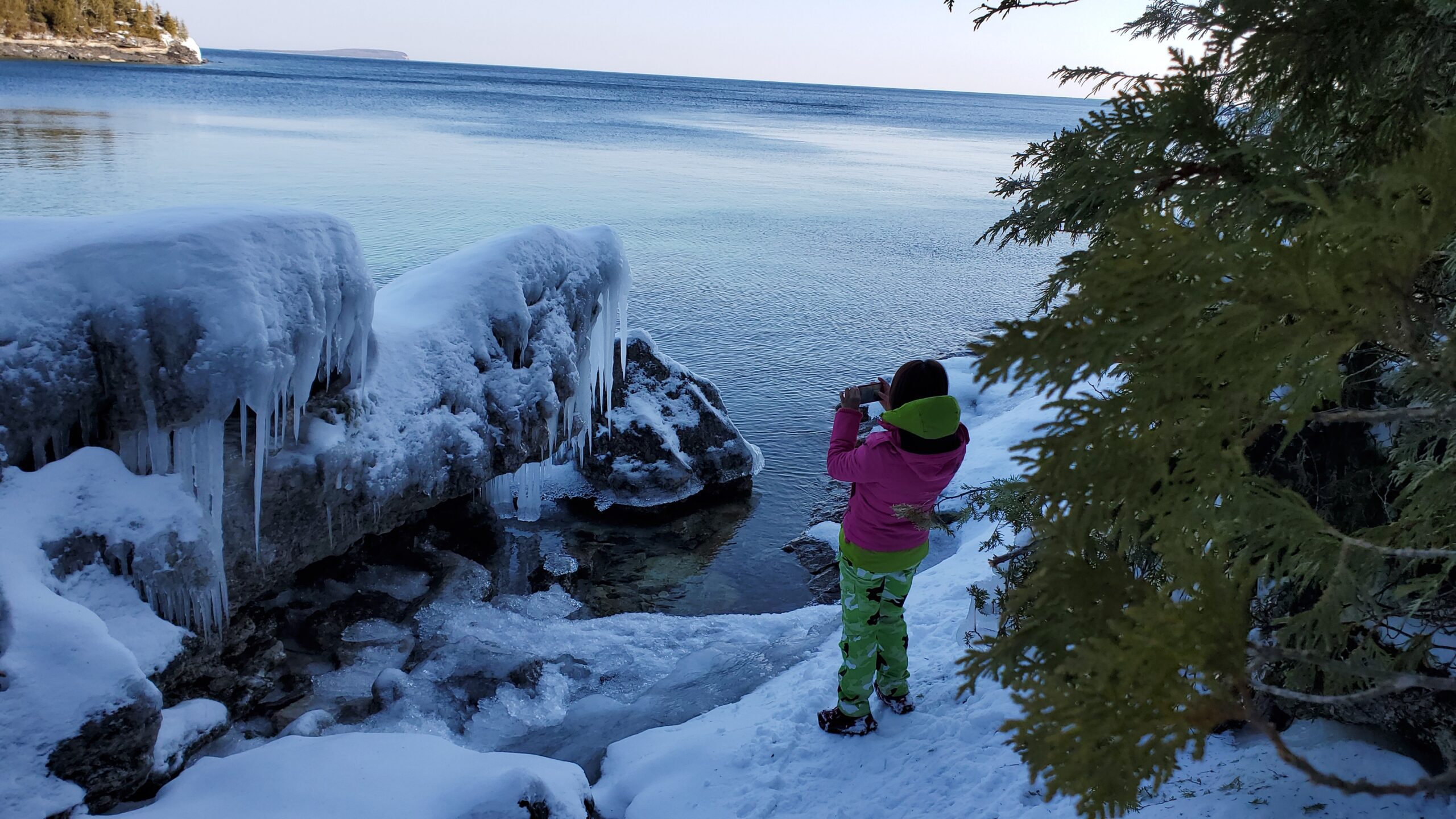
This is one of the four day hikes scheduled from Feb 23 to 26. If you are interested in participating in all four hikes and staying in an Airbnb with some of us, please reach out to me.Meetup at the Bruce Trail Parking located at the east end of Scenic Caves Rd. GPS coordinates: 44.953282, -81.128023. We will hike a combination of main trail and side trails between Rush Cove and Jackson’s Cove. The terrain is challenging with some deep ups and downs of escarpment.
Pack lunch and water. No dogs.
It may not be clear ahead of time whether snowshoes are needed or just icers will be sufficient. Come prepared for anything. Icers/microspikes are a must-have.
NEW DATE Slough of Despond Side Trail to Esthers Bluff
https://hikesstaging.brucetrail.org/event/slough-of-despond-side-trail-to-esthers-bluff-2/Sorry, the registration cut-off time for this hike has been reached.Not a member? Click here to join today!Hosting Club: Sydenham
Category: Snowshoe Hike
Location (Google Maps): Meet at the entrance to Forsyth Farms on Concession 24, east of Centre Road, west of Coles Sideroad, where the Slough of Despond Side Trail turns north. (Map 34)Hike Leader(s): Maureen McFarland Click here to contact Hike Leader(s)
Pace: Medium: 3 to 4 km/h
Terrain: Moderate: Some hills and/or poor footing
Distance: 6 kmsDescription
We carpool to the starting point on Burgess Side Road, just north side of Concession 24. This snowshoe follows an access road and cart track to farm property, crossing the field to enter the forest along a rocky trail leading to scenic lookouts over the Slough of Despond. From there we continue on the Slough of Despond Side Trail to where it meets the President’s Path. After completing the loop with the President’s Path, we retrace our steps on the Slough if Despond Side Trail to the cars. Map 34. For more information or if you are unable to register, please call or text the hike leader at 647-918-4180.Evening, Snowshoe Adventure badge #2 - Hogg's Falls Side & Main Trails
https://hikesstaging.brucetrail.org/event/evening-snowshoe-adventure-badge-2-hoggs-falls-side-main-trails/Sorry, the registration cut-off time for this hike has been reached.Not a member? Click here to join today!Hosting Club: Beaver Valley
Location (Google Maps): Meet in the Hogg’s Falls parking lot, km 65.2, Map 26, Edition 31
Hike Leader(s): Glenda Collings Click here to contact the hike leader.
Pace: Medium
Terrain: Moderate, Some steep sections
Length of Hike: Approx. 6 kmDescription
If you have participated in both Snowshoe Adventure hikes please bring $10 (members) $12 (non-members) to this hike for the badge. We will hike both the Uplands Meadow and Upper Beaver Valley Side Trails plus sections of the main trail and view Hogg’s Falls in its winter glory. On winter hikes we may encounter bare ground, light snow, deep snow, or ice. Please bring snowshoes and icers. Participants should have some experience with snowshoeing. Wear appropriate clothing for the weather plus water and a snack. Headlamps may be worn, however, if it’s a bright full moon, it is magical to hike without a light.COVID-19 Precautions Before, During and After your Hike
- Each hiker joining a Bruce Trail Club organized hike must perform a self-screening check before hiking.
Find Ontario’s self-assessment tool here: https://covid-19.ontario.ca/self-assessment/ - If you are experiencing COVID-19 symptoms, stay home.
Other Guidelines
- Arrive 15 minutes before the start of the hike.
- Wear sturdy footwear and appropriate attire for the weather and the terrain.
Hiking poles are a good idea in any season, especially if the terrain is rocky or slippery. In winter, snowshoes or icers/crampons are needed when conditions dictate.
Wearing appropriate clothing and footwear prevents injuries and shows consideration for a safe and positive group hiking experience. - Always carry I.D. and your health card.
- Bring sufficient water and snacks (or lunch if indicated). A minimum of 1L of water is recommended on all hikes, and 3L is recommended for long, challenging hikes in the heat of the summer.
- Bring sunscreen and insect repellent (for spring and summer hikes).
- Bring your own first aid kit.
- Please leave dogs at home.

Snow Moon Hike
https://hikesstaging.brucetrail.org/event/snow-moon-hike/Sorry, the registration cut-off time for this hike has been reached.Not a member? Click here to join today!Hosting Club: Caledon Hills
Category: Nature Walks
Location (Google Maps): Meet at the Mono Community Centre, 200 m south of Mono Centre (County Road 8). 44.026195, -80.071516Directions: From ON-10 head east onto Dufferin Rd. 8/Mono Centre Rd. for 6.0 km. The Community Centre is on the right.
Hike Leader(s): Richard Smythe and Sandy Green Click here to contact Hike Leader(s)
Pace: Leisurely – 3 km/hour or less
Terrain: Moderate – some hills and/or some poor footing
Distance: 5 kilometresDescription
We will explore the Whitetail Refuge Nature Reserve under a starry sky and the February Snow Moon. Pack a headlamp or flashlight. Bring icers or snowshoes depending on the snow conditions and dress for the weather. Hot chocolate will be served. (Note: This hike can be used towards earning your CHBTC 60 for the 60th commemorative badge.)
Moonlight hike - Eleventh Line Loop LATE START
https://hikesstaging.brucetrail.org/event/moonlight-hike-eleventh-line-loop-late-start/Sorry, the registration cut-off time for this hike has been reached.Not a member? Click here to join today!Hosting Club: Blue Mountains
Category: Register on-line or sign-in morning of hike
Location (Google Maps): Hike meets in the parking lot behind Tim Hortons on First St. in Collingwood.Hike Leader(s): David Little Click here to contact Hike Leader(s)
Pace: Leisurely – 3 km/hr. or less
Terrain: Easy – Mostly flat and usually good footing
Distance: 5 kmDescription
PLEASE ENSURE YOU REGISTER IF HIKING FOR A BADGE, limited number of badges. We will drive to a suitable start point for a hike through the many loop trails off the Eleventh Line, just west of Collingwood. The trails are mostly in the trees and well sheltered. The hike will be about two hours. Bring a snack and water. February’s full moon is commonly known as the Full Snow Moon in Native American cultures. These ancient tribes named this moon after the way trees cracked in the cold, or how people had to sit shoulder to shoulder around the fire for warmth. The Full Snow Moon is also known as the Bone Moon. Moonlight Badge available for $10.Hike # 4 Winter Badge Series
https://hikesstaging.brucetrail.org/event/hike-4-winter-badge-series/Sorry, the registration cut-off time for this hike has been reached.Not a member? Click here to join today!Hosting Club: Dufferin Hi-Land
Category: General Hike
Location (Google Maps): Map 20 Km 7.9 ( Bottom of 1 Line EHS )Hike Leader(s): Bryan and Carol Foley Click here to contact Hike Leader(s)
Pace: Medium
Terrain: Moderate
Distance: 8.5 kmDescription
The February Moon is known as the ” Snow Moon ” We will explore Mono Cliffs Provincial Park under a starry sky and full moon. Bring Water, Snowshoes, Icers, Headlamp ( flashlight ) Dress for the weather. Please arrive by 6:15pm ready to leave promptly at 6:30 pm. Contact hike leader if you have any questions. Please remove your name from the sign up sheet if you must cancel. - Each hiker joining a Bruce Trail Club organized hike must perform a self-screening check before hiking.
- 25February 25, 2024
Milton Escarpment Brow
https://hikesstaging.brucetrail.org/event/milton-escarpment-brow/Sorry, the registration cut-off time for this hike has been reached.Not a member? Click here to join today!Hosting Club: Dufferin Hi-Land
Category: General Hike
Location (Google Maps): Hilton Falls CA parking lot. 4985 Campbellville Road, Milton, L7P 0G3Hike Leader(s): Stuart Law Click here to contact Hike Leader(s)
Pace: Medium
Terrain: Slippery Sections Likely, Slippery and Steep Sections, Strenuous
Distance: 16 kmsDescription
Join us on a shuttle hike taking in part of the Vanderleck Side Trail and Main Trail at 17 Sideroad to and including the Philip Gosling Side Trail in the Hilton Falls Conservation Area. Great views from the cliffs of the land to the southeast including Toronto. The terrain includes some of the rockiest sections of the Bruce Trail and it will be slippery, muddy and icy. Icers and hiking boots mandatory. Poles highly recommended. Admission fee at Hilton Falls CA payable and reservation required on the Conservation Halton website. Please be respectful of the interior of your fellow hiker’s car by bringing a change of footwear and a garbage bag for the shuttle at the end of the hike. While we will be hiking in the Hilton Falls CA, we will not be taking in the Falls themselves. Please be at the Hilton Falls CA parking lot ready to shuttle at 8:45 sharp. Please bring a smile, a warm drink, lunch and a snack.
CHBTC Frosty 5 & 60 for the 60th Anniversary Badge Combo
https://hikesstaging.brucetrail.org/event/chbtc-frosty-five-60th-anniversary-badge-combo-5/Sorry, the registration cut-off time for this hike has been reached.Not a member? Click here to join today!Hosting Club: Caledon Hills
Category: General
Location (Google Maps): Meet at the BTC parking lot on the east side of 5th Line EHS, just south of Hockley Road. 43.993572, -80.014057Directions: From ON-10 turn east onto Hockley Rd./Dufferin County Rd. 7. Drive for 9.5 km. Turn south/right onto 5th Line E. The parking lot is on the left in 100 m.
Hike Leader(s): Sandy Green, Jennie Greenfield, and Roopa Dindigal Click here to contact Hike Leader(s)
Pace: Medium – 3 to 4 km/hour
Terrain: Strenuous – hilly with steep climbs and some poor footing
Distance: 12 kilometresDescription
Register individually for one, a few, or all of the Frosty 5 and 60 for the 60th Anniversary Badge Combo hikes. Participants who complete five hikes will be eligible to receive a CHBTC Winter badge and a 60th Anniversary badge. This hikes explores parts of the main Trail and Hemlock Ridge, Griffith Ravine, and Glacier Valley Side Trails in the south Hockley Valley area. Bring your choice of hydration and snacks. Hiking boots and icers/crampons are required. Hikes in the series take place on select Wednesdays and Sundays. (Note: If you wish to purchase badges, the cost of each badge is $10.00 for BTC members and $15.00 for non-members.)

Urban Walk: Waterfront Trail 6/8 - Lakeshore East
https://hikesstaging.brucetrail.org/event/urban-walk-waterfront-trail-6-8-lakeshore-east-3/Sorry, the registration cut-off time for this hike has been reached.Not a member? Click here to join today!Hosting Club: Toronto
Category: Urban Walk
Location (Google Maps): Toronto/ScarboroughHike Leader(s): Brian Rideout Click here to contact Hike Leader(s)
Pace: Moderate
Terrain: Flat
Distance: 10.9 kmDescription
Please join me at the Tim Horton’s at Lakeshore and Leslie no later than 9:50 am. We start hiking at 10:00 am.We will hike east on Lakeshore, along the Beaches Boardwalk, and on Kingston Rd to Brimley Rd. The estimated distance is 10.9 km. Here is an online map of our route Lakeshore to Brimley RdBring a snack, at least 2 liters of water, and icers. Dress for cold weather.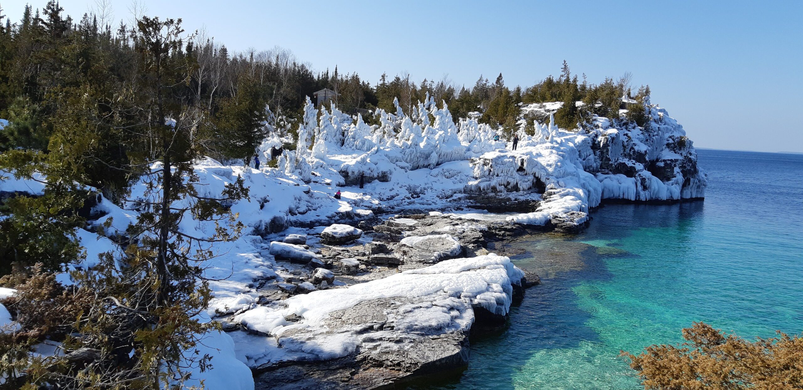
#3/4 Feb 23 -26 Bruce Peninsula National Park Hike - 12km
https://hikesstaging.brucetrail.org/event/bruce-peninsula-national-park-hike-12km/Sorry, the registration cut-off time for this hike has been reached.Not a member? Click here to join today!Hosting Club: Toronto, Peninsula
Category: Car Hike
Location (Google Maps): Bruce Peninsula National Park Parking LotHike Leader(s): Alina Lin Click here to contact Hike Leader(s)
Pace: Moderate
Terrain: Challenging, Hilly, Rocky, Variable
Distance: 10km -12kmDescription
This is one of the four day hikes scheduled from Feb 23 to 26. If you are interested in participating in all four hikes and staying in an Airbnb with some of us, please reach out to me.Meetup at the Bruce Peninsula National Park parking lot. GPS coordinates: 45.236363, -81.522626. Admission and parking fees are applied by the Park. We will hike go-and-back along the main trail between Loon Lake and Halfway Dump. The terrain is rocky and rugged so be prepared for some challenges.
Pack lunch and water. No dogs.
It may not be clear ahead of time whether snowshoes are needed or just icers will be sufficient. Come prepared for anything. Icers/microspikes are a must-have.
Urban Walk: Wayne Hike: Crothers Woods to Victoria Park Subway via Flat and Taylor Creek Trails
https://hikesstaging.brucetrail.org/event/urban-walk-wayne-hike-crothers-woods-to-victoria-park-subway-via-flat-and-taylor-creek-trails/Sorry, the registration cut-off time for this hike has been reached.Not a member? Click here to join today!Hosting Club: Toronto
Category: Urban Walk
Location (Google Maps): Meet inside Pape Subway Station at 10:15 to catch the #81 Thorncliffe Park bus at 10:30 to Millwood Rd and Overlea Blvd. From the bus stop we will walk along Millwood to Redway Rd on the left and follow it to the end around the Loblaws to the Thomas Hauser Memorial Trail Head. Alternatively, hikers wanting to meet us there directly by foot or car can do so. The proper hike will leave from the trail head at 11 am.Hike Leader(s): Andrew Proczek Click here to contact Hike Leader(s)
Pace: Moderate
Terrain: Flat, Variable
Distance: 10 kmDescription
“I decided to check out an alternative route along the Don River to avoid cycle traffic on [weekends] and it is pretty nice. I picked up the trail at the parking lot for the Loblaws on Redway Road and worked down into the valley to where it intersected with the Flats Trail on the west side of the Don River. No pavement and few bikes. Mosquitoes and stinging nettles but that is better than dodging bikes. 10 km in just over 2 hours. Need to walk with people to slow down. This on the go application is very useful in planning or tracing routes after the fact.” https://onthegomap.com/s/1u3tdtkuWayne Crockett, June 12, 2020
Please join me for this original Wayne hike. Just as Wayne did we will walk from the bus stop at Millwood and Overlea, by the Loblaws to the Crothers Wood’s Trailhead to begin the proper hike which will remain in nature until we reach Dawes Road at 8.7 km. There will be no mosquitos or Stinging Nettle but the weather forecast is calling for a return to freezing temperatures, so icers may be required. And this is a good thing since Crothers Woods is known for its mud. “Mud, did someone say mud?!” I can almost hear Wayne chiding me. “Andrew, don’t be spreading rumors of mud for one of my hikes!”
We will be visiting the ‘Passage’ installation under the Don Mills underpass as well as the Elevated Wetlands Sculptures a.k.a. ‘The Big Teeth’ along the route.
Public washrooms at Taylor Creek Park and Dawes Road, unfortunately are closed for the season. Washrooms at the start at Loblaws and bio breaks along the trail will be offered. Please pack a lunch, water or a warm beverage.
And, yes Wayne, the group will slow you down. The hike will proceed at the usual moderate pace.
Optional Pub stop at the end at The Feather’s Pub, 962 Kingston Rd at Victoria Park where we can toast Wayne for a well planned hike.
11:00 am Gerry Berkhout Trail in Fenwick
https://hikesstaging.brucetrail.org/event/1100-am-gerry-berkhout-trail-in-fenwick-2/Sorry, the registration cut-off time for this hike has been reached.Not a member? Click here to join today!Hosting Club: Niagara
Category: In and Out
Location (Google Maps):Meet at Centennial Park on Church St in Fenwick. Park in first parking lot. After the hike we can go to the Grill on Canboro for refreshments. This is a flat walk, minimal if any mud. Bring water and dress for the weather.
Hike Leader(s): Lynskie Click here to contact Hike Leader(s)
Pace: Leisurely
Terrain: Easy
Distance: 7-8kmsDescription
This will be an in/out hike. We’ll walk for an hour and then turn around. The terrain is flat (this was an old railway line) and in most sections will be dry. If you have any medical condition that you think I should know about, please see me the morning of the hike.Sunday Social Hike - Snowshoe out and back on rail trail
https://hikesstaging.brucetrail.org/event/sunday-social-hike-snowshoe-out-and-back-on-rail-trail-2/Sorry, the registration cut-off time for this hike has been reached.Not a member? Click here to join today!Hosting Club: Sydenham
Category: Snowshoe Hike
Location (Google Maps): The Owen Sound Galaxy Theatre parking lot. Meet at the tall “Galaxy Centre” sign next to the traffic lights.Hike Leader(s): Bill Snel
Pace: Leisurely: 3 km/h or less
Terrain: Easy: Mostly flat and good footing.
Distance: 5 kmDescription
We will meet at the Galaxy Cinema to carpool to Ben Allen and snowshoe west on the Georgian Bluffs rail trail and then return. Depending on snow conditions and the amount of snowmobile traffic, conditions will vary. If unable to register or for information contact the hike leader at w.snel2@gmail.com or landline (519) 470-0584. - 26February 26, 2024
9:00 am Hydro Hill Training
https://hikesstaging.brucetrail.org/event/900-am-hydro-hill-training-2/Sorry, the registration cut-off time for this hike has been reached.Not a member? Click here to join today!Hike open to BTC Members only.
Hosting Club: Niagara
Category: In and Out
Location (Google Maps):Lockhart Drive, St Catharines, by the large yellow swing gate.
Hike Leader(s): Suzanne Gourluck Click here to contact Hike Leader(s)
Pace: Brisk
Terrain: Strenuous
Distance: 6 kmsDescription
This challenging “hike” is intended for those wishing to train for future challenging hikes. Choose your own pace to go up and down the moderately steep hill in 90 min with a brief flat walk partway through. The terrain is a hard packed gravel surface. Bring water, hiking poles, snack and dress for the weather.9:00 Beamsville Hike
https://hikesstaging.brucetrail.org/event/900-beamsville-hike/Sorry, the registration cut-off time for this hike has been reached.Not a member? Click here to join today!Hosting Club: Niagara
Category: In and Out
Location (Google Maps): Meet at Kinsmen Park in Beamsville, in the parking lot.Hike Leader(s): Kathleen Manson Click here to contact Hike Leader(s)
Pace: Fast
Terrain: Moderate
Distance: Approximately 10 kmDescription
Dress for the weather, brink icers if it drops below freezing again. Gaiters are recommended for the mud.This will be in and out but utilizing other trails to add some loops.
Jones Falls Loop followed by Pot Luck Lunch
https://hikesstaging.brucetrail.org/event/jones-falls-loop-followed-by-pot-luck-lunch/Sorry, the registration cut-off time for this hike has been reached.Not a member? Click here to join today!Hosting Club: Sydenham
Category: Snowshoe Hike
Location (Google Maps): Memorial Forest. At the end of Young’s DriveHike Leader(s): Sheri Hatcher Click here to contact Hike Leader(s)
Pace: Medium: 3 to 4 km/h
Terrain: Moderate: Some hills and/or poor footing
Distance: Approximately 6 – 7 kmDescription
Weather permitting, we will walk along the Pottawatomi River, crossover a field and join the Blue Trail. We will then ascend through a crevasse to the Main Trail along the top of the escarpment. We will head to Jones Falls and explore the area. We will then take the Merle Gunby Side Trail loop and join up with the Main Trail again. This hike ends with a steep descent back to the parking lot. We will gather for a pot luck lunch following the hike. I will provide the hot soup and drinks. Please arrive 15 minutes before the start time. Please contact me through the built in Contact the Hike Leader option if you have any questions or unable to register.Great Esker & Duff Pit Side Trails in Silver Creek
https://hikesstaging.brucetrail.org/event/great-esker-duff-pit-side-trails-in-silver-creek-2/Sorry, the registration cut-off time for this hike has been reached.Not a member? Click here to join today!Hike open to BTC Members only.
Hosting Club: Iroquoia
Category: General Hike
Location (Google Maps):Meet where the Bruce Trail Eighth Line Side Trail meets the Eighth Line North of Georgetown
Hike Leader(s): Victoria Best Click here to contact Hike Leader(s)
Pace: Medium – 3 to 4 km/hr
Terrain: Dependent on Conditions, Moderate – Some hills and/or some poor footing, Slippery Sections Likely, Strenuous – Hilly with steep climbs and some poor footing
Distance: 12 kmDescription
Hike the Great Esker and Duff Pit Side Trails.
The hike distance will be reduced if hiking conditions are poor. Dress appropriately for the weather and for slippery trail conditions and rocks. Bring food and water, hiking boots, icers, and no dogs please.
Directions to Meeting Place: From where Trafalgar Road merges with Hwy 7 in Georgetown, drive north 3.4 km and then turn right onto 22 Side Rd and then left on Eighth Line. Continue along Eighth Line until you see the blue blazes for the Eighth Line Side Trail. Note: you can not access the meeting place driving south on Eighth Line from the 27 Side Rd because it is closed in the winter.
Please arrive at 9:45 for hike start time of 10:00 AM. Register using the hiking schedule. Cancellations the morning of the hike please call 905-257-6815.
#4/4 Feb 23 -26 Peninsula Bruce Trail - Rural Rocks Side Trail Hike - 4.5km
https://hikesstaging.brucetrail.org/event/peninsula-bruce-trail-rural-rocks-side-trail-hike-4-5km/Sorry, the registration cut-off time for this hike has been reached.Not a member? Click here to join today!Hosting Club: Toronto, Peninsula
Category: Car Hike
Location (Google Maps): Bruce Rd 13& Northacres Rd, WiartonHike Leader(s): Alina Lin Click here to contact Hike Leader(s)
Pace: Moderate
Terrain: Challenging, Hilly, RockyDescription
This is one of the four day hikes scheduled from Feb 23 to 26. If you are interested in participating in all four hikes and staying in an Airbnb with some of us, please reach out to me.Meetup location: 30 meters north of the intersection of Bruce Rd 13& Northacres Rd. GPS coordinates: 44.753489, -81.167505. Rural Rocks Side Trail and Obese Side Trail are satellite loop side trails – probably the only two side trails that aren’t connected to the main trail. You will see a wonderland of enormous rocks left from a time when this area was the shoreline of an ancient glacial lake. Part of the loop is very rugged and challenging to walk through.
No dogs. No drop out.
It may not be clear ahead of time whether snowshoes are needed or just icers will be sufficient. Come prepared for anything. Icers/microspikes are a must-have.