
Hike Schedule
Join us for a hike! Registration required.
All hikes available to BTC members. Some hikes are open to non-members.
See Refund Policy for Paid Hikes >
TIP: The calendar view displays up to 7 hikes on a day, but often there are more. Click “View more events” to see them all.
Categories
- 30November 30, 2024
School Bus Hike: Nottawasaga Bluffs, with Après Hike Holiday Luncheon
https://hikesstaging.brucetrail.org/event/school-bus-hike-nottawasaga-bluffs-with-apres-hike-holiday-luncheon/Sorry, the registration cut-off time for this hike has been reached.Not a member? Click here to join today!Trip Information
Departure Time: 08:00
Return to City Time: 19:00
Departure Point: York Mills Bus PickupOptional Items
Chicken Caesar Wrap & Fries ($33.00)
Fish & Chips ($33.00)
Mylar Burger & Fries ($33.00)
Vegetarian Lasagna & Salad ($33.00)Hosting Club: Toronto
Category: Bus Hike
Location (Google Maps): Nottawasaga Bluffs Conservation AreaHike Leader(s): Martina Furrer, Duro Vukman, Felix Wan, Roland Mark Click here to contact Hike Leader(s)
Pace: Brisk (4-5 km/hr), Moderate (3-4 km/hr)
Terrain: Level 2 (Intermediate – some hills and uneven surfaces, rocks and roots underfoot), Rocky, VariableDescription
Join us for a fun hike in beautiful Nottawasaga Bluffs Conservation Area. Discover Freedom Rock, the Tomb, and “Best Caves”. Climb through the Keyhole and explore limestone crevices on the Keyhole Side Trail. Revel in the awesome view from the bluffs. Choose your own adventure: a moderate hike (3 to 4 km/hr) or a brisk hike (4 to 5 km/hr). Both groups will be on the trail for about 4.5 hours. Afterwards enjoy good cheer and chatter over a festive late lunch (3 to 5 PM) at Mylar and Loreta’s Restaurant in Singhampton.When you register, please select one of the lunch choices listed under optional items. All regular entrées include fries, dessert bar, and non-alcoholic beverage. Vegetarian entrée includes salad, dessert bar, and non-alcoholic beverage. Tax and gratuity are included in the prices. Beer and wine are extra.
You will need to pay your bus fare when you register. E-transfer your lunch money ($33 per person) to martinabeatrice@gmail.com.
Important: Please register by Sat Nov 23.
Bus departs from 10 York Mills Rd at 8 AM. We hope to be back in Toronto by 7 PM.
Car Hike: Hockley Valley Provincial Park
https://hikesstaging.brucetrail.org/event/car-hike-hockley-valley-provincial-park/Sorry, the registration cut-off time for this hike has been reached.Not a member? Click here to join today!Hosting Club: Caledon Hills
Category: General
Location (Google Maps): Hockley Valley Nature Reserve, Map 18. To reach the meeting point, drive north on Hwy 10 from Orangeville and turn right onto Hockley Road. Continue approximately 5 km east until you see the parking area on your left, directly across the road from the Black Birch restaurant.Hike Leader(s): Dylan “Lana” Hubbard Click here to contact Hike Leader(s)
Pace: Medium – 3 to 4 km/hour
Terrain: Strenuous – hilly with steep climbs and some poor footing
Distance: 14 kmDescription
Join us for a 14 km hike through the Nature Preserve, known for being one of the most challenging and hilly sections of the Bruce Trail. Get ready for a workout.We will be hiking at a moderate pace with plenty of breaks in between.
We are committed to providing an inclusive and welcoming environment. This hike is an 2SLGBTQIA+ safe space, and everyone is welcome to join us!
Car Hike: Boyd Conservation Park, Vaughan
https://hikesstaging.brucetrail.org/event/car-hike-boyd-conservation-park-vaughan-6/Sorry, the registration cut-off time for this hike has been reached.Not a member? Click here to join today!Hosting Club: Toronto
Location (Google Maps): Boyd Conservation Park, Islington Avenue, Vaughan, ON free parking at the entrance of the park,
There are different public transit routes to this parking lot please check transit maps/google map
Hike Leader(s): Mohammad Aghamiri Click here to contact Hike Leader(s)
Pace: Moderate (3-4 km/hr)
Terrain: Level 2 (Intermediate – some hills and uneven surfaces, rocks and roots underfoot), Variable
Distance: 14-15 kmDescription
Explore the trails that wind through the beautiful valley at Boyd Conservation Area and the William Grainger Greenway. We will have lunch/snack in shelter with seated area. Please bring hiking poles, proper clothing for the season, hiking shoes/boots and lots of water. Distance 14-17 km. Difficulty Level:2 (Moderate)Laura Secord 2 of 2
https://hikesstaging.brucetrail.org/event/laura-secord-2-of-2/Sorry, the registration cut-off time for this hike has been reached.Not a member? Click here to join today!Hosting Club: Niagara
Category: Car Pool
Location (Google Maps): Meet at DeCew House Heritage Park. Carpool to Woodend Conservation Area and hike back to DeCew House. Upon completion, badges can be purchased. $10 for members, $15 for non-members.Hike Leader(s): Lynskie Click here to contact Hike Leader(s)
Pace: Fast
Terrain: Moderate
Distance: 15kmsDescription
This hike includes some road walking along Glendale Ave in St Catharines. We’ll walk along the old Welland Canal before walking over the bridge over the current Welland Canal.Kolopore Trails
https://hikesstaging.brucetrail.org/event/kolopore-trails/Sorry, the registration cut-off time for this hike has been reached.Not a member? Click here to join today!Hosting Club: Blue Mountains
Category: Organized Hike
Location (Google Maps): Tim Hortons, First Street, CollingwoodHike Leader(s): David Little Click here to contact Hike Leader(s)
Pace: Medium – 3 to 4 km/hr
Terrain: Moderate – Some hills and/or some poor footing
Distance: 8.5Description
We hike from the North Parking Lot at Grey Rd 2 into a hardwood forest with great views of the Escarpment
Let's Hike!
https://hikesstaging.brucetrail.org/event/lets-hike/Sorry, the registration cut-off time for this hike has been reached.Not a member? Click here to join today!Hosting Club: Iroquoia
Category: Special Event
Location (Google Maps): Bruce Trail Conservancy – 55 Head St, DundasHike Leader(s): Ruth Moffatt Click here to contact Hike Leader(s)
Pace: Leisurely – 3km/hr or less
Terrain: Easy – Mostly flat and usually good footing
Distance: Less than 3kmDescription
Are you new to hiking? Would you like a little more guidance to get started?This is a one-day workshop with a little hiking thrown in. In the workshop we will show you everything you need to get started hiking. It will be led by Hike Leaders from Iroquoia Bruce Trail Club and will include a guidebook to take home as well as a new retro-looking Let’s Hike! badge.
From the trail up, we will discuss footwear, socks, clothing, layering, what to carry in your backpack, hydration, food, hiking hacks, pole and trail etiquette and so much more. Are you ready to get started?
The workshop is 9-5pm in the boardroom of the BTC office. The workshop will include coffee, tea and cookies. You will need to bring a lunch.
Please join us!
If you have any questions, please reach out through contact on this form.

Urban Walk: Toronto Beach Walk and Glen Stewart Ravine
https://hikesstaging.brucetrail.org/event/urban-walk-toronto-beach-walk-and-glen-stewart-ravine-2/Sorry, the registration cut-off time for this hike has been reached.Not a member? Click here to join today!Hosting Club: Toronto
Category: Urban Walk
Location (Google Maps):Meet at the Toronto Public Library, Beaches Branch, 2161 Queen Street East, Toronto, M4L 1J1
Hike Leader(s): Jeanette Vincent Click here to contact Hike Leader(s)
Pace: Moderate (3-4 km/hr)
Terrain: Flat, Level 1 (Easy – mostly on flat, well maintained trails with hard-packed surface)
Distance: 12/13kmDescription
Meet at the Toronto Public Library, Beaches Branch. My late husband Gregory Vincent grew up in the beach and we often visited and walked the area. We will walk the boardwalk and easy pathways that wind along the variety of beaches between Victoria Park Avenue to Ashbridges Bay Park. It will be an out and back route with a couple short loops with lots of views into Lake Ontario, you will see many points of interest, parks, Kew gardens, including the historic Leuty Lifesaving Station and the historic architecture of the Ashbridges Bay Wastewater Treatment Plant, the R.C. Harris Filtration Plant. I have frequent visits to this area and we will make our way across Queen St. to walk the Glen Stewart Ravine a nice ascent, taking in beautiful picturesque natural areas along Ames creek, meandering on elevated boardwalks and stair cases and then descending the area on some of the pleasing neighbourhood streets back to our start at the Beaches Branch Library. A pleasing area that offers a little something for everyone!
If you want something a little shorter you can drop-out at various areas along the way.
No dogs. Wear good footwear, bring snacks/lunch and water. Dress according to the weather conditions for the day - 01December 1, 2024
Dufferin Delights - Kilgorie to the Boyne Valley - CANCELLED
https://hikesstaging.brucetrail.org/event/dufferin-delights-kilgorie-to-the-boyne-valley/Sorry, the registration cut-off time for this hike has been reached.Not a member? Click here to join today!Hosting Club: Dufferin Hi-Land
Category: Cancelled
Location (Google Maps): End of Centre Road south of 5 Sideroad. About 2 kms directly south of Whitfield. BTC Map 20, km. 17.6.Hike Leader(s): Stuart Law Click here to contact Hike Leader(s)
Pace: Medium
Terrain: Slippery and Steep Sections, Strenuous
Distance: 16.2 kmsDescription
Join us on the second of our three hikes to explore the Dufferin Section. We climb one of the longest ascents on the entire Bruce Trail – the world famous Kilgorie Hill. Not for the faint of heart. Then come the interminable ups and downs of the Boyne Valley. Tough but highly rewarding. Please dress for the weather – that may include snow and ice. Pack your icers, a snack, a lunch, a warm drink, some water and a smile. Hiking boots mandatory. Poles recommended. Please bring a change of footwear and a garbage bag for the shuttle. Please be prepared to drive other hikers too for the shuttle. Please arrive at 9:00 am to be ready to shuttle at 9:15.Dundas Valley Loop
https://hikesstaging.brucetrail.org/event/dundas-valley-loop/Sorry, the registration cut-off time for this hike has been reached.Not a member? Click here to join today!Hosting Club: Dufferin Hi-Land
Category: General Hike
Location (Google Maps): Iroquoia Section, Map 8. Dundas Valley Conservation Area Parking Lot P3. Take DVCA Trail Centre Entrance off Governors Road, near km 51.8.Hike Leader(s): Stuart Law Click here to contact Hike Leader(s)
Pace: Medium
Terrain: Moderate
Distance: 17 kmsDescription
Join us on a lovely loop hike in the Dundas Valley. We take in part of the Bruce Trail and several DVCA trails. Waterfalls like Sherman, Canterbury, and Cascade. Please bring icers, a warm drink, water, a snack for “elevensies”, lunch, hiking boots, poles and lots of smiles. Entrance fee to DVCA in effect at gate. Consider buying a Hamilton Conservation Area annual pass. It’s well worth it. Please arrive at 9:15 to be ready to hike at 9:30.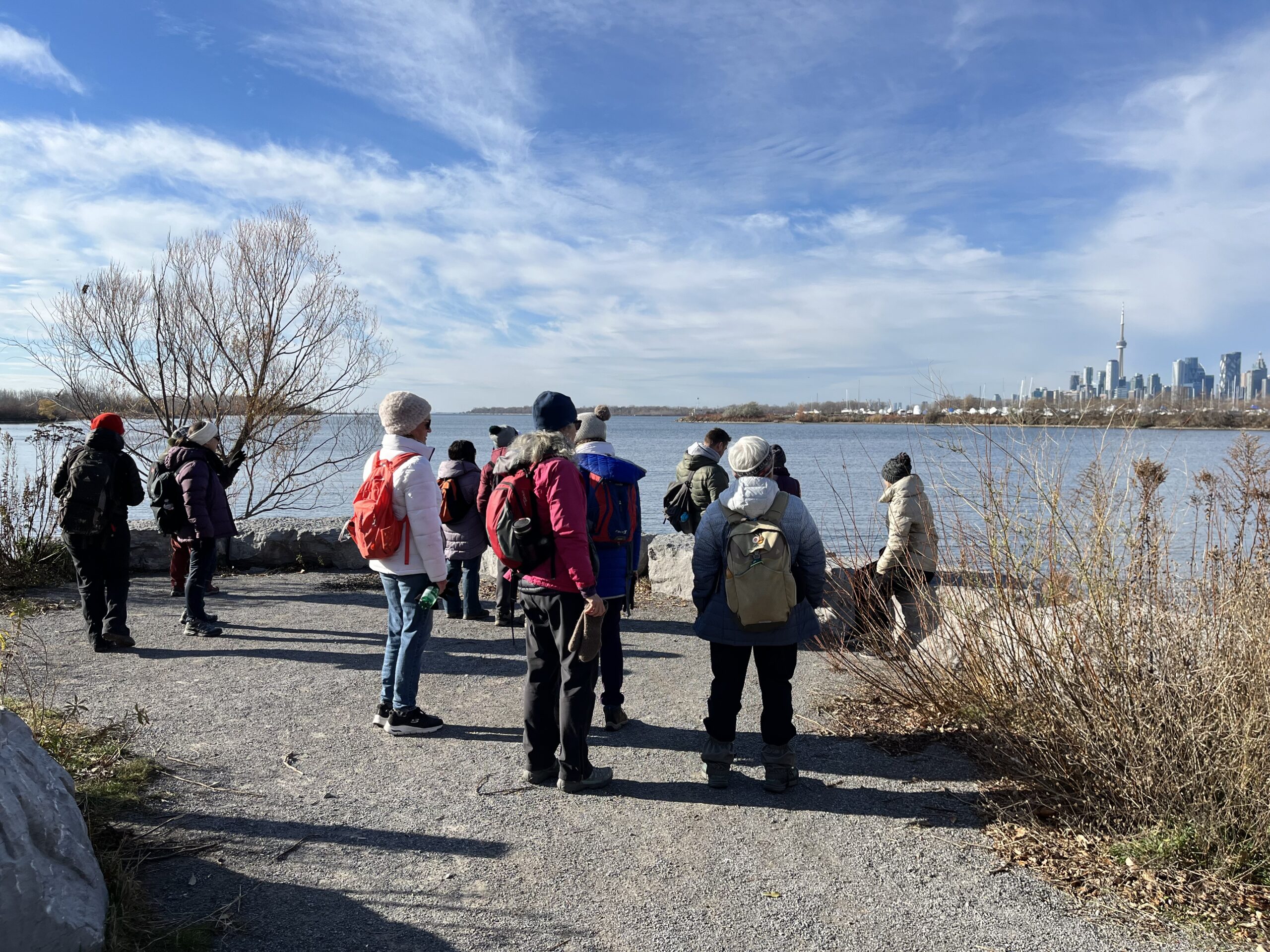
Urban Walk: Tommy Thompson Park-Toronto's Urban Wilderness (on the Leslie Street Spit) Toronto
https://hikesstaging.brucetrail.org/event/urban-walk-tommy-thompson-park-torontos-urban-wilderness-on-the-leslie-street-spit-toronto-2/Sorry, the registration cut-off time for this hike has been reached.Not a member? Click here to join today!Hosting Club: Toronto
Category: Urban Walk
Location (Google Maps):Tommy Thompson Park, 1 Leslie St. Toronto
Hike Leader(s): Jeanette Vincent Click here to contact Hike Leader(s)
Pace: Moderate (3-4 km/hr)
Terrain: Flat, Level 1 (Easy – mostly on flat, well maintained trails with hard-packed surface)
Distance: 13/14kmDescription
Meet at 10:00 a.m. at the entrance parking lot at 1 Leslie St. We will walk to the end of the spit and back using some of the various side trails loops. A unique place to experience nature and wildlife in a man made area. The spit has been made from the rubble from an ever growing Toronto which began in 1959. Visit https://tommythompsonpark.ca/about/ for the history and growth of this area. In addition to its unique natural features, the park offers picturesque views of the Toronto skyline and Lake Ontario.No dogs. Wear good walking shoes or boots. Bring snack/lunch and water. Dropouts along the way. Dress appropriate for the weather conditions.
Car Hike; Mono Cliffs
https://hikesstaging.brucetrail.org/event/car-hike-mono-cliffs/Sorry, the registration cut-off time for this hike has been reached.Not a member? Click here to join today!Hosting Club: Toronto
Category: Car Hike
Location (Google Maps): Mono Cliffs Provincial Park, Map 19Hike Leader(s): Al Brown Click here to contact Hike Leader(s)
Pace: Leisurely (2-3 km/hr)
Terrain: Level 1 (Easy – mostly on flat, well maintained trails with hard-packed surface)
Distance: 8-10 kmDescription
We will complete a loop hike through the Mono Cliffs Provincial Park on the main and side trails.After the hike those interested may join me for refreshments in the area at a place TBA.
To get to the meeting location drive north on Hwy 10 past Orangeville to County Road 8 (Mono Centre Road). Turn right and go about 5 km to Mono Centre. The parking area is on your right behind a tennis court that you will see as you approach the village (200 meters south).
- 02December 2, 2024
Iroquoia E2E Series 7 of 8
https://hikesstaging.brucetrail.org/event/iroquoia-e2e-series-7-of-8/Sorry, the registration cut-off time for this hike has been reached.Not a member? Click here to join today!Hike open to BTC Members only.
Hosting Club: Iroquoia
Location (Google Maps): Meeting Place: Crawford Lake Conservation Area Parking Lot – Reservation Required
Hike Leader(s): Pati Greenwood, Jeff Dowsett Click here to contact Hike Leader(s)
Pace: Medium – 3 to 4 km/hr
Terrain: Moderate – Some hills and/or some poor footing
Distance: 17.2Description
Join us for this 7th hike of the of 8 hike series to complete the Iroquoia Section of the Bruce Trail. Register for all 8 hikes (to be entitled to the badge) or only the ones you are available for. Car shuffle and other hike details will be emailed to registered hikers a few days prior to the hike. Bring plenty of water and a snack. Wear appropriate clothing for conditions. Hiking boots are mandatory and hiking poles are suggested. Please arrive at the meeting place by 8:15 am as we will leave promptly at 8:30 am to shuffle to our starting point.Friendship Trail (City View Park to Grindstone Creek Loop)
https://hikesstaging.brucetrail.org/event/friendship-trail-city-view-park-to-grindstone-creek-loop/Sorry, the registration cut-off time for this hike has been reached.Not a member? Click here to join today!Hosting Club: Iroquoia
Category: General Hike
Location (Google Maps): Meet at City View Park parking lot (South Entrance), Burlington. Located just south of Hwy #5 off of Kerns Rd.Hike Leader(s): Karen Capindale-Smith Click here to contact Hike Leader(s)
Pace: Medium – 3 to 4 km/hr
Terrain: Strenuous – Hilly with steep climbs and some poor footing
Distance: 10km +Description
This 10.5 km hike will follow the main BT along the edge of the escarpment for great views of the Skyway bridge , Lake Ontario and surrounding area. We will continue to the outskirts of Waterdown and down into/out of the Grindstone Creek via the McNally and Waterdown Rd Side trails and main BT. Please dress in layers and bring water, a snack and lunch (optional). Icers may be necessary.Expect baked goods 🙂
Woodford - looping north & south
https://hikesstaging.brucetrail.org/event/woodford-looping-north-south/Sorry, the registration cut-off time for this hike has been reached.Not a member? Click here to join today!Hosting Club: Sydenham
Category: General Hike
Location (Google Maps): Meet in the north-east corner of the parking lot at Home Depot on Highway 26 on the east side of Owen Sound.Hike Leader(s): Ian Mills Click here to contact Hike Leader(s)
Pace: Leisurely: 3 km/h or less
Terrain: Moderate: Some hills and/or poor footing, There might be sections with water on the trail.
Distance: 5 kmDescription
We will start our hike at Woodford and head north along the Woodford Escarpment Side Trail returning via Main Trail. Then for those who are interested we can hike along the Crevice Spring Side Trail returning via Main Trail. This will be a leisurely hike open to all levels. Depending upon weather conditions I will email all is icers or shoe shoes are required. BTC Map # 30. - 03December 3, 2024
Urban Walk: Valley View Park Thornhill
https://hikesstaging.brucetrail.org/event/urban-walk-valley-view-park-thornhill-38/Sorry, the registration cut-off time for this hike has been reached.Not a member? Click here to join today!Hosting Club: Toronto
Location (Google Maps): Parking lot at the corner of Bayview Ave, and Sycamore Dr. South of Highway 7
Sycamore Dr. is 3blocks south of highway 7 and 2 blocks north of John Street, parking lot is across plaza of Dollarama and Star boxHike Leader(s): Mohammad Aghamiri Click here to contact Hike Leader(s)
Pace: Moderate (3-4 km/hr)
Terrain: Level 2 (Intermediate – some hills and uneven surfaces, rocks and roots underfoot)
Distance: 7-8 kmDescription
We will explore Valleyview and Maple view parks, and walk along German Mill Creek, for a distance of 7-8 km. Difficulty Level: 2 (Moderate)9:00 Long Hike Wiley Road Short Hills
https://hikesstaging.brucetrail.org/event/900-long-hike-wiley-road-short-hills-34/Sorry, the registration cut-off time for this hike has been reached.Not a member? Click here to join today!Hosting Club: Niagara
Location (Google Maps):
Short Hills Wiley Road Entrance
Pace: Medium
Terrain: Moderate
: 10kmDescription
Explore Short Hills and the majestic side trails of Scarlett Tanager, Hemlock. Swayze Falls and Terrace. Register for each hikeBring Poles, Icers, snack, and dress for the weather
9:15 Short hike - Pelham Road, Short Hills
https://hikesstaging.brucetrail.org/event/915-short-hike-pelham-road-short-hills-3/Sorry, the registration cut-off time for this hike has been reached.Not a member? Click here to join today!Hosting Club: Niagara
Category: Loop
Location (Google Maps): Short Hills Provincial Park, Pelham Road entranceHike Leader(s): janet davey Click here to contact Hike Leader(s)
Pace: Medium
Terrain: Moderate
Distance: 6 kmsDescription
Hike the main and side trails in Short Hills Provincial Park. Bring hiking boots and water. Keep a pair of icers in your car in case of icy conditions.Walter Tovell and Lookout Side Trail and Main Trail Loop
https://hikesstaging.brucetrail.org/event/walter-tovell-and-lookout-side-trail-and-main-trail-loop/Sorry, the registration cut-off time for this hike has been reached.Not a member? Click here to join today!Hosting Club: Dufferin Hi-Land
Category: Tuesday Hike
Location (Google Maps):Dufferin Hi-Land Section, Map 19. Meet at roadside parking at corner of 2nd Line and 25 Sideroad.
Hike Leader(s): Inge Eckerich, Les Babbage, Julie Daley, Tony Evangelista Click here to contact Hike Leader(s)
Pace: Leisurely
Terrain: Moderate
Distance: 5 kmDescription
We will hike the Walter Tovell Side Trail, Main Trail and Lookout Side Trail. Icers and/or snowshoes may be required.Nottawasaga Bluffs - CANCELED
https://hikesstaging.brucetrail.org/event/nottawasaga-bluffs-4/Sorry, the registration cut-off time for this hike has been reached.Not a member? Click here to join today!Hosting Club: Beaver Valley
Location (Google Maps): Meet at the parking on 15/16 Sideroad provided by the Nottawasaga Conservation Authority (fee).
This parking lot is only accessible from Con 10 south.
Map 22, ED 31Hike Leader(s): Kristina Rettie Click here to contact the hike leader.
Pace: Brisk
Terrain: Some rocky footing, Some steep sections, Strenuous
Length of Hike: 9kmDescription
On this loop hike we will take in the Hamilton Bro Side Trail, Keyhole Side Trail, Nottawasaga Bluff Lookout Side Trail as well as Main Bruce Trail.We will pass by our cars at around 5km. At this point depending on conditions there will be an opportunity to bail out. If the conditions are favourable we can continue on for another 4km bringing us back to our cars.
Be prepared with snowshoes & icers
Please bring snacks and water.
No dogs!
Call or text Kristina for morning of cancelations @ 519-410-9077
COVID-19 Precautions Before, During and After your Hike
- Each hiker joining a Bruce Trail Club organized hike must perform a self-screening check before hiking.
Find Ontario’s self-assessment tool here: https://covid-19.ontario.ca/self-assessment/ - If you are experiencing COVID-19 symptoms, stay home.
- Personal Protective Equipment:
- Hikers may choose to wear masks
Transportation
It is the Bruce Trail Conservancy’s current policy that car shuttles are allowed. It is at the discrepancy of individual hike leaders to make that decision.
Other Guidelines
- Arrive 15 minutes before the start of the hike.
- Wear sturdy footwear and appropriate attire for the weather and the terrain.
Hiking poles are a good idea in any season, especially if the terrain is rocky or slippery. In winter, snowshoes or icers/crampons are needed when conditions dictate.
Wearing appropriate clothing and footwear prevents injuries and shows consideration for a safe and positive group hiking experience. - Always carry I.D. and your health card.
- Bring sufficient water and snacks (or lunch if indicated). A minimum of 1L of water is recommended on all hikes, and 3L is recommended for long, challenging hikes in the heat of the summer.
- Bring sunscreen and insect repellent (for spring and summer hikes).
- Bring your own first aid kit.
- Please leave dogs at home.
- Each hiker joining a Bruce Trail Club organized hike must perform a self-screening check before hiking.