
Hike Schedule
Join us for a hike! Registration required.
All hikes available to BTC members. Some hikes are open to non-members.
See Refund Policy for Paid Hikes >
TIP: The calendar view displays up to 7 hikes on a day, but often there are more. Click “View more events” to see them all.
Categories
- 25November 25, 2024
Iroquoia Stained Glass End 2 End (Nov25,26,27, Dec 2,3,4)
https://hikesstaging.brucetrail.org/event/iroquoia-stained-glass-end-2-end-nov252627-dec-234/Sorry, the registration cut-off time for this hike has been reached.Not a member? Click here to join today!This is a Multi-Day Hike
You are signing up for the following dates:
2024-11-25, 2024-11-26, 2024-11-27, 2024-12-02, 2024-12-03, 2024-12-04Hosting Club: Iroquoia, Caledon Hills
Category: Iroquoia E2E-in-Six
Location (Google Maps): Calcium Pits roadside parking on Twiss Rd.Hike Leader(s): Steven White Click here to contact Hike Leader(s)
Pace: Brisk – 4 to 5 km/hr
Terrain: Strenuous – Hilly with steep climbs and some poor footing
Distance: 20kmDescription
This is the eighth section in our Cairn to Cairn hike series this fall. Heather Murch and I are co-leading these hikes. Strong hikers are welcome to join for sections or individual hikes, but will need to register for each end to end section series. This series of hikes are 20-24 kms per day and due to parking or hike length, some hikes cover more than one section.
We meet at 7:30 – hikers should arrive early and be ready to shuttle at that time. We will take turns and everyone is expected to participate in the shuttling. Any parking costs will be shared.
There is another End to End hike series posted by Heather for those who want to hike and not receive this special Stained Glass badge.
Hikers should wear layered clothing, bring rainwear, poles, hiking boots, hat, water, snacks, lunch, bug spray, sunblock and be prepared for changing weather this time of year.
Hiking itinerary with parking coordinates will be emailed to registered hikers.Iroquoia E2E
https://hikesstaging.brucetrail.org/event/iroquoia-e2e/Sorry, the registration cut-off time for this hike has been reached.Not a member? Click here to join today!Hike open to BTC Members only.
This is a Multi-Day Hike
You are signing up for the following dates and times:
2024-11-25 at 07:30
2024-11-26 at 07:30
2024-11-27 at 07:30
2024-12-02 at 07:30
2024-12-03 at 07:30
2024-12-04 at 07:30Hosting Club: Iroquoia, Caledon Hills
Category: End-to-End
Location (Google Maps): Calcium Pits, roadside parking on Twiss Rd.Hike Leader(s): Heather Murch Click here to contact Hike Leader(s)
Pace: Brisk – 4 to 5 km/hour
Terrain: Moderate – some hills and/or some poor footing
Distance: 20 kmDescription
This is the eighth section in our Cairn to Cairn hike series this fall. Heather Murch and Steven White are co-leading these hikes. Strong hikers are welcome to join for sections or individual hikes, but will need to register for each end to end section series. This series of hikes are 20-24 kms per day and due to parking or hike length, some hikes cover more than one section.We meet at 7:30 – hikers should be ready to shuttle at that time. We will take turns and everyone is expected to participate in the shuttling. Any parking costs will be shared.
There is another End to End hike series posted by Steven for those who want to hike and receive a special Stained Glass badge.
Hikers should wear layered clothing, bring rainwear, poles, hiking boots, hat, water, snacks, lunch, bug spray, sunblock and be prepared for changing weather this time of year.
Hiking itinerary with parking coordinates will be emailed to registered hikers.
Iroquoia E2E Series 5 of 8
https://hikesstaging.brucetrail.org/event/iroquoia-e2e-series-5-of-8/Sorry, the registration cut-off time for this hike has been reached.Not a member? Click here to join today!Hike open to BTC Members only.
Hosting Club: Iroquoia
Location (Google Maps): Meeting Place: City View Parking Lot
Hike Leader(s): Pati Greenwood, Jeff Dowsett Click here to contact Hike Leader(s)
Pace: Medium – 3 to 4 km/hr
Terrain: Moderate – Some hills and/or some poor footing
Distance: 14.7Description
Join us for this 5th hike of the of 8 hike series to complete the Iroquoia Section of the Bruce Trail. Register for all 8 hikes (to be entitled to the badge) or only the ones you are available for. Car shuffle and other hike details will be emailed to registered hikers a few days prior to the hike. Bring plenty of water and a snack. Wear appropriate clothing for conditions. Hiking boots are mandatory and hiking poles are suggested. Please arrive at the meeting place by 8:15 am as we will leave promptly at 8:30 am to shuffle to our starting point.Toronto E2E (2 days) Stained Glass Fundraiser
https://hikesstaging.brucetrail.org/event/toronto-e2e-2-days-stained-glass-fundraiser/Sorry, the registration cut-off time for this hike has been reached.Not a member? Click here to join today!Hike open to BTC Members only.
This is a Multi-Day Hike
You are signing up for the following dates and times:
2024-11-25 at 08:30
2024-11-26 at 08:30Hosting Club: Toronto, Sydenham
Category: Fundraiser
Location (Google Maps): Roadside parking on west side of 6th Line, south of Highway 7 near Georgetown (43.658281, -79.985371)Hike Leader(s): Karen Buschert Click here to contact Hike Leader(s)
Pace: Brisk: 4 to 5 km/h
Terrain: Moderate: Some hills and/or poor footing, There might be muddy sections.
Distance: Distances range from 23-26 km per dayDescription
Through this fundraising hike, you can complete the Toronto section in 2 days and earn the Stained Glass badge! Registration cost is $30 and goes to the Toronto Bruce Trail Club. We will be hiking at a moderate pace over moderate to difficult terrain. Because of the distance we need to cover each day, please ensure you have the strength and stamina for two long hiking days.Hikers should wear layered clothing, bring rainwear, poles, hiking boots, hat, water, snacks, lunch, and be prepared for changing weather this time of year.
Hiking itinerary with parking coordinates will be emailed to registered hikers.
Limehouse Loop
https://hikesstaging.brucetrail.org/event/limehouse-loop-4/Sorry, the registration cut-off time for this hike has been reached.Not a member? Click here to join today!Hosting Club: Iroquoia
Category: General Hike
Location (Google Maps): Main parking lot at Limehouse Conservation AreaHike Leader(s): Karen Bergmann Click here to contact Hike Leader(s)
Pace: Medium – 3 to 4 km/hr
Terrain: Moderate – Some hills and/or some poor footing
Distance: 8 kmsDescription
We will hike around the historic Limehouse park and then up the road and into another forest, following the main and side trails and looping back to go up the Hole in the Wall. Hike is dependent on weather conditions.Pottawatomi/Jones Falls loop
https://hikesstaging.brucetrail.org/event/pottawatomi-jones-falls-loop/Sorry, the registration cut-off time for this hike has been reached.Not a member? Click here to join today!Hosting Club: Sydenham
Category: General Hike
Location (Google Maps): Parking lot of the Pottawatomi Conservation Area by the Owen Sound Transportation CompanyHike Leader(s): Cindy Paczkowski Click here to contact Hike Leader(s)
Pace: Leisurely: 3 km/h or less
Terrain: Moderate: Some hills and/or poor footing, There might be muddy sections., There might be sections with water on the trail.
Distance: 4.5 kmDescription
This is a loop hike beginning on the Merle Gunby side trail. We head toward the main Bruce trail northward for a short distance. We then pick up the Jones Falls side trail which descends through a crevice with some tricky footing. Depending on the flow of the river and falls, we can investigate the river bed and get some great photos of Jones Falls. From there we join up with the Memorial Forest side trail which skirts the base of the escarpment with dramatic views of the cliff wall. We climb a short but steep trail back up to the main Bruce Trail. Then we head southward and get back onto the Merle Gunby side trail heading back to the parking lot. The hike is short in distance but has some technical sections. Please wear good hiking shoes or boots. Lots of opportunity to take photos.Men's Hike: Fairways Meadow Side Trail
https://hikesstaging.brucetrail.org/event/mens-hike-fairways-meadow-side-trail/Sorry, the registration cut-off time for this hike has been reached.Not a member? Click here to join today!Hosting Club: Peninsula
Location (Google Maps): Fairway Meadows Side Trail, Little Cove, Tobermory
Hike Leader(s): Owen Glendon Click here to contact Hike Leader(s)
Pace: Medium
Terrain: Easy, Moderate
Distance: ~4 kmDescription
Hike the new Fairway Meadows Side Trail at the invitation of the new land owner, which runs between Little Cove and the main trail to Dunk’s Bay. We will take a short side trip down to the beach at Little Cove.The hike should finish by 1:00 pm.
Drive north on Hwy 6 from Ferndale.Turn right (east) on Little Cove Rd and take to the end. Parking will be arranged there.
Dress for possible windy/cold weather, bring water and some snacks and wear sturdy hiking footwear.
- 26November 26, 2024
Urban Walk: Valley View Park Thornhill
https://hikesstaging.brucetrail.org/event/urban-walk-valley-view-park-thornhill-36/Sorry, the registration cut-off time for this hike has been reached.Not a member? Click here to join today!Hosting Club: Toronto
Location (Google Maps): Parking lot at the corner of Bayview Ave, and Sycamore Dr. South of Highway 7
Sycamore Dr. is 3blocks south of highway 7 and 2 blocks north of John Street, parking lot is across plaza of Dollarama and Star boxHike Leader(s): Mohammad Aghamiri Click here to contact Hike Leader(s)
Pace: Moderate (3-4 km/hr)
Terrain: Level 2 (Intermediate – some hills and uneven surfaces, rocks and roots underfoot)
Distance: 7-8 kmDescription
We will explore Valleyview and Maple view parks, and walk along German Mill Creek, for a distance of 7-8 km. Difficulty Level: 2 (Moderate)9:00 Long Hike Wiley Road Short Hills
https://hikesstaging.brucetrail.org/event/900-long-hike-wiley-road-short-hills-33/Sorry, the registration cut-off time for this hike has been reached.Not a member? Click here to join today!Hosting Club: Niagara
Location (Google Maps):
Short Hills Wiley Road Entrance
Pace: Medium
Terrain: Moderate
: 10kmDescription
Explore Short Hills and the majestic side trails of Scarlett Tanager, Hemlock. Swayze Falls and Terrace. Register for each hikeBring Poles, Icers, snack, and dress for the weather
9:15 Short hike - Pelham Road, Short Hills
https://hikesstaging.brucetrail.org/event/915-short-hike-pelham-road-short-hills-2/Sorry, the registration cut-off time for this hike has been reached.Not a member? Click here to join today!Hosting Club: Niagara
Location (Google Maps): Pelham Road entrance, Short Hills Provincial Park
Hike Leader(s): janet davey Click here to contact Hike Leader(s)
Pace: Medium
Terrain: Moderate
Distance: 6 kmsDescription
Hike the main and side trails in Shorthills Provincial Park. Bring hiking boots and water. Please help prevent the spread of invasive species by cleaning your boots following the hike.Dundas Valley/ Sherman & Tiffany Falls
https://hikesstaging.brucetrail.org/event/dundas-valley-sherman-tiffany-falls/Sorry, the registration cut-off time for this hike has been reached.Not a member? Click here to join today!Hosting Club: Caledon Hills
Category: Tuesday Hikers
Location (Google Maps): Meet at pay parking lot at 716 Artaban Rd., 180 m north of Lion’s Club Rd. near km 46.6 on Map 8. Dundas Valley Conservation Area.Hike Leader(s): Peter Leeney Click here to contact Hike Leader(s)
Pace: Medium – 3 to 4 km/hour
Terrain: Moderate – some hills and/or some poor footing
Distance: 12 kmDescription
From Artaban Rd. we will hike east on the Main Trail with a visit to Sherman Falls and Tiffany Falls. At Scenic Drive we will turn around and return by the same route but including a few side trails.Primrose Loop Side Trail to Murphy's Pinnacle
https://hikesstaging.brucetrail.org/event/primrose-loop-side-trail-to-murphys-pinnacle-3/Sorry, the registration cut-off time for this hike has been reached.Not a member? Click here to join today!Hosting Club: Dufferin Hi-Land
Category: Tuesday Hike
Location (Google Maps):Dufferin Hi-land. Map 20. Meet at roadside parking on Prince of Wales Rd. (County Rd. 19) where the Primrose Loop Side Trail crosses Prince of Wales Rd. From Primrose (intersection of Hwy 10 and 89) drive north for about 1.5 km. Parking is about 0.7 km north of the bridge on the east side of the road.
Hike Leader(s): Tony Evangelista, Les Babbage, Inge Eckerick, Julie Daley Click here to contact Hike Leader(s)
Pace: Medium
Terrain: Slippery Sections Likely
Distance: Long hike 7 km Short hike 3kmDescription
We will hike the Primrose Loop Side Trail on the west side of Prince of Wales Rd. Then, after crossing the road and returning to the cars, we will head toward the Main Trail where we will turn left towards Murphy’s Pinnacle, climb to the top and take in the view. We will then return to Prince of Wales Rd. The short hike will end after completing the Primrose Loop Side Trail.Icers may be needed and hiking poles are recommended. Bring water and snacks.
Pretty River Valley & Petun
https://hikesstaging.brucetrail.org/event/pretty-river-valley-petun/Sorry, the registration cut-off time for this hike has been reached.Not a member? Click here to join today!Hosting Club: Beaver Valley
Location (Google Maps): Parking area located 380m north of the main trail crossing on Pretty River Rd.
Map 23, ED 31Hike Leader(s): Kristina Rettie Click here to contact the hike leader.
Pace: Brisk
Terrain: Some rocky footing, Some steep sections, Strenuous
Length of Hike: 15kmDescription
In this figure 8 loop hike we will take in all the Pretty River Valley Provincial Park has to offer including the Petun Conservation.Be prepared with snowshoes & icers
Please bring snacks and water.
No dogs!
Call or text Kristina for morning of cancelations @ 519-410-9077
COVID-19 Precautions Before, During and After your Hike
- Each hiker joining a Bruce Trail Club organized hike must perform a self-screening check before hiking.
Find Ontario’s self-assessment tool here: https://covid-19.ontario.ca/self-assessment/ - If you are experiencing COVID-19 symptoms, stay home.
- Personal Protective Equipment:
- Hikers may choose to wear masks
Transportation
It is the Bruce Trail Conservancy’s current policy that car shuttles are allowed. It is at the discrepancy of individual hike leaders to make that decision.
Other Guidelines
- Arrive 15 minutes before the start of the hike.
- Wear sturdy footwear and appropriate attire for the weather and the terrain.
Hiking poles are a good idea in any season, especially if the terrain is rocky or slippery. In winter, snowshoes or icers/crampons are needed when conditions dictate.
Wearing appropriate clothing and footwear prevents injuries and shows consideration for a safe and positive group hiking experience. - Always carry I.D. and your health card.
- Bring sufficient water and snacks (or lunch if indicated). A minimum of 1L of water is recommended on all hikes, and 3L is recommended for long, challenging hikes in the heat of the summer.
- Bring sunscreen and insect repellent (for spring and summer hikes).
- Bring your own first aid kit.
- Please leave dogs at home.
60 for the 60th Anniversary Badge Series - Hike #10 of 10 (Revised)
https://hikesstaging.brucetrail.org/event/60-for-the-60th-anniversary-badge-series-hike-10-of-10-revised/Sorry, the registration cut-off time for this hike has been reached.Not a member? Click here to join today!Hosting Club: Caledon Hills
Category: General
Location (Google Maps): Small parking area on the 2nd Line EHS, south of Hockley Rd. at km 59.9 Map 18Hike Leader(s): Louise Carberry Click here to contact Hike Leader(s)
Pace: Leisurely – 3 km/hour or less
Terrain: Moderate – some hills and/or some poor footing
Distance: 6 kmDescription
Join Louise, Marilyn and Joyce on this 2-hour, 6 km hike which is the 10th and last in the series of hikes for the new “60 for the 60th Anniversary” badge. We will hike east from the parking area into a conifer forest, to the Vineland View Side Trail, crossing a brook, and passing beside the golf course and ski hills of Hockley Resort to the 3rd line. Return on the same trail. We apologize for this change due to a Trail Closure in Whitetail Nature Reserve.The Black Birch restaurant is nearby if hikers would like to join us for lunch following the hike. Badges will be available to purchase for those who have completed the 10 hikes.
- Each hiker joining a Bruce Trail Club organized hike must perform a self-screening check before hiking.
- 27November 27, 2024
Wednesday Walkers: Bayview Escarpment
https://hikesstaging.brucetrail.org/event/wednesday-walkers-bayview-escarpment/Sorry, the registration cut-off time for this hike has been reached.Not a member? Click here to join today!Hosting Club: Beaver Valley
Location (Google Maps): Meet at the parking area by the Bayview Escarpment Side Trail on the St Vincent – Sydenham Townline, km 52.7 Map 30
Hike Leader(s): Margaret Yaraskavitch Click here to contact the hike leader.
Pace: Medium
Terrain: Moderate, Some rocky footing
Length of Hike: 5 kmDescription
We will walk along the Main Trail and take a walk into Legacy Ridge Side Trail. The Trail travels along the scarp edge. Often lined with cedars, there are views from the fall escarpment down to Georgian Bay. Return is on the Bayview Escarpment Side Trail. A cart path takes us through mixed hardwood and mature coniferous forest. Special plans: Hiker Andrew will be doing his last hike of the season. In honour, a fellow hiker will be hosting delicious butter tarts at the end of the hike. The suggestion is to bring your own flask of coffee. So BYOC.COVID-19 Precautions Before, During and After your Hike
- Each hiker joining a Bruce Trail Club organized hike must perform a self-screening check before hiking.
Find Ontario’s self-assessment tool here: https://covid-19.ontario.ca/self-assessment/ - If you are experiencing COVID-19 symptoms, stay home.
Other Guidelines
- Arrive 15 minutes before the start of the hike.
- Wear sturdy footwear and appropriate attire for the weather and the terrain.
Hiking poles are a good idea in any season, especially if the terrain is rocky or slippery. In winter, snowshoes or icers/crampons are needed when conditions dictate.
Wearing appropriate clothing and footwear prevents injuries and shows consideration for a safe and positive group hiking experience. - Always carry I.D. and your health card.
- Bring sufficient water and snacks (or lunch if indicated). A minimum of 1L of water is recommended on all hikes, and 3L is recommended for long, challenging hikes in the heat of the summer.
- Bring sunscreen and insect repellent (for spring and summer hikes).
- Bring your own first aid kit.
- Please leave dogs at home.
Double Looping Dundas Valley
https://hikesstaging.brucetrail.org/event/double-looping-dundas-valley-2/Sorry, the registration cut-off time for this hike has been reached.Not a member? Click here to join today!Hosting Club: Iroquoia
Category: Good Companions
Location (Google Maps): Dundas Valley Conservation Area, 650 Governor”s Rd. DundasHike Leader(s): Anne Armstrong Click here to contact Hike Leader(s)
Pace: Leisurely – 3km/hr or less
Terrain: Moderate – Some hills and/or some poor footing
Distance: Approx. 10 km.Description
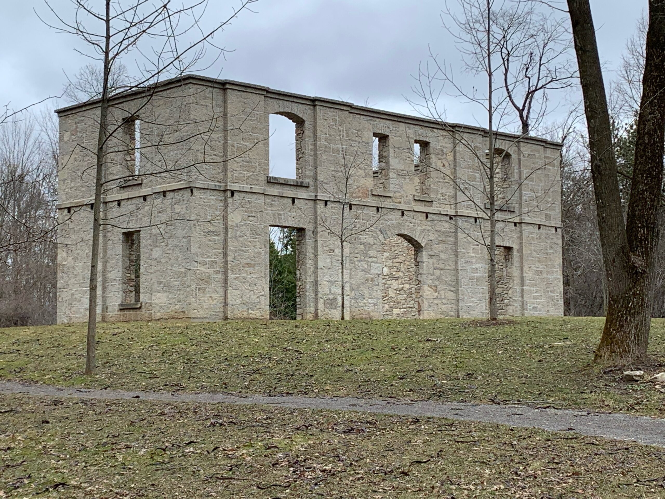
Join us for a hike in the Dundas Valley Conservation Area. With its wide trails and many hills it provides a great hike with enough hills for a good workout. We will complete the Sawmill Valley loop followed by the Main Trail loop. There will be an opportunity to drop out as we return to the Trail Centre after the Sawmill Valley loop. Meet in the large parking lot of the Dundas Valley Conservation Area at 9:45 for a 10:00 am. start. Bring water, sunscreen and a snack. Poles may be useful for the hills. Parking fee in effect or a Conservation Area pass.
Leader: Anne Armstrong. I will contact you a few days before the hikeCar Hike: Midweek Fitness Walk Around Island Lake (8.5 km)
https://hikesstaging.brucetrail.org/event/car-hike-midweek-fitness-walk-around-island-lake-8-5-km-2/Sorry, the registration cut-off time for this hike has been reached.Not a member? Click here to join today!Hosting Club: Toronto
Category: Car Hike
Location (Google Maps):Island Lake Conservation Area (Hwy 10 and 4th Ave intersection)
Hike Leader(s): Natalia Svechnikova Click here to contact Hike Leader(s)
Pace: Moderate (3-4 km/hr)
Terrain: Flat
Distance: 8.5 kmDescription
Please join me for an enjoyable fitness walk on a relatively flat and easy trail around the lake in the Island Lake Conservation area. The trail has treed sections as well as boardwalks near the water, meadows and more. I think that this hike is suitable for the end of November because it will be less muddy than many other places. We will keep some steady but still comfortable pace of approximately 3 km/h. We will have a short break on the picnic area after about 6 km. Please dress for the weather and bring 2 L of water and some snacks/light lunch. We will meet at the start of the trail (near the large trail map) at 4th Ave and Hwy 10 intersection. You can park anywhere at the Zehrs Orangeville, Winners or Mark’s parking lot which is just across Hwy 10.Please note that this hike will be cancelled in case of inclement weather.
- Each hiker joining a Bruce Trail Club organized hike must perform a self-screening check before hiking.
- 28November 28, 2024
Urban Walk: Valley View Park Thornhill 58
https://hikesstaging.brucetrail.org/event/urban-walk-valley-view-park-thornhill-37/Sorry, the registration cut-off time for this hike has been reached.Not a member? Click here to join today!Hosting Club: Toronto
Location (Google Maps): Parking lot at the corner of Bayview Ave, and Sycamore Dr. South of Highway 7
Sycamore Dr. is 3blocks south of highway 7 and 2 blocks north of John Street, parking lot is across plaza of Dollarama and Star boxHike Leader(s): Mohammad Aghamiri Click here to contact Hike Leader(s)
Pace: Moderate (3-4 km/hr)
Terrain: Level 2 (Intermediate – some hills and uneven surfaces, rocks and roots underfoot)
Distance: 7-8 kmDescription
We will explore Valleyview and Maple view parks, and walk along German Mill Creek, for a distance of 7-8 km. Difficulty Level: 2 (Moderate)9:00 am Long Hike Cave Spring
https://hikesstaging.brucetrail.org/event/900-am-long-hike-jordan-to-moyer-louth-4/Sorry, the registration cut-off time for this hike has been reached.Not a member? Click here to join today!Hosting Club: Niagara
Location (Google Maps): Cave Spring Conservation Area
Hike Leader(s): Alan Laver Click here to contact Hike Leader(s)
Pace: Medium
Terrain: Moderate
Distance: 10kDescription
From Cave Spring Conservation Area explore the trail network on the escarpment You must register for each hike. Bring Poles, snack and a drink and dress for the weatherHiking Around Jordan
https://hikesstaging.brucetrail.org/event/hiking-around-jordan-10/Sorry, the registration cut-off time for this hike has been reached.Not a member? Click here to join today!Hosting Club: Niagara
Location (Google Maps): Jordan Hollow, across from Boo’s Restaurant
Now known as Shoarishon ParkHike Leader(s): Bill Russell Click here to contact Hike Leader(s)
Pace: Medium
Terrain: ModerateDescription
Hiking various trails in and around Jordan, (Balls Falls, Jim Rainforth Trail and Bailey Bridge through the Village of Jordan.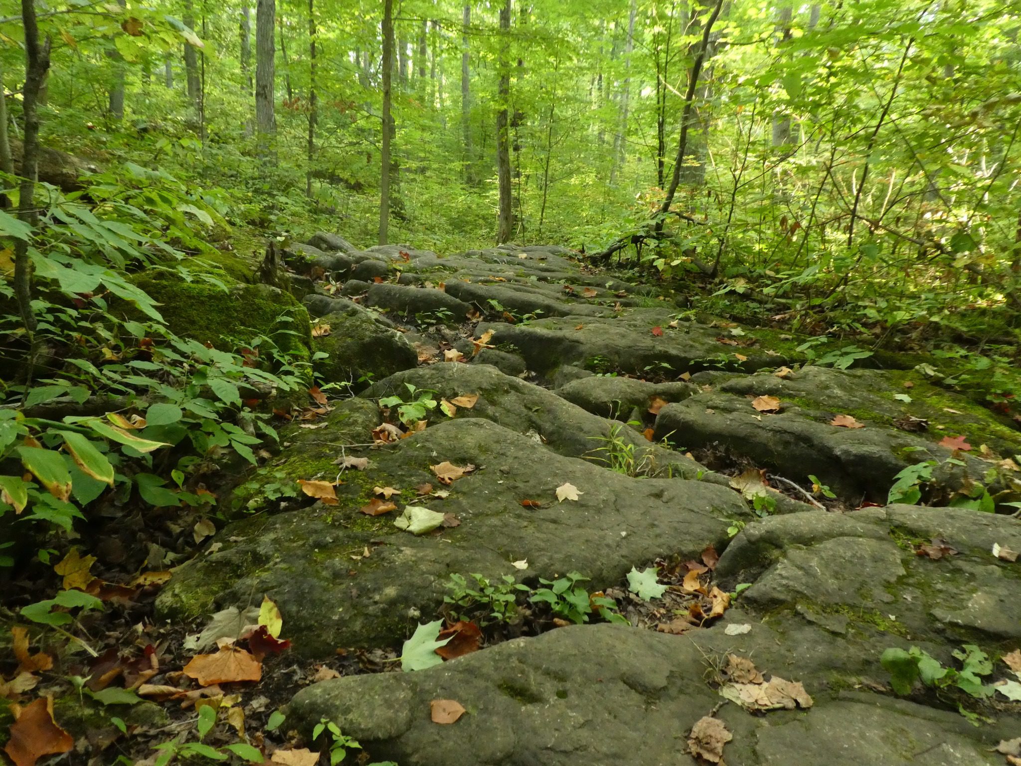
Halton Agreement Forest
https://hikesstaging.brucetrail.org/event/halton-agreement-forest-8/Sorry, the registration cut-off time for this hike has been reached.Not a member? Click here to join today!Hosting Club: Iroquoia
Category: General Hike
Location (Google Maps): Meet roadside on 4th Line, just east of Guelph Line, north of Campbellville.Hike Leader(s): Karen Bergmann Click here to contact Hike Leader(s)
Pace: Medium – 3 to 4 km/hr
Terrain: Moderate – Some hills and/or some poor footing
Distance: About 8 kmsDescription
We will hike around several of the bike trails.Memorial Forest Side Trail and Springmount Forest
https://hikesstaging.brucetrail.org/event/memorial-forest-side-trail-and-springmount-forest/Sorry, the registration cut-off time for this hike has been reached.Not a member? Click here to join today!Hosting Club: Sydenham
Category: General Hike
Location (Google Maps): West end of Youngs Drive, Owen SoundHike Leader(s): Franziska Edney Click here to contact Hike Leader(s)
Pace: Medium: 3 to 4 km/h
Terrain: Strenuous: Hilly with steep climbs and some poor footing., There are crevices or holes which may be hidden by layers of snow. Hike with extreme caution.
Distance: 5.5 kmsDescription
This is a linear hike, car shuffle will be required.NEW DATE : We will hike from Young’s Drive along the Memorial Forest Side Trail to Jones Falls, continuing south on the white trail, finishing on the Chalmers Quarry Side Trail. The hike will include beautiful views of escarpment rocks and Jones Falls, climbing a ladder and lookouts over the Sound. This is a technical hike, good footwear is a must and poles are advised. For more information please contact the hike leader. Map 32.