
Hike Schedule
Join us for a hike! Registration required:
All hikes available to BTC members. Some hikes are open to non-members.
TIP: The calendar view displays up to 7 hikes on a day, but often there are more. Click “More events” to see them all.
Categories
- 14November 14, 2024
Urban Walk: Valley View Park Thornhill
https://hikesstaging.brucetrail.org/event/urban-walk-valley-view-park-thornhill-33/Sorry, the registration cut-off time for this hike has been reached.Not a member? Click here to join today!Hosting Club: Toronto
Location (Google Maps): Parking lot at the corner of Bayview Ave, and Sycamore Dr. South of Highway 7
Sycamore Dr. is 3blocks south of highway 7 and 2 blocks north of John Street, parking lot is across plaza of Dollarama and Star boxHike Leader(s): Mohammad Aghamiri Click here to contact Hike Leader(s)
Pace: Moderate (3-4 km/hr)
Terrain: Level 2 (Intermediate – some hills and uneven surfaces, rocks and roots underfoot)
Distance: 7-8 kmDescription
We will explore Valleyview and Maple view parks, and walk along German Mill Creek, for a distance of 7-8 km. Difficulty Level: 2 (Intermediate)9:00 am Long Hike Jordan to Moyer / Louth
https://hikesstaging.brucetrail.org/event/900-am-long-hike-jordan-to-moyer-louth-2/Sorry, the registration cut-off time for this hike has been reached.Not a member? Click here to join today!Hosting Club: Niagara
Location (Google Maps):
Jordan Hollow Park 3039 King St Jordan
Pace: Medium
Terrain: Moderate
: 10kDescription
From Jordan Hollow Hike the main trail to Upper and Lower Balls Falls, Moyer Road or Louth and Return. You must register for each hike. Bring Poles, snack and a drink and dress for the weatherHiking Around Jordan
https://hikesstaging.brucetrail.org/event/hiking-around-jordan-8/Sorry, the registration cut-off time for this hike has been reached.Not a member? Click here to join today!Hosting Club: Niagara
Location (Google Maps): Jordan Hollow, across from Boo’s Restaurant
Now known as Shoarishon ParkHike Leader(s): Bill Russell Click here to contact Hike Leader(s)
Pace: Medium
Terrain: ModerateDescription
Hiking various trails in and around Jordan, (Balls Falls, Jim Rainforth Trail and Bailey Bridge through the Village of Jordan.Skinner’s Woods and Views over Georgian Bay
https://hikesstaging.brucetrail.org/event/skinners-woods-and-views-over-georgian-bay/Sorry, the registration cut-off time for this hike has been reached.Not a member? Click here to join today!Hosting Club: Sydenham
Category: General Hike
Location (Google Maps): The Owen Sound Galaxy Cinema parking lot. Meet at the tall “Galaxy Centre” sign next to the traffic lights.Hike Leader(s): Maureen McFarland Click here to contact Hike Leader(s)
Pace: Medium: 3 to 4 km/h
Terrain: Moderate: Some hills and/or poor footing, There might be icy and slippery sections., There might be muddy sections., There might be sections with water on the trail.
Distance: 8 kmsDescription
We will carpool to the start of this loop hike. We begin on the Len Holley Side Trail, then follow the snowmobile trail to Skinner’s Woods Side Trail. When we reach the escarpment we will walk along the top to the Curly Harnden Side Trail, then return to our cars via the side trail. With the leaves gone, we will enjoy some nice views over Georgian Bay and the islands. It may be wet underfoot, or if the morning is particularly cold, there could be some ice. Bring along your icers and poles, and a snack. Approximately 2 1/2 hours hiking time plus travel time to and from the hike start.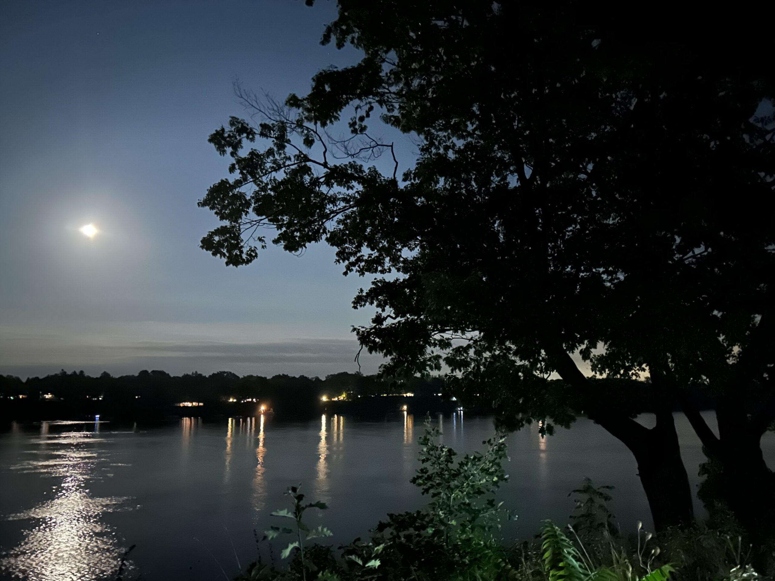
7:00 pm Moonlight Night Hike in Niagara-on-the-Lake
https://hikesstaging.brucetrail.org/event/700-pm-moonlight-night-hike-in-niagara-on-the-lake-7/Sorry, the registration cut-off time for this hike has been reached.Not a member? Click here to join today!Hosting Club: Niagara
Category: Night
Location (Google Maps): Veteran’s Memorial Park, park just outside the park on King St.Hike Leader(s): Robin Garrett Click here to contact Hike Leader(s)
Pace: Medium
Terrain: Easy
Distance: 6-7 kmDescription
Moonlight Night Hike – Take in the magic of the rising moon over Lake Ontario and the Niagara River. This hike includes a stop to connect with your senses – sights, sounds, smells and the rhythm of your breath. Counts towards your night hike badge (5 night hikes). - 15November 15, 2024

Car Hike: Caledon E2E in 5 sections - 5 of 5
https://hikesstaging.brucetrail.org/event/car-hike-caledon-e2e-in-5-sections-5-of-5/Sorry, the registration cut-off time for this hike has been reached.Not a member? Click here to join today!Hosting Club: Iroquoia, Caledon Hills
Category: General Hike
Location (Google Maps): Meet and park at km 16.1 at the southwest shoulder of the Willoughby Rd and Escarpment Sideroad intersection, and we carpool to the start.Hike Leader(s): Susan Glofcheskie Click here to contact Hike Leader(s)
Pace: Medium – 3 to 4 km/hr
Terrain: Moderate – Some hills and/or some poor footing
Distance: 16 kmDescription
Join us for this Caledon E2E in 5 sections. Sign up for all 5 sections (to be entitled to the badge) or only the ones you are available for.Please bring 2 litres of water, a snack, bug spray, sunscreen, a personal first-aid kit and appropriate clothing. Hiking boots/shoes are mandatory and poles are suggested.
Please arrive by 8 am, so we can leave at 8:15 am to shuttle to our starting point.
Click on the Google link for directions to the meeting place.
Iroquoia Stained Glass Badge, Fund Raiser in 6
https://hikesstaging.brucetrail.org/event/iroquoia-stained-glass-badge-fund-raiser-in-6/Sorry, the registration cut-off time for this hike has been reached.Not a member? Click here to join today!Hike open to BTC Members only.
This is a Multi-Day Hike
You are signing up for the following dates and times:
2024-11-15 at 08:30
2024-11-16 at 08:30
2024-11-17 at 08:31
2024-11-29 at 08:30
2024-11-30 at 08:30
2024-12-01 at 08:30Hosting Club: Toronto
Category: Car Hike
Location (Google Maps): Km 96.8, Twiss rd at No 8 Sideroad. Coordinates N 43.429065,W 79.927324 map 10.Hike Leader(s): Smadar junkin Click here to contact Hike Leader(s)
Pace: Fast (5 km/hr or greater)
Terrain: Hilly, Variable
Distance: 23 kmDescription
Hi everyone, welcome to the Iroquoia fund raising hike. The funds will be collected by the Toronto club and transferred to the Iroquoia Club and be used for the mission of keeping the promise of “A ribbon of wilderness for everyone forever”, hike participants will be allowed to miss one hike and make it on their own through the time period of this series. On the first day we will shuttle to km 120.6 we will park in Kelso, walk to the 401 bridge (end of the Iroquoia section) and hike back. The hike is planned for about 23.5 Kms but might be shorter if the Glen Eden area will be close for hiking because of mud problems.
day 2 -November 16, we will meet at the same place and shuttle to km 76. City View Park. 20km. We will shuttle to km 96.8 and walk back. 23 km.day 3- November 17, we will meet at km 58.8, Sydenham Lookout ST, Sydenham Rd. Coordinates N 43.277643,W 79.949682 map 8, we will shuttle to km 75.5 and walk back. 16.7 km
day 4- November 29, we will meet at Sydenham lookout, same as day 3, we will shuttle to km 38.6 and walk back. 21 kms.
day 5- November 30- we will meet at km 21.1, Glover Mtn Rd ST, Glover Mountain Rd, coordinates N 43.209155, W 79.773801 map 6 and shuttle to km 38.6 and walk back. 17 kms.
day 6- December 1- we will meet at the Grimsby Community Pool. Km 0.0 1 Elm St. Grimsby coordinates N 43.193201,W 79.565301 map 5. We will shuttle to km 21.1 and walk Bach. 21 km.
Please arrive 15 minutes early so we can be in the cars and ready to leave for the shuttle by 8:30. Bring 2 litres of water, snacks and lunch.
9:00 am Niagara-on-the-Lake Tour
https://hikesstaging.brucetrail.org/event/900-am-niagara-on-the-lake-tour/Sorry, the registration cut-off time for this hike has been reached.Not a member? Click here to join today!Hosting Club: Niagara
Category: Urban
Location (Google Maps): Veterans Memorial Park, park just outside the park on King StreetHike Leader(s): Robin Garrett Click here to contact Hike Leader(s)
Pace: Medium
Terrain: Easy
Distance: 6-7 kmDescription
Each Friday we will explore different neighbourhoods, trails and parkland throughout Historic Niagara-on-the-Lake.Moderate pace with some weeks entirely on sidewalks and roads while others may include a mix of trails and paved pathways. Great way to build up endurance for longer more strenuous hikes.
Prepare for cooler windy conditions on open parkland and along Lake Ontario and Niagara River trails.
Plan to stay for conversation and a warm cup of coffee or tea at Sweets & Swirls, Community Centre, Niagara Stone Road, NOTL
Inglis Falls and Creamery Hill
https://hikesstaging.brucetrail.org/event/inglis-falls-and-creamery-hill/Sorry, the registration cut-off time for this hike has been reached.Not a member? Click here to join today!Hosting Club: Sydenham
Category: General Hike
Location (Google Maps): Harrison ParkHike Leader(s): Danuta Valleau Click here to contact Hike Leader(s)
Pace: Medium: 3 to 4 km/h
Terrain: Moderate: Some hills and/or poor footing
Distance: 5.5 kmDescription
Starting from Harrison Park Inn, we will walk through the campground and up through the Grey Sauble Conservation Area pathways to cross the Sydenham River and follow the east bank to Inglis Falls. After crossing the road at Inglis Falls, we’ll go over the stile to follow a winding trail through the forest. There is about 1 km of road linking with the trail back into Harrison Park. Option for lunch at the Harrison Park Inn.
Moonlit Hike Series - Beaver Moon "Freezing Moon" (Hike 2 of a 6 part series)
https://hikesstaging.brucetrail.org/event/moonlit-hike-series-beaver-moon-hike-2-of-a-6-part-series/Sorry, the registration cut-off time for this hike has been reached.Not a member? Click here to join today!Hosting Club: Peninsula
Category: Moonlit Hike Series
Location (Google Maps): Black Creek Provincial ParkHike Leader(s): Bill Floyd Click here to contact Hike Leader(s)
Pace: Leisurely
Terrain: Easy
Distance: ~ 3 1/2 kmDescription
Join us for hike two of a six part Full Moon Hike Series (October – March).Our hike starts with a short, sandy beach walk to the entrance of this magical mixed forest trail. This 3 1/2 km hike (out and back) is generally on flat and even terrain. Once we get to the end of the trail we will be on the shores on Lake Huron. We may walk along the rocks on the shore for a short bit to get a view of the lake (and Stokes Bay). We will return to the beach on the same trail.
When we return to the beach, we will sit on a chair you bring (keep it in your vehicle until after the short hike) or the picnic benches that are there. The plan is to sit and gaze at the full moon and stars while sipping on the hot chocolate (bring your own mug) and treats.
We are soooooo pleased to share that Brenda Stewart, PBTC Archivist, will be joining us on this hike. Brenda will share stories / history of this area.
Sunset is 4:45pm
The moon rises at 4:29pm from the NE.
Start time is 6:00pm
Dress comfortably and wear sturdy shoes. Illuminate your path with a red light headlamp/flashlight. The time commitment is about 2 1/2 hours. See you there!”
You can learn more about Black Creek Provincial Park here: https://visitlionshead.ca/profile/black-creek-provincial-park/1575/
Duration: 2 – 2 1/2 hours
Full Moon Hiking Series
- stay tuned for further hike registrations in this series
Date
Name
Thursday, October 17th @ Lindsay Tract
Hunter’s Moon- Commemorating the hunting season preceding winter.
Friday, November 15th @ Black Creek Provincial Park (Sandy beach)
Beaver Moon- Reflects the time when beavers are busy building their winter dams.
Sunday, December 15th @ Cape Chin (info to follow)
Cold Moon- Evocative of winter’s chill
Monday, January 13th
Wolf Moon- named after howling wolves
Wednesday, February 12th (possible cross country or snowshoe)
Snow Moon- named after the snow on the ground.
Friday March 14th
Worm Moon- The Worm Moon gets its name from the earthworms that come out when the soil warms up. The worms provide food for birds and other animals.
CANCELLED - Full Moon hike - Start Lower Parking lot
https://hikesstaging.brucetrail.org/event/lower-parking-lot-kerncliff-park-burlington/Sorry, the registration cut-off time for this hike has been reached.Not a member? Click here to join today!Hosting Club: Iroquoia
Category: General Hike
Location (Google Maps): Start in the Lower Parking lot – no access from Hwy 5.Hike Leader(s): Madeline Grady Click here to contact Hike Leader(s)
Pace: Medium – 3 to 4 km/hr
Terrain: Moderate – Some hills and/or some poor footing
Distance: about 8 kmDescription
Start is the lower parking lot. Not accessible from Hwy.5. Access Kearns Rd from the North Service Road, or Access Kerns Rd. from Brant St. via Tyandaga. We will be on both blue side trails and the main trails. The start is hilly and then we’ll enjoy mostly flat on our way west to King Road. There are some great lookouts to see Burlington and the lake. We’ll loop back and have a hilly finish. Poles and hiking shoes/boots and head lamps are recommended. Please bring water and a snack.
Full Moon Hike Finch Corridor and East Don - 12km
https://hikesstaging.brucetrail.org/event/full-moon-hike-finch-corridor-and-east-don-13km/Sorry, the registration cut-off time for this hike has been reached.Not a member? Click here to join today!Hosting Club: Toronto
Category: Urban Walk
Location (Google Maps): Finch Station Passenger Pick-Up areaHike Leader(s): Alina Lin
Pace: Brisk (4-5 km/hr)
Terrain: Flat, Level 2 (Intermediate – some hills and uneven surfaces, rocks and roots underfoot)
Distance: 12KMDescription
Note: This hike is planned for a night with clear skies to enjoy the full moon. If the weather forecast does not promise a clear night sky, the hike will be rescheduled to 7:00pm on Friday, November 15. Should the forecast for November 15 still not indicate clear skies, the hike will be cancelled. Any changes, including rescheduling or cancellation, will be posted here, and you will also receive an email notification at least 24 hours in advance. Please check this post and your email inbox for updates.Join Us for a Full Moon Night Hike under the November full moon – the Beaver Moon! Step into the enchanting glow of the Beaver Moon as we journey along the Finch Corridor Recreational Trail and East Don Parkland Trail. Under the silver light of this November full moon, we’ll immerse ourselves in the calm and wonder of nature at night. This is more than a hike – it’s a chance to embrace the stillness, connect with the world around us, and find peace in the shadows and reflections cast by the moonlight. Together, we’ll listen to the quiet sounds of the night, watch shadows dance beneath the trees, and feel the cool November air as it stirs through the woods. There’s something magical about the full moon that invites reflection, inspiration, and a special kind of togetherness. Whether you’re coming solo, with friends, or with family, let’s share in this night of awe and serenity beneath the light of the Beaver Moon.
Meet Location: Finch Station passenger pick-up area located at the northwest of Hendon Ave and Yonge Street.
What to Bring:
- Comfortable walking shoes. Running shoes are recommended as the route is all hard paved surface.
- A flashlight or headlamp (for safety in case as we’ll rely on moonlight when possible)
- Warm layers – it can get chilly at night!
- Water and a snack
- No pets
- 16November 16, 2024
Car Hike: Rouge National Park Scarborough
https://hikesstaging.brucetrail.org/event/car-hike-rouge-national-park-scarborough-5/Sorry, the registration cut-off time for this hike has been reached.Not a member? Click here to join today!Hosting Club: Toronto
Location (Google Maps): Rouge Park, Zoo Road Parking Lot, off Meadowvale Road north of Sheppard Ave,
Hike Leader(s): Mohammad Aghamiri Click here to contact Hike Leader(s)
Pace: Moderate (3-4 km/hr)
Terrain: Hilly, Level 2 (Intermediate – some hills and uneven surfaces, rocks and roots underfoot)
Distance: 14-17 kmDescription
We will hike Orchard trail and return through Vista Trail to the parking lot Difficulty; Level: 2 (Moderate)THIS HIKE MAY BE CONSIDERED AS URBAN FOR THOSE WHOM USE PUBLIC TRANSPORT BUT NOTE THAt IT IS 14 TO 17 KM HIKE OVER SOME HILLY TERRAIN
TAKE THE BUS FOR TORONTO ZOO AND GET OFF AT LAST STOP BEFORE THE ZOO AND TURN RIGHT TOWARDS PARKING LOT OF ROUGE PARK.
Car Hike: Greenwood Conservation Area
https://hikesstaging.brucetrail.org/event/car-hike-greenwood-conservation-area/Sorry, the registration cut-off time for this hike has been reached.Not a member? Click here to join today!Hosting Club: Toronto
Category: Car Hike
Location (Google Maps):Greenwood Conservation Area
Hike Leader(s): Glynn Richardson Click here to contact Hike Leader(s)
Pace: Moderate (3-4 km/hr)
Terrain: Hilly, Level 2 (Intermediate – some hills and uneven surfaces, rocks and roots underfoot), Variable
Distance: 10-14 kmDescription
We’ll spend the morning exploring Greenwood Conservation Area.Bring snacks, lunch, water. Hiking footwear is MANDATORY. Hiking poles and gaitors are highly recommended.
Check the weather in advance and dress accordingly in layers.
There will be no dropouts and no dogs allowed.
Registered participants are to arrive 15 minutes prior to the hike for briefing
Space is limited.
School Bus Hike: Dufferin Section E2E #3 of 4
https://hikesstaging.brucetrail.org/event/school-bus-hike-dufferin-section-e2e-3-of-4/Sorry, the registration cut-off time for this hike has been reached.Not a member? Click here to join today!Trip Information
Departure Time: 08:30
Return to City Time: 18:00
Departure Point: York Mills Bus PickupOptional Items
Hosting Club: Toronto
Category: Bus Hike
Location (Google Maps):Dufferin Hi-land Section km 28.3 to km 40.7
Hike Leader(s): Tom Swales, Celia Ho Click here to contact Hike Leader(s)
Pace: Moderate (3-4 km/hr)
Terrain: Hilly, Level 2 (Intermediate – some hills and uneven surfaces, rocks and roots underfoot), Rocky, Variable
Distance: 12.4 kmDescription
Join us on the first four Saturdays of November on a series of bus hikes to complete the Dufferin Hi-Land section. Hikers who complete all four hikes may apply for the Dufferin Hi-Land Club’s pink rose E2E badge ($10.00 Members, $15.00 Non-Members) or their stained glass fundraiser Yellow Ladies Slipper badge ($30.00 – Members Only). The third hike in the series will take us from km 28.3 to km 40.7 for 12.4 km into the Pine River Valley and Kilgorie in the Mulmur Hills and past many crevices, the power plant ruins, and the Bell lookout named after the founders of the Dufferin Hi-Land club. Anyone is welcome to join one or more of the hikes even if not working on one of the E2E badges. Long distance bus fare applies for this hike. For drivers who wish to meet us at the trailhead, four spots will be reserved – cost $10 includes return shuttle to meeting location – please email the hike leaders for details on how to register as Car Hike – priority for the four spots will be given to hikers intending to join all 4 hikes.Let's Get Started - Day 1 of 2
https://hikesstaging.brucetrail.org/event/lets-get-started-day-1-of-2/Sorry, the registration cut-off time for this hike has been reached.Not a member? Click here to join today!Hosting Club: Niagara, Iroquoia
Category: General Hike
Location (Google Maps): Meet up at the parking area (GPS coord 43.145576-79.191260) on the east side of Glendale Ave Bridge (Welland Canal) – across from the GM Plant at 8:30 SHARP. From there we will shuttle to Queenston Heights parking to begin our hikeHike Leader(s): Karen Capindale-Smith Click here to contact Hike Leader(s)
Pace: Medium – 3 to 4 km/hr
Terrain: Moderate – Some hills and/or some poor footing
Distance: +/- 18 kmDescription
Day 1 of this 2 day hike will begin at the southern terminus of the Bruce Trail- Queenston Heights park and end at the Welland canal. This hike will include a combination of parks, escarpment views ,railroad track crossings and city streets. Come join us for one or both days! Please pack appropriate layers for the weather. Icers may be necessary. Remember to bring water, a snack and lunch. Expect baked goods:)Decew, Twelve Mile Creek loopish
https://hikesstaging.brucetrail.org/event/decew-twelve-mile-creek-loopish/Sorry, the registration cut-off time for this hike has been reached.Not a member? Click here to join today!Hike open to BTC Members only.
Hosting Club: Niagara
Category: Loop
Location (Google Maps): Meet at Decew House parking lot.Hike Leader(s): Lauren Doig Click here to contact Hike Leader(s)
Pace: Brisk
Terrain: Moderate
Distance: 19 kmDescription
Meet at Decew House and hike along the the reservoir to Twelve Mile Creek. Follow the Creek until it meets the 406. Return to Decew House via the same route or on the other side of the creek depending availability of the trail.Bring a snack. Hiking poles recommended. Dress for the weather.
Introduction to the Bruce Trail: Limehouse Conservation Area Loop Hike
https://hikesstaging.brucetrail.org/event/introduction-to-the-bruce-trail-limehouse-conservation-area-loop-hike/Sorry, the registration cut-off time for this hike has been reached.Not a member? Click here to join today!Hosting Club: Toronto, Peninsula
Location (Google Maps):
Hike Leader(s): Saabir Sohrab Click here to contact Hike Leader(s)
Pace: Leisurely, Medium
Terrain: Easy, Moderate
Distance: ~5Description
Join us for an introduction to hiking the Bruce Trail as we venture through the beautiful Limehouse Conservation Area! This loop hike is perfect for beginners or those looking to brush up on their hiking skills and learn more about the natural beauty and history of the Niagara Escarpment.Hike Details:
Duration: ~2 hours
What to Bring: Sturdy hiking shoes, water, snacks, weather-appropriate clothing (dress in layers)This hike will take us through a diverse landscape of forests, rocky bluffs, and creek-side views, with the famous karst topography and historic lime kiln ruins along the way.
Hike Highlights and What You’ll Learn:
1. Terrain & Safety Tips
The terrain is mostly flat with some gentle elevation changes. We’ll be walking through some rocky areas and along creekside paths, so make sure to wear sturdy shoes with good traction. Hiking boots or trail shoes are ideal, as parts of the trail can get slippery, especially near the creek. Please remember to bring water to stay hydrated, and snacks to keep your energy up during the hike. We will be stopping at key points to rest, take in the views, and discuss the trail ahead.
We will also review basic hiking safety tips along the way, including how to avoid slips and falls on uneven terrain, how to deal with wildlife encounters (like snakes and deer), and what to do in case of an emergency.
2. Introduction to the Bruce Trail Conservancy (BTC) Wayfinders
As we hike, we will take the time to introduce the Bruce Trail Conservancy (BTC) and its mission to protect and preserve the Niagara Escarpment. You’ll learn how the BTC’s wayfinders (trail markers) help guide hikers along the trail. These distinctive white blazes mark the official route of the Bruce Trail, and we’ll talk about how to read and follow them safely. This is a great opportunity to ask questions about navigating the trail and how to plan longer hikes on the Bruce Trail system.
3. Natural History and Scenic Views
As we hike through Limehouse, we’ll explore the karst landscape – a unique geological feature created by the erosion of limestone. You’ll see the Limehouse Caves and other rock formations, where the path winds through narrow passages and over rocky outcrops. We’ll also pause to enjoy views of Black Creek and the surrounding forest, and discuss the various plant and animal species that call this area home. Keep your eyes peeled for songbirds, squirrels, and perhaps even a deer or fox.
4. Historic Significance: Lime Kiln
At one point on the trail, we’ll stop to learn about the historic lime kiln that was once used to produce lime during the 19th century. This is a great spot for photos and a little bit of history! We’ll talk about the local industry in the area during that time, and how the conservation efforts today protect these important historical landmarks.
Preparing for the Hike:Clothing: Dress for the weather, and wear layers that you can adjust as we hike. Even if it’s cool in the morning, it may warm up as we go.
Footwear: Sturdy shoes or hiking boots with good support are essential. The trail may be muddy or uneven in spots, so avoid sandals or flimsy shoes.
Snacks and Water: It’s always a good idea to carry water to stay hydrated, and snacks like granola bars or fruit for a quick energy boost during the hike.
Camera and Binoculars: If you enjoy photography or birdwatching, bring a camera or a pair of binoculars to capture the stunning landscapes and wildlife along the trail.We look forward to seeing you on the trail! Don’t forget to bring your curiosity, and prepare for a fun, informative day out in nature.
Port Robinson Hike
https://hikesstaging.brucetrail.org/event/port-robinson-hike/Sorry, the registration cut-off time for this hike has been reached.Not a member? Click here to join today!Hosting Club: Niagara
Category: Leisurely
Location (Google Maps): We’ll park at the Port Robinson Park, (where Canby Street meets River St.) We’ll walk along the east side of the canal, return and do a loop around the village.Hike Leader(s): Diane Marlatt Click here to contact Hike Leader(s)
Pace: Leisurely
Terrain: Easy
Distance: 3-4 KmDescription

Rainbow Hike
https://hikesstaging.brucetrail.org/event/rainbow-hike/Sorry, the registration cut-off time for this hike has been reached.Not a member? Click here to join today!Hosting Club: Iroquoia
Category: Rainbow Hike
Location (Google Maps): 8:45am Chedoke Golf Club parking lot. Please park near the Chedoke stairs.Hike Leader(s): Ruth Moffatt Click here to contact Hike Leader(s)
Pace: Leisurely – 3km/hr or less
Terrain: Dependent on Conditions, Easy – Mostly flat and usually good footing, Moderate – Some hills and/or some poor footing
Distance: About 8kmDescription
The Iroquoia Bruce Trail Club is a welcoming and inclusive space. We value and welcome diversity, and aim to be an accessible and inclusive community that honours, respects, and reflects the various ways people connect with the Bruce Trail and the Bruce Trail Conservancy.
Rainbow Hikes are offered periodically and are open to 2SLGBTQ+ folx and allies. The rainbow badge is complimentary.
Please join us for a leisurely-paced hike on easy – moderate terrain. A descent down Chedoke stairs will occur at the end of the hike.
Please bring enough water and snacks for about a 3 hour hike.Car Hike: Forks of the Credit
https://hikesstaging.brucetrail.org/event/car-hike-forks-of-the-credit-5/Sorry, the registration cut-off time for this hike has been reached.Not a member? Click here to join today!Hosting Club: Toronto
Category: Car Hike
Location (Google Maps): Forks of the Credit Provincial Park, Map 15Hike Leader(s): Al Brown Click here to contact Hike Leader(s)
Pace: Moderate (3-4 km/hr)
Terrain: Level 2 (Intermediate – some hills and uneven surfaces, rocks and roots underfoot)
Distance: 10 kmDescription
Starting at Mississauga Road we will hike along the Elora Cataract Trailway into the Forks of the Credit PP and complete a loop hike through the PP, returning along the Trailway. The route has a couple challenging hills. After the hike those interested may join me for refreshments at a location TBA.To get to the meeting spot drive north on Mississauga Road past Belfountain to Cataract Road (about 2 km). Parking is available along both sides of Mississauga Road. Please insure you park in marked areas as you might get a ticket.

Peninsula Blue Series Hike: Juniper Flats and Harkins Side Trail
https://hikesstaging.brucetrail.org/event/peninsula-blue-series-hike-juniper-flats-and-harkins-side-trail/Sorry, the registration cut-off time for this hike has been reached.Not a member? Click here to join today!Hosting Club: Peninsula
Category: Peninsula Blue Series
Location (Google Maps): Juniper Flats and Harkins Sidetrail- Dyers Bay area.Hike Leader(s): Marg Glendon and Owen Glendon Click here to contact Hike Leader(s)
Pace: Leisurely, Medium
Terrain: ModerateDescription
This ~7 km loop hike will provide an opportunity to learn more about the special features of the BTC Nature Reserves here. A PBTC Land Steward Volunteer will join us to explain the role and responsibility of a Volunteer BTC Land Steward and share some unique features of this part of the “Bruce Trail Conservation Corridor”.Juniper Flats Sidetrail is a lovely trail which winds through three unique BTC Nature Reserves featuring a wetland and four different types of Alvar – provincially rare types. Additionally, it supports threatened species such as the Whip-poor-will and Massassauga Rattlesnake and several rare plant species.
Our return segment of this loop hike, will include Harkins Sidetrail and spectacular view of Dyers Bay and Georgian Bay from the Main Trail.
Terrain is mostly flat, but uneven with crevices, roots and slippery rocks. Please bring a light back pack for your water and snacks. Weather can be unpredictable. Wear layers, check the weather forecast, and dress accordingly. Expect to be finished within about 2 1/2 hours. Wear sturdy footwear with good grip. Hiking poles may be helpful, but are optional.
Meet at the Dyers Bay Municipal Parking Lot a few minutes prior to hike start time. Parking is free at this time of year. The cell reception is unreliable here, please contact us prior to 12 noon if you need to reach us.
Working toward your Peninsula Bear Badge – the Peninsula Blue Hike Series? This hike will include two more sidetrails to add to your hiking log!
Map 40. Bruce Trail Reference Guide (Edition 31).
Urban Walk: South Humber and Swansea Theatre Hike
https://hikesstaging.brucetrail.org/event/urban-walk-south-humber-and-swansea-theatre-hike-2/Sorry, the registration cut-off time for this hike has been reached.Not a member? Click here to join today!Hosting Club: Toronto
Location (Google Maps): Meet for a 3:00 PM departure from the TTC Route #79 Scarlett Road bus stop at the south east corner of Scarlett Road and Eglinton Avenue West.
Hike Leader(s): Miriam Stevens, Click here to contact Hike Leader(s)
Pace: Leisurely (2-3 km/hr)
Terrain: Variable
Distance: 9 – 10 kmDescription
Join us for a leisurely hike (3kms/hour- no runners!) south on the Humber River Trail and through the Swansea neighborhood. There are 3 steep staircases on the route. Optional drop out at the Old Mill subway station.
Suitable for beginners and families. We will follow the Humber River Trail to the Old Mill and then hike parts of the Swansea neighborhood to Runnymede Road and Bloor Street West which is the end of the hike across from the Runnymede subway station.After the hike you may choose to join us for dinner at 6:00 PM at either Ali Baba Mediterranean/Italian (yes, the right – now with pasta options!) Cuisine or at a nearby pub, as you wish.
We will attend the play at 8 PM at the village Players, 2190 Bloor Street West. This evening’s performance will be Terror By Gaslight by Tim KellyCall the Theatre directly 416 767 7702 to reserve your ticket($29.00 adults and seniors) and mention that you are with the Bruce Trail Conservancy, Toronto Club.
Anyone is welcome to come for the hike only, join us for the theatre performance, or, join us for all three: Hike, dinner and play at the theatre. Paid parking is available off Kennedy Avenue north of Bloor Street West (behind theatre building).
- 17November 17, 2024
Bruce Trail into Dundas Valley Conservation
https://hikesstaging.brucetrail.org/event/bruce-trail-into-dundas-valley-conservation/Sorry, the registration cut-off time for this hike has been reached.Not a member? Click here to join today!Hosting Club: Iroquoia
Category: General Hike
Location (Google Maps): The Blue side trail starts from the road/sidewalk. There is street parking on Davidson Blvd. We’ll meet at the trail head.Hike Leader(s): Madeline Grady Click here to contact Hike Leader(s)
Pace: Medium – 3 to 4 km/hr
Terrain: Moderate – Some hills and/or some poor footing
Distance: Approx 8km,Description
This is an out and back hike with some loops from the conservation area added. There are steep areas, stairs and roots. Hiking boots and poles are recommended. Bring along water and a snack and dress for the weather.Car Hike: Speyside - Blue and White Trails – 22KM
https://hikesstaging.brucetrail.org/event/car-hike-speyside-blue-and-white-trails-22km/Sorry, the registration cut-off time for this hike has been reached.Not a member? Click here to join today!Hosting Club: Toronto
Category: Car Hike
Location (Google Maps): We meet at the Parking area on St. Helena Road. This is a small road just off Halton Road 25. If you are coming from 401 exit for Hwy 25, it will be up the hill after you cross 10 Side Road. You have to turn left to enter the Road. Watch for traffic.Hike Leader(s): Fayyaz Mahmood Click here to contact Hike Leader(s)
Pace: Brisk (4-5 km/hr)
Terrain: Level 2 (Intermediate – some hills and uneven surfaces, rocks and roots underfoot)
Distance: 22 KMDescription
This is my favourite hike.We will walk to the trail-head at the end of St. Helena road. We will walk the main trail going South-East from 8.9KM, Map 12 Ed 31 to the point where it meets the Hilton Falls Side Trail at 1.4KM. We will walk the Hilton Falls Side Trail having lunch at Hilton Falls. Then proceed to Vanderlick ST turning right to meet the Al Shaw ST to meet the Main Trail at 10.6KM and return back to the parking lot about 2.5KM.
Bring 1.5 – 2 liters of water and your lunch. Please dress for the weather.
Peninsula Blue Series - Exploring Dyer’s Bay Area
https://hikesstaging.brucetrail.org/event/peninsula-blue-series-exploring-dyers-bay-area/Sorry, the registration cut-off time for this hike has been reached.Not a member? Click here to join today!Hosting Club: Peninsula
Category: Peninsula Blue Series
Location (Google Maps): Borchardt Rd, Northern Bruce Peninsula, ON N0H 1W0Hike Leader(s): Saabir Sohrab Click here to contact Hike Leader(s)
Pace: Medium
Terrain: Moderate, Difficult
Distance: ~10kmDescription
Join us for an exciting 10 km hike through the stunning Dyer’s Bay Area.. We’ll primarily traverse the BTC Protected Area. Our hike will take us through beautiful woodlands 🌳, dramatic cliffs 🏔️, serene shorelines 🌊, and unique geological features, including the iconic Flowerpot and Michiganders Arch.The hike will cover approximately 10 km at an average speed of 3 km/h, taking about 4 to 5 hours to complete. The terrain is moderate to difficult, so be prepared for a range of challenges. The expected temperature during our hike is around 5°C, so dressing in layers is essential for comfort 🧥.
Side Trails We Will Explore:
- Devil’s Monument Side Trail: Marvel at the impressive sea stack known as the “Flowerpot,” formed approximately 5,500 years ago by glacial Lake Nippissing 🌌.
- Minhinnick Side Trail: Named after landowner who provided an interpretive plaque at Devil’s Monument 📜.
- Lillie Pothole Side Trail: Discover a future geological gem—a 4-meter diameter and 4-meter deep glacial pot hole 🔍.
- Lillie Family Side Trail: This trail is dedicated to John and Sue Lillie, long-time supporters and land donors ❤️.
- Cottrill Lake Side Trail: Named after a dedicated employee of the Ministry of Natural Resources and Forestry 🌿.
- Anne & Clayton Roberts Side Trail: Recognizing decades of outstanding trail maintenance, this path reflects the dedication of trail captains Anne and Clayton Roberts’s 🛠️.
To ensure a great experience, please wear sturdy shoes with good traction 👟 and bring snacks and lunch to keep your energy up 🍎. Don’t forget to carry plenty of water as well! 💧
9:00 Witch of Cave Spring Hike
https://hikesstaging.brucetrail.org/event/900-witch-of-cave-spring-hike-2/Sorry, the registration cut-off time for this hike has been reached.Not a member? Click here to join today!Hosting Club: Niagara
Category: In and Out
Location (Google Maps):Parking lot Quarry Road Beamsville
Hike Leader(s): Angela Lytle Click here to contact Hike Leader(s)
Pace: Medium
Terrain: Moderate
Distance: 5 kmDescription
Enjoy a beautiful hike through the autumn woods and learn about local historical and mystical lore while searching for the Witch of Cave Spring.Complete this guided hike and count it towards the Screaming Tunnel Badge, more info on the badge requirements is here: https://niagarabrucetrail.club/badges/
Wearing a witch hat, while not required, is highly recommended!
Details:
This hike loops from Quarry Rd in Beamsville (limited parking, carpool if possible) along the Bruce Trail to Cave Spring Conservation area and back.
Note: The path to Cave Spring is quite rocky and has some hills. We recommend using hiking poles and wearing good hiking shoes is a must. Carry water and dress for changeable weather.
We will stop along the way at sites of interest and loop back to the car park on Quarry Rd. The loop is around 5 km. Please arrive by 8:50 to check in with the hike leader for departure at 9.
Let's Get Started- Day 2of 2
https://hikesstaging.brucetrail.org/event/lets-get-started-day-2of-2/Sorry, the registration cut-off time for this hike has been reached.Not a member? Click here to join today!Hosting Club: Niagara, Iroquoia
Category: General Hike
Location (Google Maps): Meet up at Decew Falls parking of Morning Star Mill. From there we will shuttle to the parking area (GPS coord 43.145576-79.191260) on the east side of Glendale Ave Bridge (Welland Canal) – across from the GM Plant.Hike Leader(s): Karen Capindale-Smith Click here to contact Hike Leader(s)
Pace: Medium – 3 to 4 km/hr
Terrain: Moderate – Some hills and/or some poor footing
Distance: 15.5 kmDescription
Day 2 hike will start along the Canal and meet up with the Merritt Trail. We will travel past Brock University and around Lake Moodie before finishing at Decew Falls. Please come dressed for the weather (layers). Icers may be necessary. Remember to bring water, a snack and lunch. Expect baked goods 🙂
Car Hike: Dufferin Hi-Land in 10 (New Fundraising Badge: $30/BTC member; $40/non-member)
https://hikesstaging.brucetrail.org/event/car-hike-dufferin-hi-land-in-10-new-fundraising-badge-30-btc-member-40-non-member/Sorry, the registration cut-off time for this hike has been reached.Not a member? Click here to join today!This is a Multi-Day Hike
You are signing up for the following dates:
2024-11-17, 2024-12-15, 2025-01-12, 2025-03-02, 2025-03-23, 2025-04-13, 2025-05-25, 2025-06-22, 2025-07-27, 2025-08-24Hosting Club: Toronto, Dufferin Hi-Land
Category: Car Hike
Location (Google Maps): For our first hike, we will meet at roadside parking on 2nd Line EHS (km 2.2 on Map 19 of the Bruce Trail Reference Guide, Edition 31).Hike Leader(s): Monica Pasquali Click here to contact Hike Leader(s)
Pace: Leisurely (2-3 km/hr), Moderate (3-4 km/hr)
Terrain: Level 2 (Intermediate – some hills and uneven surfaces, rocks and roots underfoot), Rocky, Variable
Distance: 10-11 km per hikeDescription
Calling all families with children who love hiking and earning badges!!!All registered hikers – including participating children – will earn the Dufferin Hi-Land Yellow Lady’s Slipper stained-glass badge!!!
You are registering for the following ten Sundays of this 2024-2025 hike series led by TBTC guest hike leader Monica Pasquali: November 17, December 16, January 12, March 2 (hike rescheduled from February due to snowstorm), March 23 (hike rescheduled from March 16 due to high winds and flooding risk), April 13, May 25, June 22, July 27, and August 24.
Hikers must strive to complete all ten hikes with the leader. Hikers are permitted to miss three of the ten hikes due to unforeseen circumstances; if this happens, they will make up the hike(s) on their own so they can still qualify for the badge. Please keep a log of the missed hike(s) and give it to the leader on the last day of the series.
The fee for this hike series goes towards supporting the Dufferin Hi-Land Bruce Trail Club, which in turn supports the mission of the Bruce Trail Conservancy in “preserving a ribbon of wilderness, for everyone, forever”.
This hike is intended to be leisurely/moderate (approximately 3 km/h). Please, register only if you are capable of sustaining this pace over varied/rocky terrain for a distance of 10-11 km.
We will NOT be doing car shuttles so that families (with already-full cars!) can participate. All of the hikes in this series will be out-and-back hikes.
You should wear sturdy footwear and appropriate clothing for the weather, and ensure you bring your ID cards and enough water and food for the entire hike.
Dufferin Hi-Land Membership Appreciation Pre-Social Hike
https://hikesstaging.brucetrail.org/event/dufferin-hi-land-membership-appreciation-pre-social-hike/Sorry, the registration cut-off time for this hike has been reached.Not a member? Click here to join today!Hike open to BTC Members only.
Hosting Club: Dufferin Hi-Land
Category: Special Events
Location (Google Maps): Mono Community Centre, 200m south of Mono Centre (County Road 8). Park in gravel lot.Hike Leader(s): Stuart Law Click here to contact Hike Leader(s)
Pace: Leisurely
Terrain: Dependent on Conditions, Slippery Sections Likely, Easy
Distance: 6 kmsDescription
The Dufferin Hi-Lands Bruce Trail Club celebrates and thanks its members, volunteers and landowners with speakers (including BTC CEO Michael McDonald and well-travelled hike enthusiast Linda Murphy) and a lunch at the Mono Community Centre at noon. Join us for a pre-Social hike taking in the South Outlier Loop and Laidlaw Side Trails by way of warm-up to the main event. Hiking boots and a smile are mandatory but poles are optional (although recommended). Please see the Dufferin Hi-Land club’s website for registration details for the lunch.Exploring Sydenham Hikes 18 and 19
https://hikesstaging.brucetrail.org/event/exploring-sydenham-hikes-18-and-19-2/Sorry, the registration cut-off time for this hike has been reached.Not a member? Click here to join today!Hosting Club: Sydenham
Category: General Hike
Location (Google Maps):Meet in the north-east corner of the parking lot at Home Depot on Highway 26 on the east side of Owen Sound.
Hike Leader(s): Bill Snel Click here to contact Hike Leader(s)
Pace: Leisurely: 3 km/h or less
Terrain: Moderate: Some hills and/or poor footing
Distance: 4 kmDescription
Originally schedule for Sun 10 Nov but changed because of deer hunting season. We will carpool to do modified Rock Springs and KOA loop hikes. The modification is due to trail changes. These are hikes 18 and 19 in the book, Exploring Sydenham. There is one secret to locate. If you do not have a book and would like one ($30) let me know by using the “Contact hike leader” link.