
Hike Schedule
Join us for a hike! Registration required.
All hikes available to BTC members. Some hikes are open to non-members.
See Refund Policy for Paid Hikes >
TIP: The calendar view displays up to 7 hikes on a day, but often there are more. Click “View more events” to see them all.
Categories
- 07October 7, 2024

Blue Mountains Stained Glass series in 4 hikes
https://hikesstaging.brucetrail.org/event/blue-mountains-stained-glass-series-in-4-hikes/Sorry, the registration cut-off time for this hike has been reached.Not a member? Click here to join today!Hike open to BTC Members only.
This is a Multi-Day Hike
You are signing up for the following dates and times:
2024-10-07 at 09:15
2024-10-08 at 07:45
2024-10-24 at 09:15
2024-10-25 at 07:45Hosting Club: Toronto, Blue Mountains
Category: Car Hike
Location (Google Maps): On day 1, we’ll meet at the Lavender Cemetery at the end of the Dufferin section. Refer to hike description for meeting locations of the following 3 hikes.Hike Leader(s): Jacquie Van Dyke and Anhong MacNeil Click here to contact Hike Leader(s)
Pace: Moderate (3-4 km/hr)
Terrain: Challenging, Hilly, Variable
Distance: 15kmDescription
Please join Anhong and myself (Jacquie) in hiking the Blue Mountain section over four hikes to earn their stained glass badge. The funds collected for this badge are used to maintain the pledge of “A Ribbon of Wilderness For Everyone”. You will be permitted to miss one hike which must be made up on your own in order to qualify for this special badge. If there is paid parking, we will all share in the cost. Bring 2L of water, snacks and a lunch. Everyone is expected to share equally in the car shuttles, both as a driver and a passenger.Oct. 7 Meet at 9:15 am at 44.268777, -80.156810 Roadside parking on Mulmur-Nottawasaga Townline, 550m east of Lavender Hill Rd, at the cemetery gate. Do not block gate. Hike distance – 15km
Oct. 8 Meet at 7:45 am at km 14.1, GPS 44.312310, -80.193602 Accessible only from Con 10 South, roadside parking on the shoulder of 9/10 Sideroad. Hike distance – 18km
Oct. 24 Meet at 9:15 am near km 46.8, GPS 44.430927, -80.275390 Parking area located 380m north of the main trail crossing on Pretty River Rd. Hike distance – 15km
Oct. 25 Meet at 7:45 am again near km 46.8 Hike distance – 21km. Badge day!!!

Hike 5 of 7 - Caledon Hills E2E
https://hikesstaging.brucetrail.org/event/hike-5-of-7-caledon-hills-e2e/Sorry, the registration cut-off time for this hike has been reached.Not a member? Click here to join today!Hosting Club: Caledon Hills
Category: End-to-End
Location (Google Maps): Meet at 9:15 at the Parking Lot at 5th Line EHS.
Shuttle to 7th Line just east of Airport RoadHike Leader(s): Jennie Greenfield Click here to contact Hike Leader(s)
Pace: Medium – 3 to 4 km/hour
Terrain: Moderate – some hills and/or some poor footing, Strenuous – hilly with steep climbs and some poor footing
Distance: 9.33 kmDescription
Lots of ups and downs passing through the Philip Gosling Nature Reserve, and the beautiful Hockleycrest property before crossing Airport Road into the Cedar Highlands Nature Reserve, a final climb to Sally’s Pinnacle before descending down the Hockley Heights Side Trail.43.3 to 51.8 + 0.25 side trails = 9.33 km (Edition 31)
This hike can be logged towards the “60 for 60th Anniversary” badge
- 08October 8, 2024
8:00 Long Hike Wiley Road Short Hills
https://hikesstaging.brucetrail.org/event/800-long-hike-wiley-road-short-hills/Sorry, the registration cut-off time for this hike has been reached.Not a member? Click here to join today!Hosting Club: Niagara
Category: Loop
Location (Google Maps):Short Hills Wiley Road Entrance
Hike Leader(s): Alan Laver Click here to contact Hike Leader(s)
Pace: Medium
Terrain: Moderate
Distance: 10kmDescription
Explore Short Hills and the majestic side trails of Scarlett Tanager, Hemlock. Swayze Falls and Terrace. Register for each hikeBring Poles, Sunscreen, bug spray water, snack, and dress for the weather
Urban Walk: Valley View Park Thornhill
https://hikesstaging.brucetrail.org/event/urban-walk-valley-view-park-thornhill-22/Sorry, the registration cut-off time for this hike has been reached.Not a member? Click here to join today!Hosting Club: Toronto
Location (Google Maps): Parking lot at the corner of Bayview Ave, and Sycamore Dr. South of Highway 7
Sycamore Dr. is 3blocks south of highway 7 and 2 blocks north of John Street, parking lot is across plaza of Dollarama and Star boxHike Leader(s): Mohammad Aghamiri Click here to contact Hike Leader(s)
Pace: Moderate (3-4 km/hr)
Terrain: Level 2 (Intermediate – some hills and uneven surfaces, rocks and roots underfoot)
Distance: 7-8 kmDescription
We will explore Valleyview and Maple view parks, and walk along German Mill Creek, for a distance of 7-8 km. Difficulty Level: 2 (Moderate)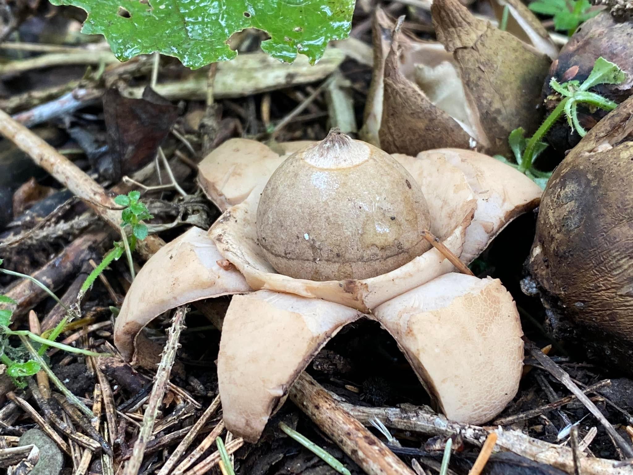
A Day in Niagara Falls - Earthstar Mushroom Hike/Floral Showcase Niagara Falls - Carpool Hike
https://hikesstaging.brucetrail.org/event/a-day-in-niagara-falls-earthstar-mushroom-hike-floral-showcase-niagara-falls-carpool-hike/Sorry, the registration cut-off time for this hike has been reached.Not a member? Click here to join today!Hosting Club: Iroquoia
Category: Special Event
Location (Google Maps): Grimsby – Casablanca Carpool – GoBus Parking LotHike Leader(s): Ruth Moffatt Click here to contact Hike Leader(s)
Pace: Leisurely – 3km/hr or less
Terrain: Easy – Mostly flat and usually good footing
Distance: 5-8kmDescription
Have you ever seen an Earthstar mushroom? Have you ever seen a fairy ring of them? Hopefully, depending on the growing conditions this fall, we will see both on this special tour of Niagara Falls.Please join Karen B and I for this magical outing.
We will meet in the carpool parking lot in Grimsby at 8:45am and proceed in one vehicle to Niagara Falls. From there, we will proceed to the Niagara Parks Floral Showcase https://www.niagaraparks.com/visit/nature-garden/floral-showhouse/ where we will tour the gardens and search for the elusive and seldom seen Earthstar mushrooms. The Art of Mosaïculture in the outdoor garden is on and we will tour the greenhouse, as well. Afterwards we can proceed to view the falls and walk along the promenade then make our way back. There is a fee to enter the Floral Showcase and shared expense for gas. Parking is arranged. If enough people would also like to tour the tunnel, we could also take that in. https://www.niagaraparks.com/visit/attractions/niagara-parks-power-station/the-tunnel-niagara-fallsWe may also head over to https://www.niagaraparks.com/visit/nature-garden/dufferin-islands/
Depending on interest, we will increase the number of participants for this outing. Parking for the second vehicle would be a shared expense.
Please arrive 15 minutes early at the carpool parking lot. Please bring enough water and snacks for a leisurely hike. Bring your lunch, too, and we will find a spot for a picnic.If anyone would like to meet us in the Parking lot at Niagara Falls, please register for the hike but let me know you will meet us there. I know there are many people who have the annual parking passes.
Photo of an Earthstar mushroom by L. O’Shea used with permission.9:15 Short hike - Pelham Road, Short Hills
https://hikesstaging.brucetrail.org/event/915-short-hike-pelham-road-short-hills-85/Sorry, the registration cut-off time for this hike has been reached.Not a member? Click here to join today!Hosting Club: Niagara
Location (Google Maps): Short Hills Provincial Park, Pelham Road entrance
Hike Leader(s): janet davey Click here to contact Hike Leader(s)
Pace: Medium
Terrain: Moderate
Distance: 6 kmsDescription
Hike the main and side trails in Shorthills Provincial Park. Bring hiking boots, water, sunscreen and bug spray. Please help prevent the spread of invasive species by cleaning your boots following the hike. Please check yourself for ticks following the hike.Caledon Hills Section in Six Hikes
https://hikesstaging.brucetrail.org/event/caledon-hills-section-in-six-hikes-3/Sorry, the registration cut-off time for this hike has been reached.Not a member? Click here to join today!Hike open to BTC Members only.
Hosting Club: Caledon Hills
Category: End-to-End
Location (Google Maps): Meet at 9:15 am at Innis Lake Rd., north of Finnerty Sideroad, km 31.5. More parking is available on the south shoulder of Finnerty Sideroad, east of Innis Lake Rd. Shuttle to start at Mono 5 Sideroad.Hike Leader(s): Elizabeth Ganong; Doris Harper; Mohammad Shafiq Click here to contact Hike Leader(s)
Pace: Medium – 3 to 4 km/hour
Terrain: Moderate – some hills and/or some poor footing, Strenuous – hilly with steep climbs and some poor footing
Distance: 45.4 – 31.5 = 13.9 km totalDescription
This is the third hike in the series and takes us along the Humber River, through Glen Haffy Conservation Area, and into “the Dingle”.Please be prepared to help with shuttling hikers at the beginning and at the end of the hike. Bring water and snacks. There will be a break. No dogs please.
Participants who complete all 6 hikes with the co-leaders, Doris Harper and Elizabeth Ganong, will be eligible to purchase the 60th Anniversary End to End badge and the 60 for the 60th Anniversary badge from the hike leaders at the end of the 6th hike. Hike one, a few, or all 6 hikes. Join any hike, complete the rest on your own, and record the hikes in a log. Check the CHBTC website for submission details.
Tuesday Hikes 20 Year Anniversary End-to-End - Hike 4
https://hikesstaging.brucetrail.org/event/tuesday-hikes-20-year-anniversary-end-to-end-hike-4/Sorry, the registration cut-off time for this hike has been reached.Not a member? Click here to join today!Hosting Club: Dufferin Hi-Land
Category: Tuesday Hike
Location (Google Maps):Dufferin Hi-Land Map 20, Km 22.7. Meet at roadside parking on north side of 8 Sideroad where the road bends onto 2nd Line EHS
Hike Leader(s): Inge Eckerich;Tony Evangelista;Les Babbage;Julie Daley Click here to contact Hike Leader(s)
Pace: Leisurely
Terrain: Slippery and Steep Sections, Strenuous
Distance: 5.1 km; Drop out at Km 19.4 can be arranged (1.8 km)Description
In 2004 a group of Dufferin Hi-Land BTC members began organizing Tuesday hikes. For their first venture, they hiked a 10 hike/10 week end-to-end series of the DH section. Join us as we recreate this series to celebrate the 20th anniversary of Tuesday hiking and recognize the pioneers who started it all.Hike 4 will take us from Centre Rd through open fields and wooded, hilly terrain to 8 Sideroad. We will car shuttle from 8 Sideroad parking back to Centre Rd.
Bring water, snacks and sun screen.
Humber Heights to Hemlock Ridges
https://hikesstaging.brucetrail.org/event/humber-heights-to-hemlock-ridges/Sorry, the registration cut-off time for this hike has been reached.Not a member? Click here to join today!Hosting Club: Caledon Hills
Category: Tuesday Hikers
Location (Google Maps): Meet at the Bruce Trail parking lot on the east side of the 5th Line East Mono just south of the Hockley Road.Hike Leader(s): Gary Hall Click here to contact Hike Leader(s)
Pace: Medium – 3 to 4 km/hour
Terrain: Moderate – some hills and/or some poor footing
Distance: 10 kmDescription
This is a car pool hike. From the meeting point on the 5th Line East Mono, we’ll car pool to the 7th Line parking lot at the Airport Road and 7th Line East Mono. The hike will begin on the Humber Heights property and pass through 12 Bruce Trail properties from Humber Heights to Hemlock Ridges. Along the way, we’ll enjoy this beautiful Ribbon of Wilderness in all its autumn splendor.
SWANS Leisurely Hike at Cape Chin
https://hikesstaging.brucetrail.org/event/swans-leisurely-hike-at-cape-chin/Sorry, the registration cut-off time for this hike has been reached.Not a member? Click here to join today!Hosting Club: Peninsula
Location (Google Maps): Park at 388 Cape Chin Rd N. We will leave some cars at the gate and carpool to the Cape Chin House. On the way, we will make stops to discuss the restoration activities on the Maple Cross Nature Reserve at Cape Chin. We will do participant photos at the Cape Chin point. At this point, SWANS that are up for it will hike 3 km back o the cars parked at the road (about 1 hr). The carpool cars, for those that are not up for the 3km hike, will return to the road and leave the property. The SWANS is a locally active women’s charity that was formerly known as The Lionesses of Lions Head.
Hike Leader(s): Tamara Wilson Click here to contact Hike Leader(s)
Pace: Leisurely
Terrain: EasyDescription
This is a fair weather hike. Participants will meet at the Cape Chin Gate at 9:45 am and head to the Cape Chin house at 10am. The carpool group will stop along the way discussing restoration activities on Maple Cross Nature Reserve at Cape Chin. After photos at the overhang, members who are not able to hike, will drive back to the road and leave the property. Members who are able, will be lead by Tamara for a hike back to their vehicles. The hike back is around 3 km and we will use a leisurely pace.
Old Baldy and McCluskey's Rock
https://hikesstaging.brucetrail.org/event/old-baldy-and-mccluskeys-rock/Sorry, the registration cut-off time for this hike has been reached.Not a member? Click here to join today!Hosting Club: Caledon Hills
Category: Tuesday Hikers
Location (Google Maps): Meet at the start of the Old Baldy Side Trail at the south edge of Kimberley. There is a blue gate on the east side of Grey Rd. 13.Hike Leader(s): Barbara Euler Click here to contact Hike Leader(s)
Pace: Medium – 3 to 4 km/hour
Terrain: Moderate – some hills and/or some poor footing
Distance: 11.5 kmDescription
A steep climb up Old Baldy with great views as we explore the top and then climb back down. Fall colours should be at their peak. We will stop along the trail for lunch.
Car Hike: Nature Appreciation - Rockside Side Trail
https://hikesstaging.brucetrail.org/event/car-hike-nature-appreciation-rockside-side-trail-2/Sorry, the registration cut-off time for this hike has been reached.Not a member? Click here to join today!Hosting Club: Toronto
Category: Car Hike
Location (Google Maps):Parking is at the end of Boston Mills Road, just west of the intersection with Mississauga Road. Take care not to block the private driveway.
Driving directions: From Highway 410 north, continue on Highway 10, left on King Street, right on Mississauga Rd., left on Boston Mills Rd. to parking at the dead end.Hike Leader(s): Janet Patterson Click here to contact Hike Leader(s)
Pace: Leisurely (2-3 km/hr)
Terrain: Variable
Distance: approximately 6 kmDescription
We’ll take a slower pace to allow time to observe and identify the ferns, fungi, birds, dragonflies, etc. that we encounter along the trail. Using the iNaturalist app, participants will be encouraged to take photos with their smartphones and contribute observations to the Bruce Trail Conservancy’s iNaturalist Project. Of course anyone who simply wants to take in the wonders of nature while we walk is also welcome to come along! Note: Limit of 10 hikers, and registration is mandatory.https://development.brucetrail.org/pages/get-involved/volunteering/citizen-science
This is a perfect opportunity to accumulate sightings towards earning your Naturalist badge!
Bring your curiosity, nature guidebooks, binoculars, camera, smartphone, lunch and water. Please wear proper hiking shoes or boots, and consider poles. There are a few steep sections. Difficulty Level: 1-2 (Easy/Moderate)
- 09October 9, 2024

Niagara ETE in Seven - New Stained Glass badge
https://hikesstaging.brucetrail.org/event/niagara-ete-in-seven-new-stained-glass-badge-2/Sorry, the registration cut-off time for this hike has been reached.Not a member? Click here to join today!Hosting Club: Niagara
Category: Event Hikes
Location (Google Maps): Hike 1, 13k: Meet at Kinsmen Park Frost Road Beamsville (43.146108n, 79.475609w) Carpool to Grimsby Lions Club Pool 1 Elm St (43.193201, -79.565301). Hike Leader Karen LimardiHike 2, October 16th, 13k: Meet at 3640 Glen Rd Jordan (43.139030, -79.373893) Carpool to Kinsmen Park Frost Road Beamsville (43.146108n, 79.475609w) Hike Leader Lauren Doig
Hike 3, October 23rd, 13k: Meet at Roland Rd parking lot east of Effingham St 43.090278, -79.305073. Carpool to 3640 Glen Rd Jordan (43.139030, -79.373893) Hike Leader Karen Limardi
Hike 4 October 30th, 14k: Meet at Decew House, Decew Rd Thorold. 43.1078074, -79.2498458. Carpool to Roland Rd parking lot east of Effingham St 43.090278, -79.305073. Hike Leader Sam Rutherford
Hike 5, November 6th, 14k, Meet at Woodend Conservation Area, Taylor Road, Niagara-on-the-Lake, 43.1432995, -79.1672588, Carpool to Decew House, Decew Rd Thorold. 43.1078074, -79.2498458. Hike Leader Sam Rutherford
Hike 6: November 13th, 9k, Meet at Fireman’s Park Dorchester road,Niagara on the Lake, (43.146105, 79.113375), Carpool to Woodend Conservation Area, Taylor Road, Niagara-on-the-Lake, (43.1432995, -79.1672588). Hike Leader Sam Rutherford
Hike 7: November 20th 8k, Meet at the BTC Southern Terminus 14184 Niagara River Pkwy, Niagara-on-the-Lake, 43.1602848, -79.052315. Carpool to Fireman’s Park Dorchester road,Niagara on the Lake, (43.146105, 79.113375). Hike Leader Lauren Doig.
Hike Leader(s): Alan Laver Click here to contact Hike Leader(s)
Pace: Medium
Terrain: Moderate
Distance: 12 – 15k per dayDescription
Meet time is 8:15 for 8:30 start. . This is a special series of 7 hikes to complete the Niagara section of the Bruce Trail. There will be a new accomplishment badge, included in the registration fee featuring the White-tailed deer – which has been designed by Joe Borges and will be made available on our last day. The White-tailed deer is common throughout Niagara. For this E2E in 7, we will be following the main trail from Grimsby to the BTC Southern Terminus at Queenston. Please note that you are signing up for the entire series of 7 hikes as a Group Hike. The section is approximately 85km so daily distances will be based on available parking. No dropout points have been established and therefore hikers who must drop out, will be responsible for their own transportation back to their vehicle. We will hike at a steady pace but there will be plenty of time to take pictures and to enjoy the flora and fauna of this beautiful but challenging section.Again, this particular set of 7 hikes is intended to be Moderate/Brisk.
Hikers will be expected to be wearing proper hiking boots and layered clothing. Sufficient food and 2 litres of water for a full day of hiking is required as well as hiking poles (if you use them). Check the daily forcast and prepare for wet weather, as well. Clothing adjustments, bio-breaks are as needed. Please let the sweep person know and they will wait for you. A morning break around 10am and a 10-15 minute on-trail lunch break will be scheduled.
Car Shuttles and Missing Hikes
A maximum of 2 (of the 7) hikes can be self-completed as a result of scheduling challenges, but it is intended that this badge be earned while hiking as part of a group led by a certified hike leader.
Some parking locations require paid parking, and hikes that enter Niagara Parks. The fee for this E2E-in-7 does not include any parking/entry fees for hikers. These costs, where applicable, will be shared amongst all participants unless you have a parking or park pass.John Haigh Side Trail Loop
https://hikesstaging.brucetrail.org/event/john-haigh-side-trail-loop-2/Sorry, the registration cut-off time for this hike has been reached.Not a member? Click here to join today!Hosting Club: Blue Mountains
Category: Organized Hike
Location (Google Maps): Hike meets in the parking lot behind Tim Hortons on First St. in Collingwood.Hike Leader(s): Flo Kusiak Click here to contact Hike Leader(s)
Pace: Leisurely – 3 km/hr. or less
Distance: 6 km
Description
We will drive to the junction of the 2nd Line and the 6th Sideroad and commence a loop hike through the upper level of the Pretty River Valley Provincial Park.
Following the John Haigh Side Trail, we will head south to join the white blazed trail, then head north to km 52.6. From here we proceed west to the cars. Bring water and a snack.Good Companions Burlington Waterfront
https://hikesstaging.brucetrail.org/event/good-companions-burlington-waterfront/Sorry, the registration cut-off time for this hike has been reached.Not a member? Click here to join today!Hosting Club: Iroquoia
Category: Good Companions
Location (Google Maps): Burlington Centre Library 2331 New Street Back parking lot by the parkHike Leader(s): Gayle Laws Click here to contact Hike Leader(s)
Pace: Medium – 3 to 4 km/hr
Terrain: Easy – Mostly flat and usually good footing
Distance: 8 kmDescription
Meeting at the Burlington Central Library, we will walk down to the Centennial Trail, then further south to the waterfront trail, to the lighthouse and back. Wear layers as it may be windy. The walk will be cancelled if raining. Come and enjoy some conversation as we gaze over Lake Ontario, along Burlington Beach.WEDNESDAY WALKERS - Grey Road 40 to Griersville
https://hikesstaging.brucetrail.org/event/wednesday-walkers-grey-road-40-to-griersville/Sorry, the registration cut-off time for this hike has been reached.Not a member? Click here to join today!Hosting Club: Beaver Valley
Location (Google Maps): Meet in the BTC parking lot on Grey Road 40, Km 105.7 Map 28 Edition 31
Hike Leader(s): Margaret Yaraskavitch Click here to contact the hike leader.
Pace: Medium
Terrain: Moderate, Some rocky footing
Length of Hike: 7.2Description
It’s time for a pleasant walk in the woods, a fairly easy walk. We begin at the parking lot on Grey Road 40, crossing the highway and walking into a BTC Nature Reserve. After reaching Grey Road 7, we return on the same route.COVID-19 Precautions Before, During and After your Hike
- Each hiker joining a Bruce Trail Club organized hike must perform a self-screening check before hiking.
Find Ontario’s self-assessment tool here: https://covid-19.ontario.ca/self-assessment/ - If you are experiencing COVID-19 symptoms, stay home.
Other Guidelines
- Arrive 15 minutes before the start of the hike.
- Wear sturdy footwear and appropriate attire for the weather and the terrain.
Hiking poles are a good idea in any season, especially if the terrain is rocky or slippery. In winter, snowshoes or icers/crampons are needed when conditions dictate.
Wearing appropriate clothing and footwear prevents injuries and shows consideration for a safe and positive group hiking experience. - Always carry I.D. and your health card.
- Bring sufficient water and snacks (or lunch if indicated). A minimum of 1L of water is recommended on all hikes, and 3L is recommended for long, challenging hikes in the heat of the summer.
- Bring sunscreen and insect repellent (for spring and summer hikes).
- Bring your own first aid kit.
- Please leave dogs at home.
Urban Walk: Bronte Village
https://hikesstaging.brucetrail.org/event/urban-walk-bronte-village-2/Sorry, the registration cut-off time for this hike has been reached.Not a member? Click here to join today!Hosting Club: Toronto
Category: Urban Walk
Location (Google Maps): Meet at the Bronte Athletic Park parking lot. The baseball diamond will be on your right as you enter.Hike Leader(s): Roger Harris Click here to contact Hike Leader(s)
Pace: Moderate (3-4 km/hr)
Terrain: Level 1 (Easy – mostly on flat, well maintained trails with hard-packed surface)
Distance: 8 kmDescription
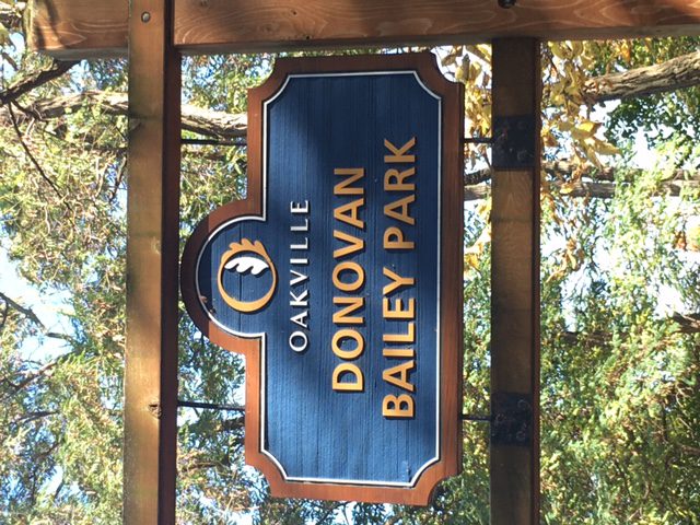
We will follow the Donovan Bailey Trail to Bronte Road, then take Heritage Trail to Bronte Harbour. After a short break, we will continue along Waterfront Trail to Water’s Edge Drive, then walk southwest along Marine Drive to return to our starting point. The route is on a mixture of paved and packed gravel paths.If you would like to read up on this walk, it is described as Hike No. 11 (‘Donovan Bailey/Bronte Village Loop’) in Nicola Ross’ book ”Halton Hikes” (2016).
Please dress appropriately for the weather, and bring water and snacks. Hiking boots and poles will not be necessary.
- Each hiker joining a Bruce Trail Club organized hike must perform a self-screening check before hiking.
- 10October 10, 2024
8:00 am Long Hike Jordan to Moyer / Louth
https://hikesstaging.brucetrail.org/event/800-am-long-hike-jordan-to-moyer-louth-83/Sorry, the registration cut-off time for this hike has been reached.Not a member? Click here to join today!Hosting Club: Niagara
Location (Google Maps):
Jordan Hollow Park 3039 King St Jordan
Pace: Medium
Terrain: Moderate
: 10kDescription
From Jordan Hollow Hike the main trail to Upper and Lower Balls Falls, Moyer Road or Louth and Return. You must register for each hike. Bring Poles, sunscreen, bug spray , snack and a drink and dress for the weatherUrban Walk: Valley View Park Thornhill
https://hikesstaging.brucetrail.org/event/urban-walk-valley-view-park-thornhill-23/Sorry, the registration cut-off time for this hike has been reached.Not a member? Click here to join today!Hosting Club: Toronto
Location (Google Maps): Parking lot at the corner of Bayview Ave, and Sycamore Dr. South of Highway 7
Sycamore Dr. is 3blocks south of highway 7 and 2 blocks north of John Street, parking lot is across plaza of Dollarama and Star boxHike Leader(s): Mohammad Aghamiri Click here to contact Hike Leader(s)
Pace: Moderate (3-4 km/hr)
Terrain: Level 2 (Intermediate – some hills and uneven surfaces, rocks and roots underfoot)
Distance: 7-8 kmDescription
We will explore Valleyview and Maple view parks, and walk along German Mill Creek, for a distance of 7-8 km. Difficulty level: 2 (Moderate)9:15 Hiking Around Jordan
https://hikesstaging.brucetrail.org/event/915-hiking-around-jordan-2/Sorry, the registration cut-off time for this hike has been reached.Not a member? Click here to join today!Hosting Club: Niagara
Category: Hike
Location (Google Maps): Shoarishon Park (formely Jordan Hollow)Hike Leader(s): Bill Russell Click here to contact Hike Leader(s)
Pace: Medium
Terrain: Moderate
Distance: 6 kmDescription
Hiking in and around Jordan, Jim Rainforth Trail, Bailey Bridge or Balls FallsNiagara End-to-End Hike 6 of 6
https://hikesstaging.brucetrail.org/event/niagara-end-to-end-hike-6-of-6/Sorry, the registration cut-off time for this hike has been reached.Not a member? Click here to join today!Hosting Club: Caledon Hills
Category: End-to-End
Location (Google Maps): Meet at Queenston Heights Park – paid parking, km 0.0 (Map 1). Shuttle to start at Woodend Conservation Area.Hike Leader(s): Nancy Mooney Click here to contact Hike Leader(s)
Pace: Medium – 3 to 4 km/hour
Terrain: Moderate – some hills and/or some poor footing
Distance: 13.3 – 0.0 = 13.3 km totalDescription
This is the last hike in the series! The trail goes through The Screaming Tunnel, crosses over the QEW on a pedestrian bridge, passes through Fireman’s Park, and ends at the Bruce Trail’s southernmost cairn close to the Niagara River.
Walk and Talk Rocks: Mono Cliffs
https://hikesstaging.brucetrail.org/event/walk-and-talk-rocks-mono-cliffs-2/Sorry, the registration cut-off time for this hike has been reached.Not a member? Click here to join today!Hike open to BTC Members only.
Hosting Club: Caledon Hills
Category: General
Location (Google Maps): Meet at 9:30 am at the parking lot at Mono Community Centre. The centre is located at 754483 Mono Centre Rd. Please park in the gravel surface lot.Hike Leader(s): Elizabeth Ganong Click here to contact Hike Leader(s)
Pace: Leisurely – 3 km/hour or less
Terrain: Moderate – some hills and/or some poor footing
Distance: Approximately 9.5 kmDescription
Let’s rock it out and explore the geology of Mono Cliffs. (This is a repeat of the geology hike offered on August 29th.) We’ll hike mainly at a leisurely pace over the approximately 9.5 km route as we cover many of the highlights of Mono Cliffs Provincial Park. Dr. Kathy Wallace will provide an introductory-level look at the geology of the park that welcomes your curiosity. Plan on a lunch break at a spectacular look-out, a total time out around four or four and a half hours, and having your way of engaging with the trail expanded. This interactive hike was created for a small group. No dogs please.Note: This hike was originally scheduled for September 26th.
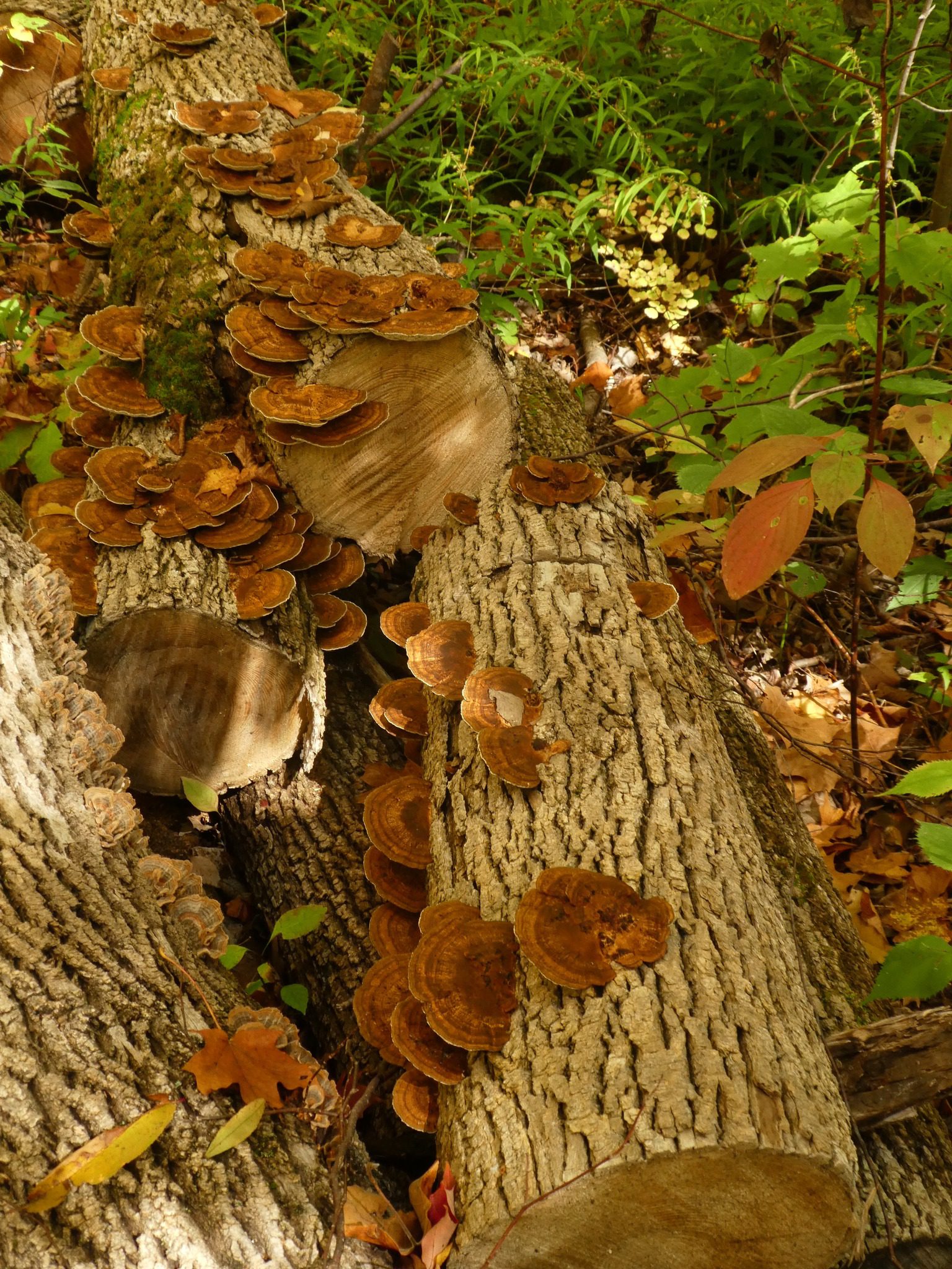
Halton Agreement Forest Mushroom Hike
https://hikesstaging.brucetrail.org/event/halton-agreement-forest-mushroom-hike/Sorry, the registration cut-off time for this hike has been reached.Not a member? Click here to join today!Hosting Club: Iroquoia
Category: General Hike
Location (Google Maps): Meet roadside on 4th Line. Up Guelph Line from the 401, turn right on 10 Side Road and follow the curve as it becomes 4th Line.Hike Leader(s): Karen Bergmann Click here to contact Hike Leader(s)
Pace: Medium – 3 to 4 km/hr
Terrain: Moderate – Some hills and/or some poor footing
Distance: 8 kmsDescription
We will hike around the bike trails in this lovely Forest, including The Den and The Pines, looking for mushrooms along the way. No foraging, just photographing.