
Hike Schedule
Join us for a hike! Registration required.
All hikes available to BTC members. Some hikes are open to non-members.
See Refund Policy for Paid Hikes >
TIP: The calendar view displays up to 7 hikes on a day, but often there are more. Click “View more events” to see them all.
Categories
- 26October 26, 2024

Coach Trip: Hardy Lake Provincial Park
https://hikesstaging.brucetrail.org/event/coach-trip-hardy-lake-provincial-park/Sorry, the registration cut-off time for this hike has been reached.Not a member? Click here to join today!Hosting Club: Toronto
Category: Coach Trip
Location (Google Maps): Hardy Lake Provincial ParkHike Leader(s): Lisa R. Lifshitz, Nijole Mockevicius, Ross Estrella, Felix Wan Click here to contact Hike Leader(s)
Pace: Moderate (3-4 km/hr)
Terrain: Flat, Hilly, Level 2 (Intermediate – some hills and uneven surfaces, rocks and roots underfoot), Rocky, Variable
Distance: 10 km and 13 kmDescription
Join us for a relaxing hike in beautiful Hardy Lake Provincial Park! This park has everything- lush tree canopy, glacial rocks, interesting plants, settlor house remains (with a spooky wooden cabin) and a scenic lake. At this time we also hope to see some fall colours. We plan to run two groups on this hike, one at a more leisurely/moderate pace and the other faster that will cover slightly more distance. We do plan to stop occasionally for photos. While some of the trails are flat, there are still a few good hills, roots and uneven ground so hiking boots are a must. Hardy Lake PP is a non-operating park so there is no place to buy food or water, so please bring two litres of water, ample snacks, lunch and dress appropriately for a Fall hike. We also plan to stop in Orillia for refreshments.Bus departs 10 York Mills Rd at 8:00 AM.
Harts Triple Inferno
https://hikesstaging.brucetrail.org/event/harts-triple-inferno-2/Sorry, the registration cut-off time for this hike has been reached.Not a member? Click here to join today!Hosting Club: Blue Mountains
Category: Organized Hike
Location (Google Maps):Hike Leader(s): Hart Fischer Click here to contact Hike Leader(s)
Pace: Brisk – 4 to 5 km/hr
Terrain: Strenuous – Hilly with steep climbs and some poor footing
Distance: 15 kmDescription
Guaranteed to be super challenging and strenuous! Come prepared for a
workout. ONLY for hikers that are experienced in longer distance hikes as well as
managing various terrains. This will be extremely
strenuous. Bring lots of water, snacks and lunch and
maybe even dinner!!
Iroquoia E2E in 10 – Fundraiser Hike - Stained Glass Butternut Tree Badge (5 weekends)
https://hikesstaging.brucetrail.org/event/iroquoia-e2e-in-10-fundraiser-hike-stained-glass-butternut-tree-badge-5-weekends/Sorry, the registration cut-off time for this hike has been reached.Not a member? Click here to join today!This is a Multi-Day Hike
You are signing up for the following dates and times:
2024-10-26 at 08:15
2024-10-27 at 08:15
2024-11-02 at 08:15
2024-11-03 at 08:15
2024-11-09 at 08:15
2024-11-10 at 08:15
2024-11-30 at 08:15
2024-12-01 at 08:15
2024-12-07 at 08:15
2024-12-08 at 08:15Hosting Club: Iroquoia
Category: Iroquoia E2E-in-Ten
Location (Google Maps): Various locations – Scheduled will be emailed to registered hikers prior to hike startHike Leader(s): Freddy Wang Click here to contact Hike Leader(s)
Pace: Brisk – 4 to 5 km/hr
Terrain: Dependent on Conditions, Moderate – Some hills and/or some poor footing, Slippery and Steep Sections, Slippery Sections Likely, Strenuous – Hilly with steep climbs and some poor footing
Distance: 11 – 15 kmDescription
This is a special series of 10 hikes to complete the entire Iroquoia section of the Bruce Trail over five weekends. There is an accomplishment badge, included in the registration fee – which was designed by Joe Borges and features the butternut tree.For this E2E in 10, we will be following the main trail southbound starting in Milton and finishing in Grimsby. Please note that you are signing up for the entire series of ten hikes as a Group Hike. The Iroquoia in 10 series is geared to experienced hikers with the expectation of a 3.5 to 5.0 km/hr pace maintained over an 11 to 15 km hike.
Hikers will be expected to wear proper hiking footwear and layered clothing. Sufficient snacks, water, hiking poles, and wet weather gear (if necessary) are recommended.
The fee goes towards supporting the Iroquoia Bruce Trail Club, which in turn supports the mission of the Bruce Trail Conservancy, which is: “Preserving a ribbon of wilderness, for everyone, forever.”
A maximum of 3 of the 10 hikes can be self-completed as a result of scheduling challenges, but it is intended that this badge be earned while hiking as part of a group led by a certified hike leader. Car shuttles are shared amongst the hikers.
Please note there are no refunds!
TRANSPORTATION
This series will be through hikes and will require car shuttling, you must be willing to drive or to be a passenger. Some parking locations require paid parking, and hikes that enter Conservation Areas (CA) will require reservations. The fee for the E2E-in-Ten does not cover any parking/entry fees for hikers who are not members of the Halton CA and/or Hamilton CA. If the group has enough hikers who are members of a CA, those will be the cars chosen to park in those areas so as to minimize costs but since conservation passes are not free, please consider nominal compensation to the pass holder. At least one hike starts at one CA and possibly ends at another, so parking fees are unavoidable for non-CA members.
Remember, you can only miss three hikes to qualify for this special Beechnut badge. You must still complete the distance you have missed. If you miss more than three but still complete the distances on your own, you may apply for the regular club End to End badge. Those who already have the Beechnut badge may elect to get the new Red Fox Independent E2E Badge.

Beaver Valley Stained Glass - End to End
https://hikesstaging.brucetrail.org/event/beaver-valley-stained-glass-end-to-end/Sorry, the registration cut-off time for this hike has been reached.Not a member? Click here to join today!This is a Multi-Day Hike
You are signing up for the following dates and times:
2024-10-26 at 08:30
2024-11-02 at 08:15
2024-11-03 at 08:15
2024-11-09 at 08:15
2024-11-10 at 08:15Hosting Club: Iroquoia, Beaver Valley
Category: Stained Glass Badge End to End Fundraiser Hike
Location (Google Maps): Kolopore Parking Lot (44.432689)Hike Leader(s): Anita Bergsma Click here to contact Hike Leader(s)
Pace: Medium – 3 to 4 km/hr
Terrain: Dependent on Conditions, Strenuous – Hilly with steep climbs and some poor footing
Distance: 18.5-26km per dayDescription
Join us for Beaver Valley End to End on October 26, November 2nd-3rd, and November 9-10th, 2024. The hikes will be at a moderate pace 3-4km per hour. This is suitable for intermediate to advanced hikers.We will be using hiker’s vehicles to shuttle to our start from our meeting point.
Proper hiking boots is a must! Bring hiking poles (if you use them), food, snacks, 2l of water, hat, sun screen, bug repellent, rain gear and first aid kit. Please check the weather forecast each day before heading out.
Arrive at 8:15 am Sharp to check in. Once everyone has arrived, we will proceed and drive to the starting point.
Your fee includes the guidance and organization of a volunteer hike leader. I will try to make arrangements for everyone to receive their Stain Glass End to End badge upon completion.
If you must miss a day but can make it up before the last scheduled hike, you will still qualify for this special badge. This is a fundraising hike for the Bruce Trail Club. Proceeds go to the Beaver Valley Club to support the trail infrastructure and to the Bruce Trail Conservancy mission “Protecting this ribbon of wilderness, for every one, forever.”
Please, no dogs or children.
There are no refunds for this hike series. Please ensure you are physically capable of these distances before signing up for this hike.
If you have any questions, please enquire to the hike leader through this form.
Day 1 – Kolopore Parking Lot (44.432689)and shuttle to Maple Lane at Swiss Meadows Parking Lot (44.4956661)-23.8kms
Day 2 – Sideroad 7B Parking Lot (44.3951417)and shuttle to Kolopore Parking Lot (44.432689)- 18.5kms
Day 3 – Hogg Falls Parking Lot, Flesherton (44.28687)and shuttle to Sideroad 7B Parking Lot (44.3951417)- 21.3kms
Day 4 – Sideroad 16C Parking Lot, Kimberly (44.4370672) and shuttle to Hogg Falls Parking Lot, Flesherton (44.28687) – 24.5kms
Day 5 – Grey Road 12 Parking Lot, Medford(44.5013845) and shuttle to Sideroad 16C Parking Lot, Kimberly (44.4370672) – 25.8kms
TRANSPORTATION
Since this is a car shuttle hike, please ensure your vehicle is car shuttle ready. All participants will be expected to take turns either driving to the start or driving the drivers back at the end of the day. Carpooling to our meeting spot with 2 people in the car is generally ok but if more than that, please let the hike leader know.
Waiver
I acknowledge that this activity in which I am participating, organized by The Bruce Trail Conservancy (BTC) and/or its member Clubs, involves risks which are beyond the control of the BTC and its member Clubs. Notwithstanding the acknowledgement of such risks, I hereby release the BTC, its member Clubs, contractors, employees, agents, assigns and executors from all claims for damage however so arising as a result of my participation in this and any other activity organised by the BTC and/or its member Clubs. I agree to pay the cost of my emergency evacuation of my person or belongings that may be necessary. I affirm that I am aware of the nature of this activity, its length, duration and degrees of difficulty and that I am properly equipped and physically able to participate. I have no medical or other condition which might preclude my participation. I agree to follow the directions of the leader and any assistants at all times.
Urban Walk: East Point Park Bird Sanctuary, Scarborough, ON
https://hikesstaging.brucetrail.org/event/urban-walk-east-point-park-bird-sanctuary-scarborough-on/Sorry, the registration cut-off time for this hike has been reached.Not a member? Click here to join today!Hosting Club: Toronto
Location (Google Maps): East Point Park Bird Sanctuary, Scarborough, ON
parking lot at the end of Beechgrove Dr.
There are different public transit routes to this parking lot please check transit maps/google mapHike Leader(s): Mohammad Aghamiri Click here to contact Hike Leader(s)
Pace: Moderate (3-4 km/hr)
Terrain: Variable
Distance: 14-17 kmDescription
We will hike along lake Ontario to the Scarborough Bluffs (14-16 km return)Please bring hiking poles, proper clothing for the season, hiking shoes/boots and lots of water,
Difficulty Level: 2 (Moderate)
Sydenham E2E, hike 5of 7
https://hikesstaging.brucetrail.org/event/sydenham-e2e-hike-5of-7/Sorry, the registration cut-off time for this hike has been reached.Not a member? Click here to join today!Hosting Club: Toronto
Category: Car Hike
Location (Google Maps): West of km 125.7, Lindenwood Rd. Coordinates N 44.685276,W 80.995970 map 33 addition 31.Hike Leader(s): Smadar Junkin Click here to contact Hike Leader(s)
Pace: Brisk
Terrain: Challenging, Variable
Distance: 22.4 kmDescription
Day 5, we will shuttle to km 103.3 and hike back. Bring food and 2litres of water. If you need to get in touch with me, use the “Contact Hike Leader” Dialogue box to send a message.
Peninsula Blue Series: Hopefully Hiking Along Hope Bay's Side Trails
https://hikesstaging.brucetrail.org/event/peninsula-blue-series-hopefully-hiking-along-hope-bays-side-trails/Sorry, the registration cut-off time for this hike has been reached.Not a member? Click here to join today!Hosting Club: Peninsula
Category: Peninsula Blue Series
Location (Google Maps): Roadside Parking at the south end of Cathedral Dr, Lion’s Head, ON N0H 1W0, CanadaHike Leader(s): Kathleen Stahlbaum Click here to contact Hike Leader(s)
Pace: Leisurely, Medium
Terrain: Difficult, Easy, Moderate
Distance: 12.5 kmDescription
Join us in hiking the side trails of Hope Bay Forest Provincial Nature Reserve and the surrounding areas of Hope Bay and Hopeness. This hike offers incredible panoramic views of Georgian Bay’s sparkling turquoise waters, rich, mature woods, and undulating, rocky terrain.We’ll be hiking a stretch of Main Trail, along with the entirety of Hopeness Side Trail, Jack Poste Side Trail, and Don Irish Side Trail. The terrain varies, with some elevation changes. We’ll spend plenty of time along both the edge of the escarpment and in the beautiful woods (with a small trip down a tree lined gravel road). Highlights include those jaw dropping Peninsula water views, the renowned Hope Bay glacial potholes, a massive crevice, some other awesome geological features including karst pavement, and perhaps even a glimpse of the slightly haunting, somewhat famed, and very mysterious stuffed animal zoo that has hung in the trees along a portion of Hopeness Road from time immemorial.
Here’s hoping (pun intended!) we’re just in time to take in the incredible Autumn views Hope Bay Forest has to offer. The lush forest below the Escarpment becomes a rich tapestry of yellows, reds, and oranges and it’s a sight to behold!
Be prepared for rocky and slippery conditions. Hiking poles are helpful and rain gear may come in handy. Wear footwear for rugged terrain (roots and rocks are plentiful throughout the trails we’ll be hiking). Pace will be leisurely to moderate and adjusted for slippery conditions, if needed. Bring plenty of water, a snack and light lunch.
This 12.5 km, ~5 hour hike counts towards the coveted side trail badge and you can check it out on Map 31 of the newest edition of the Bruce Trail guidebook!
Map 37, Edition 31

9:00 Witch of Cave Spring Hike
https://hikesstaging.brucetrail.org/event/900-witch-of-cave-spring-hike/Sorry, the registration cut-off time for this hike has been reached.Not a member? Click here to join today!Hosting Club: Niagara
Category: In and Out
Location (Google Maps):Parking lot Quarry Road Beamsville
Hike Leader(s): Angela Lytle Click here to contact Hike Leader(s)
Pace: Medium
Terrain: Moderate
Distance: 5 kmDescription
Enjoy a beautiful hike through the autumn woods and learn about local historical and mystical lore while searching for the Witch of Cave Spring.Complete this guided hike and count it towards the Screaming Tunnel Badge, more info on the badge requirements is here: https://niagarabrucetrail.club/badges/
Wearing a witch hat, while not required, is highly recommended!
Details:
This hike loops from Quarry Rd in Beamsville (limited parking, carpool if possible) along the Bruce Trail to Cave Spring Conservation area and back.
Note: The path to Cave Spring is quite rocky and has some hills. We recommend using hiking poles and wearing good hiking shoes is a must. Carry water and dress for changeable weather.
We will stop along the way at sites of interest and loop back to the car park on Quarry Rd. The loop is around 5 km. Please arrive by 8:50 to check in with the hike leader for departure at 9.

Louth Tour and Rockway
https://hikesstaging.brucetrail.org/event/louth-tour-and-rockway/Sorry, the registration cut-off time for this hike has been reached.Not a member? Click here to join today!Hosting Club: Niagara
Category: Loop
Location (Google Maps): Meet in Louth Parking lot, Staff Ave, LincolnHike Leader(s): Margaret Northfield Click here to contact Hike Leader(s)
Pace: Medium
Terrain: Strenuous
Distance: 8.5kmDescription
Hike main trail from Louth to Rockway and back. We will loop around Louth Conservation area hiking by the waterfalls. Poles recommended. Bring water and snack.Old Baldy
https://hikesstaging.brucetrail.org/event/old-baldy/Sorry, the registration cut-off time for this hike has been reached.Not a member? Click here to join today!Hosting Club: Blue Mountains
Category: Organized Hike
Location (Google Maps): Tim Hortons First Street, CollingwoodHike Leader(s): Bob Moenck Click here to contact Hike Leader(s)
Pace: Leisurely – 3 km/hr. or less
Terrain: Moderate – Some hills and/or some poor footing
Distance: 5 kmDescription
We will drive to and park at km 46.8 on Cty. Rd.13 in the Beaver Valley
section. We begin a long climb with magnificent views of the Beaver Valley before
reaching the top of the Escarpment. We will explore the MacKirk Side Trail and follow
the white blazed trail back to the cars. The trail passes lookouts where you can watch
for turkey vultures and buteo hawks. Bring a snack and waterDundas Valley Conservation Area Fall Hike
https://hikesstaging.brucetrail.org/event/dundas-valley-conservation-area-fall-hike/Sorry, the registration cut-off time for this hike has been reached.Not a member? Click here to join today!Hosting Club: Dufferin Hi-Land
Category: General Hike
Location (Google Maps): Dundas Valley Conservation Area. Meeting point Dundas Valley parking per map provided. Follow Lions Club Rd to the end where paid parking (credit card required) is located.Hike Leader(s): Gilles Gagnon Click here to contact Hike Leader(s)
Pace: Medium
Terrain: Moderate
Distance: 16-18 kmDescription
Come join me for a late Fall hike in beautiful Dundas Valley Conservation area. We’ll explore some of the known and lesser known trails in the area.
Saturday Shorts: Glen Haffy
https://hikesstaging.brucetrail.org/event/saturday-shorts-glen-haffy/Sorry, the registration cut-off time for this hike has been reached.Not a member? Click here to join today!Hike open to BTC Members only.
Hosting Club: Caledon Hills
Category: General
Location (Google Maps): Meet at 10 am at the roadside parking on Coolihans Sideroad, near where the Trail crosses the road. This is just west of the intersection of Glen Haffy Road and Coolihans Sideroad.Hike Leader(s): Elizabeth Ganong Click here to contact Hike Leader(s)
Pace: Medium – 3 to 4 km/hour
Terrain: Easy – mostly flat and usually good footing, Moderate – some hills and/or some poor footing
Distance: Approximately 5 kmDescription
Looking to get out on a Saturday but not give up your whole day? Saturday Shorts, a hiking series, will get you out in a small group on a short hike. This Saturday’s hike is at Glen Haffy, where the seasons do not disappoint. We’ll hike the main Trail and conservation trails to make a 5 km route looping around. Bring water and a snack, if desired. There will be a short break. No dogs please.
Car Hike; Crawford Lake & Bruce Trail loop 8km or continue to Nassagaweya Canyon for a 12 KM Loop
https://hikesstaging.brucetrail.org/event/car-hike-crawford-lake-bruce-trail-loop-8km-or-continue-to-nassagaweya-canyon-for-a-12-km-loop/Sorry, the registration cut-off time for this hike has been reached.Not a member? Click here to join today!Hosting Club: Toronto
Category: Car Hike
Location (Google Maps): Meet for a 10 a.m. departure from Crawford Lake Conservation Area – 3115 Conservation Rd. Milton ON L9T 2X3, Canada
Meeting point is at the upper parking lot next to the Visitor Centre.Hike Leader(s): Jeanette Vincent Click here to contact Hike Leader(s)
Pace: Moderate (3-4 km/hr)
Terrain: Level 2 (Intermediate – some hills and uneven surfaces, rocks and roots underfoot), Variable
Distance: 8km or 12kmDescription
About the hike: We will hike around Crawford Lake, a rare example of a meromictic lake and the Bruce Trail on our way to the Nassagaweya Canyon with great views, you can choose a shorter loop of 8km and head back to the Longhouse Village or continue on for another loop in the canyon and looping back to the visitor centre. Crawford Lake is also an important site for global scientific research. Click here to learn more about these studies and how our rare meromictic lake may help scientists define a new proposed epoch: the Anthropocene.What to wear and bring: Bring water, snacks and lunch. Be prepared for weather conditions for this day. Hiking shoes or boots recommended. Poles if you use them.
Parking: Upper parking lot. Reservations are not required but are recommended. Fee is per person. If you book online, you can reserve your spot and save money on gate fees. Click to reserve. https://www.conservationhalton.ca/parks/crawford-lake/
Additional Notes:Length: 8 or 12 km (4 – 4 1/2 hrs) with a lunch stop. If you are doing the shorter hike you will be finished about 12 or 12:30 p..m.
Hike level: 2 (moderate with flat and variable terrain, ( the last 4km has more descents and ascents).Buckthorn Busting at Splitrock Narrows (Moved from Honeywood Ridge) Registration Recommended, but not required
https://hikesstaging.brucetrail.org/event/buckthorn-busting-at-splitrock-narrows-moved-from-honeywood-ridge-registration-recommended-but-not-required/Sorry, the registration cut-off time for this hike has been reached.Not a member? Click here to join today!Hosting Club: Dufferin Hi-Land
Category: Special Events
Location (Google Maps): Meet at the Splitrock Narrows parking lot off 2nd Line EHS: 44.074962, -80.083756Hike Leader(s): Tom Thayer Click here to contact Hike Leader(s)
Pace: Leisurely, Medium
Terrain: Dependent on Conditions, Easy, Moderate
Distance: N/ADescription
Common buckthorn is an invasive shrub that outcompetes native plants and threatens biodiversity. Come out for a fun morning of buckthorn busting to help us remove this plant and make space for biodiversity at the Splitrock Narrows property!Small plants can be pulled by hand, while larger plants can be pulled with the help of an extractigator, which is lots of fun to use! No experience required – training will be provided.
Bring gardening/work gloves, water and sunscreen, and wear long pants and closed toed shoes. Please note that we will be working off trail for this activity, so we will be walking through some meadows with tall grasses and goldenrod as well as some forested/shrubby areas.
If we finish our work early, there will be the option to go for a nature hike through the property.
- 27October 27, 2024
Sydenham E2E hike 6 of 7
https://hikesstaging.brucetrail.org/event/sydenham-e2e-hike-6-of-7/Sorry, the registration cut-off time for this hike has been reached.Not a member? Click here to join today!Hike open to BTC Members only.
Hosting Club: Toronto
Category: Car Hike
Location (Google Maps): Same location as day 5.Hike Leader(s): Smadar Junkin Click here to contact Hike Leader(s)
Pace: Brisk
Terrain: Challenging, Variable
Distance: 23 kmDescription
We will shuttle to km 148.5 and walk back. If you need to get in touch with me, use the “Contact Hike Leader” Dialogue Box to send a message. Bring 2 litres of water, food. Be in the meeting place 15 minutes early.Hiking from Woodend to Welland Canal at Glendale Ave
https://hikesstaging.brucetrail.org/event/hiking-from-woodend-to-welland-canal-at-glendale-ave/Sorry, the registration cut-off time for this hike has been reached.Not a member? Click here to join today!Hosting Club: Niagara
Category: Hike
Location (Google Maps): Woodend Conservation ParkHike Leader(s): Sheila Massey Click here to contact Hike Leader(s)
Pace: Medium
Distance: 7-8 km
Description
Hike through Woodend Conservation Park to Welland Canal, Glendale Avenue. We will hike by the historic remains of Lock 3 of the canal, which operated from 1845-1886.
Geology Hike # 5 Boyd Crevice linear hike
https://hikesstaging.brucetrail.org/event/geology-hike-5-boyd-crevice-linear-hike/Sorry, the registration cut-off time for this hike has been reached.Not a member? Click here to join today!Hike open to BTC Members only.
Hosting Club: Sydenham
Category: Geology Hike
Location (Google Maps): Dead end of Concession Road 11 south of Superior Street, Owen Sound. Roadside parking. Please park on the east side of the road.Hike Leader(s): Carol Graham-Mullin Click here to contact Hike Leader(s)
Pace: Leisurely: 3 km/h or less
Terrain: Easy: Mostly flat and good footing., Moderate: Some hills and/or poor footing, Strenuous: Hilly with steep climbs and some poor footing.
Distance: 5.5 km approx.Description
This is an extended version of Geology Hike # 5, following Beth Gilhespy’s book “Walking Through Time” in the Sydenham Bruce Trail Section. This is a linear hike, starting on a rail trail and then entering the main trail and hiking east to the amazing karst geology, towering cliffs and cambering features of this iconic crevice system. We will return the same way.Copies of Beth’s book will be available for purchase. Special member’s only price of $37.00 . Cash, cheque or etransfer. If paying with cash, please bring exact change. A special guest may join us ! Please bring water and a snack if you wish. Proper hiking footwear and hiking poles are recommended.

Car Hike: Hike #10 to earn the Dufferin Hi-Land Youth and/or Side Trails Badge!
https://hikesstaging.brucetrail.org/event/car-hike-hike-10-to-earn-the-dufferin-hi-land-youth-and-or-side-trails-badge/Sorry, the registration cut-off time for this hike has been reached.Not a member? Click here to join today!Hosting Club: Toronto, Dufferin Hi-Land
Category: Car Hike
Location (Google Maps): We will meet at roadside parking on 15 Sideroad at Prince of Wales Road. Note that the only access to this location is from River Road, 500 m west of Kilgorie. Look for a small road sign, “15 Sideroad”, on a sharp curve on River Road. (Map 20 of the Bruce Trail Reference Guide, Edition 31).Hike Leader(s): Monica Pasquali Click here to contact Hike Leader(s)
Pace: Leisurely (2-3 km/hr)
Terrain: Variable
Distance: 8.4 kmDescription
Calling all families with children who love hiking and earning badges!!!This is the tenth in a series of ten hikes that will be offered throughout 2024 on a roughly monthly basis so that children who are 15 years of age and younger can earn the Dufferin Hi-Land Adventurer Youth Badge and their parents/guardians can earn the Dufferin Hi-Land Side Trails Badge at the same time!!! Details regarding the requirements for each badge can be found here: https://dufferinbrucetrailclub.org/dufferin-bruce-trail-club-badges/ Each of the ten hikes will be a loop hike so no car shuttles will be needed, and each hike will cover a distance of approximately 6-9 km hiked at a leisurely pace (2-3 km/h) so children and adults alike can participate.
This tenth and final hike will be an autumn hike to explore the following four side trails: the Kilgorie ST, the Bell Lookout ST, part of the Pine River Valley ST, and the Black Edge ST. (Note that the first three side trails will be completed together as a loop, and then we will drive a short distance to the BTC parking area near the intersection of 30 Sideroad and 1st Line EHS in order to hike the Black Edge ST.) Please dress appropriately for an autumn hike by dressing in layers (wear an inner layer that wicks sweat away from your skin, a middle layer that keeps you warm, and an outer layer that protects you from wind and rain), wearing a sunhat or toque (depending on the weather), and wearing comfortable footwear that has good traction. Hiking poles or walking sticks are an asset since they will help keep you balanced if the ground is muddy/slippery. As well, make sure you bring enough water and food for a 3-4 hour hike since we’ll be covering a total distance of approximately 8.4 km.
Hopefully you’ll be able to join me on Sunday, October 27th! Until then, happy hiking, everyone!
- 28October 28, 2024
Sydenham E2E, hike 7 of 7.
https://hikesstaging.brucetrail.org/event/sydenham-e2e-hike-7-of-7/Sorry, the registration cut-off time for this hike has been reached.Not a member? Click here to join today!Hike open to BTC Members only.
Hosting Club: Toronto
Category: Car Hike
Location (Google Maps): Blue Water Park, Wiarton, coordinates N 44.742514,W 81.135140Hike Leader(s): Smadar Junkin Click here to contact Hike Leader(s)
Pace: Brisk (4-5 km/hr)
Terrain: Challenging, Variable
Distance: 23.25 kmDescription
Badge day, treats or ice cream day. Another E2E will be done! Be there 15 minutes early, bring 2litres of water and food. If you need to get in touch with me use the “Contact Hike Leader” Dialogue box to send a message. We will be shuttling to km 148.5 and walking back. 😊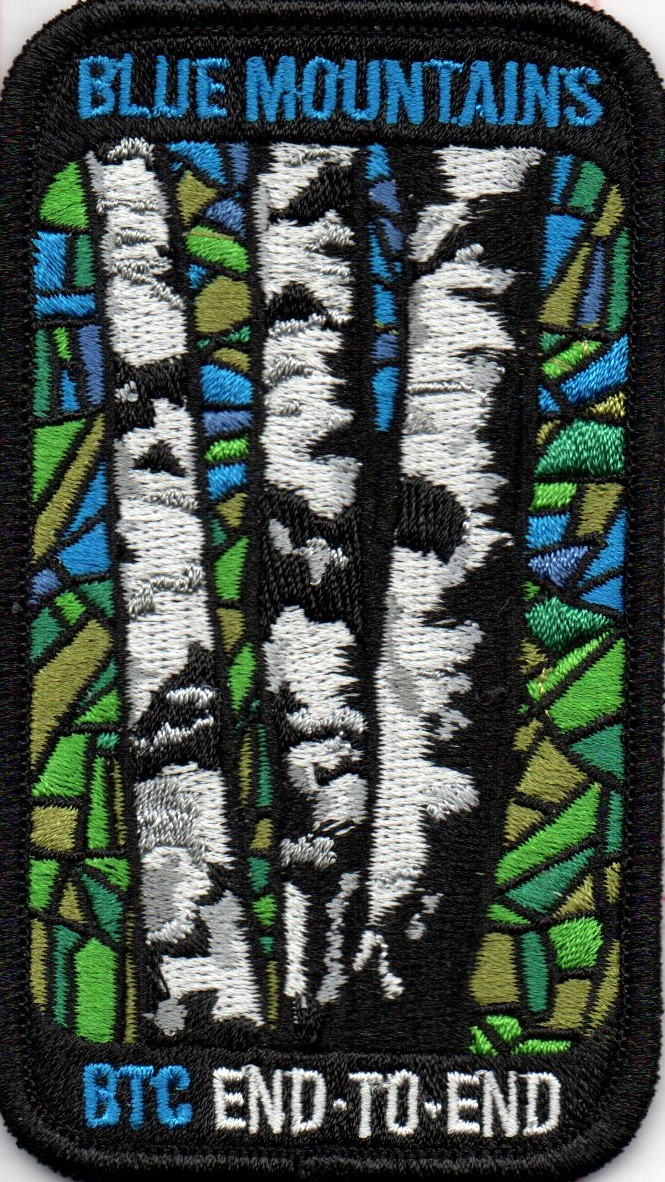
Blue Mtn End to End Fundraiser Stained Glass Badge Oct 28, 29, 30
https://hikesstaging.brucetrail.org/event/blue-mtn-end-to-end-fundraiser-stained-glass-badge-oct-28-29-30/Sorry, the registration cut-off time for this hike has been reached.Not a member? Click here to join today!This is a Multi-Day Hike
You are signing up for the following dates:
2024-10-28, 2024-10-29, 2024-10-30Hosting Club: Iroquoia, Blue Mountains
Category: Stained Glass Badge End to End Fundraiser Hike
Location (Google Maps): This is a three day fundraiser ETE for the new stained glass badge.Hike Leader(s): Ruth Moffatt Click here to contact Hike Leader(s)
Pace: Brisk – 4 to 5 km/hr
Terrain: Dependent on Conditions, Moderate – Some hills and/or some poor footing, Strenuous – Hilly with steep climbs and some poor footing
Distance: 67.50km spread over three daysDescription
Blue Mtn is the 8th club to introduce a stained glass badge, designed by Joe Borges. Distances will be spread over 3 days as equally as possible depending on the parking. Please bring enough food and snacks for a 20km + day of hiking and 2l of water minimum.
Everyone must have a first aid kit in their backpack.
We will work our way northward. Schedules will be provided to all registered participants.
The registration fee includes the badge and supports the club’s infrastructure and the mission of “Preserving a ribbon of wilderness for everyone, forever.”
Participants can make up one of the three days on their own if you have a scheduling conflict.
There are no refunds.
Hike 7 of 7 - Caledon Hills E2E.
https://hikesstaging.brucetrail.org/event/hike-7-of-7-caledon-hills-e2e/Sorry, the registration cut-off time for this hike has been reached.Not a member? Click here to join today!Hosting Club: Caledon Hills
Category: End-to-End
Location (Google Maps): Meet at 9:15 am at Hockley Road Parking Lot.
Shuttle to MonoHike Leader(s): Jennie Greenfield Click here to contact Hike Leader(s)
Pace: Medium – 3 to 4 km/hour
Terrain: Strenuous – hilly with steep climbs and some poor footing
Distance: 12.3 kmDescription
Last hike in the Caledon Hills. Through the Whitetail Refuge Nature and Hockley Valley Provincial Nature Reserves. Up and down hills, over bridges, to Hockley Road.72.4 – 61.1 + 0.75 + 0.25 side trails = 12.3 km total (Edition 31)
This hike can be logged towards the “60 for 60th Anniversary” badge
- 29October 29, 2024
9:00 Long Hike Wiley Road Short Hills
https://hikesstaging.brucetrail.org/event/900-long-hike-wiley-road-short-hills-3/Sorry, the registration cut-off time for this hike has been reached.Not a member? Click here to join today!Hosting Club: Niagara
Location (Google Maps):
Short Hills Wiley Road Entrance
Pace: Medium
Terrain: Moderate
: 10kmDescription
Explore Short Hills and the majestic side trails of Scarlett Tanager, Hemlock. Swayze Falls and Terrace. Register for each hikeBring Poles, Icers, snack, and dress for the weather
9:15 Short Hike - Short Hills Park, Pelham Rd
https://hikesstaging.brucetrail.org/event/915-short-hike-short-hills-park-pelham-rd-13/Sorry, the registration cut-off time for this hike has been reached.Not a member? Click here to join today!Hosting Club: Niagara
Category: Hike
Location (Google Maps): Short Hills Provincial Park, Pelham Rd parking lotHike Leader(s): Debbie Demizio Click here to contact Hike Leader(s)
Pace: Medium
Terrain: Moderate
Distance: ~ 6kmsDescription
Hike the main and side trails in Shorthills Provincial Park. Bring hiking boots, water, sunscreen and bug spray. Please help prevent the spread of invasive species by cleaning your boots following the hike. Please check yourself for ticks following the hike.Caledon Hills Section in Six Hikes
https://hikesstaging.brucetrail.org/event/caledon-hills-section-in-six-hikes-6/Sorry, the registration cut-off time for this hike has been reached.Not a member? Click here to join today!Hike open to BTC Members only.
Hosting Club: Caledon Hills
Category: End-to-End
Location (Google Maps): Meet at 9:15 am at Boston Mills Road, southwest of km 48.4 in the Toronto Section. Shuttle to start on Creditview Road.Hike Leader(s): Elizabeth Ganong; Doris Harper Click here to contact Hike Leader(s)
Pace: Medium – 3 to 4 km/hour
Terrain: Easy – mostly flat and usually good footing
Distance: 5.2 – 0.0 + 1.3 of Side Trail + 2.4 of Toronto = 8.9 km totalDescription
This is the last hike of the series and takes us through the Cheltenham Badlands as we make our way to the Toronto Section.Please be prepared to help with shuttling hikers at the beginning and at the end of the hike. Bring water and snacks. There will be a break. No dogs please. We will have a roadside celebration of the end-to-end as all local venues are closed on Tuesdays.
Participants who complete all 6 hikes with the co-leaders, Doris Harper and Elizabeth Ganong, will be eligible to purchase the 60th Anniversary End to End badge and the 60 for the 60th Anniversary badge from the hike leaders at the end of the 6th hike. Hike one, a few, or all 6 hikes. Join any hike, complete the rest on your own, and record the hikes in a log. Check the CHBTC website for submission details.
City View Park, Burlington, Map 9.
https://hikesstaging.brucetrail.org/event/city-view-park-burlington-map-9-3/Sorry, the registration cut-off time for this hike has been reached.Not a member? Click here to join today!Hosting Club: Caledon Hills
Category: Tuesday Hikers
Location (Google Maps): City View Park, Burlington.
From Highway 403 going west, turn right on Brant Street, left on Dundas Street, left on Kerns Rd., take second turn left into City View Park to the parking lot.Hike Leader(s): Mohammad Shafiq Click here to contact Hike Leader(s)
Pace: Medium – 3 to 4 km/hour
Terrain: Moderate – some hills and/or some poor footing
Distance: 11 kmDescription
From City View Park will connect with main Bruce Trail and hike to Smokey Hollow waterfall, also hike Kings ST and Eric Best ST on the way. After snack break will trace back our steps and return to parking.
Bring water, snack for refreshment break at Smokey Hollow.
Dress for the weather.
Poles are recommended.
Beaver Bites #8 of 8
https://hikesstaging.brucetrail.org/event/beaver-bites-8-of-8/Sorry, the registration cut-off time for this hike has been reached.Not a member? Click here to join today!Hosting Club: Beaver Valley
Location (Google Maps): Park in the Epping/John Muir lookout parking lot km94.3, Map 27, ED 31
Hike Leader(s): Kristina Rettie Click here to contact the hike leader.
Pace: Medium
Terrain: Moderate, Some rocky footing, Some steep sections, Strenuous
Length of Hike: 12.5kmDescription
This is the final hike in this series. If you have joined me in all 8 hikes you will qualify for the Beaver Bites Badge ($10/$12) If you have missed any hikes you can make them up on your own and submit your log when you are ready.This hike will take us through Epping Lookout Side Trail, Beaver Pond Side Trail and Sligo Side Trail.
Add on – Mushroom Hunter Badge. Let’s go hunting for mushrooms and other fungi. The magic of the search is in the slowing down and noticing. From the forest floor to trunks of trees, keep a keen eye out as you search for a minimum of 20 different varieties of fungi.
Bring a snack and water
Please no dogs
Text Kristina @ 519-410-9077 for morning of cancellations.
COVID-19 Precautions Before, During and After your Hike
- Each hiker joining a Bruce Trail Club organized hike must perform a self-screening check before hiking.
Find Ontario’s self-assessment tool here: https://covid-19.ontario.ca/self-assessment/ - If you are experiencing COVID-19 symptoms, stay home.
- Personal Protective Equipment:
- Hikers may choose to wear masks
Transportation
It is the Bruce Trail Conservancy’s current policy that car shuttles are allowed. It is at the discrepancy of individual hike leaders to make that decision.
Other Guidelines
- Arrive 15 minutes before the start of the hike.
- Wear sturdy footwear and appropriate attire for the weather and the terrain.
Hiking poles are a good idea in any season, especially if the terrain is rocky or slippery. In winter, snowshoes or icers/crampons are needed when conditions dictate.
Wearing appropriate clothing and footwear prevents injuries and shows consideration for a safe and positive group hiking experience. - Always carry I.D. and your health card.
- Bring sufficient water and snacks (or lunch if indicated). A minimum of 1L of water is recommended on all hikes, and 3L is recommended for long, challenging hikes in the heat of the summer.
- Bring sunscreen and insect repellent (for spring and summer hikes).
- Bring your own first aid kit.
- Please leave dogs at home.
Tuesday Hikes 20 Year Anniversary End-to-End - Hike 7
https://hikesstaging.brucetrail.org/event/tuesday-hikes-20-year-anniversary-end-to-end-hike-7/Sorry, the registration cut-off time for this hike has been reached.Not a member? Click here to join today!Hosting Club: Dufferin Hi-Land
Category: Tuesday Hike
Location (Google Maps):Dufferin Hi-Land Map 21, Km 40.7. Meet at roadside parking on Prince of Wales Rd, just south of 20 Sideroad, Mulmur. This location is best accessed from Centre Rd via 20 Sideroad or from the north from Dufferin Rd 21 via Prince of Wales Rd.
Hike Leader(s): Les Babbage;Julie Daley;Tony Evangelista;Inge Eckerich Click here to contact Hike Leader(s)
Pace: Leisurely
Terrain: Moderate, Slippery and Steep Sections
Distance: 6.9 km; Drop out at Km 36.8 can be arranged (3.0 km)Description
In 2004 a group of Dufferin Hi-Land BTC members began organizing Tuesday hikes. For their first venture, they hiked a 10 hike/10 week end-to-end series of the DH section. Join us as we recreate this series to celebrate the 20th anniversary of Tuesday hiking and recognize the pioneers who started it all.Hike 7 continues north beside the Pine River, then through the Provincial Fishing Reserve and Pine River Nature Reserve, continuing along 15 Sideroad and Prince of Wales Rd to parking at 20 Sideroad. We will car shuttle from 20 Sideroad back to Kilgorie.
Bring water and snacks.
CANCELLED - 60 for the 60th Anniversary Badge Hike Series - #9 of 10
https://hikesstaging.brucetrail.org/event/60-for-the-60th-anniversary-badge-hike-series-9-of-10/Sorry, the registration cut-off time for this hike has been reached.Not a member? Click here to join today!Hosting Club: Caledon Hills
Category: General
Location (Google Maps): 7th Line parking area located off 7th Line, immediately east of Airport Rd.; km 43.3, Map 18.Hike Leader(s): Marilyn Ross 416-895-8254 Click here to contact Hike Leader(s)
Pace: Leisurely – 3 km/hour or less
Terrain: Moderate – some hills and/or some poor footing
Distance: 6 kmDescription
Join Marilyn, Louise and Joyce on this 2 hour, 6 km hike which is the 9th in the series of hikes for the new “60 for the 60th Anniversary” badge. We will hike south towards Hwy 9 and back. Hike one, a few, or all 10 hikes. Join any hike and make up the rest on your own as long as a record is kept of their hikes to submit on completion to obtain their badge. Participants who complete all 10 hikes will be eligible to purchase the “60 for the 60th” badge.
Bring poles, and hydration.
SWANS Leisurely Hike at Cape Chin
https://hikesstaging.brucetrail.org/event/swans-leisurely-hike-at-cape-chin-2/Sorry, the registration cut-off time for this hike has been reached.Not a member? Click here to join today!Hosting Club: Peninsula
Category: Birding
Location (Google Maps): leave from 388 Cape Chin Rd N to Cape Chin pointHike Leader(s): Tamara Wilson Click here to contact Hike Leader(s)
Pace: Leisurely
Terrain: Easy
Distance: 3 kmDescription
This is a fair weather hike and will be cancelled if raining. Participants will meet up at 9:45am at 388 Cape Chin Rd N. Participants will leave at 10am and carpool 3 km to the Cape Chin, stopping along the way to discuss restoration activities on the Maple Cross Nature Reserve at Cape Chin. At the Cape Chin house, photos will be taken. For those that cannot hike the 3 km return to the cars, they will drive back and leave the property. For those that are able, Tamara will lead the group on a hike back to the cars for a 3 km at a leisurely pace.Urban Walk: Valley View Park Thornhill
https://hikesstaging.brucetrail.org/event/urban-walk-valley-view-park-thornhill-28/Sorry, the registration cut-off time for this hike has been reached.Not a member? Click here to join today!Hosting Club: Toronto
Location (Google Maps): Parking lot at the corner of Bayview Ave, and Sycamore Dr. South of Highway 7
Sycamore Dr. is 3blocks south of highway 7 and 2 blocks north of John Street, parking lot is across plaza of Dollarama and Star boxHike Leader(s): Mohammad Aghamiri Click here to contact Hike Leader(s)
Pace: Moderate (3-4 km/hr)
Terrain: Level 2 (Intermediate – some hills and uneven surfaces, rocks and roots underfoot)
Distance: 7-8 kmDescription
We will explore Valleyview and Maple view parks, and walk along German Mill Creek, for 7-8 km. Difficulty Level: 2 (Moderate) - Each hiker joining a Bruce Trail Club organized hike must perform a self-screening check before hiking.