
Hike Schedule
Join us for a hike! Registration required:
All hikes available to BTC members. Some hikes are open to non-members.
TIP: The calendar view displays up to 7 hikes on a day, but often there are more. Click “More events” to see them all.
Categories
- 16October 16, 2024
Sydenham E2E, hike 2of 7
https://hikesstaging.brucetrail.org/event/sydenham-e2e-hike-2of-7/Sorry, the registration cut-off time for this hike has been reached.Not a member? Click here to join today!Hike open to BTC Members only.
Hosting Club: Toronto
Category: Car Hike
Location (Google Maps): Km 52.7 map 30, addition 31. St. Vincent Sydenham townline. Coordinates N 44.637539,W 80.733406Hike Leader(s): Smadar Junkin Click here to contact Hike Leader(s)
Pace: Brisk
Terrain: Challenging, VariableDescription
Second hike in the series. Please register to each hike individually. We will hike about 25km. Bring 2 litres of water, food. We will shuttle to km 27, (paid parking) and walk back. If you need to get in touch with me, send a message through the “Contact Hike Leader” Dialogue Box.Beaver Valley Geology Hike Badge #8/8 hikes
https://hikesstaging.brucetrail.org/event/beaver-valley-geology-hike-badge-7-8-hikes/Sorry, the registration cut-off time for this hike has been reached.Not a member? Click here to join today!Hosting Club: Blue Mountains
Category: Organized Hike
Location (Google Maps): Hike meets in the parking lot behind Tim Hortons on First St. in Collingwood.Hike Leader(s): Annette Sandberg Click here to contact Hike Leader(s)
Pace: Leisurely – 3 km/hr. or less
Terrain: Moderate – Some hills and/or some poor footing
Distance: 5 kmDescription
Wodehouse Karst (Northern Route): Barn Foundation on Stone Foundation Side Trail at Stop 6 (Pages 95- 97) Barn Foundations are wonderful places to see many different rock types, including the Escarpment’s Fossil Hill Dolostone layer, which is full of coral and other fossils.Black Bank
https://hikesstaging.brucetrail.org/event/black-bank-5/Sorry, the registration cut-off time for this hike has been reached.Not a member? Click here to join today!Hosting Club: Blue Mountains
Category: Cancelled
Location (Google Maps): Tim Horton’s First Street, CollingwoodHike Leader(s): Myra Campbell Click here to contact Hike Leader(s)
Pace: Medium – 3 to 4 km/hr
Terrain: Moderate – Some hills and/or some poor footing, Strenuous – Hilly with steep climbs and some poor footing
Distance: 8 kmDescription
This will be a shuttle hike. We will drive to and park the cars at 20 Sideroad and Prince of Wales Rd in the Dufferin Hi-Land section. We will then drive to km 49.7 on Cty. Rd. 21 where we will begin the hike. We will follow a steep descent to the Black Bank River then climb out of the valley. After we cross Prince of Wales Rd there is an ascent to the top of the escarpment providing great views over the valley. We have a long gradual descent to the cars at the end of the hike at km 41.7. Bring a snack or lunch and water.Beaver Valley : Fairmount Loop
https://hikesstaging.brucetrail.org/event/beaver-valley-fairmount-loop/Sorry, the registration cut-off time for this hike has been reached.Not a member? Click here to join today!Hosting Club: Sydenham
Category: General Hike
Location (Google Maps): Meet at roadside parking on Sideroad 22B, just east of Grey Road 7. We will meet just west of the Blue sign for the Fairmount Side Trail. Map number 27. Please arrive at the parking spot by 08:45 so we can start hiking by 9 am.Hike Leader(s): Fran Turner Click here to contact Hike Leader(s)
Pace: Brisk: 4 to 5 km/h
Terrain: Strenuous: Hilly with steep climbs and some poor footing.
Distance: 12.5 kmDescription
This is a popular hike due to the spectacular views across the Beaver Valley. It’s also a strenuous hike, so be prepared for some steep uphill climbing. Your efforts will be amply rewarded by the many charms of this route, including a beautiful waterfall with a viewing platform, plenty of valley vistas, a babbling brook, and hopefully some vibrant fall colours. Bring a snack and lots of water. We will stop for refreshments at the waterfall.WEDNESDAY WALKERS: Griersville GSCA
https://hikesstaging.brucetrail.org/event/wednesday-walkers-griersville-gsca/Sorry, the registration cut-off time for this hike has been reached.Not a member? Click here to join today!Hosting Club: Beaver Valley
Location (Google Maps): Park in the new parking area on the north side of Euphrasia-St Vincent Townline, just west of CR 7.
Hike Leader(s): Margaret Yaraskavitch Click here to contact the hike leader.
Pace: Medium
Terrain: Moderate
Length of Hike: 6.5 kmsDescription
This hike takes us through a long stretch of forest protected by the Grey Sauble Conservation Authority and by the BTC. There are some crevices in rock to be seen here. A good walk in the woods. Once we reach the 7th Line, we return on the same route.COVID-19 Precautions Before, During and After your Hike
- Each hiker joining a Bruce Trail Club organized hike must perform a self-screening check before hiking.
Find Ontario’s self-assessment tool here: https://covid-19.ontario.ca/self-assessment/ - If you are experiencing COVID-19 symptoms, stay home.
Other Guidelines
- Arrive 15 minutes before the start of the hike.
- Wear sturdy footwear and appropriate attire for the weather and the terrain.
Hiking poles are a good idea in any season, especially if the terrain is rocky or slippery. In winter, snowshoes or icers/crampons are needed when conditions dictate.
Wearing appropriate clothing and footwear prevents injuries and shows consideration for a safe and positive group hiking experience. - Always carry I.D. and your health card.
- Bring sufficient water and snacks (or lunch if indicated). A minimum of 1L of water is recommended on all hikes, and 3L is recommended for long, challenging hikes in the heat of the summer.
- Bring sunscreen and insect repellent (for spring and summer hikes).
- Bring your own first aid kit.
- Please leave dogs at home.
11:00 am Hike & Picnic
https://hikesstaging.brucetrail.org/event/1100-am-hike-picnic-17/Sorry, the registration cut-off time for this hike has been reached.Not a member? Click here to join today!Hike open to BTC Members only.
Hosting Club: Niagara
Category: Loop
Location (Google Maps):Locust Grove Picnic Area
Hike Leader(s): Marion Hanover Click here to contact Hike Leader(s)
Pace: Medium
Terrain: Moderate
Distance: 7 kmDescription
Hike around Queenston area. Optional outdoor gathering in Locust Grove including pot luck picnic after the hike. - Each hiker joining a Bruce Trail Club organized hike must perform a self-screening check before hiking.
- 17October 17, 2024
Sydenham E2E, hike 3 of 7
https://hikesstaging.brucetrail.org/event/sydenham-e2e-hike-3-of-7/Sorry, the registration cut-off time for this hike has been reached.Not a member? Click here to join today!Hike open to BTC Members only.
Hosting Club: Toronto
Category: Car Hike
Location (Google Maps): Meet at the same location as day 2.Hike Leader(s): Smadar Junkin Click here to contact Hike Leader(s)
Pace: Brisk
Terrain: Challenging, Variable
Distance: 24 km Approx.Description
We will shuttle to km 81.3 and walk back, about 24 km, included is the reroute that we no longer walk in the KOA camping ground, about 6km less then the map shows. Sign to each hike individually, if you need to get in touch with me, use the “Contact Hike Leader” Dialogue box to send a message. Bring 2 litres of water, food.Urban Walk: Valley View Park Thornhill
https://hikesstaging.brucetrail.org/event/urban-walk-valley-view-park-thornhill-25/Sorry, the registration cut-off time for this hike has been reached.Not a member? Click here to join today!Hosting Club: Toronto
Location (Google Maps): Parking lot at the corner of Bayview Ave, and Sycamore Dr. South of Highway 7
Sycamore Dr. is 3blocks south of highway 7 and 2 blocks north of John Street, parking lot is across plaza of Dollarama and Star boxHike Leader(s): Mohammad Aghamiri Click here to contact Hike Leader(s)
Pace: Moderate (3-4 km/hr)
Terrain: Level 2 (Intermediate – some hills and uneven surfaces, rocks and roots underfoot)
Distance: 7-8 kmDescription
We will explore Valleyview and Maple view parks, and walk along German Mill Creek,for a distance of 7-8 km. Difficulty Level :2 (Moderate)Falling Water Badge Hike #1 - West Side
https://hikesstaging.brucetrail.org/event/falling-water-loop-1/Sorry, the registration cut-off time for this hike has been reached.Not a member? Click here to join today!Hosting Club: Beaver Valley
Location (Google Maps): Meet in the Hogg’s Falls parking lot. km 65.1 Map 26, Edition 3, to shuttle to the Beaver Valley Ski Club lower parking lot.
Hike Leader(s): Glenda Collings Click here to contact the hike leader.
Pace: Medium
Terrain: Moderate, Some rocky footing, Some steep sections, Strenuous
Length of Hike: 13.5 kmDescription
Be ready to enjoy fall colour views across the valley! This hike is a workout. We’ll be hiking down the west side of the valley. Bring water and snacks and dress for the weather. You can contact me using the Contact Hike leader option in the post.COVID-19 Precautions Before, During and After your Hike
- Each hiker joining a Bruce Trail Club organized hike must perform a self-screening check before hiking.
Find Ontario’s self-assessment tool here: https://covid-19.ontario.ca/self-assessment/ - If you are experiencing COVID-19 symptoms, stay home.
Other Guidelines
- Arrive 15 minutes before the start of the hike.
- Wear sturdy footwear and appropriate attire for the weather and the terrain.
Hiking poles are a good idea in any season, especially if the terrain is rocky or slippery. In winter, snowshoes or icers/crampons are needed when conditions dictate.
Wearing appropriate clothing and footwear prevents injuries and shows consideration for a safe and positive group hiking experience. - Always carry I.D. and your health card.
- Bring sufficient water and snacks (or lunch if indicated). A minimum of 1L of water is recommended on all hikes, and 3L is recommended for long, challenging hikes in the heat of the summer.
- Bring sunscreen and insect repellent (for spring and summer hikes).
- Bring your own first aid kit.
- Please leave dogs at home.
9:00 am Long Hike Jordan to Moyer / Louth NEW TIME
https://hikesstaging.brucetrail.org/event/800-am-long-hike-jordan-to-moyer-louth-84/Sorry, the registration cut-off time for this hike has been reached.Not a member? Click here to join today!Hosting Club: Niagara
Location (Google Maps):
Jordan Hollow Park 3039 King St Jordan
Hike Leader(s): Alan Laver Click here to contact Hike Leader(s)
Pace: Medium
Terrain: Moderate
Distance: 10kDescription
From Jordan Hollow Hike the main trail to Upper and Lower Balls Falls, Moyer Road or Louth and Return. You must register for each hike. Bring Poles, snack and a drink and dress for the weatherHiking Around Jordan
https://hikesstaging.brucetrail.org/event/hiking-around-jordan-4/Sorry, the registration cut-off time for this hike has been reached.Not a member? Click here to join today!Hosting Club: Niagara
Location (Google Maps): Shoarishon Park (formely Jordan Hollow)
Hike Leader(s): Bill Russell Click here to contact Hike Leader(s)
Pace: Medium
Terrain: Moderate
Distance: 6 kmDescription
Hiking in and around Jordan, Jim Rainforth Trail, Bailey Bridge or Balls Falls
Kelso Summit
https://hikesstaging.brucetrail.org/event/kelso-summit/Sorry, the registration cut-off time for this hike has been reached.Not a member? Click here to join today!Hosting Club: Iroquoia
Category: Thursday Group
Location (Google Maps): Kelso SummitHike Leader(s): Colleen Mabalay Click here to contact Hike Leader(s)
Pace: Medium – 3 to 4 km/hr
Terrain: Moderate – Some hills and/or some poor footing
Distance: 7kmDescription
We will hike the main and side trails to form a loop. Bring water + snack as we will stop for a break and enjoy the view.You will need to reserve your time at conservationhalton.ca for Kelso Summit.
Fall Colours Hike on the Bruce Peninsula
https://hikesstaging.brucetrail.org/event/fall-colours-hike-on-the-bruce-peninsula-3/Sorry, the registration cut-off time for this hike has been reached.Not a member? Click here to join today!Hosting Club: Sydenham, Peninsula
Category: Hike & Picnic
Location (Google Maps): We have permission to park in front of the barn foundation at 257 Bruce County Road 9 in the village of Colpoy`s Bay, just North of km 6.6.Hike Leader(s): Harriet Nixon Click here to contact Hike Leader(s)
Pace: Medium: 3 to 4 km/h
Terrain: Moderate: Some hills and/or poor footing
Distance: 8 kmDescription
Join members of the Peninsula Bruce Trail Club and the Sydenham Bruce Trail Club for the annual Fall Colours Hike and Picnic. We will start at the parking lot at 257 Bruce County Road 9 in Colpoys Bay and hike to the Corran to have our lunch (bring your own). There will be an opportunity to go down and back up the spiral staircase to the water`s edge. We will return to our cars the same route. The views and fall colours should be at their prime! Sturdy footwear and hiking poles are recommended.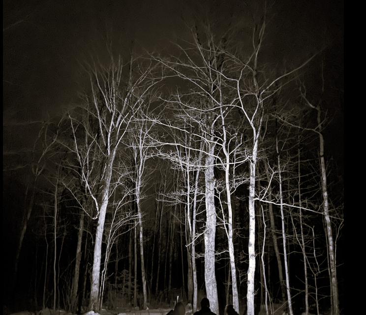
Moonlit Hike Series: Hunter's Moon
https://hikesstaging.brucetrail.org/event/moonlit-hike-series-hunters-moon/Sorry, the registration cut-off time for this hike has been reached.Not a member? Click here to join today!Hosting Club: Peninsula
Category: Moonlit Hike Series
Location (Google Maps):Bruce County Lindsay Tract Trails Parking Lot
Hike Leader(s): Saabir Sohrab, Natalie Mechalko, Madie Barker Click here to contact Hike Leader(s)
Pace: Leisurely
Terrain: Easy
Distance: ~4Description
🌕✨ Join us for a magical moonlit hike at Lindsay Tract! The trail is mostly flat, ideal for an easy two-hour hike adventure suitable for everyone. We’ll stroll about 2 km under the gentle glow of the Hunter’s Moon 🌌 before pausing in a cozy hut 🛖 to listen to the history of the area, including spooky local stories told by Brenda Stewart, the PBTC archivist. 👻📜 We’ll sip hot chocolate ☕️ (bring your own mugs!) and chit-chat for about an hour before heading back to our cars. 🚗 Dress comfortably, wear sturdy shoes 👟, and don’t forget your water bottle! 💧 Illuminate your path with a red light headlamp or flashlight 🔦. The total time commitment is about 3-4 hours. See you there! 🎉🌲
7:00 pm Moonlight Night Hike in Niagara-on-the-Lake
https://hikesstaging.brucetrail.org/event/700-pm-moonlight-night-hike-in-niagara-on-the-lake-6/Sorry, the registration cut-off time for this hike has been reached.Not a member? Click here to join today!Hosting Club: Niagara
Category: Night
Location (Google Maps): Veteran’s Memorial Park, park just outside the park on King St.Hike Leader(s): Robin Garrett Click here to contact Hike Leader(s)
Pace: Medium
Terrain: Easy
Distance: 6-7 kmDescription
Moonlight Night Hike – Take in the magic of the rising moon over Lake Ontario and the Niagara River. This hike includes a stop to connect with your senses – sights, sounds, smells and the rhythm of your breath. Counts towards your night hike badge (5 night hikes). - Each hiker joining a Bruce Trail Club organized hike must perform a self-screening check before hiking.
- 18October 18, 2024

Car Hike: Caledon E2E in 5 sections - 2 of 5
https://hikesstaging.brucetrail.org/event/car-hike-caledon-e2e-in-5-sections-2-of-5/Sorry, the registration cut-off time for this hike has been reached.Not a member? Click here to join today!Hosting Club: Iroquoia, Caledon Hills
Category: General Hike
Location (Google Maps): Meet and park at km 31.7 on Innis Lake Rd, north of Finnerty Sideroad, and we carpool to km 16.1Hike Leader(s): Susan Glofcheskie Click here to contact Hike Leader(s)
Pace: Medium – 3 to 4 km/hr
Terrain: Moderate – Some hills and/or some poor footing
Distance: 16 kmDescription
Join us for this Caledon E2E in 5 sections. Sign up for all 5 sections (to be entitled to the badge) or only the ones you are available for.Please bring 2 litres of water, a snack, bug spray, sunscreen, a personal first-aid kit and appropriate clothing. Hiking boots/shoes are mandatory and poles are suggested.
Please arrive by 8 am, so we can leave at 8:15 am to shuttle to our starting point.
Click on the Google link for directions to the meeting place.

Niagara-on-the-Lake Tour
https://hikesstaging.brucetrail.org/event/niagara-on-the-lake-tour-61/Sorry, the registration cut-off time for this hike has been reached.Not a member? Click here to join today!Hosting Club: Niagara
Category: Urban
Location (Google Maps): Meet on King St and Centre St (entrance to Veteran’s Memorial ParkHike Leader(s): Margaret Northfield Click here to contact Hike Leader(s)
Pace: Medium
Terrain: Easy
Distance: 5-6 kmDescription
Each Friday we will explore different neighbourhoods, trails and parkland throughout Historic Niagara-on-the-Lake.Moderate pace with some weeks entirely on sidewalks and roads while others may include a mix of trails and paved pathways. Great way to build up endurance for longer more strenuous hikes.
Prepare for cooler windy conditions on open parkland and along Lake Ontario and Niagara River trails.
Plan to stay for conversation and a warm cup of coffee or tea at Sweets & Swirls, Community Centre, Niagara Stone Road, NOTL
Margaret & Robin
Riverside Woods (Caledon)
https://hikesstaging.brucetrail.org/event/riverside-woods-caledon-2/Sorry, the registration cut-off time for this hike has been reached.Not a member? Click here to join today!Hosting Club: Iroquoia
Category: General Hike
Location (Google Maps): Meet in the parking lot on 1st Line EHS near Orangeville, south of Hockley Valley.Hike Leader(s): Karen Bergmann Click here to contact Hike Leader(s)
Pace: Medium – 3 to 4 km/hr
Terrain: Moderate – Some hills and/or some poor footing
Distance: 8 kmsDescription
Hiking around the side trails of this new property acquired by the BTC two years ago and then across the road and along the main trail, returning to the new property, continuing along the side trails to the cars. This property used to be a Scout Camp and has several old buildings and varied terrain (forest, meadow, etc). Some hills.The Frontenac Challenge - Multi-day Hike
https://hikesstaging.brucetrail.org/event/cat-hike-the-frontenac-challenge-multi-day-hike/Sorry, the registration cut-off time for this hike has been reached.Not a member? Click here to join today!This is a Multi-Day Hike
You are signing up for the following dates and times:
2024-10-18 at 13:00
2024-10-19 at 08:00
2024-10-20 at 08:00
2024-10-21 at 08:00
2024-10-22 at 08:00
2024-10-23 at 08:00
2024-10-24 at 08:00Hosting Club: Toronto
Category: Car Hike
Location (Google Maps): We meet at Snug Harbour Resort and drive about 9 KM to Frontenac Provincial Park.Hike Leader(s): Fayyaz Mahmood Click here to contact Hike Leader(s)
Pace: Brisk (4-5 km/hr)
Terrain: Challenging, Hilly, Rocky
Distance: 20-25KM each dayDescription
Frontenac Park is located near Kingston about 3-4 hours from Toronto. According to Parks Ontario, the Frontenac Challenge is the ultimate hiking challenge in Ontario! To qualify for the ‘Frontenac Challenge’ badge you need to complete all of Frontenac’s 11 hiking loops, totaling around 160 km!The Frontenac Challenge is managed jointly by Parks Ontario and the Friends of Frontenac. You can find details about the 2023 Frontenac challenge at –
https://www.ontarioparks.com/parksblog/frontenac-challenge/
https://www.friendsoffrontenac.com/challenge-registration
BOARDING & LODGING:
You are responsible for arranging your own food and accomodation. Most often participants find it convenient and cost-effective to stay at Snug Harbour Resort, a short distance from the park. If you intend to stay there, feel free to reach out to the trip leader and let me know whether your email can be shared with other participants. Often there are opportunities for joining others in renting a cabin and jointly preparing meals.HIKING
These hikes are for serious hikers only. You should be prepared for long hiking days. No drop-outs. You should bring your lunch and at least 1.5 – 2 litres of water. You should dress for the weather. Bring your rain gear, if needed.Additional information will be provided to participants nearer to the event.
Only a limited number of spaces are available.
- 19October 19, 2024
Coach Trip: Algonquin Park
https://hikesstaging.brucetrail.org/event/coach-trip-algonquin-park/Sorry, the registration cut-off time for this hike has been reached.Not a member? Click here to join today!Hosting Club: Toronto
Category: Coach Trip
Location (Google Maps): Algonquin Provincial ParkHike Leader(s): Martina Furrer, Duro Vukman, Roland Mark, Felix Wan, Leila Damband Kh Click here to contact Hike Leader(s)
Pace: Fast (5 km/hr or greater), Moderate (3-4 km/hr)
Terrain: Challenging, Hilly, Rocky
Distance: 12Description
Departure 1: 7 AM, 10 York Mills Rd.Departure 2: 7:20 AM, HWY 400 and Major Mackenzie Dr. Park and Ride, in front of the GO bus stop
Join us for an awesome fall hike with spectacular views of the Algonquin Park wilderness. Exact trails/routes to be decided based on conditions and access at the time of the hike. We will split into two groups. Both groups will hike the same route at similar paces so that we finish around the same time. The trails are hilly and challenging, with some rocks and routes underfoot. We hope to complete the hike in about 5 hours (including all breaks), no drop-outs. There will be many great view and water stops along the way, and a scenic lunch spot.
Bring lunch, snacks, water (at least 2 litres), sun and rain protection. We will be travelling in a washroom equipped highway coach.
The cost: $70 for members, $80 for non-members, $40 for children. This includes coach fare and park admission/bus parking fee.
No refreshment/highway stop planned.
25 Km CHALLENGE Hike
https://hikesstaging.brucetrail.org/event/25-km-challenge-hike/Sorry, the registration cut-off time for this hike has been reached.Not a member? Click here to join today!Hosting Club: Dufferin Hi-Land
Category: Special Events
Location (Google Maps): BTC Map #20 1st Line East, Bruce Trail Parking Lot – Rock Hill. Just east of Whitfield south of 10 Side Road (County Road 17).Hike Leader(s): Don Stewart Click here to contact Hike Leader(s)
Pace: Brisk, Fast
Terrain: Moderate, Slippery and Steep Sections, Slippery Sections Likely, Strenuous
Distance: 25 kmsDescription
Challenge yourself, your family, your friends or co-workers to complete the 25 Km trail through the picturesque and serene Boyne River Valley and earn the Dufferin Hi-Land 25 K “Challenge Badge”. This is a fundraising event for our club to assist in the maintenance of the Trail. We look forward to “treating” you with renown Dufferin County fare and hospitality at our checkpoints. I challenge you!Urban Walk: Boyd Conservation Park Vaughan
https://hikesstaging.brucetrail.org/event/urban-walk-boyd-conservation-park-vaughan/Sorry, the registration cut-off time for this hike has been reached.Not a member? Click here to join today!Hosting Club: Toronto
Location (Google Maps): Boyd Conservation Park, Islington Avenue, Vaughan, ON free parking at the entrance of the park,
There are different public transit routes to this parking lot please check transit maps/google map
Hike Leader(s): Mohammad Aghamiri Click here to contact Hike Leader(s)
Pace: Moderate (3-4 km/hr)
Terrain: Variable
Distance: 12-14Description
Explore the trails that wind through the beautiful valley at Boyd Conservation Area and the William Grainger Greenway. We will have lunch/snack in shelter with seated area,Please bring hiking poles, proper clothing for the season , hiking shoes/boots and lots of water.
Difficulty Level: 2 (Moderate)
Blue Mountains Stained Glass Fundraiser
https://hikesstaging.brucetrail.org/event/blue-mountains-stained-glass-fundraiser/Sorry, the registration cut-off time for this hike has been reached.Not a member? Click here to join today!This is a Multi-Day Hike
You are signing up for the following dates and times:
2024-10-19 at 08:30
2024-10-20 at 08:30
2024-11-02 at 08:30
2024-11-03 at 08:30Hosting Club: Blue Mountains, Beaver Valley
Location (Google Maps): Meet in the Snow Drifters parking lot on Pretty River Road, north east of km 46.8, Map 23, Edition 31
Hike Leader(s): Glenda Collings Click here to contact the hike leader.
Pace: Medium
Terrain: Moderate, Some rocky footing, Some steep sections, Strenuous
Length of Hike: 20.5 kmDescription
You are registering for a 4 day series of hikes to earn the Blue Mountains Stained Glass fundraiser badge. Please dress appropriately for fall weather, which can be cool, cold, rainy or snowy. It’s a good idea to have your icers in the car, you never know! Our October hikes should be a showcase of fall colours. Once the leaves are gone in November we’ll have great views through the bare trees. Hikers may miss one hike and make it up before Nov. 3 to earn the badge. See below for the hike schedule, locations and meeting times. The pace will be medium, a bit slower on the steep hills. All km are from Bruce Trail Guide Edition 31. Please meet 15 minutes before the start time ready to car shuttle. If you have any questions please contact me at beavervalleytrailactivities@gmail.comOctober 19 – Hike starts at 8:30 a.m. Meet at Maple Lane km 67.3, Map 24, at 8:15 a.m. to shuttle to the Snow Drifters parking lot on Pretty River Road, north east of km 46.8. We will be hiking across the Escarpment, then through Petun Conservation Area and Pretty River Provincial Park. Bring your energy for some hill climbing! Hike length 20.5 km
October 20 – Hike starts at 8:30 a.m. Meet at 9/10 Sideroad Nottawasaga, km 14.1, Map 21, at 8:15 a.m. to shuttle to Lavender Cemetery, Mulmur-Nottawasaga Townline, km 00.0. We’ll be hiking through Noisy River Provincial Nature Reserve and part of the Transcarioca Friendship Trail. Hike length 14.7 km
November 2 – Hike starts at 8:30 a.m. Meet at Devil’s Glen Provincial Park off County Road 124, km 29.5, Map 22, at 8:15 a.m. to shuttle to 9/10 Sideroad Nottawasaga, km 14.1. We’ll be hiking through Nottawasaga Bluffs Conservation Area and Devil’s Glen. Hike length 15.4 km
November 3 – Hike starts at 8:30 a.m. Meet at the Snow Drifters parking lot on Pretty River Road, north east of km 46.8, Map 23, at 8:15 a.m. to shuttle to Devil’s Glen Provincial Park off County Road 124, km 29.5. We’ll be hiking through Nottawasaga Lookout Provincial nature Reserve. Hike length 17.3 km
COVID-19 Precautions Before, During and After your Hike
- Each hiker joining a Bruce Trail Club organized hike must perform a self-screening check before hiking.
Find Ontario’s self-assessment tool here: https://covid-19.ontario.ca/self-assessment/ - If you are experiencing COVID-19 symptoms, stay home.
Other Guidelines
- Arrive 15 minutes before the start of the hike.
- Wear sturdy footwear and appropriate attire for the weather and the terrain.
Hiking poles are a good idea in any season, especially if the terrain is rocky or slippery. In winter, snowshoes or icers/crampons are needed when conditions dictate.
Wearing appropriate clothing and footwear prevents injuries and shows consideration for a safe and positive group hiking experience. - Always carry I.D. and your health card.
- Bring sufficient water and snacks (or lunch if indicated). A minimum of 1L of water is recommended on all hikes, and 3L is recommended for long, challenging hikes in the heat of the summer.
- Bring sunscreen and insect repellent (for spring and summer hikes).
- Bring your own first aid kit.
- Please leave dogs at home.

9:00 Woodend to Firemens Loop
https://hikesstaging.brucetrail.org/event/900-woodend-to-firemens-loop/Sorry, the registration cut-off time for this hike has been reached.Not a member? Click here to join today!Hosting Club: Niagara
Category: Loop
Location (Google Maps): Meet at the entrance to Woodend Conservation Area, Taylor Rd, Niagara-on-the-LakeHike Leader(s): Margaret Northfield Click here to contact Hike Leader(s)
Pace: Medium
Terrain: Moderate
Distance: 14kmDescription
Hike through Woodend Conservation area through the Screaming Tunnel and into Fireman’s Park, Niagara Falls. We will loop around Fireman’s and head back to Woodend. Bring water and a snack. Poles recommended.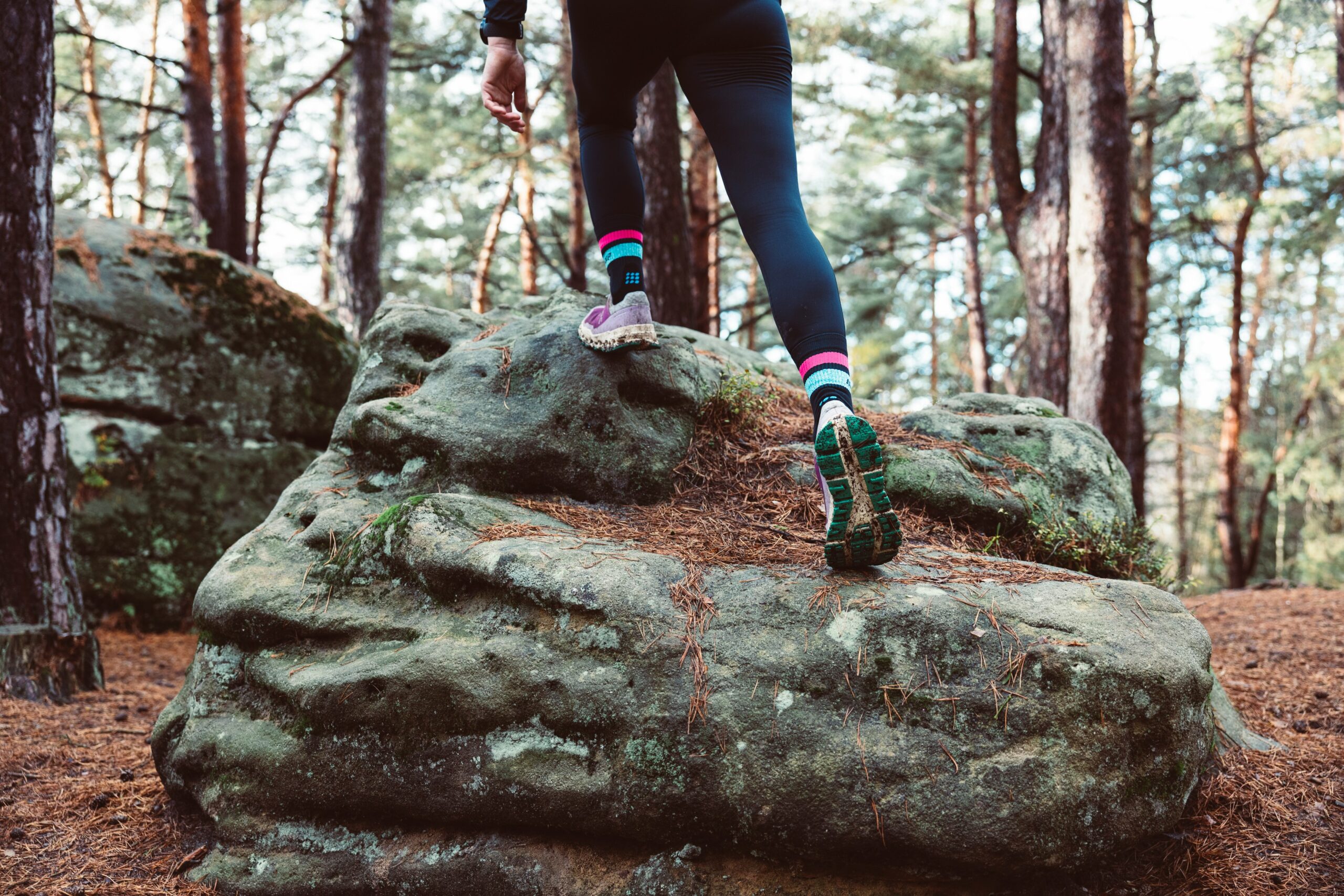
Barrow Bay - Rush Cove Loop - PBTC Trail Running Pilot #2
https://hikesstaging.brucetrail.org/event/rush-cove-cape-dundas-loop-pbtc-trail-running-pilot-2/Sorry, the registration cut-off time for this hike has been reached.Not a member? Click here to join today!Hosting Club: Peninsula
Location (Google Maps): Meet up at the BTC Parking Lot in Barrow Bay, on the east side of #2461 Bruce County Road 9. (Map 37).
Hike Leader(s): Margie Gloade Click here to contact Hike Leader(s)
Pace: Fast
Terrain: Difficult
Distance: ~7km or ~14kmDescription
The PBTC is excited to pilot two trail runs as part of their hiking series. These fall 2024 pilot trail runs will help with preliminary plans for a Peninsula E2E trail running series in 2025. The second trail run on Saturday, Oct.19, 2024, will offer two loops starting in the PBTC Parking Lot in Barrow Bay, on the east side of #2461 Bruce County Road 9. [PLEASE NOTE: this start location and route have been updated since the original website post.] Trail runners will connect to the Main Trail from the short Hawthorn ST at the parking lot. Both loops will then follow the Main Trail east for about 2.5 km to the staircase. Trail runners interested in the 7km loop will then follow the Beth Gilhespy ST, to the John Appleton ST, and back to the parking lot.Trail runners interested in the longer distance can enjoy the newly configured trails in this area since BTC secured the Sunrise Shores Nature Reserve this summer. The 14k loop will continue east on the Main Trail until about 4.5km, then turn up the escarpment following the Ivan Lemcke ST, to the Rush Cove ST, until it meets the new Main Trail in Rush Cove, following the Main Trail back (west) to the parking lot.
This is not a race. Trail runners will be expected to stay together – plan for about 2-3 hours. This is technical and challenging terrain for running. You should have some experience running trails, proper footwear, carry your own water/fuel, and fitness to maintain a jogging pace. Car pool if possible. Please join this run and share your feedback for future PBTC trail running events!

Geology Hike # 4 Woodford Escarpment
https://hikesstaging.brucetrail.org/event/geology-hike-4-woodford-escarpment/Sorry, the registration cut-off time for this hike has been reached.Not a member? Click here to join today!Hike open to BTC Members only.
Hosting Club: Sydenham
Category: Geology Hike
Location (Google Maps): Woodford Community, 107 Woodford Crescent, Owen Sound ON N4K 5W4. Please park behind the building. Loop hike from here.Hike Leader(s): Carol Graham-Mullin Click here to contact Hike Leader(s)
Pace: Leisurely: 3 km/h or less
Terrain: Easy: Mostly flat and good footing., Moderate: Some hills and/or poor footing, Strenuous: Hilly with steep climbs and some poor footing.
Distance: 3.5 km.Description
This is Geology Series # 4 following Beth Gilhespy’s book “Walking Through Time” in the Sydenham Bruce Trail Section. We will be exploring an industrial oddity, a disappearing waterfall, fossils, deep crevices and a rich forest of towering trees. Copies of Beth’s book will be available for purchase. Special member’s only price of $37.00 . Cash, cheque or etransfer. If paying with cash, please bring exact change. A special guest may join us ! Please bring water and a snack if you wish. Proper hiking footwear and hiking poles are recommended.
Urban Walk: Historical Hike - Old Georgetown and Glen Williams
https://hikesstaging.brucetrail.org/event/urban-walk-historical-hike-old-georgetown-and-glen-williams/Sorry, the registration cut-off time for this hike has been reached.Not a member? Click here to join today!Hosting Club: Toronto
Category: Urban Walk
Location (Google Maps): Georgetown Go StationHike Leader(s): Tom Swales and David Rowney Click here to contact Hike Leader(s)
Pace: Leisurely (2-3 km/hr)
Terrain: Variable
Distance: 10KDescription
Come join us for a 10K urban hike on Saturday Oct. 19 starting in Georgetown and learn about the area’s unique history in Glen Williams. Those leaving from Toronto can hop on the “Kitchener Line” Go Train at Union Station (at 9:51 am) or Bloor Go Station (at 10:01 a.m.). or Weston Go Station (10:07 a.m.) to arrive in Georgetown Go Train Station at 11:19 am (you’ll transfer to bus at Mt Pleasant Station in Brampton – a 20 minute stopover – for the rest of your journey). The return bus/train from Georgetown leaves at 3:00p.m. There is a 20-minute stopover at Mount Pleasant Station on the return trip. You’ll be back at Union Station at 4:36 p.m.If you wish, you can also drive to the Georgetown Go Station (north parking lot) for the hike. GPS: 43.656030, -79.919159.
The 2.5 hour hike will take us to the ruins of the historic Barber Mill (first site of hydro power in Ontario), then we will follow along the Credit Valley Footpath to the quaint town of Glen Wiliams (established 1825), with a chance to see artisan workshops and purchase sweets at Kits Kitchen or tea at the Main Street Market. After viewing some historic homes in the village, we will make our way back to Georgetown, following an abandoned rail line that takes us to the Georgetown Train Station, built in 1885. We’ll wander past more historic homes and finish (depending on timing) with a stop at Furnace Room craft brewery (across from the Station), or the Norval Pancake Factory nearby.
This is a Level 1 (easy) hike with a easy/moderate pace, suitable for “fit” beginners. There are some hills and depending on the weather, there could be wet areas along the Credit River footpath. Dress for the time of year, bring hiking boots, poles if you wish, water, sunscreen and lunch/snacks. Go Transit weekend day passes are available online for $10.
- Each hiker joining a Bruce Trail Club organized hike must perform a self-screening check before hiking.