
Hike Schedule
Join us for a hike! Registration required:
All hikes available to BTC members. Some hikes are open to non-members.
TIP: The calendar view displays up to 7 hikes on a day, but often there are more. Click “More events” to see them all.
Categories
- 04January 4, 2024
Urban Walk: Valley View Park Thornhill
https://hikesstaging.brucetrail.org/event/urban-walk-valley-view-park-thornhill/Sorry, the registration cut-off time for this hike has been reached.Not a member? Click here to join today!Hosting Club: Toronto
Category: Urban Walk
Location (Google Maps): Parking lot at the corner of Bayview Ave, and Sycamore Dr. South of Highway 7Hike Leader(s): Mohammad Aghamiri Click here to contact Hike Leader(s)
Pace: Moderate
Terrain: Variable
Distance: 7-8 KMDescription
We will explore Valleyview and Huntington park and walk along German Mill Creek,It is winter time and trail is hilly bring proper clothing, hiking boot sand ice cleats.

History & Hot Chocolate in Barrow Bay
https://hikesstaging.brucetrail.org/event/history-hot-chocolate-in-barrow-bay/Sorry, the registration cut-off time for this hike has been reached.Not a member? Click here to join today!Hosting Club: Peninsula
Location (Google Maps): Bruce Trail Parking lot in Barrow Bay (the old one, just south of West Shore Road)
Hike Leader(s): Leslie McBeth Click here to contact Hike Leader(s)
Pace: Leisurely
Terrain: Moderate
Distance: ~5kmDescription
On this hike, you’ll learn a little about the history of the storied hamlet of Barrow Bay. The traditional keepers of this land are the Anishinabek Nation: The People of the Three Fires known as Ojibway, Odawa, and Pottawatomie Nations. In the late 19th century, Barrow Bay because the hub of the lumber industry, and then eventually was settled by cottagers. We’ll tell stories about the old hotel that once stood on the Bruce Trail Palmer Property, and look out over Little Lake to learn of the mysterious serpent once told to inhabit the dark waters below. Then we’ll see if we can spot the old dam on Judges Creek and learn about the sawmill that once stood here. Then after the hike, hikers are invited to enjoy some hot chocolate (provided) by the campfire and share your own stories of adventures on the Saugeen (Bruce) Peninsula.Note that we’ll be walking a short distance on the road, as well as covering rocky terrain, which can be slippery, especially in the winter. Icers or crampons are recommended. Dress in layers appropriate for the weather. Rain date TBD.
9:00 am Long Hike Jordan to Moyer / Louth
https://hikesstaging.brucetrail.org/event/900-am-long-hike-jordan-to-moyer-louth-51/Sorry, the registration cut-off time for this hike has been reached.Not a member? Click here to join today!Hosting Club: Niagara
Location (Google Maps):
Jordan Hollow Park 3039 King St Jordan
Pace: Medium
Terrain: Moderate
: 10kDescription
From Jordan Hollow Hike the main trail to Upper and Lower Balls Falls, Moyer Road or Louth and Return. You must register for each hike. Bring Poles, sunscreen, bug spray , snack and a drink and dress for the weather
9:15 Short Hike - Jordan Hollow
https://hikesstaging.brucetrail.org/event/915-short-hike-jordan-hollow-90/Sorry, the registration cut-off time for this hike has been reached.Not a member? Click here to join today!Hosting Club: Niagara
Category: Loop
Location (Google Maps): Jordan Hollow Park, Jordan StationHike Leader(s): Bill Russell Click here to contact Hike Leader(s)
Pace: Medium
Terrain: Moderate
Distance: 6kDescription
Hike the main and side trails around Jordan and Ball’s Falls. Bring hiking boots, water and icers. - 05January 5, 2024

Queenston Heights Tour
https://hikesstaging.brucetrail.org/event/queenston-heights-tour/Sorry, the registration cut-off time for this hike has been reached.Not a member? Click here to join today!Hosting Club: Niagara
Category: Loop
Location (Google Maps): Meet near the Queenston Heights Restaurant, Niagara ParkwayHike Leader(s): Margaret Northfield Click here to contact Hike Leader(s)
Pace: Medium
Terrain: Easy
Distance: 5-7kmDescription
Hike around Queenston Heights park and the beginning of the Bruce Trail.Margaret & Robin
- 06January 6, 2024
CANCELLED: Winter Coach Trip, Arrowhead Provincial Park
https://hikesstaging.brucetrail.org/event/winter-coach-trip-arrowhead-provincial-park-2/Sorry, the registration cut-off time for this hike has been reached.Not a member? Click here to join today!Hosting Club: Toronto
Category: Cancelled
Location (Google Maps): Arrowhead Provincial ParkHike Leader(s): Martina Furrer, Roland Mark, Celia Ho Click here to contact Hike Leader(s)
Description
Cancelled due to lack of snow and a low number of registrants.No trail fees at Arrowhead! Bus cost includes park admission.
Bus departs 10 York Mills Rd at 8:00 AM and Major Mackenzie Dr and HWY 400 Park and Ride at 8:20 AM. If you wish to be picked up at the Major Mackenzie Dr and HWY 400 Park and Ride, select that option when you register. Please arrive 15 minutes before departure. The bus waits for no one.
Join us for an awesome day of winter fun at Arrowhead Provincial Park. For information about trail conditions visit: https://www.ontarioparks.com/skireport. For information about the park visit: https://www.ontarioparks.com/park/arrowhead. Join Roland and Celia for a guided snowshoe hike, or enjoy self-guided skiing on trails groomed for classic and skate skiing. After skiing or snowshoeing spend some time ice skating (if open) in the forest.
There are no food services in the park. Pack water/tea and lunch.
Ski and snowshoe rentals available.
Coach fares and park admission must be paid online when you register. Masks are mandatory on the bus.
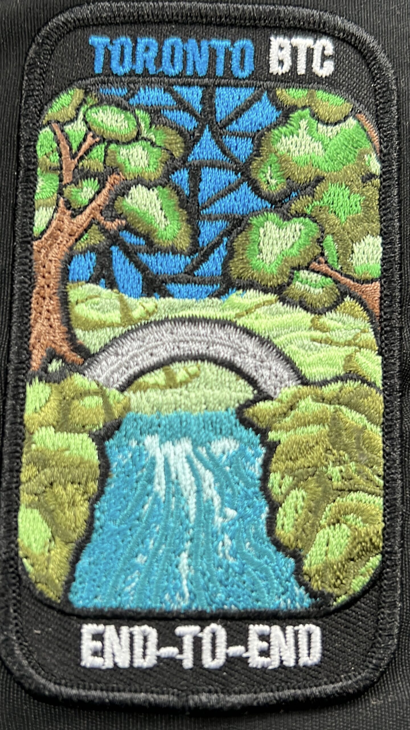
A Winter Toronto E2E - Fundraiser Hike for the Limehouse Arch Stained Glass Badge
https://hikesstaging.brucetrail.org/event/a-winter-toronto-e2e-fundraiser-hike-for-the-limehouse-arch-stained-glass-badge/Sorry, the registration cut-off time for this hike has been reached.Not a member? Click here to join today!This is a Multi-Day Hike
You are signing up for the following dates and times:
2024-01-06 at 08:15
2024-01-13 at 08:15
2024-01-20 at 08:15Hosting Club: Iroquoia, Toronto
Category: Special Event
Location (Google Maps): Toronto section E2E Led by Dave SaltHike Leader(s): Dave Salt Click here to contact Hike Leader(s)
Pace: Brisk – 4 to 5 km/hr
Terrain: Dependent on Conditions, Moderate – Some hills and/or some poor footing, Slippery Sections Likely
Distance: Varies each day – section is just under 50km in totalDescription
This is a fundraiser hike and end to end of the Toronto section in 3 outings. There are no refunds. After the finish, you will earn the special Toronto stained glass badge. You are registering for 3 days, January 6, 13 and 20th.
Hikers will need to complete the three hikes with the leader but are allowed to miss one hike and make it up on their own before the last scheduled hike. Please keep a log of the missed hike and give it to the leader on the last day.The fee goes towards supporting the Toronto Bruce Trail Club, which in turn supports the mission of the Bruce Trail Conservancy “preserving a ribbon of wilderness, for everyone, forever”.
Registration for this hike is limited to members of the Bruce Trail Conservancy.
This hike is intended to be Moderate (4k per hour). Register only if you are capable of sustaining this pace for the day over a varied rocky & snowy terrain.Hikers are expected to follow the COVID 19 guideline and stay home if they have symptoms.
Hikers may choose to wear masks.
Arrive 15 minutes early, wear sturdy footwear, ice cleats, proper layers for winter weather, always carry ID cards, bring 2 litres of water, bring your own first aid kit.
Something warm to drink at our lunch break would be a good idea!
Hikers should anticipate winter conditions – boots, icers, poles, gators, layered clothing, water, snacks, lunch, first aid kit. We will take turns shuttling from meeting place to trailhead each day and a driver will need to take the shuttle drivers back to their car at the end of the hike. We will meet each day at 8:15 and shuttle to trailhead – hikers should arrive 15 minutes early to ensure ready to leave at 8:30. Anticipate most hikes will take approx 5-6 hours including lunch and snack breaks.
Please ensure you are physically able to manage the pace, distance and potential wintery conditions & temperatures of this hike before registering. Refunds are not allowed. Your fee includes the badge.
The hike leader may change a hike date due to inclement winter conditions.Location:Day-1: (Google Maps): Km 17.4, Fourth Line. East side of the road. Coordinates N 43.615163,W 79.975157
Distance:17.4
Day-2: km 32.2 east side of 8th 8th line, at 27th sideroad intersection. Coordinates N 43.686276, W 79.975578
Day-3: km 48.3 on Boston Mills Rd, west of Mississauga Rd intersection. Coordinates N 43.750866 W 79.951452
Great Niagara Circle Route #5 Miller to Niagara Falls
https://hikesstaging.brucetrail.org/event/great-niagara-circle-route-5-miller-to-niagara-falls/Sorry, the registration cut-off time for this hike has been reached.Not a member? Click here to join today!Hosting Club: Niagara
Category: Car Pool
Location (Google Maps):Meet at Aerocar Parking Lot Niagara Falls. Car Pool to Niagara Boulevard and Miller Road,
Hike Leader(s): Alan Laver Click here to contact Hike Leader(s)
Pace: Brisk
Terrain: Easy
Distance: 14.3Description
The Greater Niagara Circle Route badge is awarded to walkers who independently complete the Circle Route Trail i.e. Lock 1 Port Weller, along the Welland Canal to Port Colborne , following the Friendship Trail to Fort Erie, following the Niagara Recreational Parkway Trail to Niagara-on-the-Lake and following the Waterfront Trail to Port Weller.
Car Hike: Hike of 2 lakes King city 116
https://hikesstaging.brucetrail.org/event/car-hike-hike-of-2-lakes-king-city-10/Sorry, the registration cut-off time for this hike has been reached.Not a member? Click here to join today!Hosting Club: Toronto, Dufferin Hi-Land
Location (Google Maps): Park along Fairfield Dr. or Dufferin Street. Gather at trail head on Dufferin Street.
Hike Leader(s): Mohammad Aghamiri Click here to contact Hike Leader(s)
Pace: Moderate
Terrain: Variable
Distance: 14-17KMDescription
We will hike in trails around Seneca lake and Mary Lake, pass by Eaton Hall and visit Pine farm where you can enjoy coffee, tea and apple pie during our snack time.Some safety procedures during the hike:
1-Hikers must stay between the leader and the sweep,
2-Hikers must advise the leader or the sweep if they wish to leave the group.
3- Hikers must follow the whistle instructions: 1 blast- stay where you are; 2 blasts come to the leader; 3 blasts – come to the leader quickly.
4-Hike leader may request volunteers to stop at trail intersections, they need to help hikers to the direction the group walk and wait till they see the sweep .
5-Hikers have to make sure they can see the persons behind and in front of them.
Standing Rock-Singhampton Caves
https://hikesstaging.brucetrail.org/event/metcalfe/Sorry, the registration cut-off time for this hike has been reached.Not a member? Click here to join today!Hosting Club: Blue Mountains
Category: Register in person the morning of hike.
Location (Google Maps): Hike meets in the parking lot behind Tim Hortons on First St. in Collingwood.Hike Leader(s): Allison Thomas Click here to contact Hike Leader(s)
Pace: Medium – 3 to 4 km/hr
Terrain: Strenuous – Hilly with steep climbs and some poor footing
Distance: 8.5Description
Oarking at the Lower Pretty Ver parking lot, we will head out along the new reroute trail that will take us over to the Pretty River where we ill follow it to the Clearview Townline. We will ascend this very steep road to the 30/31 sideroad. Entering here we will have another significant climb weaving our way up to Standing Rock Side Trail where the trail becomes challenging up and over icy rock faces and through icy cracks and crevices. Be prepared for a difficult wet or icy climb dependent on the most recent weather conditions. Crampons a must. Snowshoes if weather permits. Once at the top we will close the loop. Bring a snack or lunch and water.
Map: 22/23 Edition 30 Pace: MediumNiagara Gorge, American side
https://hikesstaging.brucetrail.org/event/niagara-gorge-american-side/Sorry, the registration cut-off time for this hike has been reached.Not a member? Click here to join today!Hosting Club: Niagara
Category: Loop
Location (Google Maps): Whirlpool State Park, Niagara Falls, NYHike Leader(s): Marion Hanover Click here to contact Hike Leader(s)
Pace: Medium
Terrain: Moderate
Distance: 10kmDescription
Let’s explore the Niagara gorge from the American side. Proper documentation needed to cross into the United States. I will arrange a car pool from St Catharines Glendale Carpool lot at 9:00am if there is an interested.Car Hike; Awenda Provincial Park
https://hikesstaging.brucetrail.org/event/car-hike-awenda-provincial-park/Sorry, the registration cut-off time for this hike has been reached.Not a member? Click here to join today!Hike open to BTC Members only.
Hosting Club: Toronto
Category: Car Hike
Location (Google Maps): Meet in front of Trail and Activity CenterHike Leader(s): Roland Mark Click here to contact Hike Leader(s)
Pace: Moderate
Terrain: Variable
Distance: 14 to 16 kmDescription
Hike will begin at 9:30 am. We’ll be staying mainly on the Bluff and Wendat Trails. We’ll head north on Brule Trail from the Trail Center to the Bluff Trail and turn eastward and hike to and around Kettle Lake and back to the Bluff Trail. Th hike will continue south alongtheu Bluff Trail and back to the Trail Center.It will be cold and possibly windy this Saturday so please dress warmly and in layers. Bring a lunch, snacks and 2L of liquid for hydration.
Woodford Escarpment Loop
https://hikesstaging.brucetrail.org/event/woodford-escarpment-loop-7/Sorry, the registration cut-off time for this hike has been reached.Not a member? Click here to join today!Hosting Club: Sydenham
Category: Snowshoe Hike
Location (Google Maps): Meet in the north-east corner of the parking lot at Home Depot on Highway 26 on the east side of Owen Sound.Hike Leader(s): Franziska Edney Click here to contact Hike Leader(s)
Pace: Medium: 3 to 4 km/h
Terrain: Moderate: Some hills and/or poor footing, There might be icy and slippery sections.
Distance: 3 kmsDescription
This is a 3 km loop, taking us by an old lime kiln, through a forested area, over a creek, up and down a few hills and through crevices (which can be avoided). If interested, we can add another 1.5 kms and hike or snowshoe the crevice Springs Loop across the road. Poles are advised. Please remember that Woodford often has more snow than Owen Sound. It is a good idea to bring both, snow shoes and grippers. Map 30. Please contact the Leader, if you have questions or are not car pooling at 519 379 2573. - 07January 7, 2024

PBTC Tree Badge Pilot Hike
https://hikesstaging.brucetrail.org/event/pbtc-tree-badge-pilot-hike/Sorry, the registration cut-off time for this hike has been reached.Not a member? Click here to join today!Hosting Club: Peninsula
Location (Google Maps): Parking lot at the east end of Scenic Caves Road [44.953282, -81.128023]
Hike Leader(s): Saabir Sohrab Click here to contact Hike Leader(s)
Pace: Leisurely
Terrain: Moderate
Distance: 5kmDescription
Calling all badge hounds! PBTC will be launching a tree badge in 2024. The tree badge will be the next in a series of conservation badges that include the birder badges, fern badge and orchid badge. Before we launch, we want to test the badge requirements in a couple of pilot hikes. This hike will allow you to test the requirements for the badge. The badge requirements are at the end of this hike description. The badge requires the use of the iNaturalist app – if you aren’t already part of the iNaturalist Bruce Trail Conservancy Project, please get the app before the hike, see details here: https://development.brucetrail.org/what-we-do/#iNaturalistPBTC volunteer Natalie Mechalko will share her knowledge of trees on the Peninsula to support hikers as they try out the Tree Badge requirement.
We will meet at the parking lot located at the east end of Scenic Cave Road [44.953282, -81.128023] and hike a loop around the Pease Side Trail and main trail.
Be prepared for variable weather and dress for the conditions on the day of the hike. Depending on the weather, icers may be required. As with all winter hikes, we will adjust or postpone the hike if required due to inclement conditions.
Draft Tree Badge Requirements:
There is no time limit for completing the badge requirements. All observations must be from the main trail or sides trails of the Peninsula section or on a PBTC-organized hike.
- Photograph, identify and document 25 different tree species along the Peninsula section of the Bruce Trail. Your list must include at least 1 tree in each of the following categories:
- Deciduous
- Coniferous
- Mast Tree – produces food for wildlife or human foragers through periodic booms in seed production. A key characteristic of mast trees is that their seed production becomes synchronized across entire populations of the same species, producing an over-abundance of food in some years (also known as bumper crops, which is a crop that has yielded a usually productive harvest), and greatly reduced production in other years. Many mast foods have great storage value, avoiding rot, or freezing on the trees to provide quality food even when everything is dormant. Mast foods also have a high nutrition content, such as fatty nuts, which helps mammals build up fat stores for winter. Periodic booms (typically once every 2-8 years) of mast production trigger a cascade of ecological effects that affects mammals, birds, insects & even diseases like Lyme. Some common types of mast trees include oak, spruce, walnut, butternut and beech.
- Wildlife Tree – standing dead or live tree (also known as snags, den trees or cavity trees) with characteristics that provide valuable habitat for wildlife. Wildlife trees may contain spike, fork or broken tops, cavities, loose bark, large platform limbs and brooms. In Ontario, at least 50 species of birds and mammals rely on snags. Many species of trees make for good snaps, but large conifers such as cedar, fir, larch, and pine, tend to rot more slowly than do deciduous trees such as alder, birch, and cherry. Large deciduous trees such as cottonwoods, big-leaf maples, and oaks can last many years as snags. While alive, large deciduous trees tend to develop cavities in their bulky live and dead branches and trunks.
- Invasive Species – could be an invasive tree species (i.e., Scots pine, Buckthorn, Norway Maple) or identification of invasive pathogen (i.e., Emerald Ash Borer, butternut canker, beech bark disease)
- Upload photos to iNaturalist.ca and add them to the Bruce Trail Project. New to iNaturalist? Not registered for the Bruce Trail Project? Visit https://development.brucetrail.org/what-we- do/#iNaturalist for details.
- For one specimen tree in each of the five categories record the following:
- Deciduous
- Common name
- Leaf category: opposite, alternate, simple, compound, pinnate, palmate, lobed, toothed, margins
- Coniferous
- Common name
- Leaf category: Short needles in opposite pairs or whorls of 3, needles in bundles or 2, 3 or 5, needles in tufts of 10 or more on dwarf shoots or single on long shoots
- Mast Tree
- Name of fruit/ seed
- Wildlife Tree
- Wildlife habitat characteristic (spike, fork or broken top, cavity, loose bark, large platform limbs or brooms) and name species that may use habitat
- Invasive Species
- Common name of tree or pathogen
- Once you have accumulated 25 species, and your entries have been verified on iNaturalist, and you have recorded the characteristics of five specimen trees, you may obtain your badge. Instructions for obtaining the badge will be available on the PBTC website at https://www.pbtc.ca/badges after the badge is launched.

Sunday Rambles at RBG (Hendrie Valley)
https://hikesstaging.brucetrail.org/event/sunday-rambles-at-rbg-hendrie-valley/Sorry, the registration cut-off time for this hike has been reached.Not a member? Click here to join today!Hosting Club: Iroquoia
Category: General Hike
Location (Google Maps):Hike Leader(s): Colleen Mabalay Click here to contact Hike Leader(s)
Pace: Medium – 3 to 4 km/hr
Terrain: Easy – Mostly flat and usually good footing, Moderate – Some hills and/or some poor footing
Distance: 6kmDescription
Meet in the parking lot at 9:45am. Bring water and snack. Dress according to weather (icers).Text 905-815-7100 if unable to attend on morning of hike.
Sunday Social Hike - Boyd’s Crevices
https://hikesstaging.brucetrail.org/event/sunday-social-hike-boyds-crevices-3/Sorry, the registration cut-off time for this hike has been reached.Not a member? Click here to join today!Hosting Club: Sydenham
Category: Snowshoe Hike
Location (Google Maps): 11th Concession – north of Km 83.9 where the road intersects with the Owen Sound Rail Trail. Map 32 edition 31Hike Leader(s): Ian Mills Click here to contact Hike Leader(s)
Pace: Leisurely: 3 km/h or less
Terrain: Moderate: Some hills and/or poor footing, There might be icy and slippery sections.
Distance: 6 kmDescription
This will be an “in and out” hike leading to some giant dolostone blocks separated by spectacular crevices. If you are unable to register please text/call the hike leader @ 416-848-8818.