
Hike Schedule
Join us for a hike! Registration required:
All hikes available to BTC members. Some hikes are open to non-members.
TIP: The calendar view displays up to 7 hikes on a day, but often there are more. Click “More events” to see them all.
Categories
- 26January 26, 2024

Niagara-on-the-Lake Tour
https://hikesstaging.brucetrail.org/event/niagara-on-the-lake-tourra/Sorry, the registration cut-off time for this hike has been reached.Not a member? Click here to join today!Hosting Club: Niagara
Category: Urban
Location (Google Maps): Meet on King St near Centre St, just outside of Veteran’s Memorial Park, Niagara-on-the-LakeHike Leader(s): Margaret Northfield Click here to contact Hike Leader(s)
Pace: Medium
Terrain: Easy
Distance: 5-7kmDescription
Each Friday we will explore different neighbourhoods, trails and parkland throughout Historic Niagara-on-the-Lake.
Moderate pace with some weeks entirely on sidewalks and roads while others may include a mix of trails and paved pathways. Great way to build up endurance for longer more strenuous hikes.
Prepare for cooler windy conditions on open parkland and along Lake Ontario and Niagara River trails.
Plan to stay for conversation and a warm cup of coffee or tea at Sweets & Swirls, Community Centre, Niagara Stone Road, NOTL
Margaret & Robin
- 27January 27, 2024
CANCELLED Winter Coach Trip: Scenic Caves
https://hikesstaging.brucetrail.org/event/winter-coach-trip-scenic-caves-3/Sorry, the registration cut-off time for this hike has been reached.Not a member? Click here to join today!Hosting Club: Toronto
Category: Cancelled
Location (Google Maps): Scenic CavesHike Leader(s): Martina Furrer, Tim Wainwright, Nijole Mockevicius Click here to contact Hike Leader(s)
Description
Cancelled due to weather.
Bus departs 10 York Mills Rd at 8 AM and Major Mackenzie Dr and HWY 400 Park and Ride at 8:20 AM. If you wish to be picked up at the Major Mackenzie Dr and HWY 400 Park and Ride, select that option when you register. Please arrive 15 minutes before departure. The bus waits for no one. Join us for an awesome day of skiing and snowshoeing at Scenic Caves Nature Adventures. Cross southern Ontario’s longest suspension bridge and enjoy great views of Georgian Bay. Snowshoers: Join Tim and Nijole for a guided snowshoe. Prepare to be outside for four hours as the group traverses, forests, fields and some great lookouts. If you prefer, you can explore the resort trails with a friend at your own pace. Skiers: Enjoy forests, fields, and rolling hills on trails expertly groomed for classic and skate skiing. Join our après ski and shoe party in our cozy, private chalet. Some wine will be provided (bring your own beer). If you would like to, bring some finger food to share. Ski and snowshoe rentals available. Scenic Caves rents equipment on a first-come, first served basis. Rental equipment must be picked up and dropped off in the main chalet and paid for individually. We’ve reserved the log cabin for our group so there will be plenty of space to leave extra gear and warm up by the fire. Coach fares must be paid online when you register. Trail fees will be collected in cash on the bus. Masks are mandatory on the bus. This trip will run if there is enough snow to ski on. Hikers: It may not be clear ahead of time whether snowshoes, icers, or just boots will be the most appropriate footwear. Come prepared for anything. If the Club cancels this trip, your coach fare will be refunded.

Great Niagara Circle Route #7 NOTL to St Catharines
https://hikesstaging.brucetrail.org/event/great-niagara-circle-route-7-notl-to-st-catharines/Sorry, the registration cut-off time for this hike has been reached.Not a member? Click here to join today!Hosting Club: Niagara
Category: Car Pool
Location (Google Maps):Meet at Charles Ansell Gateway, Bunting Road St Catharines. Car Pool to Niagara River Parkway / Ricardo St NOTL.
Hike Leader(s): Alan Laver Click here to contact Hike Leader(s)
Pace: Brisk
Terrain: Easy
Distance: 17.3Description
THIS HIKE IS AMENDED. IT WAS NOT COMPLETED LAST WEEKThe Greater Niagara Circle Route badge is awarded to walkers who independently complete the Circle Route Trail i.e. Lock 1 Port Weller, along the Welland Canal to Port Colborne , following the Friendship Trail to Fort Erie, following the Niagara Recreational Parkway Trail to Niagara-on-the-Lake and following the Waterfront Trail to Port Weller.
Car Hike: Rouge National Park Toronto 119
https://hikesstaging.brucetrail.org/event/car-hike-rouge-national-park-toronto-9/Sorry, the registration cut-off time for this hike has been reached.Not a member? Click here to join today!Hosting Club: Toronto
Location (Google Maps): Rouge Park, Zoo Road Parking Lot off Meadowvale Road, north of Sheppard Avenue
Hike Leader(s): Mohammad Aghamiri Click here to contact Hike Leader(s)
Pace: Fast
Terrain: Hilly, Variable
Distance: 12-14 kmDescription
Will explore Toronto part of Rouge park along Rouge river and Little Rouge Creek,Some safety procedures during the hike:
1-Hikers must stay between the leader and the sweep.
2-Hikers must advise the leader or the sweep if they wish to leave the group.
3- Hikers must follow the whistle instructions: 1 blast- stay where you are; 2 blasts come to the leader; 3 blasts – come to the leader quickly.
4-Hike leader may request volunteers to stop at trail intersections, they need to help hikers to the direction the group walk and wait till they see the sweep .
5-Hikers have to make sure they can see the persons behind and in front of them.
Car Hike: Beaver Valley Winter E2E in 8 hikes.
https://hikesstaging.brucetrail.org/event/car-hike-beaver-valley-winter-e2e/Sorry, the registration cut-off time for this hike has been reached.Not a member? Click here to join today!Hike open to BTC Members only.
This is a Multi-Day Hike
You are signing up for the following dates and times:
2024-01-27 at 08:30
2024-01-28 at 08:30
2024-02-01 at 08:30
2024-02-02 at 08:30
2024-03-08 at 08:30
2024-03-09 at 08:30
2024-03-15 at 08:30
2024-03-16 at 08:30Hosting Club: Toronto
Category: Car Hike
Location (Google Maps): Maple Lane. Coordinates N 44.504973,W 80.331780Hike Leader(s): Smadar Junkin Click here to contact Hike Leader(s)
Pace: Brisk, Moderate
Terrain: Challenging, Hilly
Distance: 13.7 kmDescription
This winter E2E is intended for strong hikers, experienced snowshoers. It is a tough hike in snowy conditions. It. Because of the cold weather we will need to move fast and have 2 or 3 short breaks. Each hikers is required to bring snowshoes and icersin case of improper conditions the hike leader will change the date of the hike on a very short notice. Winter parking conditions are unpredictable, we may need to change parking area. A hiking schedule will be sent to the participants.
the rewards of this hike series is to test your strength and endurance and of course the beautiful new Beaver Valley new badge.
bring plenty of water and snacks, lunch. Dress in warm layers and follow all Covid 19 protocols.Iroquoia Odyssey #2 - Stoney Creek to the Jolly Cut
https://hikesstaging.brucetrail.org/event/iroquoia-odyssey-2-stoney-creek-to-the-jolly-cut/Sorry, the registration cut-off time for this hike has been reached.Not a member? Click here to join today!Hosting Club: Dufferin Hi-Land
Category: General Hike
Location (Google Maps): Parking lot off Concession St., east side of Jolly Cut. (Southern end of the Sam Lawrence Park Side Trail). Near km 34.0 BTC Map 7.Hike Leader(s): Stuart Law Click here to contact Hike Leader(s)
Pace: Medium
Terrain: Moderate, Slippery and Steep Sections, Slippery Sections Likely
Distance: 17 kmsDescription
Join us on the second of seven shuttle hikes to complete the Iroquoia Section. We will climb up to the escarpment brow at Millen Road then proceed west with great sights of Burlington and Lake Ontario until we arrive in the Hammer at the Jolly Cut. Hiking boots, icers and poles essential. Please dress in layers for the weather. Mitts a good idea. Please bring a smile, warm drink, water, a snack and a lunch. Please meet at 8:45 am to be ready to shuttle at 9 am. Please bring a garbage bag and footwear to change into for the shuttle after the hike (it might be muddy).Hoggs Falls
https://hikesstaging.brucetrail.org/event/hoggs-falls-6/Sorry, the registration cut-off time for this hike has been reached.Not a member? Click here to join today!Hosting Club: Blue Mountains
Category: Register in person the morning of hike.
Location (Google Maps): Hike meets in the parking lot behind Tim Hortons on First St. in Collingwood.Hike Leader(s): Michael Treuman Click here to contact Hike Leader(s)
Pace: Medium – 3 to 4 km/hr
Terrain: Moderate – Some hills and/or some poor footing
Distance: 6 kmDescription
We will drive to the Hoggs Falls parking lot at km 67.5 on Lower Valley Road in the Beaver Valley section. After viewing the falls, we will do a figure 8 loop hike using both the white blazed trail and various side trails. This hike takes us through a variety of different terrains and landscapes. Bring a snack and water.
Niagara E2E in 5 - Leader Robert House - Niagara ETE Winter Badge
https://hikesstaging.brucetrail.org/event/niagara-e2e-in-5-leader-robert-house-niagara-ete-winter-badge/Sorry, the registration cut-off time for this hike has been reached.Not a member? Click here to join today!This is a Multi-Day Hike
You are signing up for the following dates and times:
2024-01-27 at 09:30
2024-01-28 at 09:30
2024-02-10 at 09:30
2024-02-11 at 09:30
2024-02-17 at 09:30Hosting Club: Niagara, Iroquoia
Category: General Hike
Location (Google Maps): Woodend Conservation Area is our first meeting spot.Hike Leader(s): Robert House Click here to contact Hike Leader(s)
Pace: Medium – 3 to 4 km/hr
Terrain: Dependent on Conditions, Moderate – Some hills and/or some poor footing
Distance: Varies but around 16km per outingDescription
Join us in earning a winter Niagara End 2 End Badge starting on January 27th for a series of 5 hikes. Each hike will be approximately 16 kms at a moderate pace. This is suitable for intermediate to advanced hikers.We will be using hiker’s vehicles to shuttle between our start and end point for each hike.
Proper hiking boots and icers are a must! Bring hiking poles, food/snacks, water, hat, and rainwinter gear.
Arrive at 9:30am for roll call/check in/drive to the starting point. Hike will start at 10 am sharp
It is important to complete each section within a time frame to consider the shorter days.
Hikers will receive their End to End badge upon completion.
If you must miss a day but can make it up before the last scheduled hike, you will still qualify for the badge.
Please, no dogs. All logistics/scheduling/start/stop and parking (shared cost if there is a fee)and a hike leader to guide you, is included.
Planed routes, gps co-ordinates and parking information to be posted closer to hike time.
——————————————————————————–
Day 1: Queenston Heights to Woodend Conservation Area (16 KM)
Day 2 Woodend Conservation area to Decew House (16 KM)
Day 3 Decew House to Rockway (16 KM)
Day 4 Rockway to Margaret Reed Side Trail Parking (18.7 KM)
Day 5 Margaret Reed Parking to Grimsby Terminus (17 KM)
Main Trail and Glen Haffy Conservation Area
https://hikesstaging.brucetrail.org/event/main-trail-and-glen-haffy-conservation-area-2/Sorry, the registration cut-off time for this hike has been reached.Not a member? Click here to join today!Hosting Club: Caledon Hills
Category: General
Location (Google Maps):Meet at roadside parking on Coolihans Sideroad, east of where the Trail crosses the road. 43.937967, -79.934650
Hike Leader(s): Elizabeth Ganong and Lynn Dobson Click here to contact Hike Leader(s)
Pace: Medium – 3 to 4 km/hour
Terrain: Moderate – some hills and/or some poor footing
Distance: 6 kmDescription
This loop starts out from Coolihans Sideroad where the Bruce Trail enters the Glen Haffy Conservation Area. It includes the Bruce Trail main trail and the Glen Haffy trails. While the length of the hike is short, it still manages to offer variety and challenges. There are some hills, some open fields, and pond views. Hiking boots and icers/crampons are required. Hiking poles are recommended. Bring a snack and water.This hike is all about taking a moment to enjoy the winter forest. Please arrive 15 minutes prior to the hike start time.
Car Hike: Oak Ridges Trail & York Region Forest Hike - 15KM
https://hikesstaging.brucetrail.org/event/car-hike-oak-ridges-trail-york-region-forest-hike-15km/Sorry, the registration cut-off time for this hike has been reached.Not a member? Click here to join today!Hosting Club: Toronto
Category: Car Hike
Location (Google Maps): Dainty Tract Parking Lot, 15182 McCowan RdHike Leader(s): Alina Lin Click here to contact Hike Leader(s)
Pace: Moderate
Terrain: Variable
Distance: 15KMDescription
Not sure how much snow is left out there but it is always nice to get some crispy fresh air in the winter forest. We will start from Clarke Tract, hike along the main trail and side trails of Oak Ridges Moraine Trail to Eldred King Woodlands, and then track back.Meetup location: Dainty Tract Parking Lot, 15182 McCowan Rd, Whitchurch-Stouffville, GPS (44.02904518432559, -79.32005545617852). Some notes:
- Bring snack or light lunch, and beverage;
- Wear Waterproof hiking boots;
- Bring icers/crampons in case;
- Dress for weather.
- Trekking poles are recommended.
Hike # 2 Winter Badge Series
https://hikesstaging.brucetrail.org/event/hike-2-winter-badge-series/Sorry, the registration cut-off time for this hike has been reached.Not a member? Click here to join today!Hosting Club: Dufferin Hi-Land
Category: General Hike
Location (Google Maps): Map 20 Km. 13.3Hike Leader(s): Bryan and Carol Foley Click here to contact Hike Leader(s)
Pace: Medium
Terrain: Moderate
Distance: 6.5 kmDescription
The January moon is known as ” The Wolf Moon ” We will hike from km 13.3 to km 10 and back. Bring Water, Snowshoes, Icers, Snack, Headlamp ( Flashlight )Dress appropriately, Please arrive by 6:45 pm ready to hike at 7 pm Contact hike leader if you have any questions. Please remove your name from the sign up sheet if you must cancel - 28January 28, 2024
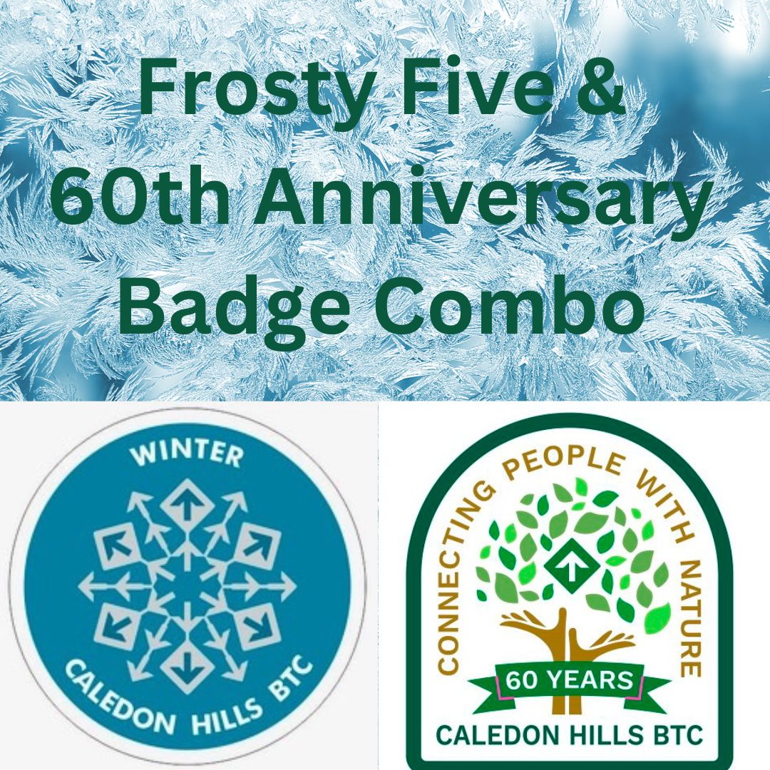
CHBTC Frosty 5 and 60 for the 60th Anniversary Badge Combo
https://hikesstaging.brucetrail.org/event/chbtc-frosty-five-and-60th-anniversary-badge-combo/Sorry, the registration cut-off time for this hike has been reached.Not a member? Click here to join today!Hosting Club: Caledon Hills
Category: General
Location (Google Maps): Meet at the parking lot on east side of 3rd Line EHS which provides access to Glen Cross Side Trail, 43.992646, -80.047917Directions: From ON-10 head east on Hockley Rd./Dufferin County Rd. 7 for 6.5 km. Turn left onto 3rd Line EHS and drive for 1.0 km. Parking is on the right.
Hike Leader(s): Sandy Green, Jennie Greenfield, and Roopa Dindigal Click here to contact Hike Leader(s)
Pace: Medium – 3 to 4 km/hour
Terrain: Strenuous – hilly with steep climbs and some poor footing
Distance: 12 kilometresDescription
Register individually for one, a few, or all of the Frosty 5 and 60 for the 60th Anniversary Badge Combo hikes. Participants who complete five hikes will be eligible to receive a CHBTC Winter badge and a 60th Anniversary badge. This hike explores main Trail and the Glen Cross and Isabell East Side Trails in the Hockley Valley Provincial Nature Reserve. Bring your choice of hydration and snacks. Hiking boots and icers/crampons are required. Hikes in the series take place on select Wednesdays and Sundays. (Note: If you wish to purchase badges, the cost of each badge is $10.00 for BTC members and $15.00 for non-members.)

Urban Walk; Waterfront Trail 2/8 - Mississauga Waterfront
https://hikesstaging.brucetrail.org/event/urban-walk-waterfront-trail-2-8-mississauga-waterfront-3/Sorry, the registration cut-off time for this hike has been reached.Not a member? Click here to join today!Hosting Club: Toronto
Category: Urban Walk
Location (Google Maps): Mississauga Waterfront TrailHike Leader(s): Brian Rideout Click here to contact Hike Leader(s)
Pace: Moderate
Terrain: Flat
Distance: 8.9 kmDescription
Please join me at Union Station under the clock inside the Great Hall no later than 9:00 am. We will take the Lakeshore West train departing 9:14 am, arriving 9:42 am (subject to GO Transit schedule changes). If you want to meet us in Port Credit, please be there by 9:42 am. We start hiking no later than 10:00 am. Consider purchasing the $10 day pass for the GO train for use with your smart phone. Some of you may find the regular senior rate is cheaper. Purchase your ticket / pass in advance.We will hike from Port Credit to Long Branch along the shoreline. The estimated distance is 8.9 km. Here is an online map of our route – Port Credit to Long Branch
Bring a snack, at least 2 liters of water, and icers. Dress for cold weather.
Car Hike: Forks Of The Credit
https://hikesstaging.brucetrail.org/event/car-hike-forks-of-the-credit-4/Sorry, the registration cut-off time for this hike has been reached.Not a member? Click here to join today!Hosting Club: Toronto
Category: Car Hike
Location (Google Maps): Forks of the Credit Provincial Park, Map 15, Ed 30Hike Leader(s): Al Brown Click here to contact Hike Leader(s)
Pace: Moderate
Terrain: Hilly
Distance: 8 KmDescription
This hike is a repeat of one I did last fall only shorter. This will be an easy winter hike, hopefully with some snow. Bring your icers.Starting at Mississauga Road we will follow the Elora Cataract Trailway into the Forks of the Credit Park and complete a loop hike through the park, returning along the Trailway to the meeting point. After the hike those inclined are invited to join me for coffee or tea at the Higher Ground coffee shop in Belfountain.
To get to the meeting point go north on Mississauga Road through Belfountain. Continue about 2 km to where the Elora Cataract Trailway crosses Mississauga Road. There is parking on both sides of the road. Beware of no parking areas.
Sunday Social Hike - Snowshoe Clearview loop
https://hikesstaging.brucetrail.org/event/sunday-social-hike-snowshoe-clearview-loop/Sorry, the registration cut-off time for this hike has been reached.Not a member? Click here to join today!Hosting Club: Sydenham
Category: Snowshoe Hike
Location (Google Maps):Meet in the north-east corner of the parking lot at Home Depot on Highway 26 on the east side of Owen Sound.
Hike Leader(s): Bill Snel Click here to contact Hike Leader(s)
Pace: Leisurely: 3 km/h or less
Terrain: Moderate: Some hills and/or poor footing
Distance: 2.8 kmDescription
Carpool to snowshoe the Clearview Side Trail loop. Map 31. If you are unable to register, please contact Bill Snel at w.snel2@gmail.com or landline at (519) 470-0584. For those with the Exploring Sydenham book, this is hike 17 and has a secret to be found. - 29January 29, 2024
9:00 Welland Canals Hikes #2 and #3 Woodend and Sobey's Parking lot
https://hikesstaging.brucetrail.org/event/900-welland-canals-hikes-2-and-3-woodend-and-sobeys-parking-lot/Sorry, the registration cut-off time for this hike has been reached.Not a member? Click here to join today!Hosting Club: Niagara
Category: In and Out
Location (Google Maps):1. Sobey’s Parking lot, Glendale Ave, St. Catharines N43.136490 W79.216689
2. Woodend Conservation Area, Taylor Rd , NOTL N43.143377 W79.167212Hike Leader(s): Lauren Doig Click here to contact Hike Leader(s)
Pace: Medium
Terrain: Easy
Distance: First hike: 8.5 km Second Hike: 9 kmDescription
We will complete Hikes #2 and #3 of the new Welland Canals Badge series . We will meet at Sobey’s Parking lot at 9:00 and complete the loopish hike. We will then move our vehicles to the start point for the next hike, which is Woodend parking lot on Taylor RdSobey’s Hike: 9 km
Woodend hike 8.5 km
Please refer to the Badge section of the NBTC website for information about all 4 hikes and the required pictures.
Mount Nemo Hiking Trails from Walkers Line
https://hikesstaging.brucetrail.org/event/mount-nemo-hiking-trails-from-walkers-line/Sorry, the registration cut-off time for this hike has been reached.Not a member? Click here to join today!Hike open to BTC Members only.
Hosting Club: Iroquoia
Category: General Hike
Location (Google Maps): Conservation Halton parking area on the west side of Walkers Line.
Directions to meeting place: Drive the QEW-403 to Walkers Line, exit and drive north on Walkers Line for 13.2 km. The Mt. Nemo Conservation parking lot is just beyond the intersection of Walkers Line and Side Rd 2.Hike Leader(s): Victoria Best Click here to contact Hike Leader(s)
Pace: Medium – 3 to 4 km/hr
Terrain: Moderate – Some hills and/or some poor footing, Slippery and Steep Sections, Slippery Sections Likely, Strenuous – Hilly with steep climbs and some poor footing
Distance: 8-9 kmDescription
The hike begins with a strenuous, steep and rocky accent to the top of the escarpment. Expect uneven surfaces which may be slippery. Hiking boots and icers required. No running shoes. Hiking poles are recommended. Bring snack and beverage. No dogs please.
Please arrive at 9:45 for a 10:00AM departure. Register using the hiking schedule.
Cancellations the morning of the hike please call 905-257-6815.
Pre-pay and reserve parking at www.conservationhalton.caLindenwood Loops
https://hikesstaging.brucetrail.org/event/lindenwood-loops-2/Sorry, the registration cut-off time for this hike has been reached.Not a member? Click here to join today!Hosting Club: Sydenham
Category: Snowshoe Hike
Location (Google Maps): The Owen Sound Galaxy Theatre parking lot. Meet at the tall “Galaxy Centre” sign next to the traffic lights, or at the parking lot on Lindenwood Road.Hike Leader(s): Franziska Edney Click here to contact Hike Leader(s)
Pace: Medium: 3 to 4 km/h
Terrain: Easy: Mostly flat and good footing., Moderate: Some hills and/or poor footing
Distance: 8.7 kms, or lessDescription
We will meet at Galaxy Theatre Parking for car pooling at 1:00 pm or at the Lindenwood Road Parking at 1:30 pm. We will hike the Lindenwood Loop plus the Lindenwood Pond Loop, if conditions allow and hikers are interested. There are no hills, but the full distance will make it a 2.5 hr hike or snowshoe hike. Please bring water and snow shoes. If there is not much snow, bring your grippers. Please contact the hike leader if you have any questions at 519 379 2573, or if you are interested in car pooling. Map 33