
Hike Schedule
Join us for a hike! Registration required.
All hikes available to BTC members. Some hikes are open to non-members.
See Refund Policy for Paid Hikes >
TIP: The calendar view displays up to 7 hikes on a day, but often there are more. Click “View more events” to see them all.
Categories
- 08September 8, 2023
9:00 Niagara-on-the-Lake Tour
https://hikesstaging.brucetrail.org/event/900-niagara-on-the-lake-tour-11/Sorry, the registration cut-off time for this hike has been reached.Not a member? Click here to join today!Hosting Club: Niagara
Category: Urban
Location (Google Maps): Park on King St just outside of Veteran’s Memorial ParkHike Leader(s): Margaret Northfield Click here to contact Hike Leader(s)
Pace: Medium
Terrain: Easy
Distance: 6-7kmDescription
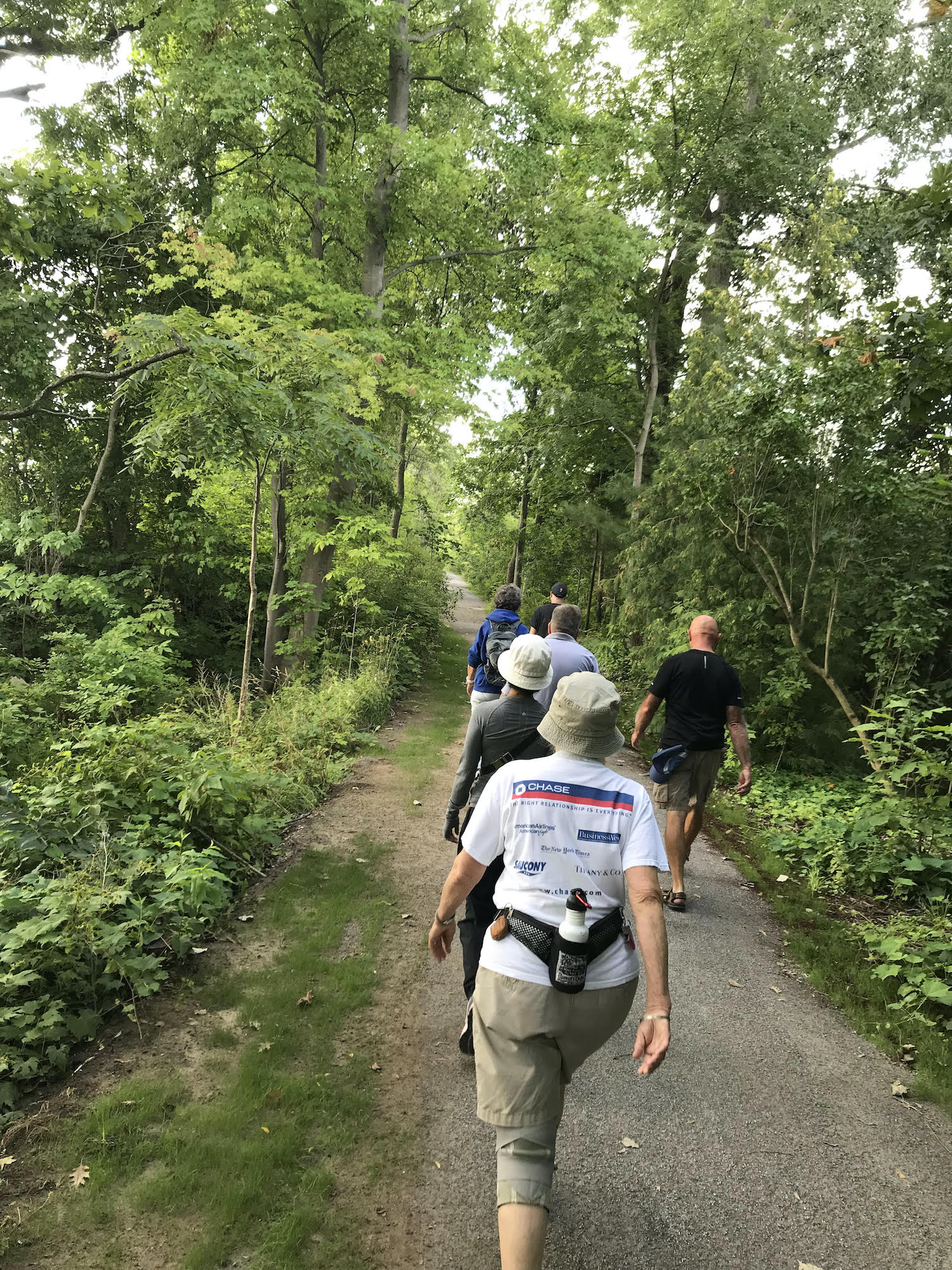
These weekly hikes will take various routes around beautiful Niagara-on-the-Lake. We may take in history or just enjoy the ambiance of the area. Urban hikes are mostly paved with some trail walking.
Plan to stay for conversation and a warm cup of coffee or tea at Sweets & Swirls, Community Centre, Niagara Stone Road, NOTL
CANCELLED - Fern hike
https://hikesstaging.brucetrail.org/event/fern-hike/Sorry, the registration cut-off time for this hike has been reached.Not a member? Click here to join today!Hosting Club: Sydenham
Category: Botany Hike
Location (Google Maps): Meet in the parking lot behind the Grey-Sauble Conservation Authority head office.
237897 Inglis Falls Road, Owen SoundHike Leader(s): Barbara Palmer Click here to contact Hike Leader(s)
Pace: Leisurely: 3 km/h or less
Terrain: Moderate: Some hills and/or poor footing, There might be muddy sections.
Distance: 5 kmDescription
The leader has had to cancel due to a foot injury. - 09September 9, 2023

TBTC Biennial1 Day End-to-End
https://hikesstaging.brucetrail.org/event/tbtc-biennial1-day-end-to-end/Sorry, the registration cut-off time for this hike has been reached.Not a member? Click here to join today!Hosting Club: Toronto
Category: Annual TBTC E2E
Location (Google Maps): Hilton Falls CA north to Cheltenham BadlandsHike Leader(s): Jacquie Van Dyke Click here to contact Hike Leader(s)
Pace: Brisk, Fast
Terrain: Variable
Distance: 50 kmDescription
Come test your grit on our 1 day E2E which will be held on Saturday Sept. 9, 2023. Cost for members is $40 which includes bus transportation from the meeting point to the hike starting point, online registrations fees, parking in Hilton Falls CA, water and snacks, and the official one day E2E badge. If any spots are still available on June 15 at 8:00 pm, registration will then open for non-members at a cost of $45. Details will be emailed to participants in early August. This long hike is not suitable for beginning hikers. Hikers are expected to maintain an average pace of 4km per hr. Hikers must reach each checkpoint by a prescribed time in order to continue and ensure everyone is off the trail before dark. You will hike on your own without a hike leader. Space is limited, hikes go rain or shine, and no dogs are permitted on this event. For questions, please contact Jacquie Van Dyke at vdyke0946@gmail.com Masks will be worn on the buses.
TBTC Annual 2 Day End-to-End
https://hikesstaging.brucetrail.org/event/tbtc-annual-2-day-end-to-end/Sorry, the registration cut-off time for this hike has been reached.Not a member? Click here to join today!This is a Multi-Day Hike
You are signing up for the following dates:
2023-09-09, 2023-09-10Hosting Club: Toronto
Category: Annual TBTC E2E
Location (Google Maps): LimehouseHike Leader(s): Jacquie Van Dyke Click here to contact Hike Leader(s)
Pace: Brisk
Terrain: Variable
Distance: Saturday’s hike is approximately 28km. Sunday’s hike is approximately 22km.Description
Plan to hike the Toronto section in late summer over two days.On Saturday, the bus will take participants to the north end of the Toronto section. Hikers will then hike south to Limehouse – a distance of approximately of 28kms.
On Sunday, the bus will take participants south to Campbellville Rd and Appleby Line where hikers will hike north to Limehouse – a distance of approximately 22kms.
There will be checkpoints along the way where light snacks and water will be available. Those who complete the distances on both days will be receive the special Club E2E badge.
Registration cost for members is $50. Refunds will not be issued. Attendance is limited to 92 (two buses). If any spots are still available at 8:00 pm on June 15, registration will also be opened for non-members at a cost of $60 each. The fee covers: bus transportation each morning from the hike end location to the hike start, a badge, parking permits, 1 or 2 checkpoints each day. Masks will be worn on the buses. You will hike on your own without a hike leader. Complete details will be provided in early August. For questions, contact Jacquie Van Dyke at vdyke0946@gmail.com

Blue Mountains End to End Part I of VI
https://hikesstaging.brucetrail.org/event/blue-mountains-end-to-end-part-i/Sorry, the registration cut-off time for this hike has been reached.Not a member? Click here to join today!Trip Information
Departure Time: 08:00
Return to City Time: 19:00
Departure Point: York Mills Bus PickupOptional Items
Hosting Club: Toronto
Category: Bus Hike
Location (Google Maps): Maps 24 and 23 of the Bruce Trail Reference and Guide. Km 67.3 to km 55.7Hike Leader(s): George Lennon and Michael Humpage Click here to contact Hike Leader(s)
Pace: Moderate
Terrain: Variable
Distance: 13.5kmDescription
Bus departs 10 York Mills Rd at 8:00 AM and Major Mackenzie Dr and HWY 400 Park and Ride at 8:20 AM. If you wish to be picked up at the Major Mackenzie Dr and HWY 400 Park and Ride, type ‘yes’ in the additional information field. Please arrive 15 minutes before departure. The bus waits for no one.We begin our hike at km 67.3 on the boundary between the Blue Mountains and Beaver Valley Sections. Our route south will take us from the Swiss Meadows subdivision. We will have spectacular views of Georgian Bay and Collingwood below us as we pass along and just below the brow of the Escarpment. The trail makes its way through the Blue Mountain and the Scenic Caves Ski Areas before descending to our final destination at km 55.7 just outside the Petun Conservation Area. We will have a chance to refresh ourselves in Collingwood before returning to Toronto.
Car Hike: Wilder Forest
https://hikesstaging.brucetrail.org/event/car-hike-wilder-forest/Sorry, the registration cut-off time for this hike has been reached.Not a member? Click here to join today!Hosting Club: Toronto
Category: Car Hike
Location (Google Maps): 2499 Brock Road, Uxbridge, ON there is a free parking when you enter the road off brock road beside Horse training facilityHike Leader(s): Mohammad Aghamiri & Amir Alemohammad Click here to contact Hike Leader(s)
Pace: Moderate
Terrain: Variable
Distance: 14-15KMDescription
We will explore Wilder forest and the beautiful scenry of Uxbridge forest.Niagara E2E #2: Woodend to DeCew Falls
https://hikesstaging.brucetrail.org/event/niagara-e2e-2-woodend-to-decew-falls/Sorry, the registration cut-off time for this hike has been reached.Not a member? Click here to join today!Hike open to BTC Members only.
Hosting Club: Dufferin Hi-Land
Category: General Hike
Location (Google Maps): Morningstar Mill parking lot off DeCew Road. 2714 DeCew Road, St. Catharines, L2R 6P7. Just to the east of km 34.2 BTC Map 3.Hike Leader(s): Stuart Law Click here to contact Hike Leader(s)
Pace: Medium
Terrain: Dependent on Conditions, Moderate, Slippery Sections Likely
Distance: 18.2 kmsDescription
Join us on this shuttle hike from Woodend to DeCew Falls taking in the main trail and the Morningstar Side Trail. Expect a lot of mud given the wet summer we have had. Please bring an extra set of footwear and a garbage bag for your shoes for the ride at the end of the hike. Please also bring 3L of water, a snack, a lunch, bug spray and sunscreen.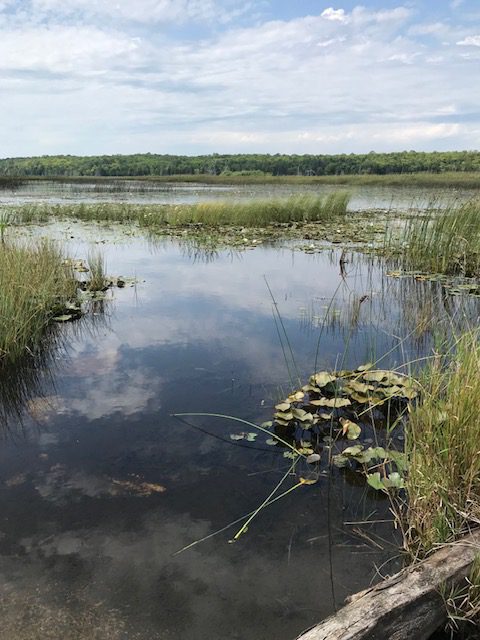
Hike and Sketch/Paint at Otter Lake - Fundraiser
https://hikesstaging.brucetrail.org/event/hike-and-sketch-paint-at-otter-lake-fundraiser/Sorry, the registration cut-off time for this hike has been reached.Not a member? Click here to join today!Hosting Club: Peninsula
Location (Google Maps): Otter Lake Side Trail (Bruce Trail Reference Guide – Map 39). Meet first at 388 Cape Chin Road North, Lion’s Head. This is the driveway to Maple Cross Nature Reserve. We will park a few vehicles in the driveway and carpool from this location to roadside parking at Otter Lake (about 1/4 mile away).
Hike Leader(s): Marg Glendon Click here to contact Hike Leader(s)
Pace: Leisurely
Terrain: Easy
Distance: ~1-3 kmDescription
Join well-known, local artists and PBTC members -Suzanne Dyke and Julie Heinrichs – for a plein air hike at Otter Lake Side Trail on Saturday, September 9th, 2023. Suzanne and Julie love the Bruce Trail and have kindly offered their time and support for this lovely experience, as a fundraiser for the Peninsula Bruce Trail Club.This peaceful location is ideal for a plein art visit. Walking will be on reasonably flat terrain on a short section of the Otter Lake Side Trail. The gentle wetland and meadow habitat attracts many species of wildflowers and birds, including the threatened Meadowlark and Bob-o-link.
Participants are asked to bring their own sketching or painting materials. A small cushion or a folding stool to sit on is required. No drawing or painting experience is required, just a willingness to put pencil/pen or brush to paper.
This is mostly non-instructional but if you wish, they will provide drawing starters and will support any and all drawing efforts. This event is designed to encourage the development of great observation skills and to enjoy time out in nature.
Bring water, snacks, lunch, sunscreen, insect repellent. Wear a hat, long pants. There are no facilities at this location. The nearest porta-pottie is located at the Borchardt Road parking lot (about a 10 minute drive from Otter Lake).
You won’t want to miss this exceptional opportunity to join Suzanne,Julie, and others who enjoy the plein art experience! Limited registration. Please register early to avoid disappointment. All proceeds will be donated to the Bruce Trail Conservancy (BTC) and used to support BTC work on the Saugeen (Bruce) Peninsula. No children or pets, please.
Learn about Suzanne and her artwork here: https://suzanne-dyke.wixsite.com/portfolio. Learn about Julie here: https://julieheinrichs.com/artist-bio/
Rain date is Sunday, September 10.
10:00 Harold Black Park
https://hikesstaging.brucetrail.org/event/1000-harold-black-park/Sorry, the registration cut-off time for this hike has been reached.Not a member? Click here to join today!Hosting Club: Niagara
Category: Hike
Location (Google Maps): Harold Black Park, FonthillHike Leader(s): Sylvia Wheeler Click here to contact Hike Leader(s)
Pace: Medium
Terrain: Easy
Distance: 8 kmDescription
10:00am Invasive Honeysuckle Removal - Work Party - 2023
https://hikesstaging.brucetrail.org/event/1000-invasive-honeysuckle-removal-work-party-2023/Sorry, the registration cut-off time for this hike has been reached.Not a member? Click here to join today!Hosting Club: Niagara
Location (Google Maps): Parking is available in the triangle at the intersection of Thirty Road & Ridge Road.
Hike Leader(s): Alicia Aitchison Click here to contact Hike Leader(s)
Pace: Leisurely
Distance: ~2km
Description
This event is to work on removing invasive honeysuckle from the BTC Thirty Mile Creek Nature Reserve off Thirty Road in Grimsby.We will meet for 10 am at the designated parking area at the intersection of Thirty Road & Ridge Road East and walk in together.
Invasive honeysuckle removal methods depend on size – small being pulled by hand and hung on tree branches by the roots to dry out, medium sized pulled through the use of extractigators (special shovel like tools that help pry out the small shrubs) & large having to be cut with chain saws. BTC Ecologists will join us as well as certified club chain sawyers. We hope to have many volunteers on site and we will tackle this area in one day/one work party per year.
Join us at ten am and stay as long as you can – it’s an easy walk out for those that just want to work for an hour or two. If you plan on staying longer pack a lunch & don’t forget lots of water, long pants, long sleeves, work gloves & sturdy footwear.Volunteers make a difference – come out and join us for a fun work day.
contact Alicia Aitchison – aliciaaitchison1@gmail.com with any questions.
Please register so we know how many people to expect & we can keep everybody informed if anything changes.
CANCELLED: Hockley Valley, Map 18
https://hikesstaging.brucetrail.org/event/car-hike-hockley-valley-map-18/Sorry, the registration cut-off time for this hike has been reached.Not a member? Click here to join today!Hosting Club: Toronto
Category: Cancelled
Location (Google Maps): Meet at the BTC parking lot 200 meters east of the Nature Reserve across the road from the Black Birch restaurant. Map 18.Hike Leader(s): Al Brown Click here to contact Hike Leader(s)
Pace: Moderate
Terrain: Challenging, Hilly
Distance: 14 kmDescription
We will complete a 14 km route through the Nature Reserve along the min and side trails. The is one of the hilliest sections of the Bruce Trail.After the hike I invite hikers to join me at the Hockley Valley Resort for refreshments.
To get to the meeting place drive north on Hwy 1o past Orangeville to Hockley Road. Turn right (east) and go about 5 km. The parking area is on your left.
Urban Walk: Theatre Hike, High Park to Village Playhouse
https://hikesstaging.brucetrail.org/event/urban-walk-theatre-hike-high-park-to-village-playhouse/Sorry, the registration cut-off time for this hike has been reached.Not a member? Click here to join today!Hosting Club: Toronto
Category: Urban Walk
Location (Google Maps): Depart at 3 PM from the meeting point at the west side Exit of High Park subway station (Quebec Avenue). Parking available close to the theatre behind 2190 Bloor street west (east of Runnymede Rd).Hike Leader(s): Miriam Stevens and Tom Swales Click here to contact Hike Leader(s)
Pace: Leisurely
Terrain: Flat, Variable
Distance: 7-9 kmDescription
Join us for a Level 1 Urban Walk at a leisurely-moderate pace of 3 km/hour to enjoy the High Park area with the options to join us for dinner and a play. We will walk into High Park and along Colborne Lodge street southbound towards the Grenadier Pond and around it towards Ellis street and up Ellis Park road to the Village Playhouse (2190 Bloor Street West) to see the Oscar Wilde play “The Importance of being Earnest”. Those who would like to walk a little further may join Tom for an extended route.duration 3 hours, pace 3 kms/hr.Terrain: mostly flat, 1 steep sidewalk, dropouts.Suitable for beginners and familiesCall the theatre directly 416 767 7702 to reserve your ticket($29.00 adults and seniors). Mention that you are with the Bruce Trail Conservancy, Toronto ClubDinner at Ali Baba 6 PM or a nearby Pub – your choice.You may choose to hike only, enjoy the theatre performance or to join us for all three: Hike, dinner and theatre. - 10September 10, 2023
Niagara E2E #3: DeCew Falls to Louth Conservation Area
https://hikesstaging.brucetrail.org/event/niagara-e2e-3-decew-falls-to-louth-conservation-area/Sorry, the registration cut-off time for this hike has been reached.Not a member? Click here to join today!Hike open to BTC Members only.
Hosting Club: Dufferin Hi-Land
Category: General Hike
Location (Google Maps): Louth Conservation Area parking lot. Enter from Staff Avenue, 500 m north of Pelham Road (Regional Road 69). Just south of km 52.2 BTC Map 3.Hike Leader(s): Stuart Law Click here to contact Hike Leader(s)
Pace: Medium
Terrain: Moderate, Slippery Sections Likely
Distance: 19 kmsDescription
Join us on this shuttle hike from DeCew Falls to Louth CA passing through Short Hills PP. We will take in Terrace Creek Falls, Swayze Falls and Rockway Falls. Mud is guaranteed so please bring a garbage bag and an extra pair of footwear for the ride back. Please also bring 3L of water, a snack, a lunch, bug spray and sunscreen.
Two-Eyed Seeing Enviro-Hike
https://hikesstaging.brucetrail.org/event/two-eyed-seeing-enviro-hike-3/Sorry, the registration cut-off time for this hike has been reached.Not a member? Click here to join today!Hosting Club: Peninsula
Location (Google Maps): McCurdy Parking Lot – 89 Moore St., Lion’s Head Ontario
Hike Leader(s): Caley Doran and Layna Lubmiiv Click here to contact Hike Leader(s)
Pace: Medium
Terrain: Moderate
Distance: ~7 KMDescription
Learn about using a two-eyed seeing approach to understanding and protecting nature, as you hike the Bruce Trail with Caley Doran, Indigenous Trail Guide and Layna Lubimiv, Chief Park Naturalist, MacGregor Point. During your hike, you will also participate in a community science project – picking up and sorting litter found along the trail and submitting litter data to the Bruce Trail Conservancy. Finish the hike by joining us for a group conversation about your experience and talk about what you have learned. This is a moderate hike covering rocky and rooty terrain with some short, steep climbs. Please bring water, light snacks, and lunch. Wear sturdy footwear, hat and sun protective clothing. Bring sunscreen, insect repellent and garden gloves.Parking Reservations are required for everyone. Parking fees apply to non-residents of Municipality of Northern Bruce Peninsula. Book early! 9:30-1:30 https://book.parkpassproject.com/book?inventoryGroup=1699994654&inventory=1592358846
Terra Cotta Loop
https://hikesstaging.brucetrail.org/event/terra-cotta-loop-7/Sorry, the registration cut-off time for this hike has been reached.Not a member? Click here to join today!Hosting Club: Iroquoia
Category: General Hike
Location (Google Maps): Roadside parking on Heritage RoadHike Leader(s): Pati Greenwood, Jeff Dowsett Click here to contact Hike Leader(s)
Pace: Medium – 3 to 4 km/hr
Terrain: Moderate – Some hills and/or some poor footing
Distance: 15 kDescription
Starting from the roadside parking, the hike will follow the main trail, the Terra Cotta Side Trail, and the Rockside Side Trail to form a loop. Regular breaks and a lunch stop will be included. Bring snacks, lunch and plenty of water. Please arrive at 9:15 am as we will depart promptly at 9:30 am.
Canada Goose/Limehouse Bruce Trail Hike
https://hikesstaging.brucetrail.org/event/canada-goose-limehouse-bruce-trail-hike/Sorry, the registration cut-off time for this hike has been reached.Not a member? Click here to join today!Hosting Club: Iroquoia
Category: General Hike
Location (Google Maps): Main Trail to Canada Goose Side Trail through to the Limehouse Conservation.Hike Leader(s): Anita Bergsma Click here to contact Hike Leader(s)
Pace: Medium – 3 to 4 km/hr
Terrain: Moderate – Some hills and/or some poor footing
Distance: 10.3Description
Join us for a beautiful hike of the Main Trail to the Canada goose Side Trail through to the Limehouse Conservation, looping back to the start point on September 10th, 2023. It will be a 10.3km at a medium pace with moderate terrain, paths and road.Meet at 9:45am Sharp to get ready and hike in at 10:00am.Duration: 2.5 hoursThere is plenty parking is on the shoulder of 4th Line . Please do not park in the garage parking lot.
The community of Limehouse was first settled in 1820. By the 1840’s limestone quarrying and “burning” of limestone in kilns to make lime, had begun. The Grand Trunk Railway built its line through Limehouse in 1856 which required 200 workers and their families to settle in the area. Discover the geological heart of the area known as the “Hole in the Wall” where a ladder leads to cracks in the escarpment rock. Experience the past as you walk by remnants of the lime industry. Stand before huge lime kilns and the old powder-house.
Also a great hike for those that would like to start hiking and looking for an introduction to hiking.Please wear hiking boots, bug spray, hat, backpack with water and snacks. Hiking poles are great for balance but optional. Wear long pants and long sleeve shirt as mosquitos and ticks have been bad.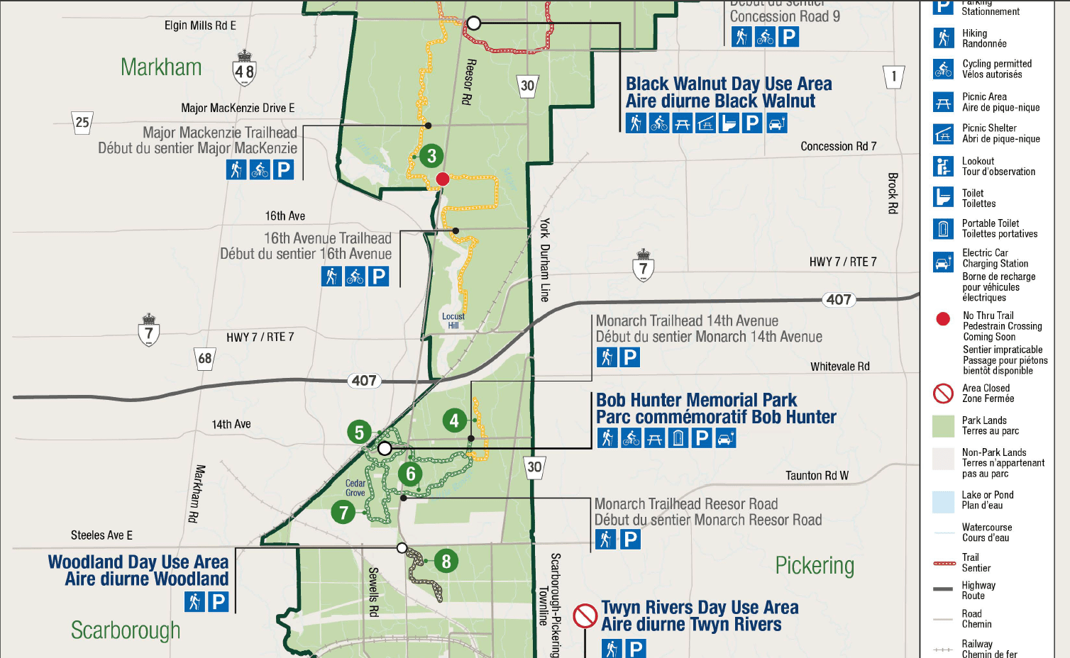
UPDATED: Urban Hike: Rouge National Urban Park 2 - Bob Hunter Memorial Park
https://hikesstaging.brucetrail.org/event/urban-hike-rouge-national-urban-park-2-bob-hunter-memorial-park/Sorry, the registration cut-off time for this hike has been reached.Not a member? Click here to join today!Hike open to BTC Members only.
Hosting Club: Toronto
Category: Urban Walk
Location (Google Maps): Rouge National Urban Park, Bob Hunter Memorial Park, 14th Avenue, Markham, ONHike Leader(s): Celia Ho, Tom Swales Click here to contact Hike Leader(s)
Pace: Moderate
Terrain: Flat, Variable
Distance: 14.1 kmDescription
***UPDATED INFORMATION***:The South Central Trail is closed for maintenance work. Therefore, that will trim off 4.2 km from the total distance making it approximately 14.1 km. Please see attached for the RNUP map. The map can also be accessed with this link: Brochures and publications – Rouge National Urban Park (canada.ca)
______________________________________________________________________________________________________________________________________________
On this hike we will continue to explore the Rouge National Urban Park, this time in the section of the park in Markham called Bob Hunter Memorial Park. The BHM Park consists of the South Central Trail, Tallgrass Trek, Monarch Trail, and Reesor Way/Tanglewood Trail.
The meeting point will be the parking lot at the Rouge National Urban Park, Bob Hunter Memorial Park, 14th Avenue, Markham, ON.
The meeting time is 10:00 AM.
There are many ways to reach the park depending on where you are coming from. You may choose to drive, bike, or take public transit. You may check Google Maps for the best routes for you. For those coming from Toronto, you may choose to meet one of the hike leaders at the Finch Go Bus Terminal at 8:25 AM to take the YRT #2 bus at 8:45 AM to get to the park by 10 AM. The bus ride is 60 minutes and there will be a 17 minutes (1.4 km) road walking to the park.
The terrain is relatively flat. The pace will be a moderate pace of 4 km/hr.
There will be drop-out points at 11.8 km and 15 km. The total distance covering all the trails will be 18.3 km.
For your reference, the Park Map for the Rouge is attached.
Hiking 101 - Fall Session, 3 hikes
https://hikesstaging.brucetrail.org/event/hiking-101-fall-session-3-hikes/Sorry, the registration cut-off time for this hike has been reached.Not a member? Click here to join today!Hosting Club: Niagara
Category: Register
Location (Google Maps): Various locations. First location is Queenston Heights Park, near the Bruce Trail cairn.Hike Leader(s): Margaret Northfield Click here to contact Hike Leader(s)
Pace: Medium
Terrain: Easy
Distance: 5-6kmDescription
In this “Introduction to Hiking” series of workshops we will share the many joys of hiking. You will learn how to prepare for a hike; safety issues that might be involved, what to bring on the trail, reading the blazes and maps; and the different types of hikes offered by Niagara Bruce Trail Club. Each workshop will include a 20-minute presentation and question-and-answer period, followed by a 1.5hr hike. Wear sturdy walking shoes (if you have them) and clothing appropriate for the weather. Bring water.
Location of workshops:
Sep 10 – Queenston Heights Park, Niagara Parkway. Enter the park at the roundabout, make first left and an immediate left to see the cairn. Park next to the Bruce Trail Cairn. Paid parking.
Sep 17 – Woodend Conservation Area, Taylor Rd, Niagara-on-the-Lake. Park at the entrance to the park, near Taylor Rd.
Sep 24 – Kinsmen Park, 3820 Frost Rd, Beamsville.
We recommend participation in all three workshops but all/any are optional.
This course is open to members and non-members. Cost is $30 for members, $40 for non-members. Upon completion of ALL three workshops participants will receive an NBTC neck scarf free ($15 value). No refunds.
Sessions are conducted rain or shine.
Sunday Social Hike - Frank Holley loop
https://hikesstaging.brucetrail.org/event/hike-the-frank-holley-loop/Sorry, the registration cut-off time for this hike has been reached.Not a member? Click here to join today!Hosting Club: Sydenham
Category: General Hike
Location (Google Maps): The Owen Sound Galaxy Theatre parking lot. Meet at the tall “Galaxy Centre” sign next to the traffic lights.Hike Leader(s): Bill Snel Click here to contact Hike Leader(s)
Pace: Leisurely: 3 km/h or less
Terrain: Moderate: Some hills and/or poor footing
Distance: 2 kmDescription
We will carpool to East Linton Sideroad W. and then hike the Frank Holley loop. This takes us through some lovely rock formations. Map 33. For more information w.snel2@gmail.com or landline (519) 470-0584. If unable to register phone the hike leader. - 11September 11, 2023
9:30 Queenston Heights
https://hikesstaging.brucetrail.org/event/930-queenston-heights/Sorry, the registration cut-off time for this hike has been reached.Not a member? Click here to join today!Hosting Club: Niagara
Category: In and Out
Location (Google Maps): locust grove parkingHike Leader(s): Heather Howkins Click here to contact Hike Leader(s)
Pace: Medium
Terrain: Moderate
Distance: 9kDescription
We will meet in the locust grove parking lot and hike the Main Bruce Trail towards St. Pauls Street and back.Please bring water and a snack and be prepared for the weather.
Poles and bug spray suggested.