
Hike Schedule
Join us for a hike! Registration required:
All hikes available to BTC members. Some hikes are open to non-members.
TIP: The calendar view displays up to 7 hikes on a day, but often there are more. Click “More events” to see them all.
Categories
- 20September 20, 2023
Beaver Valley - Falling Water #1 of 2 hikes
https://hikesstaging.brucetrail.org/event/beaver-valley-falling-waters-1-of-3-hikes/Sorry, the registration cut-off time for this hike has been reached.Not a member? Click here to join today!Hosting Club: Blue Mountains
Category: Register on-line or sign-in morning of hike
Location (Google Maps): Hike meets in the parking lot behind Tim Hortons on First St. in Collingwood.Hike Leader(s): Hart Fischer Click here to contact Hike Leader(s)
Pace: Brisk – 4 to 5 km/hr, Medium – 3 to 4 km/hr
Terrain: Moderate – Some hills and/or some poor footing, Strenuous – Hilly with steep climbs and some poor footing
Distance: 14kmDescription
Log both hikes to earn the Falling Water badge from BVBTC.
We will drive our cars and park at km 67.5 at Hoggs Falls on the Lower Valley Road in the Beaver Valley section. We will then shuttle to Beaver Valley Ski Club lower parking lot off Grey Road 30 to begin the hike. Following the Valley Crossover Side Trail west to the white blazed trail at km 79.5, we continue south down the west side of the valley to Hoggs Falls. At km 73.6 we will have the opportunity to take the Stew Hilts Side Trail and view a lovely waterfall from the base. Bring a lunch and water.Car Hike: Sydenham End to End 4 of 8
https://hikesstaging.brucetrail.org/event/car-hike-sydenham-end-to-end-4-of-8/Sorry, the registration cut-off time for this hike has been reached.Not a member? Click here to join today!Hike open to BTC Members only.
Hosting Club: Toronto
Category: Car Hike
Location (Google Maps): We will meet at km 89.2 on the west side of Hwy 6 & 10 at the top of the hill above Owen Sound (GPS N44.558005, W80.925858)Hike Leader(s): Jacqueline Van Dyke Click here to contact Hike Leader(s)
Pace: Brisk
Terrain: Hilly, Variable
Distance: 25kmDescription
This hike is number 4 of 8, of a Sydenham End to End series. We’ll hike through the Sydenham Forest East, past the Polish Tree, through the KOA, and Boyd’s Crevices, along country roads and a bit of Hwy 26.Please ensure you arrive prior to 8:15 to be ready for an 8:30 departure. This is a car shuttle hike so please be prepared to take a turn driving hikers to our starting point. All Covid protocols will be followed.
Please check the weather the night before or, the morning of the hike and dress accordingly. Bring enough water, snacks, and lunch to last the entire day.
WEDNESDAY WALKERS - Around Eugenia
https://hikesstaging.brucetrail.org/event/wednesday-walkers-around-eugenia/Sorry, the registration cut-off time for this hike has been reached.Not a member? Click here to join today!Hosting Club: Beaver Valley
Location (Google Maps): Meet at the end of North Street in Eugenia. Km 58.3, map 26, Edition 31. Park on the south side of the street facing east.
Hike Leader(s): Glenda Collings Click here to contact the hike leader.
Pace: Medium
Terrain: Moderate, Some steep sections
Length of Hike: 5.8 kmDescription
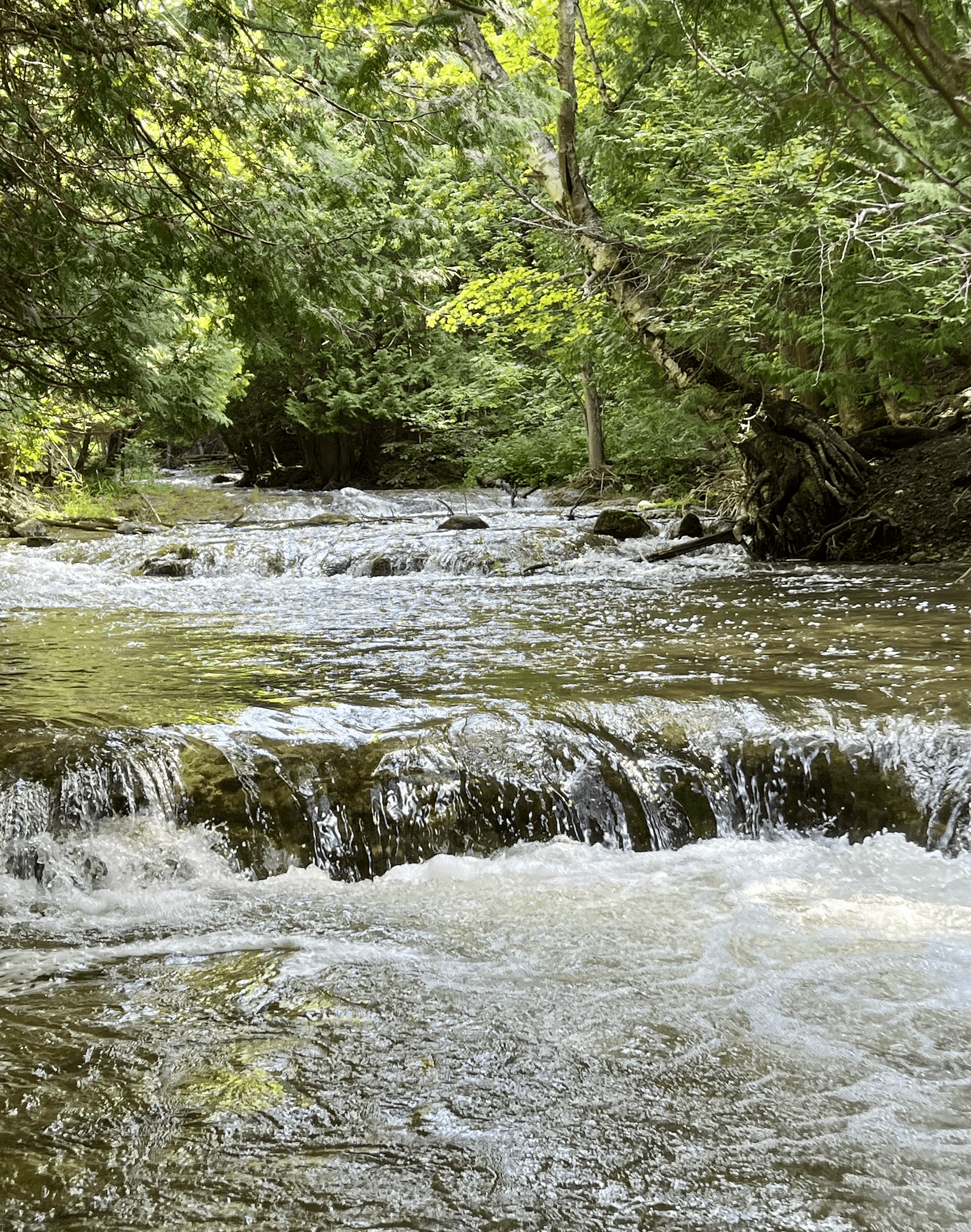
This hike route quickly enters a wooded area on Valley slope. There will be plenty of up-and-down walking until we reach Eugenia Falls Conservation Area. This is a scenic section of Trail, walking along the side of the Beaver River, crossing the river and walking along more riverside. There are old structures still in place that show some of the early history of development in the area. Hikers will see a good view of the high Eugenia Falls. This hike is a there-and-back route.Niagara Glen Short and Sassy
https://hikesstaging.brucetrail.org/event/niagara-glen-short-and-sassy/Sorry, the registration cut-off time for this hike has been reached.Not a member? Click here to join today!Hosting Club: Iroquoia
Category: Good Companions
Location (Google Maps): Niagara Glen, 3050 Niagara Parkway, Niagara-on-the-Lake, ONHike Leader(s): Craig Sim Click here to contact Hike Leader(s)
Pace: Leisurely – 3km/hr or less
Terrain: Moderate – Some hills and/or some poor footing
Distance: 4-5k (approximate)Description
Loop hike in beautiful Niagara Glen, NOT using Whirlpool Trail. We meet in between Niagara Glen parking lot and building near lot. Pay parking or Niagara parks pass. Trail ranges from moderate to quite rocky, has hills and stairs. Watch footing. Lots of boulders and great views close to Niagara River. We descend steel stairs before and after hike. Wear hiking boots or shoes. Bring water, snack, appropriate layered clothing for the weather and rain gear. Keep in mind that if you find 4-5k a short hike, you can stroll along paths immediately adjacent up top after, or drive to Niagara Falls and stroll more there. Niagara Glen is close to both Butterfly Conservatory and Floral Clock. To cancel on day of hike text cell #289-659-0007 day of hike only. - 21September 21, 2023
8:00 am Long Hike Jordan to Moyer / Louth
https://hikesstaging.brucetrail.org/event/800-am-long-hike-jordan-to-moyer-louth-59/Sorry, the registration cut-off time for this hike has been reached.Not a member? Click here to join today!Hosting Club: Niagara
Location (Google Maps):
Jordan Hollow Park 3039 King St Jordan
Pace: Medium
Terrain: Moderate
: 10kDescription
From Jordan Hollow Hike the main trail to Upper and Lower Balls Falls, Moyer Road or Louth and Return. You must register for each hike. Bring Poles, sunscreen, bug spray , snack and a drink and dress for the weather
Car Hike: Sydenham End to End 5 of 8
https://hikesstaging.brucetrail.org/event/car-hike-sydenham-end-to-end-5-of-8/Sorry, the registration cut-off time for this hike has been reached.Not a member? Click here to join today!Hike open to BTC Members only.
Hosting Club: Toronto
Category: Car Hike
Location (Google Maps): We’ll meet at km 115.5 (GPS N44.630708, W80.971398), near the intersection of Indian Acres Rd and Gordon Sutherland Parkway.Hike Leader(s): Jacqueline Van Dyke Click here to contact Hike Leader(s)
Pace: Brisk
Terrain: Hilly, Variable
Distance: 24kmDescription
On this hike (number 5 of 8 in a Sydenham End to End series), we’ll hike through the Palisades, the Inglis Falls and Pottawami Conservation Areas. Hopefully there will be water flowing from the falls!Please arrive prior to 8:15 to be ready for an 8:30 departure. This, like the others in this series, is a car shuttle hike, so be prepared to share fairly in the shuttling. All Covid-19 protocols will be followed.
Please check the weather the night before/morning of, the hike and dress accordingly. Bring enough water, snacks, and lunch to last the entire hike.
9:15 Short Hike, Jordan Hollow
https://hikesstaging.brucetrail.org/event/915-short-hike-jordan-hollow-75/Sorry, the registration cut-off time for this hike has been reached.Not a member? Click here to join today!Hosting Club: Niagara
Category: Loop
Location (Google Maps): Jordan Hollow Park, Jordan StationHike Leader(s): Bill Russell Click here to contact Hike Leader(s)
Pace: Medium
Terrain: Strenuous
Distance: ~ 6 kmsDescription
Hike the main and side trails around Jordan and Balls Falls. Bring hiking boots, water, sunscreen and bug spray.Iroquoia End-to-End Hike 3 of 10
https://hikesstaging.brucetrail.org/event/iroquoia-end-to-end-hike-3-of-10/Sorry, the registration cut-off time for this hike has been reached.Not a member? Click here to join today!Hosting Club: Caledon Hills
Category: End-to-End
Location (Google Maps): Meet at km 87.3 on the west side of Walkers Line, across from the cemetery. Shuttle to start at Kilbride School. *** This meeting area may change. An email will be sent out with paid parking arrangements prior to hike.Hike Leader(s): Nancy Mooney Click here to contact Hike Leader(s)
Pace: Medium – 3 to 4 km/hour
Terrain: Moderate – some hills and/or some poor footing, Strenuous – hilly with steep climbs and some poor footing
Distance: From 98.8 to 87.3 plus walk from parking, 11.5 km. Map 10Description
This is the third hike of ten and takes us along Twiss Rd. over Bronte Creek, more road walking to Mt. Nemo with great views and a tricky climb down to vehicles.
Twiss Rd to Crawford Lake
https://hikesstaging.brucetrail.org/event/twiss-rd-to-crawford-lake-2/Sorry, the registration cut-off time for this hike has been reached.Not a member? Click here to join today!Hosting Club: Iroquoia
Category: General Hike
Location (Google Maps):We will meet at roadside parking on Twiss Rd at the Calcium Pitts – Map 11- 102.6
Hike Leader(s): Cathie Green Click here to contact Hike Leader(s)
Pace: Medium – 3 to 4 km/hr
Terrain: Moderate – Some hills and/or some poor footing
Distance: Approximately 12 kmsDescription
We will meet at Twiss Road roadside parking -see Map 11, 102.6 and hike the White Blazes, main trail north towards Crawford Lake Conservation Area – we will hike the Conservation’s Hide and Seek trail and tour the Species at Risk wooden carvings. There may be washrooms open at the Visitor Centre- stopping for lunch/snack at picnic table at the Iroquoian Village-We will take the boardwalk around the meromictic lake on return trip and then back onto the Bruce Trail – approximately 12 kms there and back.—NOTE—The beginning of this hike can be strenuous as it involves scrambling up some rocks and for the first few kilometers the trail could be rocky footing — Wear good hiking boots/poles-Dress weather appropriate and bring water and snack/lunch -Any questions or concerns, please contact me via email or text at 416-931-2095 cathiekygreen@gmail.com
Hike participants is limited as parking is limited
I would invite anyone to consider taking out a membership with Halton Conservation(although not required for hike) – they give you a discount as a BTC member
- 22September 22, 2023

Coach Trip: Saugeen Peninsula Sept 22 to 24
https://hikesstaging.brucetrail.org/event/coach-trip-saugeen-peninsula-sept-22-to-24/Sorry, the registration cut-off time for this hike has been reached.Not a member? Click here to join today!Trip Information
Departure Time: 07:00
Return to City Time: 20:00
Departure Point: York Mills Bus PickupTrip Activities
Pick up at 10 York Mills Rd ($0.01)
Pick up at 400 & Major Mac ($0.01)
Optional ItemsHosting Club: Toronto
Category: Coach Trips
Location (Google Maps): Evergreen Resort, Red BayHike Leader(s): Martina Furrer, Brenda Dalglish, Nijole Mockevicius, Kadhim Taki Click here to contact Hike Leader(s)
Pace: Moderate
Terrain: Challenging, Hilly, Rocky
Distance: Moderate group: around 12 km, faster group: around 15 kmDescription
Join us for three days of guided hiking on the beautiful Saugeen Peninsula. Spend your days on the Bruce Trail and your evenings at Evergreen Resort overlooking Lake Huron.We will explore the Skinner’s Bluff, Cape Crocker, Hope Bay, Lion’s Head, and/or Cape Chin areas. Hikes will be up to 15 km (dropouts will not be possible) with lots of awesome views. Expect some strenuous climbs, some challenging footing over boulders and crevasses, and some exposed sections. These hikes are not suitable for people who are afraid of heights. All fit, experienced hikers comfortable walking on this type or terrain are welcome. There will be a moderate group and a slightly faster group; both will do full day hikes with no dropouts. Please note: there will not be a sight seeing group or other activities for non-hikers.
Accommodation is in one-, two-, and three-bedroom cottages (linens, bedding, and towels provided). Each cottage has a full bathroom, fridge, and heater. The resort has a hot tub and a private beach perfect for viewing sunsets. Cost is $352.04 per person (including all taxes, gratuity extra). This includes two nights’ accommodation, two dinners, two breakfasts, and two boxed lunches.
Coach fare is $140 for members, $150 for non-members, and $80 for children.
Registration instructions:
Please reserve your cottage and your seat on the coach at the same time.
Call Evergreen Resort at 519-534-1868 to book your cottage. You will need to find roommates/cottagemates. There are no single hotel rooms.
- To reserve your seat on the bus, register here starting on Saturday June 10 at 8 PM.
Cancellation policy: While we are hoping for sunshine, the trip cannot be cancelled due to weather. Coach fare is nonrefundable after July 28, 2023. If you cancel before this date you will be charged a $25 service fee.
Our coach will depart at 7 AM on Friday September 22. We plan to be back in Toronto between 7 and 8 PM on Sunday September 24. Departure locations: 10 York Mills Rd and the HWY 400 and Major Mackenzie Park and Ride.

9:00 Niagara-on-the-Lake Tour
https://hikesstaging.brucetrail.org/event/900-niagara-on-the-lake-tour-12/Sorry, the registration cut-off time for this hike has been reached.Not a member? Click here to join today!Hosting Club: Niagara
Category: Urban
Location (Google Maps): Park on King St just outside of Veteran’s Memorial ParkHike Leader(s): Margaret Northfield Click here to contact Hike Leader(s)
Pace: Medium
Terrain: Easy
Distance: 6-7kmDescription
These weekly hikes will take various routes around beautiful Niagara-on-the-Lake. We may take in history or just enjoy the ambiance of the area. Urban hikes are mostly paved with some trail walking
Plan to stay for conversation and a warm cup of coffee or tea at Sweets & Swirls, Community Centre, Niagara Stone Road, NOTL
Scotsdale Farm
https://hikesstaging.brucetrail.org/event/scotsdale-farm-15/Sorry, the registration cut-off time for this hike has been reached.Not a member? Click here to join today!Hosting Club: Iroquoia
Category: General Hike
Location (Google Maps): Scotsdale Farm Parking LotHike Leader(s): Pati Greenwood, Jeff Dowsett Click here to contact Hike Leader(s)
Pace: Medium – 3 to 4 km/hr
Terrain: Moderate – Some hills and/or some poor footing
Distance: 13kDescription
We will hike the main trail, the Bennett Side trail and the Great Esker Side Trail for a 13k loop. Bring a snack and plenty of water. Wear sturdy footwear and clothing appropriate to conditions.
- 23September 23, 2023
Car Hike: Hike of 2 lakes King city
https://hikesstaging.brucetrail.org/event/car-hike-hike-of-2-lakes-king-city-8/Sorry, the registration cut-off time for this hike has been reached.Not a member? Click here to join today!Hosting Club: Toronto
Location (Google Maps): Park along Fairfield Dr. or Dufferin Street, Gathering at trail head in Dufferin Street.
Hike Leader(s): Mohammad Aghamiri, Amir Alemohammad Click here to contact Hike Leader(s)
Pace: Moderate
Terrain: Other (Refer to Description), Variable
Distance: 14-15 KMDescription
We will hike in trails around Seneca lake and Mary Lake,pass by Eaton and visit Pine farm where you can enjoy coffee,tea,apple pie during our snack time.Some safety procedures during the hike:
1-Hikers must stay between the leader and the sweep.
2-Hikers must advise the leader or the sweep if they wish to leave the group.
3- Hikers must follow the whistle instructions: 1 blast- stay where you are; 2 blasts come to the leader; 3 blasts – come to the leader quickly.
4-Hike leader may request volunteers to stop at trail intersections, they need to help hikers to the direction the group walk and wait till they see the sweep .
5-Hikers have to make sure they can see the persons behind and in front of them.
8:30 Welland Canals Hikes #2 and #3 Woodend and Sobey's Parking lot
https://hikesstaging.brucetrail.org/event/830-welland-canals-hikes-2-and-3-woodend-and-sobeys-parking-lot/Sorry, the registration cut-off time for this hike has been reached.Not a member? Click here to join today!Hosting Club: Niagara
Category: In and Out
Location (Google Maps): 1. Sobey’s Parking lot, Glendale Ave, St. Catharines N43.136490 W79.216689
2. Woodend Conservation Area, Taylor Rd , NOTL N43.143377 W79.167212Hike Leader(s): Lauren Doig Click here to contact Hike Leader(s)
Pace: Medium
Terrain: Easy
Distance: First hike: 8.5 km Second Hike: 9 kmDescription
We will complete Hikes #2 and #3 of the new Welland Canals Badge series . We will meet at Sobey’s Parking lot at 8:30 and complete the loopish hike. We will then move our vehicles to the start point for the next hike, which is Woodend parking lot on Taylor RdSobey’s Hike: 9 km
Woodend hike 8.5 km
Please refer to the Badge section of the NBTC website for information about all 4 hikes and the required pictures.
Looping through Sydemham #6 of. 9
https://hikesstaging.brucetrail.org/event/looping-through-sydemham-6-of-9/Sorry, the registration cut-off time for this hike has been reached.Not a member? Click here to join today!Hosting Club: Blue Mountains
Category: Organized Hike
Location (Google Maps):Hike Leader(s): AnHong MacNeil Click here to contact Hike Leader(s)
Pace: Medium – 3 to 4 km/hr
Terrain: Moderate – Some hills and/or some poor footing
Distance: 13kmDescription
Derby Forest Trails 6 of 9 hikes Start time: 8:30AM Hikers meet at trailhead at 8:30AM, arrange your own carpooling. Contact leader for details of meet up.
9:00 Twelve Mile Creek Loop
https://hikesstaging.brucetrail.org/event/900-twelve-mile-creek-loop-2/Sorry, the registration cut-off time for this hike has been reached.Not a member? Click here to join today!Hosting Club: Niagara
Category: Loop
Location (Google Maps):Welland Vale Rd. (Pump Station) & Sawmill Rd., St. Catharines
Hike Leader(s): Karen Couch Click here to contact Hike Leader(s)
Pace: Medium
Terrain: Easy
Distance: 15 kmsDescription
Hike along both sides of 12 Mile Creek through St. Catharines.
Urban Walk: 16 Mile Creek, Oakville
https://hikesstaging.brucetrail.org/event/urban-walk-16-mile-creek-oakville-2/Sorry, the registration cut-off time for this hike has been reached.Not a member? Click here to join today!Hosting Club: Toronto
Category: Urban Walk
Location (Google Maps):Starts and ends at Oakville GO Station
Hike Leader(s): Ginny Giraudi Click here to contact Hike Leader(s)
Pace: Moderate
Terrain: Other (Refer to Description)
Distance: 15 kmDescription
If you are planning to travel by GO train to Oakville from Union Station, you can meet apprentice hike leader Tim Wainwright at 8:30 am by the information desk with the clock over it in Union Station in the Great Hall (off Front Street.) Tim will be wearing the blue Bruce Trail shirt. From Union you will be taking the 8:44 am westbound train. Please use the bathroom while on the GO train as there is little time for it at the Oakville GO station. You can also drive to the Oakville Station and meet us there. Parking is free on the weekends.We will all meet at 9:25 am at the Oakville Transit Bus Platform 27 at the Oakville GO Station (click here for station diagram.) From here we will board Bus 13 at 9:40 am and take a short bus ride to the start point of our hike. Oakville Transit buses accept Presto, and if you have paid for the GO train, the fare for the Oakville bus will register as zero. We will walk a 15 km looping trail through the 16-Mile Creek ravine (click here for route map), stopping at the halfway point for lunch (port-a-potties only; bring hand sanitizer and tp) and return to the Oakville GO Station. The trail is stone dust gravel or asphalt and mostly flat except for two steep declines and two long climbs. There is one long set of stairs to descend. The after-hike pub stop is at the Beertown Public House (click here for menu) near the Oakville GO Station.
New Badge! Beaver Valley Geology Hike #1
https://hikesstaging.brucetrail.org/event/new-badge-beaver-valley-geology-hike-1/Sorry, the registration cut-off time for this hike has been reached.Not a member? Click here to join today!Hosting Club: Beaver Valley
Location (Google Maps): Meet on the shoulder of 21st Sideroad, near the road allowance leading to the trail, TBM parking area, Map 24. This is paid parking and we will shuttle as many cars as possible to the corner of 21st Sideroad & 4th Line to walk to the start of the hike.
Hike Leader(s): Glenda Collings Click here to contact the hike leader.
Pace: Medium
Terrain: Moderate, Some rocky footing, Some steep sections, Strenuous
Length of Hike: 7.1 kmDescription
This is a series of 7 hikes to earn the Beaver Valley Geology badge. We will use the criteria listed in Beth Gilhespy’s book, Walking Through Time, Exploring Niagara Escarpment Geology in the Beaver Valley Bruce Trail Section. We’ll boost our knowledge of the local geology along the way as we take the required photos. Hikers are welcome to join any or all of the hikes, however, they must complete all 7 hikes to earn the badge. Bring sufficient water and snacks.Hike One: Loree Forest and the Loree Forest Side Trail
COVID-19 Precautions Before, During and After your Hike
- Each hiker joining a Bruce Trail Club organized hike must perform a self-screening check before hiking.
Find Ontario’s self-assessment tool here: https://covid-19.ontario.ca/self-assessment/ - If you are experiencing COVID-19 symptoms, stay home.
- Personal Protective Equipment:
- Hikers may choose to wear masks
Transportation
It is the Bruce Trail Conservancy’s current policy that car shuttles are allowed. It is at the discrepancy of individual hike leaders to make that decision.
Other Guidelines
- Arrive 15 minutes before the start of the hike.
- Wear sturdy footwear and appropriate attire for the weather and the terrain.
Hiking poles are a good idea in any season, especially if the terrain is rocky or slippery. In winter, snowshoes or icers/crampons are needed when conditions dictate.
Wearing appropriate clothing and footwear prevents injuries and shows consideration for a safe and positive group hiking experience. - Always carry I.D. and your health card.
- Bring sufficient water and snacks (or lunch if indicated). A minimum of 1L of water is recommended on all hikes, and 3L is recommended for long, challenging hikes in the heat of the summer.
- Bring sunscreen and insect repellent (for spring and summer hikes).
- Bring your own first aid kit.
- Please leave dogs at home.
Rock Hill/Oliver Creek Loops
https://hikesstaging.brucetrail.org/event/rock-hill-oliver-creek-loops/Sorry, the registration cut-off time for this hike has been reached.Not a member? Click here to join today!Hosting Club: Dufferin Hi-Land
Category: General Hike
Location (Google Maps):Dufferin Hi-Land, Map 20. Meet at Rock Hill parking lot on 1st Line Mulmur, just south of 10 Sideroad (Km 29.4).
Hike Leader(s): Les Babbage Click here to contact Hike Leader(s)
Pace: Medium
Terrain: Moderate, Slippery and Steep Sections
Distance: 8.4 kmDescription
Come check out the early fall colours in Walker’s Woods, one of the Bruce Trail’s finest mature forests, then visit the many crevices of Rock Hill Park. We will hike loops including Main Trail, Oliver Creek and Moss Haven Side Trails, then a loop consisting of Main Trail and Rock Hill Park Side Trail. Option to drop out after 6.8 km. Bring water, snacks.Duncan Escarpment Caves
https://hikesstaging.brucetrail.org/event/duncan-escarpment-caves/Sorry, the registration cut-off time for this hike has been reached.Not a member? Click here to join today!Hosting Club: Sydenham
Category: General Hike
Location (Google Maps): Meet in the north-east corner of the parking lot at Home Depot on Highway 26 on the east side of Owen Sound.Hike Leader(s): Ian Mills Click here to contact Hike Leader(s)
Pace: Medium: 3 to 4 km/h
Terrain: Strenuous: Hilly with steep climbs and some poor footing., There might be muddy sections., There might be sections with water on the trail.
Distance: 10 kmDescription
We will, be doing a loop at Duncan Crevice Caves Provincial Park via the Main Trail and Chuck Grant Side Trail. Wonderful elevations and scenery including Metcalfe Rock via the Metcalfe Crevice Side Trail. Closer to the hike date we can investigate if folks are interested in having lunch at (Heart’s Tavern) Kimberley. In the event you are unable to register for this hike please text or call the hike leader @ 416-848-8818.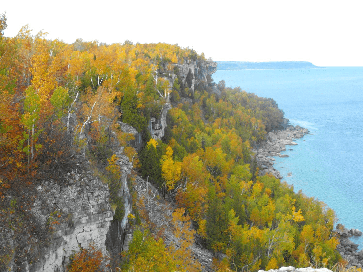
Dyer's Bay Cliffs - A Geology Hike with Beth Gilhespy
https://hikesstaging.brucetrail.org/event/dyers-bay-cliffs-a-geology-hike-with-beth-gilhespy/Sorry, the registration cut-off time for this hike has been reached.Not a member? Click here to join today!Hosting Club: Peninsula
Location (Google Maps): Meet up at the Borchardt Road Parking Lot (Bruce Trail Reference Guide Edition 30 – Map 40 ). Parking fees apply to non-residents of Municipality of Northern Bruce Peninsula.
Hike Leader(s): Marg Glendon Click here to contact Hike Leader(s)
Pace: Leisurely, Medium
Terrain: Difficult, Moderate
Distance: ~8 KMDescription
Join Beth Gilhespy on this hike to explore the clifftop shoreline of Dyer’s Bay to see the Devil’s Monument flowerpot, potholes, alvars, caves, natural arches and stunning views! Sturdy footwear is a must on this spectacular but rugged hike. The pace will be slow but steady and exploratory, as participants will be helping scout a route that will be included in Beth’s Saugeen Peninsula Geology Hike book, due to be completed in 2024. While about 8 km, hikers can expect to be out for 5 or 6 hours. Bring lunch, snacks, water and your curiosity!Autumn Forest Bathing Hike - Nottawasaga Bluffs Loop
https://hikesstaging.brucetrail.org/event/autumn-forest-bathing-hike-nottawasaga-bluffs-loop/Sorry, the registration cut-off time for this hike has been reached.Not a member? Click here to join today!Hosting Club: Caledon Hills
Category: Nature Walks
Location (Google Maps): The walk departs from Nottawasaga Valley Conservation Authority parking lot at km 21.9 – BTC Ref Guide, Map 22, in the Blue Mountains section. Driving directions: If proceeding north from Primrose, go west on Highway 10 & 89 (combined) to Highway 124, then north (right) on Highway 124 to Singhampton. At Singhampton, turn right following Highway 124 east and in .75 km turn right on Mill Town Rd. and an immediate left on Ewing Rd., turn left on 17/18 Side Road, right on Concession 10 South, left on 15/16 Side Road, parking lot is on your right. (Roads are clearly shown on Map 22.) $10 + HST parking fee – easy to pay ahead – go to Nottawasaga Valley Conservation Authority, click on Recreation, then parking fees, select on-line parking option and click on hotspot website.Hike Leader(s): Janice McClelland Click here to contact Hike Leader(s)
Pace: Medium – 3 to 4 km/hour
Terrain: Moderate – some hills and/or some poor footing
Distance: 8.2 kmDescription
A quiet hike along the Bruce Trail through forest and under the eye of interesting Escarpment cliffs, peacefully crossing streams and then following the Nottawasaga Bluffs Lookout Trail, on and through the magical Keyhole Side Trail to rejoin the Main Trail. Lunch break at a lookout point. After lunch we quietly continue through forest on the Main Trail to the Hamilton Brothers Side Trail and return to our start point. Hiking boots necessary for short, steep sections on and around the Keyhole Side Trail. Please bring lunch and water. A fine way to appreciate the first day of Autumn! - Each hiker joining a Bruce Trail Club organized hike must perform a self-screening check before hiking.