
Hike Schedule
Join us for a hike! Registration required.
All hikes available to BTC members. Some hikes are open to non-members.
See Refund Policy for Paid Hikes >
TIP: The calendar view displays up to 7 hikes on a day, but often there are more. Click “View more events” to see them all.
Categories
- 08July 8, 2023
Rim 2 Rim #1: Pretty River Rim - 1st in a series of 3 for the R2R badge
https://hikesstaging.brucetrail.org/event/rim-2-rim-1-pretty-river-rim-1st-in-a-series-of-3-for-the-r2r-badge/Sorry, the registration cut-off time for this hike has been reached.Not a member? Click here to join today!Hosting Club: Blue Mountains
Category: Organized Hike
Location (Google Maps): Bruce Trail parking lot on Pretty River RoadHike Leader(s): Hart Fischer Click here to contact Hike Leader(s)
Pace: Brisk – 4 to 5 km/hr, Medium – 3 to 4 km/hr
Terrain: Moderate – Some hills and/or some poor footing, Strenuous – Hilly with steep climbs and some poor footing
Distance: 18.5kmDescription
HIKERS MUST REGISTER ON-LINE FOR THIS HIKE, NO morning sign-ins on this series as hikers will meet at trailhead.
About 18.5 km with almost 810 m elevation gain. Park your car in the small Bruce Trail Parking Lot [BTPL] on the Pretty River Road [44.428118, -80.276849]. If this small BTPL is filled, use the large Ontario Parks Lower Pretty River lot [44.430983, -80.275474]. Do not park along Pretty River Road as it is a strictly enforced no parking zone by the Town of Blue Mtns. The hike starts in the small BTPL. We will proceed north on the white blazed trail until we come to John Haigh Side Trail. Proceeding west past the highest point on the Bruce Trail, we will continue until we reach the intersection of the 2nd line and 6th Sideroad. We will then retrace our steps to the BTPL. After a break, we will proceed east along the white blazed trail until we reach the Blue Mtns Clearview Townline and head south to continue past Osprey-The Blue Mountains Townline. We will follow the white blazed trail up until we reach the blue side trail – Standing Rock & Caves Side Trail. Turning west, we will hike through the Singhampton Caves until it rejoins the white blazed trail again. We then turn east (left) and follow the white blazed trail which will bring us back to the parking lot. Bring lots of snacks, lunch and water. Contact the hike leader if registration is closed.Boyd Conservation Park Vaughan
https://hikesstaging.brucetrail.org/event/car-hike-boyd-conservation-park-vaughan-2/Sorry, the registration cut-off time for this hike has been reached.Not a member? Click here to join today!Hosting Club: Toronto
Category: Car Hike
Location (Google Maps): Park in free parking lot beside the main gate of the parkHike Leader(s): Mohammad Aghamiri Click here to contact Hike Leader(s)
Pace: Moderate
Terrain: Variable
Distance: 14-15KMDescription
Some safety procedures during the hike:1-Hikers must stay between the leader and the sweep.
2-Hikers must advise the leader or the sweep if they wish to leave the group.
3- Hikers must follow the whistle instructions: 1 blast- stay where you are; 2 blasts come to the leader; 3 blasts – come to the leader quickly.
4-Hike leader may request volunteers to stop at trail intersections, they need to help hikers to the direction the group walk and wait till they see the sweep .
5-Hikers have to make sure they can see the persons behind and in front of them.
8:30 Louth Conservation
https://hikesstaging.brucetrail.org/event/830-louth-conservation/Sorry, the registration cut-off time for this hike has been reached.Not a member? Click here to join today!Hike open to BTC Members only.
Hosting Club: Niagara
Category: In and Out
Location (Google Maps): Meet at Louth Conservation parking, on Staff Rd.Hike Leader(s): Vince Zvonar Click here to contact Hike Leader(s)
Pace: Medium
Terrain: Moderate
Distance: 10Description
Bus Hike: Pathways To Port Dover Lynn Valley Trail
https://hikesstaging.brucetrail.org/event/bus-hike-pathways-to-port-dover-lynn-valley-trail/Sorry, the registration cut-off time for this hike has been reached.Not a member? Click here to join today!Trip Information
Departure Time: 08:30
Return to City Time: 19:00
Departure Point: Kipling Departure PointOptional Items
Hosting Club: Toronto
Category: Bus Hike
Location (Google Maps): Lynn Valley TrailHike Leader(s): Tom Swales, Tiffany Harding, Steve Harding Click here to contact Hike Leader(s)
Pace: Moderate
Terrain: Flat, Variable
Distance: 12 kmDescription
Join me for a scenic and easy paced walk, a regular summer favorite led by Wayne Crockett, along the trails running through Norfolk County ending at historic Port Dover. The route is primarily on rail trails so is ideal for those who favor a flatter and easier route in the summer heat. Dropout at 8km. After the walk there will be the opportunity to indulge in the local perch fish and chips or hang out at the beach which together make Port Dover famous. Long Distance Bus Fare applies and there will be a late return (after 6:00 Pm).
9:00 Enjoy the Flora and the Fury of the Falls
https://hikesstaging.brucetrail.org/event/930-enjoy-the-flora-and-the-falls/Sorry, the registration cut-off time for this hike has been reached.Not a member? Click here to join today!Hosting Club: Niagara
Category: In and Out
Location (Google Maps):Dufferin Islands parking lot, off Burning Springs Hill, Niagara Falls. Note: a parking fee applies, as part of the Niagara Falls Parkway parking system.
Hike Leader(s): Karen Couch Click here to contact Hike Leader(s)
Pace: Medium
Terrain: Easy
Distance: 6 kmsDescription
Experience the flora in the Dufferin Islands Nature Area, Oakes Garden Theatre and in between along the Niagara Parkway. Stop to take in the Fury of the Falls. This will include one of Niagara Parks formal Rose Gardens: Queen Victoria Park, just south of the Police station.Margaret Paull Side Trail
https://hikesstaging.brucetrail.org/event/margaret-paull-side-trail-2/Sorry, the registration cut-off time for this hike has been reached.Not a member? Click here to join today!Hosting Club: Blue Mountains
Category: Register in person the morning of hike.
Location (Google Maps): Hike meets in the parking lot behind Tim Hortons on First St. in Collingwood.Hike Leader(s): Bob Moenck Click here to contact Hike Leader(s)
Pace: Leisurely – 3 km/hr. or less
Terrain: Easy – Mostly flat and usually good footing, Moderate – Some hills and/or some poor footing
Distance: 5kmDescription
We will drive via Grey Rd.119 to the end of the 6th Line in the Beaver Valley section. We will hike along the white blazed trail to km 11.3 where it joins up with the Margaret Paull Side Trail. We will follow the side trail back to the white blazed trail, then return to the cars. Bring water and a snackCar Hike: Boyne Valley Provincial Park - BTC Map 20
https://hikesstaging.brucetrail.org/event/car-hike-boyne-valley-provincial-park-btc-map-20/Sorry, the registration cut-off time for this hike has been reached.Not a member? Click here to join today!Hosting Club: Toronto
Category: Car Hike
Location (Google Maps): BTC Map 20 – Parking lot on County Road 19 (Prince of Wales Road) 80 meters south of the southern end of Prince of Wales Side Trail.
N44.100049, W80.137339Hike Leader(s): Ross Estrella Click here to contact Hike Leader(s)
Pace: Brisk, Moderate
Terrain: Hilly, Rocky, Variable
Distance: 15 kmsDescription
Join us on a scenic hike along Prince of Wales Side Trail, Primrose Loop Side Trail reaching to top of Murphy’s Pinnacle with a 360 degrees panoramic view of the sorrounding villages and it’s landscape. We’ll make a loop along Boyne Valley Provincial Park Side Trail and part of the Main Trail to Primrose Side Trail to parking lot. Pack at least 2 liters of water, snack and lunch. Wear appropriate clothing, hiking shoes/boots, bring bug spray, sunscreen and hat for sun protection. Hiking poles are a big help. Please arrive 15 minutes early for 9:15 start.Car Hike: Hockley Valley
https://hikesstaging.brucetrail.org/event/car-hike-hockley-valley-3/Sorry, the registration cut-off time for this hike has been reached.Not a member? Click here to join today!Hosting Club: Toronto
Category: Car Hike
Location (Google Maps): Map 18, Parking lot on Hockley Road east of Hockley Valley Provincial Nature ReserveHike Leader(s): Al Brown Click here to contact Hike Leader(s)
Pace: Moderate
Terrain: Hilly
Distance: 14 km loopDescription
We will complete a 14 km loop hike through the Nature Reserve along the main and side trails. This is one of the hilliest sections of the Bruce Trail. The hike is mostly under forest canopy.After the hike those interested can join me on the patio of the nearby Hockley Valley Resort.
Parking is at the BTC lot on Hockley Road just east of the trail head. Drive north on Hwy 10 past Orangeville to Hockley Road. Turn right and go about 5 km to the parking lot which will be on your left.
Toronto Urban Badge Hike - 4 of 7
https://hikesstaging.brucetrail.org/event/toronto-urban-badge-hike-4-of-7/Sorry, the registration cut-off time for this hike has been reached.Not a member? Click here to join today!Hosting Club: Toronto
Category: Urban Walk
Location (Google Maps): Toronto, Ontario, CanadaHike Leader(s): Brian Rideout Click here to contact Hike Leader(s)
Pace: Moderate
Terrain: Flat
Distance: 11.4 kmDescription
Please join me at the north west corner of Finch and Weston by 10 AM. We will hike east along the Finch Hydro Corridor Trail to Bathurst St (N of Finch) (km 30.2 to km 41.6). Here is an online map with km markings of our route for all 7 hikes for the Toronto Urban Badge.Please make sure you bring at least 2 liters of water, a lunch, bug spray and sunscreen.
- 09July 9, 2023
Two-Eyed Seeing Enviro-Hike
https://hikesstaging.brucetrail.org/event/two-eyed-seeing-enviro-hike/Sorry, the registration cut-off time for this hike has been reached.Not a member? Click here to join today!Hosting Club: Peninsula
Location (Google Maps): 89 Moore St., Lion’s Head Ontario-McCurdy Parking Lot
Hike Leader(s): Caley Doran, Layna Lubimiv Click here to contact Hike Leader(s)
Pace: Medium
Terrain: Moderate
Distance: 7 KMDescription
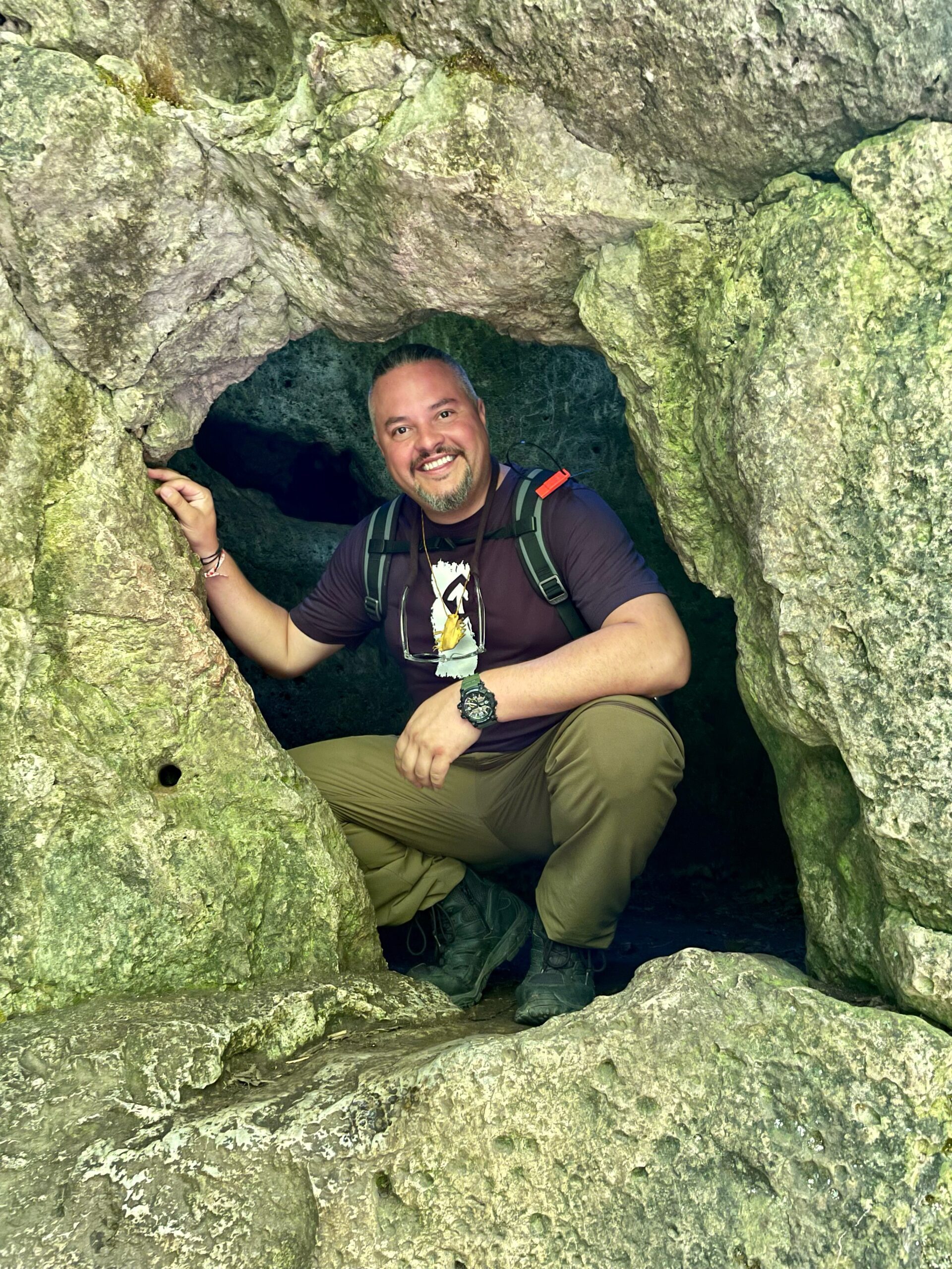
Learn about using a two-eyed seeing approach to understanding and protecting nature, as you hike the Bruce Trail with Caley Doran, Indigenous Trail Guide and Layna Lubimiv, Chief Park Naturalist, MacGregor Point. During your hike, you will also participate in a community science project – picking up and sorting litter found along the trail and submitting litter data to the Bruce Trail Conservancy. Finish the hike by joining us for a group conversation about your experience and talk about what you have learned. This is a moderately paced hike covering rocky and rooty terrain with some short, steep climbs. Please bring water, light snacks and lunch. Wear sturdy footwear, hat and sun protective clothing. Bring sunscreen, insect repellent, and garden gloves.Parking registration is required for everyone. Parking fees apply for non-residents of Northern Bruce Peninsula Book early! 9:30-1:30 https://book.parkpassproject.com/book?inventoryGroup=1699994654&inventory=1592358846
Toronto Urban Badge Hike - 2 of 7
https://hikesstaging.brucetrail.org/event/toronto-urban-badge-hike-2-of-7-2/Sorry, the registration cut-off time for this hike has been reached.Not a member? Click here to join today!Hosting Club: Toronto
Location (Google Maps): Toronto, Ontario, Canada
Hike Leader(s): Brian Rideout Click here to contact Hike Leader(s)
Pace: Moderate
Terrain: Flat
Distance: 10.9 kmDescription
Please join me at the south east corner of Eglinton and Scarlett by 10 AM. We will hike south on the Humber Recreational Trail to Lakeshore Blvd and Ellis (km 19.2 to km 8.3). Here is an online map with km markings of our route for all 7 hikes for the Toronto Urban Badge.Please make sure you bring at least 2 liters of water, a lunch, bug spray and sunscreen.
Sunday Social Hike - Dodd's Hill Loop
https://hikesstaging.brucetrail.org/event/sunday-social-hike-dodds-hill-loop/Sorry, the registration cut-off time for this hike has been reached.Not a member? Click here to join today!Hosting Club: Sydenham
Category: General Hike
Location (Google Maps): Roadside parking on Kemble Rock Rd. where it is closed to traffic at the top of the escarpment, at km 149.7 (Map 34)Hike Leader(s): Bill Snel Click here to contact Hike Leader(s)
Pace: Leisurely: 3 km/h or less
Terrain: Moderate: Some hills and/or poor footing
Distance: 6 kmDescription
We will hike the main trail along the escarpment edge to the new Tumbled Rocks Side Trail, explore it and then take the Dodd’s Hill Side Trail back to the cars. You can bring your Secrets of Sydenham book to find the secret on page 56. If you are unable to register, please call the hike leader at 519-470-0584 (landline). - 10July 10, 2023
9:30 Merritt island loop
https://hikesstaging.brucetrail.org/event/930-merritt-island-loop/Sorry, the registration cut-off time for this hike has been reached.Not a member? Click here to join today!Hosting Club: Niagara
Category: Loop
Location (Google Maps): Merritt IslandHike Leader(s): Heather Howkins Click here to contact Hike Leader(s)
Pace: Medium
Terrain: Easy
Distance: 10kmDescription
Meet at Cross St parking lot – we will hike down Merritt Island crossing over the train track and return along the recreational canal crossing the main street bridge to Cross St. Please bring water and sunscreen, little shade on both sides of waterway, so be prepared for weather. - 11July 11, 2023
8:00 Long Hike Wiley Road Short Hills
https://hikesstaging.brucetrail.org/event/800-long-hike-wiley-road-short-hills-22/Sorry, the registration cut-off time for this hike has been reached.Not a member? Click here to join today!Hosting Club: Niagara
Location (Google Maps):
Short Hills Wiley Road Entrance
Pace: Medium
Terrain: Moderate
: 10kmDescription
Explore Short Hills and the majestic side trails of Scarlett Tanager, Hemlock. Swayze Falls and Terrace. Register for each hike
Bring Poles water, snack, sunscreen and bug spray and dress for the weather
9:15 Short Hike - Pelham Road, Short Hills
https://hikesstaging.brucetrail.org/event/915-short-hike-pelham-road-short-hills-51/Sorry, the registration cut-off time for this hike has been reached.Not a member? Click here to join today!Hosting Club: Niagara
Location (Google Maps): Pelham Road entrance, Short Hills Provincial Park
Hike Leader(s): janet davey Click here to contact Hike Leader(s)
Pace: Medium
Terrain: Moderate
Distance: 6 kmsDescription
Hike the main and side trails in Short Hills Provincial Park. Bring hiking boots, water, sunscreen and bug spray.Looping through Nottawasaga Bluffs Conservation Area, Blue Mountain Section
https://hikesstaging.brucetrail.org/event/looping-through-nottawasaga-bluffs-conservation-area-blue-mountain-section/Sorry, the registration cut-off time for this hike has been reached.Not a member? Click here to join today!Hosting Club: Caledon Hills
Category: Tuesday Hikers
Location (Google Maps): Blue Mountain section, Nottawasaga Conservation Area near SinghamptonHike Leader(s): Doris Harper Click here to contact Hike Leader(s)
Pace: Medium – 3 to 4 km/hour
Terrain: Moderate – some hills and/or some poor footing
Distance: 14 kmDescription
This will be a shuttle hike.From the parking area on 15/16 Sideroad we will shuttle to the start of the hike on 9/10 Sideroad. We will hike the main trail;( the first part of this trail is part of the Transcarioca Bruce Trail Friendship Trail.) We will hike back into Nottawasaga Bluffs Conservation Area and loop through the Conservation area using the main trail, Nottawasaga Lookout Side Trail, Keyhole Side Trail (this is a unique feature as we will be crawling through a hole in the rock wall), Betty Carter Side Trail and Hamilton Brothers Side Trail; a total of about 14 km. It is possible to shorten this hike, or for hikers to drop out of the hike, by eliminating a loop or side trail.
Bring water/beverage of choice, snacks, poles (optional) sunscreen, sun hat.
If you need to cancel the hike on the day of the hike, please send a text or call me. Thank you
contact info : Doris Harper 519 589 4114 : harpt7c@gmail.com