
Hike Schedule
Join us for a hike! Registration required:
All hikes available to BTC members. Some hikes are open to non-members.
TIP: The calendar view displays up to 7 hikes on a day, but often there are more. Click “More events” to see them all.
Categories
- 29July 29, 2023
Bus Hike: Palgrave Forest and Wildlife Area Hike
https://hikesstaging.brucetrail.org/event/bus-hike-palgrave-forest-and-wildlife-area-hike/Sorry, the registration cut-off time for this hike has been reached.Not a member? Click here to join today!Trip Information
Departure Time: 08:00
Return to City Time: 17:30
Departure Point: York Mills Bus PickupOptional Items
Hosting Club: Toronto
Category: Bus Hike
Location (Google Maps): Palgrave Forest and Wildlife AreaHike Leader(s): Lisa R. Lifshitz, Nijole Mockevicius Click here to contact Hike Leader(s)
Pace: Moderate
Terrain: Variable
Distance: 13kDescription
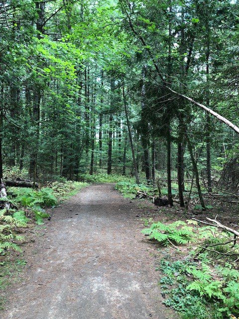
Join us for a relaxed and scenic hike at Palgrave Forest and Wildlife Area, a 306 hectare greenspace located in Peel Region. Palgrave is a small gem – it has a pond, meadows, enough changes of terrain to keep it interesting, pretty flowers and lots of tree cover. We will hike all of the key trails in the park, including some Oak Ridges Moraine Trail, starting from Duffy’s lane. The pace will be steady but not fast- around 3.5 km/hour given the temperature. We will stop for lunch. The plan will be to finish by 2.00 pm- 2.30 pm so that we have time to go into Bolton for a pub/refreshment stop before heading back to Toronto by 5.30 pm. While parts of the trail are flat and broad, there are some hills, narrow/winding trails and 1 steep ascent and descent. Be aware that we may run into bikers. Hiking boots are essential. Please bring at least 2 litres of water, your lunch, a hat, sunscreen and mosquito repellant.Rim2Rim: #2 Mad River Rim - 2nd in a series of 3 for the R2R badge
https://hikesstaging.brucetrail.org/event/rim2rim-2-mad-river-rim-2nd-in-a-series-of-3-for-the-r2r-badge/Sorry, the registration cut-off time for this hike has been reached.Not a member? Click here to join today!Hosting Club: Blue Mountains
Category: Organized Hike
Location (Google Maps): Devil’s Glen Provincial Park parking lotHike Leader(s): Hart Fischer Click here to contact Hike Leader(s)
Pace: Medium – 3 to 4 km/hr, Brisk – 4 to 5 km/hr
Terrain: Moderate – Some hills and/or some poor footing, Strenuous – Hilly with steep climbs and some poor footing
Distance: 10kmDescription
Hikers must register on-line for this hike. No morning sign-ins on this series as hikers will meet at the trailhead. About 10 km with almost 400m elevation gain. From the parking lot, we will follow the white blazed trail south and down to the Devil’s Glen Country Club parking lot. We then proceed east on the blue blazed Mad River Side Trail, continuing parallel to the Mad River, through Glen Huron and south on Conc 8 S/CR #62 until we come to Sideroad 15/16 Nottawasaga. Here we will see both white and blue blazes as this is a shared Bruce Trail/ Ganaraska Trail section. We continue up the hill until reaching the Ganaraska Trail End Marker – a large boulder close to the Devil’s Glen Country Club Gate. We then turn around and head back to the cars. Contact the hike leader if registration is closed.East Point Park Bird Sanctuary, Lake front hike ,Scarborough
https://hikesstaging.brucetrail.org/event/lake-front-hike-scarborough/Sorry, the registration cut-off time for this hike has been reached.Not a member? Click here to join today!Hosting Club: Toronto
Category: Car Hike
Location (Google Maps): East Point Park Bird Sanctuary, Scarborough, ON
There is a parking lot at the end of Beechgrove Dr. there is a free parking lotHike Leader(s): Mohammad Aghamiri , 19 Willowbrook Rd Click here to contact Hike Leader(s)
Pace: Moderate
Terrain: FlatDescription
We will hike along lake Ontario to Scarborough Bluffs.We may have a few hills on trails,
Please carefully read safety procedures during the hike:
1-Hikers must stay between the leader and the sweep.
2-Hikers must advise the leader or the sweep if they wish to leave the group.
3- Hikers must follow the whistle instructions: 1 blast- stay where you are; 2 blasts come to the leader; 3 blasts – come to the leader quickly.
4-Hike leader may request volunteers to stop at trail intersections, they need to help hikers to the direction the group walk and wait till they see the sweep .
5-Hikers have to make sure they can see the persons behind and in front of them.
At the end of hike you have a chance to swim in lake in beaches close by
Balsam Wetlands Nature Reserve
https://hikesstaging.brucetrail.org/event/balsam-wetlands-nature-reserve-2/Sorry, the registration cut-off time for this hike has been reached.Not a member? Click here to join today!Hosting Club: Blue Mountains
Category: Register in person the morning of hike.
Location (Google Maps): Hike meets in the parking lot behind Tim Hortons on First St. in Collingwood.Hike Leader(s): Jennifer Roy Click here to contact Hike Leader(s)
Pace: Leisurely – 3 km/hr. or less
Terrain: Easy – Mostly flat and usually good footing, Moderate – Some hills and/or some poor footing
Distance: 6.5kmDescription
This hike is through the 284 acres of Balsam Wetlands. We will park at km 34.2 on Concession 10 South and proceed hiking across a farmer’s field and continue through a pine forest. This hike has recently been realigned so that it no longer follows the Highlands Nordic cross country ski trail and now goes through woodlands and some interesting rock formations to the Duntroon Quarry. We will then follow the white trail passing some deep crevices to the Bruce Trail parking lot off 91. Hikers will then be shuttled back to the cars. Bring a snack and water.
Ferns and Wildfolowers
https://hikesstaging.brucetrail.org/event/ferns-and-wildfolowers/Sorry, the registration cut-off time for this hike has been reached.Not a member? Click here to join today!Hike open to BTC Members only.
Hosting Club: Peninsula
Location (Google Maps): Meet up at the south end of Cathedral Drive at the entrance to Hope Bay Nature Reserve. Map 37 (Bruce Trail Reference Guide 30th Edition) There is a small parking lot here and roadside parking available. Carpool if possible.
Hike Leader(s): Marg Glendon Click here to contact Hike Leader(s)
Pace: Leisurely
Terrain: Moderate
Distance: 7.5 kmDescription
Ferns are one of the oldest living groups of plants. Along the Bruce Trail at Hope Bay Nature Reserve, you will find many different ferns and wildflowers. Hike with Lynn Allen and Hamish Duthie, botany enthusiasts, to learn more about wildflowers, ferns and fern habitat. This is a slow-paced hike, covers some uneven terrain, and may include periods of standing when we are introduced to a fern on the trail. The hike distance is about 7.5 km. Bring your camera, binoculars, water, lunch and notebook (optional). There are no facilities here. Facilities are available at Hope Bay municipal parking area. Working on your PBTC Fern Badge? This is a great hike for you! After the hike, you may want to celebrate with an ice cream or swim at nearby Hope Bay. Please contact me if you have questions or would like to request some extra support during the hike.Toronto Urban Badge Hike - 7 of 7
https://hikesstaging.brucetrail.org/event/toronto-urban-badge-hike-7-of-7/Sorry, the registration cut-off time for this hike has been reached.Not a member? Click here to join today!Hosting Club: Toronto
Category: Urban Walk
Location (Google Maps): TorontoHike Leader(s): Brian Rideout Click here to contact Hike Leader(s)
Pace: Moderate
Terrain: Flat
Distance: 9 kmDescription
Please join me at the south east corner of Overlea Blvd and Don Mills Rd by 10 AM. We will hike south on the Don Trail to the Distillery District (km 62.4 to km 71.4). Here is an online map with km markings of our route for all 7 hikes for the Toronto Urban Badge.Please make sure you bring at least 2 liters of water, a lunch, bug spray and sunscreen.
Car Hike: Scotsdale Farm
https://hikesstaging.brucetrail.org/event/car-hike-scotsdale-farm-3/Sorry, the registration cut-off time for this hike has been reached.Not a member? Click here to join today!Hosting Club: Toronto
Category: Car Hike
Location (Google Maps): Scotsdale Farm and Georgetown Farmers Market, Map 13Hike Leader(s): Al Brown Click here to contact Hike Leader(s)
Pace: Moderate
Terrain: Variable
Distance: 10 kmDescription
We will have a leisurely 10 km hike along the main and side trails around Scotsdale Farm. Most of this trail is under the forest canopy. After the hike we will find a patio to sit on and enjoy some after hike refreshments.The start time for this hike is set to allow attendees to go to the Georgetown Farmers Market before the hike. It is open in the centre of old Georgetown from 8:00 am to 12:30 pm. I invite hikers to come a bit early and partake. Parking in the vicinity of the Farmers Market is on adjacent streets. You can check for locations on line by going to the event’s website https://www.farmersmarketgeorgetown.com/
Directions: North on Trafalgar Road to past Georgetown where it connects to Hwy 7. Continue north on Hwy 7 to Silver Creek . Turn right and go about 1.5 km to the entrance to Scotsdale Farm. The parking area is about half a km from the road, next to the farmstead.
- 30July 30, 2023
Car Hike: Raspberries and a Ramble
https://hikesstaging.brucetrail.org/event/car-hike-raspberries-and-a-ramble/Sorry, the registration cut-off time for this hike has been reached.Not a member? Click here to join today!Hosting Club: Toronto
Category: Car Hike
Location (Google Maps): We will meet at roadside parking north of km 12.1 (Map 12 of the Bruce Trail Reference Guide, Edition 30) on 15 Sideroad, 500 m northeast of Halton Road 25.Hike Leader(s): Monica Pasquali Click here to contact Hike Leader(s)
Pace: Leisurely
Terrain: Variable
Distance: 4 kmDescription
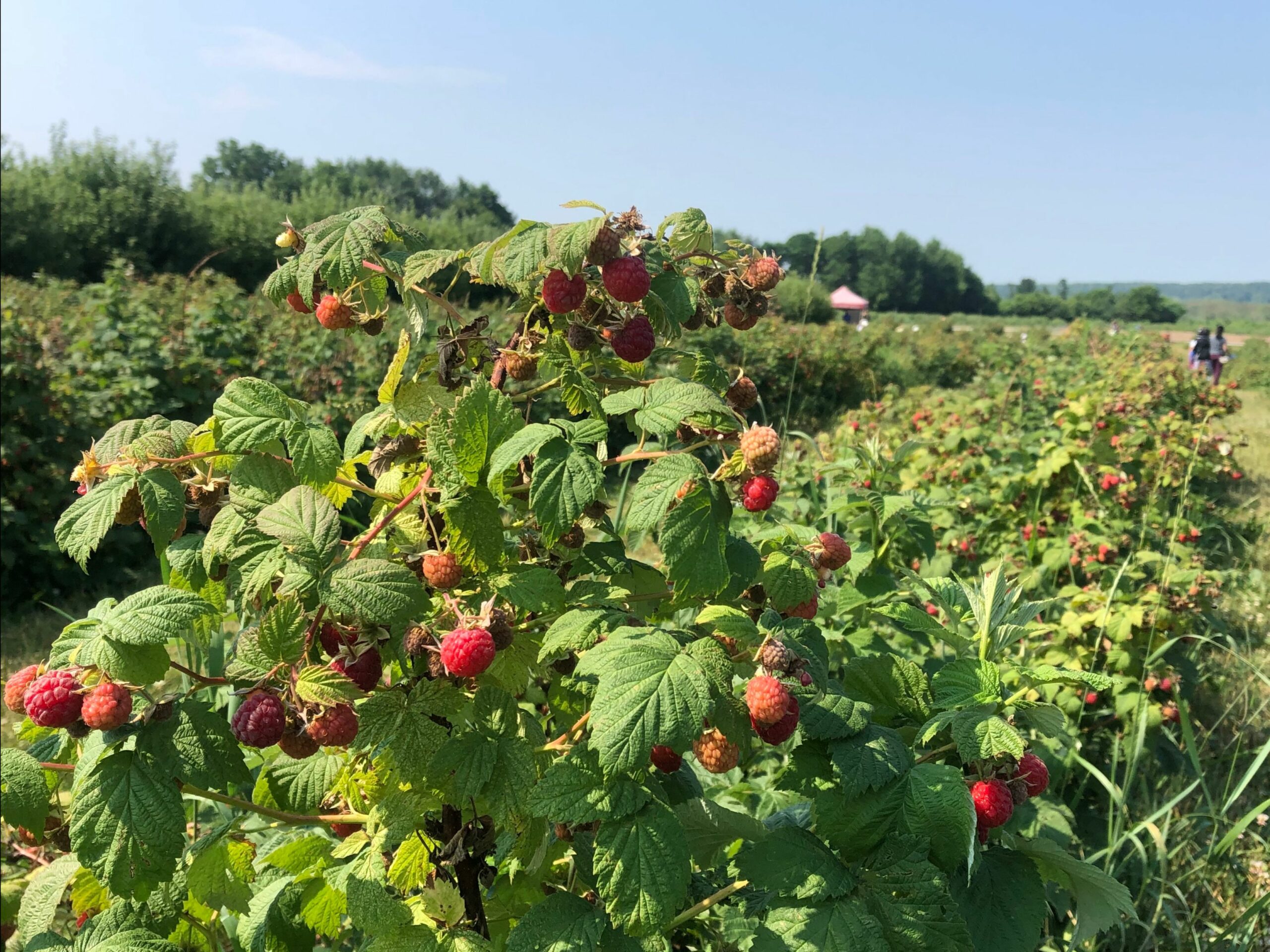
Enjoy two delightful activities in one day: a ramble along the Bruce Trail in Speyside followed by a visit to Andrew’s Scenic Acres to go raspberry picking! First we’ll do a figure-eight loop hike of the main trail, Speyside South Side Trail, and Cliff Hatch Side Trail, enjoying the varied scenery of forests and fields as we hike the area. After returning to our cars, those who would like to join me in extending their day of fun will make the 5-minute drive to reach Andrew’s Scenic Acres where wagon rides, a playground, an animal corral, a straw mountain climb, and a corn maze can be enjoyed, along with a BBQ lunch and some raspberry picking (or blueberry picking – whichever berry is in season will do!).Children under 13 years of age are encouraged to join their parents/guardians on this hike so they can fulfill the requirements for the Toronto Bruce Trail Club’s Youth Badge (https://torontobrucetrailclub.org/the-trail/badges) – all family members who are planning on joining us should register for the hike, including children. You should bring enough water and food for a 2-hour hike, comfortable hiking shoes, sun and bug protection, appropriate clothing for the weather, and money if you intend to join us at Andrew’s Scenic Acres after the hike.
Please note that there is an admission fee to visit Andrew’s Scenic Acres: $15 + HST for people between the ages of 6 and 64, $7.50 + HST for people aged 65 years and older, and free for children aged 5 years and younger. There is an additional cost of $4.75 per pound if you decide to pick your own fruit, and if you decide to enjoy a BBQ lunch then that will incur an additional fee, too – no outside food is permitted on farm grounds. More information about Andrew’s Scenic Acres can be found at their website: https://www.andrewsscenicacres.com/.

Toronto Urban Badge Hike - 5 of 7
https://hikesstaging.brucetrail.org/event/toronto-urban-badge-hike-5-of-7-2/Sorry, the registration cut-off time for this hike has been reached.Not a member? Click here to join today!Hosting Club: Toronto
Location (Google Maps): Toronto
Hike Leader(s): Brian Rideout Click here to contact Hike Leader(s)
Pace: Moderate
Terrain: Flat
Distance: 9.6 kmDescription
Please join me at the north east corner of Bathurst and Finch by 10 AM. We will hike east on the Finch Hydro Corridor Trail and south along East Don Parklands to Sheppard and Leslie (km 41.6 to km 51.2). Here is an online map with km markings of our route for all 7 hikes for the Toronto Urban Badge.Please make sure you bring at least 2 liters of water, a lunch, bug spray and sunscreen.
Sunday Social Hike - Woodford loop
https://hikesstaging.brucetrail.org/event/sunday-social-hike-woodford-loop/Sorry, the registration cut-off time for this hike has been reached.Not a member? Click here to join today!Hosting Club: Sydenham
Category: General Hike
Location (Google Maps): Meet in the north-east corner of the parking lot at Home Depot on Highway 26 on the east side of Owen Sound.Hike Leader(s): Ian Mills Click here to contact Hike Leader(s)
Pace: Leisurely: 3 km/h or less
Terrain: Moderate: Some hills and/or poor footing, There might be muddy sections.
Distance: 5 kmDescription
Loop via Woodford Escarpment side trail and main trail. We will hike through a couple of crevices and with luck pass across a small waterfall. Map 30. If you are unable to register, please call or text the hike leader at 416-848-8818. - 31July 31, 2023No events
- 01August 1, 2023
8:00 Long Hike Wiley Road Short Hills
https://hikesstaging.brucetrail.org/event/800-long-hike-wiley-road-short-hills-25/Sorry, the registration cut-off time for this hike has been reached.Not a member? Click here to join today!Hosting Club: Niagara
Location (Google Maps):
Short Hills Wiley Road Entrance
Pace: Medium
Terrain: Moderate
: 10kmDescription
Explore Short Hills and the majestic side trails of Scarlett Tanager, Hemlock. Swayze Falls and Terrace. Register for each hike
Bring Poles water, snack, sunscreen and bug spray and dress for the weather
9:15 Short Hike - Pelham Road, Short Hills
https://hikesstaging.brucetrail.org/event/915-short-hike-pelham-road-short-hills-54/Sorry, the registration cut-off time for this hike has been reached.Not a member? Click here to join today!Hosting Club: Niagara
Location (Google Maps): Pelham Road entrance, Short Hills Provincial Park
Hike Leader(s): janet davey Click here to contact Hike Leader(s)
Pace: Medium
Terrain: Moderate
Distance: 6 kmsDescription
Hike the main and side trails in Short Hills Provincial Park. Bring hiking boots, water, sunscreen and bug spray.Borers Falls to Clappison Woods and return
https://hikesstaging.brucetrail.org/event/borers-falls-to-clappison-woods-and-return/Sorry, the registration cut-off time for this hike has been reached.Not a member? Click here to join today!Hosting Club: Caledon Hills
Category: Car Hike
Location (Google Maps): Meet at Rock Chapel Nature Sanctuary parking — Map 9, km 62.0. From Hwy 403 take Hwy 6 north 3 km to Dundas St. Turn left. Follow for 2 km and turn left on Rock Chapel Rd. Follow 1.5 km to PAY parking on left.Hike Leader(s): Peter Leeney Click here to contact Hike Leader(s)
Pace: Moderate
Terrain: Hilly
Distance: 14 kmDescription
From Borer’s Falls we will hike east on the Trail under Hwy 6, through Clappison Woods as far as Snake Rd and then return. Possibly a side trip on the Rockcliffe Side Trail (720 meters).Hike will be shortened if the weather is very hot.

8:30 pm Sunset & Moonrise Night Hike in Niagara-on-the-Lake
https://hikesstaging.brucetrail.org/event/830-pm-sunset-moonrise-night-hike-in-niagara-on-the-lake-5/Sorry, the registration cut-off time for this hike has been reached.Not a member? Click here to join today!Hosting Club: Niagara
Category: Night
Location (Google Maps): Veteran’s Memorial Park, park just outside the park on King St.Hike Leader(s): Robin Garrett Click here to contact Hike Leader(s)
Pace: Medium
Terrain: Easy
Distance: 6-7 kmDescription
Sunset & Moonrise Night Hike – Take in the magic of the setting sun and rising moon over Lake Ontario and the Niagara River. This hike includes a stop to connect with your senses – sights, sounds, smells and the rhythm of your breath. Counts towards your night hike badge (5 night hikes).