
Hike Schedule
Join us for a hike! Registration required.
All hikes available to BTC members. Some hikes are open to non-members.
See Refund Policy for Paid Hikes >
TIP: The calendar view displays up to 7 hikes on a day, but often there are more. Click “View more events” to see them all.
Categories
- 17July 17, 2023

Niagara ETE in Seven - Brisk Pace - Led by Ruth Moffatt - Please read all details before registering.
https://hikesstaging.brucetrail.org/event/niagara-ete-in-seven-brisk-pace-led-by-ruth-moffatt-please-read-all-details-before-registering/Sorry, the registration cut-off time for this hike has been reached.Not a member? Click here to join today!Hike open to BTC Members only.
This is a Multi-Day Hike
You are signing up for the following dates and times:
2023-07-17 at 07:00
2023-07-18 at 07:00
2023-07-19 at 07:00
2023-07-20 at 07:00
2023-07-21 at 07:00
2023-07-22 at 07:00
2023-07-23 at 07:00Hosting Club: Niagara
Category: Event Hikes
Location (Google Maps): 17 Jul: Meet at Woodend Conservation Area, Taylor Road, Niagara-on-the-Lake, 43.1432995, -79.1672588
Carpool to 14184 Niagara River Pkwy, Niagara-on-the-Lake, 43.1602848, -79.052315.18 Jul: Meet at Woodend Conservation Area, Taylor Road, Niagara-on-the-Lake, 43.1432995, -79.1672588
Carpool to Decew House, Thorold. 43.1078074, -79.249845819 Jul: Meet at Decew House, Decew Rd Thorold. 43.1078074, -79.2498458 Carpool to Roland Rd parking lot east of Effingham St 43.090278, -79.305073
20 Jul: Meet at 3640 Glen Rd Jordan 43.1390306, -79.373893232.
Carpool to Roland Rd parking lot east of Effingham St 43.090278, -79.30507321 Jul: Meet at 3640 Glen Rd Jordan 43.1390306, -79.373893232.
Carpool to Quarry Rd, Beamsville 43.14279969065385, -79.45892212012937.22Jul: Meet at 3774 Quarry Rd Beamsville, 43.14279969065385, -79.45892212012937.
Carpool to Mountainview Road, Beamsville 43.1577899 -79.497406223 Jul: Meet at Grimsby Lions Club Pool 1 Elm St 43.193201, -79.565301
Carpool to Mountainview Conservation Area, Beamsville 43.1577899 -79.4974062Hike Leader(s): Niagara Hike Leader Click here to contact Hike Leader(s)
Pace: Brisk
Terrain: Moderate
Distance: 12 – 15k per dayDescription
Meet time is 7am. This is so that we can hopefully avoid the hottest part of the day. This is a special series of 7 hikes to complete the Niagara section of the Bruce Trail. There will be a new accomplishment badge, included in the registration fee featuring the White-tailed deer – which has been designed by Joe Borges and will hopefully be made available on our last day. The White-tailed deer is common throughout Niagara. For this E2E in 7, we will be following the main trail east to west eventually finishing in Grimsby. Some days we will hike east to west and other days, west to east depending on parking availability. Please note that you are signing up for the entire series of 7 hikes as a Group Hike. The Niagara in 7 series is geared to experienced long distance hikers with the expectation of a 3 to 5.0 km/ hr. pace maintained over a day up to 15km. The section is approximately 85km so daily distances will be based on available parking. No dropout points have been established and therefore hikers who must drop out, will be responsible for their own transportation back to their vehicle. Please be honest about your hiking abilities. We will hike at a steady pace but there will be plenty of time to take pictures and to enjoy the flora and fauna of this beautiful but challenging section.Again, this particular set of 7 hikes is intended to be Moderate/Brisk. Please be honest about your degree of physical fitness prior to registration. It is a group hike so it is important you are able to keep pace with the person in front of you.
Attire and Daily Hikes.
Hikers will be expected to be wearing proper hiking boots and layered clothing with the expectation of hot and humid weather. Sufficient food and 2 litres of water for a full day of hiking is required as well as hiking poles (if you use them). Check the daily forcast and prepare for wet weather, as well. Bug spray is strongly suggested. Clothing adjustments, bio-breaks are as needed. Please let the sweep person know and they will wait for you. A morning break around 10am and a 10-15 minute on-trail lunch break will be scheduled. An afternoon break will be based on our expected finish time. Depending on weather conditions, these times may vary. Please check for ticks everyday. Wear a wide brimmed hat and hang your backpack up off the ground. This area is endemic to black-legged ticks.
Fee
The fee goes towards supporting the Niagara Bruce Trail Club, which in turn supports the mission of the Bruce Trail Conservancy, which is: “Preserving a ribbon of wilderness, for everyone, forever.” For the time being, registration for the Niagara E2E-in-seven will be limited to members of the Bruce Trail Conservancy. Hikers may be a member of any section.
Car Shuttles and Missing Hikes
A maximum of 2 (of the 7) hikes can be self-completed as a result of scheduling challenges, but it is intended that this badge be earned while hiking as part of a group led by a certified hike leader. Car shuttles are shared amongst all hikers. If you intend to arrive at the meeting locations with more than yourself in your vehicle, please let the hike leader know in advance. Car pooling to our meeting spot with 2 people in the car is generally ok but we would like to minimize and equalize the driving/shuttling as much as possible so it is fair for all participants. If you know you will miss more than 2 of the hikes, it’s likely best to sign up for another end to end, however, whatever hikes are completed on this series may go toward completion of an independent ETE for the regular Niagara section. If you are able to complete the hikes you know you will miss ahead of time, all the better.
Transportation
This series will be through-hikes and will require car shuttling. You must be willing to drive and/or to be a passenger. Some parking locations require paid parking, and hikes that enter Niagara Parks. The fee for this E2E-in-7 does not include any parking/entry fees for hikers. These costs, where applicable, will be shared amongst all participants unless you have a parking or park pass.
Leave No Trace
Please remember, like all hikes, this is a Leave No Trace hike. Pack out whatever you pack in. Do not toss anything onto or into any sections of the trail. We will also try to leave the trail better than we found it so we will be collecting collectable garbage we might see along the way. Daily volunteers to collect trail trash will be supplied with a bag. Dogs will not be welcome on this hike.
Daily
We meet for each hike by at least 6:45am each day. The schedule is subject to change. Please set aside July 24th as a potential alternate day in the event of weather related postponement.
This hike is limited to 12 participants including the hike leader.
Blue Series Hike- Rural Roots ST and Gravelly Point ST
https://hikesstaging.brucetrail.org/event/blue-series-hike-rural-roots-st-and-gravelly-point-st/Sorry, the registration cut-off time for this hike has been reached.Not a member? Click here to join today!Hike open to BTC Members only.
Hosting Club: Peninsula
Location (Google Maps): Meet up at Colpoy’s Bay Dock Parking Lot. We will carpool to Rural Rocks ST for our morning hike. Map 35 (Bruce Trail Reference Guide 30th Edition)
Hike Leader(s): Owen Glendon Click here to contact Hike Leader(s)
Pace: Medium
Terrain: Moderate
Distance: 9 km totalDescription
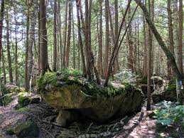
Working on your PBTC Blue Series Bear Badge? This is perfect day hike combination for you. Join this moderately paced hike which includes two side trails – Rural Roots Side Trail (4 ½ km) and Gravelly Point Side Trail (4 ½ km). Meet at Colpoy’s Bay Government Dock parking lot at 8:30 a.m. We will carpool to Rural Roots Side Trail, from here. Rural Roots Side Trail is the only part of the Bruce Trail which is not connected to the main trail. The sidetrails found here follow some difficult terrain – passing through cathedral type rock formations, over verdant patches of moss and fern, and passing by an active beaver pond. Learn about Rural Rootz Nature Reserve and be inspired by its history! Leaving Rural Rootz Nature Reserve, we will drive to Colpoys Bay and stop at the dock for a short lunch break. Porta potties are available here. From Colpoys Bay, we will carpool and make the short drive to the Mallory Beach parking lot. Gravelly Point Side Trail will be a moderately paced hike on fairly even terrain, following an old logging road. Gravelly Point Side Trail is found in the Malcolm Bluff Nature Reserve – a lovely area protected by three Conservation groups – Ontario Nature, Bruce Trail Conservancy and Nature Conservancy Canada. The end of this sidetrail leads us down to the water’s edge. Then, we retrace our steps to our vehicles. Bring a light backpack with plenty of water, snacks, lunch, insect repellent, sunscreen, hiking poles (recommended but not required). Wear a hat and sturdy footwear. - 18July 18, 2023
8:00 Long Hike Wiley Road Short Hills
https://hikesstaging.brucetrail.org/event/800-long-hike-wiley-road-short-hills-23/Sorry, the registration cut-off time for this hike has been reached.Not a member? Click here to join today!Hosting Club: Niagara
Location (Google Maps):
Short Hills Wiley Road Entrance
Pace: Medium
Terrain: Moderate
: 10kmDescription
Explore Short Hills and the majestic side trails of Scarlett Tanager, Hemlock. Swayze Falls and Terrace. Register for each hike
Bring Poles water, snack, sunscreen and bug spray and dress for the weather
Dodds Hill to Nels Maher Side Trail
https://hikesstaging.brucetrail.org/event/dodds-hill-to-nels-maher-side-trail/Sorry, the registration cut-off time for this hike has been reached.Not a member? Click here to join today!Hosting Club: Sydenham
Category: General Hike
Location (Google Maps): Parking area on Kemble Rock Road, north of km 145.3 at the Nels Maher Side Trail (Map 34)Hike Leader(s): Maureen McFarland Click here to contact Hike Leader(s)
Pace: Medium: 3 to 4 km/h
Terrain: Moderate: Some hills and/or poor footing, There might be sections with water on the trail.
Distance: 7 kmDescription
After a short car shuttle north to Dodds Hill, we start our hike south on the main trail. This is a beautiful area, rocky with one large crevice that we walk through. There is one climb down the escarpment and back up again. There are lots of great views to be enjoyed from the escarpment edge. Bring sun screen, bug repellant, lots of water and a snack. If you are unable to register, call or text the hike leader at 647-918-4180.9:15 Short Hike - Pelham Road, Short Hills
https://hikesstaging.brucetrail.org/event/915-short-hike-pelham-road-short-hills-52/Sorry, the registration cut-off time for this hike has been reached.Not a member? Click here to join today!Hosting Club: Niagara
Location (Google Maps): Pelham Road entrance, Short Hills Provincial Park
Hike Leader(s): janet davey Click here to contact Hike Leader(s)
Pace: Medium
Terrain: Moderate
Distance: 6 kmsDescription
Hike the main and side trails in Short Hills Provincial Park. Bring hiking boots, water, sunscreen and bug spray.Terra Cotta
https://hikesstaging.brucetrail.org/event/terra-cotta-9/Sorry, the registration cut-off time for this hike has been reached.Not a member? Click here to join today!Hosting Club: Caledon Hills
Category: Tuesday Hikers
Location (Google Maps): Meet at Winston Churchill Blvd., intersection with Caledon Trailway.
Driving direction: North on Highway 410, continue north on Highway 10, left on King Street, right on Winston Churchill Blvd; drive 1 kilometre to roadside parking on either side of the road.Hike Leader(s): Mohammad Shafiq Click here to contact Hike Leader(s)
Pace: Medium – 3 to 4 km/hour
Terrain: Moderate – some hills and/or some poor footing
Distance: 13 kmDescription
Will hike Terra Cotta Side Trail and main Bruce Trail. Bring water, snack, poles, sunscreen and bug sprayPhone contact for the day of hike: 416-566-0503.

Discovery Walk – GeoHike at Mono Cliffs
https://hikesstaging.brucetrail.org/event/discovery-walk-geohike-at-mono-cliffs/Sorry, the registration cut-off time for this hike has been reached.Not a member? Click here to join today!Hosting Club: Dufferin Hi-Land
Category: General Hike
Location (Google Maps): Dufferin Hi-Land Section, Map 19. Meet at the Splitrock Narrows Nature Reserve Parking Lot on 2nd Line EHS, approximately 1.3 km north of 25 Sideroad, Mono. From Hwy 10 north of Orangeville, turn right onto 25 Sideroad. Turn left at the third intersection onto 2nd Line EHS. Parking is on your right in 1.3 km. (Note: GoogleMaps may provide incorrect directions to this location)
We will shuttle to parking on 2nd Line EHS north of 20 Sideroad. Please do not go directly to this location as parking is very limited.Hike Leader(s): Lynda Bloom Click here to contact Hike Leader(s)
Pace: Leisurely
Terrain: Moderate
Distance: 5 kmDescription
Why are there cliffs in the park? Are there any fossils? This leisurely hike will make many stops to look at rocks and talk about the geological history of the area. Don’t forget to bring your camera.We will use several side trails, mostly the Walter Tovell and Carriage Trails, to visit the north and south Outlier exposures.
Please wear sturdy footwear as there are hills and stairs. Pack water, snacks and dress for the weather.
Suitable for children over 8 years old.
Please complete the waiver online if you are not a member.
- 19July 19, 2023
Bibbulmun Friendship Trail
https://hikesstaging.brucetrail.org/event/bibbulmun-friendship-trail-2/Sorry, the registration cut-off time for this hike has been reached.Not a member? Click here to join today!Hosting Club: Blue Mountains
Category: Register in person the morning of hike.
Location (Google Maps): Hike meets in the parking lot behind Tim Hortons on First St. in Collingwood.Hike Leader(s): Mary-Lynne Chenard Click here to contact Hike Leader(s)
Pace: Medium – 3 to 4 km/hr
Terrain: Moderate – Some hills and/or some poor footing
Distance: 7kmDescription
This is one of our Friendship trails running along BTC trails and other conserved land north of Boyne Valley Provincial Park. We will park at km 29.4 on 1st Line E in the Dufferin Hi-Land section. The 7 km figure eight hike will follow the white blazed trail to km 25.4, looping back to the parking lot via the Oliver Creek Side Trail and the Moss Haven Side Trail. Bring a lunch or snack and water. *The Bibbulmun Track in Western Australia stretches 1,000 km from Kalamunda in the Perth Hills to the historic town of Albany on the south coast.
WEDNESDAY WALKERS - Start at the Very Beginning (of BV)
https://hikesstaging.brucetrail.org/event/wednesday-walkers-start-at-the-very-beginning-of-bv/Sorry, the registration cut-off time for this hike has been reached.Not a member? Click here to join today!Hosting Club: Beaver Valley
Location (Google Maps): Park at the end of Maple Lane at BV Km 0.0, Map 24, Edition 30
Hike Leader(s): Margaret Yaraskavitch Click here to contact the hike leader.
Pace: Medium
Terrain: Easy, Moderate
Length of Hike: 5.0 kmDescription
This hike will be a there-and-back walk. Views from the edge of the Escarpment will show Collingwood and Nottawasaga Bay. We’ll pass Craigleith Ski Club and head towards a deep valley but then it is time to return. Often, views look different when walking in the opposite direction, promising another chance to experience wide open views of the shores of Nottawasaga Bay. Please bring water and a snack.
Double Looping Dundas Valley
https://hikesstaging.brucetrail.org/event/double-looping-dundas-valley/Sorry, the registration cut-off time for this hike has been reached.Not a member? Click here to join today!Hosting Club: Iroquoia
Category: Good Companions
Location (Google Maps): Dundas Valley Conservation Area, 650 Governor’s Rd.Hike Leader(s): Anne Armstrong Click here to contact Hike Leader(s)
Pace: Leisurely – 3km/hr or less
Terrain: Moderate – Some hills and/or some poor footing
Distance: 5 or 10 km.Description
Join us as we loop through the Valley. We will complete two loops with an option of doing only one. We will meet at the trail centre at 9:15 am. for a 9:30 am. start. Park in the last parking lot and make your way up to the Trail Centre. There are bathrooms here. We will hike Sawmill Valley loop and after a snack at the Trail Centre we will hike the main loop. Bring water, a snack or lunch, sunscreen and insect repellent. Poles may be useful. Entrance fee or Conservation Area pass.
Leader: Anne Armstrong 905 617 3937 - 20July 20, 2023
8:00 am Long Hike Jordan to Moyer / Louth
https://hikesstaging.brucetrail.org/event/800-am-long-hike-jordan-to-moyer-louth-50/Sorry, the registration cut-off time for this hike has been reached.Not a member? Click here to join today!Hosting Club: Niagara
Location (Google Maps):
Jordan Hollow Park 3039 King St Jordan
Pace: Medium
Terrain: Moderate
: 10kDescription
From Jordan Hollow Hike the main trail to Upper and Lower Balls Falls, Moyer Road or Louth and Return. You must register for each hike. Bring Poles, sunscreen, bug spray , snack and a drink and dress for the weather
9:15 Short Hike - Jordan Hollow
https://hikesstaging.brucetrail.org/event/915-short-hike-jordan-hollow-66/Sorry, the registration cut-off time for this hike has been reached.Not a member? Click here to join today!Hosting Club: Niagara
Location (Google Maps): Jordan Hollow Park, Jordan Station
Hike Leader(s): Bill Russell Click here to contact Hike Leader(s)
Pace: Medium
Terrain: Strenuous
Distance: 6 kmsDescription
Hike the main and side trails around Jordan and Balls Falls. Bring hiking boots, water, sunscreen and bug spray.Sydenham E2E Hike 13 of 14
https://hikesstaging.brucetrail.org/event/sydenham-e2e-hike-13-of-14/Sorry, the registration cut-off time for this hike has been reached.Not a member? Click here to join today!Hosting Club: Caledon Hills
Category: End-to-End
Location (Google Maps): Meet at roadside parking at km 14.4 on the shoulder of the 2nd Concession S. Shuttle to start at Bognor Marsh Conservation Area, km 29.4.Hike Leader(s): Nancy Mooney Click here to contact Hike Leader(s)
Pace: Medium – 3 to 4 km/hour
Terrain: Easy – mostly flat and usually good footing, Moderate – some hills and/or some poor footing
Distance: From km 29.4 to 14.4, total 15 km.Description
This hike begins with road walking then a pleasant change through forests and fields for a while before finishing off on the road.- James Gardens to Old Mill ** CANCELLED **
https://hikesstaging.brucetrail.org/event/evening-ramble-james-gardens-to-old-mill/Sorry, the registration cut-off time for this hike has been reached.Not a member? Click here to join today!Hosting Club: Toronto
Category: Cancelled
Location (Google Maps): Meet on east side of Scarlett Road at Edenbridge Drive (south of Eglinton) opposite the gas station.. Take Bus #79A from Runnymede Station scheduled to depart at 5:25 pmHike Leader(s): Tom Swales Click here to contact Hike Leader(s)
Pace: Moderate
Terrain: Flat
Distance: 7 KMDescription
** Canceled due to forecast of powerful thunderstorms **On this third of our series of evening rambles we will hike south on the Humber through James Gardens and Lambton Woods to the Old Mill Subway Station. Each Thursday evening in the Summer there will be an evening ramble on park trails around Toronto.