
Hike Schedule
Join us for a hike! Registration required.
All hikes available to BTC members. Some hikes are open to non-members.
See Refund Policy for Paid Hikes >
TIP: The calendar view displays up to 7 hikes on a day, but often there are more. Click “View more events” to see them all.
Categories
- 09May 9, 2023
8:00 NEW TIME Long Hike Wiley Road Short Hills
https://hikesstaging.brucetrail.org/event/800-new-time-long-hike-wiley-road-short-hills-2/Sorry, the registration cut-off time for this hike has been reached.Not a member? Click here to join today!Hosting Club: Niagara
Location (Google Maps):
Short Hills Wiley Road Entrance
Pace: Medium
Terrain: Moderate
: 10kmDescription
Explore Short Hills and the majestic side trails of Scarlett Tanager, Hemlock. Swayze Falls and Terrace. Register for each hike
Bring Poles water, snack, sunscreen and bug spray and dress for the weather
9:15 Short hike - Pelham Road, Short Hills
https://hikesstaging.brucetrail.org/event/915-short-hike-pelham-road-short-hills-42/Sorry, the registration cut-off time for this hike has been reached.Not a member? Click here to join today!Hosting Club: Niagara
Location (Google Maps): Pelham Road entrance, Short Hills Provincial Park
Hike Leader(s): janet davey Click here to contact Hike Leader(s)
Pace: Medium
Terrain: Moderate
Distance: 6 kmsDescription
Hike the main and side trails in Short Hills Provincial Park. Bring hiking boots, water and bug spray.Hockley/Humber Valley
https://hikesstaging.brucetrail.org/event/hockley-humber-valley/Sorry, the registration cut-off time for this hike has been reached.Not a member? Click here to join today!Hosting Club: Dufferin Hi-Land
Category: Tuesday Hike
Location (Google Maps): Map 17, 43.4
7th Line Parking Lot, at Airport RdHike Leader(s): Julie Daley, Les Babbage, Inge Eckerich, Tony Evangelista Click here to contact Hike Leader(s)
Pace: Medium
Terrain: Moderate, Slippery and Steep Sections
Distance: 7 km, short hike 3.5 kmDescription
From the 7th Line Parking lot (43.4) we will hike south along the main trail to hwy 9, and return on the same route. There are some hills and steep sections. The spring wildflowers should be sprouting 😊 Short hike will be to 41.8, and return, no hills, 3.5 km. Please bring water and snackBognor Marsh Loop
https://hikesstaging.brucetrail.org/event/bognor-marsh-loop/Sorry, the registration cut-off time for this hike has been reached.Not a member? Click here to join today!Hosting Club: Sydenham
Category: General Hike
Location (Google Maps): Meet at roadside parking on 4th Concession North. Take 4th Concession N south from Highway 26, park at where the road ends (Map 31)Hike Leader(s): Fran Turner Click here to contact Hike Leader(s)
Pace: Brisk: 4 to 5 km/h
Terrain: Strenuous: Hilly with steep climbs and some poor footing.
Distance: 7 kmDescription
This hike circumnavigates the Bognor Marsh. This is a good place to see water birds including ducks, herons, egrets. We start at the top of the escarpment and hike down to the marsh. We’ll hike around the south end of the marsh – it can be quite muddy here so waterproof footwear is a must! From the west side of the marsh we’ll climb back up to the top of the escarpment and back to the cars. This hike includes steep uphill and downhill climbs. Poison ivy is found along the trail in one small area, so long pants are necessary. If you are unable to register, please call or text the leader at 519-590-0706.Spllt Rock Narrows plus Mono Cliffs
https://hikesstaging.brucetrail.org/event/spllt-rock-narrows-plus-mono-cliffs-2/Sorry, the registration cut-off time for this hike has been reached.Not a member? Click here to join today!Hosting Club: Caledon Hills
Category: Tuesday Hikers
Location (Google Maps): Split Rock Narrows parking lot. From Hwy 10, turn east on 25 Sideroad then north on 2nd line EHS.Hike Leader(s): Barbara Euler 416-578-1744 Click here to contact Hike Leader(s)
Pace: Medium – 3 to 4 km/hour
Terrain: Easy – mostly flat and usually good footing
Distance: 11 kmDescription
Since Mono Cliffs is often very busy, we will start and end our hike outside the boundaries of the provincial park. There is a variety of terrain and viewpoints and we hope to see some spring wildflowers. Lunch at McCarston’s Lake.Visitors and guests welcome.
- 10May 10, 2023
Blue Mountains E2E Hike #4 in a series of 6 hikes
https://hikesstaging.brucetrail.org/event/blue-mountains-e2e-hike-4-in-a-series-of-6-hikes/Sorry, the registration cut-off time for this hike has been reached.Not a member? Click here to join today!Hosting Club: Blue Mountains
Category: Organized Hike
Location (Google Maps): Hike meets in the parking lot behind Tim Hortons on First St. in Collingwood.Hike Leader(s): Mary-Lynne Chenard Click here to contact Hike Leader(s)
Pace: Medium – 3 to 4 km/hr
Terrain: Moderate – Some hills and/or some poor footing
Distance: 10.3kmDescription
We will park the cars at km 44.5 on the Osprey-Blue Mountains Townline and car shuttle to km 34.2 where we will begin the hike. The trail enters a maple forest and follows the Escarpment through a mixed hardwood forest and crosses a farmer’s field. The trail meanders through a mature forest and heads back to the edge of the Escarpment past a lookout point. Descending through a cut in the cliff, the trail drops steeply to a stream at the base of the Escarpment. Bring a snack or lunch and water. Don’t forget to log your hike! Map 22/23 Edition 30Waterdown City Park to #5 hwy
https://hikesstaging.brucetrail.org/event/waterdown-city-park-to-5-hwy/Sorry, the registration cut-off time for this hike has been reached.Not a member? Click here to join today!Hosting Club: Iroquoia
Category: Hikers R Us
Location (Google Maps):City View Park SOUTH parking lot off of Kerns Rd which runs south from #5 hwy
Hike Leader(s): Wayne Riley Click here to contact Hike Leader(s)
Pace: Medium – 3 to 4 km/hr
Terrain: Dependent on Conditions, Moderate – Some hills and/or some poor footing
Distance: 12 km +/-Description
We will head east from the parking lot and stop at #5 hwy returning to the parking lot using the Ian Reid side trail.Hike leader: Wayne Riley RSVP thru the hike calendar
Cancellations the morning of the hike: 289-456-3498
Bring lunch, water, no dogs please, Hiking boots required
Firemans Park crazy eights
https://hikesstaging.brucetrail.org/event/firemans-park-crazy-eights/Sorry, the registration cut-off time for this hike has been reached.Not a member? Click here to join today!Hosting Club: Niagara
Category: Loop
Location (Google Maps): Fireman’s ParkHike Leader(s): Heather Howkins Click here to contact Hike Leader(s)
Pace: Medium
Terrain: Moderate
Distance: 8kDescription
Meet in upper Parking lot off Dorchester Rd – we will make a crazy eight loop through the parkPlease bring a snack and water .
Pull Party - removing invasives along the trail
https://hikesstaging.brucetrail.org/event/pull-party-removing-invasives-along-the-trail/Sorry, the registration cut-off time for this hike has been reached.Not a member? Click here to join today!Hosting Club: Niagara
Category: Event Hikes
Location (Google Maps): St Paul St Niagara Falls, north of Mountain Rd. Park on west side of road to enterHike Leader(s): Mary-Lyn Hopper Click here to contact Hike Leader(s)
Terrain: Easy
Description

Spring Wildflowers
https://hikesstaging.brucetrail.org/event/spring-wildflowers/Sorry, the registration cut-off time for this hike has been reached.Not a member? Click here to join today!Hosting Club: Iroquoia
Category: Good Companions
Location (Google Maps): Hilton Falls Conservation Area, Camp.Belleville Rd. East of Guelph LineHike Leader(s): Anne Armstrong Click here to contact Hike Leader(s)
Pace: Leisurely – 3km/hr or less
Terrain: Moderate – Some hills and/or some poor footing
Distance: 8kmDescription
Hilton Falls is rich with flora at this time of year. We will follow a little used route to a lovely flooded marsh area with lots of wildflowers and a good patch of Walking Fern. Time permitting we will visit another area of great wildflower sightings. Bring water, a snack/lunch, sunscreen and insect repellent. Poles will be useful. Make a registration through Halton Conservation Authority.
Leader: Anne Armstrong 905 617 3937 hikingrandma@gmail.com - 11May 11, 2023
8:00 am Long Hike Jordan to Moyer / Louth NEW TIME
https://hikesstaging.brucetrail.org/event/800-am-long-hike-jordan-to-moyer-louth-new-time-2/Sorry, the registration cut-off time for this hike has been reached.Not a member? Click here to join today!Hosting Club: Niagara
Location (Google Maps):
Jordan Hollow Park 3039 King St Jordan
Pace: Medium
Terrain: Moderate
: 10kDescription
From Jordan Hollow Hike the main trail to Upper and Lower Balls Falls, Moyer Road or Louth and Return. You must register for each hike. Bring Poles, sunscreen, bug spray , snack and a drink ices and dress for the weather
Lindenwood to East Linton
https://hikesstaging.brucetrail.org/event/lindenwood-to-east-linton/Sorry, the registration cut-off time for this hike has been reached.Not a member? Click here to join today!Hosting Club: Sydenham
Category: General Hike
Location (Google Maps): Roadside parking on East Linton Sideroad where the road turns north, at km 118.2 (Map 33)Hike Leader(s): Maureen McFarland Click here to contact Hike Leader(s)
Pace: Medium: 3 to 4 km/h
Terrain: Moderate: Some hills and/or poor footing, Strenuous: Hilly with steep climbs and some poor footing.
Distance: 10 kmDescription
We meet at East Linton Sideroad and carpool to the parking lot on Lindonwood Road. From there we hike south along the escarpment edge back to East Linton Road. Much of this section is rocky with crevices and runs along the escarpment edge. If the group is up for it, we’ll climb down the Gap Side Trail through a wide crevice and up again then continue hiking south. Bring a lunch or snack and plenty of water. If you are unable to register for this hike, please call or text Maureen McFarland to let her know you are coming.Sydenham E2E Hike 5 of 14
https://hikesstaging.brucetrail.org/event/sydenham-e2e-hike-5-of-14/Sorry, the registration cut-off time for this hike has been reached.Not a member? Click here to join today!Hosting Club: Caledon Hills
Category: End-to-End
Location (Google Maps): Meet at roadside parking west of km 115.5 near the intersection of Indian Acres Road and Gordon Sutherland Parkway. Shuttle to start at Lindenwood parking area.Hike Leader(s): Nancy Mooney Click here to contact Hike Leader(s)
Pace: Medium – 3 to 4 km/hour
Terrain: Moderate – some hills and/or some poor footing, Strenuous – hilly with steep climbs and some poor footing
Distance: From km 128.4 to 115.5, total distance 12.9 km.Description
This hike takes us through The Glen Management Area, including a series of crevices and mixed forests.9:15 Short hike - Jordan Hollow
https://hikesstaging.brucetrail.org/event/915-short-hike-jordan-hollow-56/Sorry, the registration cut-off time for this hike has been reached.Not a member? Click here to join today!Hosting Club: Niagara
Location (Google Maps): Jordan Hollow Park
Hike Leader(s): Bill Russell Click here to contact Hike Leader(s)
Pace: Medium
Terrain: Strenuous
Distance: 6 kmsDescription
Hike the main trail and side trails around Jordan and Balls Falls. Bring hiking boots, water and bug spray.
Nature Walk - Spring Flowers at Splitrock Narrows
https://hikesstaging.brucetrail.org/event/nature-walk-spring-flowers-at-splitrock-narrows/Sorry, the registration cut-off time for this hike has been reached.Not a member? Click here to join today!Hosting Club: Caledon Hills
Category: Nature Walks
Location (Google Maps): Meet at Bruce Trail parking, 2nd Line EHS at the beginning of the Splitrock Side Trail. Map 19. 755437 2nd Line EHS, Shelburne, ON L0N 1S8.Directions: Located east of Hwy 10, south of Hwy 89 and about 1.3 kms north of 25 Sideroad.
Hike Leader(s): Richard Smythe Click here to contact Hike Leader(s)
Pace: Leisurely – 3 km/hour or less
Terrain: Moderate – some hills and/or some poor footing
Distance: About 3 kmsDescription
This is a loop walk, guided by Hamish Duthie and Lynn Allen, following the Splitrock Side Trail and the Ralph Tremills Side Trail. It will be slow at times with numerous stops to observe the spring ephemerals, listen to bird songs, and take photos – so bring your binoculars, camera, and cellphone.Bring water and snacks. Good hiking shoes or boots, gaiters and poles are recommended.

Car Hike: Nature Appreciation - Spring Wildflowers
https://hikesstaging.brucetrail.org/event/car-hike-nature-appreciation-spring-wildflowers/Sorry, the registration cut-off time for this hike has been reached.Not a member? Click here to join today!Hosting Club: Toronto
Category: Car Hike
Location (Google Maps):Meet at the roadside parking southeast of km 44.5 where the Rockside Side Trail meets Heritage Road. Please do not block access to the gate. Map 14
Hike Leader(s): Janet Patterson Click here to contact Hike Leader(s)
Pace: Leisurely
Terrain: Variable
Distance: approx 3 kmDescription
Join us for a walk in the woods as we marvel at the abundance of spring wildflowers that border the trail. Angelika, our guide, will share her knowledge of the native plants we find, many of which are considered “ephemerals”, since they will bloom for such a brief period in late April and May. If you are not familiar with the iNaturalist app, or if you’re new to it, you’ll get some tips from Janet (please download it at home). Bring plenty of water, snacks/lunch, sunscreen, insect repellent. Optional: camera, binoculars. There will be some uneven ground, so hiking shoes are strongly recommended.This hike is brought to you by the TBTC’s Biodiversity Team. We endeavour to promote the critical role we can all play in protecting and conserving the Niagara Escarpment.
Maximum of 10 participants.
Spring Walk in the Woods
https://hikesstaging.brucetrail.org/event/spring-walk-in-the-woods/Sorry, the registration cut-off time for this hike has been reached.Not a member? Click here to join today!Hosting Club: Peninsula
Location (Google Maps): Meet at Municipal Parking Lot beside Dockside Willie’s Restaurant at Bluewater Park in Wiarton.
Hike Leader(s): Marg Glendon Click here to contact Hike Leader(s)
Pace: Leisurely
Terrain: Easy, Moderate
Distance: ~3 1/2 KMDescription
Arrive a few minutes early, if possible. At the meet-up location, we will organize a carpool to drive to the entrance of Spirit Rock Conservation Area. Our walk down the laneway leads us through a mixed forest and arrives at the Corran. We will take time to explore the ruins of the McNeil mansion and read the information plaques which describe the settler history of this site. At this time of year, birds are returning and spring wildflowers are beginning to emerge– so bring your binoculars and identification resources. Spirit Rock Side Trail departs from the Corran and leads to a lovely lookout over Colpoy’s Bay. Group participants may stay at the Corran or join us for a short walk on the Spirit Rock Side Trail to the lookout. The Spirit Rock Side Trail is on uneven terrain. We will return to the parked vehicles and carpool back to the municipal parking lot.What to bring: Light back pack with water, snacks, insect repellent. Hiking poles would helpful, but not essential. This is a leisurely 2 ½ hour hike.

Toronto, Toronto Islands
https://hikesstaging.brucetrail.org/event/toronto-toronto-islands-10/Sorry, the registration cut-off time for this hike has been reached.Not a member? Click here to join today!Hosting Club: Toronto
Location (Google Maps): Meet inside the Jack Layton Ferry Terminal, foot of Bay Street, beyond the cashiers selling the ferry tickets, in the open area with the benches and Muskoka chairs. From Union Station take the LRT one stop to “Ferry Docks” or take bus number #19 or #72 on Bay Street southbound to the Queens Quay. Walk across Queen Quay south through the park to the ferry terminal.
Hike Leader(s): Miriam Stevens, Tom Swales Click here to contact Hike Leader(s)
Pace: Leisurely
Terrain: Flat
Distance: 8-12 kmDescription
After a day’s work, come and “cool off” on the Toronto Islands free of fumes and traffic to enjoy the view of the city skyline and Toronto’s own beautiful island parkland oasis away from the city. Pack a dinner for a sit-down picnic. Note that food is not available for purchase on the islands early in the season. Bring a warm jacket and flashlight. Return ticket for the ferry is approximately $8.70, $5.60 for seniors. The hike will take place rain or shine. Toronto Island Evening Hikes will take place every Thursday in May and June, same time and meeting place. The route and time we return to the city may vary depending if the ferries are running on the Spring or Summer (starts in May) schedule. Contact Hike Leaders via the Contact form for further information or to confirm the current ferry schedule that will be in place the week of the hike. Registration is not required for this hike – just meet the Hike Leader at the above location. - 12May 12, 2023
Niagara-on-the-Lake Tour
https://hikesstaging.brucetrail.org/event/niagara-on-the-lake-tour-38/Sorry, the registration cut-off time for this hike has been reached.Not a member? Click here to join today!Hosting Club: Niagara
Category: Urban
Location (Google Maps): Park on King St near Centre St, Niagara-on-the-LakeHike Leader(s): Margaret Northfield Click here to contact Hike Leader(s)
Pace: Medium
Terrain: Easy
Distance: 5-6 kmDescription
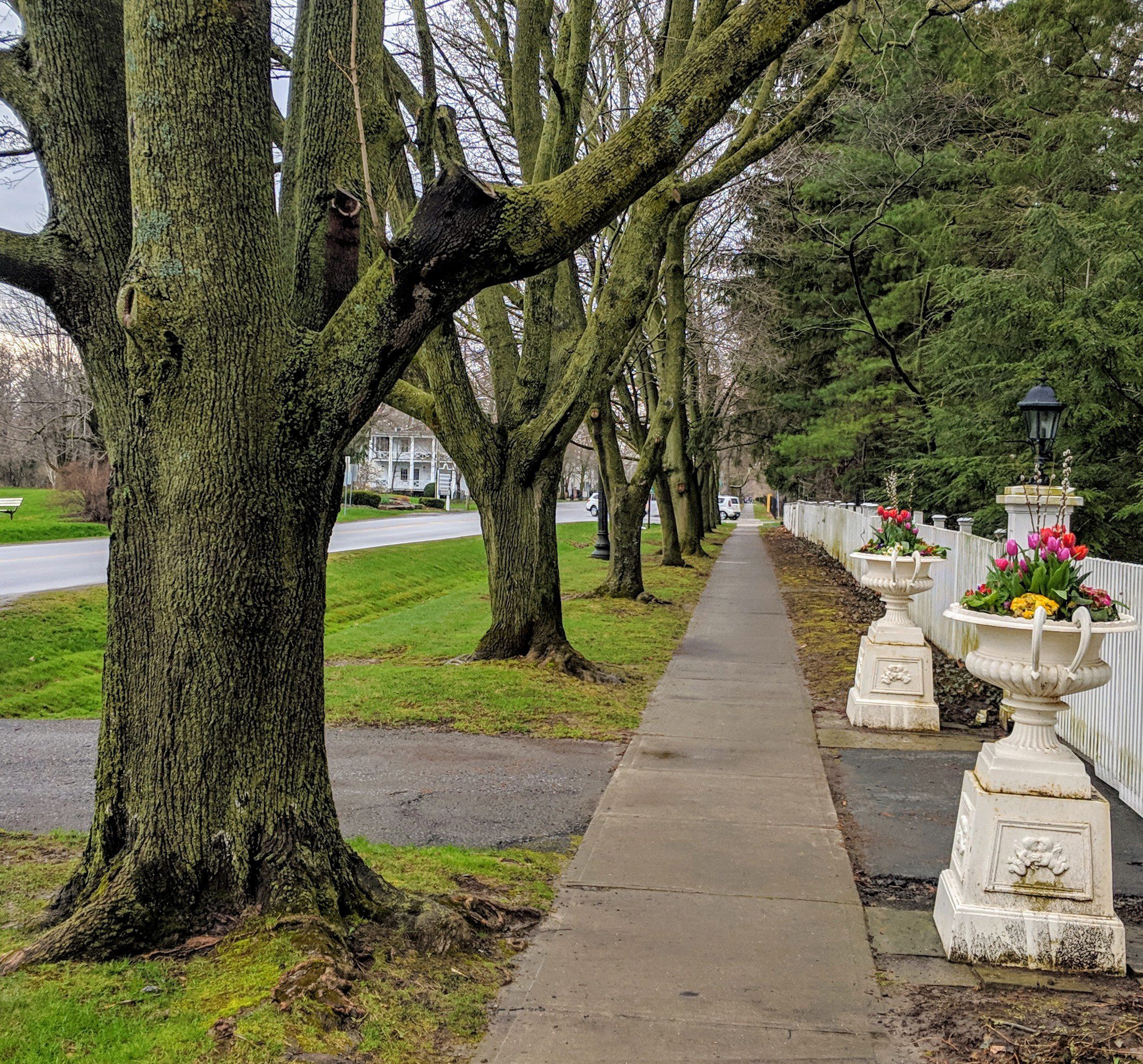
Each Friday we will explore different neighbourhoods, trails and parkland throughout Historic Niagara-on-the-Lake.
Moderate pace with some weeks entirely on sidewalks and roads while others may include a mix of trails and paved pathways. Great way to build up endurance for longer more strenuous hikes.
Plan to stay for conversation and a warm cup of coffee or tea at Sweets & Swirls, Community Centre, Niagara Stone Road, NOTL
Eco Hike Series #2 of 2 - Identifying Birds, Plants, Trees
https://hikesstaging.brucetrail.org/event/eco-hike-series-2-of-2-identifying-birds-plants-trees/Sorry, the registration cut-off time for this hike has been reached.Not a member? Click here to join today!Hosting Club: Dufferin Hi-Land
Category: General Hike
Location (Google Maps): Meet at Rock Hill parking lot on 1st Line EHS north of HWY 89, between 10 and 5 Sideroads, Mulmur Township.Hike Leader(s): Margery Cruise Click here to contact Hike Leader(s)
Pace: Leisurely
Terrain: Easy, Moderate
Distance: 5 kmDescription
We will explore the main trail and side trails (Enchanted Forest and Moss Haven) looking for wild flowers and listening for birds. We recommend that all participants download Merlin, Seek and iNaturalist apps to their phones. These apps will be used for identification of birdds, plants, trees.Directions: From HWY 10 and HWY 89, travel east on HWY 89 to 1st Line E in Mulmur to parking lot on east side, south of 10 sideroad.
Wildflower Hike with Barbara Palmer
https://hikesstaging.brucetrail.org/event/wildflower-hike-with-barbara-palmer/Sorry, the registration cut-off time for this hike has been reached.Not a member? Click here to join today!Hosting Club: Sydenham
Category: Botany Hike
Location (Google Maps): Small parking lot on 6th Concession S, south of Sideroad 6, north of km 23.1 (Map 29)Hike Leader(s): Barbara Palmer Click here to contact Hike Leader(s)
Pace: Leisurely: 3 km/h or less
Terrain: Easy: Mostly flat and good footing., Moderate: Some hills and/or poor footing, There might be muddy sections.Description
Join Barbara Palmer, a local amateur botanist, for an exploration of the wildflowers that make their home in Sydenham section. The warm weather this weekend will speed up the pace of spring, bringing more of the wildflowers out. This will be a leisurely hike with lots of stops to examine and identify the flowers and plants that we find along the trail. Bring sunscreen and bug spray. Approx. 2 hours.