
Hike Schedule
Join us for a hike! Registration required.
All hikes available to BTC members. Some hikes are open to non-members.
See Refund Policy for Paid Hikes >
TIP: The calendar view displays up to 7 hikes on a day, but often there are more. Click “View more events” to see them all.
Categories
- 07May 7, 2023
Car Hike: Clappison Woods To Smokey Hollow.
https://hikesstaging.brucetrail.org/event/car-hike-clappison-woods-to-smokey-hollow/Sorry, the registration cut-off time for this hike has been reached.Not a member? Click here to join today!Hosting Club: Toronto
Category: Car Hike
Location (Google Maps): We will meet each other in front of Walmart at 90 Dundas St E, Waterdown, Hamilton.Hike Leader(s): Mehrnoush Ahmadi; Minoo Namazi
Pace: Brisk, Moderate
Terrain: Challenging, Rocky
Distance: 19km.Description
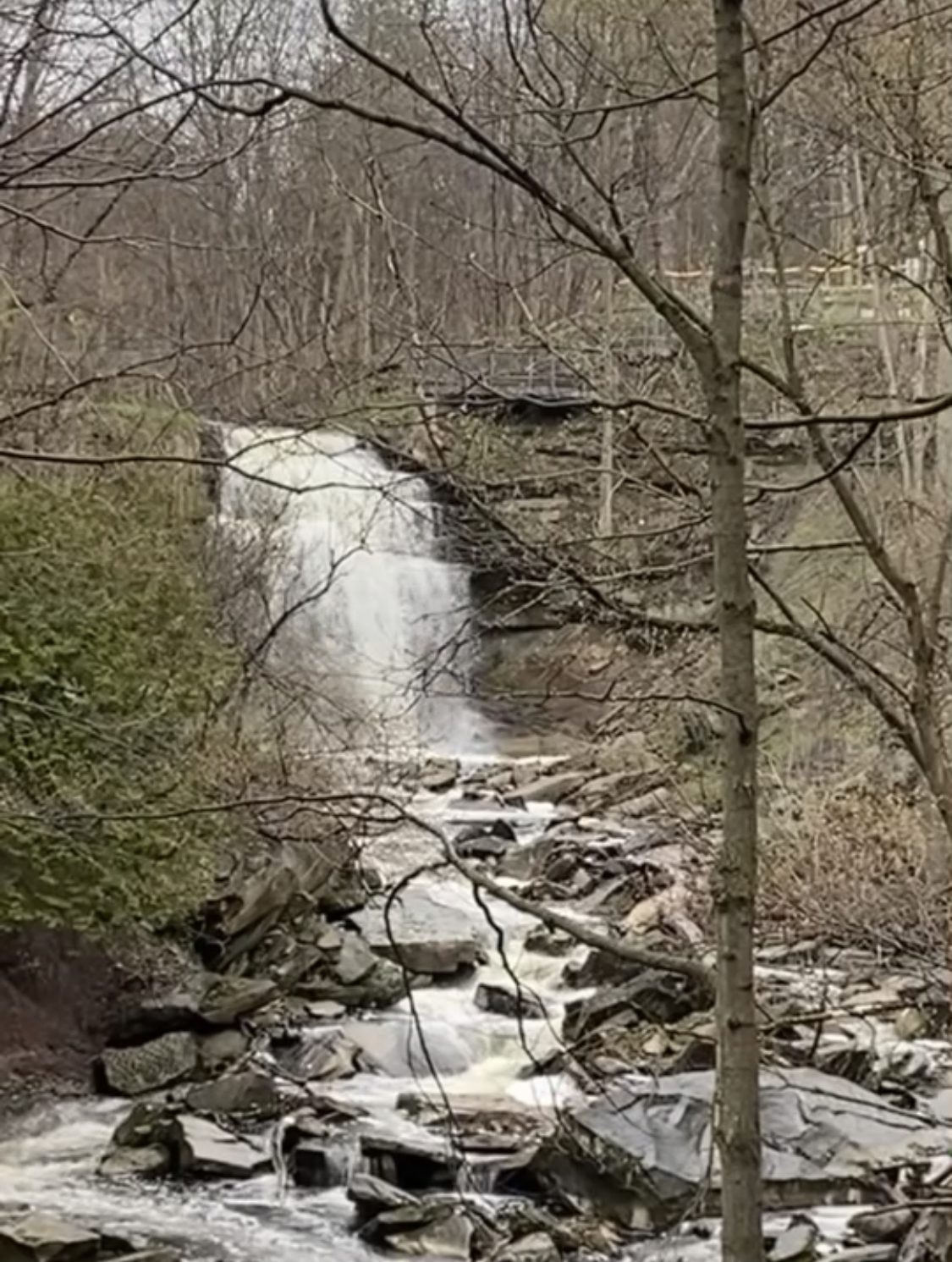
Welcome to Clappison Woods, where we’ll be embarking on a scenic hike with a stunning waterfall as our destination. The hike will take us on a winding spiral path through the woods, offering breathtaking views of the natural landscape.As we make our way towards Smoke Hollow Waterfall, we’ll traverse a rocky and sometimes muddy terrain. It’s important that all hikers come equipped with sturdy hiking boots to provide ample support and traction, as well as gaiters to keep the mud and rocks out of your shoes. Additionally, trekking poles will prove useful for maintaining balance and taking some pressure off your joints.
The hike will feature several short water breaks to keep us hydrated and energized throughout our journey. When we arrive at Smokey Hollow Waterfall, we’ll take a well-deserved half-hour break to rest our legs and enjoy the stunning natural beauty around us. Take a moment to savor a snack, and let the soothing sound of the waterfall wash over you.
Overall, this hike promises to be a challenging but rewarding adventure, filled with natural wonders and stunning views. Get ready to lace up your hiking boots and experience the beauty of Clappison Woods and Smoke Hollow Waterfall
Car Hike; Loop hike exploring Glasgow, Goodwood, Secord Forest Trails at Durham Region.
https://hikesstaging.brucetrail.org/event/car-hike-loop-hike-exploring-glasgow-goodwood-secord-forest-trails-at-durham-region/Sorry, the registration cut-off time for this hike has been reached.Not a member? Click here to join today!Hosting Club: Toronto
Category: Car Hike
Location (Google Maps): Meet in the parking lot east side of Concession 2, (Whitchurch-Stouffville), 200m south of Webb Rd. This is a free Parking lot.Hike Leader(s): Amir Alemohammad
Pace: Moderate
Terrain: Flat, Hilly, Variable
Distance: 14-16 KmDescription
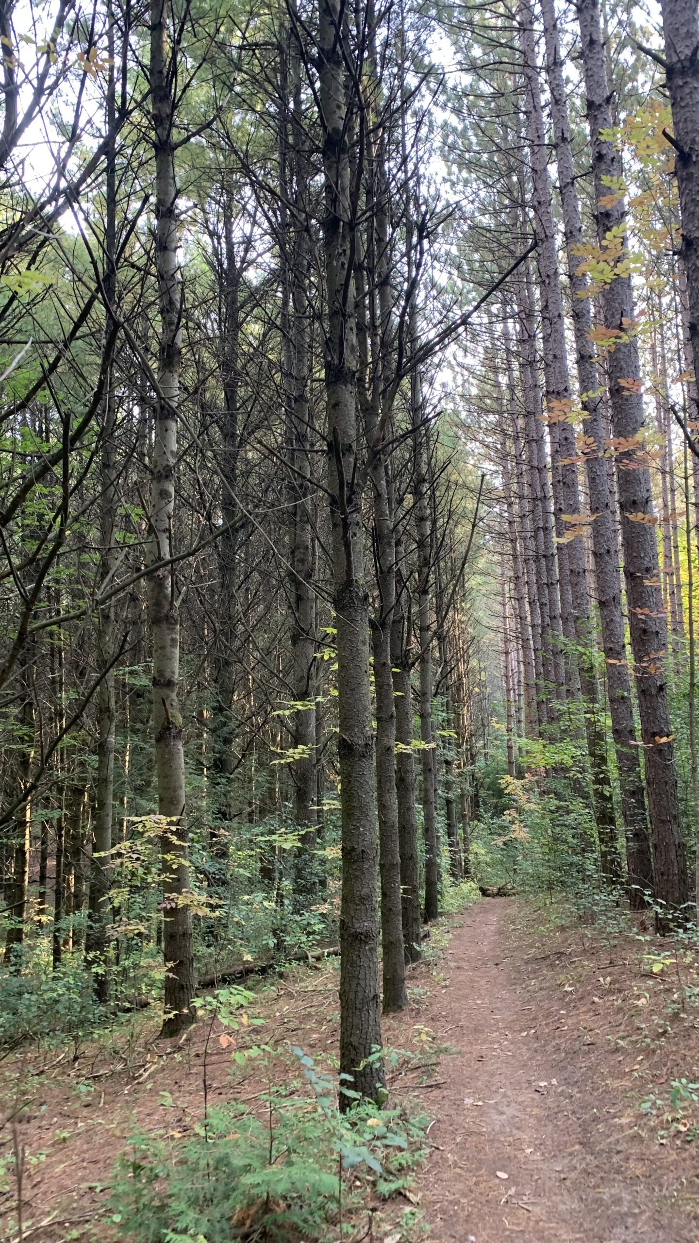
Join me to explore the nature of Goodwood and Secord Forest. The trail is fairly level lowland wetlands with many boardwalks making an otherwise inaccessible terrain traversable. There are a few meadows and upland woods thrown in there though. Although mostly a flat trail, expect some hills and sharp steep trails in between. In this season a mix of birds sounds and spring flowers adds to the beauty of the scene. Secord Forest, Pond and dog cemetery will be on our way to the hike. Bring at least two litters of water and your favorite snacks. Boots mandatory, poles highly recommended. Dress according to the spring humid. Be prepared for the rise of the bugs and make your spray ready on hand.
Prediction Hike
https://hikesstaging.brucetrail.org/event/prediction-hike/Sorry, the registration cut-off time for this hike has been reached.Not a member? Click here to join today!Hosting Club: Caledon Hills
Category: Prediction Hike Fundraiser
Location (Google Maps): Whitetail Refuge Nature Reserve a BTC Protected Natural Area
JUST SOUTH OF 754415 Mono Centre Road
Mono Centre, ONGoogle GPS Coordinates: 44.020487, -80.070738
Directions: From ON-10 turn east onto Dufferin Rd 8/Mono Centre Rd. Drive for approximately 5.0 km. Park on the field on the east side of the road as directed by volunteers.
From Airport Road/County Rd 18 turn west onto Dufferin Rd 8/Mono Centre Rd. Drive for 7.5 km. Park on the field on the east side of the road as directed by volunteers.
[/if 111]
Event Coordinator(s): Sandy Green & Sally Cohen Click here to contact Event Coordinator(s)
Terrain: Moderate – some hills and/or some poor footing
Distance: 7 km and 16 kmDescription
Plan for a fantastic FUN-filled time hiking with family and friends in the northern section of our trail. Choose to complete one of two predetermined hikes, a distance of approximately 7 km or 16km. Be ready to provide a personal ‘to-the-second’ prediction of how long it will take you to complete the distance. Go to http://caledonbrucetrail.ca/hiking/club-badges/prediction-hike-fundraiser-badge/ for specific route directions.Take lots of pictures, but remember NO peeking at time, pace, or distance technology during the hike. Participants hiking the longer distance will start between 8:30 am and 8:45 am and those hiking the shorter distance between 8:45 am and 9:00 am.
Light refreshments and beverages will be served at a mid location checkpoint and as part of a celebration at the end. Trail Marshalls will be situated along the trail to help with directions and other concerns.
The hikers in each distance category with the closest prediction to their actual time will be awarded a fabulous prize. Everyone will receive a spectacular collectible badge. This year’s new badge will be the final one of the series.
Legs of Sydenham May 2023 (Hike 3 of 3)
https://hikesstaging.brucetrail.org/event/legs-of-sydenham-may-2023-hike-3-of-3/Sorry, the registration cut-off time for this hike has been reached.Not a member? Click here to join today!Hosting Club: Iroquoia
Category: General Hike
Location (Google Maps):We will meet at Parking St Vincent-Sydenham townline just north of Highway 26. Approx KM 44.4 of Sydenham Section. Map 30.
Hike Leader(s): Karen Capindale-Smith Click here to contact Hike Leader(s)
Pace: Medium – 3 to 4 km/hr
Terrain: Moderate – Some hills and/or some poor footing
Distance: 21 kmDescription
This is the third of 3 legs in the Sydenham Section. Please see mate hikes on May 5 & 6. Join us for one hike or all. On this hike, we will meet at roadside Parking St Vincent-Sydenham townline just north of Highway 26. Approx KM 44.4 of Sydenham Section. Map 30. We will car shuttle to roadside parking on Irish Block Rd just north of Highway 26. Approx km 67 of Sydenham Section. Map 31. We will hike back to our meeting Point for a total of Approx 21 KM. Please bring water, snack, lunch and appropriate layered clothing. Carpooling recommended due to limited parking.Hike leader: Karen Capindale-Smith, kjcapindale@gmail.com. Please use cell (905-749-0914) for hike morning cancellations.
No Dogs Please. Rain or Shine.
Expect a baked goods surprise!

Walking Through Time – Book Launch & Geology Hike with Beth Gilhespy
https://hikesstaging.brucetrail.org/event/walking-through-time-book-launch-geology-hike-with-beth-gilhespy-3/Sorry, the registration cut-off time for this hike has been reached.Not a member? Click here to join today!Hosting Club: Beaver Valley
Location (Google Maps): Meet in the Johnston’s Sideroad parking area on the north side of the road, km 74.3, Map 26, Edition 30 of Bruce Trail Guide. Please follow the directions of the parking attendant.
Hike Leader(s): Glenda Collings Click here to contact the hike leader.
Pace: Leisurely
Terrain: Moderate, Some steep sections, Some rocky footing
Length of Hike: The hike will be approximately 1 1/2 hours.Description
You’ll join Beth Gilhespy, conservationist and long time Bruce Trail supporter for the launch of her book, “Walking Through Time – Exploring Niagara Escarpment Geology in the Beaver Valley Bruce Trail Section”. Chat with Beth and mingle with other hikers and geology lovers before you head out on a guided hike south to Hilt’s Falls, with commentary by Beth along the way. Books will be available for sale with the added bonus of a signed copy to treasure.COVID-19 Precautions Before, During and After your Hike
- Each hiker joining a Bruce Trail Club organized hike must perform a self-screening check before hiking.
Find Ontario’s self-assessment tool here: https://covid-19.ontario.ca/self-assessment/ - If you are experiencing COVID-19 symptoms, stay home.
- Personal Protective Equipment:
- Hikers may choose to wear masks.
- Wear sturdy footwear and appropriate attire for the weather and the terrain.
Hiking poles are a good idea in any season, especially if the terrain is rocky or slippery.
Wearing appropriate clothing and footwear prevents injuries and shows consideration for a safe and positive group hiking experience. - Always carry I.D. and your health card.
- Bring sufficient water and snacks (or lunch if indicated). A minimum of 1L of water is recommended.
- Bring sunscreen and insect repellent (for spring and summer hikes).
- Bring your own first aid kit.
- Please leave dogs at home.

Walking Through Time – Book Launch & Geology Hike with Beth Gilhespy
https://hikesstaging.brucetrail.org/event/walking-through-time-book-launch-geology-hike-with-beth-gilhespy-4/Sorry, the registration cut-off time for this hike has been reached.Not a member? Click here to join today!Hosting Club: Beaver Valley
Location (Google Maps): Meet in the Johnston’s Sideroad parking area on the north side of the road, km 74.3, Map 26, Edition 30 of Bruce Trail Guide. Please follow the directions of the parking attendant.
Hike Leader(s): Glenda Collings Click here to contact the hike leader.
Pace: Leisurely
Terrain: Moderate, Some steep sections, Some rocky footingDescription
You’ll join Beth Gilhespy, conservationist and long time Bruce Trail supporter for the launch of her book, “Walking Through Time – Exploring Niagara Escarpment Geology in the Beaver Valley Bruce Trail Section”. Chat with Beth and mingle with other hikers and geology lovers before you head out on a guided hike south to Hilt’s Falls, with commentary by Beth along the way. Books will be available for sale with the added bonus of a signed copy to treasure.COVID-19 Precautions Before, During and After your Hike
- Each hiker joining a Bruce Trail Club organized hike must perform a self-screening check before hiking.
Find Ontario’s self-assessment tool here: https://covid-19.ontario.ca/self-assessment/ - If you are experiencing COVID-19 symptoms, stay home.
- Personal Protective Equipment:
- Hikers may choose to wear masks.
- Wear sturdy footwear and appropriate attire for the weather and the terrain.
Hiking poles are a good idea in any season, especially if the terrain is rocky or slippery.
Wearing appropriate clothing and footwear prevents injuries and shows consideration for a safe and positive group hiking experience. - Always carry I.D. and your health card.
- Bring sufficient water and snacks (or lunch if indicated). A minimum of 1L of water is recommended.
- Bring sunscreen and insect repellent (for spring and summer hikes).
- Bring your own first aid kit.
- Please leave dogs at home.
Sunday Social Hike - Loop hike on Owen Sounds' West Rocks
https://hikesstaging.brucetrail.org/event/sunday-social-hike-loop-hike-on-owen-sounds-west-rocks/Sorry, the registration cut-off time for this hike has been reached.Not a member? Click here to join today!Hosting Club: Sydenham
Category: General Hike
Location (Google Maps):Parking at the north end of Georgian Bluffs Concession 3, north of km 98.7 (Map 32)
Hike Leader(s): Bill Snel Click here to contact Hike Leader(s)
Pace: Leisurely: 3 km/h or less
Terrain: Easy: Mostly flat and good footing., Moderate: Some hills and/or poor footing
Distance: 4 kmDescription
We will hike north to the Derby Forest Side Trail then east to the the escarpment edge above Owen Sound. Then south until we come out on concession 3 and then a short road piece back to our cars. For more information contact Bill Snel at w.snel2@gmail.com or call landline (519) 470-0584. If you are unable to register, please contact the leader to let him know you will be attending.
2:00pm AGM Nature Hike
https://hikesstaging.brucetrail.org/event/200pm-agm-nature-hike/Sorry, the registration cut-off time for this hike has been reached.Not a member? Click here to join today!Hosting Club: Niagara
Category: Citizen Science
Location (Google Maps): Fireman’s Park Lower Parking Lot, Dorchester Ave, Niagara FallsHike Leader(s): Niagara Hike Leader Click here to contact Hike Leader(s)
Pace: Leisurely
Terrain: Easy
Distance: 5kDescription
Join us for a pre AGM Nature Hike with the BTC Conservationist and 2 other hike leaders. We will hike the trails around Fireman’s Park and focus on floral and tree species identification.
We will split into groups of hikers as people arrive with a total of 3 hikes and a maximum of 25 per hike.
NBTC AGM follows
Dress for the weather and bring snacks and water.
NBTC Annual General Meeting
https://hikesstaging.brucetrail.org/event/nbtc-annual-general-meeting-2/Sorry, the registration cut-off time for this hike has been reached.Not a member? Click here to join today!Hosting Club: Niagara
Category: Register
Location (Google Maps): Upper parking lot of Firemen’s Park, 2275 Dorchester Road, Niagara Falls, OntarioDescription
Come out to meet the Niagara Bruce Trail Board as well as other members!Guest Speaker: Adam Brylowski, Manager of Conservation and Trail, Bruce Trail Conservancy
Learn what the board has done and what their future plans are. Make your voice heard.
Volunteer Appreciation Awards Presentation.
This event is outside. Please dress accordingly. Bring your own chair.
Stay for the BBQ ($5 fee). T-shirts, neck scarves and bumper stickers available to purchase. Cash or transfers accepted.
Registration Required.
- Each hiker joining a Bruce Trail Club organized hike must perform a self-screening check before hiking.
- 08May 8, 2023
Caledon Hills end to end 2 of 4
https://hikesstaging.brucetrail.org/event/caledon-hills-end-to-end-2-of-4/Sorry, the registration cut-off time for this hike has been reached.Not a member? Click here to join today!Hike open to BTC Members only.
Hosting Club: Niagara
Category: Car Pool
Location (Google Maps): Meet on Glenhaffy Rd. (km 35.2) and Coolihans Sideroad, carpool to km 16.1, Willoughby Rd.
Note, this hike had to be changed with the next hike(#3) because of road work on Escarpment RD.Hike Leader(s): Vince Zvonar Click here to contact Hike Leader(s)
Pace: Brisk
Terrain: Moderate
Distance: 19Description
Waterdown City Park to Smokey Hollow
https://hikesstaging.brucetrail.org/event/waterdown-city-park-to-smokey-hollow/Sorry, the registration cut-off time for this hike has been reached.Not a member? Click here to join today!Hosting Club: Iroquoia
Category: Happy Wanderers
Location (Google Maps):City View Park SOUTH parking lot off of Kerns Rd which runs south from #5 hwy
Hike Leader(s): Wayne Riley Click here to contact Hike Leader(s)
Pace: Medium – 3 to 4 km/hr
Terrain: Dependent on Conditions, Moderate – Some hills and/or some poor footing
Distance: 14 km +/-Description
We will head west from the City View parking lot returning using the King Rd side trail and on to Smokey Hollow then return to the parking lot.Hike leader: Wayne Riley RSVP thru the hike calendar
Cancellations the morning of the hike: 289-456-3498
Bring lunch, water, no dogs please, Hiking boots required
Duncan Crevice Caves & Metcalfe Rock Loop CANCELLED
https://hikesstaging.brucetrail.org/event/duncan-crevice-caves-metcalfe-rock-loop/Sorry, the registration cut-off time for this hike has been reached.Not a member? Click here to join today!Hosting Club: Beaver Valley
Location (Google Maps): Meet in the Metcalfe Rock parking area, 10th Line, just south of km 27.9, Map 25, Edition 30.
Hike Leader(s): Glenda Collings Click here to contact the hike leader.
Pace: Medium
Terrain: Moderate, Some rocky footing, Some steep sections, Strenuous
Length of Hike: 9 kmDescription
This is a popular loop hike taking in Metcalfe Rock, Duncan Crevices, Pinnacle Rock and Mill Creek. The leaves should be popping! Be prepared for some mud on the trail and bring snacks and water.COVID-19 Precautions Before, During and After your Hike
- Each hiker joining a Bruce Trail Club organized hike must perform a self-screening check before hiking.
Find Ontario’s self-assessment tool here: https://covid-19.ontario.ca/self-assessment/ - If you are experiencing COVID-19 symptoms, stay home.
- Personal Protective Equipment:
- Hikers may choose to wear masks
Transportation
It is the Bruce Trail Conservancy’s current policy that car shuttles are allowed. It is at the discrepancy of individual hike leaders to make that decision.
Other Guidelines
- Arrive 15 minutes before the start of the hike.
- Wear sturdy footwear and appropriate attire for the weather and the terrain.
Hiking poles are a good idea in any season, especially if the terrain is rocky or slippery. In winter, snowshoes or icers/crampons are needed when conditions dictate.
Wearing appropriate clothing and footwear prevents injuries and shows consideration for a safe and positive group hiking experience. - Always carry I.D. and your health card.
- Bring sufficient water and snacks (or lunch if indicated). A minimum of 1L of water is recommended on all hikes, and 3L is recommended for long, challenging hikes in the heat of the summer.
- Bring sunscreen and insect repellent (for spring and summer hikes).
- Bring your own first aid kit.
- Please leave dogs at home.
Dodds Hill loop
https://hikesstaging.brucetrail.org/event/dodds-hill-loop-5/Sorry, the registration cut-off time for this hike has been reached.Not a member? Click here to join today!Hosting Club: Sydenham
Category: General Hike
Location (Google Maps): Meet at 9:45 am at Kemble Arena parking lot to carpool to trail head. Limited parking at trail head. 5 minute drive from Kemble.Hike Leader(s): Carol Graham-Mullin Click here to contact Hike Leader(s)
Pace: Medium: 3 to 4 km/h
Terrain: Moderate: Some hills and/or poor footing, There might be muddy sections., There might be sections with water on the trail.
Distance: 4 km. approxDescription
We will hike from the trailhead at end of Concession Rd 24 and hike along the Dodd’s Hill sidetrail east, meet the main trail and head north along the scarp edge and west to the Dodd’s Hill sidetrail and loop back to the start. We may also add a short section west to see the view of the islands. If you are unable to register, please call or text the leader at 226-787-8804. - Each hiker joining a Bruce Trail Club organized hike must perform a self-screening check before hiking.
- 09May 9, 2023
8:00 NEW TIME Long Hike Wiley Road Short Hills
https://hikesstaging.brucetrail.org/event/800-new-time-long-hike-wiley-road-short-hills-2/Sorry, the registration cut-off time for this hike has been reached.Not a member? Click here to join today!Hosting Club: Niagara
Location (Google Maps):
Short Hills Wiley Road Entrance
Pace: Medium
Terrain: Moderate
: 10kmDescription
Explore Short Hills and the majestic side trails of Scarlett Tanager, Hemlock. Swayze Falls and Terrace. Register for each hike
Bring Poles water, snack, sunscreen and bug spray and dress for the weather
9:15 Short hike - Pelham Road, Short Hills
https://hikesstaging.brucetrail.org/event/915-short-hike-pelham-road-short-hills-42/Sorry, the registration cut-off time for this hike has been reached.Not a member? Click here to join today!Hosting Club: Niagara
Location (Google Maps): Pelham Road entrance, Short Hills Provincial Park
Hike Leader(s): janet davey Click here to contact Hike Leader(s)
Pace: Medium
Terrain: Moderate
Distance: 6 kmsDescription
Hike the main and side trails in Short Hills Provincial Park. Bring hiking boots, water and bug spray.Bognor Marsh Loop
https://hikesstaging.brucetrail.org/event/bognor-marsh-loop/Sorry, the registration cut-off time for this hike has been reached.Not a member? Click here to join today!Hosting Club: Sydenham
Category: General Hike
Location (Google Maps): Meet at roadside parking on 4th Concession North. Take 4th Concession N south from Highway 26, park at where the road ends (Map 31)Hike Leader(s): Fran Turner Click here to contact Hike Leader(s)
Pace: Brisk: 4 to 5 km/h
Terrain: Strenuous: Hilly with steep climbs and some poor footing.
Distance: 7 kmDescription
This hike circumnavigates the Bognor Marsh. This is a good place to see water birds including ducks, herons, egrets. We start at the top of the escarpment and hike down to the marsh. We’ll hike around the south end of the marsh – it can be quite muddy here so waterproof footwear is a must! From the west side of the marsh we’ll climb back up to the top of the escarpment and back to the cars. This hike includes steep uphill and downhill climbs. Poison ivy is found along the trail in one small area, so long pants are necessary. If you are unable to register, please call or text the leader at 519-590-0706.Hockley/Humber Valley
https://hikesstaging.brucetrail.org/event/hockley-humber-valley/Sorry, the registration cut-off time for this hike has been reached.Not a member? Click here to join today!Hosting Club: Dufferin Hi-Land
Category: Tuesday Hike
Location (Google Maps): Map 17, 43.4
7th Line Parking Lot, at Airport RdHike Leader(s): Julie Daley, Les Babbage, Inge Eckerich, Tony Evangelista Click here to contact Hike Leader(s)
Pace: Medium
Terrain: Moderate, Slippery and Steep Sections
Distance: 7 km, short hike 3.5 kmDescription
From the 7th Line Parking lot (43.4) we will hike south along the main trail to hwy 9, and return on the same route. There are some hills and steep sections. The spring wildflowers should be sprouting 😊 Short hike will be to 41.8, and return, no hills, 3.5 km. Please bring water and snackSpllt Rock Narrows plus Mono Cliffs
https://hikesstaging.brucetrail.org/event/spllt-rock-narrows-plus-mono-cliffs-2/Sorry, the registration cut-off time for this hike has been reached.Not a member? Click here to join today!Hosting Club: Caledon Hills
Category: Tuesday Hikers
Location (Google Maps): Split Rock Narrows parking lot. From Hwy 10, turn east on 25 Sideroad then north on 2nd line EHS.Hike Leader(s): Barbara Euler 416-578-1744 Click here to contact Hike Leader(s)
Pace: Medium – 3 to 4 km/hour
Terrain: Easy – mostly flat and usually good footing
Distance: 11 kmDescription
Since Mono Cliffs is often very busy, we will start and end our hike outside the boundaries of the provincial park. There is a variety of terrain and viewpoints and we hope to see some spring wildflowers. Lunch at McCarston’s Lake.Visitors and guests welcome.
- 10May 10, 2023
Blue Mountains E2E Hike #4 in a series of 6 hikes
https://hikesstaging.brucetrail.org/event/blue-mountains-e2e-hike-4-in-a-series-of-6-hikes/Sorry, the registration cut-off time for this hike has been reached.Not a member? Click here to join today!Hosting Club: Blue Mountains
Category: Organized Hike
Location (Google Maps): Hike meets in the parking lot behind Tim Hortons on First St. in Collingwood.Hike Leader(s): Mary-Lynne Chenard Click here to contact Hike Leader(s)
Pace: Medium – 3 to 4 km/hr
Terrain: Moderate – Some hills and/or some poor footing
Distance: 10.3kmDescription
We will park the cars at km 44.5 on the Osprey-Blue Mountains Townline and car shuttle to km 34.2 where we will begin the hike. The trail enters a maple forest and follows the Escarpment through a mixed hardwood forest and crosses a farmer’s field. The trail meanders through a mature forest and heads back to the edge of the Escarpment past a lookout point. Descending through a cut in the cliff, the trail drops steeply to a stream at the base of the Escarpment. Bring a snack or lunch and water. Don’t forget to log your hike! Map 22/23 Edition 30Waterdown City Park to #5 hwy
https://hikesstaging.brucetrail.org/event/waterdown-city-park-to-5-hwy/Sorry, the registration cut-off time for this hike has been reached.Not a member? Click here to join today!Hosting Club: Iroquoia
Category: Hikers R Us
Location (Google Maps):City View Park SOUTH parking lot off of Kerns Rd which runs south from #5 hwy
Hike Leader(s): Wayne Riley Click here to contact Hike Leader(s)
Pace: Medium – 3 to 4 km/hr
Terrain: Dependent on Conditions, Moderate – Some hills and/or some poor footing
Distance: 12 km +/-Description
We will head east from the parking lot and stop at #5 hwy returning to the parking lot using the Ian Reid side trail.Hike leader: Wayne Riley RSVP thru the hike calendar
Cancellations the morning of the hike: 289-456-3498
Bring lunch, water, no dogs please, Hiking boots required
Firemans Park crazy eights
https://hikesstaging.brucetrail.org/event/firemans-park-crazy-eights/Sorry, the registration cut-off time for this hike has been reached.Not a member? Click here to join today!Hosting Club: Niagara
Category: Loop
Location (Google Maps): Fireman’s ParkHike Leader(s): Heather Howkins Click here to contact Hike Leader(s)
Pace: Medium
Terrain: Moderate
Distance: 8kDescription
Meet in upper Parking lot off Dorchester Rd – we will make a crazy eight loop through the parkPlease bring a snack and water .

Spring Wildflowers
https://hikesstaging.brucetrail.org/event/spring-wildflowers/Sorry, the registration cut-off time for this hike has been reached.Not a member? Click here to join today!Hosting Club: Iroquoia
Category: Good Companions
Location (Google Maps): Hilton Falls Conservation Area, Camp.Belleville Rd. East of Guelph LineHike Leader(s): Anne Armstrong Click here to contact Hike Leader(s)
Pace: Leisurely – 3km/hr or less
Terrain: Moderate – Some hills and/or some poor footing
Distance: 8kmDescription
Hilton Falls is rich with flora at this time of year. We will follow a little used route to a lovely flooded marsh area with lots of wildflowers and a good patch of Walking Fern. Time permitting we will visit another area of great wildflower sightings. Bring water, a snack/lunch, sunscreen and insect repellent. Poles will be useful. Make a registration through Halton Conservation Authority.
Leader: Anne Armstrong 905 617 3937 hikingrandma@gmail.comPull Party - removing invasives along the trail
https://hikesstaging.brucetrail.org/event/pull-party-removing-invasives-along-the-trail/Sorry, the registration cut-off time for this hike has been reached.Not a member? Click here to join today!Hosting Club: Niagara
Category: Event Hikes
Location (Google Maps): St Paul St Niagara Falls, north of Mountain Rd. Park on west side of road to enterHike Leader(s): Mary-Lyn Hopper Click here to contact Hike Leader(s)
Terrain: Easy
Description