
Hike Schedule
Join us for a hike! Registration required:
All hikes available to BTC members. Some hikes are open to non-members.
TIP: The calendar view displays up to 7 hikes on a day, but often there are more. Click “More events” to see them all.
Categories
- 20May 20, 2023

Saturday Only Niagara End to End
https://hikesstaging.brucetrail.org/event/saturday-only-niagara-end-to-end/Sorry, the registration cut-off time for this hike has been reached.Not a member? Click here to join today!Hosting Club: Niagara
Category: Event Hikes
Location (Google Maps):Saturday May 20: Lions Swimming Pool Elm St, Grimsby 43.193664, -79.564864
Terrain: Moderate
Distance: 25Description
This is the NBTC Annual End to End Event Day 1 Only from Balls Falls to Grimsby
Participants will be transported by bus from check in to the start of the hike and will hike at their own pace to the final checkpoint.It is a self led hike Day 1 25 k: https://www.plotaroute.com/route/994249?units=km
Bring snacks, water and bug spray.
We would also recommend sunscreen, basic first aid supplies, spare socks and a cell phone.
There will be 3 checkpoints on each day along the trail to replenish water and snacks and anyone wishing to drop out of the hike should do so where possible at the checkpoint. Trail angels will also be available should hikers become incapacitated and unable to reach a checkpoint. Hikers are responsible for informing the Organizing Niagara Personnel of their intention to drop out.
3 DAY Niagara End to End
https://hikesstaging.brucetrail.org/event/3-day-niagara-end-to-end/Sorry, the registration cut-off time for this hike has been reached.Not a member? Click here to join today!This is a Multi-Day Hike
You are signing up for the following dates and times:
2023-05-20 at 07:00
2023-05-21 at 07:00
2023-05-22 at 07:00Hosting Club: Niagara
Category: Event Hikes
Location (Google Maps):Saturday May 20: Lions Swimming Pool Elm St, Grimsby 43.193664, -79.564864
Sunday May 21: Brock University Parking Lot Merrittville Highway, St Catharines 43.115423, -79.247160
Monday May 22: Queenston Heights Park, Niagara Parkway, Niagara-on-the-Lake, ON 43.1593144, -79.055405Terrain: Moderate
Distance: 83.3Description
This is the NBTC Annual End to End Event over 3 days from Grimsby to Queenston.
Participants will be transported by bus from check in to the start of the hike and will hike at their own pace to the final checkpoint.It is a self led hike Day 1 25 k: https://www.plotaroute.com/route/994249?units=km
Day 2 27k : https://www.plotaroute.com/route/994840?units=km
Day 3 28k :https://www.plotaroute.com/route/995636?units=kmBring snacks, water and bug spray.
We would also recommend sunscreen, basic first aid supplies, spare socks and a cell phone.
There will be 3 checkpoints on each day along the trail to replenish water and snacks and anyone wishing to drop out of the hike should do so where possible at the checkpoint. Trail angels will also be available should hikers become incapacitated and unable to reach a checkpoint. Hikers are responsible for informing the Organizing Niagara Personnel of their intention to drop out.Car Hike: Bethesda Trail Richmond Hill
https://hikesstaging.brucetrail.org/event/car-hike-bethesda-trail-richmond-hill-10/Sorry, the registration cut-off time for this hike has been reached.Not a member? Click here to join today!Hosting Club: Toronto
Location (Google Maps): Meet at Bethesda Trail Head Parking on Bethesda Sideroad off Bayview Avenue, across from Lake Wilcox. This parking lot is free.
Hike Leader(s): Mohammad Aghamiri Click here to contact Hike Leader(s)
Pace: Moderate
Terrain: Variable
Distance: 14-17KMDescription
Join us to explore Jefferson Forest and Bond lake ,Right time to see thousands of Trillium wild flowers covering more than hundred acres of the forest,
we will repeat this hike possibly 2 more times to see these beautiful wild flowers growing.
Please bring hiking poles, proper closing and shoes and lots of water,
Please carefully read safety procedures during the hike:
1-Hikers must stay between the leader and the sweep.
2-Hikers must advise the leader or the sweep if they wish to leave the group.
3- Hikers must follow the whistle instructions: 1 blast- stay where you are; 2 blasts come to the leader; 3 blasts – come to the leader quickly.
4-Hike leader may request volunteers to stop at trail intersections, they need to help hikers to the direction the group walk and wait till they see the sweep .
5-Hikers have to make sure they can see the persons behind and in front of them.
Hiker Initiation Program (H.I.P.) Bus Hike - Scotsdale Farm (Introductory Hike)
https://hikesstaging.brucetrail.org/event/hiker-initiation-program-h-i-p-introductory-hike-scotsdale-farm/Sorry, the registration cut-off time for this hike has been reached.Not a member? Click here to join today!Trip Information
Departure Time: 08:30
Return to City Time: 16:30
Departure Point: York Mills Bus PickupOptional Items
Hosting Club: Toronto
Category: Bus Hike
Location (Google Maps): Scotsdale Heritage FarmThe Bus will depart from the north side of York Mills Road just east of Yonge Street in front of the York Mills Centre opposite the Shell gas station. Look for the yellow school bus.
Several other groups depart from this location so verify that it is the Bruce Trail Bus before boarding.Hike Leader(s): Tom Swales,George Lennon, Tanya Cora, Danny Pivnick
Pace: Moderate (3-4 km/hr)
Terrain: Rocky, Variable
Distance: 7 – 12 kmDescription
Join us for an introductory hike suitable for beginners at scenic Scottsdale Farm near Georgetown. We will hike on the Bruce Trail and side trails in the area for a distance of 10-12 km. Bruce Trail Reference Guide Map # 13We will be on the trail for around 4 hours, so bring lunch, snack and at least 1.5 L of water. We’ll hike a circular route on trails which include the main Bruce Trail, Bennett Heritage Trail, and Maureen smith Side Trails. Expect variable terrain with a few hills, rocky spots. Hiking Boots are strongly recommended. Bring gear appropriate for the weather conditions of the day. Toronto Bruce Trail Club hikes go rain or shine. Those that want a shorter hike will have an option of a 7 km hike.
The Bus Fare will be provided at the reduced rate of $20.00 (to be prepaid online by credit card upon registration). Children under 12 are free. Please note that participants are required to wear a mask on the bus.
This introductory hike is part of the 2023 Hiker Initiation Program hosted by Toronto Bruce Trail Club (TBTC). An information webinar will be held Monday May 15th at 6:30 PM where TBTC hike leaders will speak on reasons to hike, the Bruce Trail, our hiking activity program, biodiversity, and how to enjoy the trail responsibly. If you are new to hiking and/or the Bruce Trail consider registering for this presentation. You may register for the Webinar here: https://us02web.zoom.us/webinar/register/WN_fc7gzs0DQNaKZBLT4iod6w
Members are encouraged to bring a friend that have expressed interest in hiking but haven’t had the chance to hike with the club.
We’ll have a refreshment stop in Georgetown before heading back to the city. We expect to arrive back at York Mills Subway by 4:30 depending on the traffic.
Hiker Initiation Program (H.I.P) Scotsdale Farm Car Hike
https://hikesstaging.brucetrail.org/event/hiker-initiation-program-h-i-p-scotsdale-farm-car-hike/Sorry, the registration cut-off time for this hike has been reached.Not a member? Click here to join today!Hosting Club: Toronto
Category: TBTC Special Events
Location (Google Maps):Scotsdale Heritage Farm Parking Area. From Hwy 401 at Exit 328 take Trafalgar Rd north for 10 km to where Trafalgar joins Hwy 7 at traffic lights. Turn left and follow for 3 km until Hwy 7 swings left. At that point continue straight ahead on Trafalgar for 2 km. Entrance to Scotsdale Farm is on your right. Look for the blue sign. BTC Reference Guide Map 13. Address: 13807 Trafalgar Road.
Cell #’s for Hike Leaders – Peter (905) 301-4091, Liz Hemmerick (416) 805-6729
Hike Leader(s): Peter Leeney, Sajedeh Zahraei, Liz Hemmerick, Natalia Svechnikova Click here to contact Hike Leader(s)
Pace: Leisurely
Terrain: Rocky, Variable
Distance: 10KM+Description
This introductory hike is part of the 2023 Hiker Initiation Program hosted by Toronto Bruce Trail Club (TBTC). The are multiple events included in this program:1 – Hiking Information Session Webinar – Monday May 15, 6:30pm – 8:00pm
An overview of the Bruce Trail and the ins-and-outs of hiking presented by our experienced Hike Leaders. Register for the Webinar here: https://us02web.zoom.us/webinar/register/WN_fc7gzs0DQNaKZBLT4iod6w2 – Car Hike – Scotsdale Farm – Saturday May 20 - Venture out by car for scenic 10 km loop hike on the Main Bruce Trail and Side Trails at Silver Creek Conservation Area.
3 – Bus Hike – Scotsdale Farm – Saturday May 20 – Venture out by bus for scenic hike on the Main Bruce Trail and Side Trails at Silver Creek Conservation Area.
4 — Everyone is welcome to participate in any of the above events. Registration for the Webinar is through this link: https://us02web.zoom.us/webinar/register/WN_fc7gzs0DQNaKZBLT4iod6w. Registration for all hikes is through the Bruce Trail Conservancy Hike Calendar. All hikes are free of charge except for the Bus Hike to which a $20 Return Bus Fare (payable by Credit Card upon registration) applies.
Please arrive for the Hike by 8:40am to attain a parking spot and give yourself time to get ready. The group will depart at 9:00am. We will be at the trail for around 4 hours, so bring lunch, snack and at least 1.5 L of water.
We’ll hike a circular route on trails around Scotsdale Farm near Georgetown which include the main Bruce Trail and Side Trails. Expect variable terrain with a few hills, rocky spots. Hiking Boots are strongly recommended. Bring gear appropriate for the weather conditions of the day. Our hikes go rain or shine except in the event of hazardous conditions.
This is a “Car Hike” which means hikers provide their own transportation to the trail. Hikers without access to a car should plan to join the Bus Hike the same day.
East Linton, Frank Holley, Ron Savage Side Trail Loop
https://hikesstaging.brucetrail.org/event/east-linton-frank-holley-ron-savage-side-trail-loop/Sorry, the registration cut-off time for this hike has been reached.Not a member? Click here to join today!Hosting Club: Sydenham
Category: General Hike
Location (Google Maps): The Owen Sound Galaxy Theatre parking lot. Meet at the tall “Galaxy Centre” sign next to the traffic lights.Hike Leader(s): Franziska Edney Click here to contact Hike Leader(s)
Pace: Medium: 3 to 4 km/h
Terrain: Moderate: Some hills and/or poor footing, Strenuous: Hilly with steep climbs and some poor footing.
Distance: 8.2 kmsDescription
We will climb to the top of the escarpment, then follow the white trail, and return via the Ron Savage and Frank Holley Side Trail. This is a beautiful wooded area with many crevices and interesting rock formations. Poles advised, bring a snack if you wish. If you are unable to register, please call or text the leader at 519 379 2573.Urban Walk: Leslie Street Spit Bird Watching
https://hikesstaging.brucetrail.org/event/urban-walk-leslie-street-spit-bird-watching/Sorry, the registration cut-off time for this hike has been reached.Not a member? Click here to join today!Hosting Club: Toronto
Category: Urban Walk
Location (Google Maps):Entrance to Tommy Thompson Park at Leslie St and Unwin Ave.
Hike Leader(s): Ray Berzins Click here to contact Hike Leader(s)
Pace: Leisurely
Terrain: Flat
Distance: 7 kmDescription
For first 3.5 km we will try to observe as much as possible along natural footpaths, so wear long pants, long stockings and whatever else will protect you from ticks. Bring binoculars. After lunch the nature walk will end and hikers can use the Multi-use Trail to continue walking to the end of the spit or return back to the park entrance by 2PM. It will be cooler and more windy than inland so bring warm clothing and a warm beverage with your lunch.
#1/5 Loop of Toronto Hike for Urban Hiking Badge - 15km
https://hikesstaging.brucetrail.org/event/1-5-loop-of-toronto-hike-for-urban-hiking-badge-15km/Sorry, the registration cut-off time for this hike has been reached.Not a member? Click here to join today!Hosting Club: Toronto
Category: Urban Walk
Location (Google Maps): Southwest corner of Yonge Street & Queens Quay WHike Leader(s): Alina Lin
Pace: Moderate
Terrain: Flat
Distance: 15kDescription
Embark on a captivating journey through Toronto’s remarkable urban trail systems. From the scenic Don River in the east to the captivating Waterfront in the south, the tranquil Humber River in the west, and the enchanting Finch Corridor in the north, this diverse collection of trails offers an unforgettable opportunity to explore the city’s longest trails on foot.
By interconnecting these four trail systems, which weave through more than ten parks and trails, we are creating an awe-inspiring loop spanning approximately 74 kilometers. As a testament to your accomplishment, completing the entire loop will earn you the Toronto Urban Hiking Badge—the first ever urban hiking badge launched by the Toronto Bruce Trail Club.
Distance: 15km. Start from Yonge & Queens Quay and end at Old Mills Station.
Pace: 4kph
Trail condition: mostly flat and paved.
Bring water and snacks. Dress and prepare for the weather.

Hiker Initiation Program (H.I.P.) – Hiking Tips and Basic Survival Skills, and Urban Hike in High Park
https://hikesstaging.brucetrail.org/event/hiker-initiation-program-h-i-p-hiking-tips-and-basic-survival-skills-and-urban-hike-in-high-park/Sorry, the registration cut-off time for this hike has been reached.Not a member? Click here to join today!Hosting Club: Toronto
Category: TBTC Special Events
Location (Google Maps): High Park Nature Centre
375 Colborne Lodge Dr, Toronto ON M6S 0A4
(next to the Tennis Courts)Hike Leader(s): Marie-Josée Roy Click here to contact Hike Leader(s)
Pace: Leisurely
Terrain: Variable
Distance: n/aDescription
Let’s get started on the right (hiking) foot! Join us for a workshop on hiking tips and basic survival skills. Topics covered: proper gear/clothing/footwear; essentials to carry in your backpack; priority survival skills; First Aid; communication; navigation; and more. The workshop will be followed by a 1-hour hike in beautiful High Park.This hike is part of the 2023 Hiker Initiation Program hosted by the Toronto Bruce Trail Club
On Monday May 15th those new to the Bruce Trail and hiking are invited to join experienced Hike Leaders for a Webinar Introductory Session to learn the reasons to hike, about the Bruce Trail, our hiking activity program, biodiversity, and how to enjoy the trail responsibly. You may register for the Webinar here: https://us02web.zoom.us/webinar/register/WN_fc7gzs0DQNaKZBLT4iod6w
to learn about the Bruce Trail,
- 21May 21, 2023
Sunday Only Niagara End to End
https://hikesstaging.brucetrail.org/event/sunday-only-niagara-end-to-end/Sorry, the registration cut-off time for this hike has been reached.Not a member? Click here to join today!Hosting Club: Niagara
Category: Event Hikes
Location (Google Maps):Sunday May 21: Brock University Parking Lot Merrittville Highway, St Catharines 43.115423, -79.247160
Terrain: Moderate
Distance: 27.1Description
This is the NBTC Annual End to End Event over 3 days from Grimsby to Queenston.
You are registering for Day 2 Only
Participants will be transported by bus from check in to the start of the hike and will hike at their own pace to the final checkpoint.It is a self led hike
Day 2 27k : https://www.plotaroute.com/route/994840?units=kmBring snacks, water and bug spray.
We would also recommend sunscreen, basic first aid supplies, spare socks and a cell phone.
There will be 3 checkpoints on each day along the trail to replenish water and snacks and anyone wishing to drop out of the hike should do so where possible at the checkpoint. Trail angels will also be available should hikers become incapacitated and unable to reach a checkpoint. Hikers are responsible for informing the Organizing Niagara Personnel of their intention to drop out.Caledon Hills E2E Hike #5- Hockley Valley to Mono Cliffs
https://hikesstaging.brucetrail.org/event/caledon-hills-e2e-hike-5-hockley-valley-to-mono-cliffs/Sorry, the registration cut-off time for this hike has been reached.Not a member? Click here to join today!Hike open to BTC Members only.
Hosting Club: Dufferin Hi-Land
Category: General Hike
Location (Google Maps): Red P BTC parking on 3rd Line EHS north of Hockley Road at the start of the Glen Cross Side Trail. BTC Map 18.Hike Leader(s): Stuart Law Click here to contact Hike Leader(s)
Pace: Medium
Terrain: Dependent on Conditions, Slippery Sections Likely, Strenuous
Distance: 19 kmsDescription
Join us on our final Humane Hiking hike to complete the Caledon Hills section. We journey from the big hills of the Hockley Valley to the beautiful trails of Mono Cliffs Provincial Park taking in the main trail and the Glen Cross, South Outlier, Walter Tovell, Lookout and Laidlaw Side Trails. Please bring 2.5L of water, a garbage bag and extra footwear for the shuttle, bug spray, a snack, a lunch, an appreciation of nature and a smile.
Car Hike: Springtime Family Hike at Silver Creek
https://hikesstaging.brucetrail.org/event/car-hike-springtime-family-hike-at-silver-creek/Sorry, the registration cut-off time for this hike has been reached.Not a member? Click here to join today!Hosting Club: Toronto
Category: Car Hike
Location (Google Maps): We will meet at the parking lot of the Silver Creek Outdoor Education Centre.Hike Leader(s): Monica Pasquali, Andrew Proczek Click here to contact Hike Leader(s)
Pace: Leisurely
Terrain: Variable
Distance: 4.5 km, with the option to drop out at 3 kmDescription
Enjoy the sights, sounds, and smells of spring with a leisurely, family-friendly nature hike in the Silver Creek Conservation Area! After meeting at the Silver Creek Outdoor Education Centre parking lot at 10 am, we will walk north along the main trail, climbing the escarpment as we go, and then we will turn around and walk back south going downhill via the Roberts Side Trail, making a 3 km loop. For those who would like to extend their hike, they can join us on an additional loop that includes the Irwin Quarry Side Trail going up and the main trail going down, which will add an additional 1.5 km to the day’s hiking distance. Children under 13 years of age are encouraged to join their parents/guardians on this hike so they can fulfill the requirements for the Toronto Bruce Trail Club’s Youth Badge – all family members who are planning on joining us should register for the hike, including children. You should bring enough water and food for a 2-hour hike, comfortable hiking shoes, sun and bug protection, appropriate clothing for the weather, and good observational skills so we can spot lots of flora, fauna, and fungi while we hike. Please note that the trail is quite rocky and hilly in places, and is therefore not stroller-friendly, so any children who join us should be capable of walking on their own or be carried comfortably by their parents/guardians for the duration of the hike.Sunday Social Hike - Above Colpoys Bay
https://hikesstaging.brucetrail.org/event/above-colpoys-bay/Sorry, the registration cut-off time for this hike has been reached.Not a member? Click here to join today!Hosting Club: Sydenham
Category: General Hike
Location (Google Maps): The Owen Sound Galaxy Theatre parking lot. Meet at the tall “Galaxy Centre” sign next to the traffic lights.Hike Leader(s): Danuta Valleau Click here to contact Hike Leader(s)
Pace: Medium: 3 to 4 km/h
Terrain: Moderate: Some hills and/or poor footing
Distance: 6 kmDescription
Following the Curley Harnden Side Trail, we walk along the forest track to the escarpment edge, turn right to follow the main trail for 2 km, then follow the Len Holley Side Trail for another 1.6 km to the parked cars.Bring bug repellent, sunscreen, water and snacks. Walking poles or sticks are helpful. If you are unable to register, please call or text Danuta Valleau at 519-378-5630 to let her know you are coming.
- 22May 22, 2023

Monday only Niagara End to End
https://hikesstaging.brucetrail.org/event/monday-only-niagara-end-to-end/Sorry, the registration cut-off time for this hike has been reached.Not a member? Click here to join today!Hosting Club: Niagara
Category: Event Hikes
Location (Google Maps):Monday May 22: Queenston Heights Park, Niagara Parkway, Niagara-on-the-Lake, ON 43.1593144, -79.055405
Terrain: Moderate
Distance: 28Description
This is the NBTC Annual End to End Event over 3 days from Grimsby to Queenston.
You are Registering for Monday only
Participants will be transported by bus from check in to the start of the hike and will hike at their own pace to the final checkpoint.It is a self led hike
Day 3 28k :https://www.plotaroute.com/route/995636?units=kmBring snacks, water and bug spray.
We would also recommend sunscreen, basic first aid supplies, spare socks and a cell phone.
There will be 3 checkpoints on each day along the trail to replenish water and snacks and anyone wishing to drop out of the hike should do so where possible at the checkpoint. Trail angels will also be available should hikers become incapacitated and unable to reach a checkpoint. Hikers are responsible for informing the Organizing Niagara Personnel of their intention to drop out.
Clappison Woods to Smokey Hollow MAP 9
https://hikesstaging.brucetrail.org/event/clappison-woods-to-smokey-hollow-map-9-2/Sorry, the registration cut-off time for this hike has been reached.Not a member? Click here to join today!Hosting Club: Iroquoia
Category: General Hike
Location (Google Maps): Park at Clappison Corners Walmart Parking Lot -east side -also parking lot above near Dollar Tree-we will meet in the grassy area between parking lotsHike Leader(s): Cathie Green Click here to contact Hike Leader(s)
Pace: Medium – 3 to 4 km/hr
Terrain: Moderate – Some hills and/or some poor footing
Distance: Approximately 12 kmsDescription
There and Back through Clappison Woods – we will follow that along to Grindstone Creek and Smokey Hollow FallsSome steep and rocky trail as well as staircase to view the Great Falls – Pack water, snack, wear weather appropriate clothing, hiking poles, boots recommended as well as bug spray
- 23May 23, 2023
8:00 NEW TIME Long Hike Wiley Road Short Hills
https://hikesstaging.brucetrail.org/event/800-new-time-long-hike-wiley-road-short-hills-4/Sorry, the registration cut-off time for this hike has been reached.Not a member? Click here to join today!Hosting Club: Niagara
Location (Google Maps):
Short Hills Wiley Road Entrance
Pace: Medium
Terrain: Moderate
: 10kmDescription
Explore Short Hills and the majestic side trails of Scarlett Tanager, Hemlock. Swayze Falls and Terrace. Register for each hike
Bring Poles water, snack, sunscreen and bug spray and dress for the weather
Spring Birds and Blooms
https://hikesstaging.brucetrail.org/event/spring-birds-and-blooms/Sorry, the registration cut-off time for this hike has been reached.Not a member? Click here to join today!Hosting Club: Peninsula
Location (Google Maps): Meet up at Dyers Bay Parking Lot 45.162455727854116, -81.34088304473234 . We will carpool to Britain Lake Road to Lillie Parking area km 113.4. Parking fees may be in effect for non-resident vehicles at Dyers Bay.
Hike Leader(s): Marg Glendon Click here to contact Hike Leader(s)
Pace: Leisurely
Terrain: Easy, Moderate
Distance: ~1.5 km with possibility of extended the hike distance, if time allows.Description
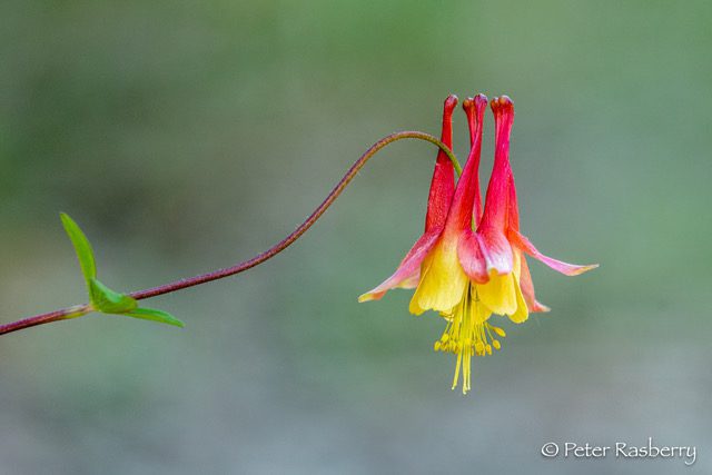
Join Peter Rasberry for a leisurely Spring hike on the Cottrill Lake Side Trail. This lovely sidetrail winds 1.4km through both mixed and hardwood forest, and along the shore of this small inland lake. This should be peak time for both spring wildflowers, and bird migration, so it will be a leisurely walk focusing on the identification and appreciation of both! If time permits, we will have the option of adding on the Anne and Clayton Roberts Side Trail.We will meet at the parking lot in Dyers Bay 45.162455727854116, -81.34088304473234 at 9:00 am, and car pool out the Britain Lake Road to the start of our hike at the Lillie Parking area km 113.4. Parking fees may be in effect for non-resident vehicles at Dyers Bay. Dress appropriately, bring snacks, water, cameras, binoculars and field guides. Insect repellant might also be useful.
This hike (including car pooling) is approximately 3 hours in duration.
9:15 Short hike - Pelham Road, Short Hills
https://hikesstaging.brucetrail.org/event/915-short-hike-pelham-road-short-hills-44/Sorry, the registration cut-off time for this hike has been reached.Not a member? Click here to join today!Hosting Club: Niagara
Location (Google Maps): Pelham Road entrance, Short Hills Provincial Park
Hike Leader(s): janet davey Click here to contact Hike Leader(s)
Pace: Medium
Terrain: Moderate
Distance: 6 kmsDescription
Hike the main and side trails in Short Hills Provincial Park. Bring hiking boots, water and bug spray.Forks of the Credit
https://hikesstaging.brucetrail.org/event/forks-of-the-credit-15/Sorry, the registration cut-off time for this hike has been reached.Not a member? Click here to join today!Hosting Club: Caledon Hills
Category: Tuesday Hikers
Location (Google Maps): Mississauga Rd. intersection with Elora-Cataract Trailway.
Driving direction: From Highway 401, north on Mississauga Rd., pass through Belfountain village, after crossing Cataract Rd. and Elora-Cataract Trailway, park on either side of the road.
Alternate: North on Highway 410, continue on Highway 10, at Caledon Village, left on Charleston Sideroad (24), left on Mississauga Rd., drive 2 km to the roadside parking.Hike Leader(s): Mohammad Shafiq Click here to contact Hike Leader(s)
Pace: Medium – 3 to 4 km/hour
Terrain: Moderate – some hills and/or some poor footing
Distance: 13 kmDescription
Will enter Forks of the Credit Conservation Area using the Elora-Cataract Trailway and hike the main Bruce Trail, Mill Pond, Cataract and Dorothy Medhurst Side Trails and parts of conservation trails. Lunch break at a lovely spot on the Credit River, one of the sweet spots on the river.
Bring 2 bottles of water and snack; poles are recommended.Will observe Forest Bathing for 20 minutes during the hike.
Distance will be adjusted depending on weather, ie reduced if too warm.
Hike leader contact: 416-566-0503