
Hike Schedule
Join us for a hike! Registration required.
All hikes available to BTC members. Some hikes are open to non-members.
See Refund Policy for Paid Hikes >
TIP: The calendar view displays up to 7 hikes on a day, but often there are more. Click “View more events” to see them all.
Categories
- 10May 10, 2023
Blue Mountains E2E Hike #4 in a series of 6 hikes
https://hikesstaging.brucetrail.org/event/blue-mountains-e2e-hike-4-in-a-series-of-6-hikes/Sorry, the registration cut-off time for this hike has been reached.Not a member? Click here to join today!Hosting Club: Blue Mountains
Category: Organized Hike
Location (Google Maps): Hike meets in the parking lot behind Tim Hortons on First St. in Collingwood.Hike Leader(s): Mary-Lynne Chenard Click here to contact Hike Leader(s)
Pace: Medium – 3 to 4 km/hr
Terrain: Moderate – Some hills and/or some poor footing
Distance: 10.3kmDescription
We will park the cars at km 44.5 on the Osprey-Blue Mountains Townline and car shuttle to km 34.2 where we will begin the hike. The trail enters a maple forest and follows the Escarpment through a mixed hardwood forest and crosses a farmer’s field. The trail meanders through a mature forest and heads back to the edge of the Escarpment past a lookout point. Descending through a cut in the cliff, the trail drops steeply to a stream at the base of the Escarpment. Bring a snack or lunch and water. Don’t forget to log your hike! Map 22/23 Edition 30Waterdown City Park to #5 hwy
https://hikesstaging.brucetrail.org/event/waterdown-city-park-to-5-hwy/Sorry, the registration cut-off time for this hike has been reached.Not a member? Click here to join today!Hosting Club: Iroquoia
Category: Hikers R Us
Location (Google Maps):City View Park SOUTH parking lot off of Kerns Rd which runs south from #5 hwy
Hike Leader(s): Wayne Riley Click here to contact Hike Leader(s)
Pace: Medium – 3 to 4 km/hr
Terrain: Dependent on Conditions, Moderate – Some hills and/or some poor footing
Distance: 12 km +/-Description
We will head east from the parking lot and stop at #5 hwy returning to the parking lot using the Ian Reid side trail.Hike leader: Wayne Riley RSVP thru the hike calendar
Cancellations the morning of the hike: 289-456-3498
Bring lunch, water, no dogs please, Hiking boots required
Firemans Park crazy eights
https://hikesstaging.brucetrail.org/event/firemans-park-crazy-eights/Sorry, the registration cut-off time for this hike has been reached.Not a member? Click here to join today!Hosting Club: Niagara
Category: Loop
Location (Google Maps): Fireman’s ParkHike Leader(s): Heather Howkins Click here to contact Hike Leader(s)
Pace: Medium
Terrain: Moderate
Distance: 8kDescription
Meet in upper Parking lot off Dorchester Rd – we will make a crazy eight loop through the parkPlease bring a snack and water .
Pull Party - removing invasives along the trail
https://hikesstaging.brucetrail.org/event/pull-party-removing-invasives-along-the-trail/Sorry, the registration cut-off time for this hike has been reached.Not a member? Click here to join today!Hosting Club: Niagara
Category: Event Hikes
Location (Google Maps): St Paul St Niagara Falls, north of Mountain Rd. Park on west side of road to enterHike Leader(s): Mary-Lyn Hopper Click here to contact Hike Leader(s)
Terrain: Easy
Description

Spring Wildflowers
https://hikesstaging.brucetrail.org/event/spring-wildflowers/Sorry, the registration cut-off time for this hike has been reached.Not a member? Click here to join today!Hosting Club: Iroquoia
Category: Good Companions
Location (Google Maps): Hilton Falls Conservation Area, Camp.Belleville Rd. East of Guelph LineHike Leader(s): Anne Armstrong Click here to contact Hike Leader(s)
Pace: Leisurely – 3km/hr or less
Terrain: Moderate – Some hills and/or some poor footing
Distance: 8kmDescription
Hilton Falls is rich with flora at this time of year. We will follow a little used route to a lovely flooded marsh area with lots of wildflowers and a good patch of Walking Fern. Time permitting we will visit another area of great wildflower sightings. Bring water, a snack/lunch, sunscreen and insect repellent. Poles will be useful. Make a registration through Halton Conservation Authority.
Leader: Anne Armstrong 905 617 3937 hikingrandma@gmail.com - 11May 11, 2023
8:00 am Long Hike Jordan to Moyer / Louth NEW TIME
https://hikesstaging.brucetrail.org/event/800-am-long-hike-jordan-to-moyer-louth-new-time-2/Sorry, the registration cut-off time for this hike has been reached.Not a member? Click here to join today!Hosting Club: Niagara
Location (Google Maps):
Jordan Hollow Park 3039 King St Jordan
Pace: Medium
Terrain: Moderate
: 10kDescription
From Jordan Hollow Hike the main trail to Upper and Lower Balls Falls, Moyer Road or Louth and Return. You must register for each hike. Bring Poles, sunscreen, bug spray , snack and a drink ices and dress for the weather
Lindenwood to East Linton
https://hikesstaging.brucetrail.org/event/lindenwood-to-east-linton/Sorry, the registration cut-off time for this hike has been reached.Not a member? Click here to join today!Hosting Club: Sydenham
Category: General Hike
Location (Google Maps): Roadside parking on East Linton Sideroad where the road turns north, at km 118.2 (Map 33)Hike Leader(s): Maureen McFarland Click here to contact Hike Leader(s)
Pace: Medium: 3 to 4 km/h
Terrain: Moderate: Some hills and/or poor footing, Strenuous: Hilly with steep climbs and some poor footing.
Distance: 10 kmDescription
We meet at East Linton Sideroad and carpool to the parking lot on Lindonwood Road. From there we hike south along the escarpment edge back to East Linton Road. Much of this section is rocky with crevices and runs along the escarpment edge. If the group is up for it, we’ll climb down the Gap Side Trail through a wide crevice and up again then continue hiking south. Bring a lunch or snack and plenty of water. If you are unable to register for this hike, please call or text Maureen McFarland to let her know you are coming.9:15 Short hike - Jordan Hollow
https://hikesstaging.brucetrail.org/event/915-short-hike-jordan-hollow-56/Sorry, the registration cut-off time for this hike has been reached.Not a member? Click here to join today!Hosting Club: Niagara
Location (Google Maps): Jordan Hollow Park
Hike Leader(s): Bill Russell Click here to contact Hike Leader(s)
Pace: Medium
Terrain: Strenuous
Distance: 6 kmsDescription
Hike the main trail and side trails around Jordan and Balls Falls. Bring hiking boots, water and bug spray.Sydenham E2E Hike 5 of 14
https://hikesstaging.brucetrail.org/event/sydenham-e2e-hike-5-of-14/Sorry, the registration cut-off time for this hike has been reached.Not a member? Click here to join today!Hosting Club: Caledon Hills
Category: End-to-End
Location (Google Maps): Meet at roadside parking west of km 115.5 near the intersection of Indian Acres Road and Gordon Sutherland Parkway. Shuttle to start at Lindenwood parking area.Hike Leader(s): Nancy Mooney Click here to contact Hike Leader(s)
Pace: Medium – 3 to 4 km/hour
Terrain: Moderate – some hills and/or some poor footing, Strenuous – hilly with steep climbs and some poor footing
Distance: From km 128.4 to 115.5, total distance 12.9 km.Description
This hike takes us through The Glen Management Area, including a series of crevices and mixed forests.
Nature Walk - Spring Flowers at Splitrock Narrows
https://hikesstaging.brucetrail.org/event/nature-walk-spring-flowers-at-splitrock-narrows/Sorry, the registration cut-off time for this hike has been reached.Not a member? Click here to join today!Hosting Club: Caledon Hills
Category: Nature Walks
Location (Google Maps): Meet at Bruce Trail parking, 2nd Line EHS at the beginning of the Splitrock Side Trail. Map 19. 755437 2nd Line EHS, Shelburne, ON L0N 1S8.Directions: Located east of Hwy 10, south of Hwy 89 and about 1.3 kms north of 25 Sideroad.
Hike Leader(s): Richard Smythe Click here to contact Hike Leader(s)
Pace: Leisurely – 3 km/hour or less
Terrain: Moderate – some hills and/or some poor footing
Distance: About 3 kmsDescription
This is a loop walk, guided by Hamish Duthie and Lynn Allen, following the Splitrock Side Trail and the Ralph Tremills Side Trail. It will be slow at times with numerous stops to observe the spring ephemerals, listen to bird songs, and take photos – so bring your binoculars, camera, and cellphone.Bring water and snacks. Good hiking shoes or boots, gaiters and poles are recommended.

Car Hike: Nature Appreciation - Spring Wildflowers
https://hikesstaging.brucetrail.org/event/car-hike-nature-appreciation-spring-wildflowers/Sorry, the registration cut-off time for this hike has been reached.Not a member? Click here to join today!Hosting Club: Toronto
Category: Car Hike
Location (Google Maps):Meet at the roadside parking southeast of km 44.5 where the Rockside Side Trail meets Heritage Road. Please do not block access to the gate. Map 14
Hike Leader(s): Janet Patterson Click here to contact Hike Leader(s)
Pace: Leisurely
Terrain: Variable
Distance: approx 3 kmDescription
Join us for a walk in the woods as we marvel at the abundance of spring wildflowers that border the trail. Angelika, our guide, will share her knowledge of the native plants we find, many of which are considered “ephemerals”, since they will bloom for such a brief period in late April and May. If you are not familiar with the iNaturalist app, or if you’re new to it, you’ll get some tips from Janet (please download it at home). Bring plenty of water, snacks/lunch, sunscreen, insect repellent. Optional: camera, binoculars. There will be some uneven ground, so hiking shoes are strongly recommended.This hike is brought to you by the TBTC’s Biodiversity Team. We endeavour to promote the critical role we can all play in protecting and conserving the Niagara Escarpment.
Maximum of 10 participants.
Spring Walk in the Woods
https://hikesstaging.brucetrail.org/event/spring-walk-in-the-woods/Sorry, the registration cut-off time for this hike has been reached.Not a member? Click here to join today!Hosting Club: Peninsula
Location (Google Maps): Meet at Municipal Parking Lot beside Dockside Willie’s Restaurant at Bluewater Park in Wiarton.
Hike Leader(s): Marg Glendon Click here to contact Hike Leader(s)
Pace: Leisurely
Terrain: Easy, Moderate
Distance: ~3 1/2 KMDescription
Arrive a few minutes early, if possible. At the meet-up location, we will organize a carpool to drive to the entrance of Spirit Rock Conservation Area. Our walk down the laneway leads us through a mixed forest and arrives at the Corran. We will take time to explore the ruins of the McNeil mansion and read the information plaques which describe the settler history of this site. At this time of year, birds are returning and spring wildflowers are beginning to emerge– so bring your binoculars and identification resources. Spirit Rock Side Trail departs from the Corran and leads to a lovely lookout over Colpoy’s Bay. Group participants may stay at the Corran or join us for a short walk on the Spirit Rock Side Trail to the lookout. The Spirit Rock Side Trail is on uneven terrain. We will return to the parked vehicles and carpool back to the municipal parking lot.What to bring: Light back pack with water, snacks, insect repellent. Hiking poles would helpful, but not essential. This is a leisurely 2 ½ hour hike.

Toronto, Toronto Islands
https://hikesstaging.brucetrail.org/event/toronto-toronto-islands-10/Sorry, the registration cut-off time for this hike has been reached.Not a member? Click here to join today!Hosting Club: Toronto
Location (Google Maps): Meet inside the Jack Layton Ferry Terminal, foot of Bay Street, beyond the cashiers selling the ferry tickets, in the open area with the benches and Muskoka chairs. From Union Station take the LRT one stop to “Ferry Docks” or take bus number #19 or #72 on Bay Street southbound to the Queens Quay. Walk across Queen Quay south through the park to the ferry terminal.
Hike Leader(s): Miriam Stevens, Tom Swales Click here to contact Hike Leader(s)
Pace: Leisurely
Terrain: Flat
Distance: 8-12 kmDescription
After a day’s work, come and “cool off” on the Toronto Islands free of fumes and traffic to enjoy the view of the city skyline and Toronto’s own beautiful island parkland oasis away from the city. Pack a dinner for a sit-down picnic. Note that food is not available for purchase on the islands early in the season. Bring a warm jacket and flashlight. Return ticket for the ferry is approximately $8.70, $5.60 for seniors. The hike will take place rain or shine. Toronto Island Evening Hikes will take place every Thursday in May and June, same time and meeting place. The route and time we return to the city may vary depending if the ferries are running on the Spring or Summer (starts in May) schedule. Contact Hike Leaders via the Contact form for further information or to confirm the current ferry schedule that will be in place the week of the hike. Registration is not required for this hike – just meet the Hike Leader at the above location. - 12May 12, 2023
Niagara-on-the-Lake Tour
https://hikesstaging.brucetrail.org/event/niagara-on-the-lake-tour-38/Sorry, the registration cut-off time for this hike has been reached.Not a member? Click here to join today!Hosting Club: Niagara
Category: Urban
Location (Google Maps): Park on King St near Centre St, Niagara-on-the-LakeHike Leader(s): Margaret Northfield Click here to contact Hike Leader(s)
Pace: Medium
Terrain: Easy
Distance: 5-6 kmDescription
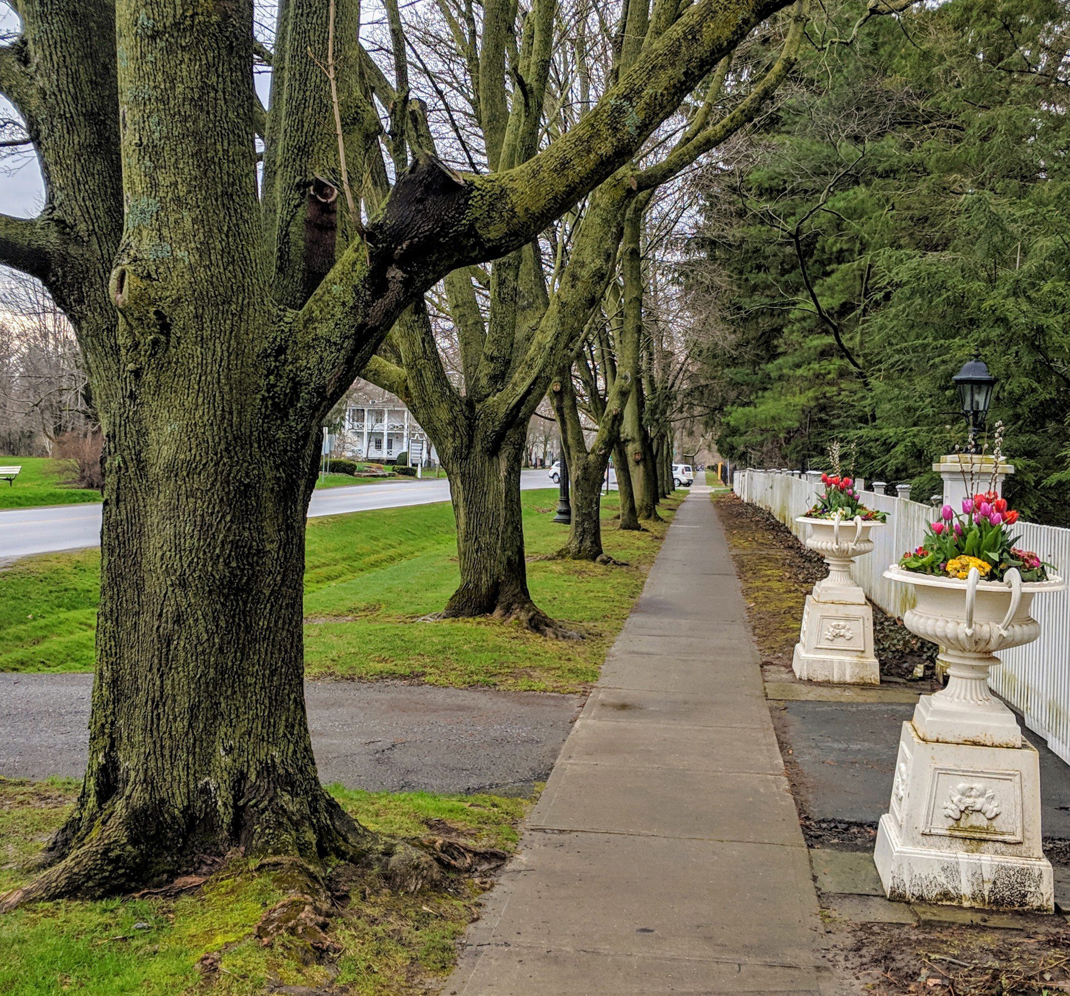
Each Friday we will explore different neighbourhoods, trails and parkland throughout Historic Niagara-on-the-Lake.
Moderate pace with some weeks entirely on sidewalks and roads while others may include a mix of trails and paved pathways. Great way to build up endurance for longer more strenuous hikes.
Plan to stay for conversation and a warm cup of coffee or tea at Sweets & Swirls, Community Centre, Niagara Stone Road, NOTL
Eco Hike Series #2 of 2 - Identifying Birds, Plants, Trees
https://hikesstaging.brucetrail.org/event/eco-hike-series-2-of-2-identifying-birds-plants-trees/Sorry, the registration cut-off time for this hike has been reached.Not a member? Click here to join today!Hosting Club: Dufferin Hi-Land
Category: General Hike
Location (Google Maps): Meet at Rock Hill parking lot on 1st Line EHS north of HWY 89, between 10 and 5 Sideroads, Mulmur Township.Hike Leader(s): Margery Cruise Click here to contact Hike Leader(s)
Pace: Leisurely
Terrain: Easy, Moderate
Distance: 5 kmDescription
We will explore the main trail and side trails (Enchanted Forest and Moss Haven) looking for wild flowers and listening for birds. We recommend that all participants download Merlin, Seek and iNaturalist apps to their phones. These apps will be used for identification of birdds, plants, trees.Directions: From HWY 10 and HWY 89, travel east on HWY 89 to 1st Line E in Mulmur to parking lot on east side, south of 10 sideroad.
Wildflower Hike with Barbara Palmer
https://hikesstaging.brucetrail.org/event/wildflower-hike-with-barbara-palmer/Sorry, the registration cut-off time for this hike has been reached.Not a member? Click here to join today!Hosting Club: Sydenham
Category: Botany Hike
Location (Google Maps): Small parking lot on 6th Concession S, south of Sideroad 6, north of km 23.1 (Map 29)Hike Leader(s): Barbara Palmer Click here to contact Hike Leader(s)
Pace: Leisurely: 3 km/h or less
Terrain: Easy: Mostly flat and good footing., Moderate: Some hills and/or poor footing, There might be muddy sections.Description
Join Barbara Palmer, a local amateur botanist, for an exploration of the wildflowers that make their home in Sydenham section. The warm weather this weekend will speed up the pace of spring, bringing more of the wildflowers out. This will be a leisurely hike with lots of stops to examine and identify the flowers and plants that we find along the trail. Bring sunscreen and bug spray. Approx. 2 hours. - 13May 13, 2023

Sydenham official end to end
https://hikesstaging.brucetrail.org/event/sydenham-official-end-to-end/Sorry, the registration cut-off time for this hike has been reached.Not a member? Click here to join today!Hike open to BTC Members only.
This is a Multi-Day Hike
You are signing up for the following dates:
2023-05-13, 2023-05-14, 2023-06-03, 2023-06-04, 2023-09-16, 2023-09-17, 2023-09-30, 2023-10-01Hosting Club: Sydenham
Category: General Hike
Location (Google Maps): Owen Sound area – details to be provided by email after registrationHike Leader(s): Bill Snel Click here to contact Hike Leader(s)
Pace: Medium: 3 to 4 km/h
Terrain: Moderate: Some hills and/or poor footing, There might be muddy sections., There might be sections with water on the trail.
Distance: The 8 hikes vary from 19.0 to 24.1 kmsDescription
The official Sydenham end-to-end consists of 8 hikes on 4 week-ends. Registration will be on the Bruce Trail on-line hike schedule (hikes.brucetrail.org) under Saturday 13 May 2023. COVID protocols will be followed. You must bring a mask and wear it on the bus. Attendance is restricted to 48 (one bus). At 8 pm on Wednesday 01 March 2023 registration opens for Bruce Trail members only at $120 each. NO REFUNDS. If any spots are still available at 8 pm on Wednesday 15 March 2023 registration will also be opened for non-members at a cost of $160 each. The fee covers: bus transportation each morning from the hike end location to the hike start, a badge, 1 or 2 checkpoints each day with water and snacks. You will hike on your own without a hike leader. Complete details will be provided once you are registered. For questions contact Bill Snel at sydenhame2e@gmail.com.
Two Day End to End
https://hikesstaging.brucetrail.org/event/two-day-end-to-end/Sorry, the registration cut-off time for this hike has been reached.Not a member? Click here to join today!This is a Multi-Day Hike
You are signing up for the following dates:
2023-05-13, 2023-05-14Hosting Club: Dufferin Hi-Land
Category: Special Events
Location (Google Maps): 586387 10th Sideroad
GPS Coordinates: N 44 13849 W 080 13649
This is the first farm 200m west of Center Rd on 10th (also called 17 when west of Center rd) There is a church on the corner. Please arrive by 7:45 latest to allow time for check in. Buses depart at 8:00 amMap Reference #20
Directions to Parking Location:
If coming by Hwy 10 from Orangeville
– follow 10 north to Primrose
– proceed straight through the intersection onto Dufferin County Road 19, also called Prince of Wales Road
– follow this road for 6 km to first stop sign
– the road sign says
– turn right, proceed approx 1 km
– the church is highly visible on the left side, parking is 200m west of the church.Hike Leader(s): Hyo-Eun Shin, Les Babbage, Susan Bate Click here to contact Hike Leader(s)
Pace: Brisk
Terrain: Dependent on Conditions, Moderate, Strenuous
Distance: 55km (29km & 26km)Description
Join us for two days of hiking the rolling hills of Dufferin County. Enjoy the spring flowers while earning your Red Trillium Badge. Hike distances are approximately 29km on Day 1 and 26km on Day 2. There will be checkpoints along the hike with volunteers providing assistance, refreshments and snacks. Registration is $55 for members and $65 for non-members, which includes shuttle bus service, checkpoint snacks and refreshments, Red Trillium Badge (must complete full hike to earn badge), and post-hike refreshments. Space is limited so register early!Bus Hike: Awenda Provincial Park
https://hikesstaging.brucetrail.org/event/bus-hike-awenda-provincial-park/Sorry, the registration cut-off time for this hike has been reached.Not a member? Click here to join today!Trip Information
Departure Time: 08:00
Return to City Time: 18:15
Departure Point: York Mills Bus PickupOptional Items
Hosting Club: Toronto
Category: Bus Hike
Location (Google Maps): Awenda Provincial ParkHike Leader(s): Martina Furrer, Nijole Mockevicius, Ross Estrella, Lisa Lifshitz Click here to contact Hike Leader(s)
Pace: Moderate
Terrain: Hilly, Variable
Distance: 12 – 14Description
Join us for an awesome spring hike in Awenda Provincial Park. Enjoy amazing views of Georgian Bay and beautiful spring wildflowers. Mostly small rolling hills. One steep climb to come back up from the beach. Two groups.Bring lunch, water (1.5 to 2 litres), and sun, rain and bug protection.
Bus departs 10 York Mills Rd at 8 AM. We hope to be back in Toronto around 6 PM. Return time will depend on traffic and road conditions. In good conditions driving time is around 1.5 hours. No refreshment stop.
Car Hike: Bethesda Trail Richmond Hill
https://hikesstaging.brucetrail.org/event/car-hike-bethesda-trail-richmond-hill-9/Sorry, the registration cut-off time for this hike has been reached.Not a member? Click here to join today!Hosting Club: Toronto
Location (Google Maps): Meet at Bethesda Trail Head Parking on Bethesda Sideroad off Bayview Avenue, across from Lake Wilcox. This parking lot is free.
Hike Leader(s): Mohammad Aghamiri Click here to contact Hike Leader(s)
Pace: Moderate
Terrain: Variable
Distance: 14-17KMDescription
Join us to explore Jefferson Forest and Bond lake ,Right time to see thousands of Trillium wild flowers covering more than hundred acres of the forest,
we will repeat this hike possibly 2 more times to see these beautiful wild flowers growing.
Please bring hiking poles, proper closing and shoes and lots of water,
Please carefully read safety procedures during the hike:
1-Hikers must stay between the leader and the sweep.
2-Hikers must advise the leader or the sweep if they wish to leave the group.
3- Hikers must follow the whistle instructions: 1 blast- stay where you are; 2 blasts come to the leader; 3 blasts – come to the leader quickly.
4-Hike leader may request volunteers to stop at trail intersections, they need to help hikers to the direction the group walk and wait till they see the sweep .
5-Hikers have to make sure they can see the persons behind and in front of them.
Iroquoia Bruce Trail Club AGM Pre-Hike River & Ruin
https://hikesstaging.brucetrail.org/event/iroquoia-bruce-trail-club-agm-pre-hike-river-ruin/Sorry, the registration cut-off time for this hike has been reached.Not a member? Click here to join today!Hike open to BTC Members only.
Hosting Club: Iroquoia
Category: Special Event
Location (Google Maps): Kilbride Public School, 6611Panton Street, Burlington, ON
River & Ruin side trailHike Leader(s): Dave Salt Click here to contact Hike Leader(s)
Pace: Medium – 3 to 4 km/hr
Terrain: Moderate – Some hills and/or some poor footing
Distance: 7.7Description
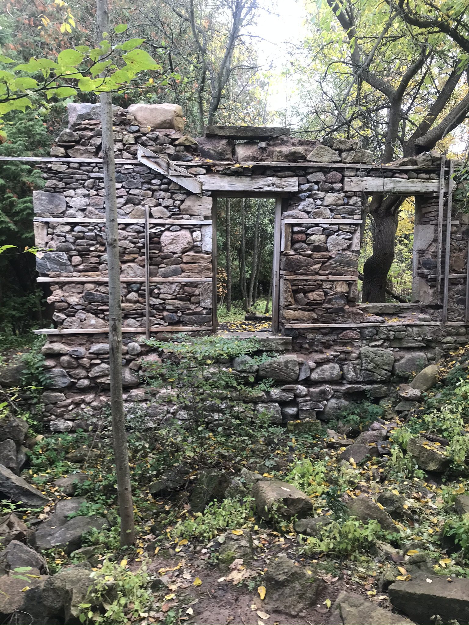
Please meet at the Kilbride public school. There is ample parking for us around the back of the school.We will walk along Panton Street, followed by the 8th sideroad where we will access the Bruce trail at Twiss road. Follow the BT south where we will branch off on the river & ruin side trail before rejoining the BT to a return at the school parking area.
We will be joined today by Martin Rumble who will provide some insight into conservation efforts.
Please arrive by 08:45 as we will be leaving promptly at 09:00
Please dress accordingly for the weather. Hiking shoes are required, water and snack.
Our hike distance today will be 7.7 km
Aprox 2.5 hrs
Lime Kiln, Caves and Standing Rock
https://hikesstaging.brucetrail.org/event/lime-kiln-caves-and-standing-rock/Sorry, the registration cut-off time for this hike has been reached.Not a member? Click here to join today!Hosting Club: Blue Mountains
Category: Register on-line or sign-in morning of hike
Location (Google Maps): Hike meets in the parking lot behind Tim Hortons on First St. in Collingwood.Hike Leader(s): Allison Thomas Click here to contact Hike Leader(s)
Pace: Medium – 3 to 4 km/hr
Terrain: Moderate – Some hills and/or some poor footing
Distance: 10kmDescription
MUST HAVE LONG SPIKE CRAMPONS (ICERS)We start at the BTC parking lot off of Cty. Rd. 91. This in and out hike. Hikers will explore Frank’s Lime Kiln first. We will then follow the white blazed trail to km 41.3 and take the Singhampton Side Trail back to the white blazed trail. We then head to the Standing Rock Side Trail to explore. Bring crampons as you won’t get through without them. Once we make it to the top of the caves, we loop around, retracing some of our steps back to the cars. Bring water and a snack. Map 22 Edition 30Caledon Hills E2E Hike #4 - Forks of the Credit
https://hikesstaging.brucetrail.org/event/caledon-hills-e2e-hike-4-forks-of-the-credit/Sorry, the registration cut-off time for this hike has been reached.Not a member? Click here to join today!Hike open to BTC Members only.
Hosting Club: Dufferin Hi-Land
Category: General Hike
Location (Google Maps): Western end of Boston Mills Road west of Mississauga Road near km 47.4 BTC Map 14.Hike Leader(s): Stuart Law Click here to contact Hike Leader(s)
Pace: Medium
Terrain: Dependent on Conditions, Moderate
Distance: 18.5 kmsDescription
Join us on our 4th in a series of five Humane Hiking hikes to complete the Caledon Hills section. Today we take in the Cheltenham Badlands and the Forks of the Credit. Some road walking required but lots of time in the woods too. Some hills for sure but nothing remotely like the Hockley Valley! Please bring 2.5L of water, bug spray, a garbage bag and extra pair of shoes for the shuttle, a snack, a lunch, an appreciation of nature and a smile.
Iroquoia Bruce Trail Club AGM Pre-Hike River & Ruin
https://hikesstaging.brucetrail.org/event/iroquoia-bruce-trail-club-agm-pre-hike-river-ruin-2/Sorry, the registration cut-off time for this hike has been reached.Not a member? Click here to join today!Hike open to BTC Members only.
Hosting Club: Iroquoia
Category: Special Event
Location (Google Maps): Kilbride Public School – 6611 Panton Street, Burlington, ON
River & Ruin Side TrailHike Leader(s): Anita Bergsma Click here to contact Hike Leader(s)
Pace: Leisurely – 3km/hr or less
Terrain: Moderate – Some hills and/or some poor footing
Distance: 5kmDescription
Join us on Saturday May 13th for a gentle hike on the River and Ruin side trail!Please meet at the Kilbride Public School. There is parking for everyone at the back of the school.
We will walk along Panton Street, followed by the 8th sideroad where we will access the Bruce trail at Twiss road. Follow the BT south where we will branch off on the River & Ruin Side Trail hiking to the bridge then turning around to return to the school parking area.
This hike is suitable for families with children, please note parents are responsible for their children for the duration of the hike.
Free Junior Hiker badges are available for the children participating in the hike.
Bring snacks, a warm beverage, and weather-appropriate clothing.
Your Hike Leaders are: Anita Bergsma, Karen Capindale-Smith, Robert House
This will be a 5 km hike at gentle pace for adults and children for approximately 1.5 hours. The terrain is moderate with some hills
See you on the trail.
9:30 Enjoy the Flora around The Falls
https://hikesstaging.brucetrail.org/event/930-enjoy-the-flora-around-the-falls/Sorry, the registration cut-off time for this hike has been reached.Not a member? Click here to join today!Hosting Club: Niagara
Category: In and Out
Location (Google Maps): Dufferin Islands parking lot, off Burning Springs Hill, Niagara Falls. Note: a parking fee applies, as part of the Niagara Falls Parkway parking system.Hike Leader(s): Karen Couch Click here to contact Hike Leader(s)
Pace: Medium
Terrain: Easy
Distance: 6 kmsDescription
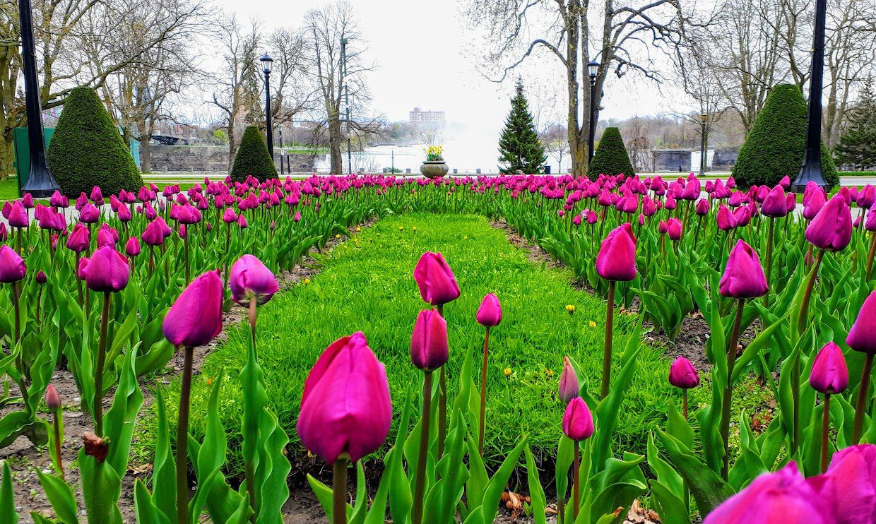
Experience the flora in the Dufferin Islands Nature Area, Oakes Garden Theatre and in between along the Niagara Parkway. With luck the tulips will be in full bloom.Nature Hike - observing spring growth
https://hikesstaging.brucetrail.org/event/nature-hike-observing-spring-growth/Sorry, the registration cut-off time for this hike has been reached.Not a member? Click here to join today!Hosting Club: Niagara
Category: Hike
Location (Google Maps): Woodend Conservation AreaHike Leader(s): Mary-Lyn Hopper Click here to contact Hike Leader(s)
Pace: Leisurely
Terrain: ModerateDescription
In this leisurely hike we will look for signs of spring and identify spring flowers.Fossil Glen Geology Hike with Beth Gilhespy
https://hikesstaging.brucetrail.org/event/fossil-glen-geology-hike-with-beth-gilhespy/Sorry, the registration cut-off time for this hike has been reached.Not a member? Click here to join today!Hosting Club: Sydenham
Category: Geology Hike
Location (Google Maps): The Owen Sound Galaxy Theatre parking lot. Meet at the tall “Galaxy Centre” sign next to the traffic lights.Hike Leader(s): Beth Gilhespy Click here to contact Hike Leader(s)
Pace: Leisurely: 3 km/h or less
Terrain: Easy: Mostly flat and good footing., Moderate: Some hills and/or poor footing
Distance: 2 kmDescription
Beth Gilhespy, a conservationist, amateur geologist and former Bruce Trail Conservancy CEO, will introduce us to the geology and fossils found in our area. This will be a slow, exploratory hike of 1 1/2 to 2 hours in length. Beth will explain the geological history of this area and help us to find and identify fossils. This hike is suitable for anyone who would like to learn more about geology and fossils, including families and children. Non members are welcome. Preregistration is required.If you do not wish to carpool from Owen Sound, please call or text Maureen McFarland at 647-918-4180 or email at maureen.mcfarland@gmail.com.