
Hike Schedule
Join us for a hike! Registration required:
All hikes available to BTC members. Some hikes are open to non-members.
TIP: The calendar view displays up to 7 hikes on a day, but often there are more. Click “More events” to see them all.
Categories
- 21April 21, 2023

9:00 am Niagara-on-the-Lake Tour
https://hikesstaging.brucetrail.org/event/900-am-niagara-on-the-lake-tour-12/Sorry, the registration cut-off time for this hike has been reached.Not a member? Click here to join today!Hosting Club: Niagara
Location (Google Maps):
Veterans Memorial Park, park just outside the park on King Street
Hike Leader(s): Robin Garrett Click here to contact Hike Leader(s)
Pace: Medium
Terrain: Easy
Distance: 6-7 kmDescription
Each Friday we will explore different neighbourhoods, trails and parkland throughout Historic Niagara-on-the-Lake.Moderate pace with some weeks entirely on sidewalks and roads while others may include a mix of trails and paved pathways. Great way to build up endurance for longer more strenuous hikes.
Prepare for cooler windy conditions on open parkland and along Lake Ontario and Niagara River trails.
Plan to stay for conversation and a warm cup of coffee or tea at Sweets & Swirls, Community Centre, Niagara Stone Road, NOTL

Fletcher Creek Preserve, Puslinch, HCA Property
https://hikesstaging.brucetrail.org/event/fletcher-creek-preserve-puslinch-hca-property-3/Sorry, the registration cut-off time for this hike has been reached.Not a member? Click here to join today!Hosting Club: Iroquoia
Category: General Hike
Location (Google Maps): Park at Fletcher Creek Ecological Preserve on Concession 7 just north of Gore Rd , Puslinch
HCA passes can be used or 7.50 per vehicleHike Leader(s): Cathie Green Click here to contact Hike Leader(s)
Pace: Medium – 3 to 4 km/hr
Terrain: Easy – Mostly flat and usually good footing
Distance: Approx. 10 kmsDescription
Fletcher’s Creek Preserve is an abandoned quarry site that has been rehabilitated and is located at the headwaters of the Spencer Creek watershed
We will loop hike through the preserve as well as an adjacent trail that also was part of the quarry back in the day-lots of local history- it was the area swimming hole and some still use it.
Wear appropriate clothing and footwear for the weather-could be wet. Bring water, snack, hiking poles, cell
Please feel free to call or text me if you have any concerns or questions Cathie 416-931-2095 cathiekygreen@gmail.com
- 22April 22, 2023
Car Hike: Happy Valley King City
https://hikesstaging.brucetrail.org/event/car-hike-happy-valley-king-city-3/Sorry, the registration cut-off time for this hike has been reached.Not a member? Click here to join today!Hosting Club: Toronto
Category: Car Hike
Location (Google Maps): Park along 16th Sideroad off Weston RoadHike Leader(s): Mohammad Aghamiri Click here to contact Hike Leader(s)
Pace: Moderate
Terrain: Variable
Distance: 14-15KMDescription
We will hike Happy valley in spring with beautiful scenery and great look out.Please bring your hiking poles, proper closing and shoes and lots of water.
Please carefully read safety procedures during the hike:
1-Hikers must stay between the leader and the sweep.
2-Hikers must advise the leader or the sweep if they wish to leave the group.
3- Hikers must follow the whistle instructions: 1 blast- stay where you are; 2 blasts come to the leader; 3 blasts – come to the leader quickly.
4-Hike leader may request volunteers to stop at trail intersections, they need to help hikers to the direction the group walk and wait till they see the sweep .
5-Hikers have to make sure they can see the persons behind and in front of them.
Creemore Nature Preserve - Mingay Tract
https://hikesstaging.brucetrail.org/event/creemore-nature-preserve-mingay-tract-4/Sorry, the registration cut-off time for this hike has been reached.Not a member? Click here to join today!Hosting Club: Blue Mountains
Category: Register on-line or sign-in morning of hike
Location (Google Maps): Hike meets in the parking lot behind Tim Hortons on First St. in Collingwood.Hike Leader(s): Michael Treuman Click here to contact Hike Leader(s)
Pace: Leisurely – 3 km/hr. or less
Terrain: Easy – Mostly flat and usually good footing
Distance: 5kmDescription
This 204 acre property features majestic, mature sugar maple trees, a meandering cold water stream, and small pockets of wetlands. This lush Niagara Escarpment forest is home to a variety of rare and at-risk species. The sounds of hairy and pileated woodpeckers echo through the trees. The skies above are home to red-shouldered hawks. We will creatively combine Mingay, Maple Leaf and Trout trails to complete a loop-de-loop. Bring water and a snack.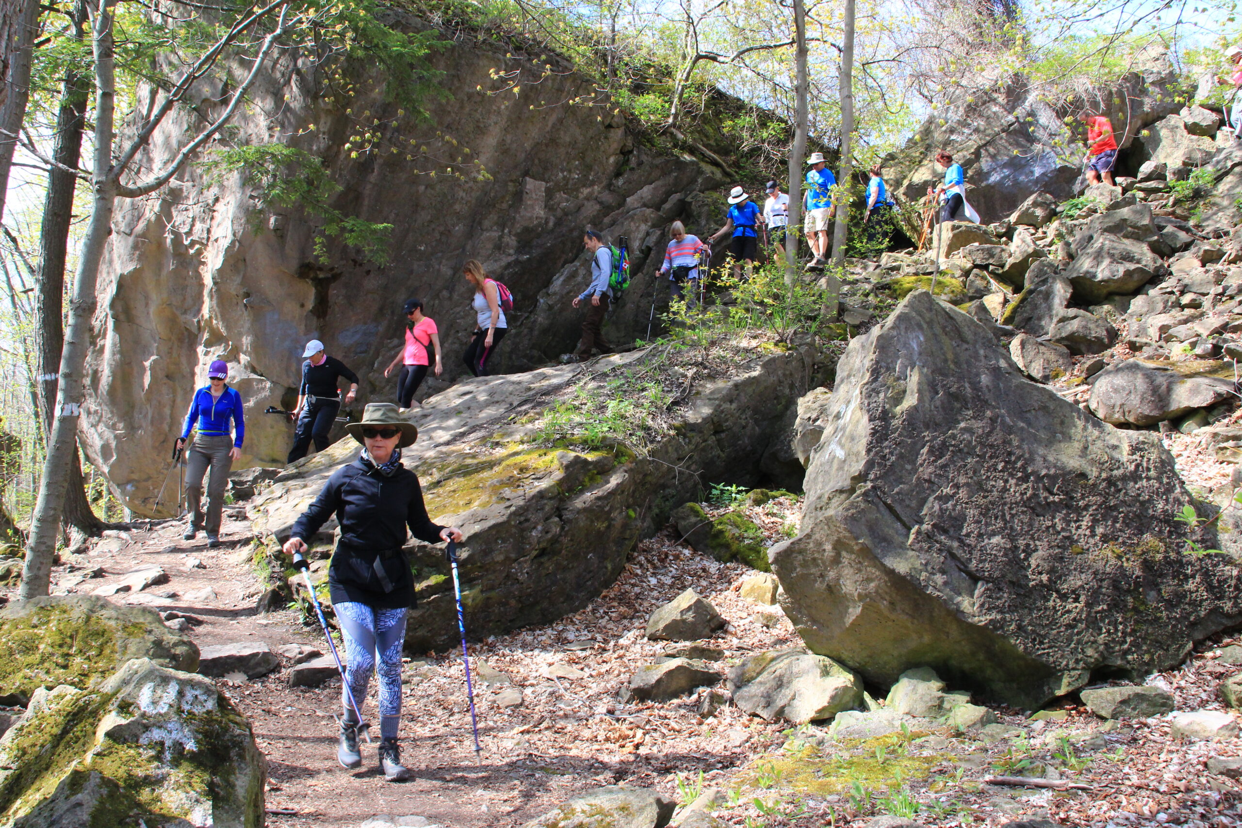
9:00 Niagara Glen Hike
https://hikesstaging.brucetrail.org/event/900-niagara-glen-hike-2/Sorry, the registration cut-off time for this hike has been reached.Not a member? Click here to join today!Hosting Club: Niagara
Category: Loop
Location (Google Maps): Meet at the Niagara Glen Nature Centre parking lot, 3050 Niagara Parkway, Niagara Falls. There is a parking fee. Parking passes recommended.Hike Leader(s): Dan Wilson Click here to contact Hike Leader(s)
Pace: Medium
Terrain: Strenuous
Distance: 11kmDescription
Hike deep in the Niagara Gorge, along stairways cut into the rock and rugged paths that wind through this pristine pocket of Carolinian Forest. View ancient geological formations and fossils dating back millions of years, while hiking along the turbulent rapids of the Niagara River. This is a strenuous hike and there is a good chance hikers will get wet! Bring water, gaiters and hiking poles, if necessary. Dress appropriately.
Wetlands in Focus - Windermere Basin
https://hikesstaging.brucetrail.org/event/wetlands-in-focus-windermere-basin/Sorry, the registration cut-off time for this hike has been reached.Not a member? Click here to join today!Hosting Club: Iroquoia
Category: Education Hike
Location (Google Maps): Windermere Basin Park,
105 Eastport Dr,
Hamilton, ON L8H 7S4Hike Leader(s): Bronwen Tregunno Click here to contact Hike Leader(s)
Pace: Leisurely – 3km/hr or less
Terrain: Easy – Mostly flat and usually good footing
Distance: 2 kmDescription
Come and learn about waterfowl and other migrants with Chris Motherwell, Past President Hamilton Naturalists Club, West End Lake Ontario(WELO) bird count coordinator and shore bird expert. Chris will talk about how this restored wetlands provides an important stopover for birds migrating to their northern nesting grounds. He’ll discuss the range of species seen here from Snowy Owls to various species of willets, snipes and sandpipers. We may even see some terns starting to nest in this birding hotspot. More about birds seen here on eBird https://ebird.org/hotspot/L602320 Bring binoculars if you have them. There is a short loop walk where we may view tree swallows checking out the boxes. May be low spots so wear hikers that can take some damp. Parking lot is small but you may park along Eastport Drive. This is a short leisurely walk with no facilities so bring your own snack and water. Contact IBTC Hike Leader Bron for more information brontreg@cogeco.caEarth Day Forest Bathing
https://hikesstaging.brucetrail.org/event/earth-day-forest-bathing/Sorry, the registration cut-off time for this hike has been reached.Not a member? Click here to join today!Hosting Club: Caledon Hills
Category: Nature Walks
Location (Google Maps): Depart from Mono Community Centre parking lot (south west of km 1.2), BTC Reference Guide Map 19, Caledon Hills sectionHike Leader(s): Janice McClelland Click here to contact Hike Leader(s)
Pace: Leisurely – 3 km/hour or less
Terrain: Moderate – some hills and/or some poor footing
Distance: 6 kmDescription
On this Earth Day Forest Bathing walk, we will walk quietly, using all our senses to absorb the gifts of the Earth.(Additional participants may join us as part of the Township of Mono Earth Day event.)

Biodiversity Nature Walk - Native Species Scavenger Hunt
https://hikesstaging.brucetrail.org/event/biodiversity-nature-walk-native-species-scavenger-hunt/Sorry, the registration cut-off time for this hike has been reached.Not a member? Click here to join today!Hosting Club: Caledon Hills
Category: Nature Walks
Location (Google Maps): Mono Community Centre, 754483 Mono Centre Road on the east side of 2nd Line EHS, 200 metres south of Mono CentreMeet at the northeast corner of the main parking lot.
44.026195, -80.071516Hike Leader(s): Gary Hall and Richard Smythe Click here to contact Hike Leader(s)
Pace: Leisurely – 3 km/hour or less
Terrain: Easy – mostly flat and usually good footing
Distance: 3.5 kilometresDescription
Celebrate Earth Day with our Biodiversity Team on this guaranteed to be fun Native Species Scavenger Hunt. To enhance your experience, download the What3Words, Merlin, Seek or iNaturalist apps, but not a necessity.
You are invited to come early, between 10:00 – 12:00 to learn more about the nature apps and join in the “Let’s Make Mono Shine” Community Event festivities.
- 23April 23, 2023
TBTC AGM Kortright Bus Hike from Kipling
https://hikesstaging.brucetrail.org/event/tbtc-agm-kortright-bus-hike-from-kipling/Sorry, the registration cut-off time for this hike has been reached.Not a member? Click here to join today!Trip Information
Departure Time: 08:15
Return to City Time: 16:45
Departure Point: Kipling Departure PointOptional Items
Hosting Club: Toronto
Category: Bus Hike
Location (Google Maps): Kipling Subway Station, North Lot. Please arrive by 8 am for a 8:15 Departure.Hike Leader(s): Andrew Proczek; Peter Leeney; Monica Pasquali; Ross Estrella Click here to contact Hike Leader(s)
Pace: Moderate
Terrain: Hilly, Variable
Distance: 7.7 kmDescription
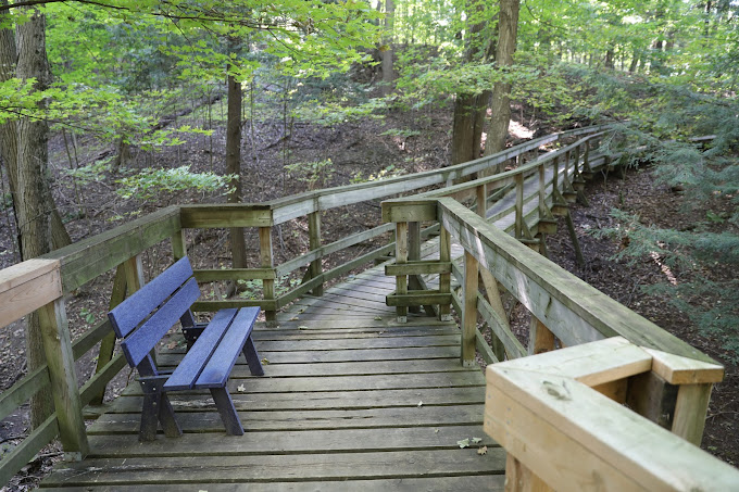
Join us for a enjoyable 2.5 hour loop hike on the Kortright Centre for Conservation trails in Kleinberg (beginners are welcome) and a delightful lunch before the club’s first in-person AGM since 2019 beginning at 1:00 pm. The theme of the meeting will be biodiversity with guest speaker Dr. Justina Ray who will be speaking on the topic after the business part of the meeting. Both the bus and lunch are being offered for a reduced fee and so a high turnout is needed for the success of the event. Please join us to reconnect with friends, make new friends and spend a fun and interactive day. It’s also a wonderful opportunity to get to know your TBTC better and to invite a friend or family member so they can learn what our club and the BT Conservancy is all about.
The online route for our morning hike can be found here: https://onthegomap.com/s/dfk1d9j7
Please note that you must register for the meeting and lunch separately from the hike registration. You can register for the AGM and Lunch on Eventbrite at: https://www.eventbrite.com/e/524619770857
A reduced bus fare of $20.00 applies.
Please feel free to email us if you have any questions.
TBTC Annual General Meeting - Biodiversity Hike / Photography Hike
https://hikesstaging.brucetrail.org/event/tbtc-annual-general-meeting-biodiversity-hike-photography-hike/Sorry, the registration cut-off time for this hike has been reached.Not a member? Click here to join today!Trip Information
Departure Time: 08:30
Return to City Time: 17:00
Departure Point: York Mills Bus PickupOptional Items
Hosting Club: Toronto
Category: Bus Hike
Location (Google Maps): Kortright Centre for Conservation
9550 Pine Valley Drive
Woodbridge, Ontario
905-832-2289Hike Leader(s): George Lennon; Marie-Josée Roy; Click here to contact Hike Leader(s)
Pace: Leisurely
Terrain: Variable
Distance: n/aDescription
Please join us for the Toronto Bruce Trail Club Annual General Meeting.There are two hikes available:
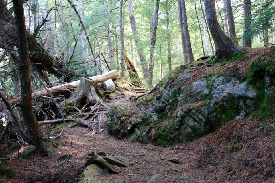
Biodiversity Hike — Comparing the Humber River Watershed and the Niagara Escarpment, what might we learn from both of these habitats about the importance of protecting biodiversity in the Greenbelt? This 3 km hike will involve learning to identify in the field spring flora and fauna, as well as talks and discussions led by members of the Biodiversity Team about their work on Bruce Trail Conservancy properties in the Toronto Club section along the Niagara Escarpment.
Photography Hike — With professional photographer David Allen. As described on his website (http://www.highparkphotos.ca), “David has been a professional photographer for many years, both in the studio and on numerous locations across Canada.” He will provide tips and advice on how to improve your pictures. Bring your DSLR camera, iPad or iPhone, or other devices.
After the hike, we will arrive at the Kortright Centre for lunch before the AGM starts.
Note: You must register separately for the AGM and Lunch on Eventbrite – https://www.eventbrite.com/e/524619770857
Reduced Bus Fare Applies: $20.00 /$10 Children
Pine River Nature Reserve Cleanup (Rain Date in Effect)
https://hikesstaging.brucetrail.org/event/pine-river-nature-reserve-cleanup-2/Sorry, the registration cut-off time for this hike has been reached.Not a member? Click here to join today!Hosting Club: Dufferin Hi-Land
Category: Special Events
Location (Google Maps): Meet at the intersection of Sideroad 15 and 2nd Line West, east of Horning’s Mills.We were hoping that the rain would subside in time to have the event today but unfortunately the rain is not going to behave. Therefore, we are making the call to move the cleanup to tomorrow.
We hope to see you there. The event will start at 10am tomorrow, April 23rd.
Hike Leader(s): Tom Thayer Click here to contact Hike Leader(s)
Pace: Leisurely
Description
NOTE: Registration is not required – Just show up and we will be happy
Rain Date is set for April 23rd from 10 am to 5 pm, if Needed.
Help us clean up the Pine River Nature Reserve as part of Earth Week.
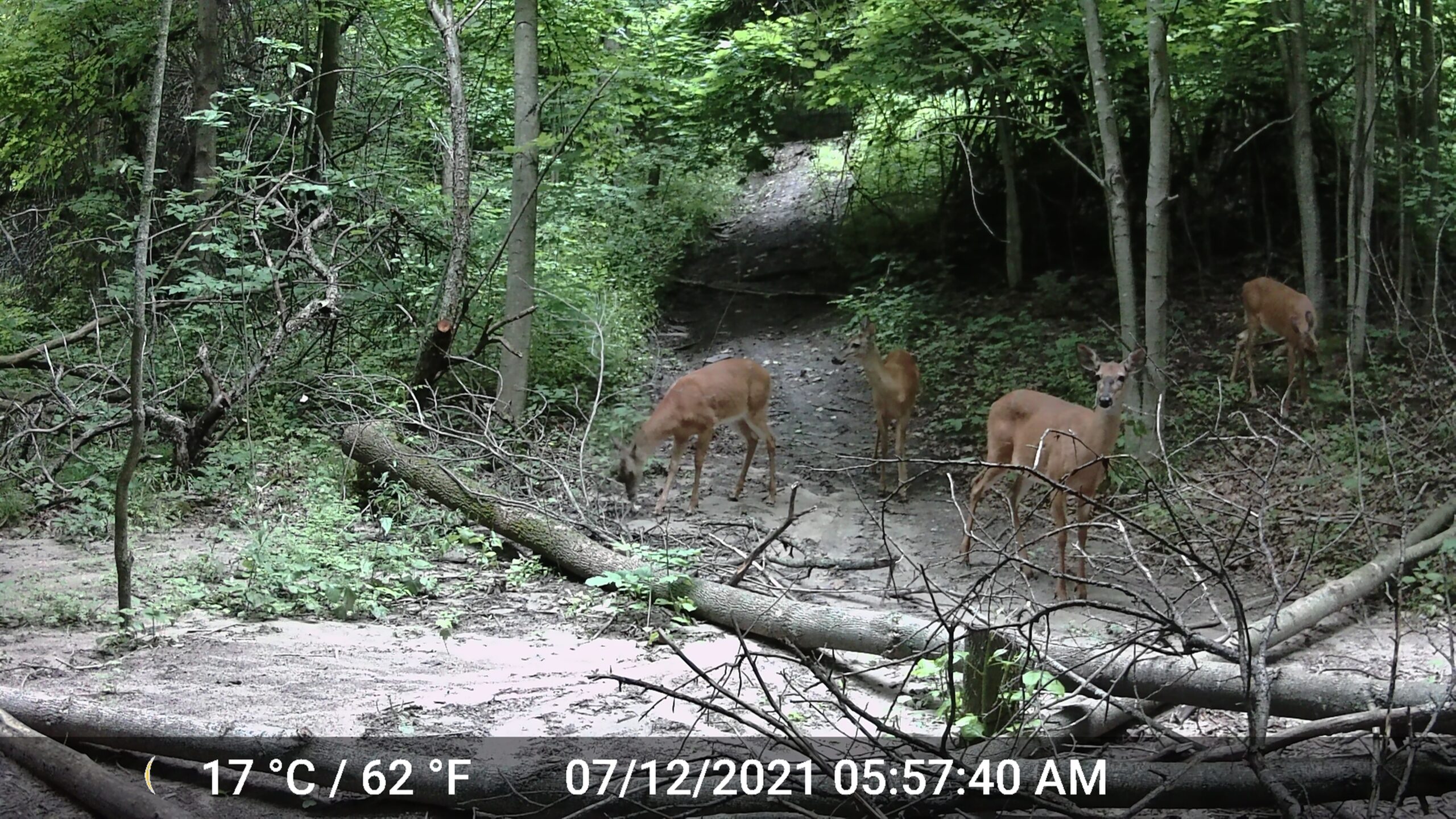
The Pine River Nature Reserve had been used for many years, prior to the Bruce Trail acquiring the reserve, by many off-roaders and people that were not overly concerned with preserving the lands. As such, there is a considerable amount of garbage to be found throughout the reserve. Your help in cleaning up this garbage will help the earth, wildlife, and future generations to come.
Bring a bag and come along and join us!
Park at 2nd line west and 15 sideroad and walk along 15 sideroad to find us and our garbage bin. All ages are welcome to help and “Take a Hike” buttons for kids.
Off to Griersville!
https://hikesstaging.brucetrail.org/event/off-to-griersville/Sorry, the registration cut-off time for this hike has been reached.Not a member? Click here to join today!Hosting Club: Beaver Valley
Location (Google Maps): Meet in the new parking lot on the south side of Grey Road 40, where the trail crosses. Near km 108.4, Map 28, Edition 30
Hike Leader(s): Glenda Collings Click here to contact the hike leader.
Pace: Medium
Terrain: Moderate
Length of Hike: approx. 7 km returnDescription
This will be an in and out hike that takes us along the escarpment which winds around to Grey Road 7. We’ll pass through woodlands and have views to the north. Bring a snack and water.COVID-19 Precautions Before, During and After your Hike
- Each hiker joining a Bruce Trail Club organized hike must perform a self-screening check before hiking.
Find Ontario’s self-assessment tool here: https://covid-19.ontario.ca/self-assessment/ - If you are experiencing COVID-19 symptoms, stay home.
- Personal Protective Equipment:
- Hikers may choose to wear masks
Transportation
It is the Bruce Trail Conservancy’s current policy that car shuttles are allowed. It is at the discrepancy of individual hike leaders to make that decision.
Other Guidelines
- Arrive 15 minutes before the start of the hike.
- Wear sturdy footwear and appropriate attire for the weather and the terrain.
Hiking poles are a good idea in any season, especially if the terrain is rocky or slippery. In winter, snowshoes or icers/crampons are needed when conditions dictate.
Wearing appropriate clothing and footwear prevents injuries and shows consideration for a safe and positive group hiking experience. - Always carry I.D. and your health card.
- Bring sufficient water and snacks (or lunch if indicated). A minimum of 1L of water is recommended on all hikes, and 3L is recommended for long, challenging hikes in the heat of the summer.
- Bring sunscreen and insect repellent (for spring and summer hikes).
- Bring your own first aid kit.
- Please leave dogs at home.
TBTC AGM Car Hike Kortright
https://hikesstaging.brucetrail.org/event/tbtc-agm-car-hike-kortright/Sorry, the registration cut-off time for this hike has been reached.Not a member? Click here to join today!Hosting Club: Toronto
Category: Car Hike
Location (Google Maps): Kortright Centre for ConservationHike Leader(s): Frank Ye, Alina Lin, & Jen Zhang Click here to contact Hike Leader(s)
Pace: Moderate
Terrain: Hilly, Variable
Distance: 9 KMDescription
Join us for a morning hike around the Kortright Centre for Conservation trails in Kleinberg before the club’s first in-person AGM since 2019. The theme of the meeting will be biodiversity with guest speaker Dr. Justina Ray who will be speaking on the topic after the business part of the meeting. Meet Frank, Jen, and Alina by the entrance to the visitor centre.Note that you must register separately for the AGM and Lunch on Eventbrite – https://www.eventbrite.com/e/524619770857
Caledon Hills E2E Hike #3 - Hockley Valley
https://hikesstaging.brucetrail.org/event/caledon-hills-e2e-hike-3-hockley-valley/Sorry, the registration cut-off time for this hike has been reached.Not a member? Click here to join today!Hosting Club: Dufferin Hi-Land
Category: General Hike
Location (Google Maps): Red P Bruce Trail parking on 5th Line EHS just south of Hockley Road (just west of Airport Road) north of km 50.8 BTC Map 18.Hike Leader(s): Stuart Law Click here to contact Hike Leader(s)
Pace: Medium
Terrain: Slippery and Steep Sections, Slippery Sections Likely, Strenuous
Distance: 15.5 kmsDescription
Join us on the third hike in our quest to complete a Caledon Hills Section E2E. We will journey through some of the most undulating terrain on the Bruce Trail through the Hockley Valley but there will also be plenty of time to catch our breath and admire wildflowers too. Did I say hills? Yes Virginia, there will be hills. There may also be some residual ice so please pack your icers just in case. Please also bring a change of footwear and a garbage bag for the car shuttle, hiking boots, at least 2L of water, a warm drink, a snack, a lunch, a smile and an appreciation of nature. Gaiters and poles highly recommended given muddy slippery slopes. Please be ready to car shuttle at 9:15. This is a strenuous but highly rewarding hike.Rim to Rim Hike Series - # 4 of 4 - Pretty River North
https://hikesstaging.brucetrail.org/event/rim-to-rim-hike-series-4-of-4-pretty-river-north/Sorry, the registration cut-off time for this hike has been reached.Not a member? Click here to join today!Hosting Club: Dufferin Hi-Land
Category: General Hike
Location (Google Maps): Meet at the Snowmobile Parking Lot, 63597 Pretty River Rd north of Duntroon.Hike Leader(s): Margery Cruise,Les Babbage Click here to contact Hike Leader(s)
Pace: Medium
Terrain: Moderate, Strenuous
Distance: 11.9Description
We will walk 380 meters on Pretty River road to the trail start at km 46.8 (Map 23, Blue Mountains Section). We will follow the main trail to km 52.6, ignoring the side trails. Then we will walk 500 meters to the west on 6th Sideroad to km 53.1. We will follow Russ McConnell Side Trail south, join the main trail at km 51.2, hike to km 50.0 and follow Pretty River Side Trail to km 48.1, then follow the main trail back to km 46.8 and walk east on Pretty River Road to the parking lot.Directions: From CR 124 and HW 89, north on CR 124 to Singhampton, continue east on CR 124 and then north to Sideroad 33 and 34 Nottawasaga. Turn left and look for Snowmobile Parking Lot.
Hikers completing all 4 hikes in this series will be eligible to purchase the Rim to Rim Badge from Blue Mountains BTC. You can also make up any hikes you aren’t able to attend or register for by completing the hike yourself at a more convenient time.
Decew to brock
https://hikesstaging.brucetrail.org/event/decew-to-brock/Sorry, the registration cut-off time for this hike has been reached.Not a member? Click here to join today!Hosting Club: Niagara
Category: Hike
Location (Google Maps): Decew House behind BrockHike Leader(s): Sylvia Wheeler Click here to contact Hike Leader(s)
Pace: Fast
Terrain: Moderate
Distance: 7 km.Description
Sunday Social Hike - Palisades figure 8 loop
https://hikesstaging.brucetrail.org/event/palisades-figure-8-loop-2/Sorry, the registration cut-off time for this hike has been reached.Not a member? Click here to join today!Hosting Club: Sydenham
Category: General Hike
Location (Google Maps):Roadside parking on Owen Sound 7th Ave. E. just south of 1st St. E, west of km 90.2 (Map 32)
Hike Leader(s): Bill Snel Click here to contact Hike Leader(s)
Pace: Leisurely: 3 km/h or less
Terrain: Moderate: Some hills and/or poor footing, Strenuous: Hilly with steep climbs and some poor footing.
Distance: 1.8 kmDescription
A figure 8 hike on the east side of Owen Sound with many interesting rock formations. It also contains 1 Secret of Sydenham. For more information contact Bill Snel at w.snel2@gmail.com or call landline (519) 470-0584 - Each hiker joining a Bruce Trail Club organized hike must perform a self-screening check before hiking.
- 24April 24, 2023

Peninsula End2Endin10
https://hikesstaging.brucetrail.org/event/peninsula-end2endin10/Sorry, the registration cut-off time for this hike has been reached.Not a member? Click here to join today!Hike open to BTC Members only.
This is a Multi-Day Hike
You are signing up for the following dates:
2023-04-24, 2023-04-25, 2023-04-26, 2023-04-27, 2023-04-28, 2023-05-01, 2023-05-02, 2023-05-03, 2023-05-04, 2023-05-05Hosting Club: Peninsula
Location (Google Maps): Peninsula E2E in 10 – April 24-May 5. Please read all details in the hike description before registering for the hike.
Hike Leader(s): Steven White Click here to contact Hike Leader(s)
Pace: Brisk
Terrain: Difficult
Distance: 10-25 kms per dayDescription
Peninsula End-2-End-in-10 is a 10 hike schedule to complete the entire Peninsula section of the Bruce Trail. Hikes are Monday to Friday, April 24-28 and May 1-5. We will meet at 7:30 each day except Mondays when we will meet at 9:00. We will car pool/shuttle to the trail head and hike back to our cars at the meeting place each day. We will hike from south to north, Wiarton to Tobermory. One driver will be selected each day to shuttle drivers back to their cars. Hikers must complete all 10 hikes to qualify for the new Turkey Vulture End to End badge, and 7 hikes must be completed on an organized hike with Peninsula Hike Leader. Cost is $30 to register and non-refundable if a hiker cancels. I will send out details of the hikes and meeting places the week before. This section is more than 160 kilometers and hikes are 10 to 25 kilometers per day, averaging 16km. There will be some parking/park entrance fees in addition to the $30 registration fee.Please be honest about your hiking abilities. We will hike at a steady pace and there will be plenty of time for pictures and to enjoy the flora and fauna of this beautiful, rugged and challenging section. The pace will be brisk (4-5 km/hr) and hikers should be aware of their own level of physical fitness prior to registering. We will take snack/bio breaks and a short lunch break each day.
Hikers should be aware of weather forecasts and come with layers of clothing, hats, hiking footwear, poles (if you use them), rain gear, water, bug repellent, sunscreen, snacks and lunches.
The hike is limited to 12 participants, including the hike leader.Caledon Hills end to end 1 of 4
https://hikesstaging.brucetrail.org/event/caledon-hills-end-to-end-1-of-4/Sorry, the registration cut-off time for this hike has been reached.Not a member? Click here to join today!Hike open to BTC Members only.
Hosting Club: Niagara
Category: Car Pool
Location (Google Maps): Meet on Willoughby Rd. and Escarpment Sideroad (km 16.1) carpool to Creditview Rd. (km 0.0)East of Boston Mills Rd.Hike Leader(s): Vince Zvonar Click here to contact Hike Leader(s)
Pace: Brisk
Terrain: Moderate
Distance: 16.1Description
Christie Conservation area
https://hikesstaging.brucetrail.org/event/christie-conservation-area-4/Sorry, the registration cut-off time for this hike has been reached.Not a member? Click here to join today!Hosting Club: Iroquoia
Category: Happy Wanderers
Location (Google Maps):Hike Leader(s): Wayne Riley Click here to contact Hike Leader(s)
Pace: Medium – 3 to 4 km/hr
Terrain: Moderate – Some hills and/or some poor footing
Distance: 14-16 kmDescription
We will meet at 20 Marshboro Ave in Dundas and hike around Christie Lake and Spenser Creek trail and back to the start. There will be an optional 2k to make it 16k total.Hike leader: Wayne Riley
Bring lunch, water, hiking boots, bug spray, no dogs please
Register using the BTC web site
Cancelations the morning of the hike: 289-456-3498

Dundas Valley CA Main Loop
https://hikesstaging.brucetrail.org/event/dundas-valley-ca-main-loop/Sorry, the registration cut-off time for this hike has been reached.Not a member? Click here to join today!Hosting Club: Iroquoia
Category: General Hike
Location (Google Maps): Dundas Valley Conservation AreaHike Leader(s): Bronwen Tregunno Click here to contact Hike Leader(s)
Pace: Leisurely – 3km/hr or less
Terrain: Moderate – Some hills and/or some poor footing
Distance: 6-7 kmDescription
Start your week with a hike through the beautiful Dundas CA. Starting at Dundas Valley Trail Centre, we’ll follow the Main Loop and do parts of Monarch and Sulphur Creek Trail. Come 10 min early so we can start right at 9:30 am. Bring water, snack, sun filter, insect repellant and personal first aid kit. Hiking boots recommended. Hamilton Conservation Authority parking fee in effect or free with annual pass. Contact Bron at brontreg@cogeco.ca or phone/text 905-334-4013 if any questions.