
Hike Schedule
Join us for a hike! Registration required.
All hikes available to BTC members. Some hikes are open to non-members.
See Refund Policy for Paid Hikes >
TIP: The calendar view displays up to 7 hikes on a day, but often there are more. Click “View more events” to see them all.
Categories
- 03March 3, 2023
Coach Trip: Winter Weekend in Magog, Quebec March 3 to 6, 2023
https://hikesstaging.brucetrail.org/event/coach-trip-winter-weekend-in-magog-quebec-march-3-to-6-2023/Sorry, the registration cut-off time for this hike has been reached.Not a member? Click here to join today!Trip Information
Departure Time: 07:00
Return to City Time: 21:00
Departure Point: York Mills Bus PickupTrip Activities
The phone number I provided is for the cell phone I will have with me ($0.01)
I don't have a cell phone ($0.01)
Optional Items
I am a vegetarian ($0.01)Hosting Club: Toronto
Category: Coach Trips
Location (Google Maps): Magog, QuebecHike Leader(s): Martina Furrer, David Royle, Roland Mark Click here to contact Hike Leader(s)
Description
Please do not register if you don’t have a roommate; also, you and your roommate should register at the same time. Space is running out. Unfortunately, single occupancy isn’t possible.Spend your days exploring the Parc Régional du Mont Orford and your evenings on the shore of Lake Memphremagog. Explore the park on foot or cross-country skis. Join a guided snowshoe hike each day or team up with friends and explore at your own pace (30 km of trails to explore). Or snap on your skis and enjoy self-guided tours on trails groomed for classic (50 km) and skate (26 km) skiing. We might also explore the Parc des Sommets in nearby Bromont. Join us for winter fun in Quebec’s Eastern Townships.
Travel direct from Toronto in a luxury highway coach. Bus will depart from 10 York Mills Rd at 7 AM on Friday March 3, 2023 and be back in Toronto between 8 and 9 PM on Monday March 6, 2023.
We’ll be staying in the Auberge du Grand Lac in the heart of Magog, walking distance to shops, galleries, pubs, cafés, and a 2.8 km skating trail (lit at night) on the shore of Lake Memphremagog. The Marais de la Riviere aux Cerises with hiking and snowshoe trails (5 km) can also be reached on foot from the Auberge du Grand Lac.
Note to winter hikers/snowshoers: Expect more hills and longer climbs than in southern Ontario. On some routes there could be sustained climbs with elevation gains that are four times as much as Murphy’s Pinnacle or two times the Beaver Valley ski hill.
Coach fare is $170 for members, $190 for non-members, and $100 for children 12 and under.
Accommodation is $268.50 (plus tax and gratuity) per person based on double occupancy. This includes three overnights, three breakfasts, and three dinners. The restaurant serves Asian food and has vegetarian options. Note: The Auberge du Grand Lac has 28 rooms so single occupancy will not be possible. If you need help finding a roommate contact Martina.
Trail fees are not included in the above prices. Expect to pay about $20 per day.
Equipment rentals: Cross-country ski equipment is available in the Le Cerisier Discovery and Visitors Centre in the Parc Régional du Mont Orford. Reservation by phone (1-800-665-6527) is mandatory at least 24 hours in advance. Snowshoes and crampons are also available; reservations aren’t necessary for them. Ice skates can’t be rented in the park or in Magog. Equipment can’t be rented in the Parc des Sommets in Bromont.
Registration instructions:
- Complete the online registration form and pay your coach fare to secure your seat on the bus.
- Martina will send you the Auberge du Grand Lac’s registration form.
- Once you receive the form you will have 48 hours to complete it, email it to the Auberge du Grand Lac, and pay your deposit. Please pay your deposit (50 % of your stay) at the same time you send in your form.
Cancellation policy: This trip will not be cancelled due to weather. If there isn’t enough snow to ski and snowshoe we will hike.
COVID-19 protocol: For everyone’s comfort and safety masks (KN95 or N95 recommended) are mandatory while on the bus.
Register by December 10. Bus fare is non-refundable. All applicable fuel surcharges and taxes in effect as of October have been included in the coach fare. However in these volatile times the Toronto Bruce Trail Club reserves the right to charge for currently unanticipated increases in the cost of fuel.
Questions? Contact Martina at martinabeatrice@gmail.com
Car Hike: Caledon E2E and winter badge 4/4
https://hikesstaging.brucetrail.org/event/car-hike-caledon-e2e-and-winter-badge-4-4/Sorry, the registration cut-off time for this hike has been reached.Not a member? Click here to join today!Hike open to BTC Members only.
This is a Multi-Day Hike
You are signing up for the following dates and times:
2023-03-03 at 08:30Hosting Club: Toronto
Category: Car Hike
Location (Google Maps): Km 52. Coordinates N 43.993572,W 80.014057Hike Leader(s): Smadar Junkin Click here to contact Hike Leader(s)
Pace: Brisk
Terrain: Challenging, Hilly
Distance: 17 kmDescription
Last hike in the series. Badges day. We will shuttle to the end of the Caledon section and walk back on the new section of the trail. Bring snowshoes and icers. Bring 2 litres of water. Check your email for change of date because of bad weather. We will follow covid 19 rules.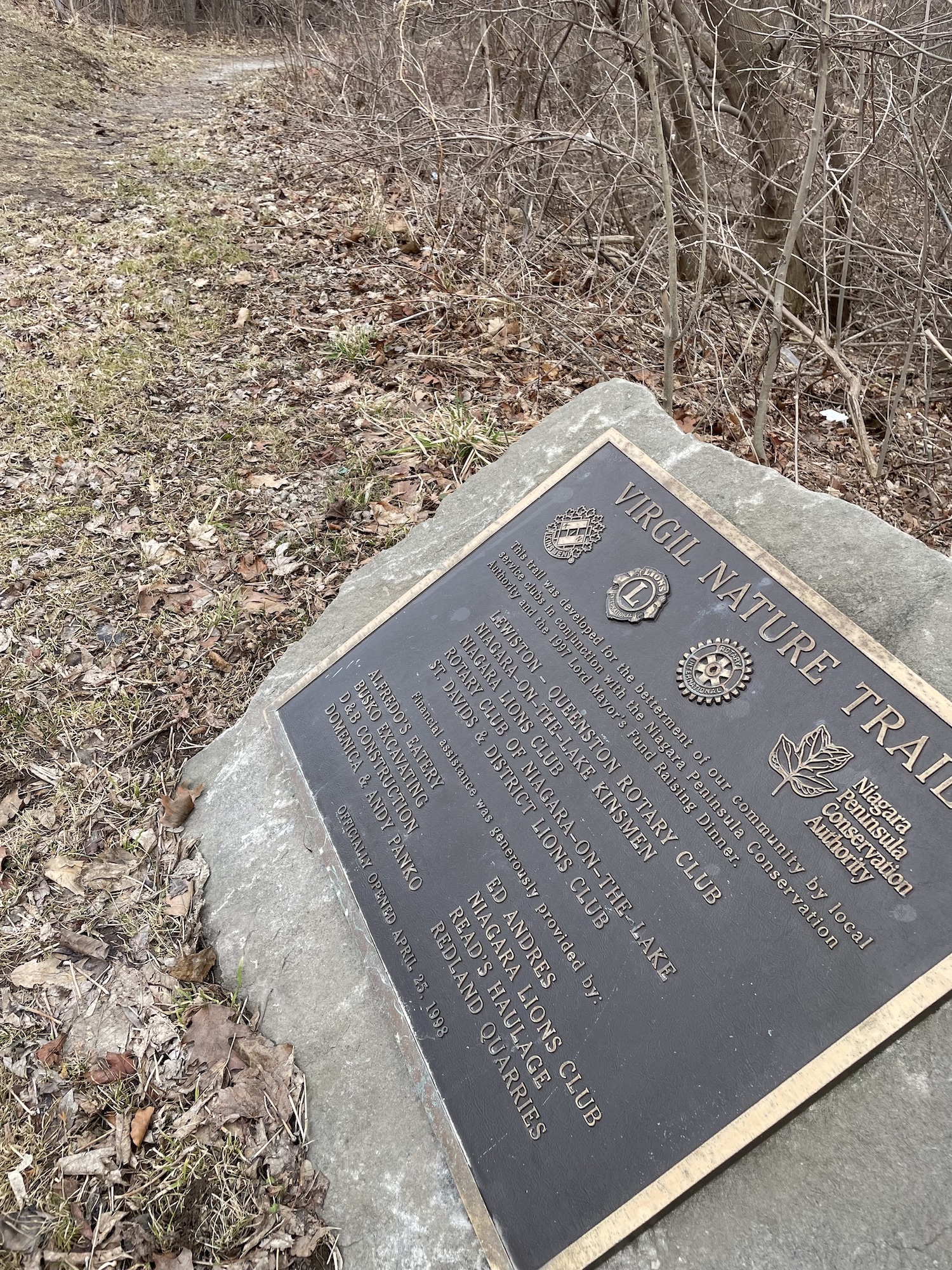
9:00 Canceled - changed to NOTL the Commons -Virgil & The Mennonites
https://hikesstaging.brucetrail.org/event/900-virgil-the-mennonites/Sorry, the registration cut-off time for this hike has been reached.Not a member? Click here to join today!Hosting Club: Niagara
Category: Urban
Location (Google Maps): Meet on King St near Centre- at the entrance to Veteran’s Memorial Park, Niagara-on-the-LakeHike Leader(s): Margaret Northfield Click here to contact Hike Leader(s)
Pace: Medium
Terrain: Easy
Distance: 5-6kmDescription
Changed to the Commons. Virgil will be rescheduled for another time. Tour around Virgil and learn more about the strong Mennonite history. - 04March 4, 2023
Hockley Valley
https://hikesstaging.brucetrail.org/event/hockley-valley-12/Sorry, the registration cut-off time for this hike has been reached.Not a member? Click here to join today!Hosting Club: Blue Mountains
Category: Register on-line or sign-in morning of hike
Location (Google Maps): Hike meets in the parking lot behind Tim Hortons on First St. in Collingwood.Hike Leader(s): Hart Fischer Click here to contact Hike Leader(s)
Pace: Brisk – 4 to 5 km/hr
Terrain: Moderate – Some hills and/or some poor footing, Strenuous – Hilly with steep climbs and some poor footing
Distance: 12kmDescription
Please be prepared with icers’s or snowshoes. This is a BRISK pace. We will park in the parking lot east of km 61.3 on Hockley Valley Rd. in the Caledon Hills
section. Leaving the parking lot on the Hockley Rd Side Trail we hike west and at km 61.3
hike north on the Bruce Trail FriendshipTrail: Jeju-Olle. We will climb, climb and climb until we reach the Glen Cross Side Trail. We will hike this blue blazed side trail and loop around until we connect back up with the white blazed trail retracing our path until intersecting with the Tom East Side Trail. This side trail will take us out and to the cars. This is a challenging hike. Bring water, snacks/lunch.Car Hike: Cherry Beach Down town Toronto
https://hikesstaging.brucetrail.org/event/car-hike-cherry-beach-down-town-toronto/Sorry, the registration cut-off time for this hike has been reached.Not a member? Click here to join today!Hosting Club: Toronto
Category: Car Hike
Location (Google Maps): Cherry Street parking lotHike Leader(s): Mohammad Aghamiri , Click here to contact Hike Leader(s)
Pace: Moderate
Terrain: Flat
Distance: 14-15KMDescription
Park in Cherry Beach parking lotWe will explore:
Tommy Thompson Park on the Leslie Street Spit ,lake Ontario,beatiful swans ,Nice views of Downtown and possibly songs of birds
It is winter time all participants are required to have Ice cleats , proper shoes and warm clothing .
Some safety procedures during the hike:
1-Hikers must stay between the leader and the sweep.
2-Hikers must advise the leader or the sweep if they wish to leave the group.
3- Hikers must follow the whistle instructions: 1 blast- stay where you are; 2 blasts come to the leader; 3 blasts – come to the leader quickly.
4-Hike leader may request volunteers to stop at trail intersections, they need to help hikers to the direction the group walk and wait till they see the sweep .
5-Hikers have to make sure they can see the persons behind and in front of them.

Frosty Five Winter Blues Badge Series 5/5 Weekend
https://hikesstaging.brucetrail.org/event/frosty-five-winter-blues-badge-series-5-5-weekend/Sorry, the registration cut-off time for this hike has been reached.Not a member? Click here to join today!Hosting Club: Caledon Hills
Category: General
Location (Google Maps): Meet at roadside parking, km 16.1 along the southwest shoulder of the Willoughby Road and Escarpment Sideroad intersection. 43.831244, -79.980588 (Map 15, Edition 30)Directions: From ON-10 turn west onto Escarpment Sideroad. Drive for 1.6 kilometres to 2521 Escarpment Sideroad.
From here, we will carpool to the Forks of the Credit Provincial Park. Individuals can also choose to drive alone. Parking is by reservation and paid by car. Closer to the date, participants will be emailed to indicate travel preferences.
Hike Leader(s): Sandy Green Click here to contact Hike Leader(s)
Pace: Medium – 3 to 4 km/hour
Terrain: Strenuous – hilly with steep climbs and some poor footing
Distance: 12 kilometresDescription
THE MEET UP TIME HAS CHANGED FOR THIS HIKE TO 10:00 am. Beat the winter blues! Register individually for one, a few, or all of our Frosty Five Winter Blues Weekend Badge hikes. Participants who complete all five hikes will be eligible to receive a CHBTC Winter badge and a Sideways badge on the final hike. Hike five explores the trails within the Forks of the Credit Provincial Park.Bring your choice of hydration and snacks. Hiking boots and icers/crampons are required. See January 7, January 21, February 4, and February 18 for details pertaining to the other hikes in the series. (Note: If you wish to purchase badges, the cost of each badge is $10.00 for BTC members and $15.00 for non-members.)
- 05March 5, 2023
Car Hike: Greenwood Conservation Area: Learn about environment protection and wildlife
https://hikesstaging.brucetrail.org/event/car-hike-greenwood-conservation-area-learn-about-environment-protection-and-wildlife/Sorry, the registration cut-off time for this hike has been reached.Not a member? Click here to join today!Hosting Club: Toronto
Category: Car Hike
Location (Google Maps): Greenwood Conservation North Entrance, 5th Concession Rd, Pickering, ON. From Toronto, take Don Valley hwy 404 northbound and get on 401 hwy eastbound towards Pickering. Take exit 399 to hwy 1 Brock Road and head northbound. Take a right at 5th Concession road. If there is no parking in the parking lot, park on the north side of the street.Hike Leader(s): KJ Chong; Jacqueline Van Dyke Click here to contact Hike Leader(s)
Pace: Moderate
Terrain: Variable
Distance: 11 km (EDIT: distance may be lower eg. 8 km depending on conditions)Description
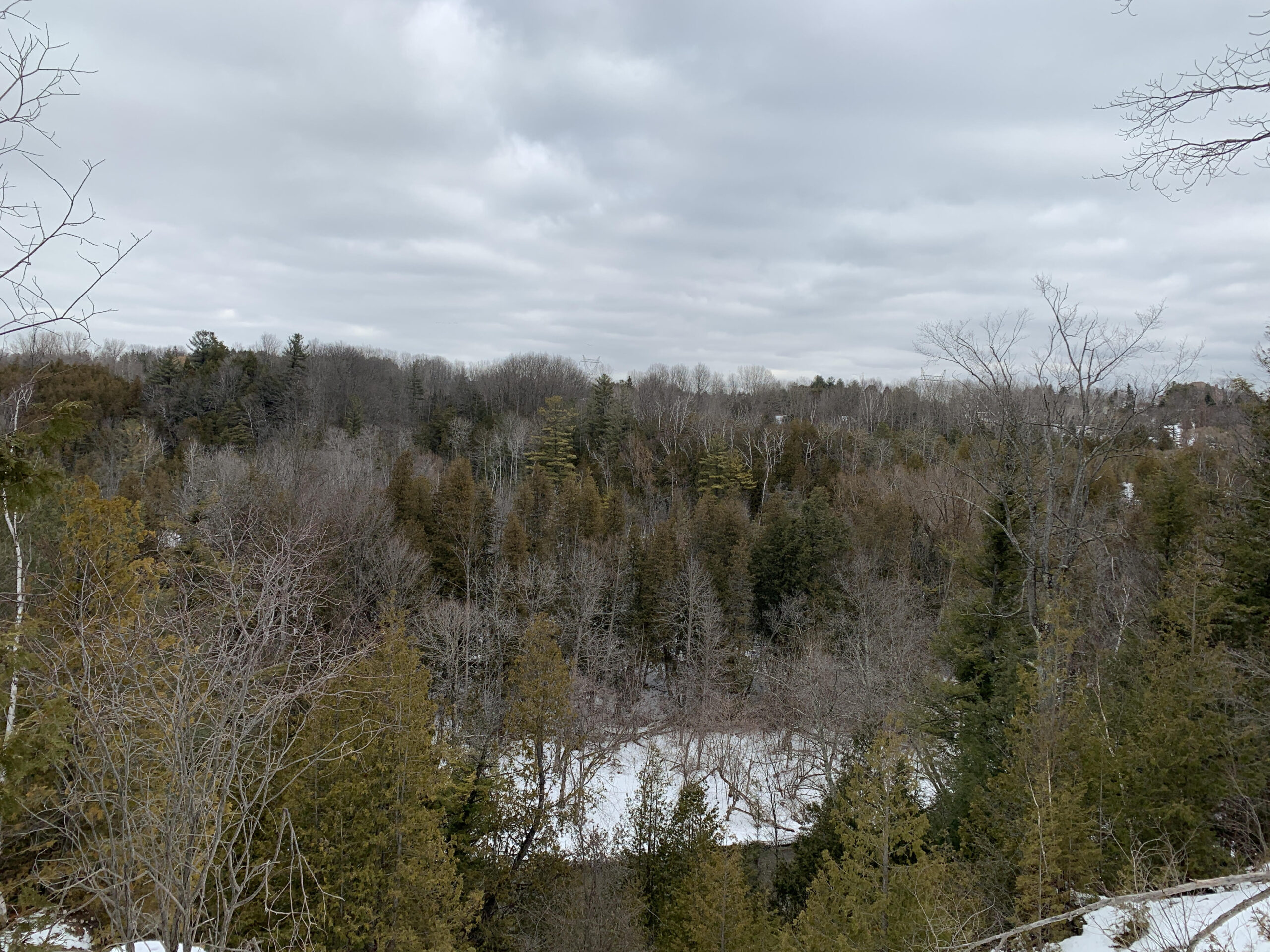
An educational hike into Greenwood Conservation Area, a beautiful area with forests, creeks and a look outpoint. This hike will have multiple stops to share information about environmental protection, wildlife in the area and interesting plants and invasive species. We will also visit a barn ruins and see farm remnants along the way. It is expected to be icy but generally gentle slopes. There will be two times in which we cross over some (likely frozen) water with wooden logs and one area in which there will be a rope along a few feet of slope. Please note one section will be hiking around an off leash dog park to reach a look out point.Mandatory equipment: icers – if you do not have at trail head, you will be turned away.
Please leave your dogs at home.
Drop out at around 8 km.
Mono Centre - Mono Cliffs
https://hikesstaging.brucetrail.org/event/mono-centre-mono-cliffs/Sorry, the registration cut-off time for this hike has been reached.Not a member? Click here to join today!Hosting Club: Dufferin Hi-Land
Category: General Hike
Location (Google Maps): Red P BTC parking lot at the Mono Community Centre (off 2nd Line EHS), 200 m south of Mono Centre.Hike Leader(s): Stuart Law Click here to contact Hike Leader(s)
Pace: Medium
Terrain: Moderate, Slippery Sections Likely
Distance: 13 kmsDescription
Join us on a snowy Sunday hike on some new BTC trails just south of Mono Centre (Turnball and Springwater) together with the South Outlier and Laidlaw Side Trails and parts of the Main Trail connecting them all. We will be exploring some land purchased by the BTC in 2022. Our donor money in action! Given all the snow we have had and the snow expected in the days before the hike, we could well be snow shoeing instead of hiking in which case we will shorten the length of our hike. Please have your snow shoes in the car just in case. Snow shoeing will be optional though so those not wishing to do so remain most welcome. Icers mandatory. Please pack a warm drink, some water, a snack, a lunch, an appreciation of nature and a smile. Optional pub stop after.
Dundas Valley Double Loop Cancelled
https://hikesstaging.brucetrail.org/event/dundas-valley-double-loop/Sorry, the registration cut-off time for this hike has been reached.Not a member? Click here to join today!Hosting Club: Iroquoia
Category: General Hike
Location (Google Maps): Dundas Valley Conservation Area, 650 Governor’s Rd. DundasHike Leader(s): Anne Armstrong Click here to contact Hike Leader(s)
Pace: Medium – 3 to 4 km/hr
Terrain: Moderate – Some hills and/or some poor footing
Distance: Approx. 10 km.Description
Join us to hike the lovely trails and hills of the Dundas Valley Conservation Area with its many hills and ravines. Park in the last parking lot of the Governor’s Rd. entrance and make your way up to the trail centre which has bathrooms. The hike starts at 10:00 am. so try to arrive by 9:45 am. Bring water, a snack/lunch, icers and poles if using. Parking fee or Conservation Area pass.
Leader: Anne Armstrong 905 617 3937 hikingrandma@gmail.com
Urban Walk: Waterfront Trail 8/8 - Beechgrove to Pickering!
https://hikesstaging.brucetrail.org/event/urban-walk-waterfront-trail-8-8-beechgrove-to-pickering/Sorry, the registration cut-off time for this hike has been reached.Not a member? Click here to join today!Hosting Club: Toronto
Location (Google Maps): Scarborough/Durham Waterfront Trail
Hike Leader(s): Brian Rideout Click here to contact Hike Leader(s)
Pace: Moderate
Terrain: Flat
Distance: 11.9 kmDescription
This hike is cancelled due to snow accumulation.Please meet me at Kennedy Station by 10:05 am. We will take the 86 Scarborough bus departing 10:19 am, arriving 10:54 am. We start hiking 11:00 am.
Due to a trail closure the hike will start at Port Union. We will hike along the Waterfront Trail through Port Union and Rouge Hill to Pickering GO. The estimated distance is 9.8 km. Here is an online map of our route – Port Union to Pickering
Bring a snack, at least 2 liters of water, and icers. Dress for cold weather.
Snowshoe Cottonwood Side Trail
https://hikesstaging.brucetrail.org/event/snowshoe-cottonwood-side-trail/Sorry, the registration cut-off time for this hike has been reached.Not a member? Click here to join today!Hosting Club: Sydenham
Category: Snowshoe Hike
Location (Google Maps): Meet in the north-east corner of the parking lot at Home Depot on Highway 26 on the east side of Owen Sound.Hike Leader(s): Maureen McFarland Click here to contact Hike Leader(s)
Pace: Leisurely: 3 km/h or less
Terrain: Easy: Mostly flat and good footing.
Distance: 2.1 kmsDescription
Come out and explore Sydenham Bruce Trail Club’s newest side trail. This is an easy snowshoe on flat terrain. Great for beginners and families. There is a beautiful, huge cottonwood tree on the property. Fun fact – Cottonwoods are the fastest growing trees in North America and can grow as much as 6’ per year. In spring the female cottonwood trees produce a cottony substance that helps with seed dispersal. We will also visit a waterfall.If you don’t have snowshoes, they can be borrowed for free from the Owen Sound library. If you are unable to register, please call or text Maureen at 647-918-4180.
- 06March 6, 2023
Car Hike: Toronto E2E 1/3
https://hikesstaging.brucetrail.org/event/car-hike-toronto-e2e-1-3/Sorry, the registration cut-off time for this hike has been reached.Not a member? Click here to join today!Hike open to BTC Members only.
Hosting Club: Toronto
Category: Car Hike
Location (Google Maps): We will meet at km 17.4 (GPS N43.615163, W79.975157) on the east side of the road where the trail crosses Fourth Line.Hike Leader(s): Jacquie Van Dyke Click here to contact Hike Leader(s)
Pace: Brisk
Terrain: Rocky, Variable
Distance: 18 kmDescription
This is the first of three hikes to hike the Toronto section E2E. We will be hiking in later winter/early spring conditions (mud, ice, snow) so be prepared for it all. Please bring your icers, gaitors, and poles. Hiking boots/shoes are mandatory. Please bring at least 2L of water, snacks, and your lunch.We will be shuttling to Hilton Falls CA parking, close to Appleby Line, and hiking by the location of the first blaze on the Bruce Trail. Please note, we will need to pay for parking at Hilton Falls. If any hiker has an annual pass, please let me know. Pass holders can do this shuttle and the rest of the hikers are expected to pay the driver $2. If there are no pass holders, hikers will share the cost of the parking. Hikers are expected to follow all Covid 19 restrictions.
Please arrive by 7:45 so we can get organized. We will begin our shuttle at 8:00 am.