
Hike Schedule
Join us for a hike! Registration required:
All hikes available to BTC members. Some hikes are open to non-members.
TIP: The calendar view displays up to 7 hikes on a day, but often there are more. Click “More events” to see them all.
Categories
- 19March 19, 2023
9:00 Merritt Island
https://hikesstaging.brucetrail.org/event/900-merritt-island-5/Sorry, the registration cut-off time for this hike has been reached.Not a member? Click here to join today!Hosting Club: Niagara
Category: Loop
Location (Google Maps):Parking Lot on Merritt Island at the west end of cross street Welland
Hike Leader(s): Sylvia Wheeler Click here to contact Hike Leader(s)
Pace: Medium
Terrain: Easy
Distance: 7kDescription
Flat hike along paved trail alongside the Welland Canal.
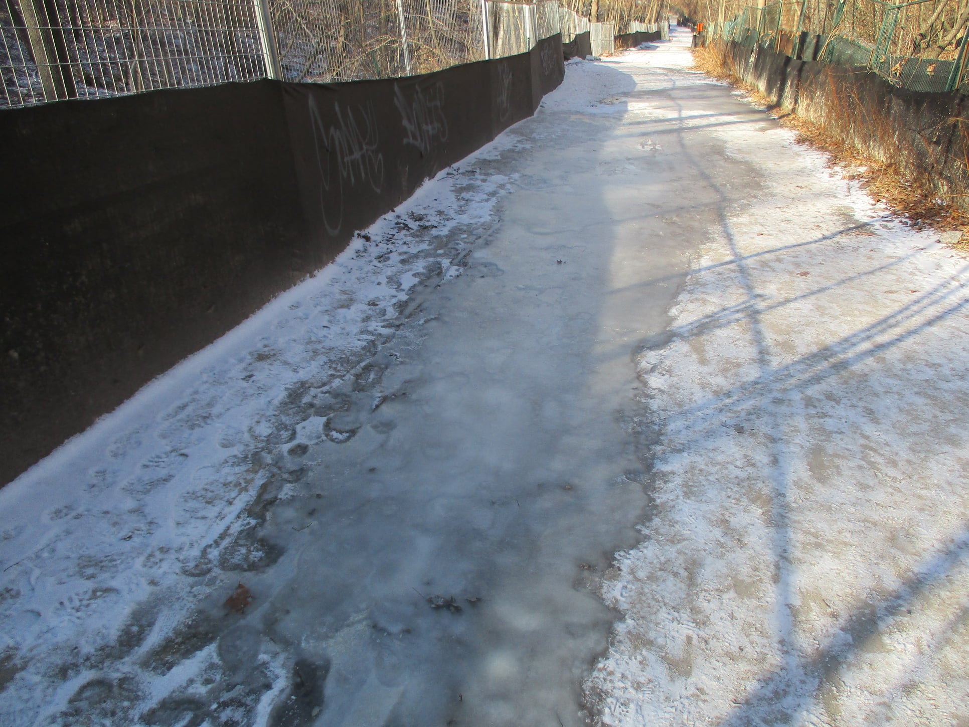
Urban Walk: Wayne's Beltline Trail Hike - Castle Frank Station modified to Glencairn Station
https://hikesstaging.brucetrail.org/event/urban-walk-waynes-beltline-trail-hike-castle-frank-station-to-east-of-caledonia-road/Sorry, the registration cut-off time for this hike has been reached.Not a member? Click here to join today!Hosting Club: Toronto
Category: Urban Walk
Location (Google Maps): Meet outside Castle Frank Subway Station, Castle Frank Road Exit. If wanting to drive to the hike, park at the Evergreen Brickworks (550 Bayview Ave). Arrive by 10:15 am and wait by the washrooms. Please inform me by email if you are using this option.Hike Leader(s): Andrew Proczek; Michael Humpage Click here to contact Hike Leader(s)
Pace: Moderate
Terrain: Flat
Distance: 11.3 kmDescription
“Brisk morning walk from Castle Frank subway station to the end of the Beltline Trail, just west of Caledonia Road. Very warmish in the sun. Walked off without the water bottle I’d just filled. Not critical on a day like this but still would have been good to have it.“The start of the annual Moore Park Ravine Glacier. Bookended by the steeper Milkman’s Lane Glacier off Craigleigh Park. I am always impressed by the aesthetic sense shown by the city parks department when they put up fencing along the trails. Strong vibe of industrial waste zone.
“Someone is decorating the trees along the path from The Brickworks north to Moore Park Avenue. That would be most of the pictures I took as I’ve done the route a thousand times, give or take a few.” Wayne Crockett, December 12th, 2020.
Well, Wayne I have a little catching up to do. This will be my 2nd, so 998 more times to go, give or take a few. I chose this one of Wayne’s many urban hikes for this day to allow anyone wanting to attend the St. Pat’s Parade to be able to drop out at Oriole Park at 7 km, a short walk from Davisville Subway Station, and still be able to catch the parade which starts at 12 pm. Oriole Park will also be our lunch spot. Hikers will be able to walk over to the Tim Hortons across from the Subway. We will follow Wayne’s route except for a slight detour in Mount Pleasant Cemetery to visit the burial place of Glenn Gould and also the last resting spot of another valued and departed leader of our club, Jacqueline Holmes.
I will not be doing the final 2 plus Km of beltline past Allan Road but diverting north through Viewmount Park to Glencairn Station (Line 1).
The Route: https://onthegomap.com/s/8kt5jhve
I will inform if icers are needed. Washrooms at the Brickworks at 2 km, Tim Hortons (Yonge & Chaplin Cres.) at 7 km, and Larry Grossman Forest Hill Memorial Arena at 9 km. Please don’t follow Wayne’s example and forget your water bottle.
Drop out #1: 7 km Davisville Subway Station. Drop out #2: 9.6 km Bathurst St.
Migration Monitor Hike
https://hikesstaging.brucetrail.org/event/migration-monitor-hike-4/Sorry, the registration cut-off time for this hike has been reached.Not a member? Click here to join today!Hosting Club: Peninsula
Location (Google Maps): Parking for all hikes start at km 109.7, 30th Ed Ref Manual. Park adjacent to Cape Chin Mail boxes on Cape Chin North Road
Hike1 (Mar 12, 26, Apr 9): Otter Lake/Cape Chin Loop – see details below
Hike 2 (Mar 19, Apr 2, Apr 16): Borchardt/Cotrill Lk Loop – see details belowHike Leader(s): Tamara Wilson Click here to contact Hike Leader(s)
Pace: Leisurely
Terrain: Difficult
Distance: Each hike ranges 10 to 12 kmDescription
Join us as we look for clues of spring’s arrival on Cape Chin North. We will alternate two routes on a weekly basis, watching for seasonal changes along the wetlands, small inland lakes, woodlands and escarpment shoreline. We will stop, look and listen for the arrival of plants and flowers, birds and other harbingers of spring. Hikes are weather dependent and will be cancelled for treacherous local driving conditions (mud), rain, snow or very strong winds. Always check the road and weather conditions for the entire length of your trip up as local weather can be quite different. Some hikes may recommend snow shoe hikes (I will let you know). Poles and crampons are recommended for navigating wet and slippery conditions typical of spring hikes. It is recommended to bring snacks and water for the hike. A dry set of socks and shoes is a good idea for the trip home. A sweep, topic experts – all are welcome!Alternating hikes:
Hike1 (Mar 12, 26, Apr 9): From km 109.7 parking, Otter Lk ST (2.2 km), up Cape Chin N Rd (past Tagwerk) to Cape Chin Meadow ST (1km) to Cape Chin Driveway (2.5 km) to house, North along MT back to parked vehicles (3.6 km ) – Total 9.3 km approx
Hike 2: (Mar 19, Apr 2, Apr 16) – From km 109.7 parking, MT North through Cape Chin Woods to Borchardt Parking (2.3 km), Minhinnik ST (1.7km) to Lillie Parking Lot, Take Cotrill Lk ST (1.4km) to Anne and Clayton Robert’s St (turn right) back to Britain Lk Rd (1km). At this point we will either a) follow Britain Lk Rd and reverse the route that we took (Minhinnik to Borchardt back along Borchardt to parking) – approx 12km OR b) if conditions are good, we will follow the Main Trail back along the escarpment to Borchardt PL and hike back to the vehicles along Borchardt.

Urban Walk: Waterfront Trail 8/8 - Port Union to Pickering!
https://hikesstaging.brucetrail.org/event/urban-walk-waterfront-trail-8-8-beechgrove-to-pickering-2/Sorry, the registration cut-off time for this hike has been reached.Not a member? Click here to join today!Hosting Club: Toronto
Category: Urban Walk
Location (Google Maps):Scarborough/Durham Waterfront Trail
Hike Leader(s): Brian Rideout Click here to contact Hike Leader(s)
Pace: Moderate
Terrain: Flat
Distance: 11.9 kmDescription
Please meet me at Kennedy Station by 10:05 am. We will take the 86 Scarborough bus departing 10:19 am, arriving 10:54 am (includes a transfer to the 54 Lawrence East bus). We start hiking 11:00 am.Due to a trail closure the hike will start at Port Union. We will hike along the Waterfront Trail through Port Union and Rouge Hill to Pickering GO. The estimated distance is 9.8 km. Here is an online map of our route – Port Union to Pickering
Bring a snack, at least 2 liters of water, and icers. Dress for cold weather.
Harrison Park Ramble & Refreshments
https://hikesstaging.brucetrail.org/event/harrison-park-ramble/Sorry, the registration cut-off time for this hike has been reached.Not a member? Click here to join today!Hosting Club: Sydenham
Category: General Hike
Location (Google Maps): Parking lot at Harrison Park, Owen Sound, in front of the Harrison Park Inn, north of km 96.7 (Map 32)Hike Leader(s): Maureen McFarland Click here to contact Hike Leader(s)
Pace: Leisurely: 3 km/h or less
Terrain: Easy: Mostly flat and good footing., There might be icy and slippery sections.
Distance: 2-3 kmsDescription
We will explore Harrison Park for an hour to an hour and a half. Where we go will depend upon the walking conditions. Snowshoes or icers may be needed. Check with the leader if you are unsure of what to bring. Refreshments afterwards at the Harrison Park Inn. Suitable for families and new hikers. Fun fact – The lands comprising Harrison Park were sold to the City of Owen Sound by the family of John Harrison after his death for $10,000 (half of which was paid by the Harrison family). The park was officially turned over to the city on July 7, 1912. For more informaion or if you are unable to register, please call or text the leader at 647-918-4180.2:00 pm Glenridge Quarry Loop
https://hikesstaging.brucetrail.org/event/200-pm-glenridge-quarry-loop-3/Sorry, the registration cut-off time for this hike has been reached.Not a member? Click here to join today!Hike open to BTC Members only.
Hosting Club: Niagara
Category: Hike
Location (Google Maps): Glenridge Quarry Parking Lot, St. David’s Road, Map 3Hike Leader(s): Larry Lloyd Click here to contact Hike Leader(s)
Pace: Leisurely
Terrain: Easy
Distance: 5kDescription
Acombination of open trails with spectacular views across Lake Ontario and wooded trails including the main trail.