
Hike Schedule
Join us for a hike! Registration required.
All hikes available to BTC members. Some hikes are open to non-members.
See Refund Policy for Paid Hikes >
TIP: The calendar view displays up to 7 hikes on a day, but often there are more. Click “View more events” to see them all.
Categories
- 18March 18, 2023
Boyd Conservation Park Vaughan
https://hikesstaging.brucetrail.org/event/boyd-conservation-park-vaughan-6/Sorry, the registration cut-off time for this hike has been reached.Not a member? Click here to join today!Hosting Club: Toronto
Location (Google Maps): Parking lot before the main gate of Boyd conservation park Islington Avenue,
Hike Leader(s): Mohammad Aghamiri
Pace: Moderate
Terrain: VariableDescription
Explore the trails that wind through the beautiful valley at Boyd Conservation Area and the William Grainger Greenway. We will have lunch/snack in shelter with seated area,It is winter time all participants are required to have Ice cleats with them, have proper shoes, warm clothing and hot drinks with you.
Please carefully read safety procedures during the hike:
1-Hikers must stay between the leader and the sweep.
2-Hikers must advise the leader or the sweep if they wish to leave the group.
3- Hikers must follow the whistle instructions: 1 blast- stay where you are; 2 blasts come to the leader; 3 blasts – come to the leader quickly.
4-Hike leader may request volunteers to stop at trail intersections, they need to help hikers to the direction the group walk and wait till they see the sweep .
5-Hikers have to make sure they can see the persons behind and in front of them.

9:00 Woodend Hike
https://hikesstaging.brucetrail.org/event/900-woodend-hike-2/Sorry, the registration cut-off time for this hike has been reached.Not a member? Click here to join today!Hosting Club: Niagara
Category: Loop
Location (Google Maps):Meet at Woodend Conservation Area parking lot off Taylor Road.
Hike Leader(s): Dan Wilson Click here to contact Hike Leader(s)
Pace: Leisurely
Terrain: Moderate
Distance: 6 kmDescription
We will hike the main trail, as well as a few side trails above and below the escarpment. Please bring hiking poles and icers, if necessary.
9:00 NBTC Side Trails Hike – Rockway ST’s, Louth ST’s, Staff Ave ST
https://hikesstaging.brucetrail.org/event/900-nbtc-side-trails-hike-rockway-sts-louth-sts-staff-ave-st/Sorry, the registration cut-off time for this hike has been reached.Not a member? Click here to join today!Hosting Club: Niagara
Category: In and Out
Location (Google Maps): Park at Rockway Community CentreHike Leader(s): Sam Rutherford Click here to contact Hike Leader(s)
Pace: Medium
Terrain: Moderate
Distance: 12kDescription
Take Rockway ST to the end. Hike back to where it meets Lower Falls Side Trail @ km 47.9. Take Main Trail until it meets Lower Falls Side Trail. Take Lower Falls Side Trail until it meets main trail again then continue up Midway Side Trail until it meets Main trail again. Take Main Trail up the hill until it meets Staff Ave ST. Take Staff Ave ST out and back. Then take Louth Side Trail until it meets Main Trail at km 51.2. Turn right and follow Main trail back to Rockway. Photos required towards side trail badge are 1) Upper Rockway Falls 2) Lower Rockway Falls 3) Moss covered boulders on Louth ST 4) Lower Louth FallsNottawasaga Lookout Loop
https://hikesstaging.brucetrail.org/event/nottawasaga-lookout-loop/Sorry, the registration cut-off time for this hike has been reached.Not a member? Click here to join today!Hosting Club: Blue Mountains
Category: Register on-line or sign-in morning of hike
Location (Google Maps): Hike meets in the parking lot behind Tim Hortons on First St. in Collingwood.Hike Leader(s): Mary Jane McIntyre Click here to contact Hike Leader(s)
Pace: Leisurely – 3 km/hr. or less
Terrain: Easy – Mostly flat and usually good footing
Distance: 5Description
We will drive to the Blue Mountains/Clearview Townline, north of Grey Road 91 and park at Eagle Cres for a hike through the Nottawasaga Lookout Nature Reserve. We will start the hike at km 42.5 and hike through the woods for about an hour before retracing our steps. Bring a snack and water.
Murray Stewart Trail and Bolton Camp Loop
https://hikesstaging.brucetrail.org/event/murray-stewart-trail-and-bolton-camp-loop/Sorry, the registration cut-off time for this hike has been reached.Not a member? Click here to join today!Hosting Club: Dufferin Hi-Land
Category: General Hike
Location (Google Maps): (Google Maps) The Murray Stewart Trail is located in Bolton. From King Street and Hwy 50 (Queen Street) drive east on King Street for 0.4 km and turn left onto Humber Lea Rd. Go up the hill to Kingsview Drive and turn right. After 0.4 km turn left onto Kingsview Drive. The trailhead is located just past the stop sign on your right at the Kingsview Drive and Longwood Drive intersection. Park on Kingsview Drive.Hike Leader(s): Tony Evangelista Click here to contact Hike Leader(s)
Pace: Medium
Terrain: Easy, Slippery and Steep Sections
Distance: 7 kmDescription
We will hike the Murray Stewart Trail to the end and then turn back to hike the Bolton Camp loop. This loop rejoins the Murray Stewart Trail and heads back to the parked cars on Kingsview drive. Along the way, we will experience a variety of ecosystems-mature forests, meadows, and wetlands. We will also observe the remnants of the Bolton Camp and see the future plans for the site.Bring water and snacks. Icers may be needed.
Optional refreshment stop afterward at Coffee Time in Bolton.
Urban Walk: St Patrick's Day (1 Day Late) Hike To Distillery District
https://hikesstaging.brucetrail.org/event/urban-walk-st-patricks-day-1-day-late-hike-to-distillery-district/Sorry, the registration cut-off time for this hike has been reached.Not a member? Click here to join today!Hosting Club: Toronto
Category: Urban Walk
Location (Google Maps): Meet outside Castlefrank Subway StationHike Leader(s): Tom Swales, Monica Pasquali Click here to contact Hike Leader(s)
Pace: Moderate
Terrain: Variable
Distance: 9 kmDescription
St Paddy’s Day in 2023 is on Friday this year but for those of us who have day jobs we’ll celebrate with a hike on the Saturday followed by an optional pub stop in the Distillery District after the hike. We will hike to the Evergreen Brickworks by Milkman’s Lane and the Rosedale Ravine Trail, north in the Don Valley to Pottery Road and south on the Don Valley Trail to Mill Street and the Distillery District. Effective icers will be mandatory as the trails are very slippery this time of year. This hike and Andrew’s hike on Sunday are both urban walks led by Wayne Crockett so join one them or both of them to make it a “Wayne weekend” remembering Wayne’s contribution to our urban walks. Those who wish may join us for a post-hike refreshment stop at the Mill Street Beer Hall in the Distillery District to toast St Patrick’s Day and Wayne. Please let us know in the “additional information” field when registering if you plan on joining us at the pub so we have an idea of the numbers. - 19March 19, 2023
9:00 Merritt Island
https://hikesstaging.brucetrail.org/event/900-merritt-island-5/Sorry, the registration cut-off time for this hike has been reached.Not a member? Click here to join today!Hosting Club: Niagara
Category: Loop
Location (Google Maps):Parking Lot on Merritt Island at the west end of cross street Welland
Hike Leader(s): Sylvia Wheeler Click here to contact Hike Leader(s)
Pace: Medium
Terrain: Easy
Distance: 7kDescription
Flat hike along paved trail alongside the Welland Canal.
Urban Walk: Wayne's Beltline Trail Hike - Castle Frank Station modified to Glencairn Station
https://hikesstaging.brucetrail.org/event/urban-walk-waynes-beltline-trail-hike-castle-frank-station-to-east-of-caledonia-road/Sorry, the registration cut-off time for this hike has been reached.Not a member? Click here to join today!Hosting Club: Toronto
Category: Urban Walk
Location (Google Maps): Meet outside Castle Frank Subway Station, Castle Frank Road Exit. If wanting to drive to the hike, park at the Evergreen Brickworks (550 Bayview Ave). Arrive by 10:15 am and wait by the washrooms. Please inform me by email if you are using this option.Hike Leader(s): Andrew Proczek; Michael Humpage Click here to contact Hike Leader(s)
Pace: Moderate
Terrain: Flat
Distance: 11.3 kmDescription
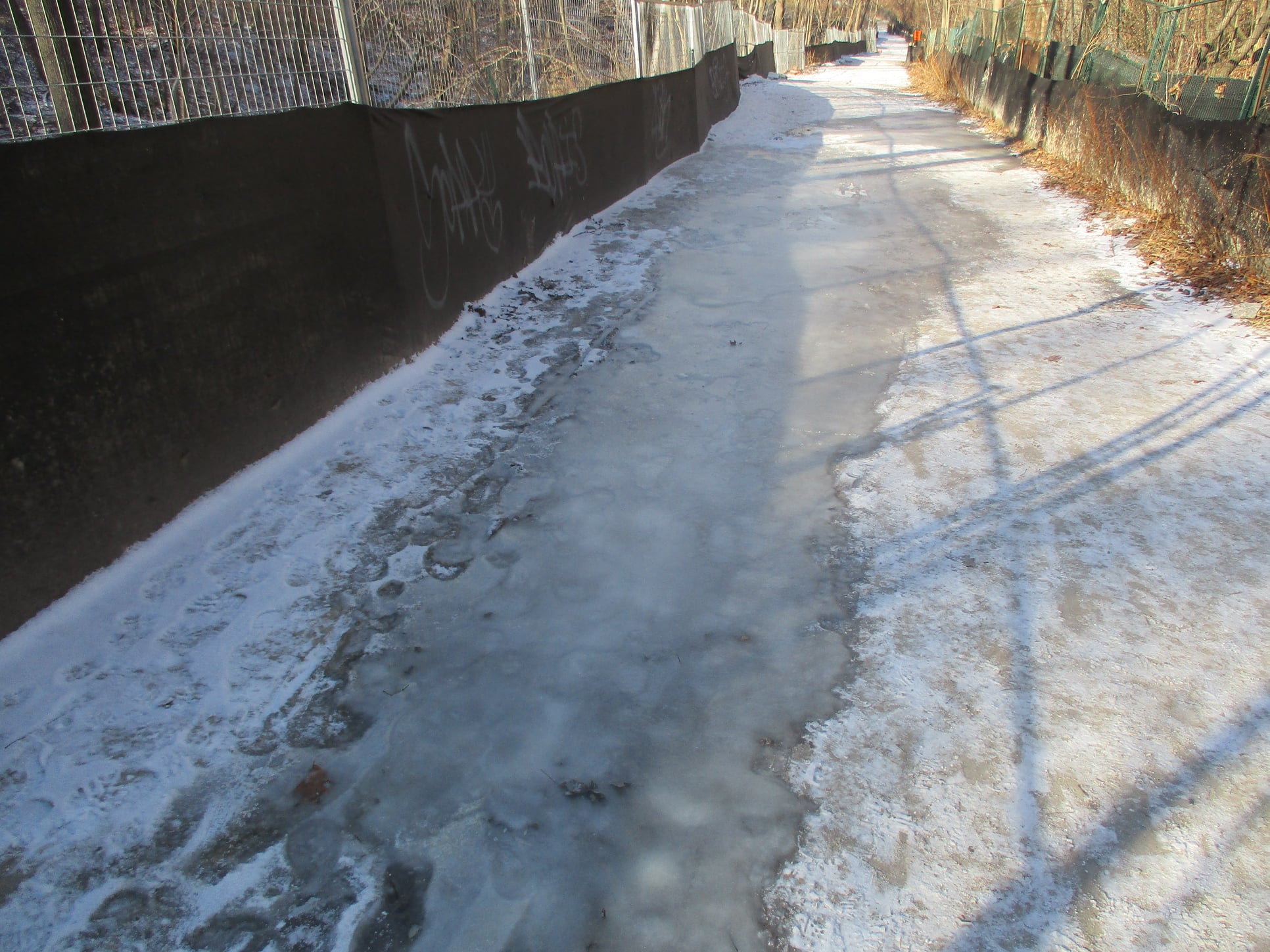
“Brisk morning walk from Castle Frank subway station to the end of the Beltline Trail, just west of Caledonia Road. Very warmish in the sun. Walked off without the water bottle I’d just filled. Not critical on a day like this but still would have been good to have it.“The start of the annual Moore Park Ravine Glacier. Bookended by the steeper Milkman’s Lane Glacier off Craigleigh Park. I am always impressed by the aesthetic sense shown by the city parks department when they put up fencing along the trails. Strong vibe of industrial waste zone.
“Someone is decorating the trees along the path from The Brickworks north to Moore Park Avenue. That would be most of the pictures I took as I’ve done the route a thousand times, give or take a few.” Wayne Crockett, December 12th, 2020.
Well, Wayne I have a little catching up to do. This will be my 2nd, so 998 more times to go, give or take a few. I chose this one of Wayne’s many urban hikes for this day to allow anyone wanting to attend the St. Pat’s Parade to be able to drop out at Oriole Park at 7 km, a short walk from Davisville Subway Station, and still be able to catch the parade which starts at 12 pm. Oriole Park will also be our lunch spot. Hikers will be able to walk over to the Tim Hortons across from the Subway. We will follow Wayne’s route except for a slight detour in Mount Pleasant Cemetery to visit the burial place of Glenn Gould and also the last resting spot of another valued and departed leader of our club, Jacqueline Holmes.
I will not be doing the final 2 plus Km of beltline past Allan Road but diverting north through Viewmount Park to Glencairn Station (Line 1).
The Route: https://onthegomap.com/s/8kt5jhve
I will inform if icers are needed. Washrooms at the Brickworks at 2 km, Tim Hortons (Yonge & Chaplin Cres.) at 7 km, and Larry Grossman Forest Hill Memorial Arena at 9 km. Please don’t follow Wayne’s example and forget your water bottle.
Drop out #1: 7 km Davisville Subway Station. Drop out #2: 9.6 km Bathurst St.
Migration Monitor Hike
https://hikesstaging.brucetrail.org/event/migration-monitor-hike-4/Sorry, the registration cut-off time for this hike has been reached.Not a member? Click here to join today!Hosting Club: Peninsula
Location (Google Maps): Parking for all hikes start at km 109.7, 30th Ed Ref Manual. Park adjacent to Cape Chin Mail boxes on Cape Chin North Road
Hike1 (Mar 12, 26, Apr 9): Otter Lake/Cape Chin Loop – see details below
Hike 2 (Mar 19, Apr 2, Apr 16): Borchardt/Cotrill Lk Loop – see details belowHike Leader(s): Tamara Wilson Click here to contact Hike Leader(s)
Pace: Leisurely
Terrain: Difficult
Distance: Each hike ranges 10 to 12 kmDescription
Join us as we look for clues of spring’s arrival on Cape Chin North. We will alternate two routes on a weekly basis, watching for seasonal changes along the wetlands, small inland lakes, woodlands and escarpment shoreline. We will stop, look and listen for the arrival of plants and flowers, birds and other harbingers of spring. Hikes are weather dependent and will be cancelled for treacherous local driving conditions (mud), rain, snow or very strong winds. Always check the road and weather conditions for the entire length of your trip up as local weather can be quite different. Some hikes may recommend snow shoe hikes (I will let you know). Poles and crampons are recommended for navigating wet and slippery conditions typical of spring hikes. It is recommended to bring snacks and water for the hike. A dry set of socks and shoes is a good idea for the trip home. A sweep, topic experts – all are welcome!Alternating hikes:
Hike1 (Mar 12, 26, Apr 9): From km 109.7 parking, Otter Lk ST (2.2 km), up Cape Chin N Rd (past Tagwerk) to Cape Chin Meadow ST (1km) to Cape Chin Driveway (2.5 km) to house, North along MT back to parked vehicles (3.6 km ) – Total 9.3 km approx
Hike 2: (Mar 19, Apr 2, Apr 16) – From km 109.7 parking, MT North through Cape Chin Woods to Borchardt Parking (2.3 km), Minhinnik ST (1.7km) to Lillie Parking Lot, Take Cotrill Lk ST (1.4km) to Anne and Clayton Robert’s St (turn right) back to Britain Lk Rd (1km). At this point we will either a) follow Britain Lk Rd and reverse the route that we took (Minhinnik to Borchardt back along Borchardt to parking) – approx 12km OR b) if conditions are good, we will follow the Main Trail back along the escarpment to Borchardt PL and hike back to the vehicles along Borchardt.

Urban Walk: Waterfront Trail 8/8 - Port Union to Pickering!
https://hikesstaging.brucetrail.org/event/urban-walk-waterfront-trail-8-8-beechgrove-to-pickering-2/Sorry, the registration cut-off time for this hike has been reached.Not a member? Click here to join today!Hosting Club: Toronto
Category: Urban Walk
Location (Google Maps):Scarborough/Durham Waterfront Trail
Hike Leader(s): Brian Rideout Click here to contact Hike Leader(s)
Pace: Moderate
Terrain: Flat
Distance: 11.9 kmDescription
Please meet me at Kennedy Station by 10:05 am. We will take the 86 Scarborough bus departing 10:19 am, arriving 10:54 am (includes a transfer to the 54 Lawrence East bus). We start hiking 11:00 am.Due to a trail closure the hike will start at Port Union. We will hike along the Waterfront Trail through Port Union and Rouge Hill to Pickering GO. The estimated distance is 9.8 km. Here is an online map of our route – Port Union to Pickering
Bring a snack, at least 2 liters of water, and icers. Dress for cold weather.
Harrison Park Ramble & Refreshments
https://hikesstaging.brucetrail.org/event/harrison-park-ramble/Sorry, the registration cut-off time for this hike has been reached.Not a member? Click here to join today!Hosting Club: Sydenham
Category: General Hike
Location (Google Maps): Parking lot at Harrison Park, Owen Sound, in front of the Harrison Park Inn, north of km 96.7 (Map 32)Hike Leader(s): Maureen McFarland Click here to contact Hike Leader(s)
Pace: Leisurely: 3 km/h or less
Terrain: Easy: Mostly flat and good footing., There might be icy and slippery sections.
Distance: 2-3 kmsDescription
We will explore Harrison Park for an hour to an hour and a half. Where we go will depend upon the walking conditions. Snowshoes or icers may be needed. Check with the leader if you are unsure of what to bring. Refreshments afterwards at the Harrison Park Inn. Suitable for families and new hikers. Fun fact – The lands comprising Harrison Park were sold to the City of Owen Sound by the family of John Harrison after his death for $10,000 (half of which was paid by the Harrison family). The park was officially turned over to the city on July 7, 1912. For more informaion or if you are unable to register, please call or text the leader at 647-918-4180.2:00 pm Glenridge Quarry Loop
https://hikesstaging.brucetrail.org/event/200-pm-glenridge-quarry-loop-3/Sorry, the registration cut-off time for this hike has been reached.Not a member? Click here to join today!Hike open to BTC Members only.
Hosting Club: Niagara
Category: Hike
Location (Google Maps): Glenridge Quarry Parking Lot, St. David’s Road, Map 3Hike Leader(s): Larry Lloyd Click here to contact Hike Leader(s)
Pace: Leisurely
Terrain: Easy
Distance: 5kDescription
Acombination of open trails with spectacular views across Lake Ontario and wooded trails including the main trail. - 20March 20, 2023
Car Hike: Toronto E2E 3/3
https://hikesstaging.brucetrail.org/event/car-hike-toronto-e2e-3-3/Sorry, the registration cut-off time for this hike has been reached.Not a member? Click here to join today!Hike open to BTC Members only.
Hosting Club: Toronto
Category: Car Hike
Location (Google Maps): We will meet at km 48.3 (GPS N43.750866, W79.951452) at Boston Mills Rd. just west of the Mississauga Rd intersection.Hike Leader(s): Jacquie Van Dyke Click here to contact Hike Leader(s)
Pace: Brisk
Terrain: Rocky, Variable
Distance: 18 kmDescription
The third of three hikes to complete the Toronto E2E which includes a 4 km in/out due to parking in relation to where Toronto ends/Caledon begins. It’s badge day and hikers may wish to visit the Spirit Tree after the hike.It’s early spring so mud may abound! Be prepared with poles and gaitors. Hiking boots/shoes are mandatory. We’ll stop for snacks and lunch so bring 2L of water, snacks, and your lunch.
Be prepared to shuttle if you haven’t already had a turn.

9:30 Chloe Cooley Commemorative Hike
https://hikesstaging.brucetrail.org/event/930-chloe-cooley-commemorative-hike/Sorry, the registration cut-off time for this hike has been reached.Not a member? Click here to join today!Hosting Club: Niagara
Category: In and Out
Location (Google Maps): Locust Grove Picnic Area, 14888 Niagara Parkway, Queenston, L0S 1L0Hike Leader(s): Karen Couch Click here to contact Hike Leader(s)
Pace: Medium
Terrain: Moderate
Distance: 7.4 kmsDescription
Chloe Cooley was a young Black enslaved woman whose brave act of resistance paved the way to freedom for so many like her, and set the stage for the great freedom movement of enslaved African Americans known as the Underground Railroad. We will hike to where her bravery took place, 14 MAR 1793. This will take us along the General Brock Side Trail (GBST) and on then on the Niagara Parkway (NP). The GBST’s terrain is hilly/moderate, whereas the NP is flat/easy. We will then retrace our steps back.For more information about Chloe Cooley click on the link below.
https://www.ctvnews.ca/lifestyle/canada-post-honours-chloe-cooley-with-stamp-for-black-history-month-1.6256243
- 21March 21, 2023
9:00 Long Hike Rockway
https://hikesstaging.brucetrail.org/event/900-long-hike-wiley-road-short-hills-17/Sorry, the registration cut-off time for this hike has been reached.Not a member? Click here to join today!Hosting Club: Niagara
Location (Google Maps): Rockway
Hike Leader(s): Alan Laver Click here to contact Hike Leader(s)
Pace: Medium
Terrain: Moderate
Distance: 10kmDescription
Explore Rockway and Louth Conservation area Register for each hike
Bring Poles water, snack and Dress for the weather, Icers and layers/p>
9:15 Short hike - Rotary Park, St. Catharines
https://hikesstaging.brucetrail.org/event/915-short-hike-rotary-park-st-catharines-3/Sorry, the registration cut-off time for this hike has been reached.Not a member? Click here to join today!Hosting Club: Niagara
Location (Google Maps): Rotary Park, St Catharines
Hike Leader(s): janet davey Click here to contact Hike Leader(s)
Pace: Medium
Terrain: Moderate
Distance: 6 kmsDescription
Hike the trails in Rotary Park. Bring hiking boots, water and icers.Humber Valley - 5 Sideroad to Glen Haffy Side Trail
https://hikesstaging.brucetrail.org/event/humber-valley-5-sideroad-to-glen-haffy-side-trail/Sorry, the registration cut-off time for this hike has been reached.Not a member? Click here to join today!Hosting Club: Dufferin Hi-Land
Category: Tuesday Hike
Location (Google Maps): Caledon Hills Section, Map 18, Km 45.5
Meet at parking lot on 5 sideroad, east of Airport Rd, north of Hwy 9Hike Leader(s): Julie Daley, Les Babbage, Inge Eckerich, Tony Evangelista Click here to contact Hike Leader(s)
Pace: Leisurely, Medium
Terrain: Moderate, Slippery and Steep Sections
Distance: 7km, Short hike 3kmDescription
Hike will begin at the main parking lot on the north side of 5 Sideroad. We will hike the Main trail south to 7th Line (short hike will end here), continue south, then take the Glen Haffy Side Trail through the Humber Valley, ending at Mono-Adjala Townline. Cars will be shuttled to the end. Bring icers, snowshoes and/or poles, depending on the conditions. Bring snack.Old Baldy Climb
https://hikesstaging.brucetrail.org/event/old-baldy-climb/Sorry, the registration cut-off time for this hike has been reached.Not a member? Click here to join today!Hosting Club: Beaver Valley
Location (Google Maps): Park at Km 46.8 Beaver Valley section on the east side of County Rd 13. (blue gates)
Map 26 Edition 30Hike Leader(s): Kristina Rettie Click here to contact the hike leader.
Pace: Brisk
Terrain: Some steep sections, Strenuous
Length of Hike: 6kmDescription
We will begin our hike with a 1.25km uphill challenge (heehee) Once all hikers have reached the top we will loop around the Mac Kirk Side Trail followed by a short out and back on the main trail. Then we retrace our steps back down the hill.Bring water and a snack
Please no dogs
Please text Kristina @ 519-410-9077 for morning of cancelations
COVID-19 Precautions Before, During and After your Hike
- Each hiker joining a Bruce Trail Club organized hike must perform a self-screening check before hiking.
Find Ontario’s self-assessment tool here: https://covid-19.ontario.ca/self-assessment/ - If you are experiencing COVID-19 symptoms, stay home.
- Personal Protective Equipment:
- Hikers may choose to wear masks
Transportation
It is the Bruce Trail Conservancy’s current policy that car shuttles are allowed. It is at the discrepancy of individual hike leaders to make that decision.
Other Guidelines
- Arrive 15 minutes before the start of the hike.
- Wear sturdy footwear and appropriate attire for the weather and the terrain.
Hiking poles are a good idea in any season, especially if the terrain is rocky or slippery. In winter, snowshoes or icers/crampons are needed when conditions dictate.
Wearing appropriate clothing and footwear prevents injuries and shows consideration for a safe and positive group hiking experience. - Always carry I.D. and your health card.
- Bring sufficient water and snacks (or lunch if indicated). A minimum of 1L of water is recommended on all hikes, and 3L is recommended for long, challenging hikes in the heat of the summer.
- Bring sunscreen and insect repellent (for spring and summer hikes).
- Bring your own first aid kit.
- Please leave dogs at home.
Halton Regional Forest
https://hikesstaging.brucetrail.org/event/halton-regional-forest-5/Sorry, the registration cut-off time for this hike has been reached.Not a member? Click here to join today!Hosting Club: Caledon Hills
Category: Tuesday Hikers
Location (Google Maps): Parking at: 10 Side Road and 4th Line Nassagaweya (trail entrance to Halton Regional Forest).
From Highway 401 West, turn right (north) on Guelph Line, right on 10 Side Rd. it will bend northwards and become 4th Line Nassagaweya; park at the bend, roadside.Hike Leader(s): Mohammad Shafiq Click here to contact Hike Leader(s)
Pace: Medium – 3 to 4 km/hour
Terrain: Moderate – some hills and/or some poor footing
Distance: 13 kmDescription
Will hike trails in Halton Regional Forest and Hilton Falls Conservation Area, beautiful trails are relatively flat with some rocky parts. Snack break at Hilton Falls, possibly around fire pit. Will use different set of trails than last hike on Feb. 7th.
Bring water, snack and a warm drink.
Dress according to weather, icers are required, poles recommended.
Hike leader cell phone: 416-566-0503 (note that reception in hiking area is usually poor, leave messages to callback).
Check your email at 7:30 am, on the hike day, a message will be sent if there is change due to adverse weather or driving conditions. - Each hiker joining a Bruce Trail Club organized hike must perform a self-screening check before hiking.